
Search for another town



Free U.S. delivery 7 to 10 days after you order
Gardiner, Maine Map Art
Building by building, with labeled streets and shaded relief.
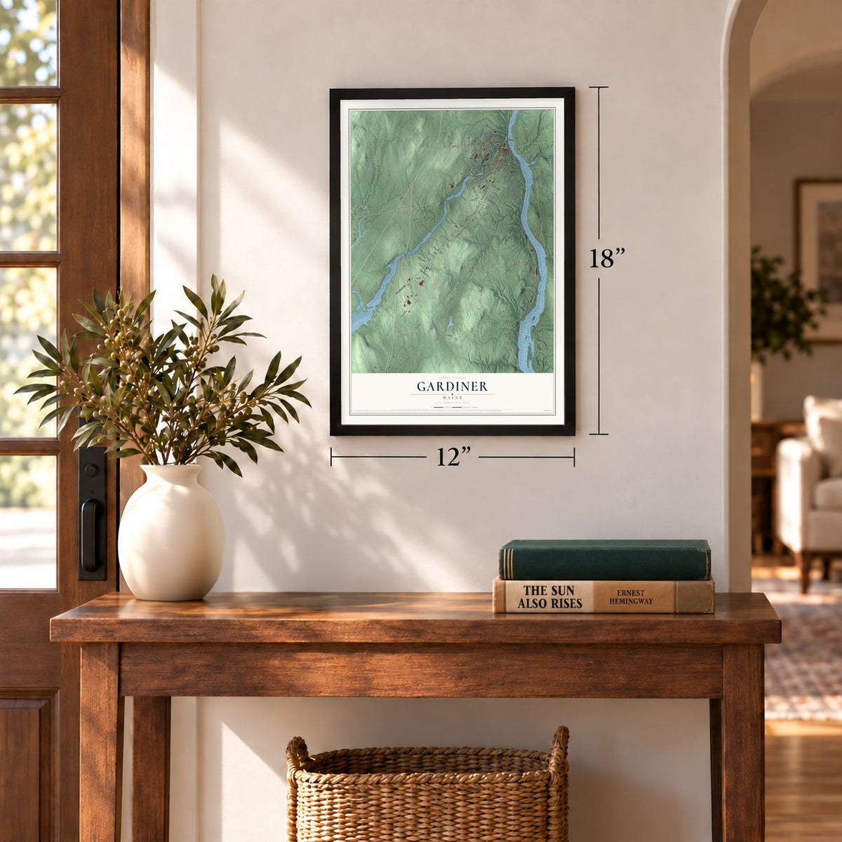
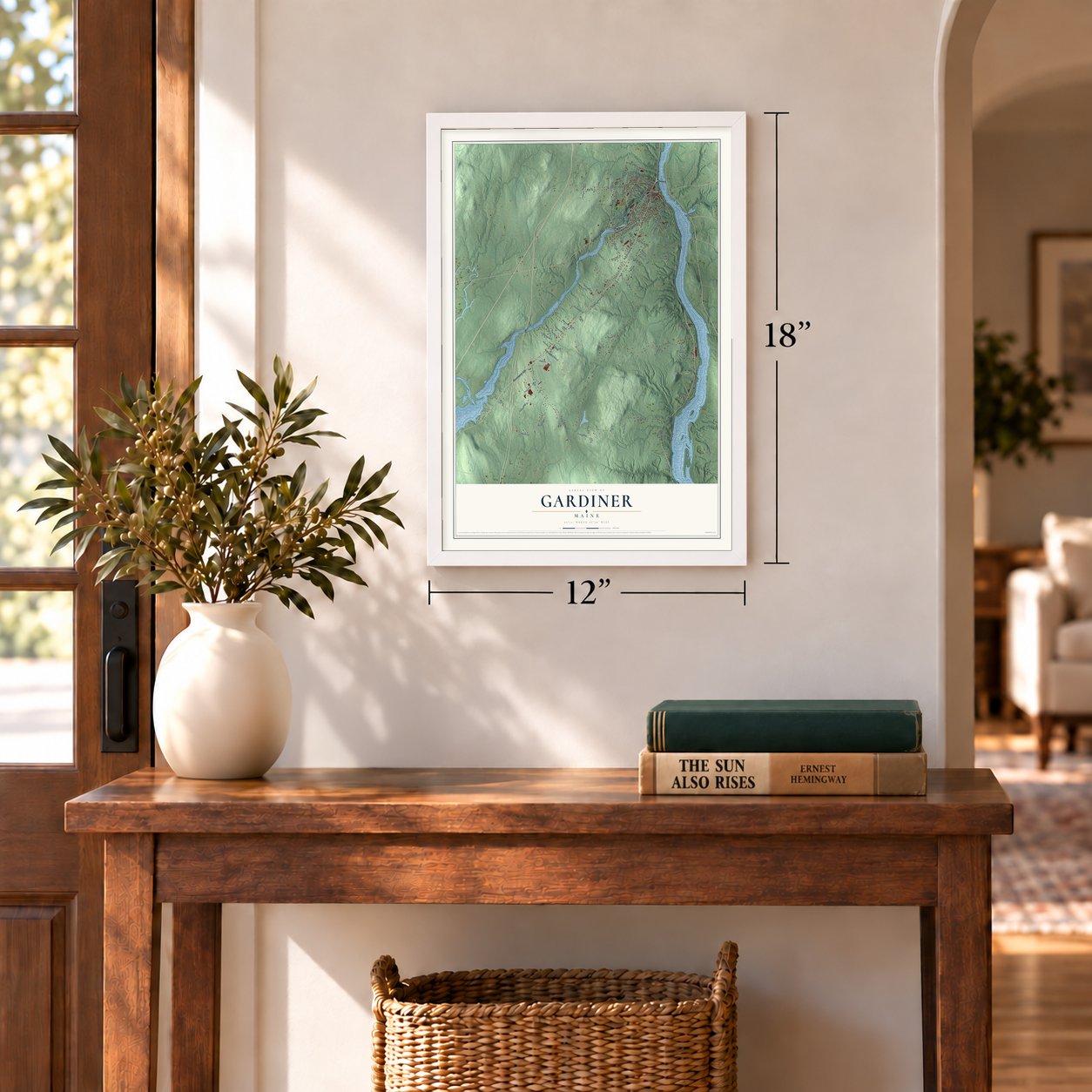
12" x 18" Archival Matte Print
A Map of Home. A Work of Art.
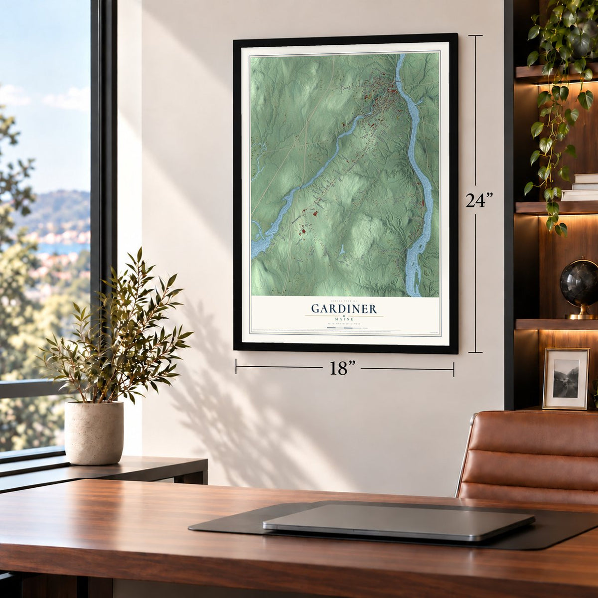
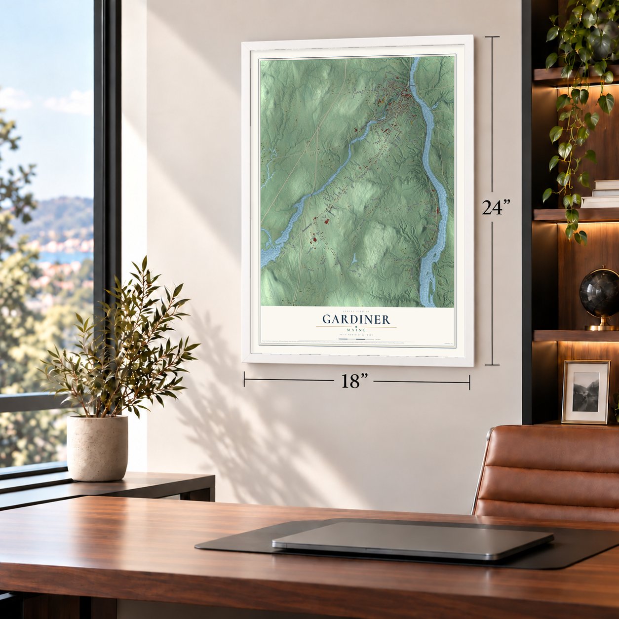
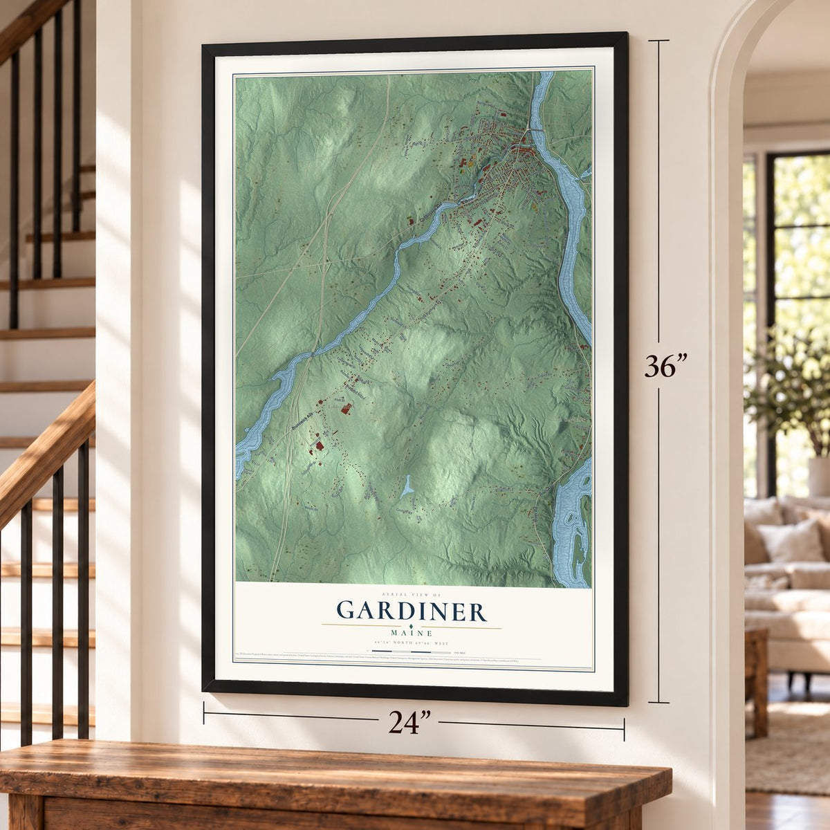
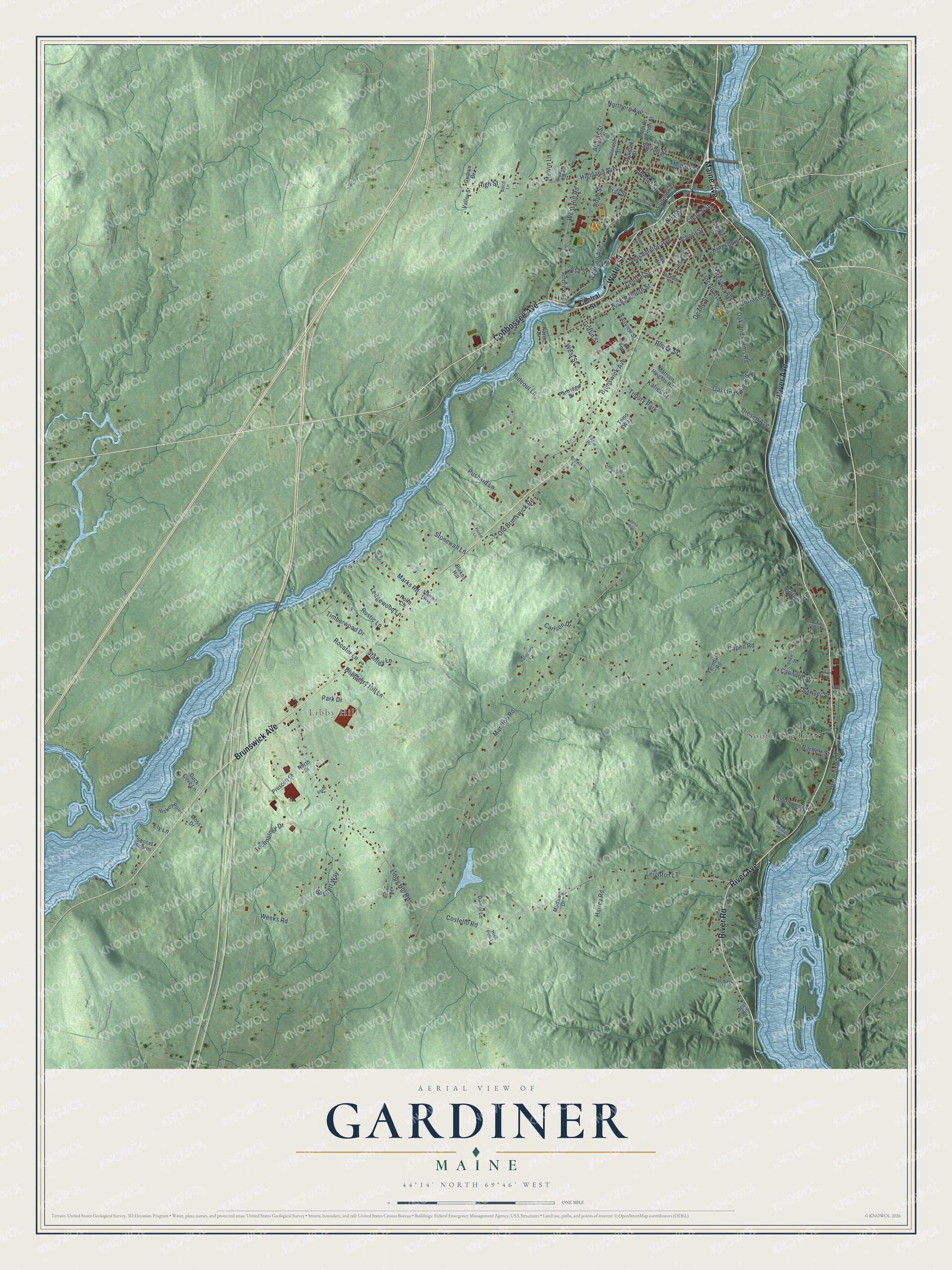
Explore Gardiner, Maine from a whole new perspective. Created using aerial imagery and detailed geographic data, this map captures Gardiner building by building, with labeled streets, familiar landmarks, and shaded topographical relief that highlights the natural contours of the landscape.
Combining modern data with the timeless character of a vintage atlas, this map is just as interesting up close as it is beautiful on the wall. Whether you grew up in Gardiner, spent memorable years there, or call it home today, this unique map is a great way to celebrate a place that means something to you. Zoom in on the preview to look for your street, and then order a print to put your memories on the wall.
Three ways to hang it
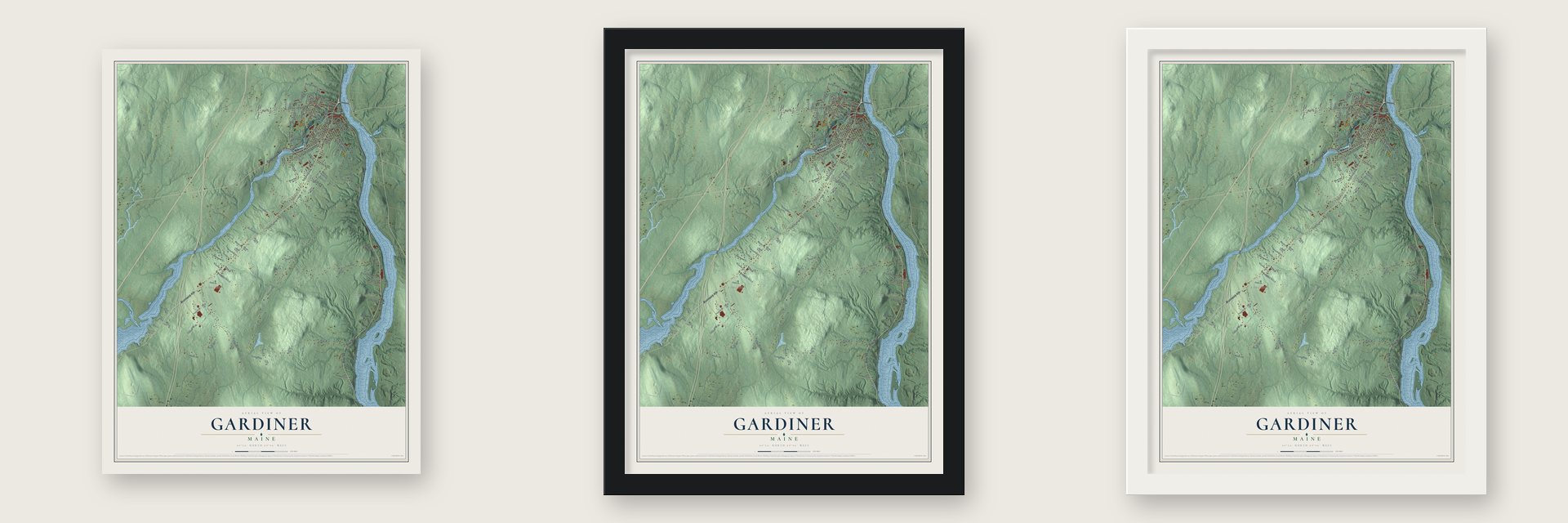
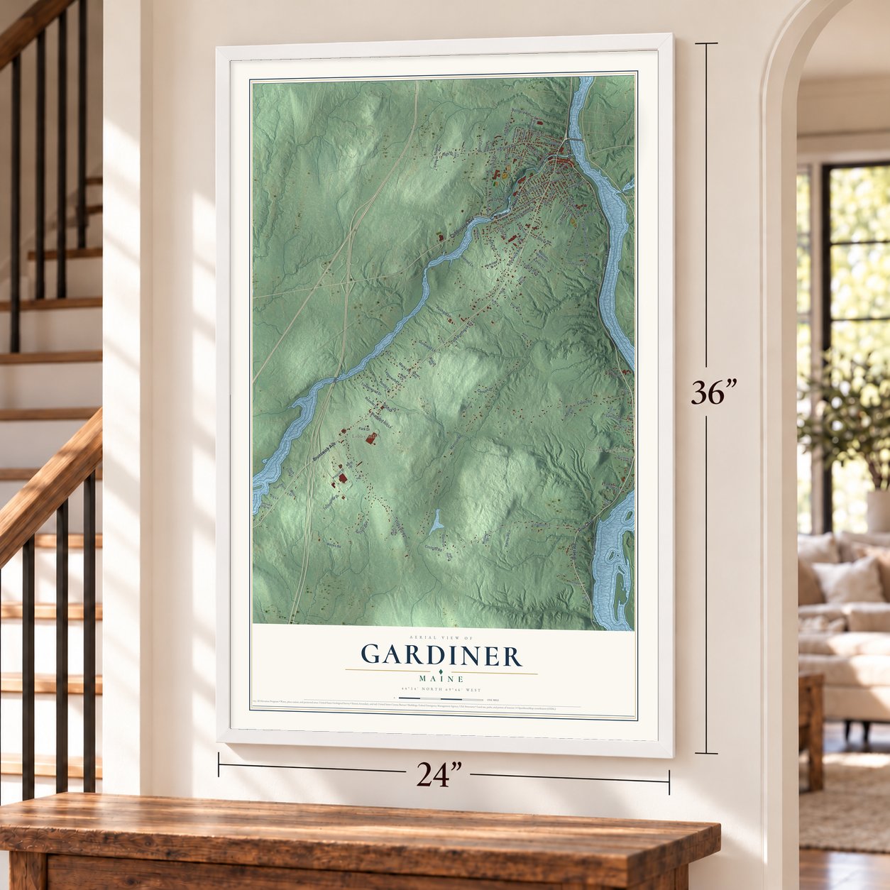
Unframed archival matte, a black wood frame or a white wood frame.
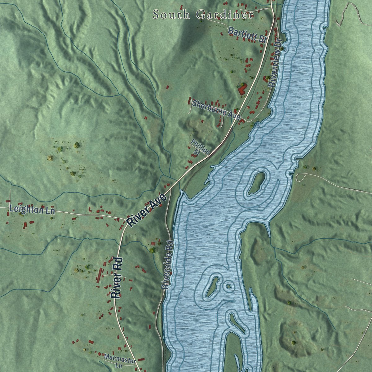
Up close
Geography Worth Displaying
This map was created using accurate cartographic data and authoritative geographic sources, including the U.S. Geological Survey (USGS) and FEMA. The map brings together terrain, waterways, roads, and building detail. The majority of the streets are labeled, houses are accurately depicted, and the topography is derived from government sources. Combining local data with carefully composed color and shading leads to this beautifully detailed Gardiner artwork for your wall.
Rather than simply showing street outlines, we’ve included as many of the street names as we could reasonably fit on the map while keeping their names legible. Zoom in on the high resolution preview to see exactly what’s on the map. We truly set out to create a statement piece for anyone who loves Gardiner. So whether it’s for you, or a gift for someone you love, we hope this map of Gardiner brings back fond memories.
Explore the full map of Gardiner, Maine and read about the local places it shows.

Find your street
Names on the Gardiner map
Every name below is printed on this map. Look for your street, your school, the park where you played, or the pond down the road.
Places and landmarks3
- Libby Hill
- South Gardiner
- Tilbury Park
Streets and roads117
- River Avenue
- Water Street
- Maine Avenue
- Brunswick Avenue
- River Road
- Cobbossee Avenue
- Griffin Street
- Costello Road
- Leighton Lane
- Central Street
- Northern Avenue
- Summer Street
- Marston Road
- West Street
- Weeks Road
- Capen Road
- Libby Hill Road
- Highland Avenue
- Lincoln Avenue
- Old Brunswick Road
- Dresden Avenue
- Rideout Lane
- Riverside Road
- Harrison Avenue
- West Hill Road
- Oakland Farms Road
- High Street
- High Holborn Street
- Stonewall Lane
- Technology Drive
Show all 117 streets
- Riverview Drive
- Spring Street
- Pushard Lane
- Katies Court
- Adams Street
- Washington Avenue
- Rooster Lane
- Rustic Lane
- Oakland Farm Road
- Marks Road
- Blueberry Hill Lane
- Timberwood Drive
- Cannard Street
- Bartlett Street
- Winter Street
- Cottage Street
- Ledgewood Lane
- Park Drive
- Harley Road
- Pierce Street
- Kingsbury Street
- School Street
- Deane Street
- Barnett Way
- Stanley Lane
- Dresen Avenue
- Andrews Street
- Pope Street
- Church Street
- Carlson Drive
- Sawyer Street
- Ash Street
- Neal Street
- Melvin Lane
- Pray Street
- Middle Street
- Ely Lane
- Mattson Heights Road
- Warren Avenue
- Ferndale Road
- Mount Vernon Street
- Elm Street
- Hickey Point
- Sherburne Avenue
- Duck Cove Lane
- Mudawg Drive
- Hillcrest Street
- Daniel Lane
- Fairview Street
- Prescott Street
- Toms Way
- Partridge Drive
- Liberty Street
- Gudrun Drive
- Plaisted Street
- Dennis Street
- Valley Street
- Sunset Shores
- North Street
- Moss Drive
- Blakes Hill
- Lions Street
- Karen Drive
- Deer Hill
- Rolfe Circle
- Snow Street
- Booker Road
- Macmaster Lane
- Harding Street
- Heselton Street
- Slamins Way
- Orchard Street
- Abcd Lane
- High Pine Lane
- Phillips Street
- Brown Lane
- Carey Lane
- Eagle Drive
- Mill Street
- Maple Street
- Puringtons Lane
- Ledgeside
- Farm Family Lane
- Union Street
- Parent Lane
- South
- Justa Way
Names are listed as they appear on the printed map. Zoom into the product photos to find them.
About Gardiner, Maine
Gardiner is a city of 5,961 people in Kennebec County, set along the Kennebec River's west bank south of Augusta. Dr. Silvester Gardiner, a Boston physician who grew rich selling drugs and became a principal owner of the Kennebec Purchase, founded Gardinerstown Plantation here in 1754. He chose the head of navigation, where Cobbosseecontee Stream drops 130 feet into the river, because that fall could drive mills. He persuaded a carpenter, a wheelwright, a millwright and a gristmill builder to settle, along with Isaac "Hazard" Stockbridge, a man he enslaved.
Dr. Gardiner remained a Loyalist and fled Boston along with the departing British in 1776, and his Maine lands were seized. A mistake in the confiscation let his heirs recover the property, and his grandson Robert Hallowell Gardiner arrived in the early 1800s to run it. He settled titles with the squatters, rebuilt the dams and mills, and added stores, a church, an inn and a wharf. The town was incorporated on February 17, 1803, and he later became its first mayor.
- Ice from the KennebecEvery winter, crews sawed large blocks out of the frozen river and stored them in warehouses under sawdust so they would last into summer. Ships carried the ice all year to ports across the United States and overseas. Buyers prized Gardiner ice because it was cut as far upriver as deep-draft ships could sail, and the trade lasted from the 1880s into the 1920s.
- Eight dams on the streamBy 1850 Gardiner ranked among the leading ports on the Kennebec, and eight dams on Cobbosseecontee Stream powered its mills. The railroad came in 1851, a working steam automobile was built here in 1858, and paper mills grew from the 1860s. Many mills shut down by the 1960s, which left the brick downtown along Water Street from the late 1800s largely untouched, including the public library that Henry Richards designed in 1881.
- The model for Tilbury TownEdwin Arlington Robinson arrived in Gardiner in 1870, aged about one, and grew up at 67 Lincoln Avenue. Gardiner became his Tilbury Town, where "Richard Cory" and "Mr. Flood's Party" take place.
- Laura E. RichardsLaura E. Richards, a daughter of Julia Ward Howe, came to Gardiner in 1876 when her husband went to work running his family's paper mill. She published more than 90 books, among them Captain January, and in 1917 she and her sisters shared a Pulitzer Prize for a biography of Howe. In 1935 she led a nationwide fund drive for the Robinson monument on Gardiner Common, and a city elementary school bears her name.
- Two Gothic Revival landmarksSilvester Gardiner organized the Christ Episcopal Church congregation in 1772, the oldest in the Episcopal Diocese of Maine. Its stone church on the common, built in 1820, is New England's oldest known Gothic Revival church and holds his cenotaph. South of downtown, Richard Upjohn designed Oaklands, a granite house for the Gardiner family begun in 1835 with stone from Hallowell. The estate above the Kennebec is still farmed.
Keep exploring Maine
Gardiner is one of 536 Maine towns we've mapped. Every dot on the map is a print of its own.
The search covers every state, Maine first.
Near Gardiner
Order 2 or more town maps and save 10%. Shown in the size and finish you picked above, so they hang as a set.
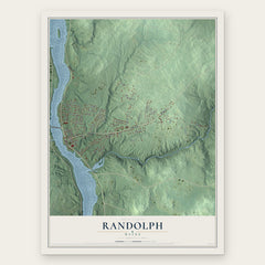
- Randolph 12" x 18" / Archival Matte Print $39.99
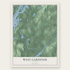
- West Gardiner 12" x 18" / Archival Matte Print $39.99
- Pittston 12" x 18" / Archival Matte Print $39.99

More maps nearby: Farmingdale, Richmond, Chelsea, Hallowell and Litchfield.
The art of mapping a place
How This Map Was Made
Real places. Remarkable detail. Discover the layers that turn geographic data into a map of home.

The view from above
Aerial imagery reveals the character of the land: woodland, open fields, and the patterns of a place.

The shape of the land
Elevation data brings hills, valleys, and subtle changes in the landscape into view.

The details of home
Roads, waterways, and building footprints come together to make the map feel unmistakably local.

Geography becomes art
Considered color, shading, and typography bring the layers together in a map made for your wall.


Process illustrated with Mendon, Massachusetts. Aerial imagery: USDA NAIP. Terrain: USGS 3D Elevation Program. Map details and finished artwork: KNOWOL.
The Details
About This Print
Choose an archival matte print, or a black or white Ayous wood frame. The archival matte print is unframed.
Select your size and finish above to see the matching product image and price.
Materials & Craftsmanship
A contemporary map with the character of a classic atlas, printed on archival matte paper. Optional frames are made from Ayous wood.
Your printed map does not include the watermark shown in the full-map preview.
Shipping & Delivery
Free shipping within the United States. Every print is made to order in the USA.
Buying a gift? Add a note in your cart and we'll include it. We never put prices in the package.
Prints ship within 2 to 3 business days. Allow 7 to 10 days total from ordering for delivery. Timing may vary during holidays or periods of high order volume.
Read our shipping policy.
Returns and damaged prints
Each print is made to order. Change-of-mind refunds are not available after production.
If your print arrives damaged, misprinted or incorrect, contact support@knowol.com within 30 days of receiving it. Include your order number, photos and a description of the issue.
Read our full refund and replacement policy. For questions about your order, email support@knowol.com.