
Search for another town



Free U.S. delivery 7 to 10 days after you order
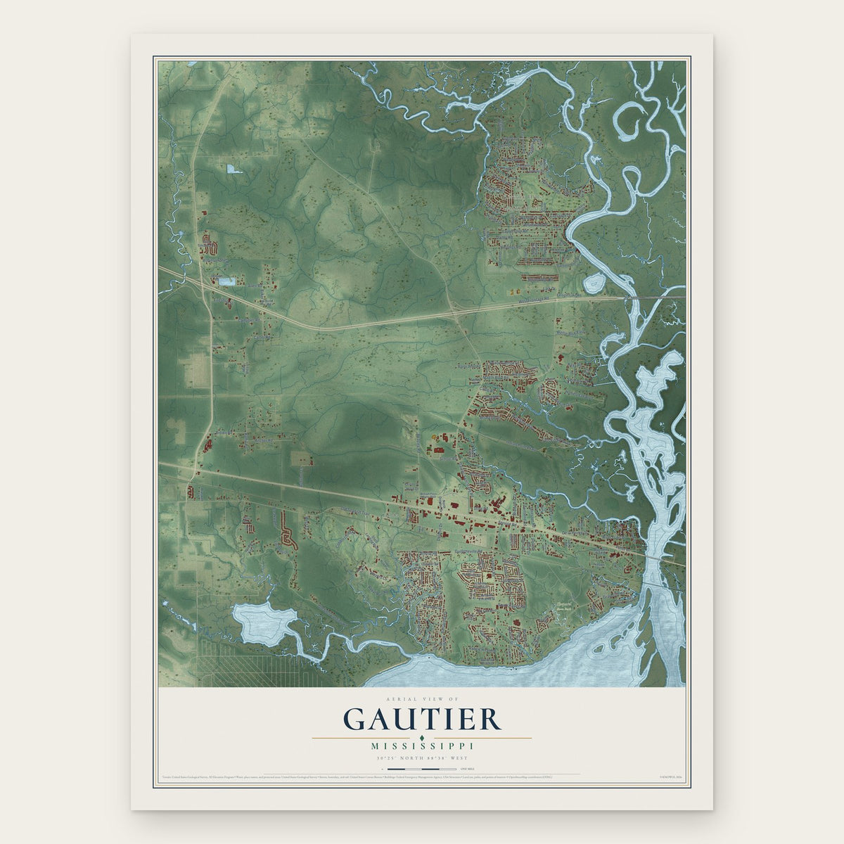
Gautier, Mississippi Map Art
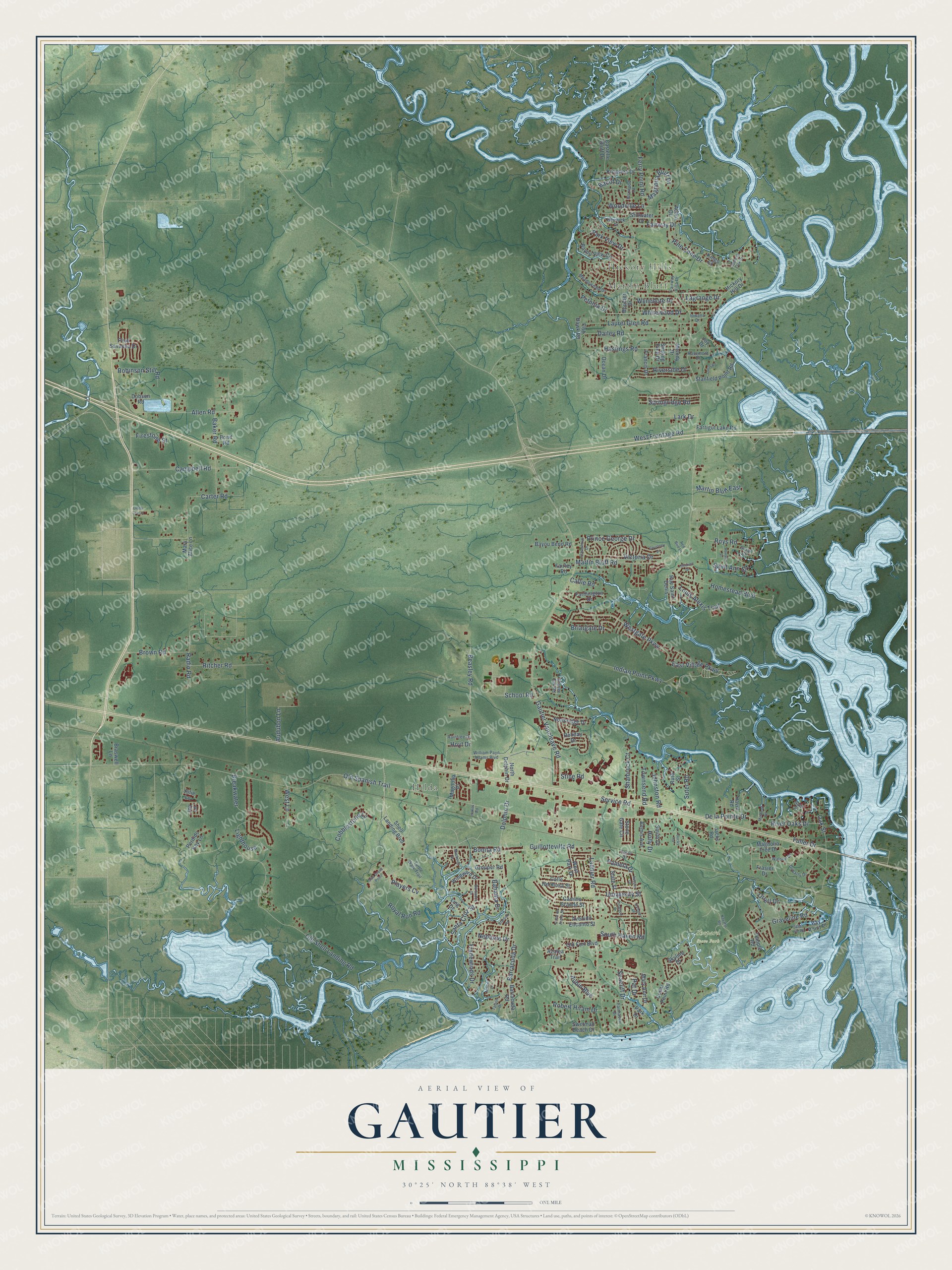
A new map of Gautier, Mississippi, made in 2026 and printed to order on thick archival matte paper.
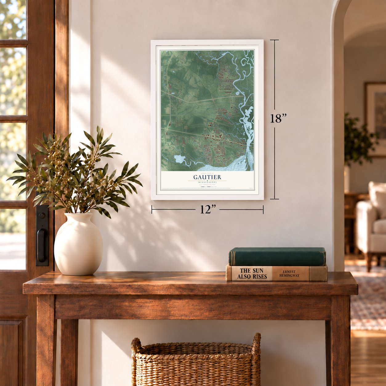
12" x 18" Archival Matte Print
A Map of Home. A Work of Art.
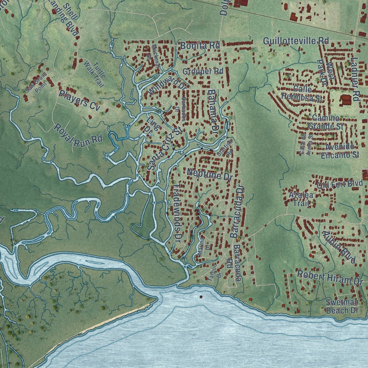
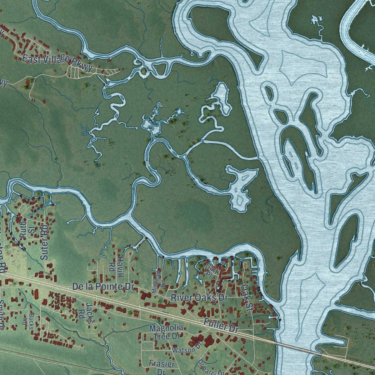
Explore Gautier, Mississippi from a whole new perspective. Created using aerial imagery and detailed geographic data, this map captures Gautier building by building, with labeled streets, familiar landmarks, and shaded topographical relief that highlights the natural contours of the landscape.
Combining modern data with the timeless character of a vintage atlas, this map is just as interesting up close as it is beautiful on the wall. Whether you grew up in Gautier, spent memorable years there, or call it home today, this unique map is a great way to celebrate a place that means something to you. Zoom in on the preview to look for your street, and then order a print to put your memories on the wall.
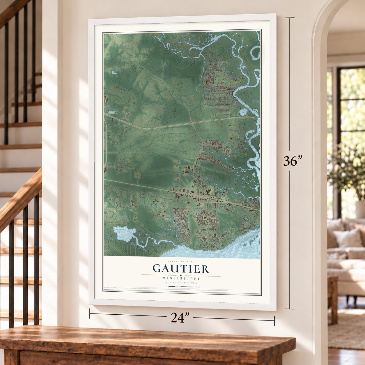
Three ways to hang it
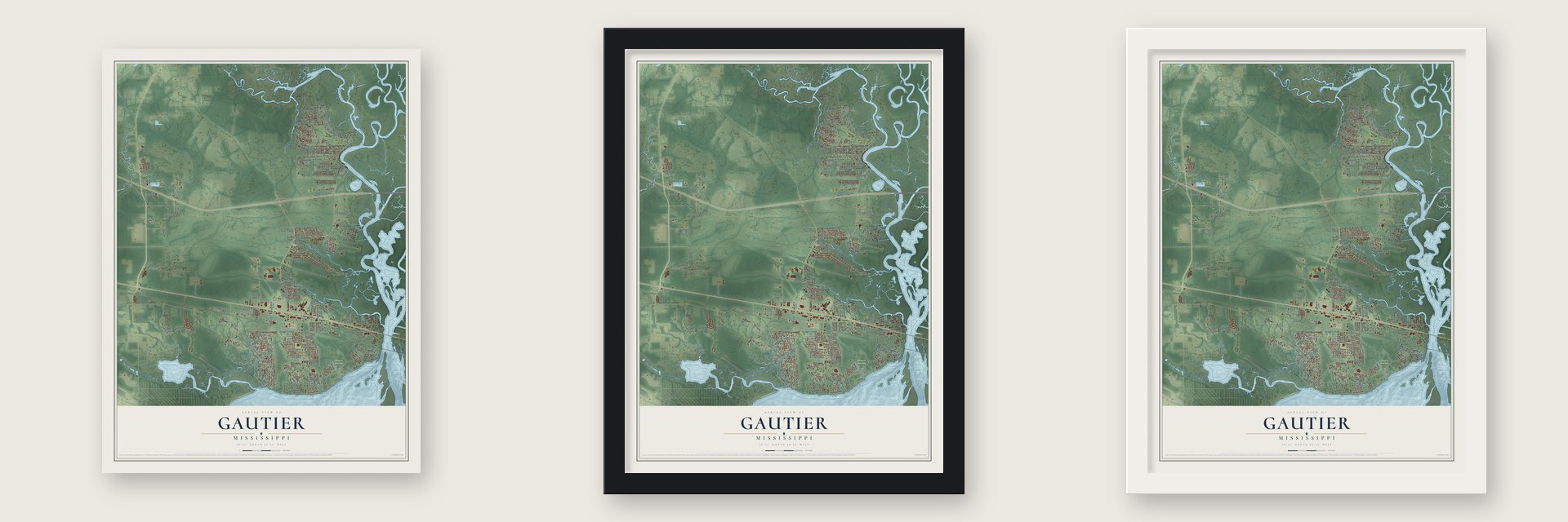
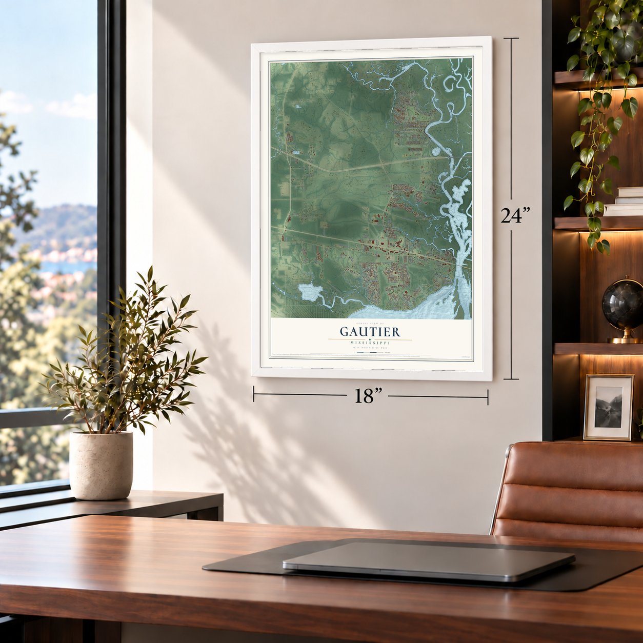
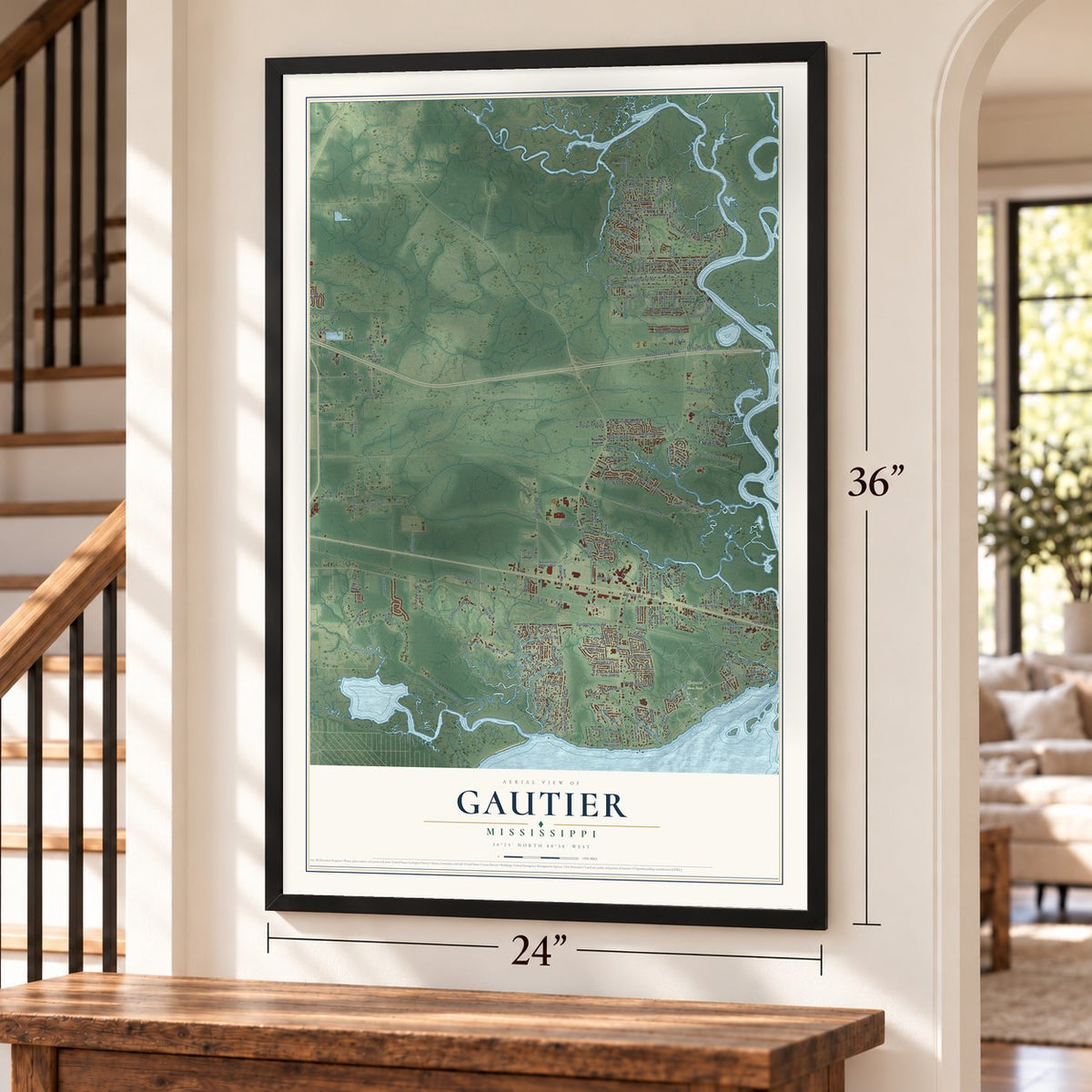
Unframed archival matte, a black wood frame or a white wood frame.
Up close
Geography Worth Displaying
This map was created using accurate cartographic data and authoritative geographic sources, including the U.S. Geological Survey and the Census Bureau. The map brings together terrain, waterways, roads, and building detail. The majority of the streets are labeled, houses are accurately depicted, and the topography is derived from government sources. Combining local data with carefully composed color and shading leads to this beautifully detailed Gautier artwork for your wall.
Rather than simply showing street outlines, we’ve included as many of the street names as we could reasonably fit on the map while keeping their names legible. Zoom in on the high resolution preview to see exactly what’s on the map. We truly set out to create a statement piece for anyone who loves Gautier. So whether it’s for you, or a gift for someone you love, we hope this map of Gautier brings back fond memories.
Read the story behind this map of Gautier, Mississippi from 2026.

About Gautier, Mississippi
Gautier, pronounced GOH-SHAY, is a city of 19,024 people in Jackson County, where the West Pascagoula River flows into Mississippi Sound. Locals know the river as the Singing River. In the 1690s the French colonizer Pierre Le Moyne, Sieur d'Iberville, set up forts and settlements along this coast, and some of those early outposts later grew into Gautier and Ocean Springs.
The town is named for the Gautier family, who came from Lyon, France. Fernando Upton Gautier was born in 1822 aboard a cargo ship while his parents were moving to New Orleans. In 1867 he built a roomy homestead near the mouth of the Pascagoula River and started a sawmill that made good money, and a town grew up around the mill. Gautier has been run by a city manager and council since 1987, and in 2002 it annexed enough land to more than double its size.
- The Old PlaceFernando Upton Gautier's 1867 homestead still stands, and locals call it "The Old Place." Descendants of Fernando and his wife, Theresa Fayard Gautier, still own the house, and they open it for private and public events.
- A hamlet of 27 in 1900An old state history described Gautier as a post-hamlet at the mouth of the Pascagoula River, a mile from the West Pascagoula station on the L. & N. railroad. The 1900 census counted just 27 people there, and by 1906 the estimate had grown to 150.
- A Blue Ribbon schoolGautier High School opened its doors in 1996. In 2005 the Department of Education gave it blue ribbon status, the same year Hurricane Katrina struck the coast on August 29 and cost the town homes and jobs. Mississippi Gulf Coast Community College runs its Jackson County campus in Gautier as well.
- 900 acres saved in 2023Bayous and wetlands surround Gautier on three sides. In 2023 the city gained the Eric Clark Coastal Preserve, 900 acres of protected coastal land with trails for hiking.
Find your street
Names on the Gautier map
Every name below is printed on this map. Look for your street, your school, the park where you played, or the pond down the road.
Places and landmarks4
- Hilda
- Hickory Hills
- Martin Bluff
- Shepard State Park
Streets and roads180
- Lagrange Drive
- School Road
- Petunia Drive
- Barracuda Drive
- Park View Drive
- Old Spanish Trail
- Gautier Vancleave Road
- Martin Bluff Road
- Graveline Road
- Old Shell Landing Road
- Dolphin Drive
- Ladnier Road
- West Frontage Road
- Brown Road
- Beasley Road
- De la Pointe Drive
- Indian Point Parkway
- Hastings Road
- Allen Road
- Ferry Point Road
- Westgate Parkway
- Homestead Boulevard
- Dailey Road
- Laurel Glen Road
- Campbell Road
- Pine Cone Drive
- Baker Road
- Tradewinds Drive
- Breakwater
- Louis Alexis Trail
Show all 180 streets
- Bonita Road
- Victoria Drive
- Royal Run Road
- Guillotteville Road
- Oak Street
- Ritcher Road
- Cobblestone Lane
- Prince George Drive
- Roys Road
- Martin Bluff East
- Shamrock Court
- East Village Parkway
- Springridge Road
- Robinson Still Road
- Stine Road
- Lighthouse
- Lark Drive
- West Lane
- Riverside Drive
- Magnolia Bluff Drive
- Robert Hiram Drive
- Firestone Street
- Seacliff Drive
- River Oaks Drive
- Townsend Road
- Audubon Lane
- South Haven Road
- Whitewood Drive
- Santa Cruz Street
- Aubin Boulevard
- Carter Road
- Suter Road
- Wynedote Drive
- Saint Ann Street
- University Street
- Fairway Drive
- Orrell Drive
- Johnston Road
- Fuller Drive
- Briargate Drive
- Players Cv
- Pat Drive
- Woodville Lane
- Bacot Drive
- Bahama Drive
- Neptune Drive
- Holly Drive
- Radio Road
- Service Road
- Pamela Drive
- Callie Road
- Hoyt Drive
- Hickory Hill Drive
- Camino Grande Street
- Barracuda Road
- Shell Landing Boulevard
- Windward Drive
- North Dolphin Drive
- Stone Gate Circle
- Stanfield Point Road
- Bayou View Circle
- West Park Drive
- Kingslea Drive
- Magnolia Tree Drive
- Pine Savanna Drive
- Farrigut Lake Road
- Castelle Bluff Drive
- Northridge Drive
- Avenido Encanto Street
- Bayou Bend Road
- Calle Hermosa Street
- Old Fort Boulevard
- Cedar Point Road
- Mary Ann Drive
- Bemis Avenue
- Stillwater Drive
- Farmington Drive
- Fish Hawk Road
- Azalea Trail
- Ocean Drive
- Rue Saint Denis
- Grouper Road
- Perdido Key Lane
- Smith Drive
- Francis Drive
- Boulder Drive
- Magnolia Place
- Ling Drive
- State Street
- Bay Point Place
- Swetman Beach Drive
- Kings Court
- Dobson Road
- Skyline Drive
- Singing Pine Drive
- Havill Road
- Braswell Lane
- Fairley Road
- Jacks Road
- Temple Road
- Frasier Drive
- Mary Alice Lane
- Acorn Drive
- Holiday Drive
- Bond Road
- Melody Drive
- Joy Lane
- Ruth Street
- Julie Lane
- Park Drive
- Joy Drive
- Susan Circle
- Meadowdale Drive
- Dubarry Drive
- Fairway Villa Drive
- Fairhaven Drive
- William Payn Adams Boulevard
- Boxwood Lane
- Rosemont Drive
- Turtle Walk Trail
- Raintree Drive
- Hemlock Drive
- Watson Drive
- Scarlet Oak Road
- Iowana Drive
- Carol Drive
- Gatti Place
- Marina Drive
- Mackeral Drive
- Oxford Drive
- Claresholm Drive
- Barbados Drive
- Roxane Street
- Starfish Road
- Courtney Drive
- Saw Grass Point
- Tarpon Drive
- Auburn Drive
- Hillcrest Drive
- Lucas Road
- Calle de Arena Street
- Navaho Road
- Spanish Oak Drive
- Linwood Drive
- Milstead Road
- Italian Isle Road
- Red Bird Lane
- Bucks Road
- Linda Lee Lane
- Hakes Road
Names are listed as they appear on the printed map. Zoom into the product photos to find them.
The art of mapping a place
How This Map Was Made
Real places. Remarkable detail. Discover the layers that turn geographic data into a map of home.

The view from above
Aerial imagery reveals the character of the land: woodland, open fields, and the patterns of a place.

The shape of the land
Elevation data brings hills, valleys, and subtle changes in the landscape into view.

The details of home
Roads, waterways, and building footprints come together to make the map feel unmistakably local.

Geography becomes art
Considered color, shading, and typography bring the layers together in a map made for your wall.


Process illustrated with Mendon, Massachusetts. Aerial imagery: USDA NAIP. Terrain: USGS 3D Elevation Program. Map details and finished artwork: KNOWOL.
The Details
About This Print
Choose an archival matte print, or a black or white Ayous wood frame. The archival matte print is unframed.
Select your size and finish above to see the matching product image and price.
Materials & Craftsmanship
A contemporary map with the character of a classic atlas, printed on archival matte paper. Optional frames are made from Ayous wood.
Your printed map does not include the watermark shown in the full-map preview.
Shipping & Delivery
Free shipping within the United States. Every print is made to order in the USA.
Buying a gift? Add a note in your cart and we'll include it. We never put prices in the package.
Prints ship within 2 to 3 business days. Allow 7 to 10 days total from ordering for delivery. Timing may vary during holidays or periods of high order volume.
Read our shipping policy.
Returns and damaged prints
Each print is made to order. Change-of-mind refunds are not available after production.
If your print arrives damaged, misprinted or incorrect, contact support@knowol.com within 30 days of receiving it. Include your order number, photos and a description of the issue.
Read our full refund and replacement policy. For questions about your order, email support@knowol.com.
Find your town
Looking for another city?
Find a map of home in our Mississippi collection, or any town in the country.
Nearby
Maps of towns near Gautier
Know someone from one of these towns? Their map makes a great gift.
 Gulf Park Estates
, Mississippi
From $39.99See the map
 Pascagoula
, Mississippi
From $39.99See the map
 Moss Point
, Mississippi
From $39.99See the map
More maps nearby: Ocean Springs, Escatawpa, Gulf Hills, Vancleave and Helena.