
Search for another town



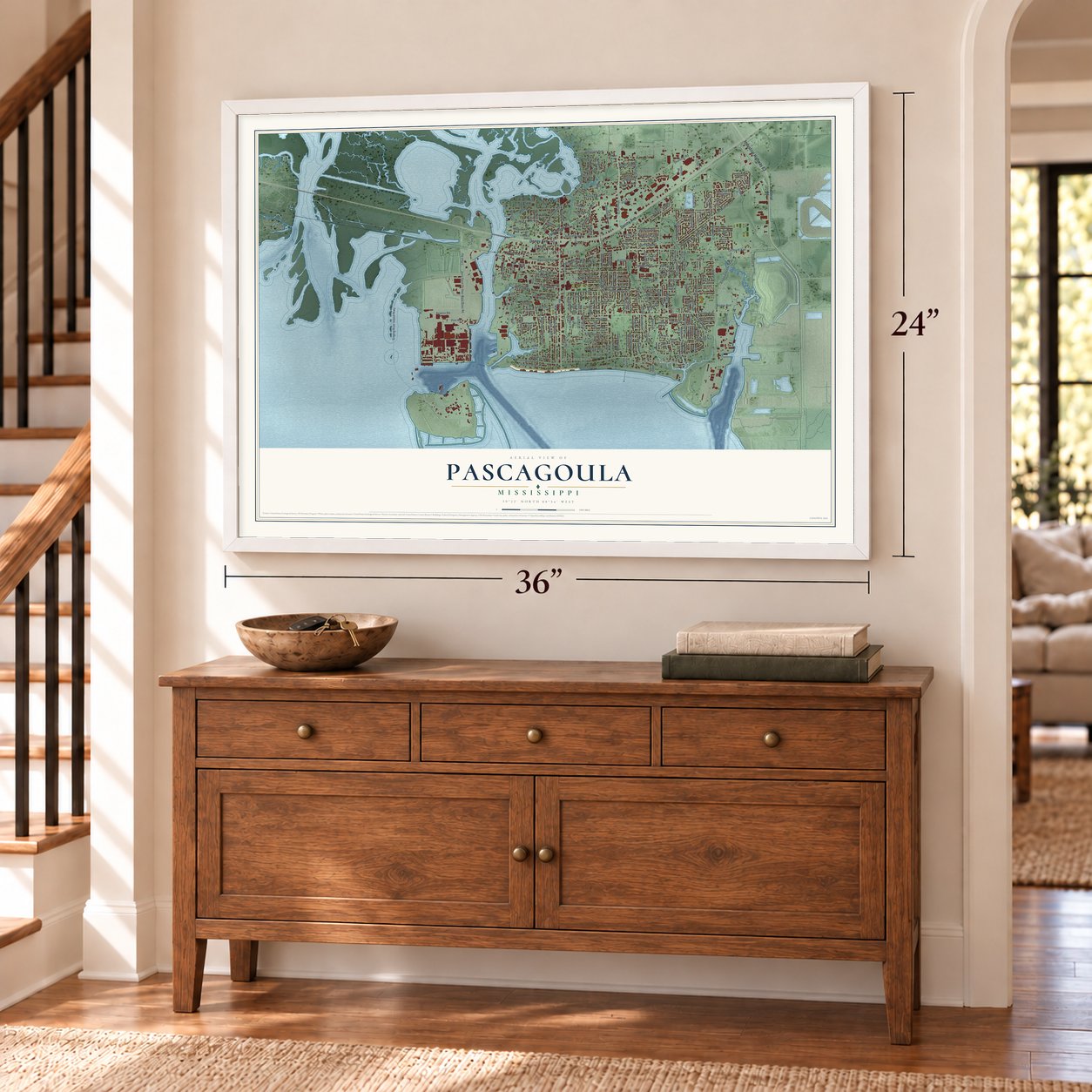

Free U.S. delivery 7 to 10 days after you order
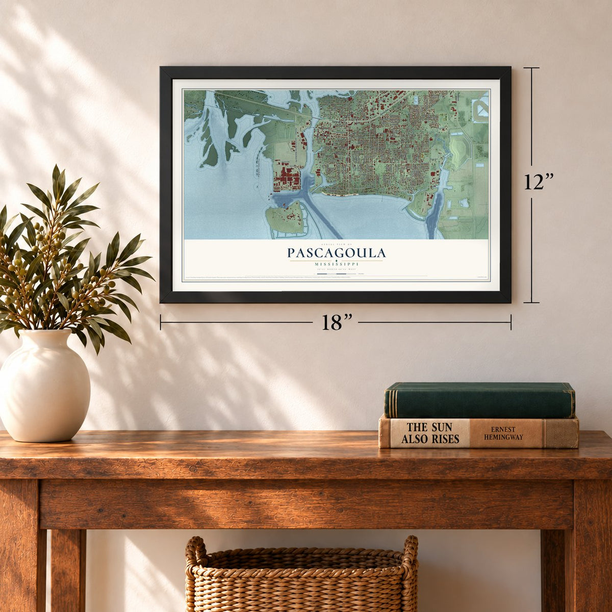
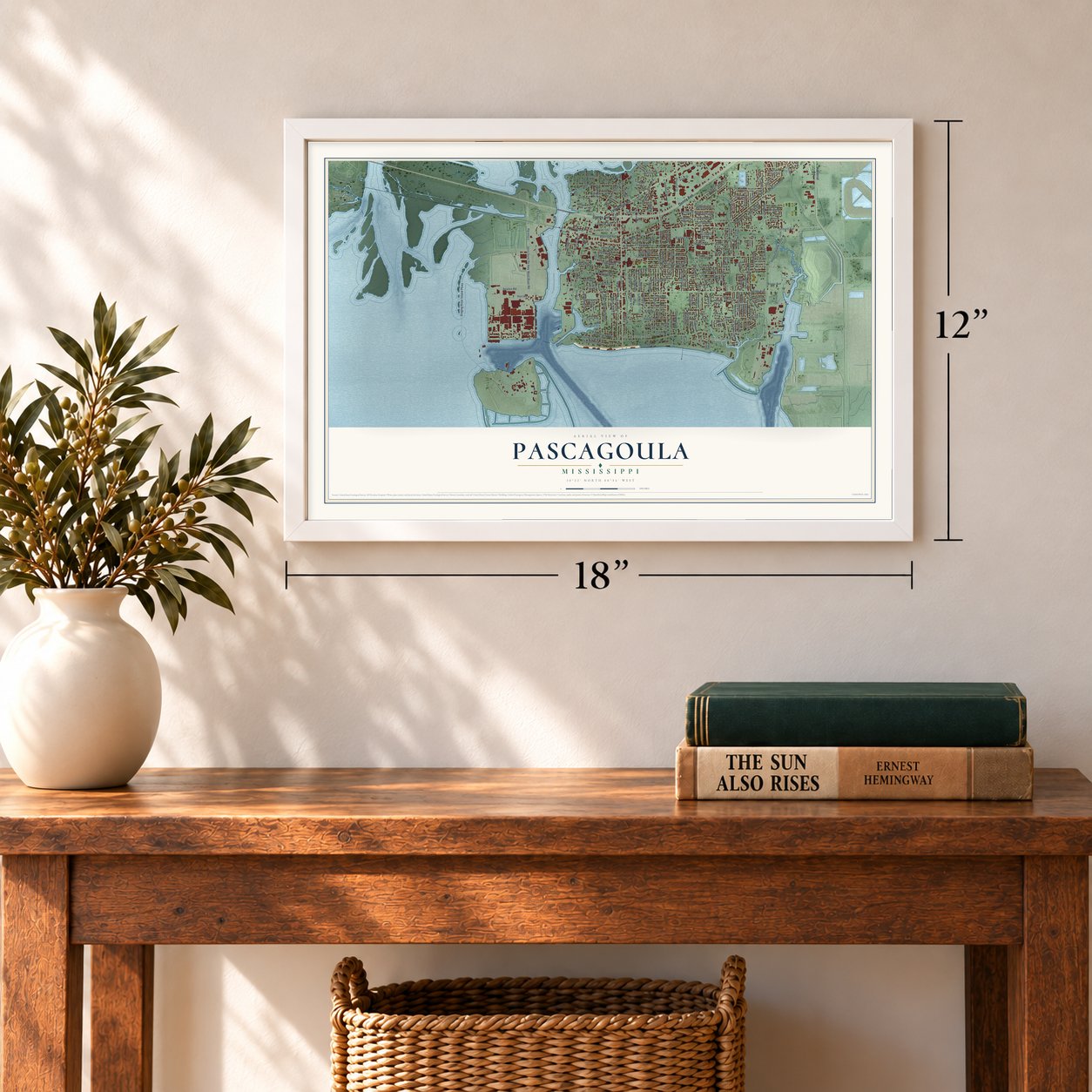
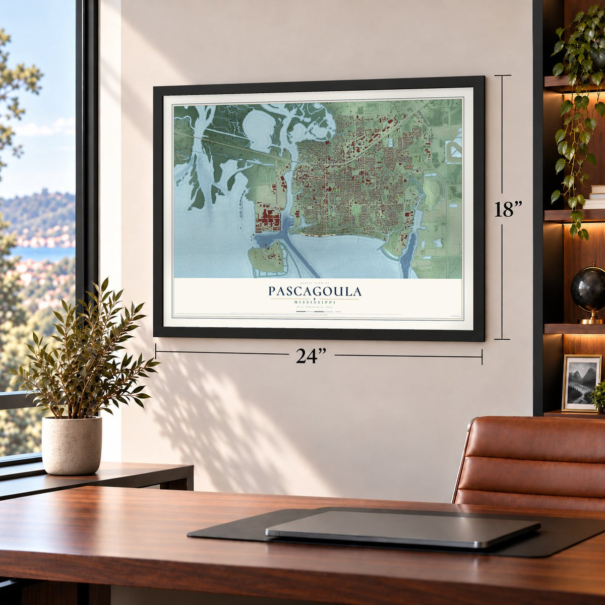
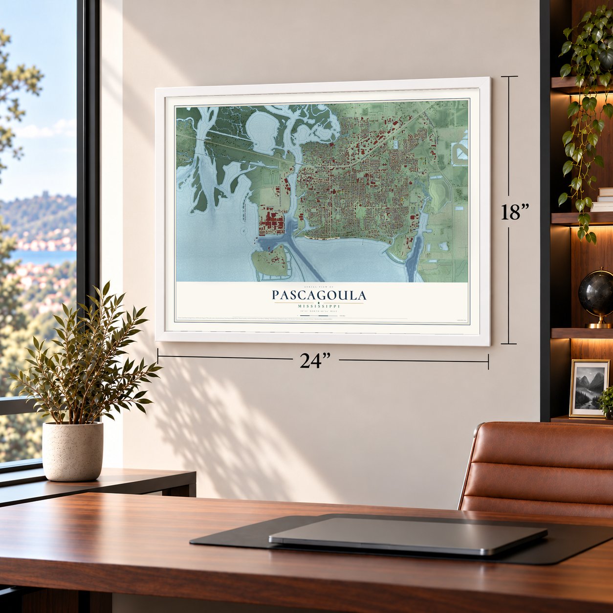
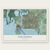
Pascagoula, Mississippi Map Art
A new map of Pascagoula, Mississippi, made in 2026 and printed to order on thick archival matte paper.
12" x 18" Archival Matte Print
A Map of Home. A Work of Art.
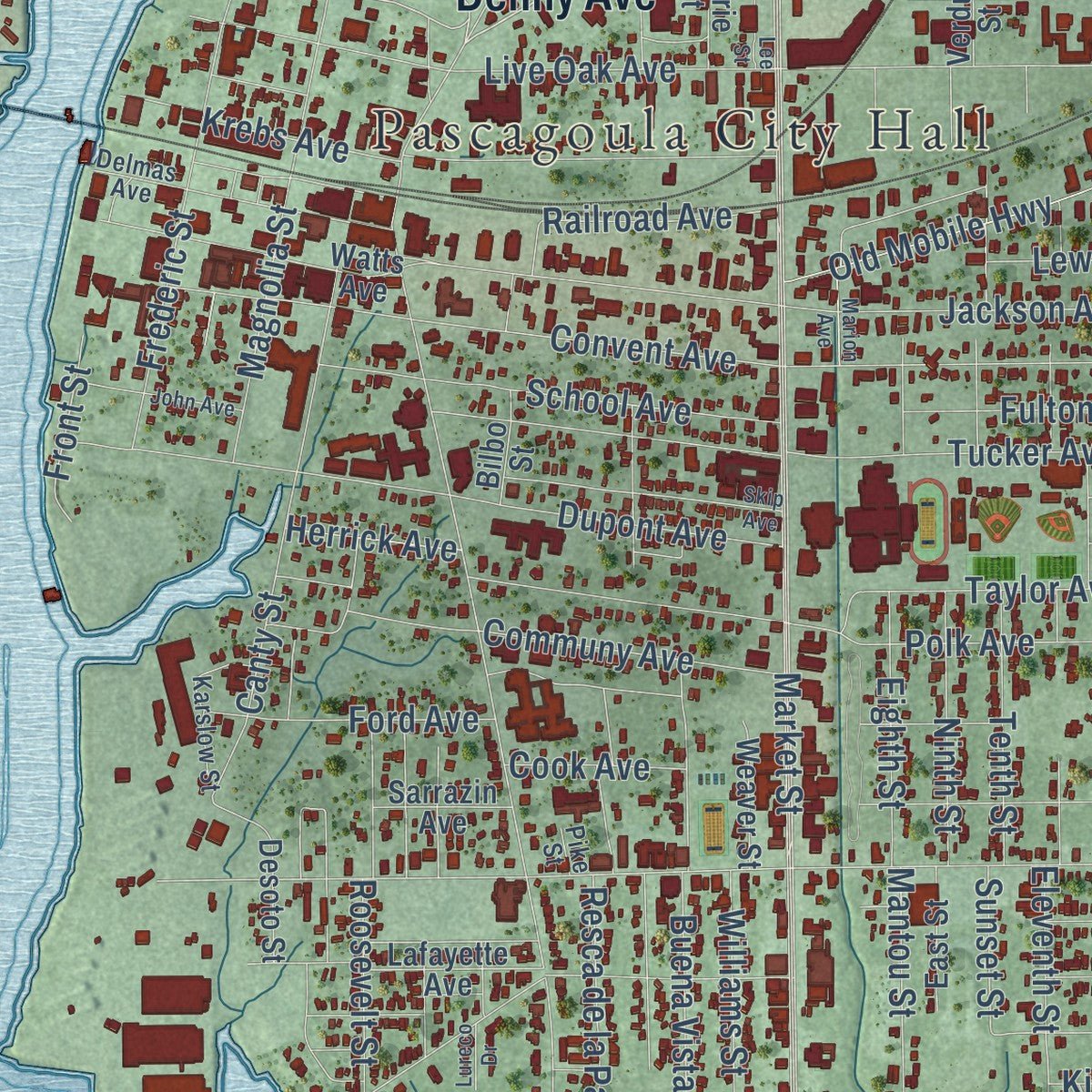
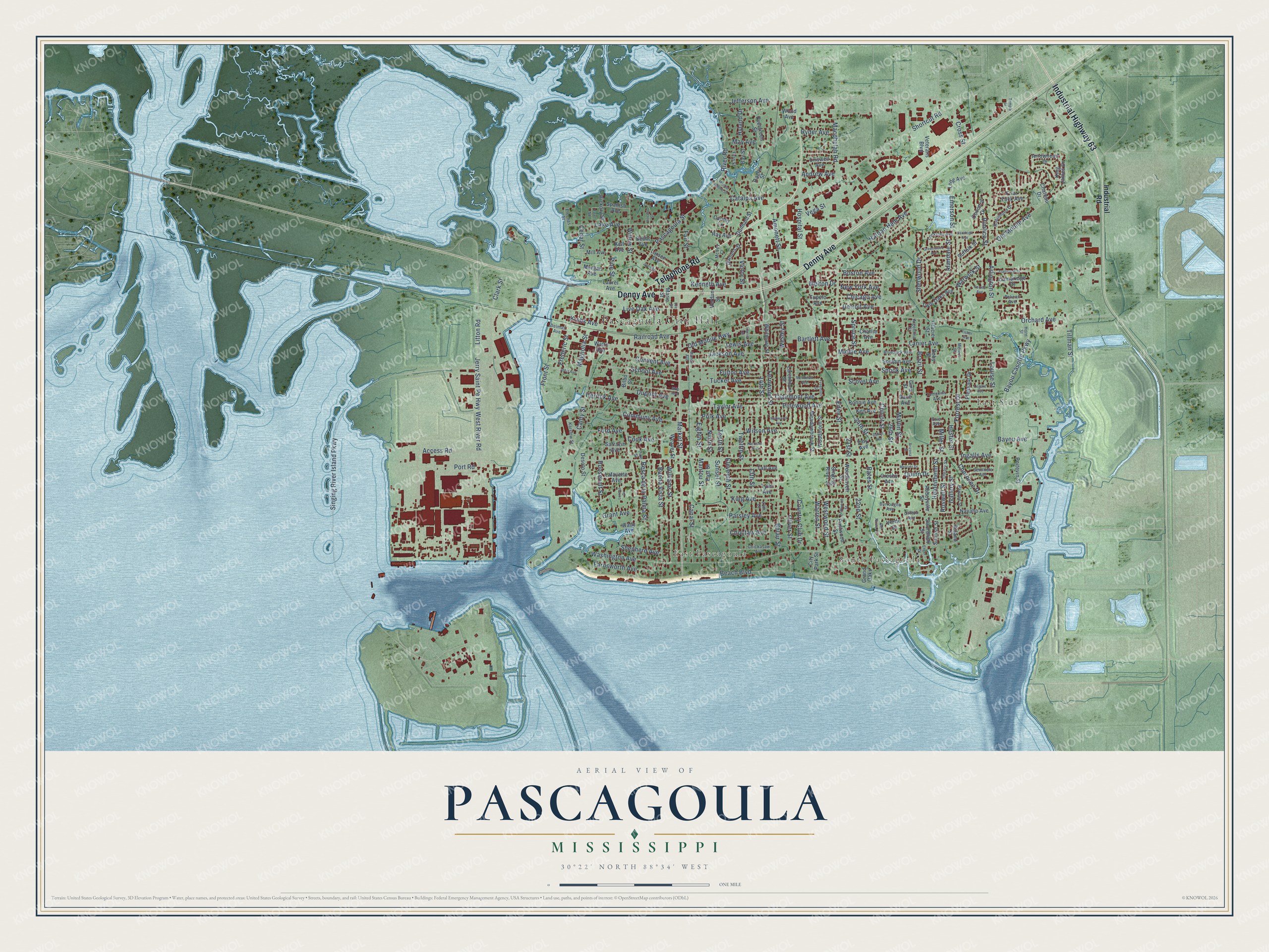
Explore Pascagoula, Mississippi from a whole new perspective. Created using aerial imagery and detailed geographic data, this map captures Pascagoula building by building, with labeled streets, familiar landmarks, and shaded topographical relief that highlights the natural contours of the landscape.
Combining modern data with the timeless character of a vintage atlas, this map is just as interesting up close as it is beautiful on the wall. Whether you grew up in Pascagoula, spent memorable years there, or call it home today, this unique map is a great way to celebrate a place that means something to you. Zoom in on the preview to look for your street, and then order a print to put your memories on the wall.
Three ways to hang it
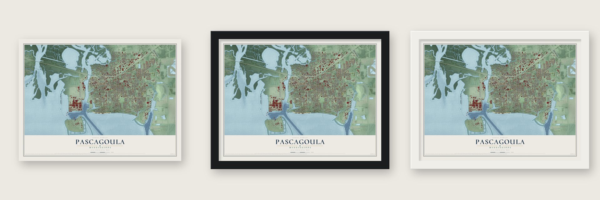
Unframed archival matte, a black wood frame or a white wood frame.
Up close
Geography Worth Displaying
This map was created using accurate cartographic data and authoritative geographic sources, including the U.S. Geological Survey and the Census Bureau. The map brings together terrain, waterways, roads, and building detail. The majority of the streets are labeled, houses are accurately depicted, and the topography is derived from government sources. Combining local data with carefully composed color and shading leads to this beautifully detailed Pascagoula artwork for your wall.
Rather than simply showing street outlines, we’ve included as many of the street names as we could reasonably fit on the map while keeping their names legible. Zoom in on the high resolution preview to see exactly what’s on the map. We truly set out to create a statement piece for anyone who loves Pascagoula. So whether it’s for you, or a gift for someone you love, we hope this map of Pascagoula brings back fond memories.
Read the story behind this map of Pascagoula, Mississippi from 2026.
About Pascagoula, Mississippi
Pascagoula is a city of 22,010 people and the seat of Jackson County, on Mississippi Sound at the mouth of the Pascagoula River. It takes its name from the Pascagoula people, whose villages stood upriver, and the name is usually translated as "bread eater." English, French and Spanish rulers took turns holding this coast. For 74 days in 1810 it belonged to the Republic of West Florida, and in 1812 it joined the Mississippi Territory for good.
Its neighbor Scranton was incorporated in 1870. Pascagoula became a village in 1892 and a city in 1901, and a governor's proclamation joined the two towns in 1904, which a legislative act confirmed in 1912. That is why today's downtown was once Scranton. Before World War II Pascagoula was a quiet fishing village of about 5,000, but wartime shipbuilding paid high wages, workers poured in, and the small town grew into a small city.
“we found a wide bay, called the Bay of the Pascagoulas ; because, within this bay, there flows a river, upon the borders of which the Pascagoulas are established, at a distance of about twenty leagues inland”
- The Old Spanish FortBuilders put up the Old Spanish Fort sometime in the 1750s, and it is counted as the oldest building in the Mississippi Valley.
- Ingalls and the LottsIngalls Shipbuilding grew out of the state's Balance Agriculture with Industry program in the late 1930s and 1940s and soon became Mississippi's largest industrial employer. Chester Paul Lott was one of the many who moved here to work at the yard. His son Trent grew up in Pascagoula and served for many years as a U.S. senator from Mississippi.
- Legend of the Singing RiverLorin Thompson painted the mural Legend of the Singing River for the Pascagoula post office in 1939. It was restored in the 1960s, when the building became the public library. After Hurricane Katrina damaged the building in 2005, the mural went into storage, and in 2010 it was hung again in the new post office on Jackson Avenue.
- The fishermen's story of 1973In October 1973 two co-workers, Charles Hickson and Calvin Parker, said aliens took them aboard a craft while they were fishing near Pascagoula. Their account drew reporters from across the country. In June 2019 the city put up a historical marker near the spot, and it now celebrates the story every year downtown at Goula Palooza.
- Katrina's 20-foot surgeHurricane Katrina struck on August 29, 2005, at high tide, and its 20-foot storm surge flooded nearly 92% of the city. Most homes along Beach Boulevard were lost. Few residents had flood insurance, and many had to raise their houses on pilings before they could get a permit to rebuild.
Find your street
Names on the Pascagoula map
Every name below is printed on this map. Look for your street, your school, the park where you played, or the pond down the road.
Places and landmarks4
- Pascagoula City Hall
- East Side
- South Pascagoula
- East Pascagoula
Streets and roads244
- Telephone Road
- Denny Avenue
- Industrial Highway 63
- Access Road
- Jerry Saint Pe Highway
- Convent Avenue
- Jefferson Avenue
- 24th Street
- Pascagoula Street
- Lake Avenue
- Cedar Street
- Martin Street
- Singing River Island Parkway
- Old Mobile Avenue
- Market Street
- Ingalls Avenue
- Washington Avenue
- Beach Boulevard
- 14th Street
- Chicot Street
- Port Road
- Bayou Casotte Parkway
- Belair Street
- Shortcut Road
- Orchard Avenue
- Eleventh Street
- Eden Street
- Jackson Avenue
- Live Oak Avenue
- Buena Vista Street
Show all 244 streets
- Louise Street
- West River Road
- Lanier Avenue
- Hospital Street
- Tucker Avenue
- Twelfth Street
- Nathan Hale Avenue
- Polk Avenue
- 13th Street
- 22nd Street
- Dupont Avenue
- Litton Road
- Scovel Avenue
- Magnolia Street
- Krebs Avenue
- Clark Street
- Canty Street
- Wilson Avenue
- Frederic Street
- Parsley Avenue
- Mantou Street
- Williams Street
- River Road
- Resca de la Palma Street
- Tillman Street
- Vega Street
- Kenneth Avenue
- Catalpa Avenue
- Willow Street
- Old Mobile Highway
- School Avenue
- Railroad Avenue
- Communy Avenue
- Cherokee Drive
- Macphelah Road
- Emerson Street
- Westwood Street
- Taylor Avenue
- Hester Street
- Pine Street
- Forrest Drive
- Oliver Street
- Eighth Street
- Ninth Street
- Tenth Street
- Roosevelt Street
- Victor Street
- Bayou Avenue
- Amonett Street
- Farnsworth Avenue
- Canal Street
- Brazil Street
- Andrew Avenue
- Fulton Avenue
- Alandale Street
- Pimlico Street
- Arlington Street
- Heidenheim Street
- Warren Street
- Fair Street
- Fernwood Street
- Ford Avenue
- 26th Street
- Pinewood Avenue
- Country Club Drive
- Sherwood Drive
- King Avenue
- Boston Avenue
- Lewis Avenue
- Warwick Street
- New York Avenue
- Clairmont Avenue
- Chicago Avenue
- Detroit Avenue
- Middle Avenue
- Bartlett Avenue
- Shepherd Avenue
- Grant Avenue
- May Avenue
- Choctaw Avenue
- Cross Street
- Roswell Street
- Front Street
- Bates Street
- Ryder Avenue
- Quinn Drive
- Spruce Street
- Gallery Street
- Cook Avenue
- Herrick Avenue
- Hyland Drive
- 21st Street
- Snook Avenue
- Miller Street
- Wesley Street
- Melton Drive
- Sunset Street
- Industrial Road
- Abbeyville Street
- Navaho Avenue
- Sarrazin Avenue
- King James Drive
- Arrowhead Drive
- Friar Tuck Avenue
- Lafayette Avenue
- Veterans Boulevard
- Criswell Avenue
- Watts Avenue
- Tyler Avenue
- Meadowbrook Street
- Woodmont Street
- Taft Avenue
- Pleasant Drive
- Eastwood Street
- Desoto Street
- Twin Oaks Avenue
- Becht Avenue
- Dace Avenue
- Evergreen Street
- Kell Avenue
- Grand Oaks
- Spanish Avenue
- Cambridge Drive
- Woodhaven Street
- Singing River Street
- Ronnie Avenue
- Larchmont Street
- Laurel Avenue
- Concord Drive
- Hickory Street
- Sculpin Avenue
- Larsen Avenue
- Suffolk Street
- Morgan Avenue
- Ken Avenue
- Whitmore Street
- Poitevin Street
- Mill Avenue
- Dunham Street
- Cauley Lane
- Weaver Street
- Swordfish Street
- East Street
- Long Avenue
- Charlie Avenue
- Daniels Street
- Sunfish Street
- Glacier Street
- Marie Street
- City Park Street
- Ruland Street
- Bay Street
- Tiny Avenue
- Ray Avenue
- Wood Avenue
- Tupelo Avenue
- Chateau Drive
- Bilbo Street
- Doby Street
- Crosby Avenue
- Verde Drive
- Verdun Street
- Ragby Street
- Wade Avenue
- Gina Street
- Pelican Avenue
- Evie Avenue
- Robinhood Drive
- Delmas Avenue
- Chickasaw Avenue
- Oleary Street
- Locksley Avenue
- Blueback Avenue
- Seminole Avenue
- Pawnee Street
- Argentina Street
- Burroughs Avenue
- Fern Street
- Flechas Street
- Karslow Street
- Tompkins Avenue
- Horn Street
- 13th Court
- Fort Street
- Meteor Street
- McVey Court
- Clifton Avenue
- Pike Street
- Del Norte Circle
- Harrison Avenue
- Skip Avenue
- Mercier Drive
- Trailwood Drive
- John Avenue
- Ferrell Avenue
- Saratoga Avenue
- Darryl Avenue
- Joe Avenue
- Greenwood Avenue
- Harris Street
- Legare Avenue
- Freemont Street
- Marion Avenue
- Margie Moore Street
- Redwood Avenue
- Montclair Avenue
- Driftwood Street
- Arizona Street
- Enger Drive
- Lee Street
- Temple Street
- Vincent Street
- Lureco Drive
- Fisher Avenue
Names are listed as they appear on the printed map. Zoom into the product photos to find them.
The art of mapping a place
How This Map Was Made
Real places. Remarkable detail. Discover the layers that turn geographic data into a map of home.

The view from above
Aerial imagery reveals the character of the land: woodland, open fields, and the patterns of a place.

The shape of the land
Elevation data brings hills, valleys, and subtle changes in the landscape into view.

The details of home
Roads, waterways, and building footprints come together to make the map feel unmistakably local.

Geography becomes art
Considered color, shading, and typography bring the layers together in a map made for your wall.


Process illustrated with Mendon, Massachusetts. Aerial imagery: USDA NAIP. Terrain: USGS 3D Elevation Program. Map details and finished artwork: KNOWOL.
The Details
About This Print
Choose an archival matte print, or a black or white Ayous wood frame. The archival matte print is unframed.
Select your size and finish above to see the matching product image and price.
Materials & Craftsmanship
A contemporary map with the character of a classic atlas, printed on archival matte paper. Optional frames are made from Ayous wood.
Your printed map does not include the watermark shown in the full-map preview.
Shipping & Delivery
Free shipping within the United States. Every print is made to order in the USA.
Buying a gift? Add a note in your cart and we'll include it. We never put prices in the package.
Prints ship within 2 to 3 business days. Allow 7 to 10 days total from ordering for delivery. Timing may vary during holidays or periods of high order volume.
Read our shipping policy.
Returns and damaged prints
Each print is made to order. Change-of-mind refunds are not available after production.
If your print arrives damaged, misprinted or incorrect, contact support@knowol.com within 30 days of receiving it. Include your order number, photos and a description of the issue.
Read our full refund and replacement policy. For questions about your order, email support@knowol.com.
Find your town
Looking for another city?
Find a map of home in our Mississippi collection, or any town in the country.
Nearby
Maps of towns near Pascagoula
Know someone from one of these towns? Their map makes a great gift.
 Moss Point
, Mississippi
From $39.99See the map
 Gautier
, Mississippi
From $39.99See the map
 Escatawpa
, Mississippi
From $39.99See the map
More maps nearby: Helena, Gulf Park Estates, Ocean Springs, Vancleave and Gulf Hills.