
Search for another town





Free U.S. delivery 7 to 10 days after you order
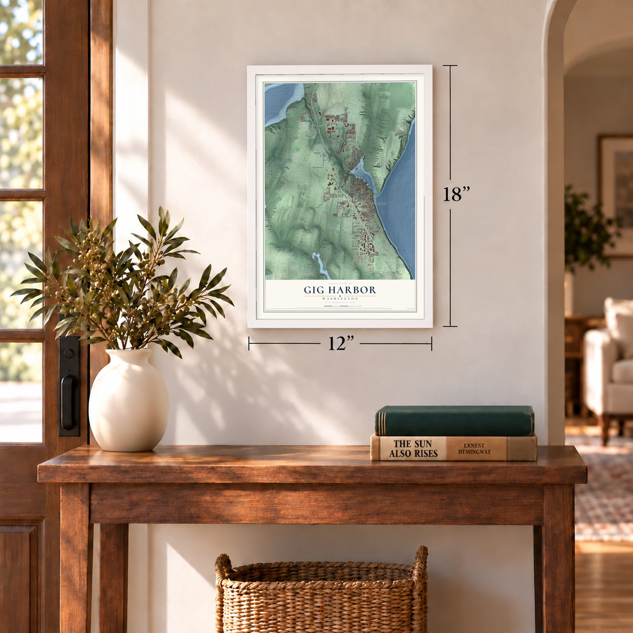
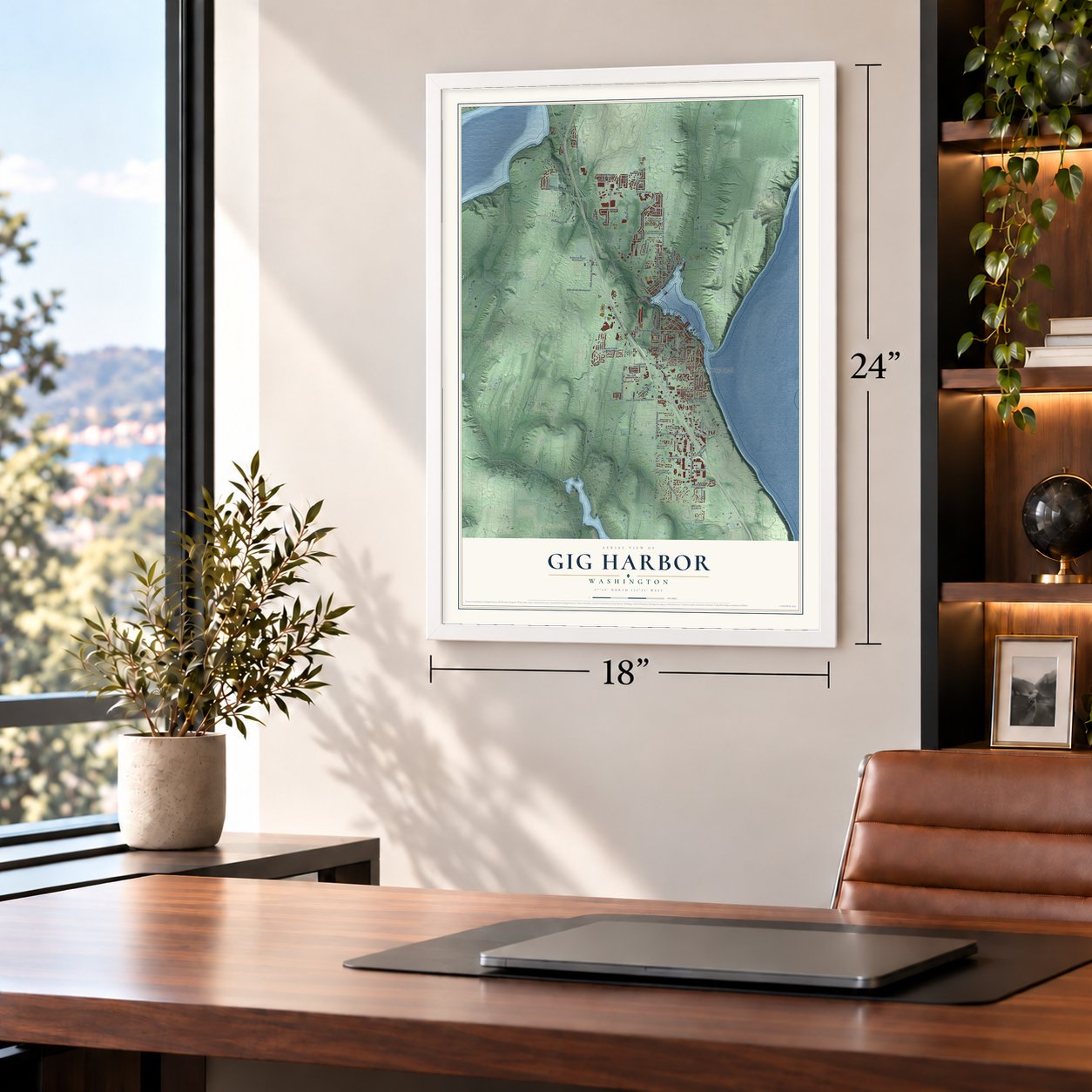
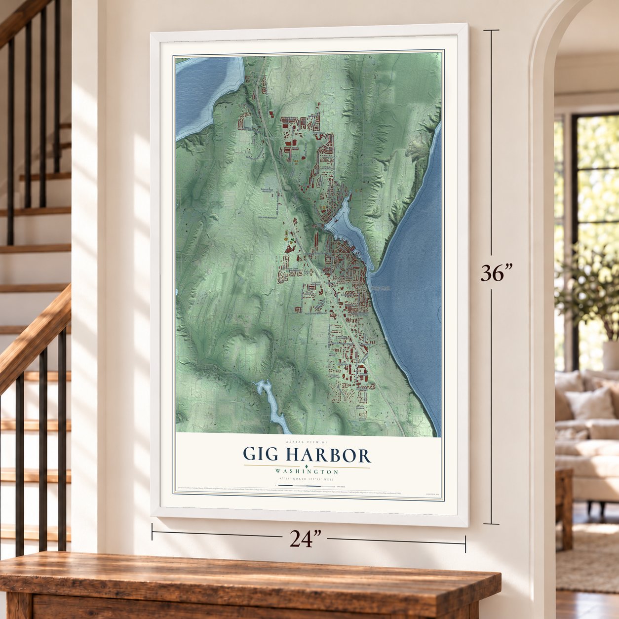
Gig Harbor, Washington Map Art
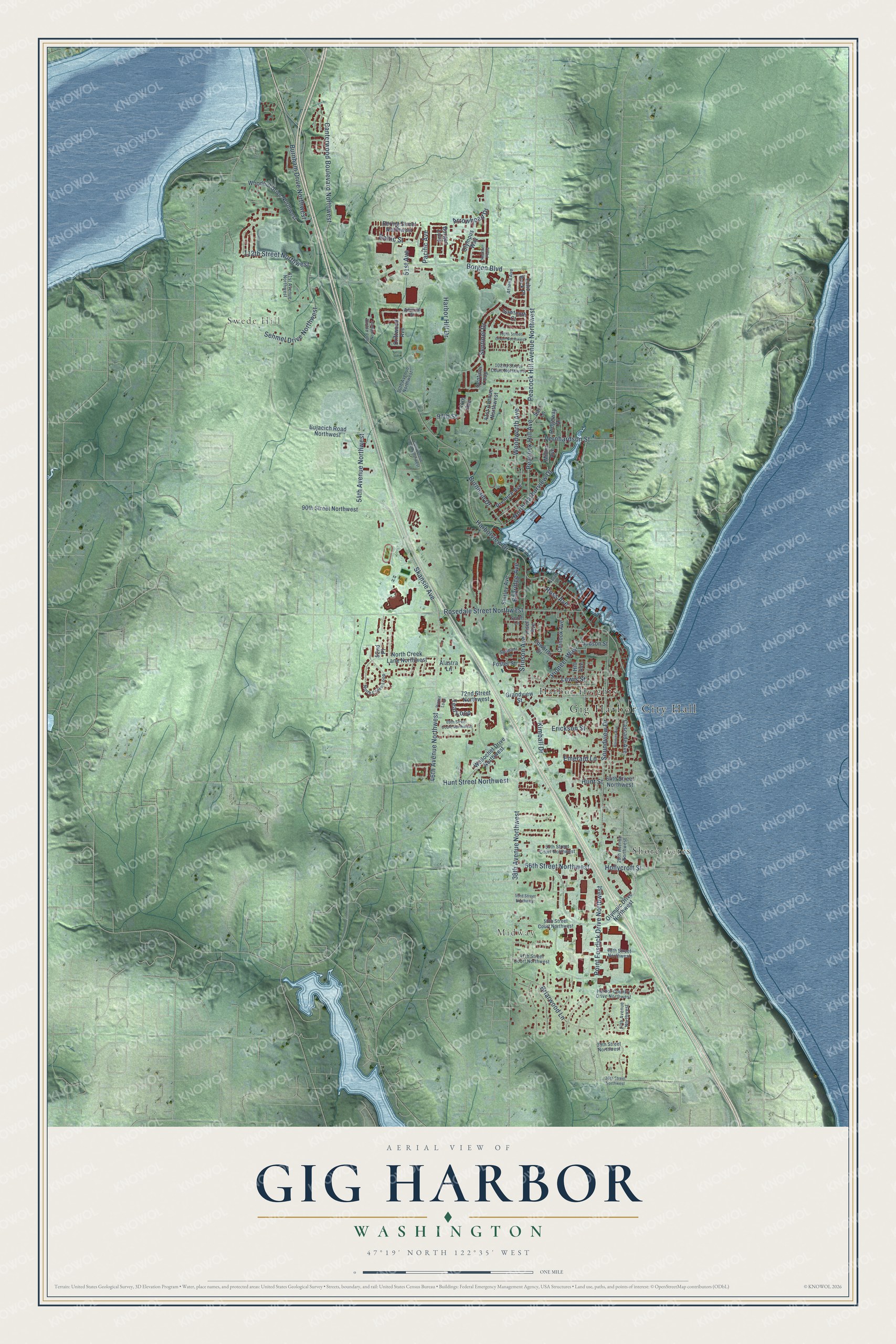
A new map of Gig Harbor, Washington, made in 2026 and printed to order on thick archival matte paper.
12" x 18" Archival Matte Print
A Map of Home. A Work of Art.
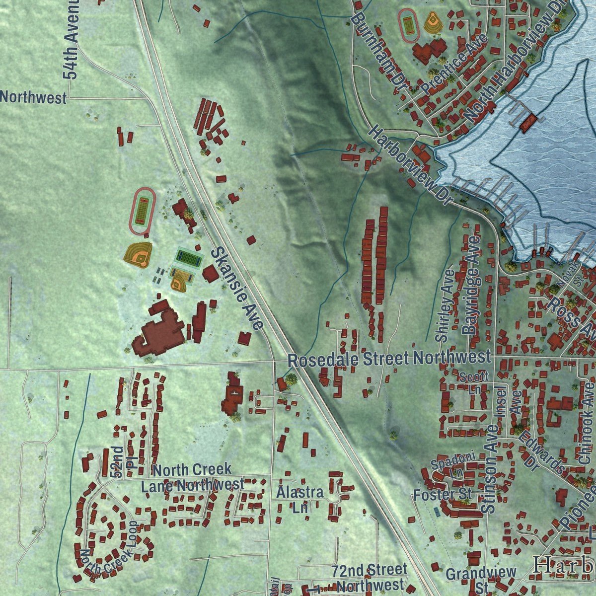
Explore Gig Harbor, Washington from a whole new perspective. Created using aerial imagery and detailed geographic data, this map captures Gig Harbor building by building, with labeled streets, familiar landmarks, and shaded topographical relief that highlights the natural contours of the landscape.
Combining modern data with the timeless character of a vintage atlas, this map is just as interesting up close as it is beautiful on the wall. Whether you grew up in Gig Harbor, spent memorable years there, or call it home today, this unique map is a great way to celebrate a place that means something to you. Zoom in on the preview to look for your street, and then order a print to put your memories on the wall.
Three ways to hang it
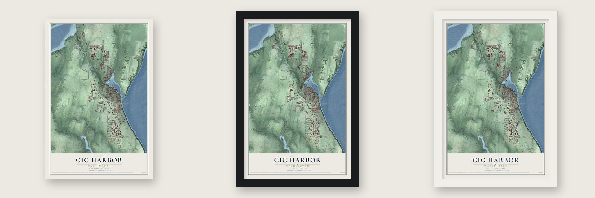
Unframed archival matte, a black wood frame or a white wood frame.
Up close
Geography Worth Displaying
This map was created using accurate cartographic data and authoritative geographic sources, including the U.S. Geological Survey and the Census Bureau. The map brings together terrain, waterways, roads, and building detail. The majority of the streets are labeled, houses are accurately depicted, and the topography is derived from government sources. Combining local data with carefully composed color and shading leads to this beautifully detailed Gig Harbor artwork for your wall.
Rather than simply showing street outlines, we’ve included as many of the street names as we could reasonably fit on the map while keeping their names legible. Zoom in on the high resolution preview to see exactly what’s on the map. We truly set out to create a statement piece for anyone who loves Gig Harbor. So whether it’s for you, or a gift for someone you love, we hope this map of Gig Harbor brings back fond memories.
Read the story behind this map of Gig Harbor, Washington from 2026.

About Gig Harbor, Washington
Gig Harbor is a city of 12,029 people in Pierce County, on a small Puget Sound bay of the same name that faces Tacoma across the Tacoma Narrows. The Twa-Wal-Kut, a Puyallup band, lived for centuries where Donkey Creek empties into the bay, in a 100-foot longhouse ringed by cedar huts. Peter Puget sailed past the narrow entrance in 1792 without seeing it. On May 15, 1841, Midshipman Joseph Sandford of the Wilkes Expedition found the opening behind a sand spit, and sailing master George Sinclair rowed in after him in the captain's gig and named the bay for it.
In 1867 three fishermen, Samuel Jerisich, Peter Goldsmith and John Farrague, rowed in from Vancouver Island and liked the bay enough to stay. Jerisich and Goldsmith were Croatian, and more Croatians followed, along with Scandinavians and Minnesota farmers in the 1880s and 1890s. Voters turned down incorporation by 13 votes in September 1945, then approved it on July 12, 1946. The town had 803 residents in 1950, the year the new Tacoma Narrows Bridge opened and made it a home for Tacoma commuters. Gig Harbor became a city in 1981.
“you either rowed or stayed home”
- Nets on the empty lotThe Croatian settlers had mastered purse seining, setting out a huge net and pulling its bottom shut like a coin purse, a job that took two rowboats and a strong crew. The nets needed room, so for decades Gig Harbor houses often stood with a vacant lot between them, where men and boys mended the cotton nets, tarred them and laid them out to dry. Today 17 historic netsheds still line the waterfront.
- Free lots for white housesDr. Alfred Burnham came from Albert Lea, Minnesota, in 1886 and opened the first general store. In 1888 he platted the City of Gig Harbor at the north end of the bay, on land bought from the three founders, and set a stone monument with a cross at Front and Harbor Streets. The story goes that he offered old neighbors a free lot if they built a house and painted it white.
- Motors from the Skansie yardIn 1905 the Skansie brothers became the first in the area to put a gasoline engine in a fishing boat, refitting hulls with motors of about 7 horsepower. The crews still hauled their nets by hand, and the small engines couldn't carry the boats as far as Alaska. The Skansie shipyard went on to build fishing vessels from the late 1910s into the early 1950s.
- A 107-mile drive to TacomaBefore any bridge, the Mosquito Fleet steamers carried most travelers to Tacoma, and a car had to go 107 miles around through Olympia. The Washington Navigation Company started a Point Defiance ferry in 1927 that held 80 vehicles. The first Tacoma Narrows Bridge opened in July 1940 and fell a few months later, so the ferries ran again until the second bridge opened in 1950. A third span followed in 2007.
- The longhouse lasted to 1915An 1879 Indian census counted 46 members of the Gig Harbor Band, probably more people than the white settlers on the bay at the time. Well into the 1890s their village still held gatherings and potlatches for other Puget Sound tribes, and the longhouse stood until settlers tore it down in 1915.
Find your street
Names on the Gig Harbor map
Every name below is printed on this map. Look for your street, your school, the park where you played, or the pond down the road.
Places and landmarks5
- Gig Harbor City Hall
- Midway
- Swede Hill
- Harbor Heights
- Shore Acres
Streets and roads98
- Woodworth Avenue
- Arrowhead Drive
- Baltic Street
- Hunt Street
- Burnham Drive Northwest
- 38th Avenue Northwest
- Harborview Drive
- Skansie Avenue
- Soundview Drive
- Rosedale Street Northwest
- Point Fosdick Drive Northwest
- Borgen Boulevard
- Canterwood Boulevard Northwest
- Stinson Avenue
- 46th Avenue Northwest
- Peacock Hill Avenue Northwest
- Hunt Street Northwest
- North Harborview Drive
- Pioneer Way
- Vernhardson Street
- Harbor Hill Drive
- Briarwood Lane
- Sehmel Drive Northwest
- 54th Avenue Northwest
- Peacock Hill Avenue
- Sentinel Drive
- Kimball Drive
- 56th Street Northwest
- Hollycroft Street
- Burnham Drive
Show all 98 streets
- 112th Street Northwest
- Erickson Street
- Teal Loop
- Bayridge Avenue
- Ross Avenue
- Emerald Lane
- 97th Street
- Lewis Street
- Pacific Avenue
- 51st Avenue
- 41st Avenue Northwest
- Cascade Avenue
- Driftwood Avenue
- Olympic Drive Northwest
- Bujacich Road Northwest
- Grandview Street
- Borgen Loop
- Woodhill Drive Northwest
- Wollochet Drive Northwest
- Prentice Avenue
- North Creek Lane Northwest
- Sentinel Loop
- 90th Street Northwest
- Olympus Way
- 72nd Street Northwest
- Bering Street Northwest
- Echo Rock Place
- Edwards Drive
- Shirley Avenue
- Chinook Avenue
- Ridgeway Drive
- Milton Avenue
- 64th Street Northwest
- Sawtooth Court
- Foster Street
- Judson Street
- 44th Avenue
- Sari Lane
- Insel Avenue
- Alastra Lane
- Hill Avenue
- 52nd Place
- Admiral Street
- 28th Avenue Northwest
- North Creek Loop
- 50th Avenue Northwest
- 50th Street Court Northwest
- 57th Street Court Northwest
- 27th Avenue Northwest
- 102nd Street Court Northwest
- Harbor Country Drive Northwest
- 47th Street Court Northwest
- Spadoni Lane
- 48th Street Northwest
- 61st Avenue Northwest
- Athena Avenue
- 39th Street Northwest
- Scott Lane
- 49th Avenue Court Northwest
- 105th Street Court Northwest
- 69th Street Court Northwest
- Rainier Avenue
- Novak Street
- 53rd Avenue Northwest
- 36th Street Northwest
- 53rd Street Northwest
- Heather Plaza
- Pintail Loop
Names are listed as they appear on the printed map. Zoom into the product photos to find them.
The art of mapping a place
How This Map Was Made
Real places. Remarkable detail. Discover the layers that turn geographic data into a map of home.

The view from above
Aerial imagery reveals the character of the land: woodland, open fields, and the patterns of a place.

The shape of the land
Elevation data brings hills, valleys, and subtle changes in the landscape into view.

The details of home
Roads, waterways, and building footprints come together to make the map feel unmistakably local.

Geography becomes art
Considered color, shading, and typography bring the layers together in a map made for your wall.


Process illustrated with Mendon, Massachusetts. Aerial imagery: USDA NAIP. Terrain: USGS 3D Elevation Program. Map details and finished artwork: KNOWOL.
The Details
About This Print
Choose an archival matte print, or a black or white Ayous wood frame. The archival matte print is unframed.
Select your size and finish above to see the matching product image and price.
Materials & Craftsmanship
A contemporary map with the character of a classic atlas, printed on archival matte paper. Optional frames are made from Ayous wood.
Your printed map does not include the watermark shown in the full-map preview.
Shipping & Delivery
Free shipping within the United States. Every print is made to order in the USA.
Buying a gift? Add a note in your cart and we'll include it. We never put prices in the package.
Prints ship within 2 to 3 business days. Allow 7 to 10 days total from ordering for delivery. Timing may vary during holidays or periods of high order volume.
Read our shipping policy.
Returns and damaged prints
Each print is made to order. Change-of-mind refunds are not available after production.
If your print arrives damaged, misprinted or incorrect, contact support@knowol.com within 30 days of receiving it. Include your order number, photos and a description of the issue.
Read our full refund and replacement policy. For questions about your order, email support@knowol.com.
Find your town
Looking for another city?
Find a map of home in our Washington collection, or any town in the country.
Nearby
Maps of towns near Gig Harbor
Know someone from one of these towns? Their map makes a great gift.
 Rosedale
, Washington
From $39.99See the map
 Canterwood
, Washington
From $39.99See the map
 Maplewood
, Washington
From $39.99See the map
More maps nearby: Raft Island, Artondale, Wollochet, Purdy and Wauna.