
Search for another town



Free U.S. delivery 7 to 10 days after you order
Greeley, Colorado Map Art
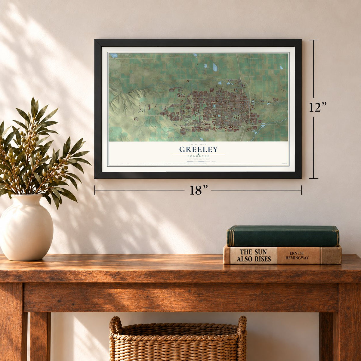
A new map of Greeley, Colorado, made in 2026 and printed to order on thick archival matte paper.
12" x 18" Archival Matte Print
A Map of Home. A Work of Art.
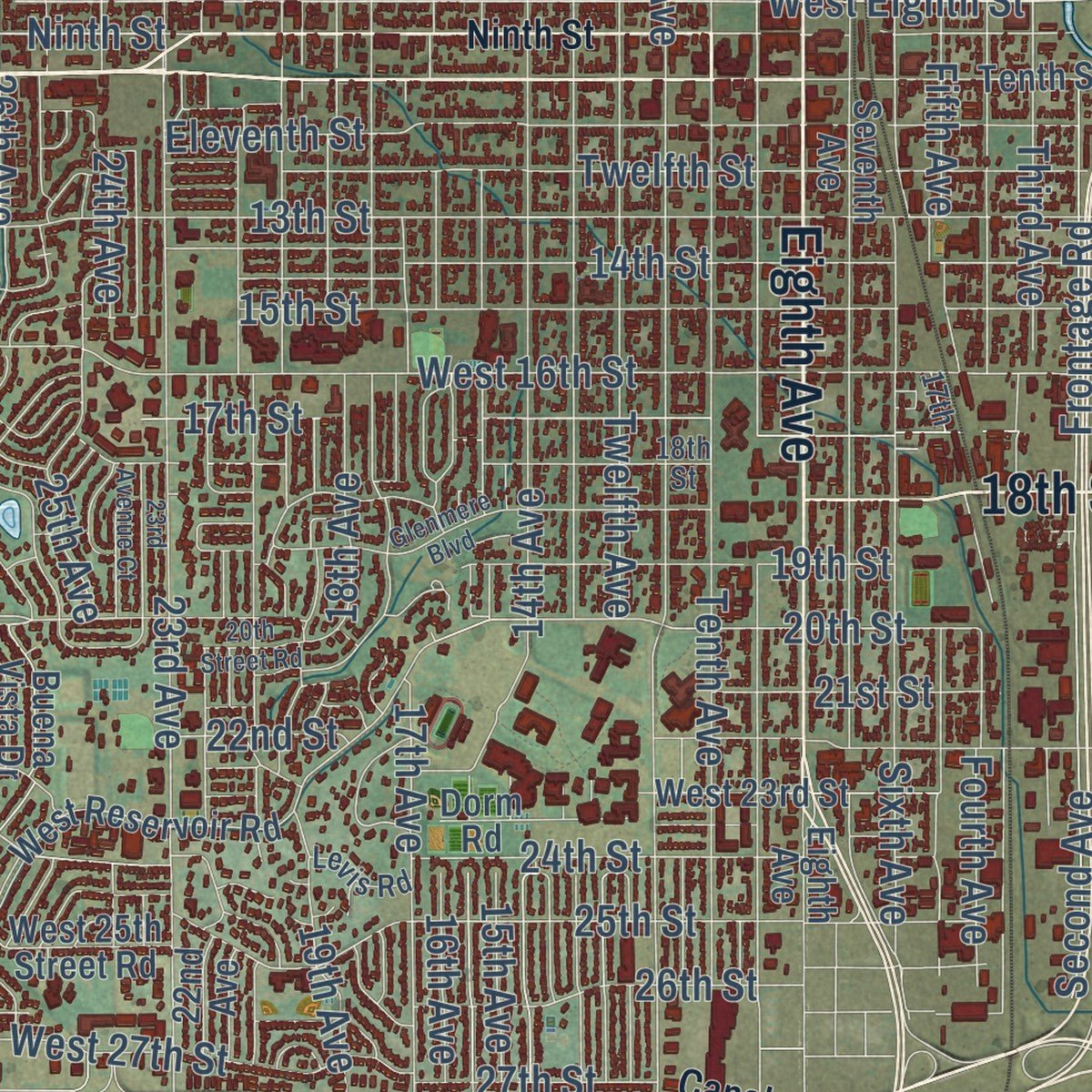
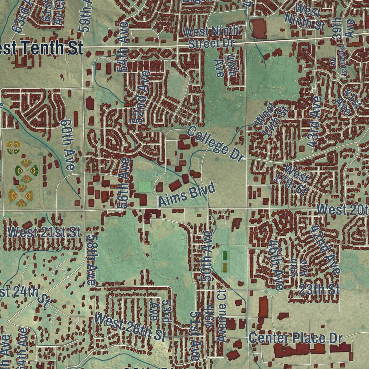
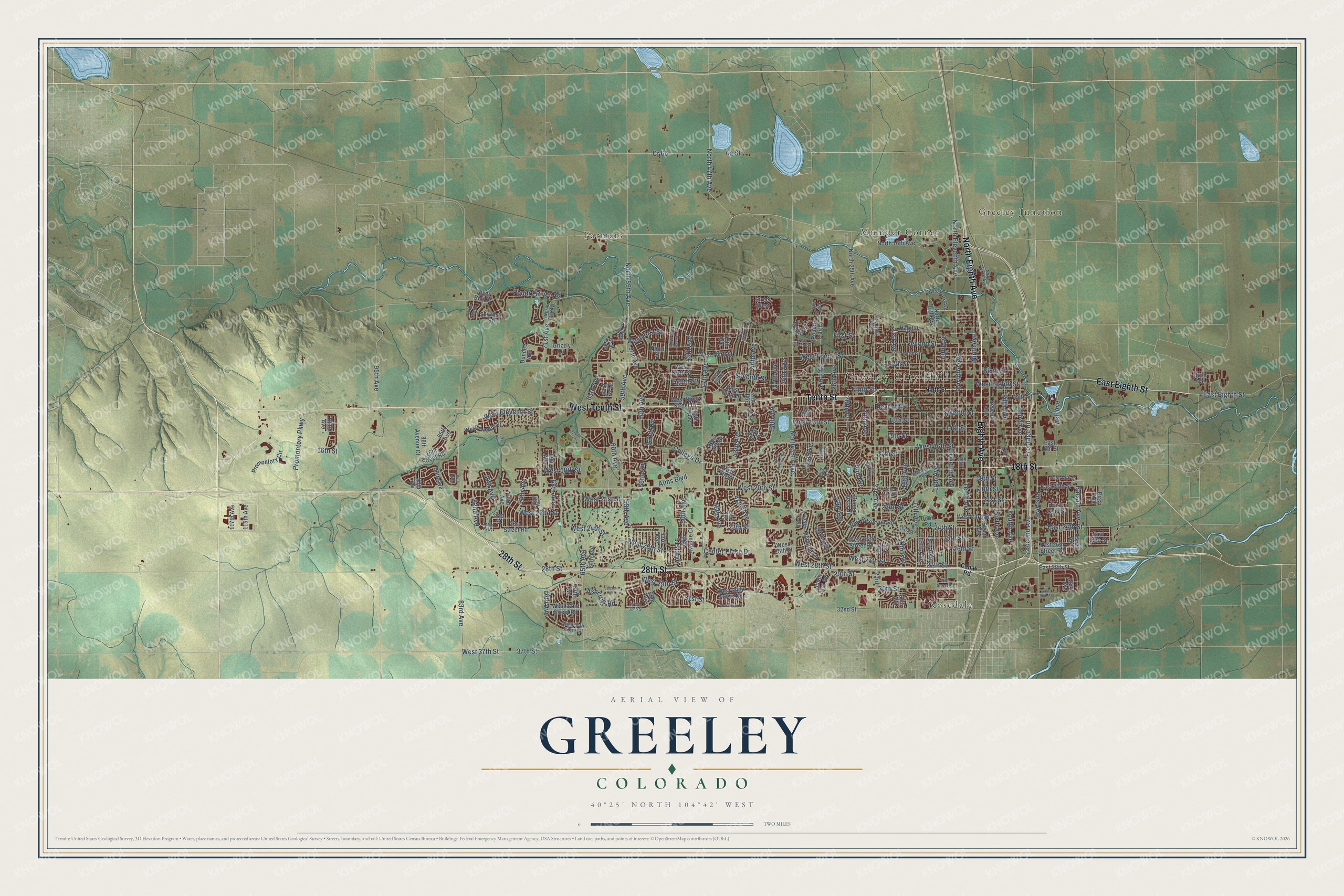
Explore Greeley, Colorado from a whole new perspective. Created using aerial imagery and detailed geographic data, this map captures Greeley building by building, with labeled streets, familiar landmarks, and shaded topographical relief that highlights the natural contours of the landscape.
Combining modern data with the timeless character of a vintage atlas, this map is just as interesting up close as it is beautiful on the wall. Whether you grew up in Greeley, spent memorable years there, or call it home today, this unique map is a great way to celebrate a place that means something to you. Zoom in on the preview to look for your street, and then order a print to put your memories on the wall.
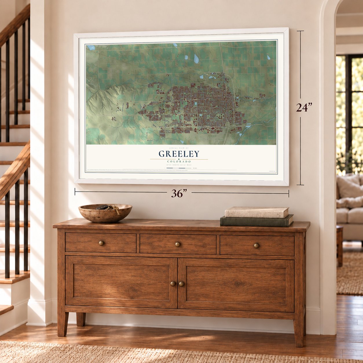
Three ways to hang it
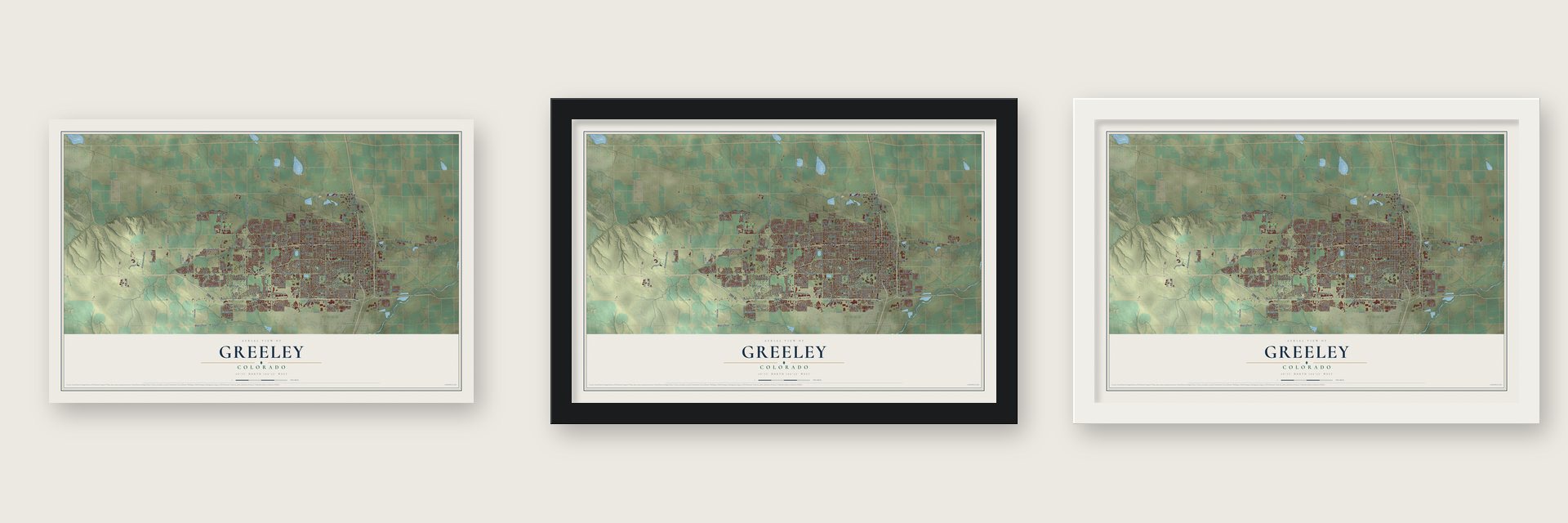
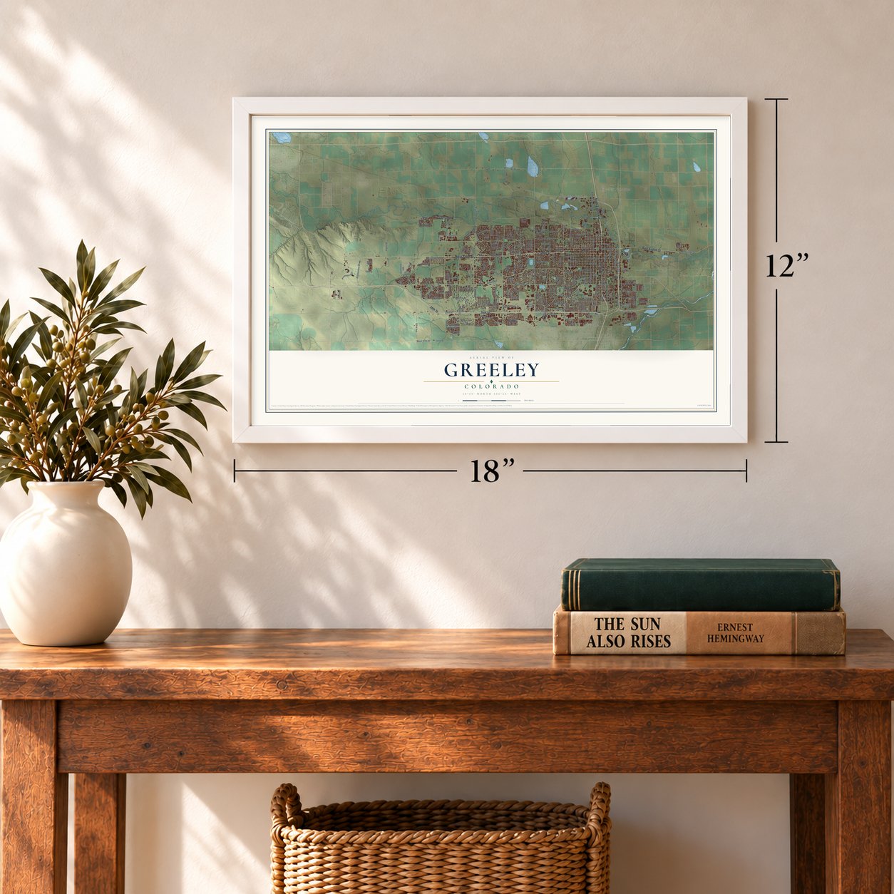
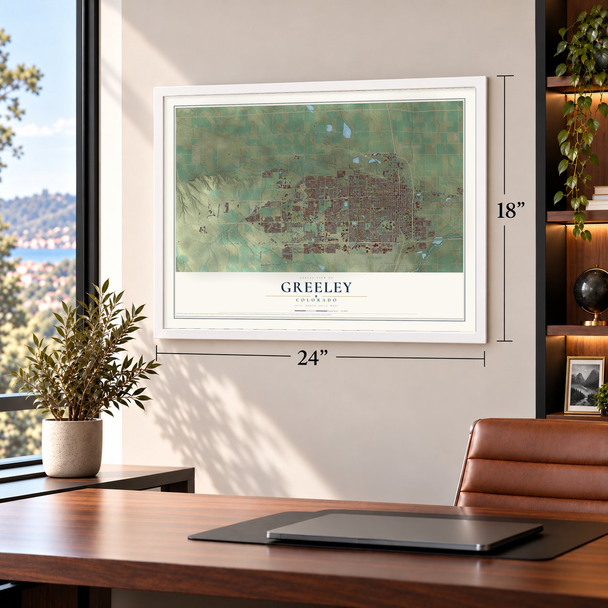
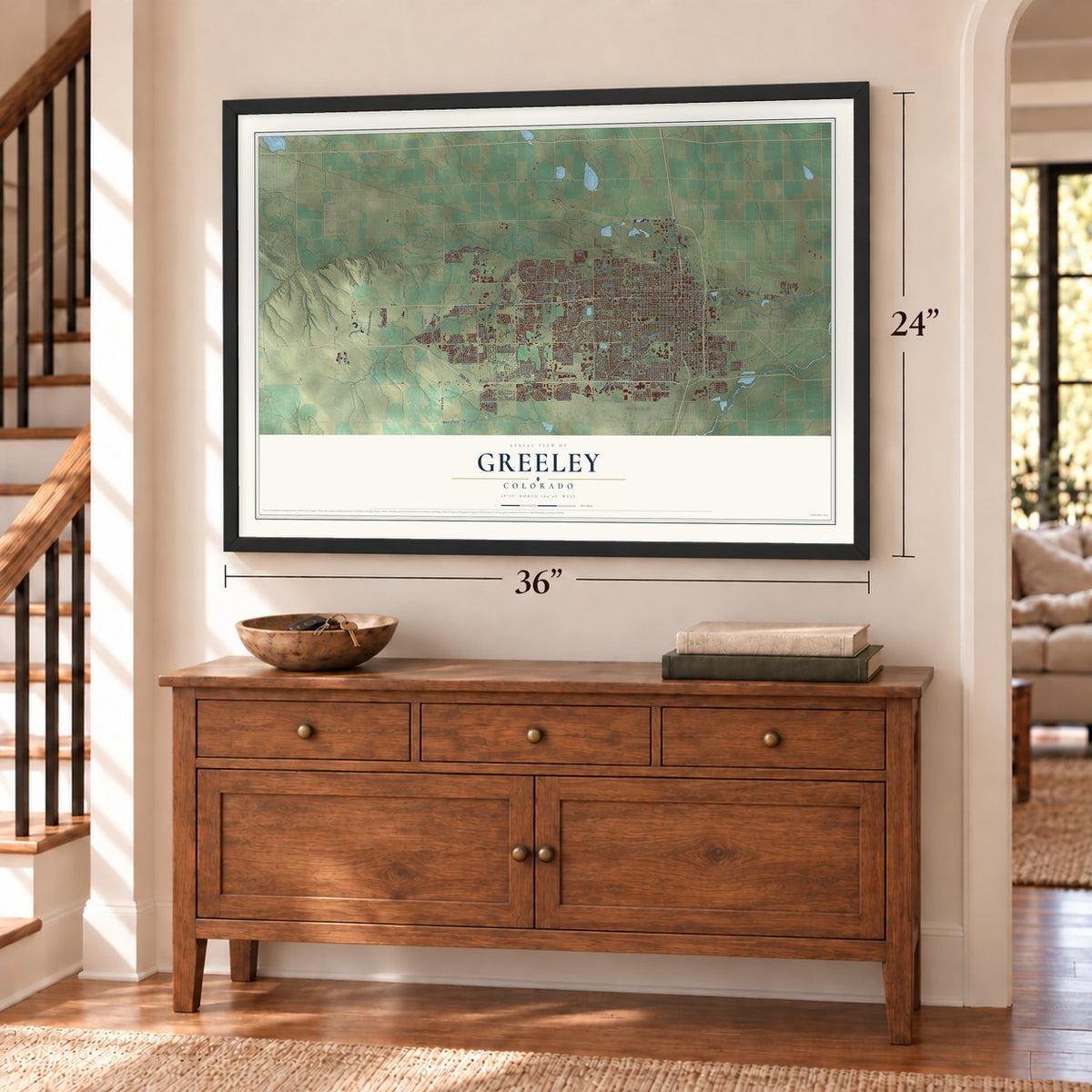
Unframed archival matte, a black wood frame or a white wood frame.
Up close
Geography Worth Displaying
This map was created using accurate cartographic data and authoritative geographic sources, including the U.S. Geological Survey and the Census Bureau. The map brings together terrain, waterways, roads, and building detail. The majority of the streets are labeled, houses are accurately depicted, and the topography is derived from government sources. Combining local data with carefully composed color and shading leads to this beautifully detailed Greeley artwork for your wall.
Rather than simply showing street outlines, we’ve included as many of the street names as we could reasonably fit on the map while keeping their names legible. Zoom in on the high resolution preview to see exactly what’s on the map. We truly set out to create a statement piece for anyone who loves Greeley. So whether it’s for you, or a gift for someone you love, we hope this map of Greeley brings back fond memories.
Read the story behind this map of Greeley, Colorado from 2026.

About Greeley, Colorado
Greeley is a city of 108,795 people and the seat of Weld County, in northern Colorado. It began in 1869 as the Union Colony, a farming experiment planned by Nathan C. Meeker, who wrote about agriculture for the New York Tribune. His editor, Horace Greeley, backed the plan, and the colonists pledged themselves to temperance, religion, farming, schooling and family life.
A committee that included Meeker and Robert Alexander Cameron, a former Civil War general, bought 12,000 acres where the Cache la Poudre meets the South Platte. The land lay on the Denver Pacific Railroad, halfway between Denver and Cheyenne, and by May some 500 settlers had come. The colony then took Horace Greeley's name. A post office began serving it on April 21, 1870, and Greeley was incorporated as a town on November 15, 1885.
- Temperance ended in 1969The colony was founded on temperance, and that rule held in Greeley for a century. In 1969 voters finally allowed the sale of alcohol, and the measure passed by just 477 votes.
- From Spud Rodeo to StampedeThe summer celebration began in 1922 as the Greeley Spud Rodeo and had become the Greeley Independence Stampede by 1972. It runs for nearly two weeks before the Fourth of July, with rodeos, a demolition derby, a carnival, concerts and a parade, and draws nearly 250,000 visitors a year.
- Fort Latham came firstJust east of where Greeley grew stood an Overland Trail stagecoach station, opened as Cherokee City in 1862 and renamed Latham in 1863 for Milton S. Latham, an early California senator. Known as Fort Latham, it served as headquarters for government troops during the Indian conflicts. It was the Weld County seat from 1868 until 1870, when the seat moved to Evans.
- The first Department of CultureGreeley started its philharmonic orchestra in 1911. In 1922 its station KFKA went on the air, among the earliest radio broadcasters anywhere in the country. In 1958 Greeley became the first city to create a Department of Culture.
- A limestone courthouseAs the seat of Weld County, Greeley is home to the county courthouse. It was designed in the Neo-Classic style and built of marble and Indiana limestone, and it joined the National Register in 1978.
Find your street
Names on the Greeley map
Every name below is printed on this map. Look for your street, your school, the park where you played, or the pond down the road.
Places and landmarks5
- Greeley City Hall
- Farmers
- Greeley Junction
- Mumper Corner
- Rosedale
Streets and roads226
- 28th Street
- West Tenth Street
- Tenth Street
- Eighth Avenue
- North Eighth Avenue
- East Eighth Street
- 18th Street
- West 18th Street
- West Eleventh Street
- 40th Avenue
- Promontory Parkway
- 82nd Avenue
- 54th Avenue
- West 20th Street
- Twelfth Street
- 21st Street
- 37th Street
- 13th Street
- West 29th Street
- West 24th Street
- West First Street
- 16th Avenue
- First Street
- 29th Avenue
- Center Place Drive
- Ninth Avenue
- 16th Street
- 20th Street
- West 16th Street
- West Fourth Street
Show all 226 streets
- North 35th Avenue
- 95th Avenue
- West Eighth Street
- 83rd Avenue
- 23rd Avenue
- Eighth Street
- 47th Avenue
- 71st Avenue
- 59th Avenue
- West 22nd Street
- Seventh Street
- Eleventh Avenue
- 28th Avenue
- 21st Avenue
- First Avenue
- 14th Street
- Eleventh Street
- 14th Avenue
- 17th Avenue
- 43rd Avenue
- 50th Avenue
- West 13th Street
- 15th Street
- Sixth Avenue
- 24th Street
- 51st Avenue
- 26th Street
- Tenth Avenue
- 13th Avenue
- 25th Street
- 25th Avenue
- Sixth Street
- 19th Avenue
- 29th Street
- Second Street
- 17th Street
- 65th Avenue
- Twelfth Avenue
- West 27th Street
- Fifth Street
- 27th Avenue
- West 28th Street
- Fifth Avenue
- Fourth Avenue
- Frontage Road
- Second Avenue
- 18th Avenue
- 31st Avenue
- 46th Avenue
- 26th Avenue
- North Eleventh Avenue
- 49th Avenue
- Ash Avenue
- 42nd Avenue
- West 26th Street
- North 47th Avenue
- 27th Street
- East 24th Street
- 22nd Street
- 52nd Avenue
- 56th Avenue
- 58th Avenue
- 30th Street
- 19th Street
- 15th Avenue
- Poudre River Road
- 24th Avenue
- Third Avenue
- 38th Avenue
- 63rd Avenue
- Aa Street
- Ninth Street
- North 59th Avenue
- 68th Avenue
- West 21st Street
- 30th Avenue
- 70th Avenue
- West 37th Street
- Balsam Avenue
- Cr 66
- 74th Avenue
- 31st Street
- Aims Boulevard
- 60th Avenue
- 36th Avenue
- 79th Avenue
- 37th Avenue
- College Drive
- Ashcroft Road
- 23th Street
- 88th Avenue Court
- Habitat Lane
- West Twelfth Street
- 61st Avenue
- West Ninth Street Drive
- 16th Street Road
- West 17th Street
- West Sixth Street
- West Ninth Street
- 22nd Avenue
- West 23rd Street
- Seventh Avenue
- West Reservoir Road
- 23rd Street
- Promontory Circle
- West 25th Street
- 33rd Avenue
- 41st Avenue
- 39th Avenue
- West Third Street
- 49th Avenue Court
- Third Street
- 45th Avenue
- West 14th Street
- 57th Avenue
- West 32nd Street Road
- 53rd Avenue
- 20th Avenue
- East 20th Street
- Aspen Avenue
- Mountair Lane
- West 25th Street Road
- 55th Avenue
- North 16th Avenue
- Rodeo Drive
- Dundee Avenue
- West 30th Street Road
- 64th Avenue
- 32nd Street
- 69th Avenue
- Grizzly Drive
- 23rd Street Road
- Buena Vista Drive
- 48th Avenue
- East 22nd Street
- East 26th Street Road
- Dorm Road
- 67th Avenue
- North 25th Avenue
- South 31st Avenue
- 86th Avenue
- Arbor Avenue
- 76th Avenue
- East 28th Street
- North 14th Avenue
- Poudre Trail Drive
- Street West
- Skyview Street
- 115th Avenue
- 117th Avenue
- East 16th Street
- River Run Drive
- East 25th Street
- Birch Avenue
- 103rd Avenue
- 85th Avenue
- 23rd
- 90th Avenue
- Buss Avenue
- 61st Av Court
- Canal Road
- West 34th Street Road
- 44th Avenue
- Fourth Street
- North 71st Avenue
- North Sixth Avenue
- 72nd Avenue
- 32nd Avenue
- West Park Avenue
- North 23rd Avenue
- East 19th Street
- North 60th Avenue
- Levis Road
- 17th
- 84th Avenue
- 29th Street Road
- West Second Street
- West 19th Street
- West Fifth Street
- 23rd Avenue Court
- 36th Avenue Court
- Talon Parkway
- Glenmere Boulevard
- 77th Avenue
- West 31st Place
- Lesser Drive
- 20th Street Road
- West 32nd Street
- Polomar Drive
- Double Tree Drive
- 29th Avenue Place
- North 50th Avenue Court
- North 43rd Avenue
- North 30th Avenue
- Leisure Lane
- East 30th Street
Names are listed as they appear on the printed map. Zoom into the product photos to find them.
The art of mapping a place
How This Map Was Made
Real places. Remarkable detail. Discover the layers that turn geographic data into a map of home.

The view from above
Aerial imagery reveals the character of the land: woodland, open fields, and the patterns of a place.

The shape of the land
Elevation data brings hills, valleys, and subtle changes in the landscape into view.

The details of home
Roads, waterways, and building footprints come together to make the map feel unmistakably local.

Geography becomes art
Considered color, shading, and typography bring the layers together in a map made for your wall.


Process illustrated with Mendon, Massachusetts. Aerial imagery: USDA NAIP. Terrain: USGS 3D Elevation Program. Map details and finished artwork: KNOWOL.
The Details
About This Print
Choose an archival matte print, or a black or white Ayous wood frame. The archival matte print is unframed.
Select your size and finish above to see the matching product image and price.
Materials & Craftsmanship
A contemporary map with the character of a classic atlas, printed on archival matte paper. Optional frames are made from Ayous wood.
Your printed map does not include the watermark shown in the full-map preview.
Shipping & Delivery
Free shipping within the United States. Every print is made to order in the USA.
Buying a gift? Add a note in your cart and we'll include it. We never put prices in the package.
Prints ship within 2 to 3 business days. Allow 7 to 10 days total from ordering for delivery. Timing may vary during holidays or periods of high order volume.
Read our shipping policy.
Returns and damaged prints
Each print is made to order. Change-of-mind refunds are not available after production.
If your print arrives damaged, misprinted or incorrect, contact support@knowol.com within 30 days of receiving it. Include your order number, photos and a description of the issue.
Read our full refund and replacement policy. For questions about your order, email support@knowol.com.
Find your town
Looking for another city?
Find a map of home in our Colorado collection, or any town in the country.
Nearby
Maps of towns near Greeley
Know someone from one of these towns? Their map makes a great gift.
 Garden City
, Colorado
From $39.99See the map
 Evans
Evans, Colorado
From $39.99See the map
 La Salle
, Colorado
From $39.99See the map
More maps nearby: Severance, Eaton, Milliken, Windsor and Gilcrest.