
Search for another town



Free U.S. delivery 7 to 10 days after you order
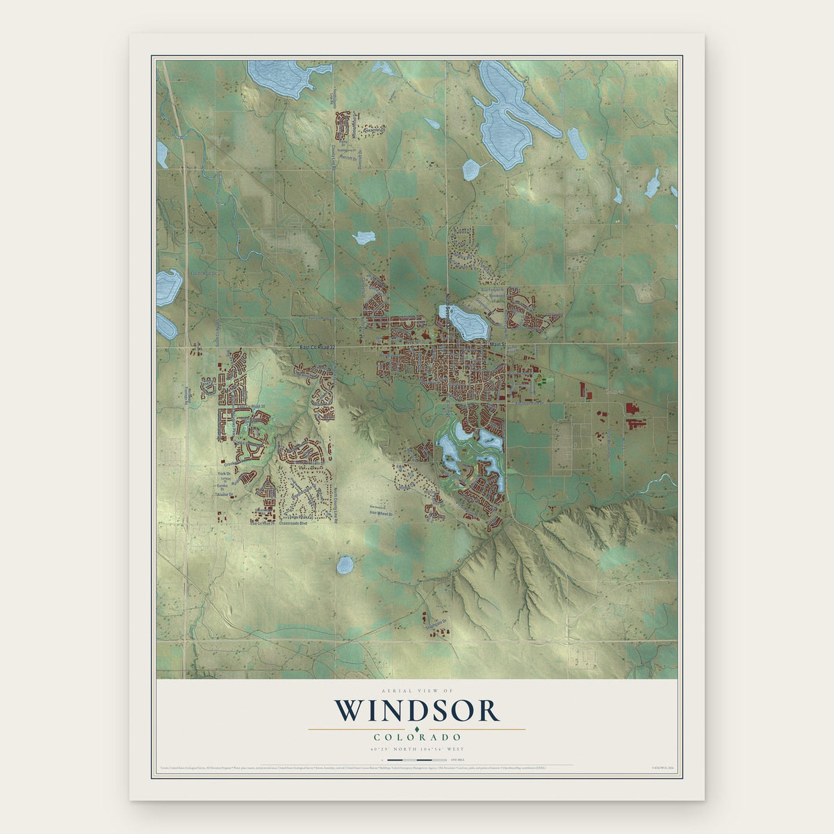
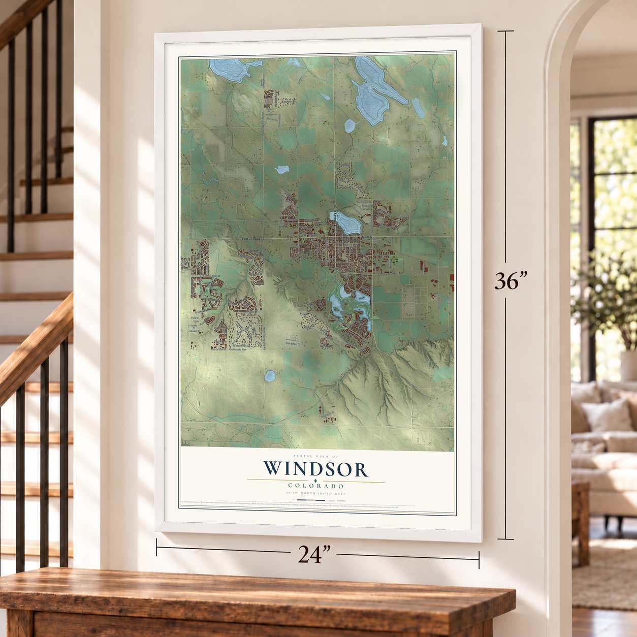
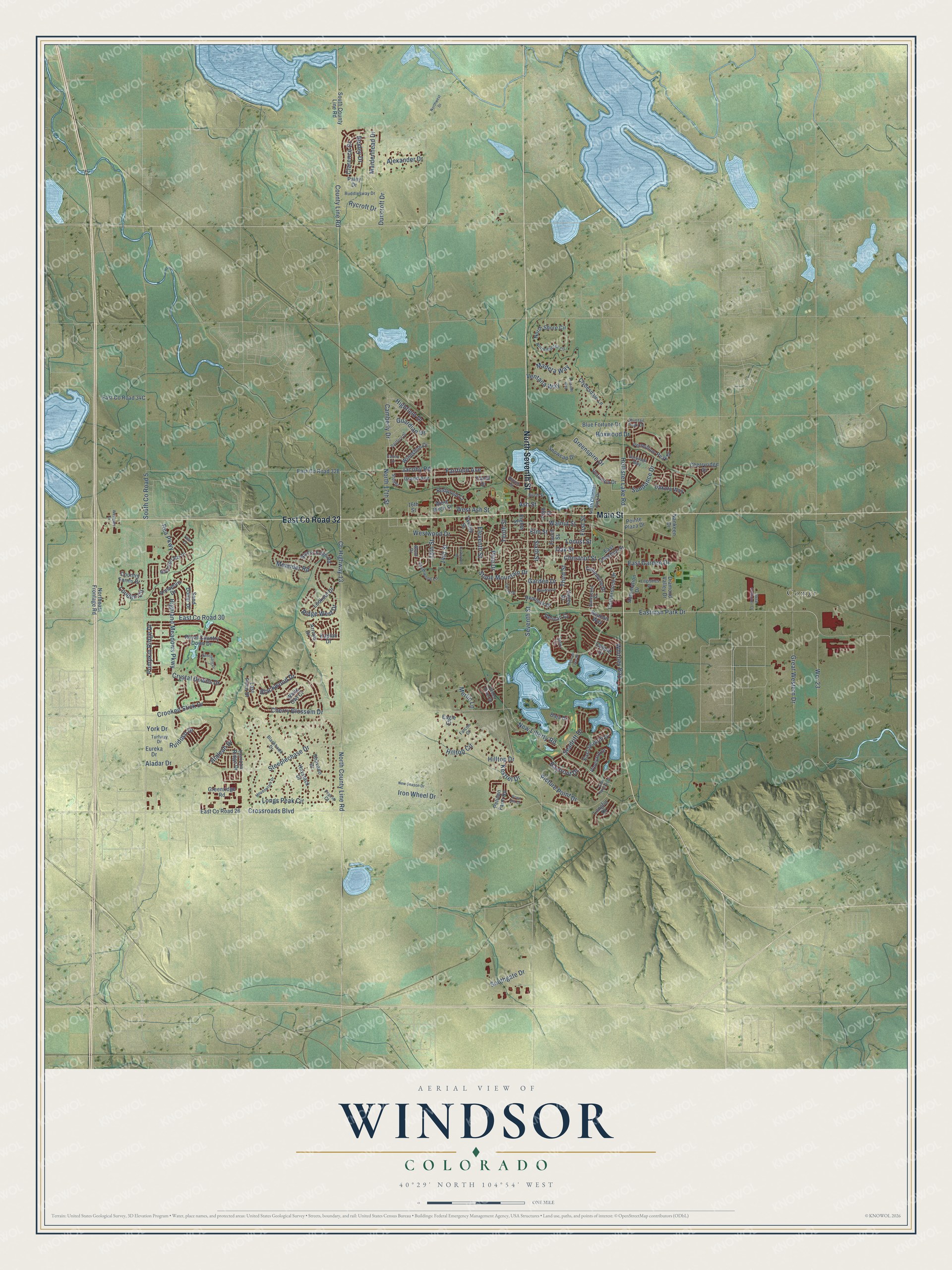
Windsor, Colorado Map Art
A new map of Windsor, Colorado, made in 2026 and printed to order on thick archival matte paper.
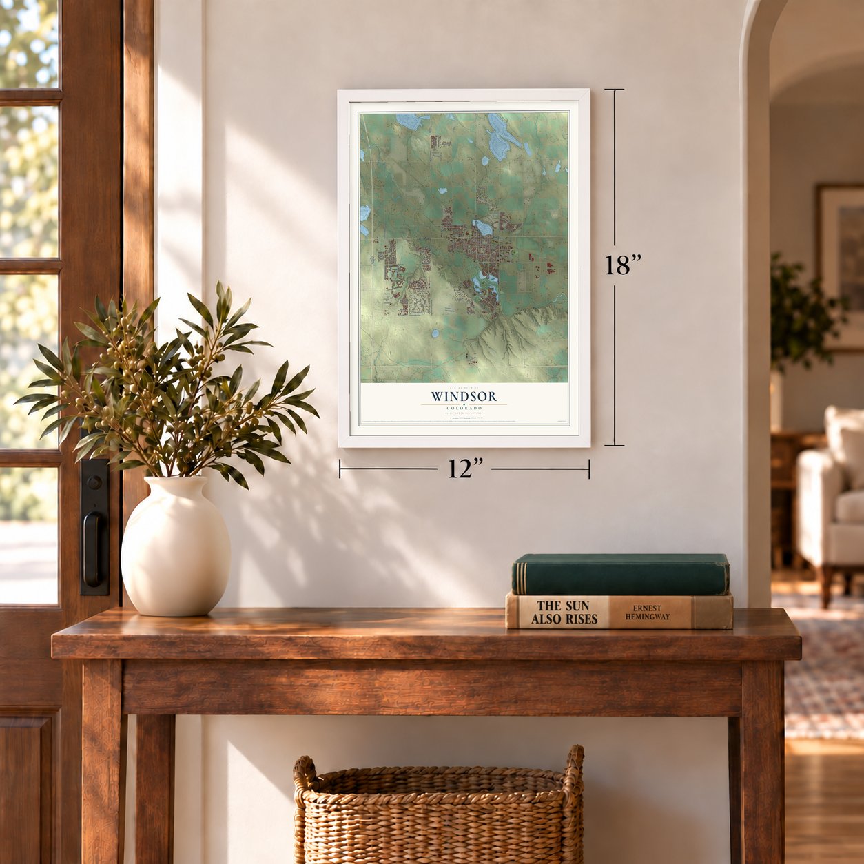
12" x 18" Archival Matte Print
A Map of Home. A Work of Art.
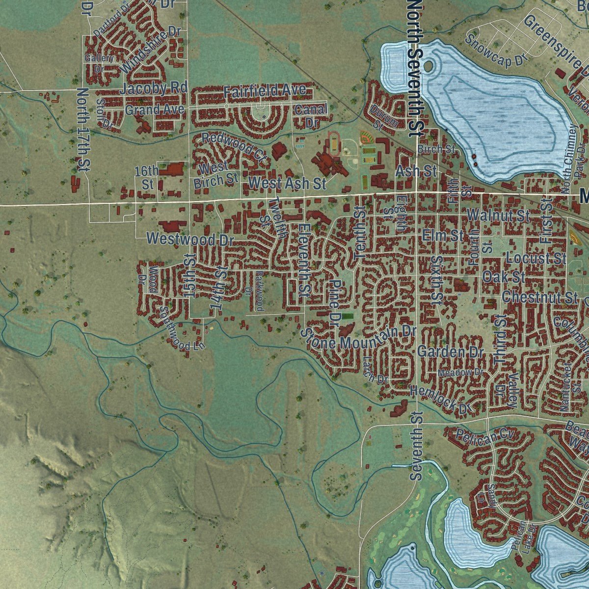
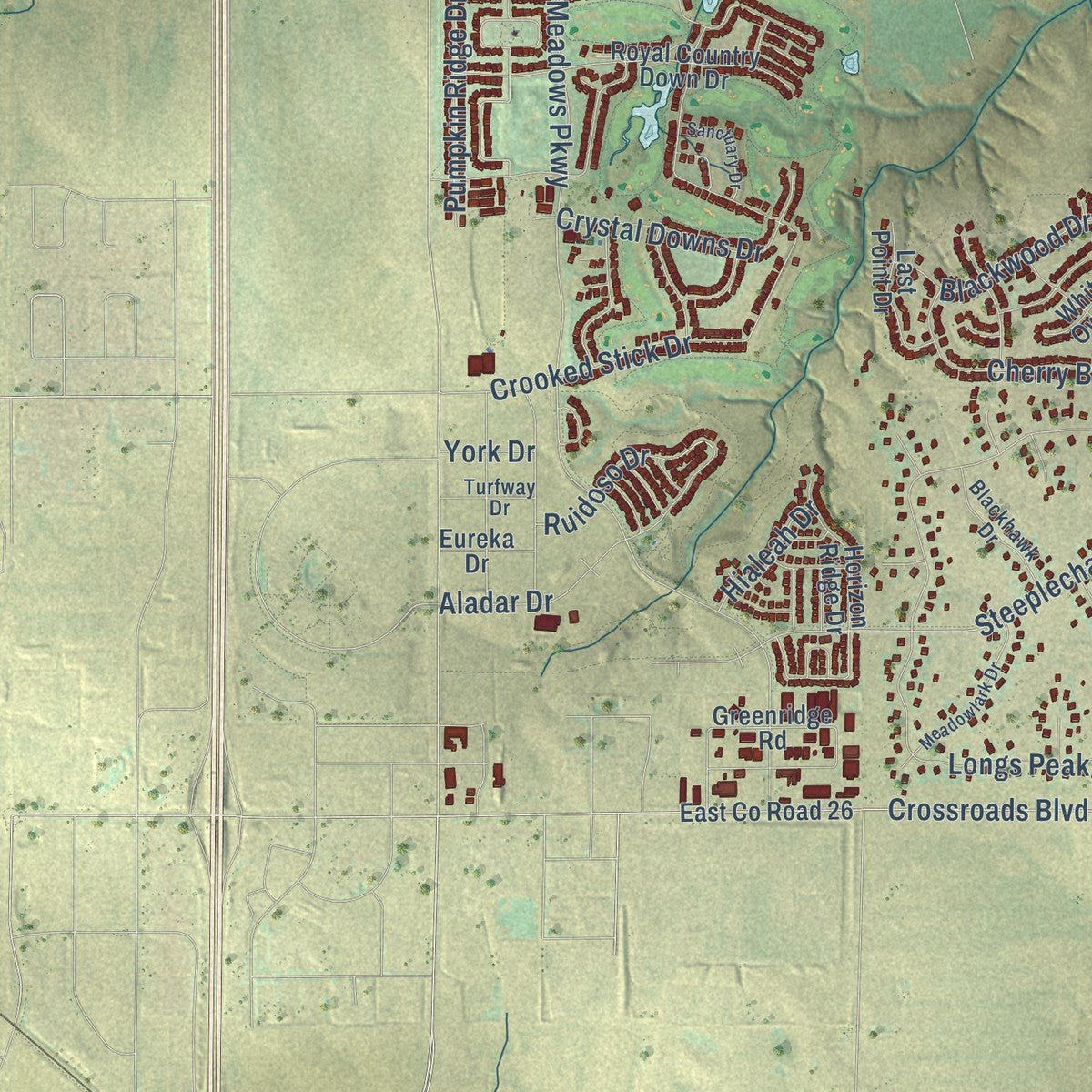
Explore Windsor, Colorado from a whole new perspective. Created using aerial imagery and detailed geographic data, this map captures Windsor building by building, with labeled streets, familiar landmarks, and shaded topographical relief that highlights the natural contours of the landscape.
Combining modern data with the timeless character of a vintage atlas, this map is just as interesting up close as it is beautiful on the wall. Whether you grew up in Windsor, spent memorable years there, or call it home today, this unique map is a great way to celebrate a place that means something to you. Zoom in on the preview to look for your street, and then order a print to put your memories on the wall.
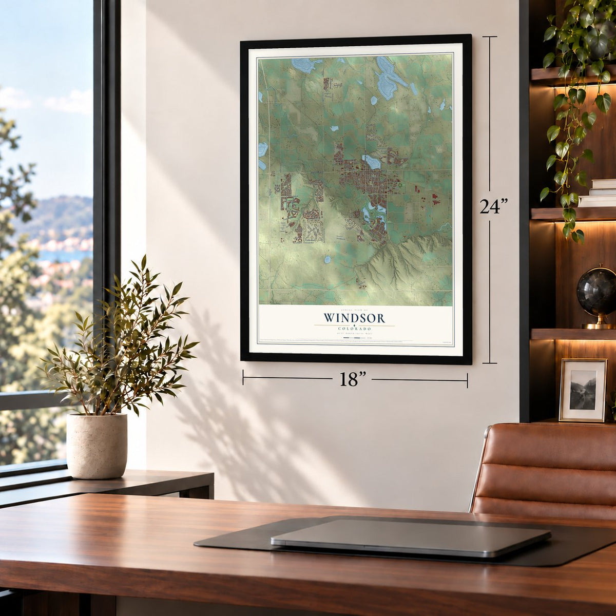
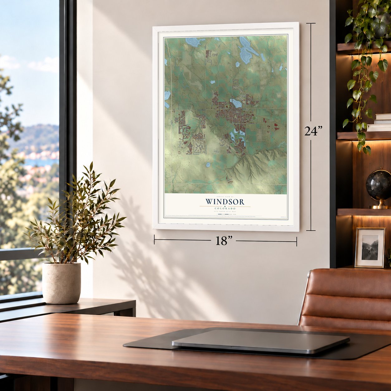
Three ways to hang it
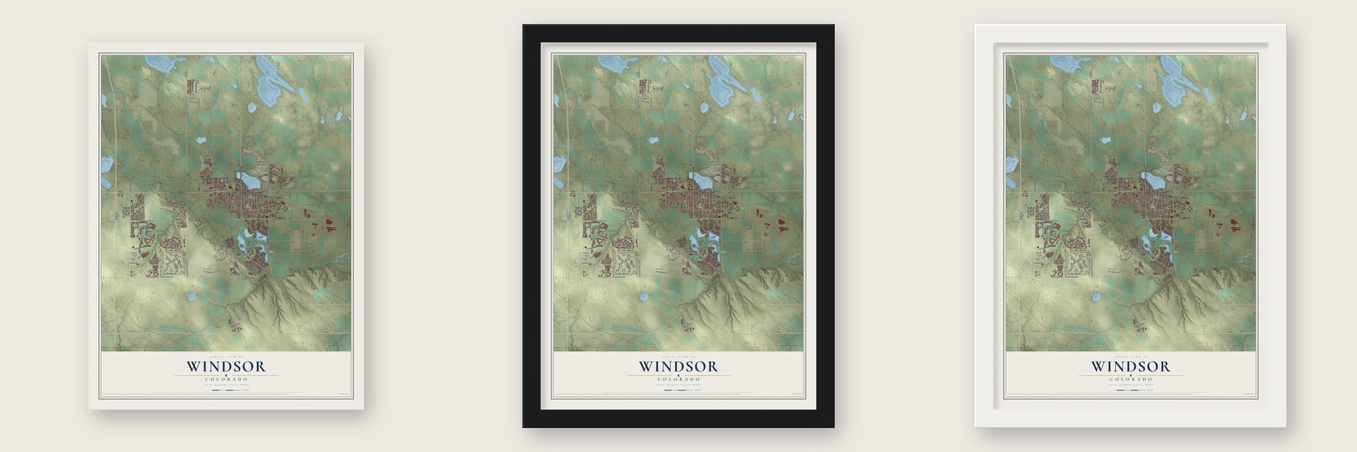
Unframed archival matte, a black wood frame or a white wood frame.
Up close
Geography Worth Displaying
This map was created using accurate cartographic data and authoritative geographic sources, including the U.S. Geological Survey and the Census Bureau. The map brings together terrain, waterways, roads, and building detail. The majority of the streets are labeled, houses are accurately depicted, and the topography is derived from government sources. Combining local data with carefully composed color and shading leads to this beautifully detailed Windsor artwork for your wall.
Rather than simply showing street outlines, we’ve included as many of the street names as we could reasonably fit on the map while keeping their names legible. Zoom in on the high resolution preview to see exactly what’s on the map. We truly set out to create a statement piece for anyone who loves Windsor. So whether it’s for you, or a gift for someone you love, we hope this map of Windsor brings back fond memories.
Read the story behind this map of Windsor, Colorado from 2026.

About Windsor, Colorado
Windsor is a town of 32,716 people in Weld and Larimer counties, on the Cache la Poudre River between Greeley and Fort Collins. In 1873 J.L. Hilton put up a small house at the midpoint between those two towns, and travelers came to call it the half-way house. The Greeley, Salt Lake and Pacific railway soon followed the route it marked, and the trains brought investors and farmers.
Wheat grew well on the river plains, irrigation let farmers raise a wider range of crops, and trains carried the harvest off to buyers. Windsor was platted in 1882, when its railroad depot was built, and it was incorporated in 1890. It had been called New Liberty and New Windsor before it settled on the name of the Rev. Samuel Asa Windsor.
- Sugar beets from 1903By 1900, tariffs on foreign sugar had opened a market for new sources, and Colorado Agricultural College in Fort Collins was working on better ways to grow beets. Windsor got a beet sugar factory in 1903. German immigrants from Russia came to work the fields, and within one generation they owned the most productive beet farms. The Great Western Sugar Company carried the town's economy until the mid-1960s, when the factory closed and Kodak opened a plant.
- The mill that came backA flour mill was among Windsor's first businesses, built to grind the area's wheat. After a fire in 1899 it was rebuilt as the Windsor Milling and Elevator Company, and the building joined the National Register in 1998. The 2008 tornado badly damaged it, and repairs took nearly 10 years.
- The tornado of May 22, 2008At about 11:50 a.m. a tornado with winds up to 165 mph tore through eastern Windsor on an unusual west to northwest path. One man, a Vietnam War veteran, died in his RV, and 78 people were seriously hurt. Every child and staff member at the Windmill Daycare Center escaped with only minor cuts. President George W. Bush declared a federal disaster area on May 26, and about 24,000 claims totaled $193.5 million in damage.
- Harvest Festival on Labor DayEvery Labor Day weekend Windsor holds its Harvest Festival, with a parade, concerts, a carnival, a home and garden fair and hot air balloons. At Boardwalk Park beside Windsor Lake, a museum keeps seven original buildings, among them a train depot with its caboose, a schoolhouse, a farmhouse, a prayer meeting house and a beet shanty from the sugar beet years.
Find your street
Names on the Windsor map
Every name below is printed on this map. Look for your street, your school, the park where you played, or the pond down the road.
Places and landmarks1
- Comer
Streets and roads167
- Main Street
- East County Road 32
- North Seventh Street
- Bayfront Drive
- Greenspire Drive
- Hollister Lake Road
- North 17th Street
- Sundance Drive
- Highland Meadows Parkway
- Fairfield Avenue
- Camberly Drive
- County Highway 13
- Eastman Park Drive
- North County Line Road
- Longs Peak Circle
- Walnut Street
- Crossroads Boulevard
- South County Road 5
- County Line Road
- Steeplechase Drive
- Crooked Stick Drive
- Seventh Street
- East County Road 30
- New Liberty Road
- Oak Street
- First Street
- Blackwood Drive
- Cherry Blossom Drive
- Eleventh Street
- Hilltop Drive
Show all 167 streets
- Great Western Drive
- Boxwood Drive
- Locust Street
- Aladar Drive
- Third Street
- East Garden Drive
- Ridge West Drive
- Stone Mountain Drive
- Elm Street
- Clarence Drive
- Garden Drive
- Tenth Street
- Jacoby Road
- Sixth Street
- Whitney Bay
- Crystal Downs Drive
- Chestnut Street
- Westwood Drive
- Madera Way
- Iron Wheel Drive
- Pumpkin Ridge Drive
- Meander Road
- Hilltop Circle
- Ash Street
- 14th Street
- Guardian Drive
- Southgate Drive
- Wcr 23
- Picture Point Drive
- Ruidoso Drive
- Louden Circle
- Seadrift Drive
- Highfield Drive
- Pine Drive
- Maidenhead Drive
- Ventana Way
- West Ash Street
- Alexander Drive
- Rycroft Drive
- Kestrel Drive
- Merlin Lane
- Bexley Drive
- Hialeah Drive
- Duncroft Drive
- Rea Parkway
- 15th Street
- York Drive
- Grand Avenue
- East Seadrift Drive
- 16th Street
- Canal Drive
- Kaplan Drive
- Paley Drive
- East County Road 26
- North Shore Circle
- Annapolis Drive
- Sand Dollar Drive
- Royal Country Down Drive
- Rivers Edge Road
- Cornerstone Drive
- Hemlock Drive
- Vermillion Peak Drive
- Vineyard Drive
- Dakota Way
- Snowcap Drive
- Windshire Drive
- Haystack Drive
- Cherryridge Drive
- Blue Fortune Drive
- Automation Drive
- Northeast Frontage Road
- Diamond Valley Drive
- Clydesdale Lane
- Lookout Drive
- Fourth Street
- South County Line Road
- Fifth Street
- Shavano Drive
- Twelfth Street
- Horizon Ridge Drive
- Last Point Drive
- Veronica Drive
- Columbine Drive
- Redwood Court
- Country Farms Drive
- East Chestnut Street
- Pelican Cv
- Greenridge Road
- Pelican Farm Road
- Valley Drive
- Beacon Way
- Cobble Drive
- Pointe Plaza Drive
- Longfin Drive
- Nankeen Drive
- West Birch Street
- Eureka Drive
- White Owl Court
- Arroyo Drive
- Eagle Court
- Eighth Street
- Baja Drive
- Durum Street
- North Shores Circle
- Saratoga Way
- North Chimney Park Drive
- Green River Drive
- Southwood Lane
- Moonlight Bay Drive
- Blackhawk Drive
- Ruddlesway Drive
- Shirttail Peak Drive
- Logistics Drive
- Nantucket Street
- Larch Drive
- Turfway Drive
- Stoll Drive
- Birch Street
- Prairie Court
- Falcon Court
- Wood Drive
- Cape Hatteras Drive
- Dartford Drive
- Meadowlark Drive
- New Season Drive
- Sanctuary Drive
- Presado Way
- Meadow Drive
- Metal Container Court
- Northwest Drive
- Westgate Drive
- Gallery Drive
- Parkwood Drive
- Pelican Lake Drive
- Sandy Lane
- Grain Bin Court
- Tiller Court
Names are listed as they appear on the printed map. Zoom into the product photos to find them.
The art of mapping a place
How This Map Was Made
Real places. Remarkable detail. Discover the layers that turn geographic data into a map of home.

The view from above
Aerial imagery reveals the character of the land: woodland, open fields, and the patterns of a place.

The shape of the land
Elevation data brings hills, valleys, and subtle changes in the landscape into view.

The details of home
Roads, waterways, and building footprints come together to make the map feel unmistakably local.

Geography becomes art
Considered color, shading, and typography bring the layers together in a map made for your wall.


Process illustrated with Mendon, Massachusetts. Aerial imagery: USDA NAIP. Terrain: USGS 3D Elevation Program. Map details and finished artwork: KNOWOL.
The Details
About This Print
Choose an archival matte print, or a black or white Ayous wood frame. The archival matte print is unframed.
Select your size and finish above to see the matching product image and price.
Materials & Craftsmanship
A contemporary map with the character of a classic atlas, printed on archival matte paper. Optional frames are made from Ayous wood.
Your printed map does not include the watermark shown in the full-map preview.
Shipping & Delivery
Free shipping within the United States. Every print is made to order in the USA.
Buying a gift? Add a note in your cart and we'll include it. We never put prices in the package.
Prints ship within 2 to 3 business days. Allow 7 to 10 days total from ordering for delivery. Timing may vary during holidays or periods of high order volume.
Read our shipping policy.
Returns and damaged prints
Each print is made to order. Change-of-mind refunds are not available after production.
If your print arrives damaged, misprinted or incorrect, contact support@knowol.com within 30 days of receiving it. Include your order number, photos and a description of the issue.
Read our full refund and replacement policy. For questions about your order, email support@knowol.com.
Find your town
Looking for another city?
Find a map of home in our Colorado collection, or any town in the country.
Nearby
Maps of towns near Windsor
Know someone from one of these towns? Their map makes a great gift.
 Severance
, Colorado
From $39.99See the map
 Timnath
, Colorado
From $39.99See the map
 Greeley
, Colorado
From $39.99See the map
More maps nearby: Loveland, Fort Collins, Eaton, Johnstown and Milliken.