
Search for another town





Free U.S. delivery 7 to 10 days after you order
Loveland, Colorado Map Art
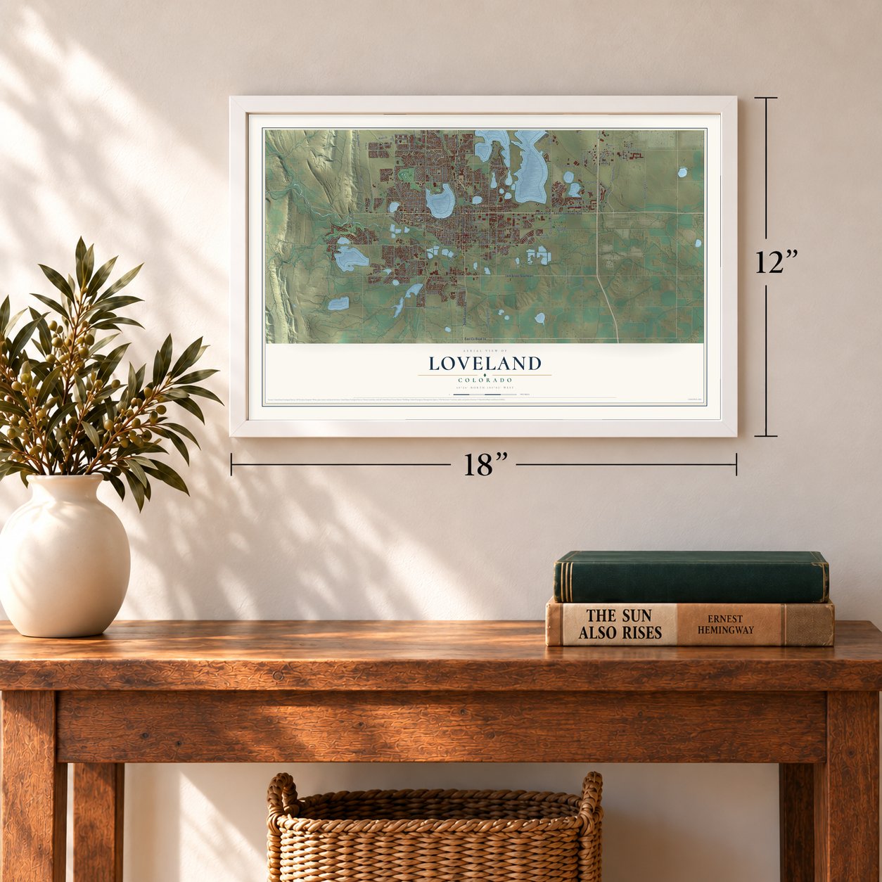
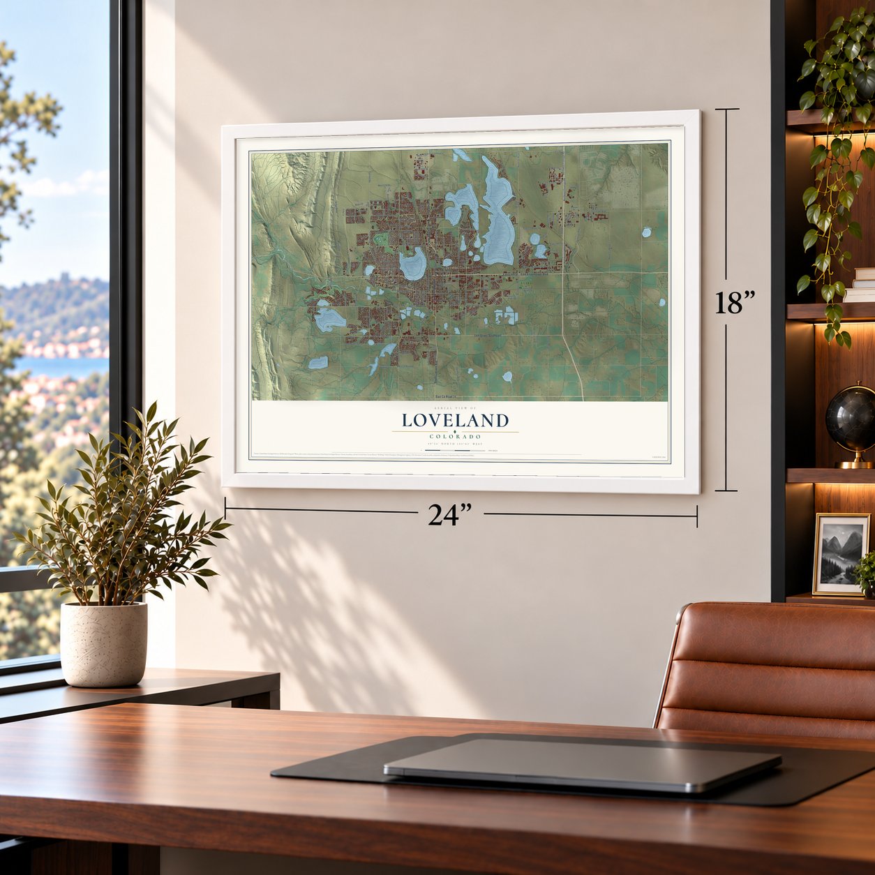
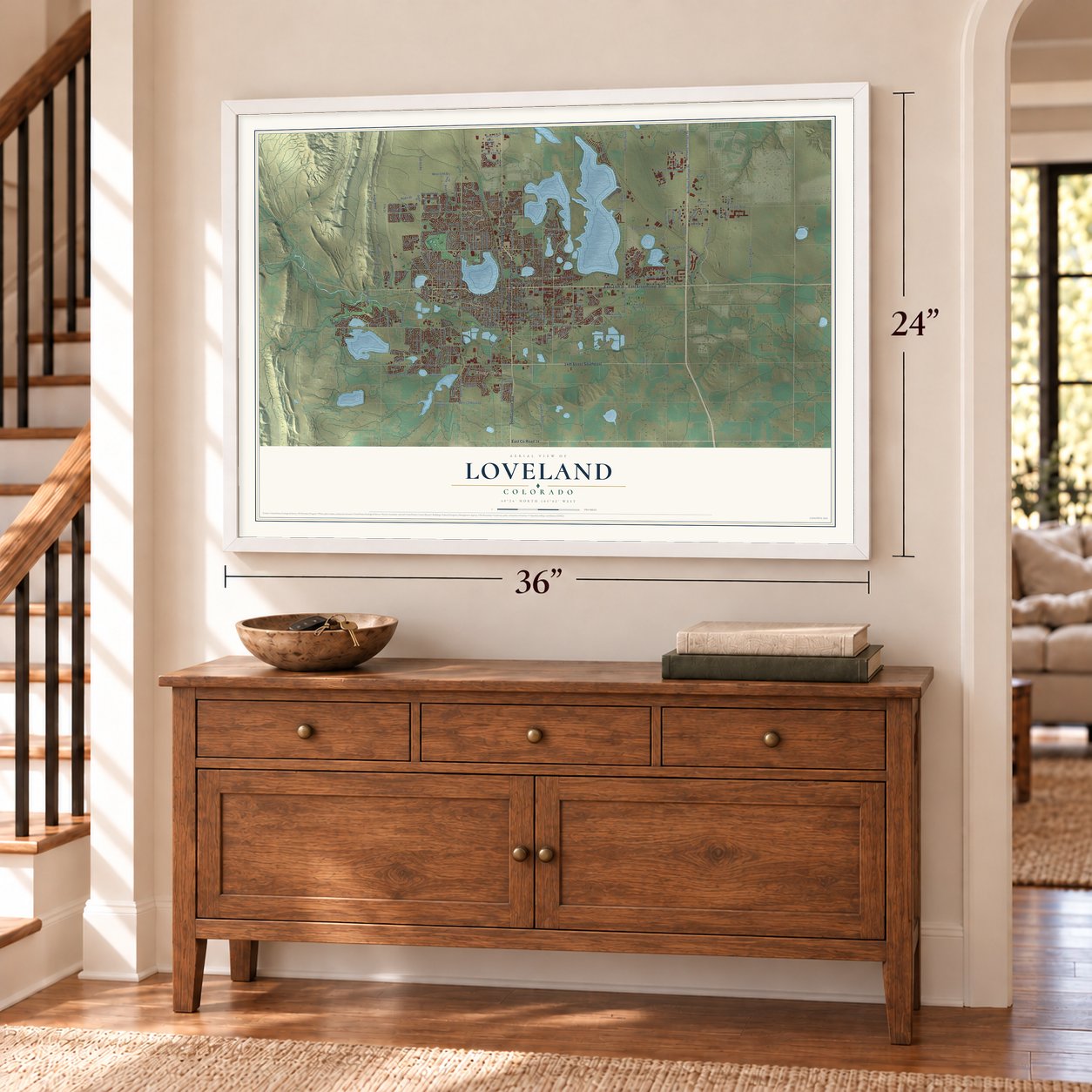
A new map of Loveland, Colorado, made in 2026 and printed to order on thick archival matte paper.
12" x 18" Archival Matte Print
A Map of Home. A Work of Art.
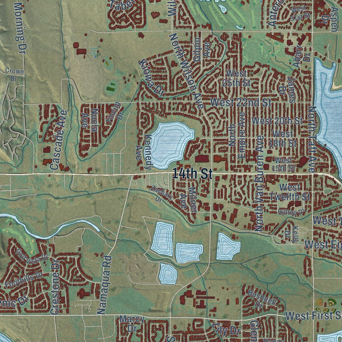
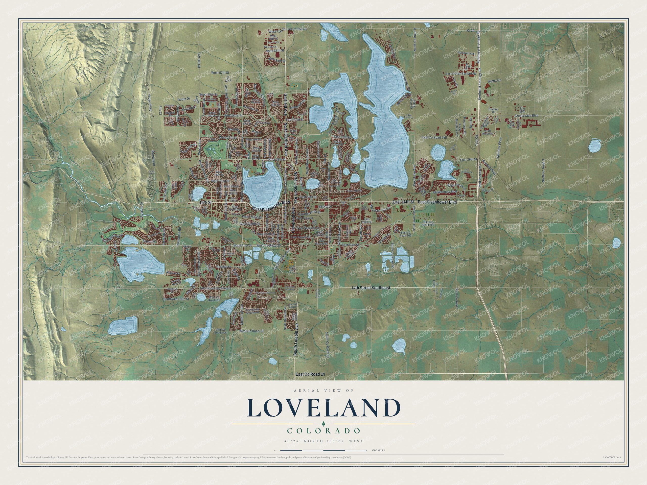
Explore Loveland, Colorado from a whole new perspective. Created using aerial imagery and detailed geographic data, this map captures Loveland building by building, with labeled streets, familiar landmarks, and shaded topographical relief that highlights the natural contours of the landscape.
Combining modern data with the timeless character of a vintage atlas, this map is just as interesting up close as it is beautiful on the wall. Whether you grew up in Loveland, spent memorable years there, or call it home today, this unique map is a great way to celebrate a place that means something to you. Zoom in on the preview to look for your street, and then order a print to put your memories on the wall.
Three ways to hang it
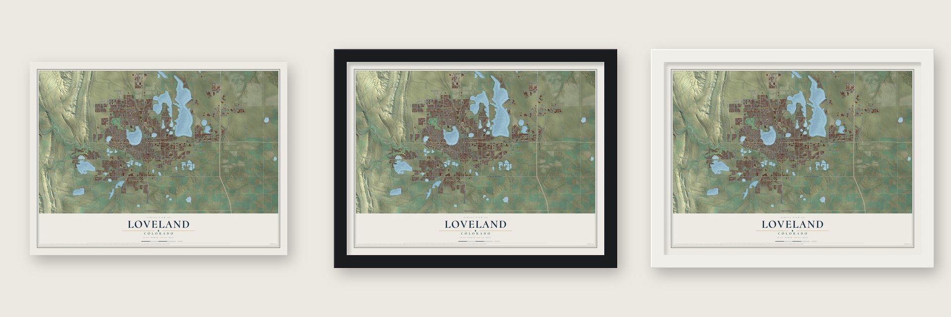
Unframed archival matte, a black wood frame or a white wood frame.
Up close
Geography Worth Displaying
This map was created using accurate cartographic data and authoritative geographic sources, including the U.S. Geological Survey and the Census Bureau. The map brings together terrain, waterways, roads, and building detail. The majority of the streets are labeled, houses are accurately depicted, and the topography is derived from government sources. Combining local data with carefully composed color and shading leads to this beautifully detailed Loveland artwork for your wall.
Rather than simply showing street outlines, we’ve included as many of the street names as we could reasonably fit on the map while keeping their names legible. Zoom in on the high resolution preview to see exactly what’s on the map. We truly set out to create a statement piece for anyone who loves Loveland. So whether it’s for you, or a gift for someone you love, we hope this map of Loveland brings back fond memories.
Read the story behind this map of Loveland, Colorado from 2026.

About Loveland, Colorado
Loveland is a city of 76,378 people in Larimer County, where the Big Thompson River comes out of the Front Range foothills. French fur trappers worked this country in the late 18th and early 19th centuries, and in 1858 Mariano Medina built the area's first settlement, Fort Namaqua, which served as a trading post and stage station. Its site is now Namaqua Park.
The Colorado Central Railroad built a new line through the valley, and in 1877 Loveland was founded beside the tracks near the place where they crossed the river. The town took the name of the railroad's president, William A. H. Loveland. A small settlement called St. Louis already stood a mile away, and its buildings were moved to the new townsite. A post office named Big Thompson opened on January 10, 1878, and Loveland became an incorporated town on April 30, 1881.
“A Valentine Greeting from Sweetheart Town, Loveland, Colorado”
- A sugar factory in 1901For the first half of the 20th century, Loveland lived on farming, and its main crops were sugar beets and sour cherries. The Great Western Sugar Company built a factory here in 1901, and it kept local people employed until it shut down in 1977. Later in the century, Hewlett-Packard, Teledyne and Hach brought manufacturing jobs to town.
- Cherries worth $1 million a yearBy the late 1920s, Spring Glade Orchard ranked as the largest cherry orchard west of the Mississippi, and Loveland's orchards brought in more than $1 million in cherries each year. Droughts, blight, competition from Michigan and other states, and at last a hard freeze ended the trade. By the late 1960s cherries were no longer grown here at scale.
- Sweetheart Town since 1947In January 1947 postmaster Elmer Ivers got about 30 valentines from people asking for a Loveland postmark. He and Ted Thompson saw a way to advertise the town, and the Chamber of Commerce backed the idea. Thompson drew a cachet of an arrow-pierced heart above the Rocky Mountains. Every year since has brought a new verse and design, and the program now re-mails more than 160,000 cards from across the U.S. and more than 110 countries.
- 475 works of public artSo many artists made their homes in Loveland that the city gained three foundries, an art museum and yearly sculpture shows each August, including Sculpture in the Park, put on by the Loveland High Plains Arts Council. The public art collection holds 475 pieces, most of them sculpture, and more than 150 stand in Benson Sculpture Garden.
Find your street
Names on the Loveland map
Every name below is printed on this map. Look for your street, your school, the park where you played, or the pond down the road.
Places and landmarks2
- Kings Corner
- Browns Corner
Streets and roads261
- North Lincoln Avenue
- East County Road 14
- South Lincoln Avenue
- Garfield Avenue
- North Garfield Avenue
- East Eisenhower Boulevard
- East 14th Street
- West Eisenhower Boulevard
- 14th Street
- 14th Street Southeast
- Cleveland Avenue
- West County Road 20
- West First Street
- East First Street
- East 37th Street
- Madison Avenue
- Crestone Drive
- South Railroad Avenue
- Hahns Peak Drive
- Centerra Parkway
- North Monroe Avenue
- Test Circle
- Taft Avenue
- North County Road 9
- Wilson Avenue
- Boyd Lake Avenue
- North Wilson Avenue
- 14th Street Southwest
- West 29th Street
- West 57th Street
Show all 261 streets
- West 43rd Street
- North Boise Avenue
- Northeast Frontage Road
- North Taft Avenue
- Clearwater Drive
- Byrd Drive
- Franklin Avenue
- North Duffield Avenue
- West 22nd Street
- South Taft Avenue
- Crossroads Boulevard
- North County Road 3
- West Eighth Street
- Northwest Frontage Road
- West 50th Street
- East Eleventh Street
- Grant Avenue
- McWhinney Boulevard
- Rossum Drive
- West 37th Street
- Silver Leaf Drive
- East 16th Street
- Sheridan Avenue
- East 29th Street
- Colorado Avenue
- West County Road 16
- South County Road 13
- East Seventh Street
- Harrison Avenue
- East Fourth Street
- Denver Avenue
- West Tenth Street
- Deer Meadow Drive
- Earhart Road
- Eagle Drive
- Mountain Lion Drive
- Boise Avenue
- Carlisle Drive
- Arena Circle
- Angora Drive
- Glen Isle Drive
- North Van Buren Avenue
- Valley Oak Drive
- Southwest 18th Street
- South Wilson Avenue
- West Fifth Street
- Florence Drive
- Logan Drive
- Mall Access Road
- Cascade Avenue
- Morning Drive
- Park Drive
- Precision Drive
- Tabernash Drive
- Ridge Parkway
- Cove Drive
- Knobcone Drive
- Cr 30
- Kincaid Drive
- Scenic Drive
- Namaqua Road
- Katie Drive
- West 64th Street
- Kiowa Drive
- East 42nd Street
- Taft Hill Road
- Lucerne Avenue
- West 65th Street
- Diana Drive
- Nickel Drive
- Kendall Parkway
- Maple Drive
- Finch Street
- Antero Drive
- Boulder Drive
- Rodin Drive
- West 71st Street
- Lear Drive
- Corvus Drive
- Glenda Drive
- Avon Avenue
- Fruita Drive
- Yew Drive
- Fife Court
- Lily Drive
- North Madison Avenue
- Cottonwood Drive
- Georgetown Drive
- West 25th Street
- Leopard Street
- Heron Drive
- East County Road 30
- Rocky Mountain Avenue
- East Fifth Street
- Lake Drive
- South Dotsero Drive
- Seven Lakes Drive
- West 45th Street
- North Empire Avenue
- Monroe Avenue
- East 57th Street
- 23rd Street Southwest
- East 23rd Street
- South Garfield Avenue
- West Twelfth Street
- West 36th Street
- North Boyd Lake Avenue
- Roaring Fork Drive
- West 18th Street
- 28th Str Southwest
- West 41st Street
- Draft Horse Drive
- Frances Drive
- West 33rd Street
- East Second Street
- East Ninth Street
- West 44th Street
- Sea Gull Circle
- East 18th Street
- James Drive
- Kennedy Avenue
- Ash Avenue
- East Tenth Street
- Clydesdale Parkway
- West Third Street
- South County Road 7
- Cub Lake Drive
- Rockwell Avenue
- Derby Hill Drive
- Heather Drive
- Johnson Avenue
- West 30th Street
- West 20th Street
- Marcy Drive
- Lavastone Avenue
- Virgo Circle
- Apricot Drive
- Sunny Shore Drive
- Green Teal Drive
- Bent Drive
- Piper Drive
- West 48th Street
- Banyan Court
- Aspen Drive
- Prickly Pear Drive
- Tarryall Street
- Vona Drive
- Patton Avenue
- Milner Avenue
- Stallion Drive
- Abarr Drive
- West 69th Street
- Sitka Court
- Piney River Drive
- Split Rock Drive
- Olson Drive
- Higgins Street
- Nucla Avenue
- Magpie Drive
- Gilpin Avenue
- Ward Avenue
- La Veta Drive
- Elder Drive
- Lepus Drive
- Janus Drive
- Degas Drive
- Ivy Drive
- Lake Shore Drive
- South Roosevelt Avenue
- Foothills Drive
- South Edinburgh Drive
- Roosevelt Avenue
- East 13th Street
- West 15th Street
- Buffalo Mountain Drive
- Ranae Drive
- West 66th Street
- South Boise Avenue
- Macarthur Avenue
- Sky Pond Drive
- Challenger Point Drive
- Bushnell Drive
- Norway Maple Drive
- East 21st Street
- Glen Haven Drive
- Hayes Avenue
- Cedar Drive
- Fletcher Street
- Crooked Wash Drive
- Polk Drive
- Apple Avenue
- Tincup Drive
- Divide Drive
- Gemini Court
- Artisan Drive
- Daniel Lee Drive
- Dafina Drive
- Topaz Drive
- Cirrus Street
- Belle Drive
- Kelly Drive
- South Colorado Avenue
- East 15th Street
- Sculptor Drive
- South Tyler Drive
- 16th Street Southwest
- Tupelo Drive
- Filbert Drive
- West 31st Street
- Spirit Crossing Drive
- Cheyenne Avenue
- Sally Ann Drive
- Sunridge Drive
- Saint Cloud Drive
- Golf Vista Drive
- Hilltop Drive
- 19th Street Southeast
- Foxtrail Drive
- Zachary Drive
- West 67th Street
- East 19th Street
- Steamboat Springs Street
- Zinc Avenue
- Emerald Street
- Canter Lane
- Allen Drive
- Olsen Drive
- Flagler Avenue
- Seeley Drive
- Crown Drive
- Logan Court
Names are listed as they appear on the printed map. Zoom into the product photos to find them.
The art of mapping a place
How This Map Was Made
Real places. Remarkable detail. Discover the layers that turn geographic data into a map of home.

The view from above
Aerial imagery reveals the character of the land: woodland, open fields, and the patterns of a place.

The shape of the land
Elevation data brings hills, valleys, and subtle changes in the landscape into view.

The details of home
Roads, waterways, and building footprints come together to make the map feel unmistakably local.

Geography becomes art
Considered color, shading, and typography bring the layers together in a map made for your wall.


Process illustrated with Mendon, Massachusetts. Aerial imagery: USDA NAIP. Terrain: USGS 3D Elevation Program. Map details and finished artwork: KNOWOL.
The Details
About This Print
Choose an archival matte print, or a black or white Ayous wood frame. The archival matte print is unframed.
Select your size and finish above to see the matching product image and price.
Materials & Craftsmanship
A contemporary map with the character of a classic atlas, printed on archival matte paper. Optional frames are made from Ayous wood.
Your printed map does not include the watermark shown in the full-map preview.
Shipping & Delivery
Free shipping within the United States. Every print is made to order in the USA.
Buying a gift? Add a note in your cart and we'll include it. We never put prices in the package.
Prints ship within 2 to 3 business days. Allow 7 to 10 days total from ordering for delivery. Timing may vary during holidays or periods of high order volume.
Read our shipping policy.
Returns and damaged prints
Each print is made to order. Change-of-mind refunds are not available after production.
If your print arrives damaged, misprinted or incorrect, contact support@knowol.com within 30 days of receiving it. Include your order number, photos and a description of the issue.
Read our full refund and replacement policy. For questions about your order, email support@knowol.com.
Find your town
Looking for another city?
Find a map of home in our Colorado collection, or any town in the country.
Nearby
Maps of towns near Loveland
Know someone from one of these towns? Their map makes a great gift.
 Windsor
, Colorado
From $39.99See the map
 Fort Collins
, Colorado
From $39.99See the map
 Timnath
, Colorado
From $39.99See the map
More maps nearby: Berthoud, Johnstown, Severance, Milliken and Mead.