
Search for another town


Free U.S. delivery 7 to 10 days after you order
Fort Collins, Colorado Map Art
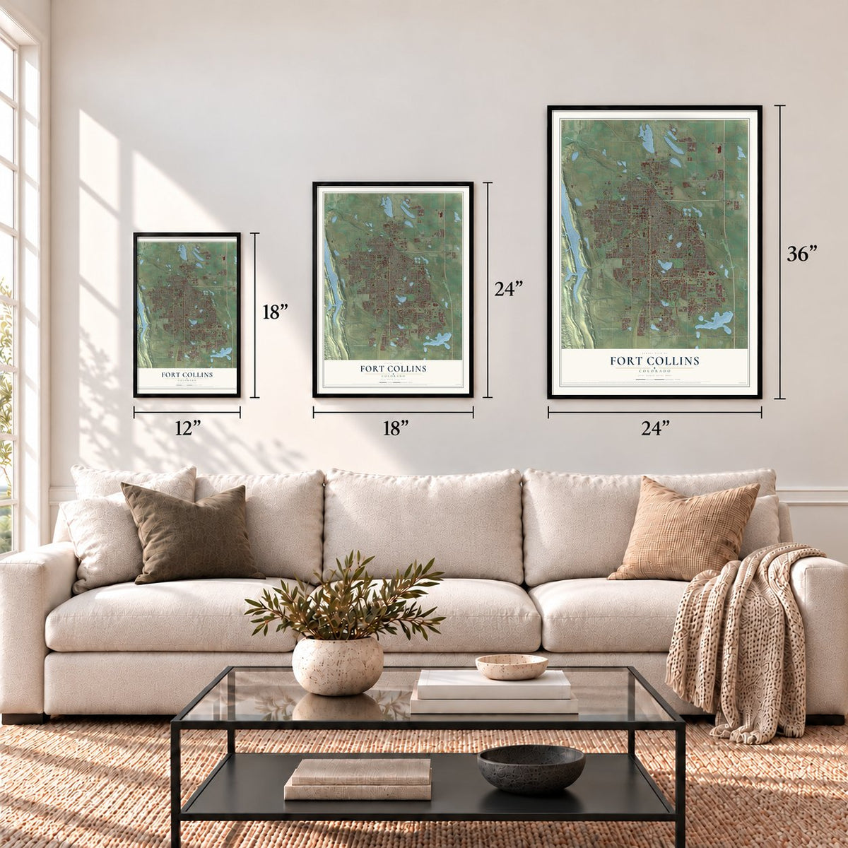
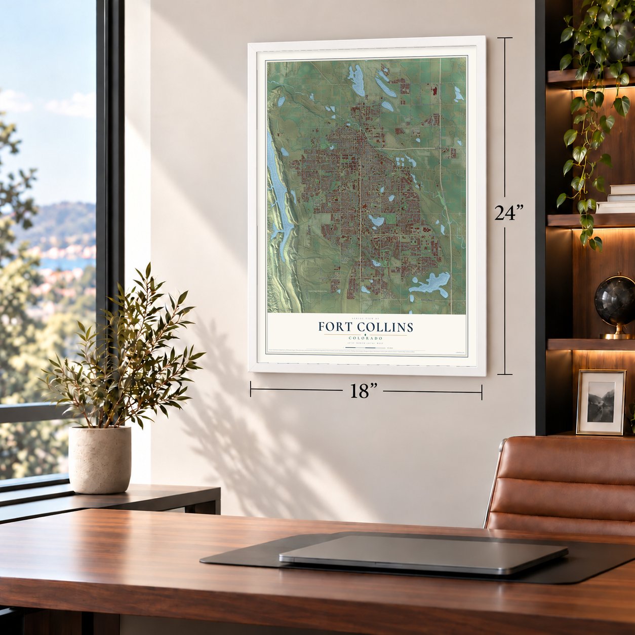
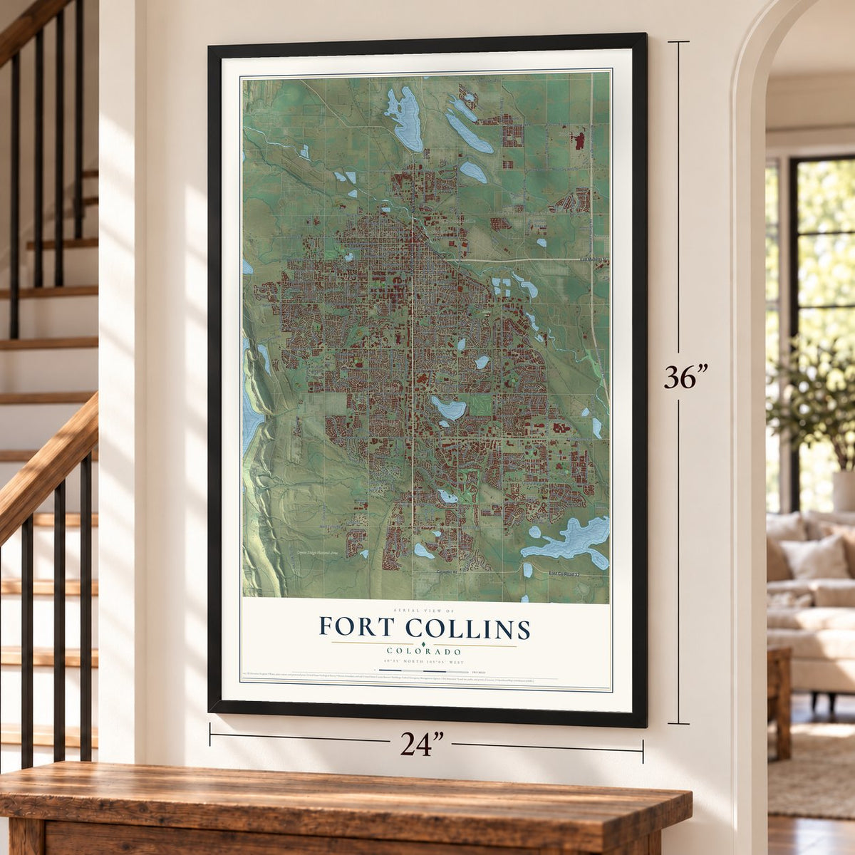
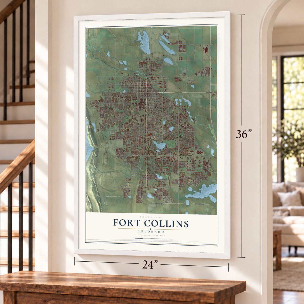
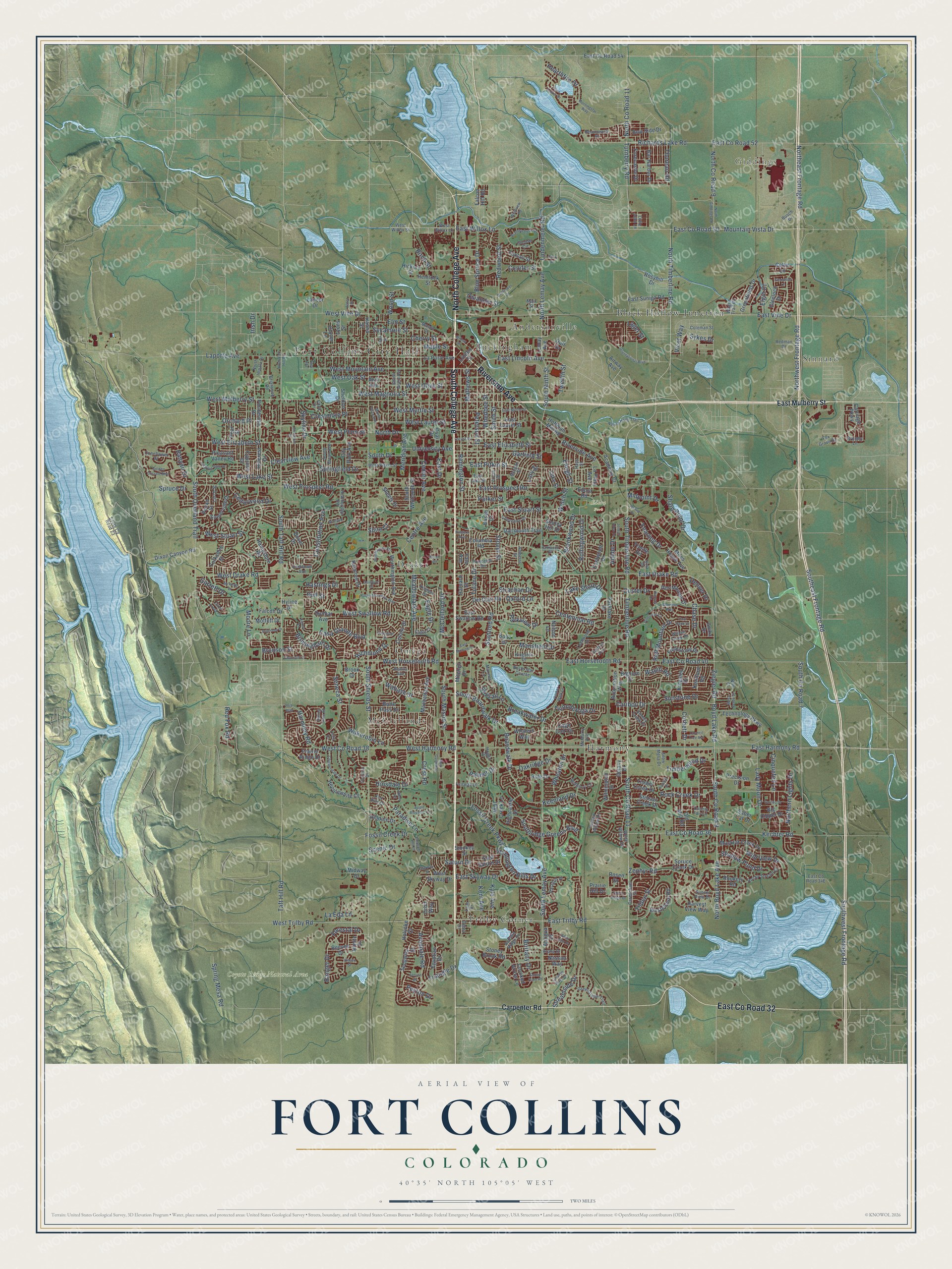
A new map of Fort Collins, Colorado, made in 2026 and printed to order on thick archival matte paper.
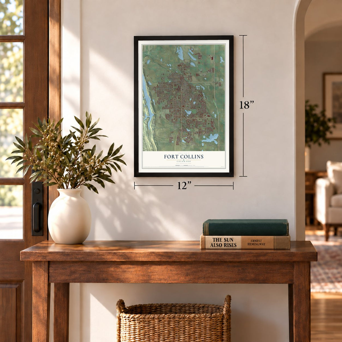
12" x 18" Archival Matte Print
A Map of Home. A Work of Art.
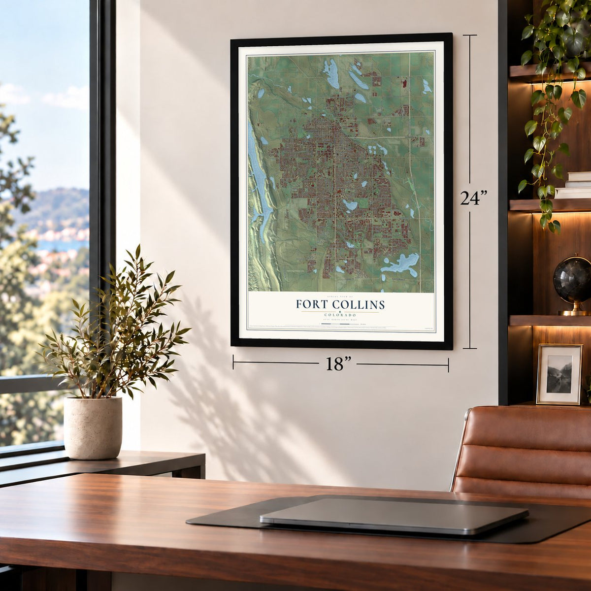
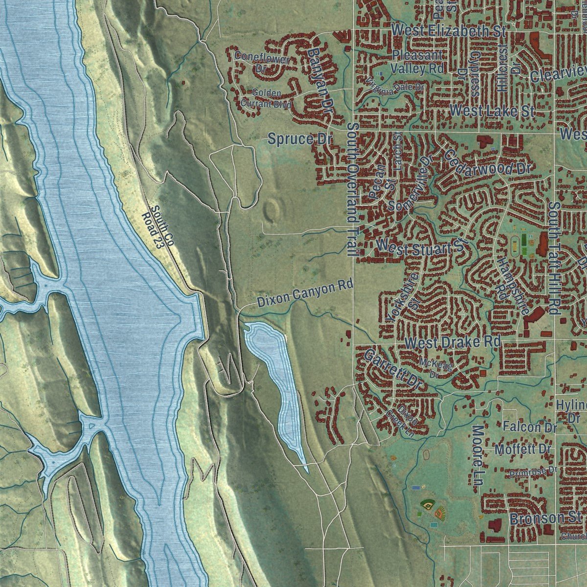
Explore Fort Collins, Colorado from a whole new perspective. Created using aerial imagery and detailed geographic data, this map captures Fort Collins building by building, with labeled streets, familiar landmarks, and shaded topographical relief that highlights the natural contours of the landscape.
Combining modern data with the timeless character of a vintage atlas, this map is just as interesting up close as it is beautiful on the wall. Whether you grew up in Fort Collins, spent memorable years there, or call it home today, this unique map is a great way to celebrate a place that means something to you. Zoom in on the preview to look for your street, and then order a print to put your memories on the wall.
Three ways to hang it
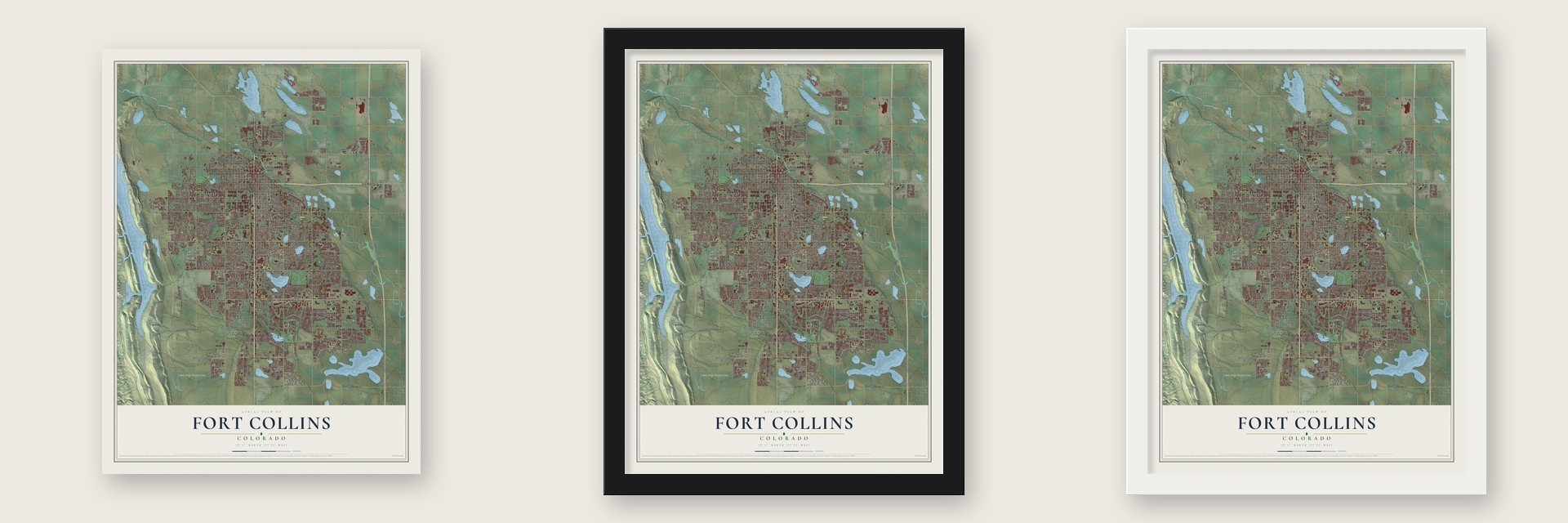
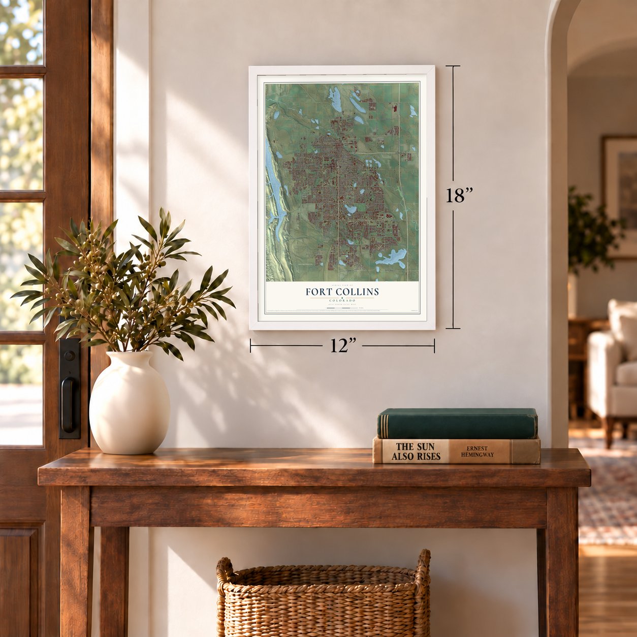
Unframed archival matte, a black wood frame or a white wood frame.
Up close
Geography Worth Displaying
This map was created using accurate cartographic data and authoritative geographic sources, including the U.S. Geological Survey and the Census Bureau. The map brings together terrain, waterways, roads, and building detail. The majority of the streets are labeled, houses are accurately depicted, and the topography is derived from government sources. Combining local data with carefully composed color and shading leads to this beautifully detailed Fort Collins artwork for your wall.
Rather than simply showing street outlines, we’ve included as many of the street names as we could reasonably fit on the map while keeping their names legible. Zoom in on the high resolution preview to see exactly what’s on the map. We truly set out to create a statement piece for anyone who loves Fort Collins. So whether it’s for you, or a gift for someone you love, we hope this map of Fort Collins brings back fond memories.
Read the story behind this map of Fort Collins, Colorado from 2026.

About Fort Collins, Colorado
Fort Collins is a city of 169,810 people and the seat of Larimer County, on the Cache La Poudre River at the foot of the Front Range. It began with Camp Collins, an Army post near today's Laporte that guarded the Overland mail route during the Indian wars of the mid-1860s. A flood wiped out that camp in June 1864, so its commander wrote to Colonel William O. Collins at Fort Laramie and proposed a new site a few miles downstream.
Two companies of the 11th Ohio Volunteer Cavalry held the new post, which never had walls, and its post office opened on June 27, 1865. Settlers came almost at once, and the first school and church opened in 1866. The Army shut the fort in 1867, the year the town was platted. In 1868 local businessman Joseph Mason led the residents in a campaign that moved the county seat from LaPorte to Fort Collins.
- A farm colony in 1872The town's first boom came in 1872, when an agricultural colony brought hundreds of settlers who built on lots just south of Old Town. Friction between the newcomers and the earlier residents split local politics, and the town was incorporated in 1873. Colorado Agricultural College, founded in 1870, held its first classes in 1879. Its enrollment doubled in the 1960s, and as Colorado State University it became the city's main economic force by the end of the century.
- Lamb feeding capital of the worldStone quarrying, sugar beets, chestnuts and sheep slaughter were among the area's first industries. The college and its agricultural experiment station supported the beet crop, and the leftover beet tops made plentiful feed for local sheep. By the early 1900s people were calling the area the "Lamb feeding capital of the world."
- Dry until 1969Whether to ban alcohol was a bitter fight in the town's early decades. The ban held from the late 1890s until student activism helped end it in 1969. Today the city has over 20 breweries, among them New Belgium and Odell, and each late June the Colorado Brewer's Festival brings beers from as many as 45 Colorado brewers and around 30,000 visitors.
- The flood of 1997In late July 1997, 10 to 14 inches of rain fell on the city over a 31-hour stretch, the most ever recorded in an urban part of Colorado. The flash flood killed five people and did $5 million in damage to the city. Water also filled Colorado State University's library, costing the school about $140 million.
Find your street
Names on the Fort Collins map
Every name below is printed on this map. Look for your street, your school, the park where you played, or the pond down the road.
Places and landmarks13
- Fort Collins City Hall
- Giddings
- Coyote Ridge Natural Area
- Edora Park
- Andersonville
- Black Hollow Junction
- Buckingham
- Drakes
- Harmony
- McClellands
- Omega
- Sinnard
Show all 13 places
- Trilby Corner
Streets and roads431
- South College Avenue
- North College Avenue
- Riverside Avenue
- East County Road 32
- Timberline Road
- South County Road 11
- Turnberry Road
- East Lincoln Avenue
- South Timberline Road
- East Vine Drive
- Clearview Avenue
- Center Avenue
- Meridian Avenue
- East Trilby Road
- East County Road 52
- North Boyd Lake Avenue
- East Harmony Road
- South Lemay Avenue
- South Shields Street
- South Taft Hill Road
- East Prospect Road
- Southeast Frontage Road
- Southwest Frontage Road
- Laporte Avenue
- Ziegler Road
- Northeast Frontage Road
- South County Road 9
- West Prospect Road
- Stover Street
- East Horsetooth Road
Show all 431 streets
- West Drake Road
- West Mulberry Street
- East Drake Road
- Richards Lake Road
- East County Road 36
- North County Road 11
- West Horsetooth Road
- South Overland Trail
- West Lake Street
- West Trilby Road
- West Elizabeth Street
- South Mason Street
- South County Road 7
- Mathews Street
- Fossil Creek Parkway
- East County Road 50
- West Stuart Street
- Boyd Lake Road
- Remington Street
- Kechter Road
- Boardwalk Drive
- Southridge Greens Boulevard
- Mountain Vista Drive
- Lady Moon Drive
- South Boardwalk Drive
- West Swallow Road
- West Mountain Avenue
- Rock Creek Drive
- East Pitkin Street
- West County Road 38
- West Harmony Road
- West Plum Street
- Peterson Street
- West Oak Street
- Maple Street
- Whedbee Street
- Cherry Street
- Stanford Road
- East Stuart Street
- North Lemay Avenue
- Corbett Drive
- North Timberline Road
- Taft Hill Road
- East County Road 40
- Constitution Avenue
- Seneca Street
- Lindenmeier Road
- Spring Mesa Road
- Wheaton Drive
- Northwest Frontage Road
- Centre Avenue
- East Elizabeth Street
- West Laurel Street
- Springfield Drive
- West Vine Drive
- Brookwood Drive
- West Magnolia Street
- Conifer Street
- Elm Street
- East Willox Lane
- Fossil Creek Drive
- Zephyr Road
- Meadowlark Avenue
- Northern Lights Drive
- Wood Street
- Timberwood Drive
- Oakridge Drive
- Skyline Drive
- Orchard Place
- Sunstone Drive
- Smith Street
- Wabash Street
- West Olive Street
- West Myrtle Street
- Cinquefoil Lane
- McClelland Drive
- North County Road 9
- Blue Spruce Drive
- Tilden Street
- Tulane Drive
- Caribou Drive
- Garfield Street
- Thoreau Road
- Custer Drive
- Hinsdale Drive
- Huntington Hills Drive
- Midpoint Drive
- University Avenue
- Welch Street
- Redwood Street
- Crestmore Place
- Centennial Road
- Triangle Drive
- Brittany Drive
- Streamside Drive
- Mansfield Drive
- Breakwater Drive
- Avondale Road
- Hearthfire Drive
- Shallow Pond Drive
- South Ninth Street
- Richmond Drive
- Sycamore Street
- Birmingham Drive
- Wild View Drive
- Adobe Drive
- Eagle Drive
- Chase Drive
- Keenland Drive
- Cedarwood Drive
- Casa Grande Boulevard
- Harmony Road
- Moore Lane
- Sharp Point Drive
- Banyan Drive
- Birch Street
- South Drive
- Wakerobin Lane
- Strachan Drive
- Ranger Drive
- Rollingwood Drive
- Palmer Drive
- Parker Street
- Vicot Way
- Hastings Drive
- Red Mountain Drive
- Ticonderoga Drive
- North Drive
- Forestal Drive
- La Eda Lane
- Lake Shore Drive
- Hull Street
- East Skyway Drive
- Sykes Drive
- Red Fox Road
- Kyle Avenue
- Denver Drive
- Skysail Lane
- Wapiti Road
- Scenic Drive
- Parkview Drive
- Elgin Court
- Yearling Drive
- Emigh Street
- East Drive
- Oxford Lane
- Bronson Street
- Twelfth Street
- Paradise Lane
- Crest Road
- Peyton Drive
- Kent Avenue
- Osiander Street
- Garrett Drive
- Saturn Drive
- Spruce Drive
- Shire Court
- Lager Street
- Lory Street
- Irish Drive
- East Mulberry Street
- Carpenter Road
- Carriage Parkway
- South Whitcomb Street
- La Porte Avenue
- Crooked Arrow Lane
- Technology Parkway
- Dunbar Avenue
- Columbia Road
- Hampshire Road
- East Swallow Road
- East Laurel Street
- Worthington Avenue
- Yorkshire Street
- Ponderosa Drive
- Rookery Road
- Dartmouth Trail
- Precision Drive
- City Park Avenue
- Bar Harbor Drive
- East Suniga Road
- Westchase Road
- Linden Street
- Spruce Creek Drive
- Hoffman Mill Road
- Dixon Canyon Road
- Des Moines Drive
- Kingsley Drive
- Hickory Street
- Raintree Drive
- Muskrat Creek Drive
- Manhattan Avenue
- Old Mill Road
- Hillcrest Drive
- Hepplewhite Court
- Parklake Drive
- Colony Drive
- Sheldon Drive
- Falcon Drive
- Del Clair Road
- Hemlock Street
- Eastwood Drive
- Forecastle Drive
- East Saturn Drive
- Stetson Creek Drive
- Somerville Drive
- Saber Cat Drive
- East County Road 54
- Big Dipper Drive
- Boltz Drive
- Automation Way
- Rule Drive
- Timber Creek Drive
- Wilmington Drive
- Delany Drive
- Pleasant Valley Road
- Fieldstone Drive
- West Skyway Drive
- Pecan Street
- Prairie Ridge Drive
- Greenfields Drive
- Lancer Drive
- Highcastle Drive
- Sheely Drive
- Hanna Street
- Sedgwick Drive
- Cape Cod Circle
- Lyons Street
- Miles House Avenue
- Whalers Way
- Clover Lane
- Foxtail Street
- Butte Pass Drive
- Oval Drive
- Academy Court
- Bow Side Drive
- Mail Creek Lane
- Cypress Drive
- Airway Avenue
- Prairie Hill Drive
- Reeves Drive
- Moffett Drive
- Hilldale Drive
- Holyoke Court
- Harvard Street
- Harvest View Way
- Egyptian Drive
- Stoney Hill Drive
- Luke Street
- Stoney Brook Road
- Edora Road
- Lemay Avenue
- Celtic Lane
- Kentford Road
- Glenloch Drive
- La Plata Avenue
- Rosybill Drive
- Pear Street
- Trestle Road
- Nassau Way
- Yale Avenue
- Antigua Drive
- Brook Drive
- Midway Drive
- Smokey Street
- Bighorn Drive
- Mitchell Drive
- Rosen Drive
- Akin Avenue
- Anika Drive
- Duff Drive
- Dover Drive
- Hyline Drive
- Nelson Lane
- Falcon Hill Road
- Nimitz Drive
- Orbit Way
- Busch Court
- Circle Drive
- McMurry Avenue
- South Bryan Avenue
- Busch Drive
- East Lake Street
- West Pitkin Street
- Briarwood Road
- Greenstone Trail
- Stoney Creek Drive
- White Willow Drive
- South Grant Avenue
- Lochwood Drive
- Autumn Ridge Drive
- Princeton Road
- North Star Course
- Hogan Drive
- Carmichael Street
- Coneflower Drive
- Killdeer Drive
- West Willox Lane
- West Willox Street
- Rocky Stream Drive
- Mason Court
- County Fair Lane
- Cheyenne Drive
- Wagon Trail Road
- Morgan Street
- Iowa Drive
- Golden Willow Drive
- Fairway Lane
- Snow Mesa Drive
- Paragon Place
- Yorktown Avenue
- Willow Creek Drive
- Lynn Drive
- Heatheridge Road
- North Impala Drive
- Carlton Avenue
- Fox Grove Drive
- Redberry Court
- Beamreach Place
- Sunset View Drive
- Fox Hills Drive
- Coleman Street
- Eagle Court
- Redman Drive
- Larch Street
- Cook Drive
- South County Road 23
- Mariner Lane
- Kingston Drive
- Grouse Circle
- Aruba Drive
- Amherst Street
- Little John Lane
- Corsica Drive
- Brumby Lane
- Main Street
- Debra Drive
- Hays Street
- Bonita Avenue
- Nite Court
- North Giddings Road
- Parkwood Drive
- Rocky Mountain Way
- Nature Hiking Trail
- East Myrtle Street
- International Boulevard
- East Monroe Drive
- Locust Street
- Joseph Allen Drive
- Golden Currant Boulevard
- Glenmoor Drive
- Snowy Plain Road
- Park Street
- Willow Street
- Gunnison Drive
- Worthington Circle
- Chippendale Drive
- Council Tree Avenue
- North Taft Hill Road
- Annelise Way
- Falcon Ridge Drive
- Bramblebush Street
- Virginia Dale Drive
- Mesa Verde Street
- Kansas Drive
- Pinecone Circle
- Davidson Drive
- Rolling Gate Road
- Galileo Drive
- Harbor Walk Lane
- Morningstar Way
- Winfield Drive
- McKeag Drive
- Jessup Drive
- Max Guideway
- Churchill Court
- Apple Blossom Lane
- Kittery Court
- Town Center Drive
- Jansen Drive
- Primrose Drive
- Laramie River Drive
- Starway Street
- Saint John Place
- Westview Road
- Pleasant Hill Lane
- Dixon Creek Lane
- Bellflower Drive
- Glenarbor Lane
- Monte Vista Avenue
- Coal Bank Drive
- Abbey Road
- Clark Street
- Aztec Drive
- Rutgers Avenue
- Sawhill Drive
- Vinson Street
- Frey Avenue
- Craig Drive
- Booth Road
- Phia Way
Names are listed as they appear on the printed map. Zoom into the product photos to find them.
The art of mapping a place
How This Map Was Made
Real places. Remarkable detail. Discover the layers that turn geographic data into a map of home.

The view from above
Aerial imagery reveals the character of the land: woodland, open fields, and the patterns of a place.

The shape of the land
Elevation data brings hills, valleys, and subtle changes in the landscape into view.

The details of home
Roads, waterways, and building footprints come together to make the map feel unmistakably local.

Geography becomes art
Considered color, shading, and typography bring the layers together in a map made for your wall.


Process illustrated with Mendon, Massachusetts. Aerial imagery: USDA NAIP. Terrain: USGS 3D Elevation Program. Map details and finished artwork: KNOWOL.
The Details
About This Print
Choose an archival matte print, or a black or white Ayous wood frame. The archival matte print is unframed.
Select your size and finish above to see the matching product image and price.
Materials & Craftsmanship
A contemporary map with the character of a classic atlas, printed on archival matte paper. Optional frames are made from Ayous wood.
Your printed map does not include the watermark shown in the full-map preview.
Shipping & Delivery
Free shipping within the United States. Every print is made to order in the USA.
Buying a gift? Add a note in your cart and we'll include it. We never put prices in the package.
Prints ship within 2 to 3 business days. Allow 7 to 10 days total from ordering for delivery. Timing may vary during holidays or periods of high order volume.
Read our shipping policy.
Returns and damaged prints
Each print is made to order. Change-of-mind refunds are not available after production.
If your print arrives damaged, misprinted or incorrect, contact support@knowol.com within 30 days of receiving it. Include your order number, photos and a description of the issue.
Read our full refund and replacement policy. For questions about your order, email support@knowol.com.
Find your town
Looking for another city?
Find a map of home in our Colorado collection, or any town in the country.
Nearby
Maps of towns near Fort Collins
Know someone from one of these towns? Their map makes a great gift.
 Timnath
, Colorado
From $39.99See the map
 Laporte
, Colorado
From $39.99See the map
 Loveland
, Colorado
From $39.99See the map
More maps nearby: Windsor, Wellington, Severance, Pierce and Ault.