
Search for another town


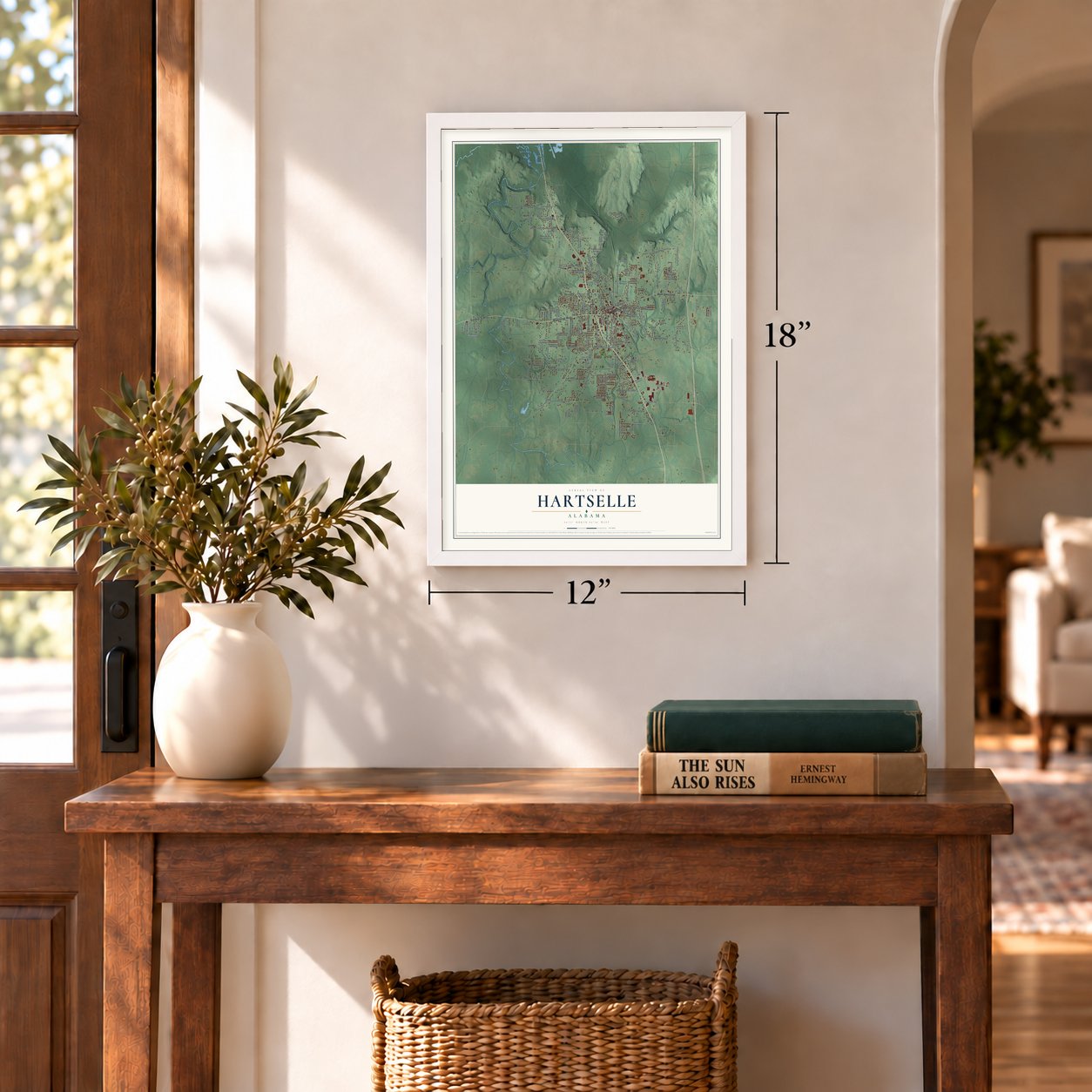

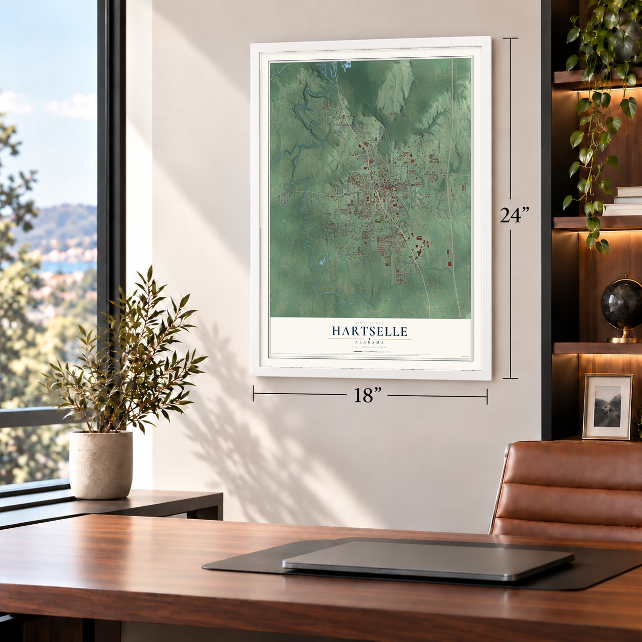
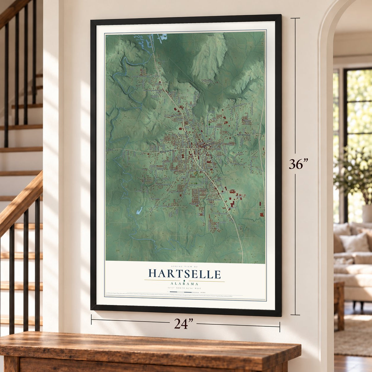
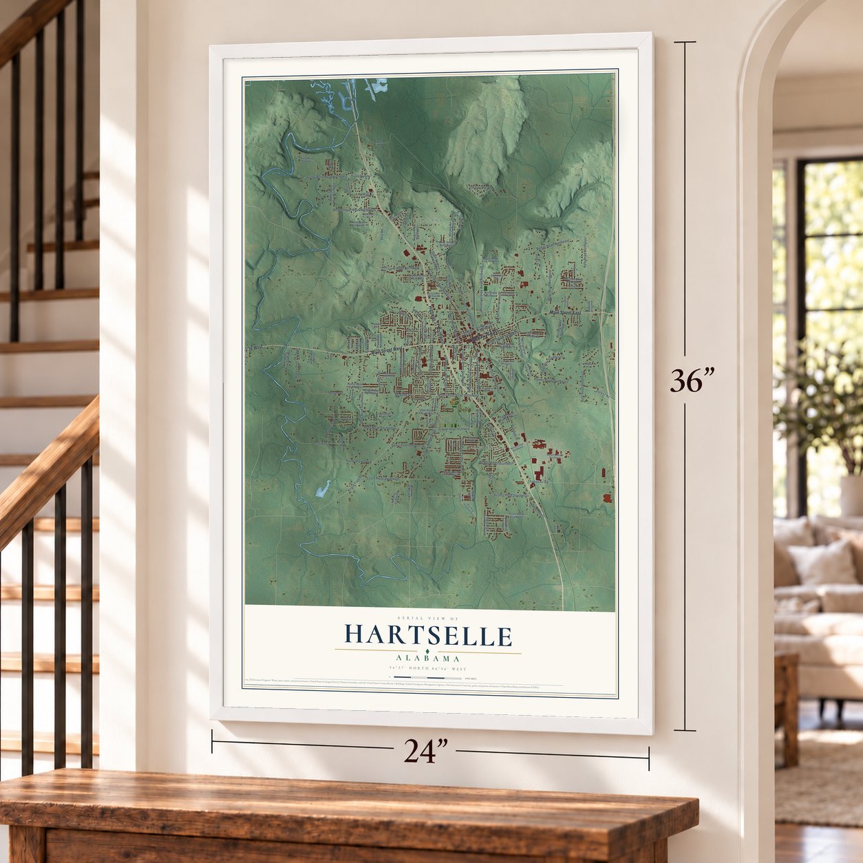

Free U.S. delivery 7 to 10 days after you order
Hartselle, Alabama Map Art
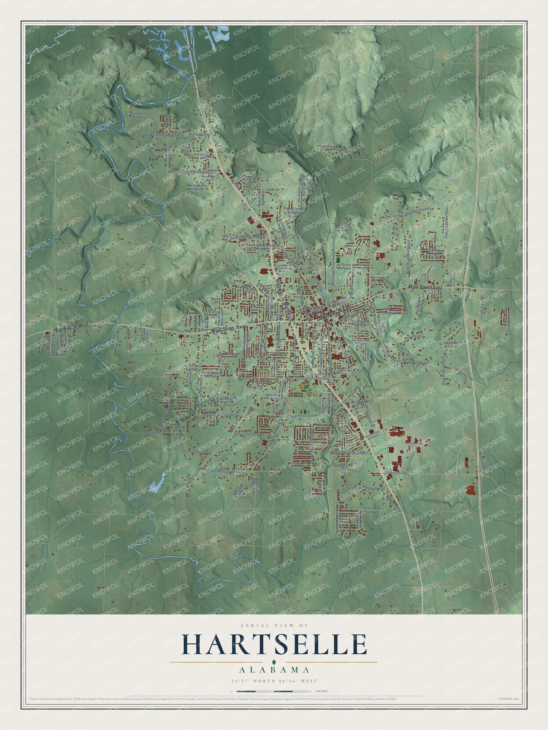
A new map of Hartselle, Alabama, made in 2026 and printed to order on thick archival matte paper.
12" x 18" Archival Matte Print
A Map of Home. A Work of Art.
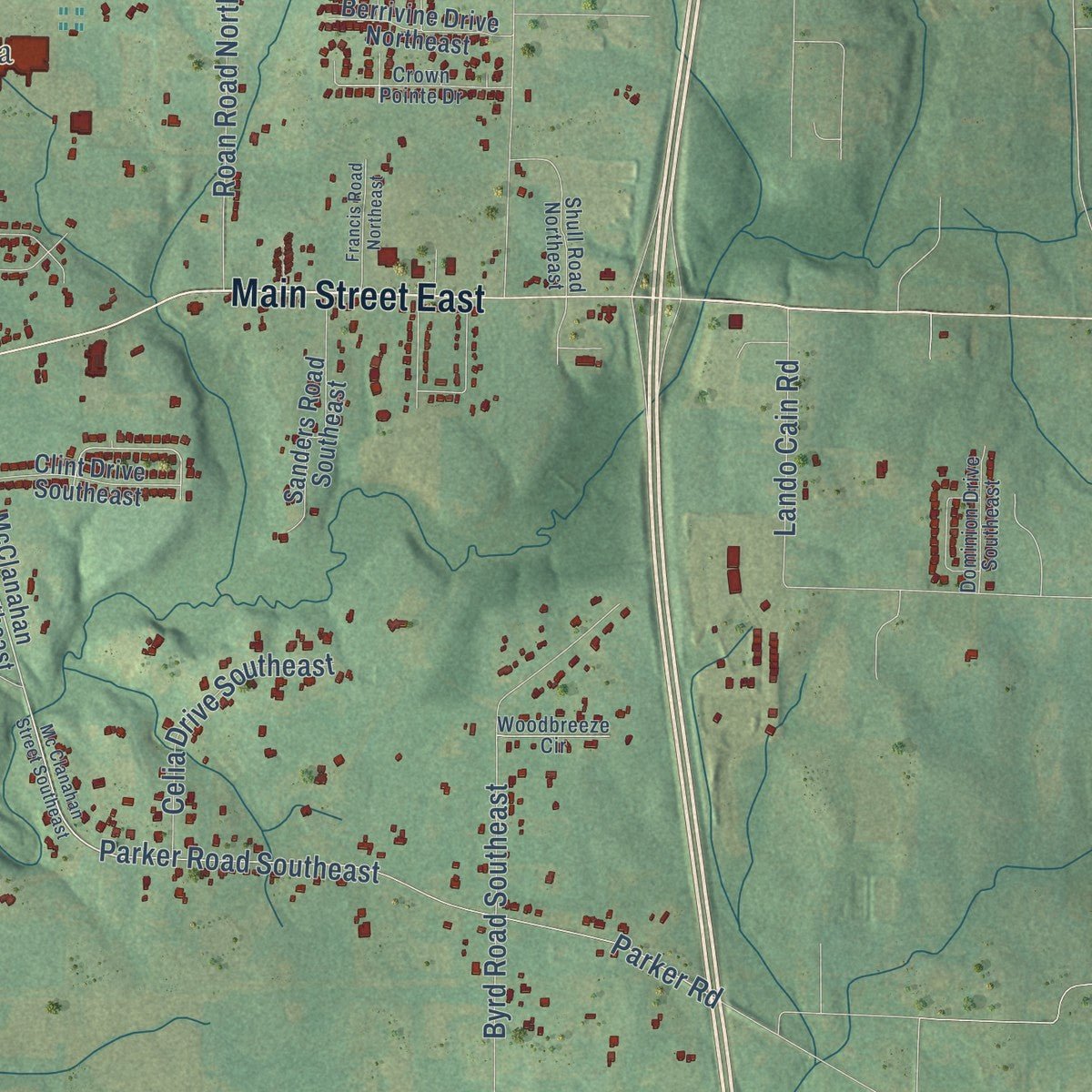
Explore Hartselle, Alabama from a whole new perspective. Created using aerial imagery and detailed geographic data, this map captures Hartselle building by building, with labeled streets, familiar landmarks, and shaded topographical relief that highlights the natural contours of the landscape.
Combining modern data with the timeless character of a vintage atlas, this map is just as interesting up close as it is beautiful on the wall. Whether you grew up in Hartselle, spent memorable years there, or call it home today, this unique map is a great way to celebrate a place that means something to you. Zoom in on the preview to look for your street, and then order a print to put your memories on the wall.
Three ways to hang it
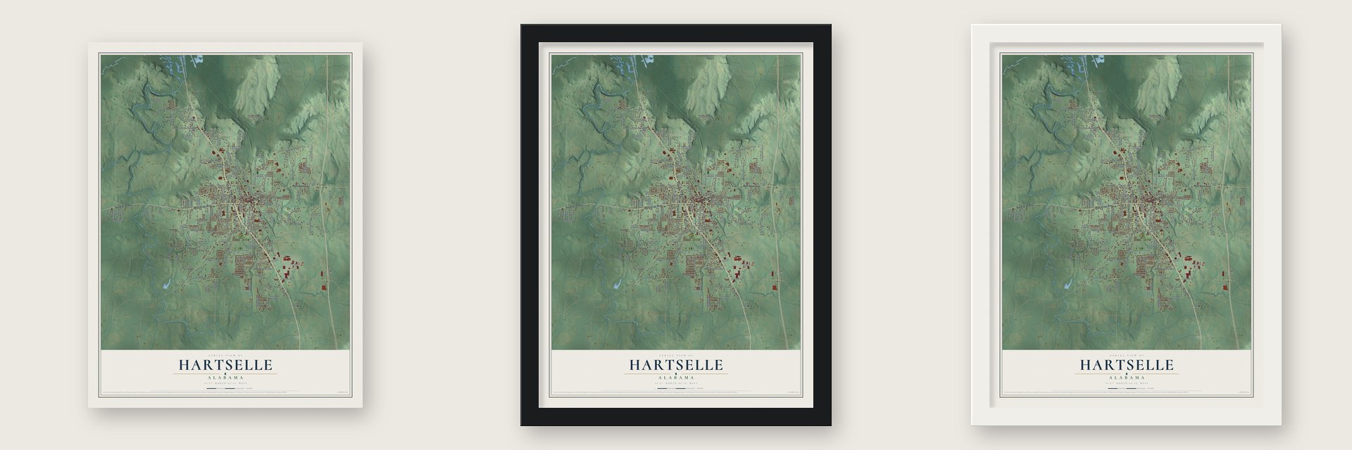
Unframed archival matte, a black wood frame or a white wood frame.
Up close
Geography Worth Displaying
This map was created using accurate cartographic data and authoritative geographic sources, including the U.S. Geological Survey and the Census Bureau. The map brings together terrain, waterways, roads, and building detail. The majority of the streets are labeled, houses are accurately depicted, and the topography is derived from government sources. Combining local data with carefully composed color and shading leads to this beautifully detailed Hartselle artwork for your wall.
Rather than simply showing street outlines, we’ve included as many of the street names as we could reasonably fit on the map while keeping their names legible. Zoom in on the high resolution preview to see exactly what’s on the map. We truly set out to create a statement piece for anyone who loves Hartselle. So whether it’s for you, or a gift for someone you love, we hope this map of Hartselle brings back fond memories.
Read the story behind this map of Hartselle, Alabama from 2026.

About Hartselle, Alabama
Hartselle is a city of 15,455 people in Morgan County, in north-central Alabama, on Shoal Creek about 14 miles south of Decatur. The Louisville & Nashville Railroad opened a station here in 1872, and the town's streets were laid out along the tracks. A post office came in 1873, and Hartselle was incorporated as a town on March 1, 1875.
The name honors George Hartselle, one of the early settlers, and the community was already on maps by 1870. After the railroad arrived, logging and timber mills carried the local economy. That trade peaked around the turn of the century, then slowly faded until it no longer counted for much by 1932. Hartselle was also where much of the county's cotton was ginned, and its population climbed from 596 in 1890 to 1,374 in 1910.
- Downtown burned in 1916In August 1916 a fire tore through the business district and wiped out every one of its 21 buildings. Hartselle built its downtown again, added a public waterworks in 1926 and an electric plant in 1938. Today the rebuilt downtown holds more than 30 antique and gift shops.
- A four-hour bank holdupIn 1926 a gang of robbers seized the bank in Hartselle and kept hostages inside for about four hours. They got away with roughly $15,000 in cash and gold, and the raid is still remembered as one of the most notorious events in the town's past.
- From academy to high schoolHartselle opened its first school in 1883. In 1895 it took the name Hartselle Male and Female Academy, and it taught local children until 1908, when Morgan County High School was founded in the town.
- Huie and SparkmanThe novelist and journalist William Bradford Huie was born in Hartselle, and his work earned the city a place on the Southern Literary Trail. John J. Sparkman, the progressive congressman and senator, was born here too. Sparkman Park, an 80-acre complex named for him, has ball fields, an 18-hole golf course, walking trails and the Military Order of the Purple Heart Memorial.
- Depot Days in SeptemberEvery year on the last Saturday in September, Hartselle holds its Depot Days Festival to honor the railroad that gave the town its start. The day brings a car show, crafts, food, music and games for children.
Find your street
Names on the Hartselle map
Every name below is printed on this map. Look for your street, your school, the park where you played, or the pond down the road.
Places and landmarks3
- Valley View
- Tanner Heights
- Georgia
Streets and roads153
- Main Street West
- Highway 31 Northwest
- Highway 36 East
- Highway 36 West
- Main Street East
- Nance Ford Road Southwest
- Railroad Street Northwest
- Puckett Road
- Byrd Road Southeast
- Mitwede Street
- Bethel Road Northeast
- Ausley Bend Road Northwest
- Thompson Road
- Nance Ford Road
- Sparkman Street Southwest
- Tunsel Road Southwest
- Parker Road Southeast
- Garner Road Southwest
- Barkley Bridge Road Southwest
- Sparkman Street Northwest
- Penn Road Southwest
- Kyle Road Northeast
- Rice Road Southwest
- Parker Road
- Salem Road Southwest
- Railroad Street Southwest
- Roan Road Northeast
- Mountain View Road Northeast
- Corsbie Street Southwest
- Barkley Street Southwest
Show all 153 streets
- Moss Chapel Road Northwest
- Airport Road Southwest
- Lane Road Northwest
- Pattillo Street Southwest
- Cedar Street Northwest
- Mason Drive
- Penn Road
- Short Street Southeast
- Walker Road Southwest
- Celia Drive Southeast
- Hampton Street
- Railroad Street
- Lando Cain Road
- Vest Road
- Vines Drive
- Mallone Road
- Sunset Drive
- Barclift Street
- Elm Street
- Collier Drive
- Foote Road Southwest
- McClanahan Street Southeast
- Springdale Drive Southwest
- Weinman Street Southwest
- Ausley Bend Road
- Hall Street Southwest
- Peach Orchard Road Northwest
- Bethel Street Northeast
- Teague Road Northwest
- Groover Road Southwest
- Crestline Drive Southwest
- Lane Road
- Higdon Road Southwest
- Rhodes Street Northwest
- Nethery Road Southwest
- Ausley Bend Drive Northwest
- Rock Street Southeast
- Nelson Street Southwest
- Hayes Street Southwest
- Sanders Road Southeast
- Bellemeade Street Southwest
- Ray Road Southwest
- Oak Trail Northeast
- Old Highway 31
- South Point Street Southwest
- Slate Street Southwest
- Shaw Road Northwest
- Barkley Bridge Road
- State Street Northwest
- Tabernacle Road Southwest
- Clint Drive Southeast
- College Street Northeast
- Nethery Road
- Moss Street Northwest
- Washington Street Northwest
- Berrivine Drive Northeast
- Huckaby Bridge Road
- Little Drive Southwest
- Elrod Circle
- Nix Street Northeast
- Linwood Street
- Marks Drive Northwest
- Table Rock Drive
- Coleman Street
- Rustic Lane Southwest
- Stage Road Southwest
- Wayward Way
- Pinehurst Street
- Stallworth Street
- Bel Aire Drive
- Cedar Lane
- Kayo Road
- North Railroad Street
- Sivley Road Northwest
- College Street Northwest
- Nesmith Street Southwest
- Wellden Street Southwest
- Mountain View Drive Northeast
- Morningside Drive Northwest
- Stewart Street Southwest
- Hillview Street Northwest
- Curry Street Northwest
- Magnolia Place Lane Southwest
- Eubanks Street Southwest
- White Street Northwest
- Johnson Street Southwest
- Industrial Drive Southeast
- Dominion Drive Southeast
- Cooper Lane Southwest
- Ridgedale Street
- Hunter Lane Southwest
- Brewer Street Southeast
- Crown Pointe Drive
- Shull Road Northeast
- Metco Street Southwest
- Bain Street Southeast
- Brookwood Private Drive
- Woodbreeze Circle
- Sunshine Street
- Elrod Street
- Bluff Street
- Mc Clanahan Street Southeast
- Lee Avenue Northwest
- Celestial Drive Southwest
- Westwood Road Southwest
- Park Avenue Northwest
- Guire Road Northwest
- Tracy Lane Southwest
- Blue Ridge Road Southwest
- Petain Street Southwest
- Cherry Street Northwest
- Ridgecrest Lane
- Nelson Street Northwest
- Francis Road Northeast
- Madison Street Southwest
- Vest Street Southwest
- Halbrooks Road Southwest
- Chantels Way Southwest
- Sherry Street Northeast
- Anders Pass
- Danielle Drive
- Blue Ridge Road
- Bibb Street
Names are listed as they appear on the printed map. Zoom into the product photos to find them.
The art of mapping a place
How This Map Was Made
Real places. Remarkable detail. Discover the layers that turn geographic data into a map of home.

The view from above
Aerial imagery reveals the character of the land: woodland, open fields, and the patterns of a place.

The shape of the land
Elevation data brings hills, valleys, and subtle changes in the landscape into view.

The details of home
Roads, waterways, and building footprints come together to make the map feel unmistakably local.

Geography becomes art
Considered color, shading, and typography bring the layers together in a map made for your wall.


Process illustrated with Mendon, Massachusetts. Aerial imagery: USDA NAIP. Terrain: USGS 3D Elevation Program. Map details and finished artwork: KNOWOL.
The Details
About This Print
Choose an archival matte print, or a black or white Ayous wood frame. The archival matte print is unframed.
Select your size and finish above to see the matching product image and price.
Materials & Craftsmanship
A contemporary map with the character of a classic atlas, printed on archival matte paper. Optional frames are made from Ayous wood.
Your printed map does not include the watermark shown in the full-map preview.
Shipping & Delivery
Free shipping within the United States. Every print is made to order in the USA.
Buying a gift? Add a note in your cart and we'll include it. We never put prices in the package.
Prints ship within 2 to 3 business days. Allow 7 to 10 days total from ordering for delivery. Timing may vary during holidays or periods of high order volume.
Read our shipping policy.
Returns and damaged prints
Each print is made to order. Change-of-mind refunds are not available after production.
If your print arrives damaged, misprinted or incorrect, contact support@knowol.com within 30 days of receiving it. Include your order number, photos and a description of the issue.
Read our full refund and replacement policy. For questions about your order, email support@knowol.com.
Find your town
Looking for another city?
Find a map of home in our Alabama collection, or any town in the country.
Nearby
Maps of towns near Hartselle
Know someone from one of these towns? Their map makes a great gift.
 Falkville
, Alabama
From $39.99See the map
 Priceville
, Alabama
From $39.99See the map
 Somerville
, Alabama
From $39.99See the map
More maps nearby: Decatur, Eva, Mooresville, Trinity and West Point.