
Search for another town


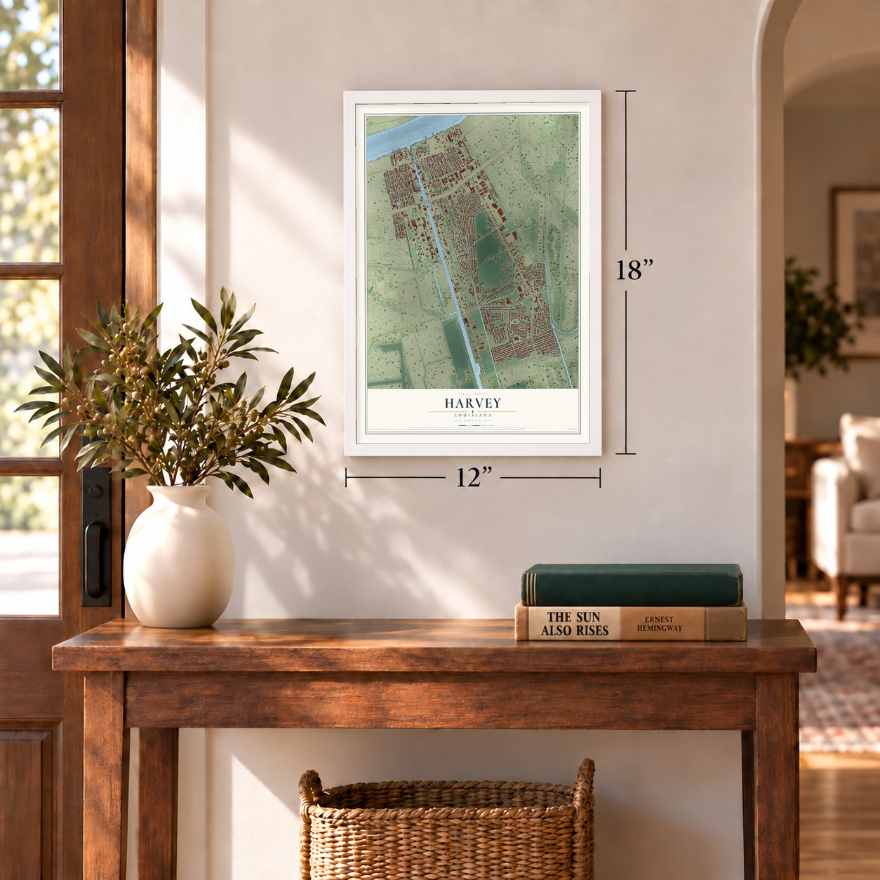

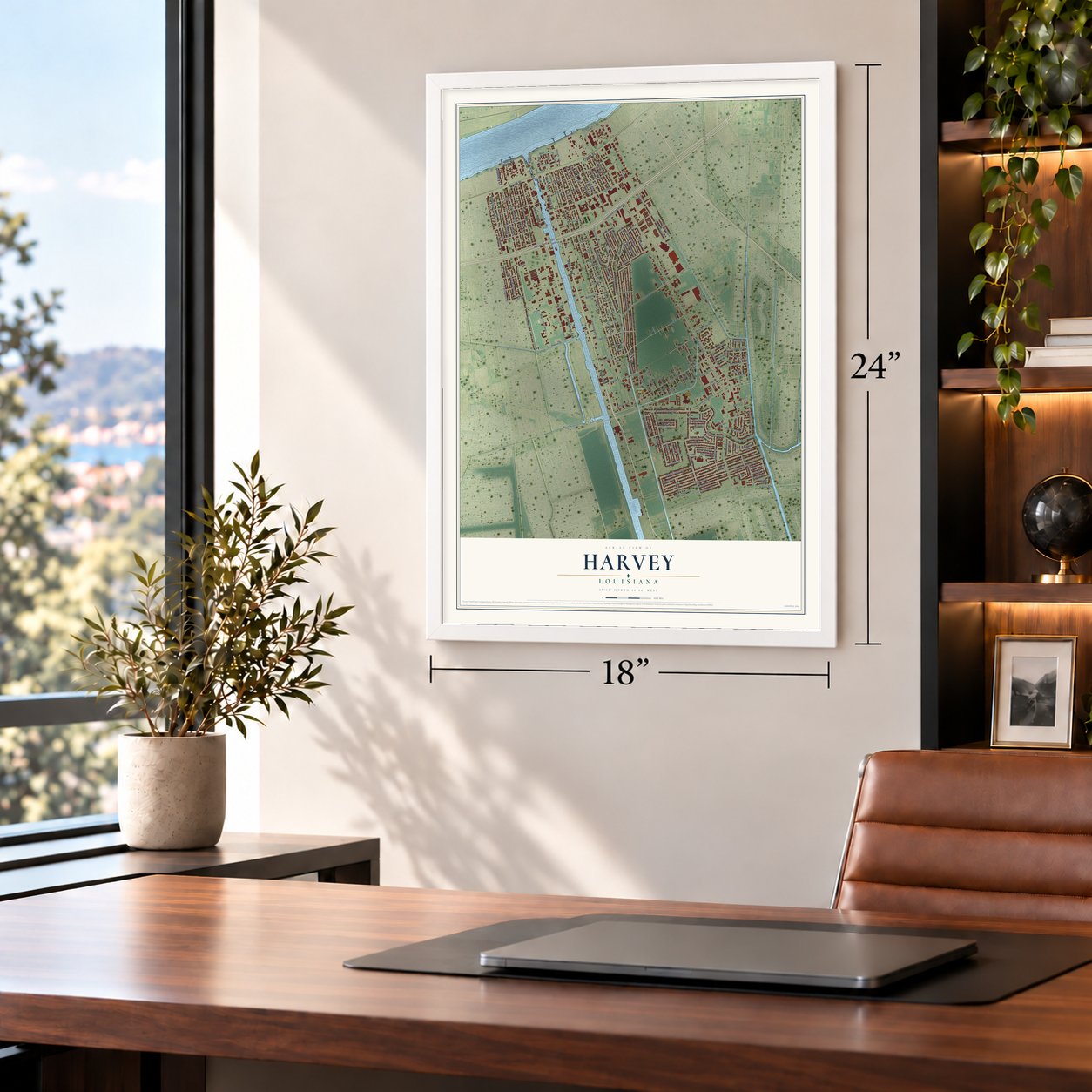

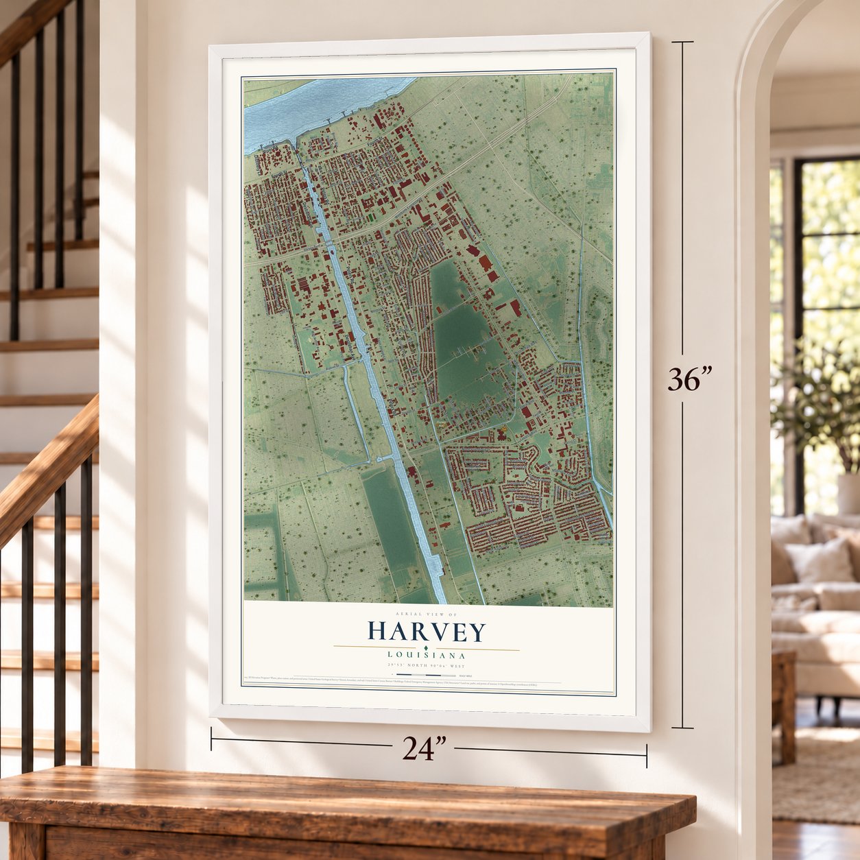

Free U.S. delivery 7 to 10 days after you order
Harvey, Louisiana Map Art
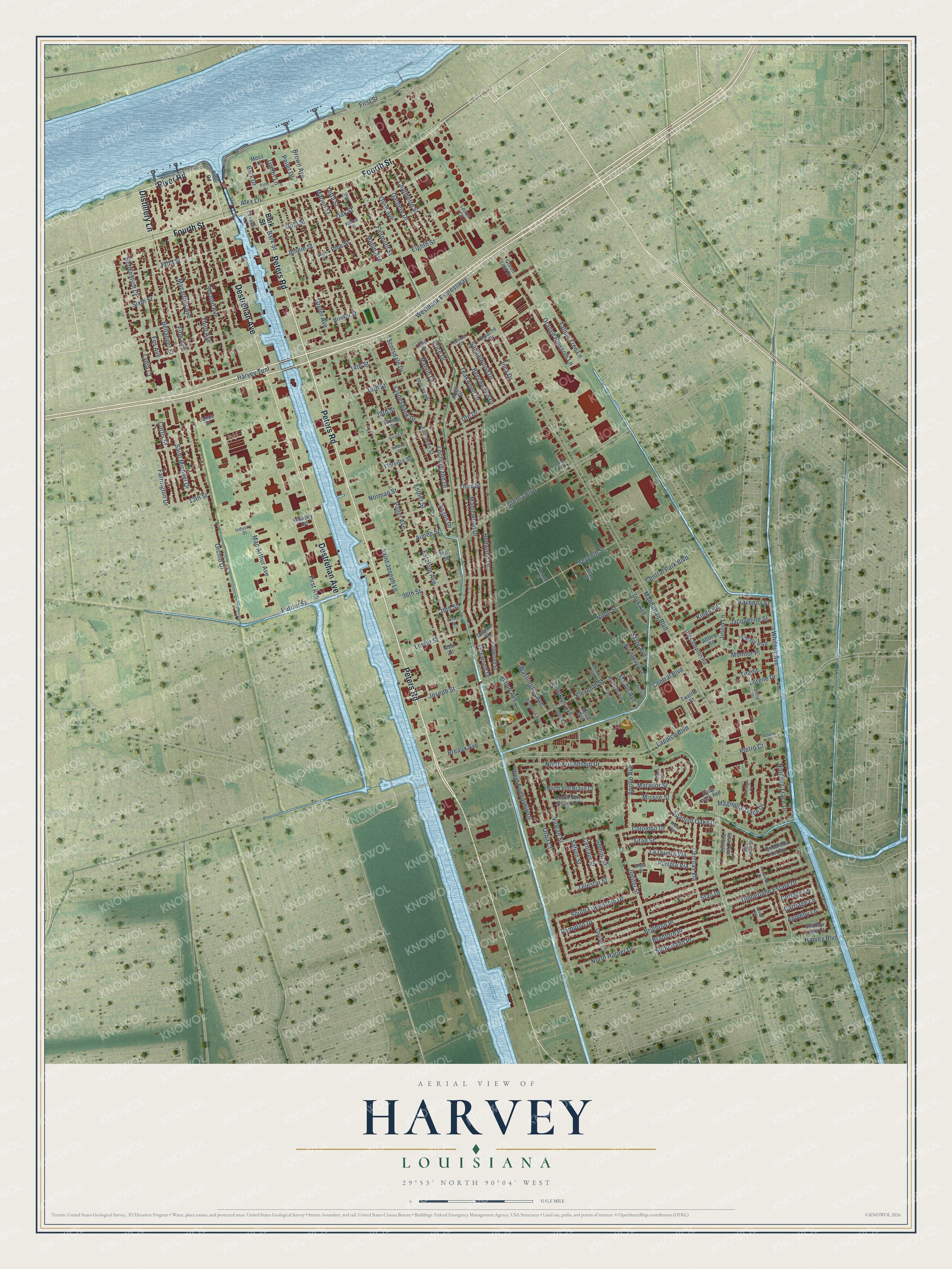
A new map of Harvey, Louisiana, made in 2026 and printed to order on thick archival matte paper.
12" x 18" Archival Matte Print
A Map of Home. A Work of Art.
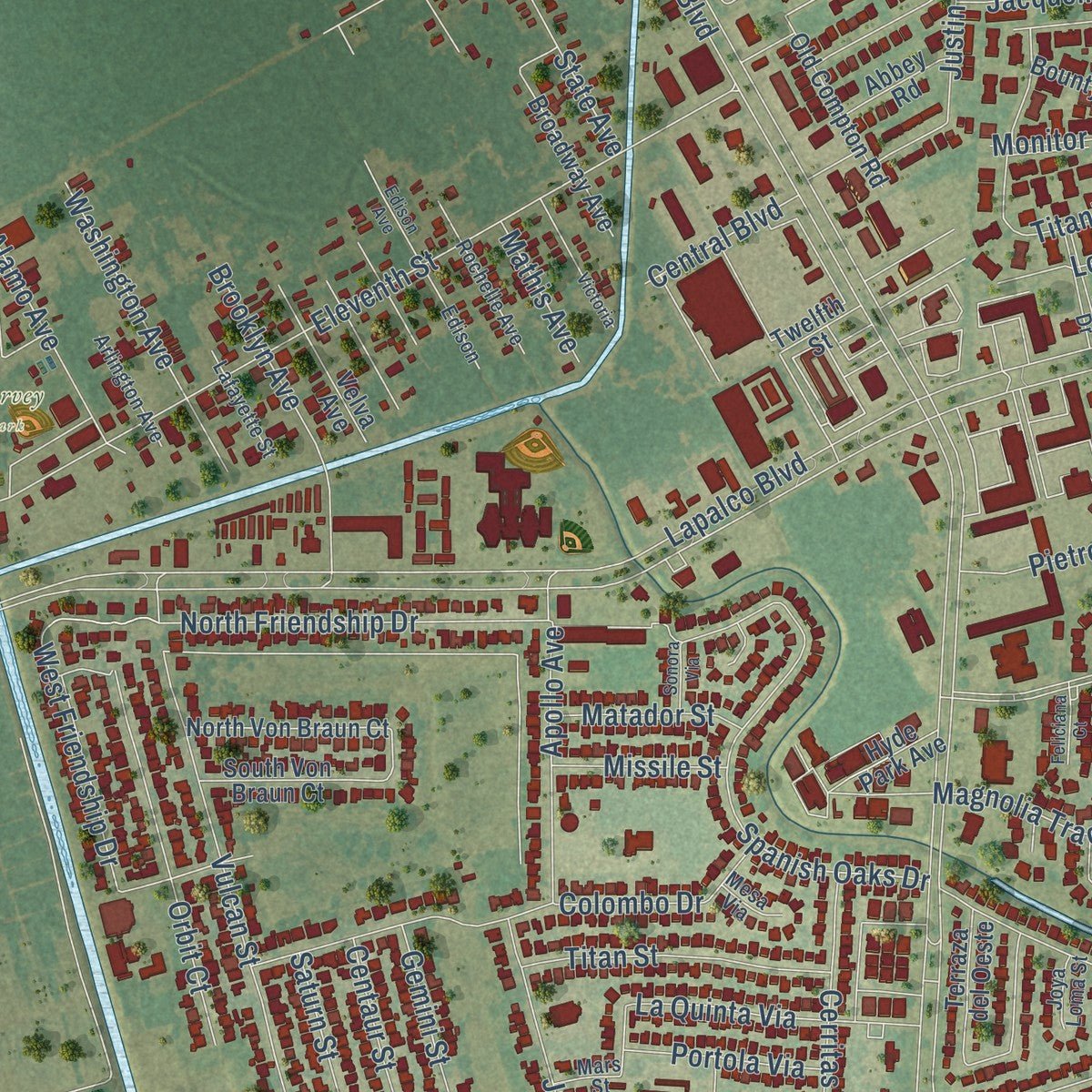
Explore Harvey, Louisiana from a whole new perspective. Created using aerial imagery and detailed geographic data, this map captures Harvey building by building, with labeled streets, familiar landmarks, and shaded topographical relief that highlights the natural contours of the landscape.
Combining modern data with the timeless character of a vintage atlas, this map is just as interesting up close as it is beautiful on the wall. Whether you grew up in Harvey, spent memorable years there, or call it home today, this unique map is a great way to celebrate a place that means something to you. Zoom in on the preview to look for your street, and then order a print to put your memories on the wall.
Three ways to hang it
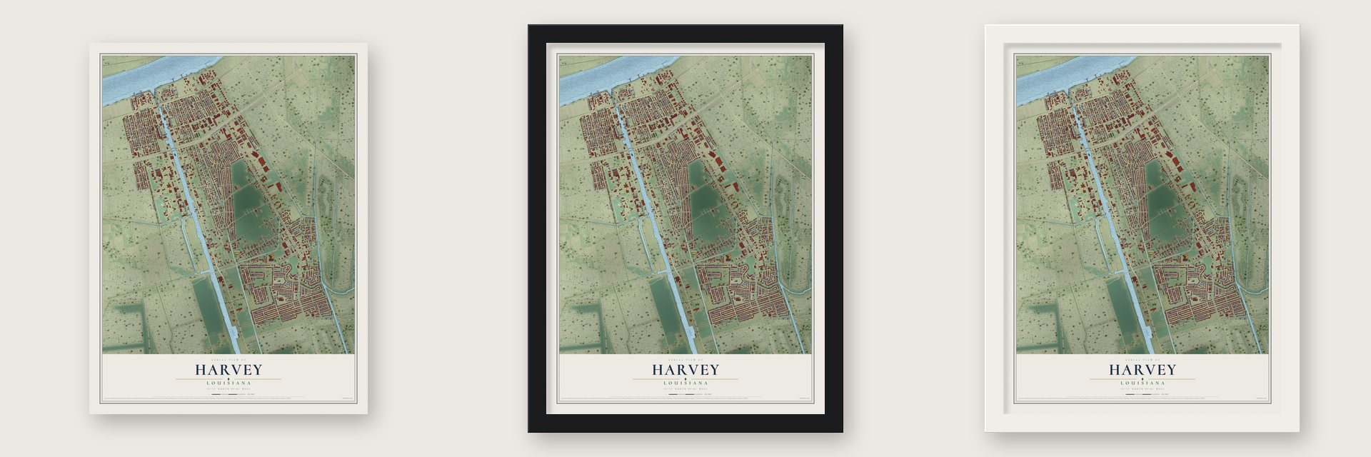
Unframed archival matte, a black wood frame or a white wood frame.
Up close
Geography Worth Displaying
This map was created using accurate cartographic data and authoritative geographic sources, including the U.S. Geological Survey and the Census Bureau. The map brings together terrain, waterways, roads, and building detail. The majority of the streets are labeled, houses are accurately depicted, and the topography is derived from government sources. Combining local data with carefully composed color and shading leads to this beautifully detailed Harvey artwork for your wall.
Rather than simply showing street outlines, we’ve included as many of the street names as we could reasonably fit on the map while keeping their names legible. Zoom in on the high resolution preview to see exactly what’s on the map. We truly set out to create a statement piece for anyone who loves Harvey. So whether it’s for you, or a gift for someone you love, we hope this map of Harvey brings back fond memories.
Read the story behind this map of Harvey, Louisiana from 2026.

About Harvey, Louisiana
Harvey is a community of 22,236 people in Jefferson Parish, on the West Bank of the Mississippi River across from New Orleans. In the French colonial era the land belonged to Jean-Baptiste d'Estrehan de Beaupre, the colony's royal treasurer and comptroller, who started a plantation here. Enslaved workers on his plantation dug a ditch south from the river toward the back of Bayou Barataria, so boats could reach his land more easily.
Later d'Estrehan hired German settlers to widen the ditch, and they did the work with wooden shovels. He paid them with small plots of land downriver in Mechanicsham, which is now the city of Gretna. He built his house where the ditch met the river and named the settlement Cosmopolite City. Joseph Hale Harvey, born March 7, 1816, married Louise Destrehan, a great-granddaughter of the planter. He built the place up as a company town and gave it his family name, and the couple began building locks to join the canal to the Mississippi. Their son Horace Harvey kept up the canal work until his death in 1938.
- Harvey Castle, built 1844Joseph Hale Harvey and Marie Louise Destrehan built their Gothic Revival home in 1844, and it became known as Harvey Castle. From 1874 to 1884 the house was used as the third courthouse of Jefferson Parish.
- A railroad village by 1914A 1914 Louisiana encyclopedia described Harvey as a village in the northern part of the parish, on the west bank of the river about 6 miles above New Orleans, with a stop on the Southern Pacific Railroad.
- The West Bank's largest libraryIn 1990 Jefferson Parish Library opened its West Bank Regional Library in Harvey and named it for Jane O'Brien Chatelain. Covering 35,000 square feet, it is the biggest public library anywhere on the parish's West Bank.
- Fats Domino and a spelling championFats Domino, the rock and roll singer and pianist, is among Harvey's notable people. So are Zaila Avant-garde, who won the 2021 Scripps National Spelling Bee, Joseph N. Jackson, who invented the programmable TV remote, and NFL receiver Ja'Marr Chase.
Find your street
Names on the Harvey map
Every name below is printed on this map. Look for your street, your school, the park where you played, or the pond down the road.
Places and landmarks1
- Harvey Park
Streets and roads188
- Peters Road
- Destrehan Avenue
- Fourth Street
- River Road
- Distillery Lane
- Westbank Expressway
- Bark Drive
- Grefer Lane
- Eleventh Street
- Kings Road
- Manhattan Boulevard
- Lapalco Boulevard
- Pailet Avenue
- First Avenue
- Estalote Avenue
- Brown Avenue
- Saint Joseph Lane
- Eighth Street
- Maplewood Drive
- Gretna Boulevard
- Seventh Street
- Stall Drive
- First Street
- Farrington Drive
- Dogwood Drive
- Hampton Drive
- Mac Arthur Avenue
- Redwood Drive
- Grefer Avenue
- Spanish Oaks Drive
Show all 188 streets
- Orchid Drive
- Ninth Street
- Magnolia Trace Drive
- Brighton Place
- Esther Street
- Fifth Avenue
- Macarthur Avenue
- Third Avenue
- Second Avenue
- Sixth Street
- West Friendship Drive
- Maple Avenue
- Vulcan Street
- Fifth Street
- Colombo Drive
- Bradford Place
- Beechwood Drive
- Angus Drive
- Bellanger Street
- Fos Avenue
- North Friendship Drive
- Patriot Street
- Natchez Trace Drive
- Pine Street
- Tallow Tree Lane
- Jupiter Street
- Oak Street
- Scotsdale Drive
- Harvey Boulevard
- Orange Blossom Lane
- Fairmont Street
- Orbit Court
- Mathis Avenue
- Chalmette Street
- Lochlomand Drive
- Marion Street
- Whitney Avenue
- Yetta Street
- Gardere Drive
- Titanic
- Cerritas Via
- Timberlane Estate Drive
- Rebenstich Drive
- Curtis Street
- South Friendship Drive
- 36th Street
- State Avenue
- La Quinta Via
- Apollo Avenue
- Brooklyn Avenue
- Olive Avenue
- Washington Avenue
- Ute Drive
- Teakwood Drive
- Breaux Avenue
- North Harper Drive
- Aimee Street
- Titan Street
- Sandalwood Drive
- Marvin Court
- Bark Street
- Sutherland Place
- Lester Street
- Inca Drive
- Alamo Avenue
- Harvey Tunl
- Price Drive
- Gold Street
- Saint Michael Drive
- Jennie Street
- Central Park Boulevard
- Jacqueline Street
- Norman Street
- Pailet Drive
- Clydesbank Drive
- Saturn Street
- Gemini Street
- Centaur Street
- Portola Via
- 13th Street
- Lorene Drive
- Matador Street
- Justin Lane
- Lydia Court
- Pietro Court
- Central Boulevard
- Missile Street
- Joseph Street
- 14th Street
- 16th Street
- Third Street
- Telestar Street
- Carriage Lane
- Appleby Lane
- Cottage Lane
- Ravenna Street
- York Avenue
- Monitor Place
- 38th Street
- 18th Street
- Alex Lane
- Moss Lane
- Brinker Street
- Hyde Park Avenue
- Aberdeen Street
- Hugh Drive
- Broadway Avenue
- North Von Braun Court
- Old Compton Road
- Twelfth Street
- South Von Braun Court
- Louise Street
- Velva Avenue
- Quebrada del Sur
- Shadow Lake Court
- Bounty Boulevard
- Redwood Street
- Terraza del Oeste
- Apache Drive
- Green Leaf Drive
- Abbey Road
- Florence Street
- Otis Street
- Industry Road
- Janus Street
- Leson Court
- Texaco Lane
- Doleac Street
- York Street
- Stores Street
- 41st Street
- 34th Street
- Aberdeen Drive
- Rochelle Avenue
- Arlington Avenue
- Philip Drive
- Lafayette Street
- Willow Street
- Edison
- Mars Street
- Pine Drive
- State Street
- Industry Street
- Eunice Street
- Joya Loma Street
- Mesa Via
- Fig Street
- Rosette Drive
- Edison Avenue
- Antoinette Drive
- Rochelle Street
- Victoria
- Feliciana Court
- Sonora Via
- Harold Street
- Sandoz Street
- Devon Road
- Shirley Street
Names are listed as they appear on the printed map. Zoom into the product photos to find them.
The art of mapping a place
How This Map Was Made
Real places. Remarkable detail. Discover the layers that turn geographic data into a map of home.

The view from above
Aerial imagery reveals the character of the land: woodland, open fields, and the patterns of a place.

The shape of the land
Elevation data brings hills, valleys, and subtle changes in the landscape into view.

The details of home
Roads, waterways, and building footprints come together to make the map feel unmistakably local.

Geography becomes art
Considered color, shading, and typography bring the layers together in a map made for your wall.


Process illustrated with Mendon, Massachusetts. Aerial imagery: USDA NAIP. Terrain: USGS 3D Elevation Program. Map details and finished artwork: KNOWOL.
The Details
About This Print
Choose an archival matte print, or a black or white Ayous wood frame. The archival matte print is unframed.
Select your size and finish above to see the matching product image and price.
Materials & Craftsmanship
A contemporary map with the character of a classic atlas, printed on archival matte paper. Optional frames are made from Ayous wood.
Your printed map does not include the watermark shown in the full-map preview.
Shipping & Delivery
Free shipping within the United States. Every print is made to order in the USA.
Buying a gift? Add a note in your cart and we'll include it. We never put prices in the package.
Prints ship within 2 to 3 business days. Allow 7 to 10 days total from ordering for delivery. Timing may vary during holidays or periods of high order volume.
Read our shipping policy.
Returns and damaged prints
Each print is made to order. Change-of-mind refunds are not available after production.
If your print arrives damaged, misprinted or incorrect, contact support@knowol.com within 30 days of receiving it. Include your order number, photos and a description of the issue.
Read our full refund and replacement policy. For questions about your order, email support@knowol.com.
Find your town
Looking for another city?
Find a map of home in our Louisiana collection, or any town in the country.
Nearby
Maps of towns near Harvey
Know someone from one of these towns? Their map makes a great gift.
 Gretna
, Louisiana
From $39.99See the map
 Timberlane
, Louisiana
From $39.99See the map
 Irish Channel
, Louisiana
From $39.99See the map
More maps nearby: Terrytown, East Riverside, Marrero, Garden District and Touro.