
Search for another town

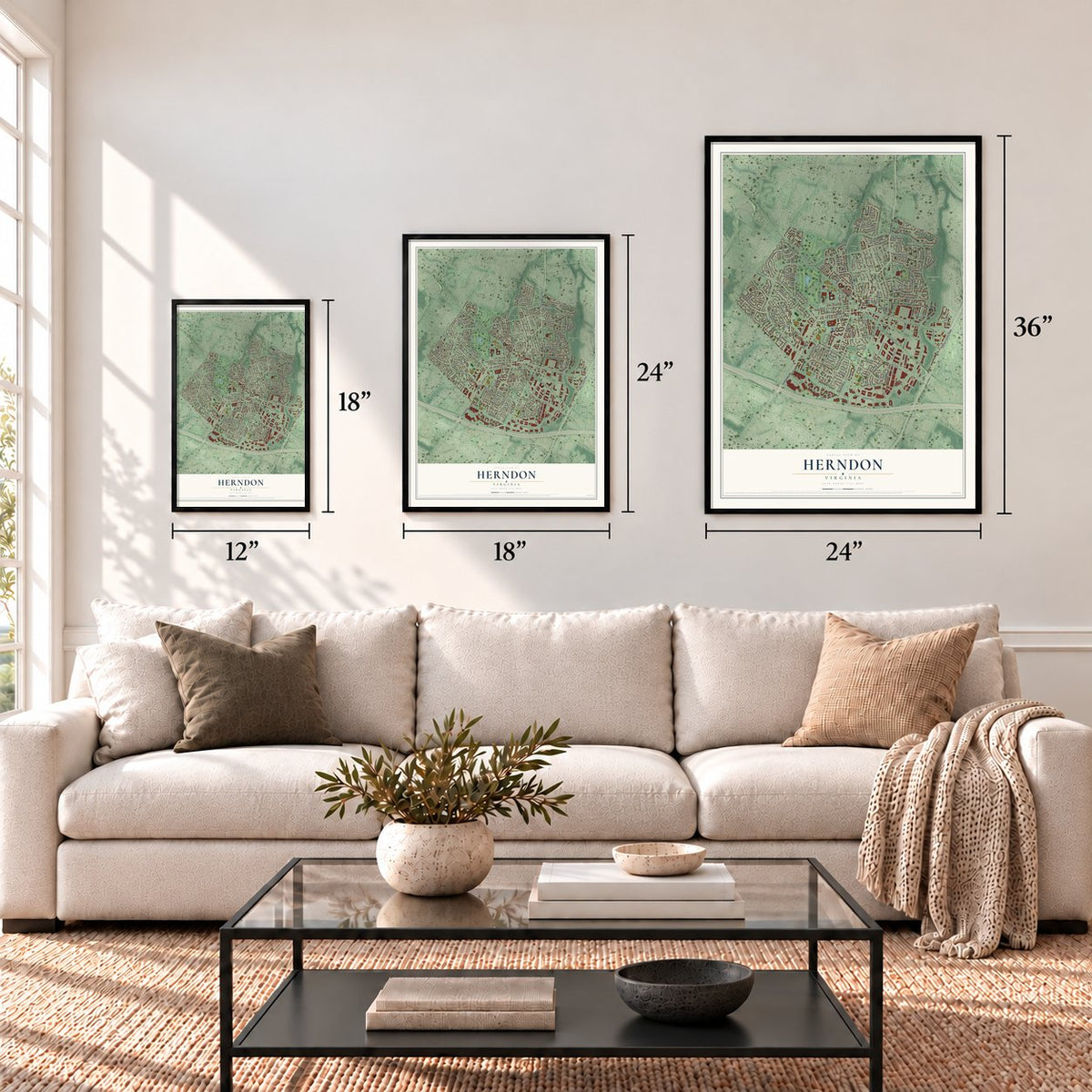


Free U.S. delivery 7 to 10 days after you order
Herndon, Virginia Map Art
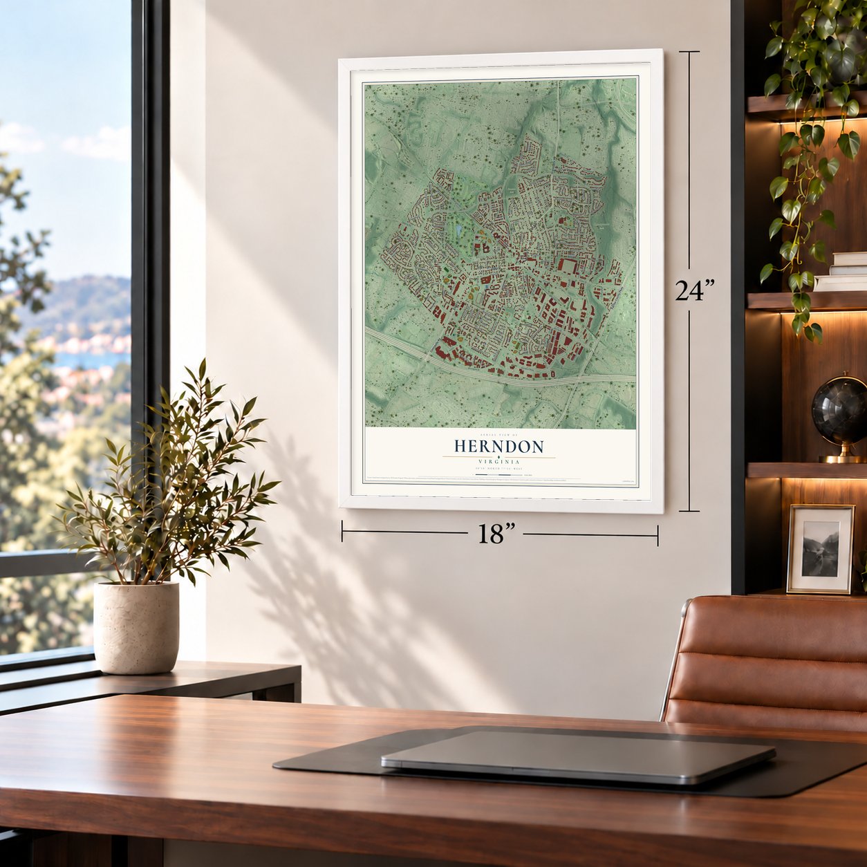
A new map of Herndon, Virginia, made in 2026 and printed to order on thick archival matte paper.
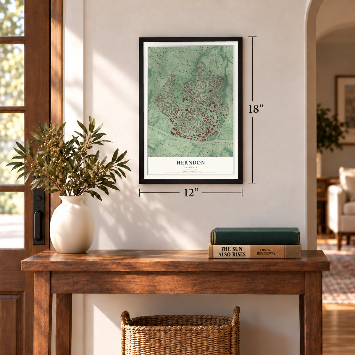
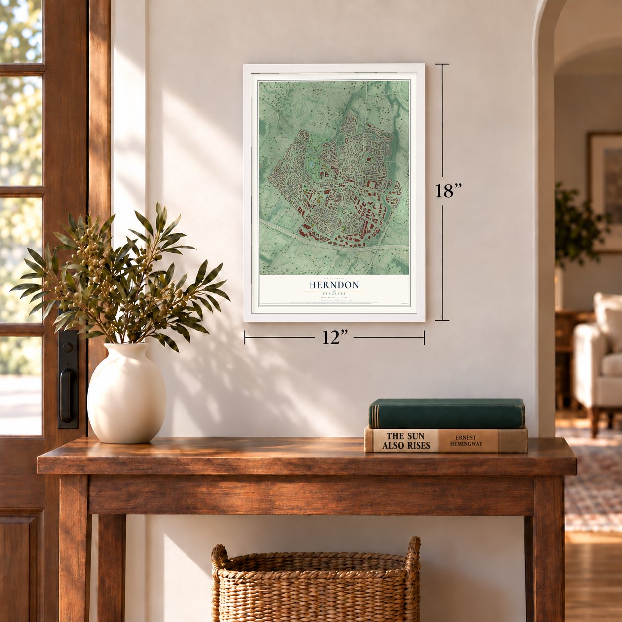
12" x 18" Archival Matte Print
A Map of Home. A Work of Art.
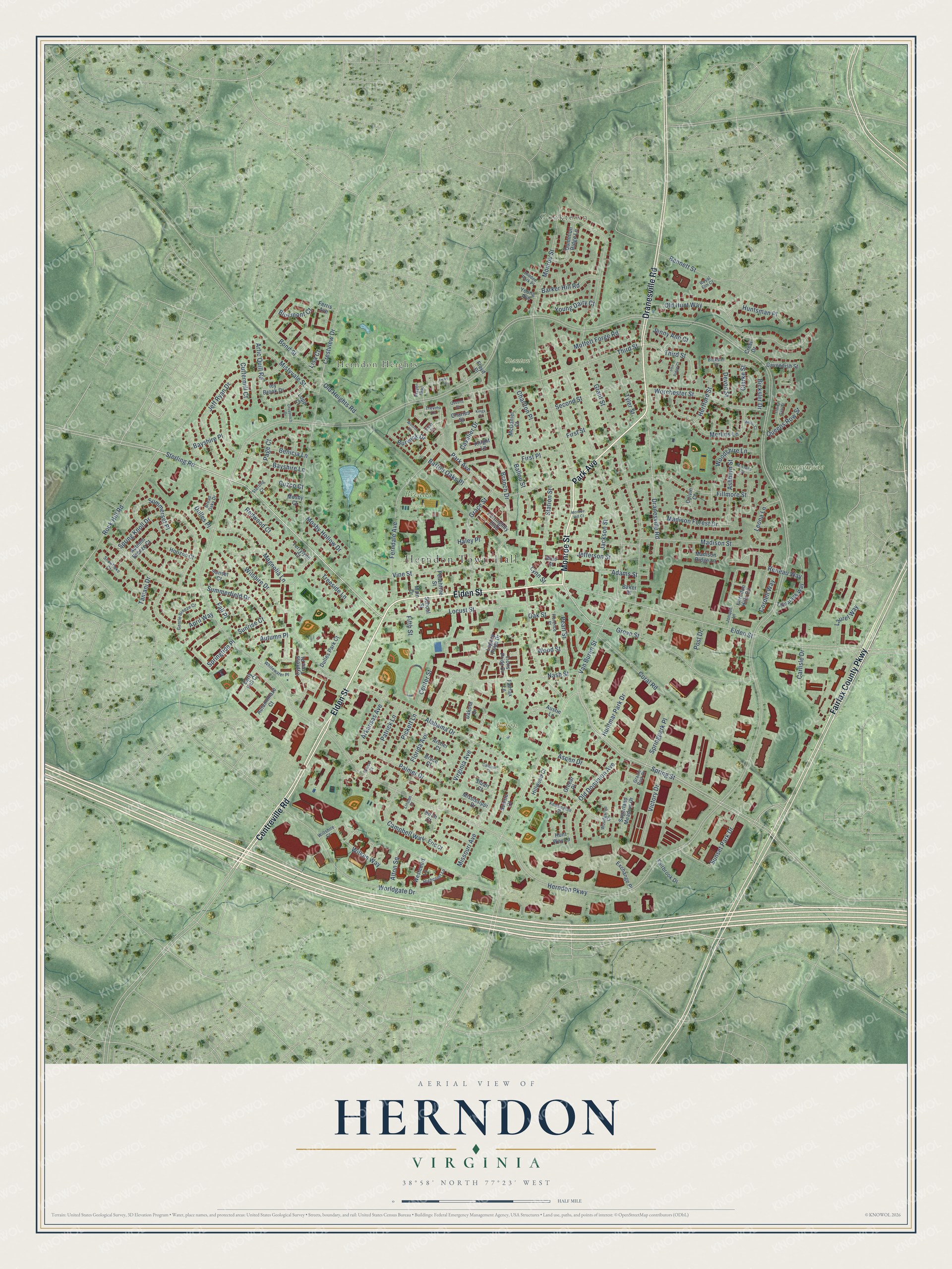
Explore Herndon, Virginia from a whole new perspective. Created using aerial imagery and detailed geographic data, this map captures Herndon building by building, with labeled streets, familiar landmarks, and shaded topographical relief that highlights the natural contours of the landscape.
Combining modern data with the timeless character of a vintage atlas, this map is just as interesting up close as it is beautiful on the wall. Whether you grew up in Herndon, spent memorable years there, or call it home today, this unique map is a great way to celebrate a place that means something to you. Zoom in on the preview to look for your street, and then order a print to put your memories on the wall.
Three ways to hang it
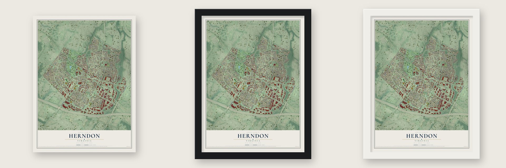
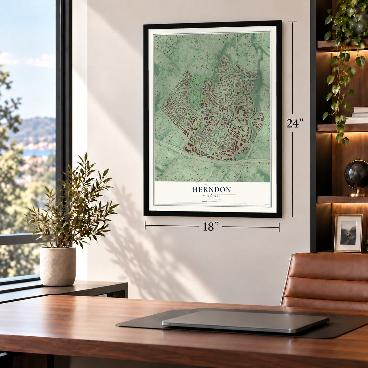
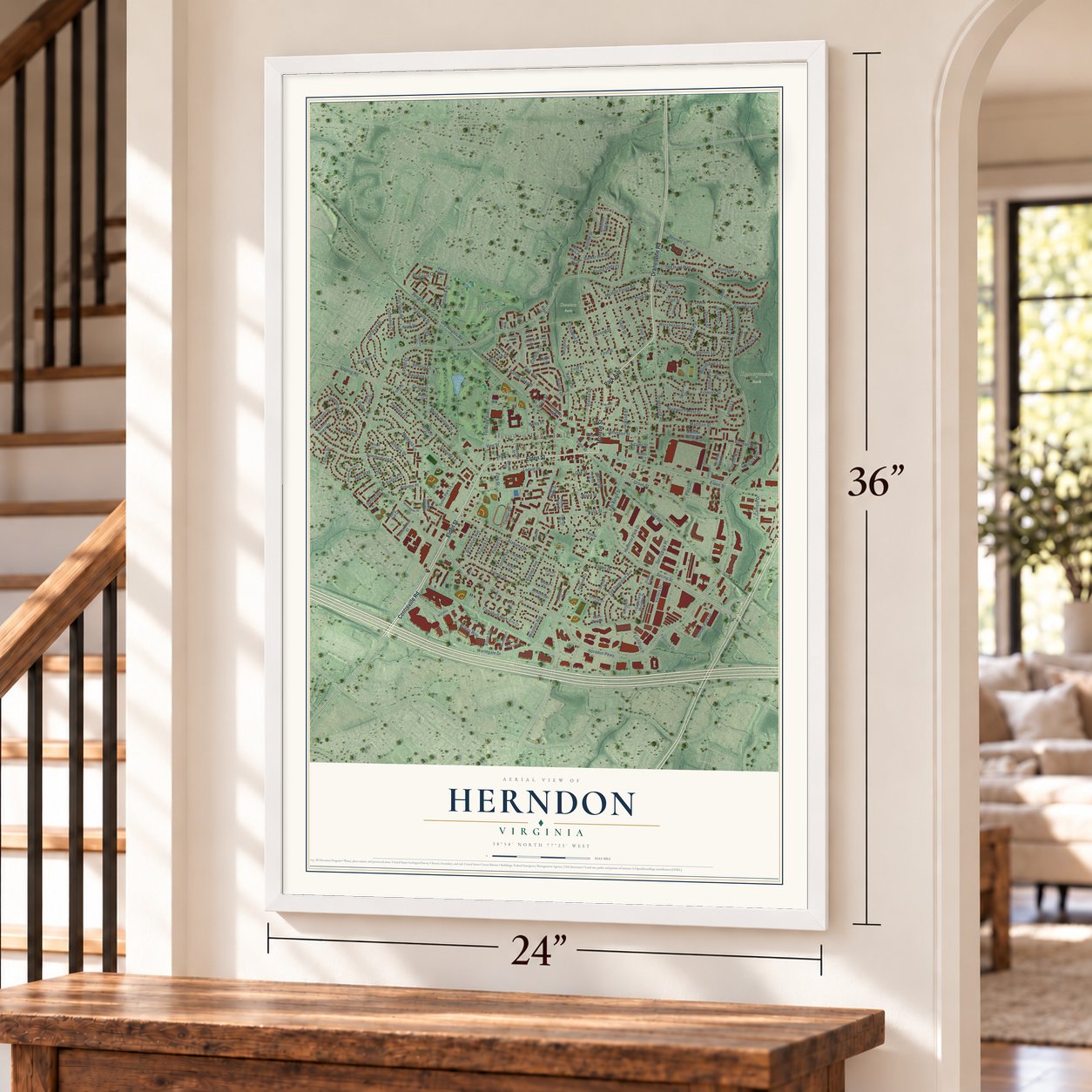
Unframed archival matte, a black wood frame or a white wood frame.
Up close
Geography Worth Displaying
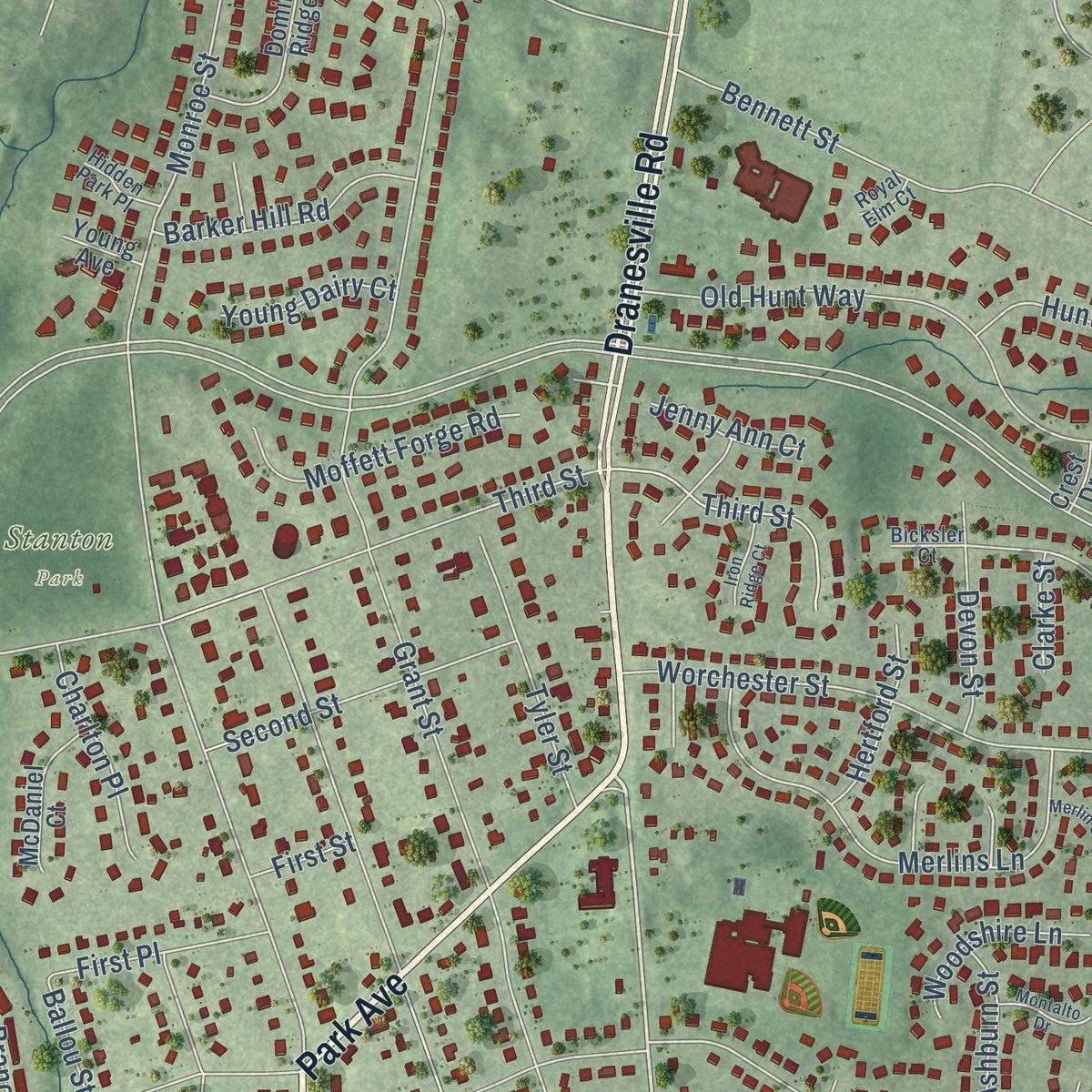
This map was created using accurate cartographic data and authoritative geographic sources, including the U.S. Geological Survey and the Census Bureau. The map brings together terrain, waterways, roads, and building detail. The majority of the streets are labeled, houses are accurately depicted, and the topography is derived from government sources. Combining local data with carefully composed color and shading leads to this beautifully detailed Herndon artwork for your wall.
Rather than simply showing street outlines, we’ve included as many of the street names as we could reasonably fit on the map while keeping their names legible. Zoom in on the high resolution preview to see exactly what’s on the map. We truly set out to create a statement piece for anyone who loves Herndon. So whether it’s for you, or a gift for someone you love, we hope this map of Herndon brings back fond memories.
Read the story behind this map of Herndon, Virginia from 2026.
About Herndon, Virginia
Herndon is a town of 24,655 people in Fairfax County, the largest of the county's three incorporated towns. In 1858 the settlement took the name of Commander William Lewis Herndon, a naval explorer who wrote Exploration of the Valley of the Amazon. He later commanded the steamer SS Central America, and when it sank he went down with the ship after helping save more than 150 of the people on board.
Mild weather and cheap land drew many Northern soldiers and their families to Herndon during the 1870s. The town sat on the Alexandria, Loudoun and Hampshire Railroad, which was later renamed the Washington and Old Dominion. With that line, Herndon became a hub for dairy farms and a summer retreat for people from around Washington.
“A landmark in the center of the town of Herndon in western Fairfax County, the board-and-batten Herndon Depot is a surviving example of the simple railroad stations that served small communities in the 19th century.”
- Mosby's Raid in 1863On St. Patrick's Day in 1863, Herndon Station was the scene of a Civil War skirmish remembered as Mosby's Raid. The Herndon Depot Museum stands on the site today.
- The depot that stayedTrains stopped running through Herndon in the 1960s, and the town restored its old depot to hold town offices. When the rail line became a trail for walkers and cyclists, the station was turned into a museum and visitors center. The Herndon Depot is listed on the National Register.
- A caboose since 1989George Moore of the Herndon Historical Society acquired a Norfolk Southern caboose in 1989, and it was moved near the depot and painted in Washington and Old Dominion colors. It never ran through Herndon, but it became a downtown favorite, and it was dedicated to Moore after he died in 2003.
- Accredited police in 1986On November 8, 1986, the town's own police department became the seventh agency in Virginia and the 42nd in the nation to earn accreditation from the Commission on Accreditation for Law Enforcement Agencies.
Find your street
Names on the Herndon map
Every name below is printed on this map. Look for your street, your school, the park where you played, or the pond down the road.
Places and landmarks7
- Herndon Town Hall
- Cooktown
- Herndon Heights
- Bready Park
- Runnymede Park
- Bruin Park
- Stanton Park
Streets and roads193
- Elden Street
- Dranesville Road
- Monroe Street
- Park Avenue
- Centreville Road
- Fairfax County Parkway
- Sterling Road
- Virginia Avenue
- Third Street
- Herndon Parkway
- Van Buren Street
- Spring Street
- Grant Street
- Center Street
- Alabama Drive
- Ferndale Avenue
- Worldgate Drive
- Crestview Drive
- Summerfield Drive
- Old Hunt Way
- Madison Street
- Grove Street
- Palmer Drive
- Locust Street
- Spring Knoll Drive
- Fillmore Street
- Jeff Ryan Drive
- Alton Square
- Station Street
- Vine Street
Show all 193 streets
- Grace Street
- Bayshire Lane
- Rock Hill Road
- Worchester Street
- Florida Avenue
- Merlins Lane
- Missouri Avenue
- Campbell Way
- Artic Quill Road
- Bond Street
- Branch Drive
- Old Dominion Avenue
- Sunset Park Drive
- April Way
- Springtide Place
- Nash Street
- Wilkes Way
- Jackson Street
- Wilshire Drive
- Reneau Way
- Cavalier Drive
- Dulles Place
- Magnolia Lane
- Coral Road
- Second Street
- Madison Forest Drive
- Victory Drive
- Jefferson Street
- Mistyvale Street
- Ashburn Street
- Bicksler Drive
- Summerset Place
- Moffett Forge Road
- Arkansas Avenue
- Bennett Street
- Leona Lane
- Tyler Street
- Fall Place
- Page Court
- Huntsman Place
- Aspen Drive
- Barker Hill Road
- Pearl Street
- Cordell Way
- Burwick Drive
- Ballou Street
- Mosby Hollow Drive
- Devon Street
- Charlton Place
- Patrick Lane
- Pickett Lane
- Lynn Street
- Laurel Way
- First Place
- Springpark Place
- Huntmar Park Drive
- Cuttermill Court
- Woodshire Lane
- Post Drive
- Autumn Place
- Queens Row Street
- Hertford Street
- Old Heights Road
- Carlisle Drive
- Barton Oaks Place
- Young Dairy Court
- Benicia Lane
- Treeside Lane
- Redwood Court
- Bluemont Court
- Jenny Ann Court
- Adams Street
- Bayshire Place
- Haley Place
- Oak Street
- Sunrise Court
- Wood Street
- Tamani Drive
- Clarke Street
- Cuzco Court
- First Street
- Fifth Street
- Lisa Court
- Legacy Pride Drive
- Cypress Tree Place
- Early Fall Court
- Autumnhaze Court
- Tamarack Way
- Dominion Ridge Lane
- Herndon Hills Circle
- Knight Lane
- Dulles Park Court
- Fortnightly Boulevard
- Austin Lane
- Senate Court
- Sugarland Meadow Drive
- Peachtree Street
- Icy Brook Drive
- McDaniel Court
- Madison Ridge Lane
- Cavendish Street
- Westcourt Lane
- Fairbrook Drive
- Autumn Breeze Court
- Lions Pride Drive
- Exchange Place
- Dakota Drive
- Hillwood Court
- Mississippi Drive
- Horizon Court
- Archer Court
- Bruce Court
- Colvin Court
- Terrylynn Court
- Main Drive
- Hunt Way Lane
- Charles Street
- Fairfax Lane
- Mosby Court
- Pine Street
- Stuart Court
- Ferris Avenue
- Sunset Court
- Eric Court
- Floyd Place
- Young Avenue
- Baker Place
- Greear Place
- Crest Drive
- School Street
- Lopp Court
- Birch Court
- Trevino Lane
- Gentle Breeze Court
- Broad Oaks Drive
- Woodgrove Court
- Gracie Park Drive
- Highcourt Lane
- Whitewater Place
- Snowflake Court
- Kensington Place
- Jonquil Lane
- Hidden Park Place
- Player Way
- Wiltshire Court
- Florence Place
- Sterling Court
- Bicksler Court
- Linden Court
- Royal Elm Court
- Queens Court
- Trinity Gate Street
- Montalto Drive
- Iron Ridge Court
- Merlin Court
- Crosstitch Drive
- Kings Court
- Wintrol Court
- Monroe Hill Court
- Calhoun Court
- Tway Lane
- Spruce Court
- Elder Court
Names are listed as they appear on the printed map. Zoom into the product photos to find them.
The art of mapping a place
How This Map Was Made
Real places. Remarkable detail. Discover the layers that turn geographic data into a map of home.

The view from above
Aerial imagery reveals the character of the land: woodland, open fields, and the patterns of a place.

The shape of the land
Elevation data brings hills, valleys, and subtle changes in the landscape into view.

The details of home
Roads, waterways, and building footprints come together to make the map feel unmistakably local.

Geography becomes art
Considered color, shading, and typography bring the layers together in a map made for your wall.


Process illustrated with Mendon, Massachusetts. Aerial imagery: USDA NAIP. Terrain: USGS 3D Elevation Program. Map details and finished artwork: KNOWOL.
The Details
About This Print
Choose an archival matte print, or a black or white Ayous wood frame. The archival matte print is unframed.
Select your size and finish above to see the matching product image and price.
Materials & Craftsmanship
A contemporary map with the character of a classic atlas, printed on archival matte paper. Optional frames are made from Ayous wood.
Your printed map does not include the watermark shown in the full-map preview.
Shipping & Delivery
Free shipping within the United States. Every print is made to order in the USA.
Buying a gift? Add a note in your cart and we'll include it. We never put prices in the package.
Prints ship within 2 to 3 business days. Allow 7 to 10 days total from ordering for delivery. Timing may vary during holidays or periods of high order volume.
Read our shipping policy.
Returns and damaged prints
Each print is made to order. Change-of-mind refunds are not available after production.
If your print arrives damaged, misprinted or incorrect, contact support@knowol.com within 30 days of receiving it. Include your order number, photos and a description of the issue.
Read our full refund and replacement policy. For questions about your order, email support@knowol.com.
Find your town
Looking for another city?
Find a map of home in our Virginia collection, or any town in the country.
Nearby
Maps of towns near Herndon
Know someone from one of these towns? Their map makes a great gift.
 Hutchison
, Virginia
From $39.99See the map
 McNair
, Virginia
From $39.99See the map
 Oak Grove
, Virginia
From $39.99See the map
More maps nearby: Dranesville, Reston, Sterling, Floris and Great Falls Crossing.