
Search for another town




Free U.S. delivery 7 to 10 days after you order
Reston, Virginia Map Art
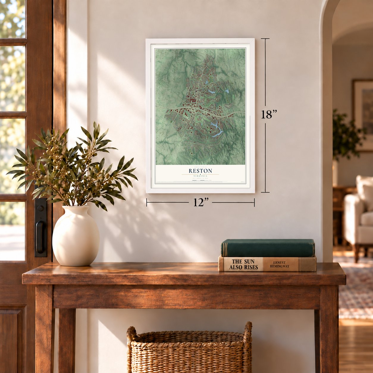
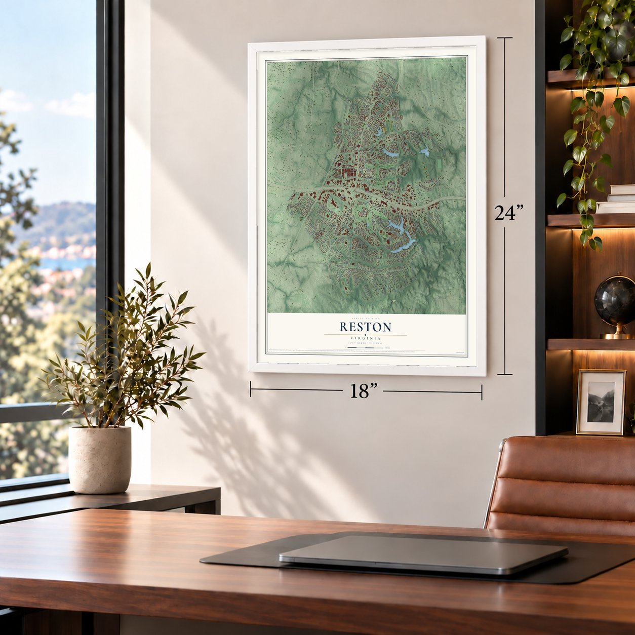
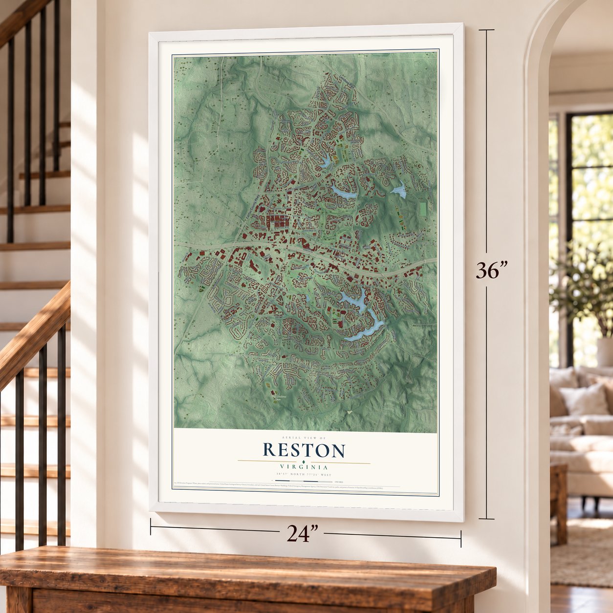
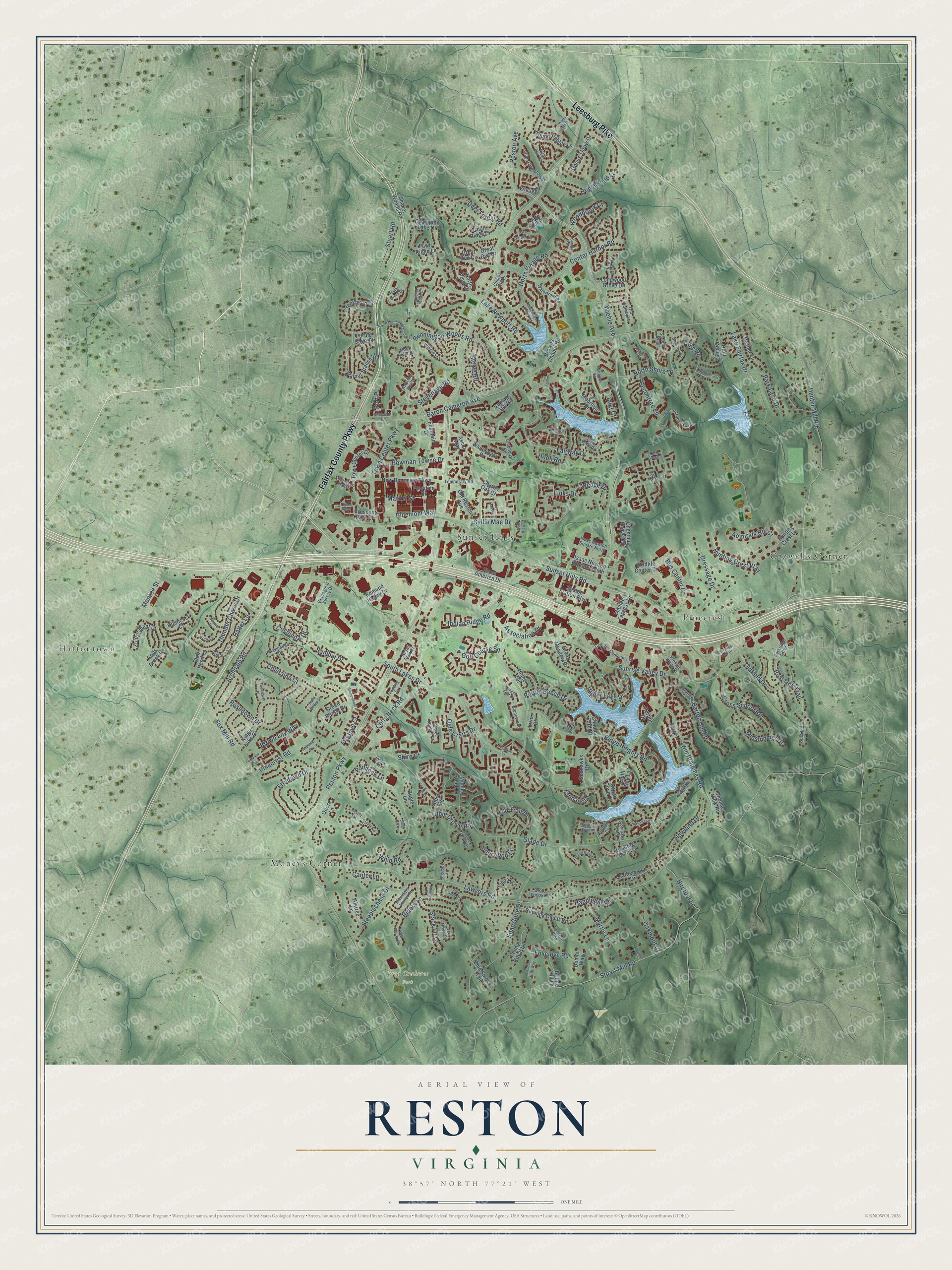
A new map of Reston, Virginia, made in 2026 and printed to order on thick archival matte paper.
12" x 18" Archival Matte Print
A Map of Home. A Work of Art.
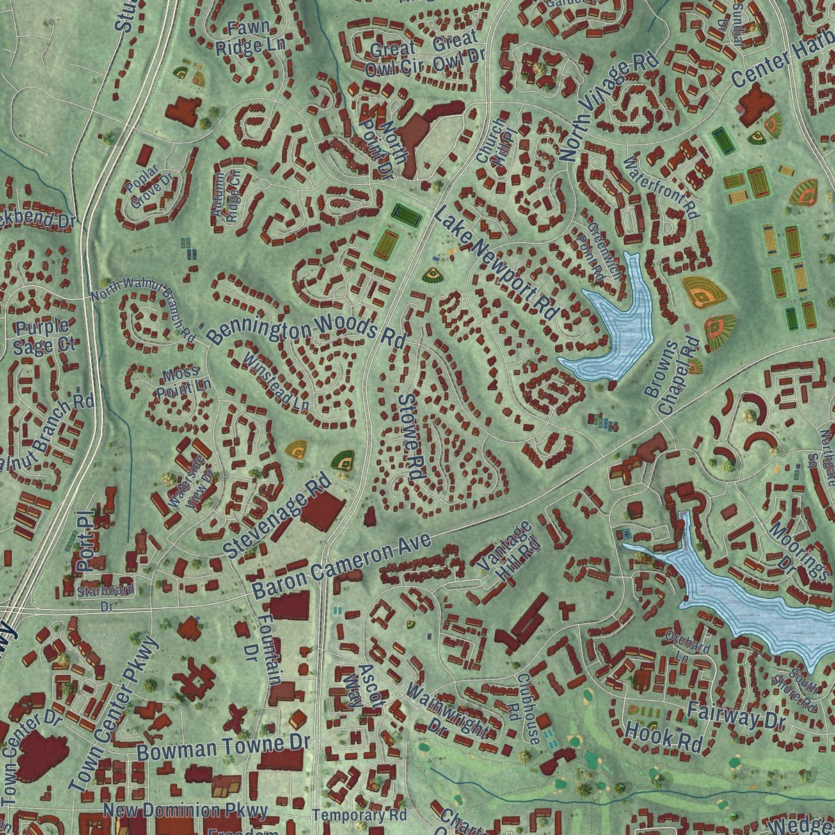
Explore Reston, Virginia from a whole new perspective. Created using aerial imagery and detailed geographic data, this map captures Reston building by building, with labeled streets, familiar landmarks, and shaded topographical relief that highlights the natural contours of the landscape.
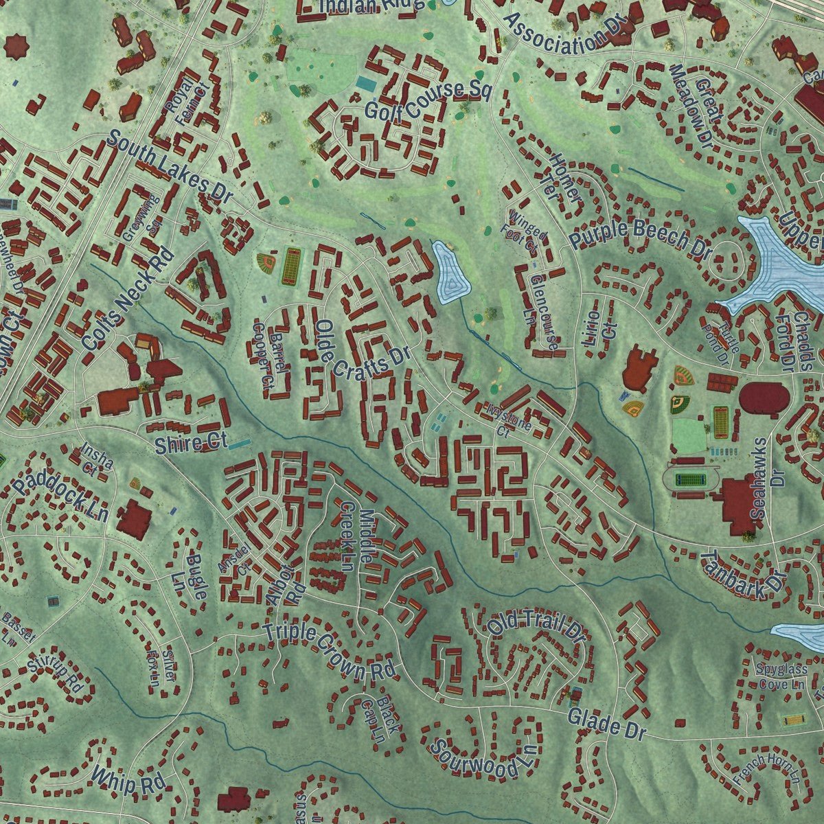
Combining modern data with the timeless character of a vintage atlas, this map is just as interesting up close as it is beautiful on the wall. Whether you grew up in Reston, spent memorable years there, or call it home today, this unique map is a great way to celebrate a place that means something to you. Zoom in on the preview to look for your street, and then order a print to put your memories on the wall.
Three ways to hang it
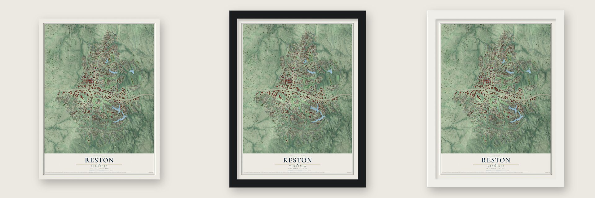
Unframed archival matte, a black wood frame or a white wood frame.
Up close
Geography Worth Displaying
This map was created using accurate cartographic data and authoritative geographic sources, including the U.S. Geological Survey and the Census Bureau. The map brings together terrain, waterways, roads, and building detail. The majority of the streets are labeled, houses are accurately depicted, and the topography is derived from government sources. Combining local data with carefully composed color and shading leads to this beautifully detailed Reston artwork for your wall.
Rather than simply showing street outlines, we’ve included as many of the street names as we could reasonably fit on the map while keeping their names legible. Zoom in on the high resolution preview to see exactly what’s on the map. We truly set out to create a statement piece for anyone who loves Reston. So whether it’s for you, or a gift for someone you love, we hope this map of Reston brings back fond memories.
Read the story behind this map of Reston, Virginia from 2026.

About Reston, Virginia
Reston is a community of 63,226 people in Fairfax County. Its land was once part of the Northern Neck Proprietary, which King Charles II granted to Lord Thomas Fairfax, and the Fairfax family held it until 1852. In 1886 two buyers, Carl A. Wiehle and William Dunn, purchased 6,449 acres beside the railroad and divided them, and Wiehle took the land north of the tracks. He dreamed of a town with a hotel and parks, but he had built only a few houses when he died in 1901.
The land then passed through several owners and finally reached the family of A. Smith Bowman. They ran a bourbon distillery there, and by 1947 they owned over 7,000 acres. In 1961 Robert E. Simon bought most of it with money from his family's sale of Carnegie Hall. The Bowmans kept 60 acres, and their distillery ran there until 1987. Simon picked his 50th birthday, April 10, 1964, as the day Reston began, and named it for his initials, R.E.S. The first residents moved in late that year.
- Lake Anne came firstArchitects James Rossant and William J. Conklin planned Reston as a town for 75,000 people. Its first village center, Lake Anne Plaza, set shops, houses, townhouses and apartments beside a man-made lake with a tall jet fountain, and Charles M. Goodman designed the cubist townhouses of nearby Hickory Cluster. Simon wanted seven village centers, and five were built. After Lake Anne came Hunters Woods and Tall Oaks, and later South Lakes and North Point.
- Gulf Oil takes overSales were slow because Simon would not lower his standards, so a Reston townhouse could cost as much as a whole house elsewhere in the county. He took a $15 million loan from Gulf Oil, and by 1967 Gulf had pushed him out and formed Gulf Reston, Inc. Gulf mostly kept to his plan and added apartments for low- and moderate-income families. In 1978 it sold the last 3,700 undeveloped acres to Mobil.
- Reston Town Center, 1996Mobil's Reston Land Corporation built the South Lakes and North Point villages. It also started work on Reston Town Center, a 460-acre project that had been part of Simon's first plan. Its first four blocks opened in 1996 with a hotel, restaurants, a cinema and offices. That same year Mobil sold its land business, Reston holdings included, to Westbrook Partners for $324 million.
- A virus named for the townIn December 1989 a virus first feared to be Ebola turned up among monkeys at an office-park lab close to the corner of Sunset Hills Road and Wiehle Avenue. It proved harmless to people and was named Reston virus, and the scare led to the 1994 book The Hot Zone. The lab building was later torn down, and a daycare now stands on the site.
Find your street
Names on the Reston map
Every name below is printed on this map. Look for your street, your school, the park where you played, or the pond down the road.
Places and landmarks6
- Hattontown
- Fred Crabtree Park
- Crowells Corner
- Moneys Corner
- Pinecrest
- Sunset Hills
Streets and roads233
- Fairfax County Parkway
- Leesburg Pike
- Sunset Hills Road
- Monroe Street
- Links Drive
- Inlet Court
- Hook Road
- Reston Parkway
- Wiehle Avenue
- Sunrise Valley Drive
- Glade Drive
- North Shore Drive
- Lawyers Road
- Fox Mill Road
- Baron Cameron Avenue
- South Lakes Drive
- Soapstone Drive
- Hunter Mill Road
- Stuart Mill Road
- Colts Neck Road
- North Village Road
- Steeplechase Drive
- Bennington Woods Road
- Lake Newport Road
- Freetown Drive
- Center Harbor Road
- Foxclove Road
- Town Center Parkway
- Twin Branches Road
- Ridge Heights Road
Show all 233 streets
- Riders Lane
- Upper Lake Drive
- Thunder Chase Drive
- Rosedown Drive
- Fairway Drive
- Post Oak Trail
- Ring Road
- Cross School Road
- Stuart Road
- Myrtle Lane
- Bright Pond Lane
- Archdale Road
- Market Street
- Deer Forest Road
- Dressage Drive
- Barton Hill Road
- Purple Beech Drive
- Old Trail Drive
- Association Drive
- Sallie Mae Drive
- Handlebar Road
- Triple Crown Road
- Pinecrest Road
- Midsummer Drive
- Hunting Crest Way
- Coleraine Court
- Bowman Towne Drive
- Bluemont Way
- Oldfield Drive
- Stevenage Road
- Reston Avenue
- Olde Crafts Drive
- Howland Drive
- Cocquina Drive
- Bus Center Drive
- Park Lake Drive
- Paddock Lane
- Stowe Road
- Lake Fairfax Drive
- Becontree Lane
- Admirals Hill Court
- Wedge Drive
- Birdfoot Lane
- Golf Course Square
- Brown Fox Way
- Sanibel Drive
- Indian Ridge Road
- Woodbrook Lane
- Freetown Court
- Black Fir Court
- Tanbark Drive
- Oakmont Court
- Sourwood Lane
- Canter Lane
- Halter Lane
- Whip Road
- Port Place
- Shire Court
- Moorings Drive
- Seahawks Drive
- Charter Oak Court
- Vantage Hill Road
- Shaker Woods Road
- Walnut Branch Road
- Plaza America Drive
- Wainwright Drive
- New Dominion Parkway
- Fountain Drive
- Stones Throw Drive
- Running Cedar Road
- Chestnut Grove Square
- Kings Lake Drive
- Longwood Grove Drive
- Hunting Crest Lane
- Round Pebble Lane
- Hunt Club Road
- Creekbend Drive
- Green Range Drive
- Crescent Park Drive
- Fawn Ridge Lane
- Old Reston Avenue
- Quorn Lane
- Dasher Lane
- Champion Lake Court
- Great Owl Circle
- Colts Brook Drive
- Town Center Drive
- Middle Creek Lane
- Vintage Place
- North Point Drive
- Great Meadow Drive
- Leatherwood Drive
- South Bay Lane
- Ascot Way
- Blue Smoke Trail
- Albot Road
- Quail Ridge Drive
- Wildlife Center Drive
- Reston Station Boulevard
- Tournament Drive
- Edmund Halley Drive
- Hunting Horn Lane
- Pinoak Lane
- Bridge Hill Lane
- Penny Royal Lane
- Hitchcock Court
- Isaac Newton Square South
- Aintree Lane
- Browns Chapel Road
- Michael Faraday Drive
- Cedar Cove Court
- Freedom Drive
- Chadds Ford Drive
- Thomas View Road
- Club Pond Lane
- Homer Terrace
- Great Owl Drive
- Purple Sage Court
- Harbor Court
- Bugle Lane
- Gate Hill Place
- Donns Way
- Lirio Court
- Parkridge Boulevard
- Geological Survey Drive
- Saffold Way
- Waterfront Road
- Becontree Lake Drive
- Stirrup Road
- Royal Fern Court
- Campus Commons Drive
- Glencourse Lane
- Thrush Ridge Road
- Church Hill Place
- Preston White Drive
- Drop Forge Lane
- Wild Hawthorn Way
- Barrel Cooper Court
- Beacon Place
- Thanlet Lane
- Buckthorn Lane
- Granby Court
- Grey Birch Place
- Black Cap Lane
- Isaac Newton Square North
- Temporary Road
- Mountain Laurel Place
- Foxcroft Way
- Winstead Lane
- Marginella Drive
- Clubhouse Road
- Bridoon Lane
- Pegasus Lane
- Moss Point Lane
- Old Quincy Lane
- Compass Point Lane
- Abington Hall Place
- Taffrail Court
- Insha Court
- Orchard Lane
- Northgate Square
- North Walnut Branch Road
- Greywing Square
- Autumn Ridge Circle
- Poplar Grove Drive
- Park Garden Lane
- Ivy Oak Square
- South Shore Road
- Water Pointe Lane
- Sundial Drive
- Waterside View Drive
- Stonewheel Drive
- Starboard Drive
- Winged Foot Court
- New Bedford Lane
- Silver Fox Lane
- Deep Run Lane
- Timberhead Lane
- French Horn Lane
- Fox View Way
- Greenmont Court
- Alexander Bell Drive
- Darius Lane
- Greenwich Point Road
- Wild Cherry Place
- Yonder Hills Way
- Night Star Way
- Bayard Drive
- Spyglass Cove Lane
- Toddsbury Place
- Park Glen Court
- Saint Bedes Court
- Ivystone Court
- Turtle Pond Drive
- Andorra Place
- Golf View Court
- Coulter Lane
- Ansdel Court
- Basset Lane
- Tryton Way
- Tree Fern Court
- Farsta Court
- Heath Place
Names are listed as they appear on the printed map. Zoom into the product photos to find them.
The art of mapping a place
How This Map Was Made
Real places. Remarkable detail. Discover the layers that turn geographic data into a map of home.

The view from above
Aerial imagery reveals the character of the land: woodland, open fields, and the patterns of a place.

The shape of the land
Elevation data brings hills, valleys, and subtle changes in the landscape into view.

The details of home
Roads, waterways, and building footprints come together to make the map feel unmistakably local.

Geography becomes art
Considered color, shading, and typography bring the layers together in a map made for your wall.


Process illustrated with Mendon, Massachusetts. Aerial imagery: USDA NAIP. Terrain: USGS 3D Elevation Program. Map details and finished artwork: KNOWOL.
The Details
About This Print
Choose an archival matte print, or a black or white Ayous wood frame. The archival matte print is unframed.
Select your size and finish above to see the matching product image and price.
Materials & Craftsmanship
A contemporary map with the character of a classic atlas, printed on archival matte paper. Optional frames are made from Ayous wood.
Your printed map does not include the watermark shown in the full-map preview.
Shipping & Delivery
Free shipping within the United States. Every print is made to order in the USA.
Buying a gift? Add a note in your cart and we'll include it. We never put prices in the package.
Prints ship within 2 to 3 business days. Allow 7 to 10 days total from ordering for delivery. Timing may vary during holidays or periods of high order volume.
Read our shipping policy.
Returns and damaged prints
Each print is made to order. Change-of-mind refunds are not available after production.
If your print arrives damaged, misprinted or incorrect, contact support@knowol.com within 30 days of receiving it. Include your order number, photos and a description of the issue.
Read our full refund and replacement policy. For questions about your order, email support@knowol.com.
Find your town
Looking for another city?
Find a map of home in our Virginia collection, or any town in the country.
Nearby
Maps of towns near Reston
Know someone from one of these towns? Their map makes a great gift.
 Herndon
, Virginia
From $39.99See the map
 Great Falls Crossing
, Virginia
From $39.99See the map
 Difficult Run
, Virginia
From $39.99See the map
More maps nearby: McNair, Dranesville, Floris, Hutchison and Franklin Farm.