
Search for another town

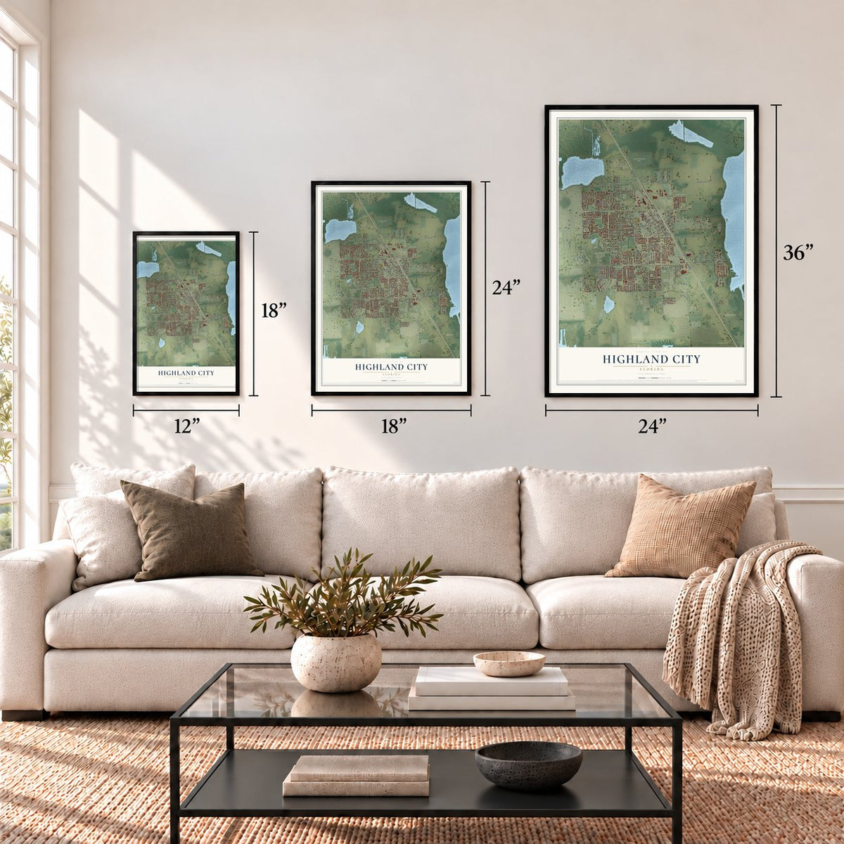

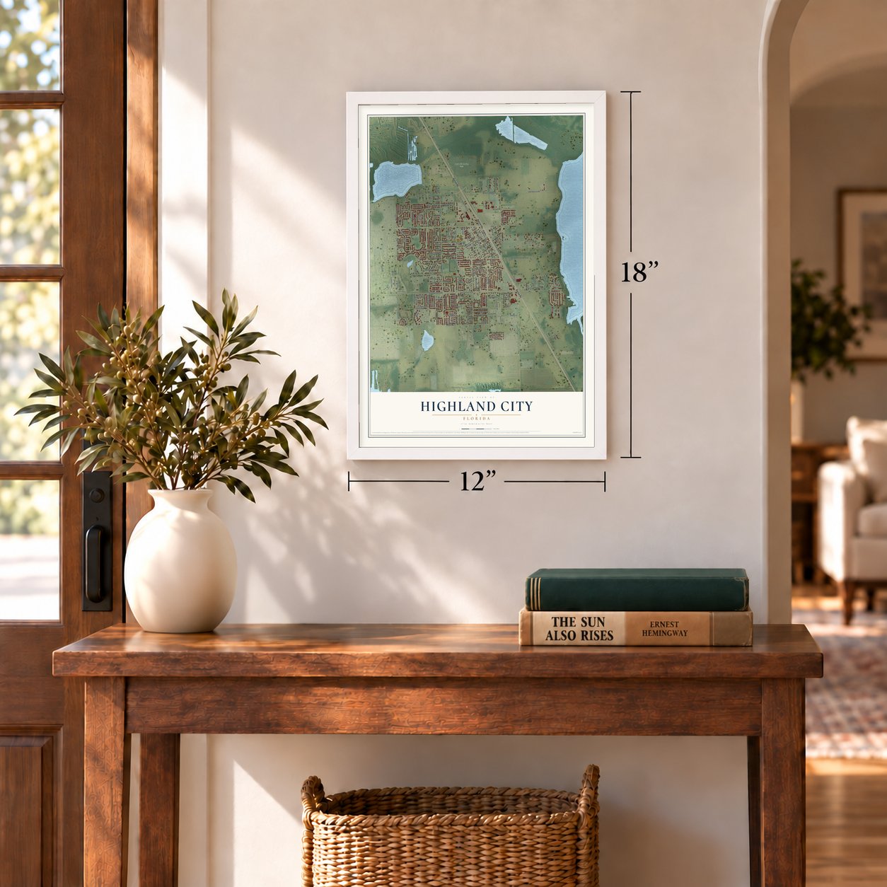

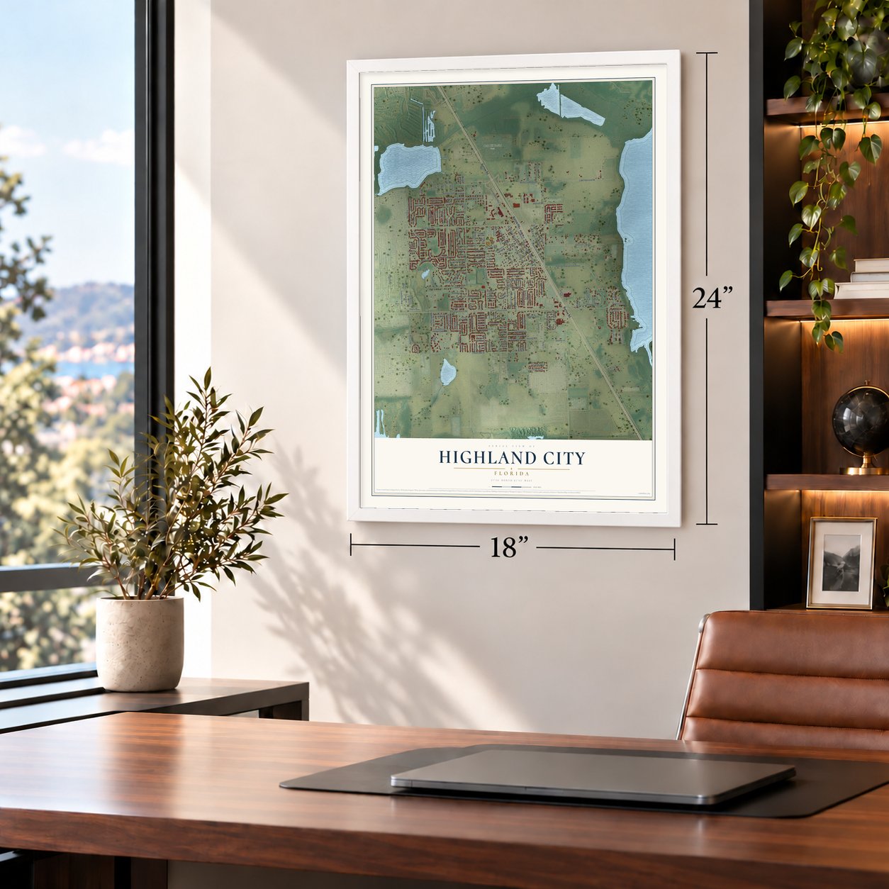


Free U.S. delivery 7 to 10 days after you order
Highland City, Florida Map Art
Building by building, with labeled streets and shaded relief.
12" x 18" Archival Matte Print
A Map of Home. A Work of Art.
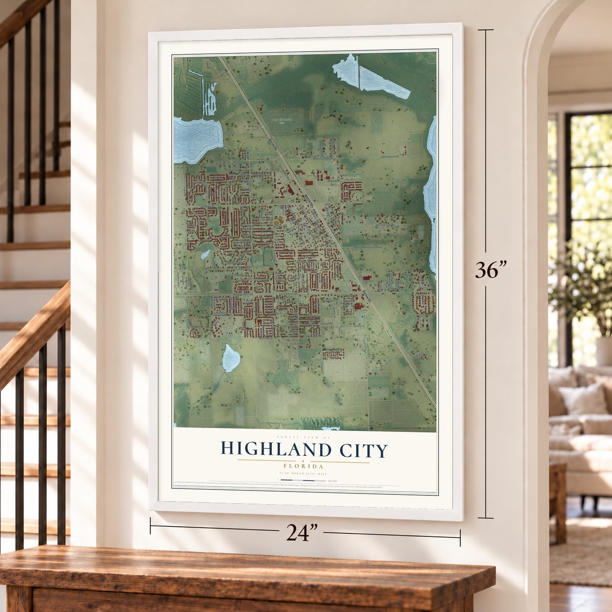
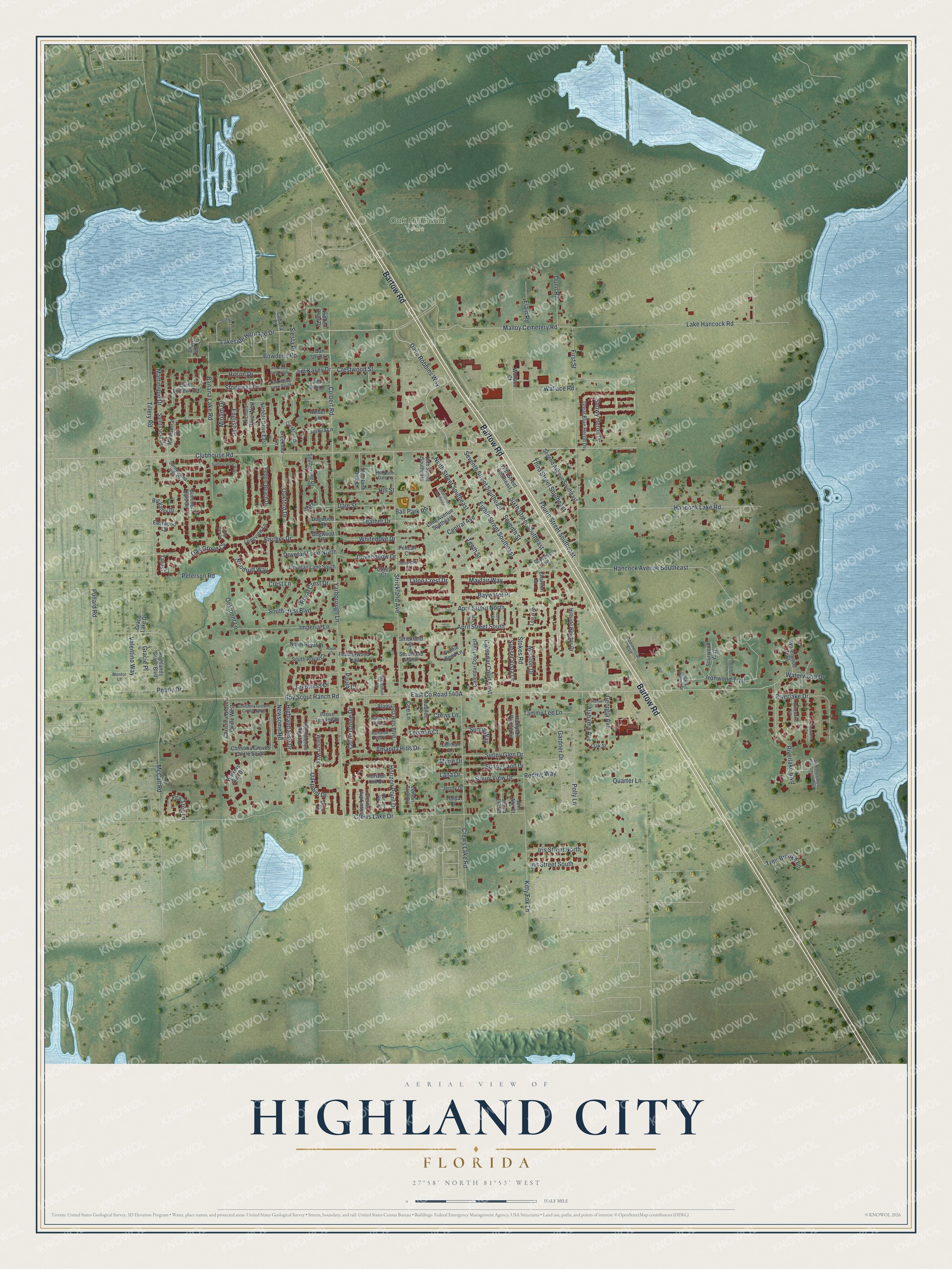
Explore Highland City, Florida from a whole new perspective. Created using aerial imagery and detailed geographic data, this map captures Highland City building by building, with labeled streets, familiar landmarks, and shaded topographical relief that highlights the natural contours of the landscape.
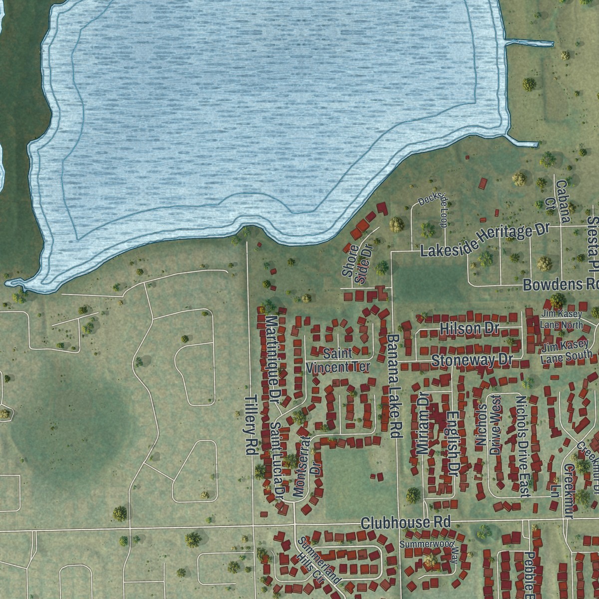
Combining modern data with the timeless character of a vintage atlas, this map is just as interesting up close as it is beautiful on the wall. Whether you grew up in Highland City, spent memorable years there, or call it home today, this unique map is a great way to celebrate a place that means something to you. Zoom in on the preview to look for your street, and then order a print to put your memories on the wall.
Three ways to hang it
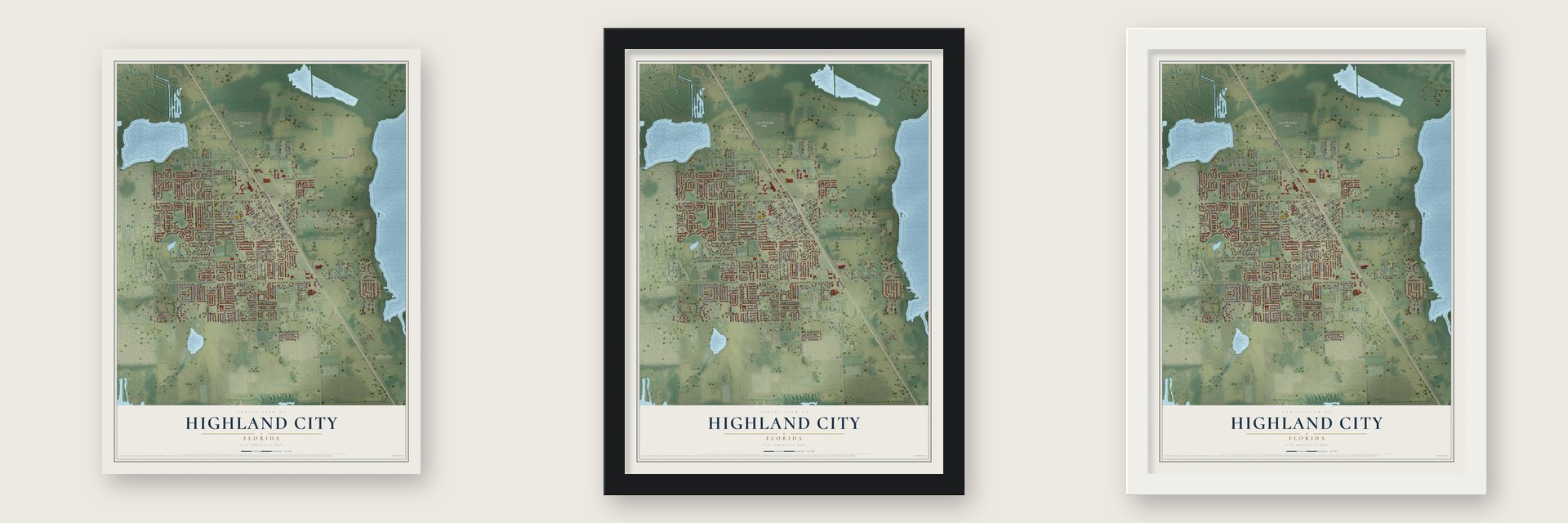
Unframed archival matte, a black wood frame or a white wood frame.
Up close
Geography Worth Displaying
This map was created using accurate cartographic data and authoritative geographic sources, including the U.S. Geological Survey and the Census Bureau. The map brings together terrain, waterways, roads, and building detail. The majority of the streets are labeled, houses are accurately depicted, and the topography is derived from government sources. Combining local data with carefully composed color and shading leads to this beautifully detailed Highland City artwork for your wall.
Rather than simply showing street outlines, we’ve included as many of the street names as we could reasonably fit on the map while keeping their names legible. Zoom in on the high resolution preview to see exactly what’s on the map. We truly set out to create a statement piece for anyone who loves Highland City. So whether it’s for you, or a gift for someone you love, we hope this map of Highland City brings back fond memories.
Read the story behind this map of Highland City, Florida from 2026.

Find your street
Names on the Highland City map
Every name below is printed on this map. Look for your street, your school, the park where you played, or the pond down the road.
Places and landmarks1
- Oak Hill Burial Park
Streets and roads196
- Bartow Road
- Eighth Street Southeast
- Colbert Road
- Dave Robbins Way
- Stokes Road
- Malloy Cemetery Road
- Seventh Street
- Sixth Street Southeast
- Mission Drive
- Riverlake Drive
- Jim Kasey Drive
- Alabama Avenue
- Boy Scout Ranch Road
- Clubhouse Road
- Crews Lake Road
- Crews Lake Drive
- Yarborough Lane
- Strickland Avenue
- Kitty Fox Lane
- Tillery Road
- First Street
- Hancock Avenue Southeast
- Lake Hancock Road
- Hancock Lake Road
- Pearly Drive
- Central Avenue
- Banana Lake Road
- Ninth Street Southeast
- Oakpoint Drive
- Fischer Drive
Show all 196 streets
- Baywater Place
- Peterson Road
- McCall Road
- Pollard Road
- Ironwood Trail
- Sunset Vista Drive
- Wallace Road
- Imperial Lane
- Horizon Point Drive
- Third Street Southeast
- Southcrest Boulevard
- Fourth Street Southeast
- Polly Lane
- Frentress Drive
- Riverlake Boulevard
- Lakeside Heritage Drive
- Amanda Hills Drive
- Whitedove Drive
- Feather Drive
- Reding Way
- Dale Street
- Highland Rise Drive
- Oakford Drive
- Gardner Drive
- Miriam Drive
- Seventh Street Southeast
- Stoneway Drive
- Woodruff Way
- Tenth Street
- Bowdens Road
- April Street North
- April Street South
- English Drive
- Trey-Brooke Lane
- Sunny Land Drive
- Sunny View Drive
- Dovehollow Drive
- Mayfair Way
- Hill Street
- Sunny Glen Drive
- Calendar Court East
- Newsome Road
- Dovetail Lane North
- Valentino Way
- Crest Lane
- Hilson Drive
- Cornerstone Drive
- Iris Street South
- Talon Crest Drive
- Iris Street North
- Royal Crest Drive
- Georgia Avenue
- Crestwood Street
- Waterwood Drive
- Lehman Court
- Tammy Lee Lane
- Dunn Road
- Snowy Heron Drive
- Sunny Way
- Fox Tree Lane
- Elam Road
- Oakmont Lane
- Ball Park Road
- Gracie Place
- Martinique Drive
- Oak Grove Cv
- Quarter Lane
- Siesta Place
- Cee Lane
- Crews Lane
- Paula Court
- Marie Drive
- Lana Drive
- Summer Hills Circle
- Christina Groves Circle South
- Oak Street
- North Royal Court
- Great Blue Heron Drive
- Hillside Heights Drive
- Hampton Pointe Circle
- Pebble Beach Drive
- Lime Avenue Southeast
- Alamanda Hills Boulevard
- Saint Lucia Drive
- Montserrat Drive
- Featherwood Trail
- Highlands Grace Boulevard
- Crerws Vue Loop
- Second Avenue Southeast
- Calendar Court West
- Walkers Glen Drive
- Dovetail Lane South
- Creekmur Lane
- Fifth Street Southeast
- Horizon Hill Drive
- Christina Groves Circle West
- Nichols Drive East
- Prominence Point Drive
- Nichols Drive West
- Waterwood Trail
- Hidden Hills Drive
- Cabana Court
- Big Valley Drive
- Saint Vincent Terrace
- Lehman Lane
- Hill North Dale Lane
- 13th Street Southeast
- South Royal Court
- Joshua Lane
- Southgrove Drive
- Sourwood Way
- Eastwood Drive
- Prairie Bend Lane
- Lemon Tree Drive
- Longview Lane
- Shore Side Drive
- Cypress Avenue
- Welsch Way
- Jubilee Lane
- Wallace Court
- Grove Terrace Drive
- Strickland Court
- Strickland Manor
- Tanasi Court
- Pelican Court
- Jenny Drive
- Jim Kim Lane
- Dogwood Court
- Dogwood Place
- Beal Lane
- Dan Unie Lane
- Ami Ann Court
- Jenna Lee Court
- Amber Lane
- Charlton Drive
- Grace Lake Drive
- Spa Street
- Covey Court
- Tonya Court
- Lee Avenue
- Summerland Hills Circle
- Creekmur Drive
- Riverlake Lane
- Christina Groves Circle North
- Hill North Dale Place
- Horizon Vw Lp
- Summertimes Plantation Boulevard
- Commercial Boulevard
- Jim Kasey Lane South
- Waterman Lane
- Spoonbill Court
- Black Walnut Drive
- Mentor Lane
- Deckside Loop
- Summerwood Way
- Long View Lane
- Sweet Gum Run
- Tenth Street Southeast
- Jim Kasey Lane North
- Alamanda Hills Place
- Alamanda Hills Lane
- July Street
- May Street
- Walnut Street
- Riverlake Court
- Royal Court
Names are listed as they appear on the printed map. Zoom into the product photos to find them.
About Highland City, Florida
Highland City is a community of 12,355 people in Polk County, between Lakeland and Bartow. In 1885 the South Florida Railroad finished its Pemberton Ferry Branch linking those two cities, and the one stop along the way was named Haskell, for two brothers who had invested in the railroad. Thomas A. Goode became the first postmaster on February 9, 1887, and he was also the depot's first freight agent.
Haskell stayed a quiet village until the Florida boom of the 1920s. By 1924 developer W. F. Hallam was building Lakeland Highlands to the west, and the newcomers it drew helped Haskell grow. That year the community took the name Highland City, and in 1925 the Florida legislature incorporated it. A lawsuit filed for a few landowners shrank the town's area by 1927, and that ended its short life as an incorporated town.
- Fort Fraser in 1837The U.S. Army built Fort Fraser here in 1837, during its war with the Seminoles. Zachary Taylor, who later became president, commanded it for a short time, and the army left the fort soon after it was built. The name came back on December 9, 2006, when the Fort Fraser Trail opened. The 7.75-mile path for walkers and cyclists starts at the Polk State College campus and heads south to Bartow.
- A locomotive named E. B. HaskellE. B. Haskell published a newspaper in Boston. Dr. C. C. Haskell of Maitland, his brother, held one of the first stakes in the South Florida Railroad. Along with the town, the railroad named its #6 locomotive the E. B. Haskell. The Haskell freight depot stood beside the road that became U.S. Highway 98 until 1958, when it was torn down for being too close to the road and a new freight building took its place.
- Highland, not HighlandsPeople often add an S and write Highlands City. When the new depot went up in 1958, its sign carried that spelling, and Lakeland Ledger reporter Courtland Anderson called out the mistake in the caption of his photo. The plural did have its moment: it was the official form during the town's brief incorporation in the 1920s.
- Volunteer firefightersFor many years the Highland City Volunteer Fire Department fought fires here entirely with volunteers. During the closing decades of the 20th century, the county combined a number of its fire districts, and the station in Highland City became an official county fire station under the Polk County fire chief. The volunteers still work alongside the county department.
Keep exploring Florida
Highland City is one of 1,049 Florida towns we've mapped. Every dot on the map is a print of its own.
The search covers every state, Florida first.
Near Highland City
Order 2 or more town maps and save 10%. Shown in the size and finish you picked above, so they hang as a set.
- Lakeland Highlands 12" x 18" / Archival Matte Print $39.99
- Crystal Lake 12" x 18" / Archival Matte Print $39.99
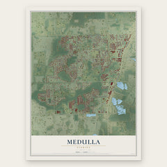
- Medulla 12" x 18" / Archival Matte Print $39.99

More maps nearby: Bartow, Jan Phyl Village, Fussels Corner, Combee Settlement and Eagle Lake.
The art of mapping a place
How This Map Was Made
Real places. Remarkable detail. Discover the layers that turn geographic data into a map of home.

The view from above
Aerial imagery reveals the character of the land: woodland, open fields, and the patterns of a place.

The shape of the land
Elevation data brings hills, valleys, and subtle changes in the landscape into view.

The details of home
Roads, waterways, and building footprints come together to make the map feel unmistakably local.

Geography becomes art
Considered color, shading, and typography bring the layers together in a map made for your wall.


Process illustrated with Mendon, Massachusetts. Aerial imagery: USDA NAIP. Terrain: USGS 3D Elevation Program. Map details and finished artwork: KNOWOL.
The Details
About This Print
Choose an archival matte print, or a black or white Ayous wood frame. The archival matte print is unframed.
Select your size and finish above to see the matching product image and price.
Materials & Craftsmanship
A contemporary map with the character of a classic atlas, printed on archival matte paper. Optional frames are made from Ayous wood.
Your printed map does not include the watermark shown in the full-map preview.
Shipping & Delivery
Free shipping within the United States. Every print is made to order in the USA.
Buying a gift? Add a note in your cart and we'll include it. We never put prices in the package.
Prints ship within 2 to 3 business days. Allow 7 to 10 days total from ordering for delivery. Timing may vary during holidays or periods of high order volume.
Read our shipping policy.
Returns and damaged prints
Each print is made to order. Change-of-mind refunds are not available after production.
If your print arrives damaged, misprinted or incorrect, contact support@knowol.com within 30 days of receiving it. Include your order number, photos and a description of the issue.
Read our full refund and replacement policy. For questions about your order, email support@knowol.com.