
Search for another town





Free U.S. delivery 7 to 10 days after you order
Holbrook, Arizona Map Art
Building by building, with labeled streets and shaded relief.
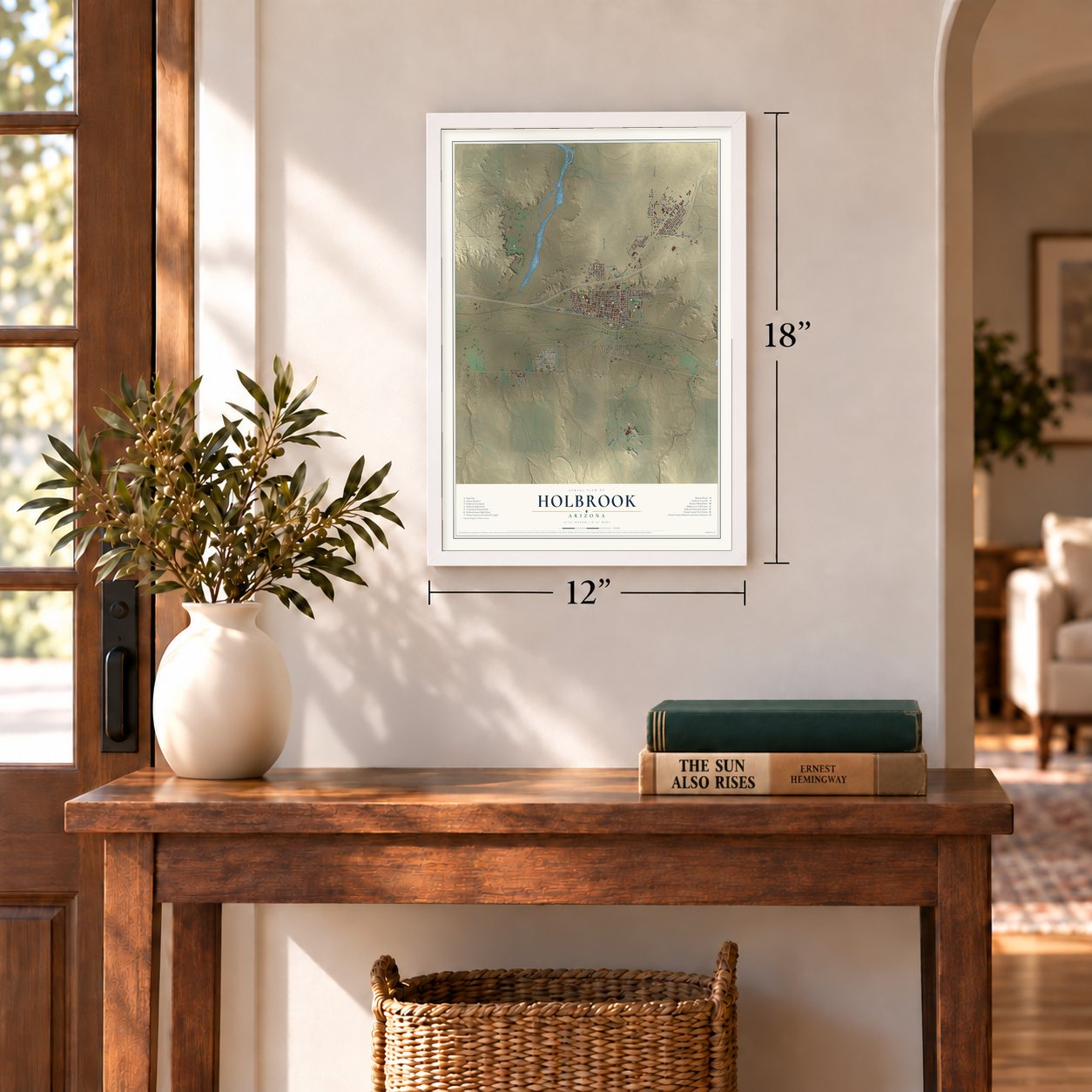
12" x 18" Archival Matte Print
A Map of Home. A Work of Art.
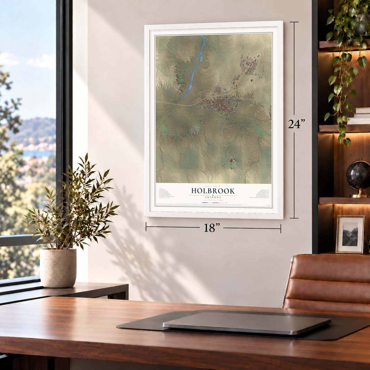
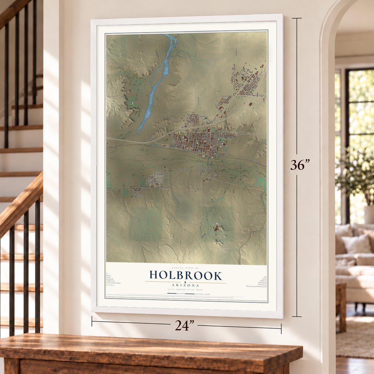
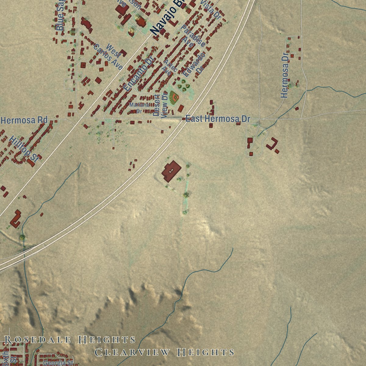
Explore Holbrook, Arizona from a whole new perspective. Created using aerial imagery and detailed geographic data, this map captures Holbrook building by building, with labeled streets, familiar landmarks, and shaded topographical relief that highlights the natural contours of the landscape.
Combining modern data with the timeless character of a vintage atlas, this map is just as interesting up close as it is beautiful on the wall. Whether you grew up in Holbrook, spent memorable years there, or call it home today, this unique map is a great way to celebrate a place that means something to you. Zoom in on the preview to look for your street, and then order a print to put your memories on the wall.

Three ways to hang it
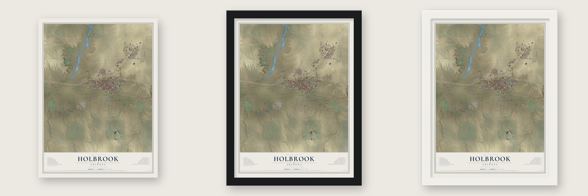
Unframed archival matte, a black wood frame or a white wood frame.
Up close
Geography Worth Displaying
This map was created using accurate cartographic data and authoritative geographic sources, including the U.S. Geological Survey (USGS) and FEMA. The map brings together terrain, waterways, roads, and building detail. The majority of the streets are labeled, houses are accurately depicted, and the topography is derived from government sources. Combining local data with carefully composed color and shading leads to this beautifully detailed Holbrook artwork for your wall.
Rather than simply showing street outlines, we’ve included as many of the street names as we could reasonably fit on the map while keeping their names legible. Zoom in on the high resolution preview to see exactly what’s on the map. We truly set out to create a statement piece for anyone who loves Holbrook. So whether it’s for you, or a gift for someone you love, we hope this map of Holbrook brings back fond memories.
Explore the full map of Holbrook, Arizona and read about the local places it shows.
Find your street
Names on the Holbrook map
Every name below is printed on this map. Look for your street, your school, the park where you played, or the pond down the road.
Places and landmarks5
- Holbrook City Hall
- Clearview Heights
- Rosedale Heights
- Sierra Plaza Subdivision
- Hunt Park
Streets and roads92
- Old US Highway 66
- Navajo Boulevard
- West Hopi Drive
- Apache Avenue
- East Hermosa Drive
- Lizard Lane
- Spurlock Avenue
- Northeast Central Avenue
- Willow Way
- Joy Nevin Avenue
- Northwest Central Avenue
- Hermosa Road
- North Seventh Street
- Smithson Drive
- East Iowa Street
- Central Avenue
- Hermosa Drive
- McLaws Road
- Third Street
- Joy Nevin
- Blue Sage Street
- West Romero Street
- South Whiting Avenue
- Mission Lane
- Buffalo Street
- West Arizona Street
- Anita Drive
- West Florida Street
- Encanto Drive
- Broadcast Lane
Show all 92 streets
- East Romero Street
- Gregg Drive
- South Apache Drive
- Crestview Drive
- West Vis
- Bermuda Drive
- Boyse Road
- East Hopi Drive
- Lewis Drive
- Hilltop Street
- Morris Lane
- Hill Road
- Ruth
- Heber Road
- West Hill Road
- South Westover Avenue
- Paradise Avenue
- Edwardo Drive
- Pinyon Parkway
- East Florida Street
- West Erie Street
- North Second Street
- Desert View Drive
- Fifth Avenue
- Helen Road
- North Sixth Avenue
- Hutchinson Avenue
- 13th Avenue
- West Hampshire Street
- Vista Drive
- Colorado Drive
- Heywood Avenue
- West Dewitt Road
- Fifth Street
- Buzzard Boulevard
- West Carlos Avenue
- Seventh Drive
- East Arizona Street
- Hennessy Street
- Elm Drive
- Fourth Street
- 14th Avenue
- Fisher Lane
- Sixth Street
- Grama Drive
- Greer Drive
- Cedar Avenue
- North Eighth Avenue
- West Randall Road
- Eleventh Avenue
- Airport Road
- Georgia Street
- Aztec Avenue
- Brimhall
- Greer Avenue
- Tamarisk Trail
- Mariana Drive
- Randall Road
- East California Street
- East Erie Street
- Ridgecrest Drive
- Coronado Drive
Names are listed as they appear on the printed map. Zoom into the product photos to find them.
About Holbrook, Arizona
Holbrook is a city of 4,858 people and the county seat of Navajo County. Before the railroad came, a store and saloon stood where the Puerco meets the Little Colorado, two miles east of today's town, at a spot called Horsehead Crossing, and Mormon families from Utah settled nearby in 1876. Tracks were laid in 1881 and 1882, and the new station was named for Henry Randolph Holbrook, the Atlantic and Pacific Railroad's first chief engineer.
The railroad sold a million acres to a group of Boston investors. They organized the Aztec Land and Cattle Company and drove in about 32,000 head of Texas cattle. Its hash knife brand gave it the name Hashknife Outfit, and after leasing another million acres it made Holbrook its headquarters, turning the station into a cow town. Navajo County was split from Apache County in 1895 with Holbrook as its seat, but by 1902 the Hashknife had gone bankrupt, and the Babbitt brothers bought its land.
“the town too tough for women and churches”
- The Holbrook Shootout, 1887On September 4, 1887, Apache County Sheriff Commodore Perry Owens came to Holbrook to arrest Andy Blevins, also known as Andy Cooper, for stealing horses. Owens went alone to the Blevins house, knocked, and told Blevins why he was there. Blevins refused to give up, and in the gunfight Blevins, two of his brothers, a friend and his horse were all shot. Only one brother survived, while Owens walked away unhurt and became a legend. The house still stands.
- A meteorite in 1912At 7:15 p.m. on July 19, 1912, a meteorite of about 419 pounds blew apart high above Navajo County. An estimated 16,000 or more fragments came down about 6 miles east of town, and the blast was heard at least 40 miles away. Pauline McCleve, who was 17 at the time, said she never heard anything louder in her life. The biggest piece recovered weighs 14.5 pounds and is kept at Arizona State University in Tempe.
- The Wigwam MotelIn 1938, on a visit to Cave City, Kentucky, Chester E. Lewis saw a wigwam design by Frank A. Redford. In 1950 he built his own version on Hopi Drive, and he paid Redford with the coins that guests dropped into the room radios. Fifteen wigwams of concrete and steel, each 32 feet tall, stand along three sides of a square. The National Register lists the motel under the name Wigwam Village #6.
- Closed and reopenedLewis closed the motel in 1974, after Interstate 40 carried traffic around downtown Holbrook. He died in 1986, and two years later his children Clifton, Paul and Elinor restored the wigwams and opened the motel again.
- Holbrook's oldest buildingPedro Montaño built an adobe house here between 1881 and 1883. Over the years it served as a boarding house, then the Brunswick Hotel, then a hospital wing in the 1930s, and during World War II it housed Navy pilot candidates. Renamed the Arizona Rancho in the 1940s, it closed after Interstate 40 pulled traffic away, and it joined the National Register on October 17, 1997.
Keep exploring Arizona
Holbrook is one of 528 Arizona towns we've mapped. Every dot on the map is a print of its own.
The search covers every state, Arizona first.
Near Holbrook
Order 2 or more town maps and save 10%. Shown in the size and finish you picked above, so they hang as a set.
- Sun Valley 12" x 18" / Archival Matte Print $39.99
- Joseph City 12" x 18" / Archival Matte Print $39.99
- Woodruff 12" x 18" / Archival Matte Print $39.99


More maps nearby: Snowflake, Winslow West, Winslow, Dilkon and Taylor.
The art of mapping a place
How This Map Was Made
Real places. Remarkable detail. Discover the layers that turn geographic data into a map of home.

The view from above
Aerial imagery reveals the character of the land: woodland, open fields, and the patterns of a place.

The shape of the land
Elevation data brings hills, valleys, and subtle changes in the landscape into view.

The details of home
Roads, waterways, and building footprints come together to make the map feel unmistakably local.

Geography becomes art
Considered color, shading, and typography bring the layers together in a map made for your wall.


Process illustrated with Mendon, Massachusetts. Aerial imagery: USDA NAIP. Terrain: USGS 3D Elevation Program. Map details and finished artwork: KNOWOL.
The Details
About This Print
Choose an archival matte print, or a black or white Ayous wood frame. The archival matte print is unframed.
Select your size and finish above to see the matching product image and price.
Materials & Craftsmanship
A contemporary map with the character of a classic atlas, printed on archival matte paper. Optional frames are made from Ayous wood.
Your printed map does not include the watermark shown in the full-map preview.
Shipping & Delivery
Free shipping within the United States. Every print is made to order in the USA.
Buying a gift? Add a note in your cart and we'll include it. We never put prices in the package.
Prints ship within 2 to 3 business days. Allow 7 to 10 days total from ordering for delivery. Timing may vary during holidays or periods of high order volume.
Read our shipping policy.
Returns and damaged prints
Each print is made to order. Change-of-mind refunds are not available after production.
If your print arrives damaged, misprinted or incorrect, contact support@knowol.com within 30 days of receiving it. Include your order number, photos and a description of the issue.
Read our full refund and replacement policy. For questions about your order, email support@knowol.com.