
Search for another town




Free U.S. delivery 7 to 10 days after you order
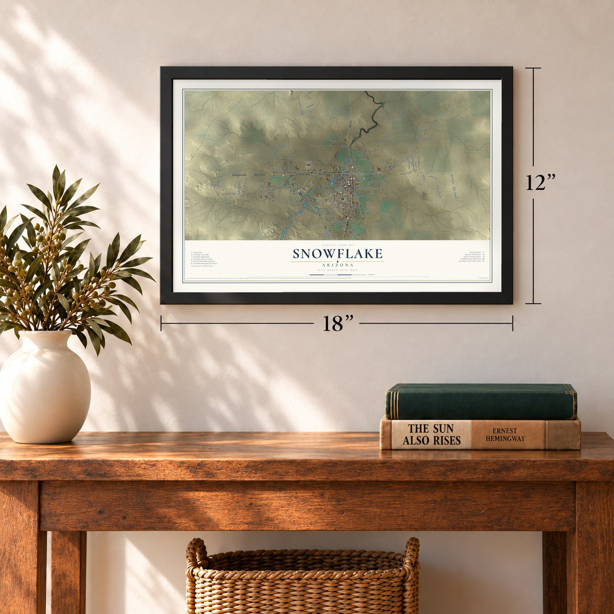
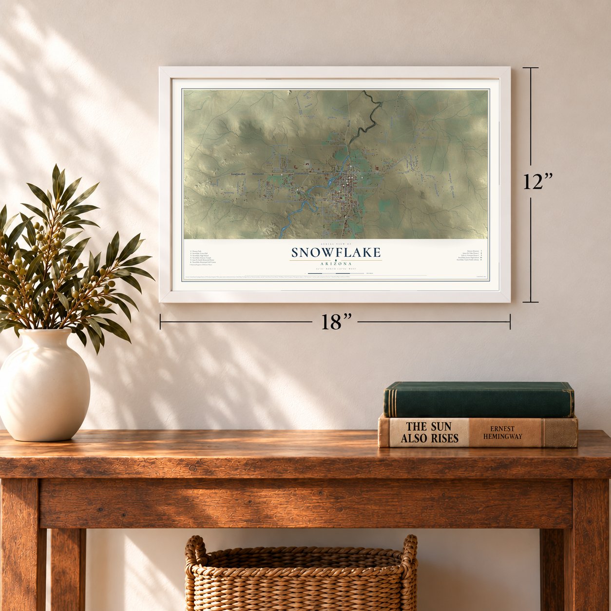
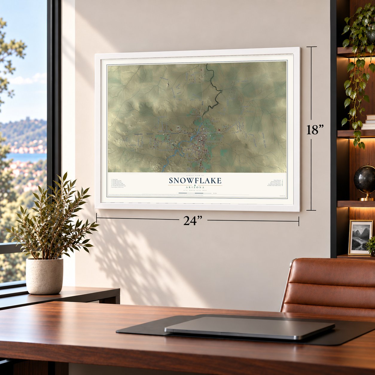
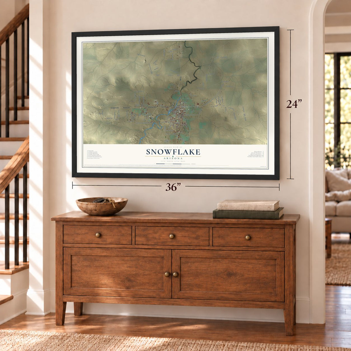
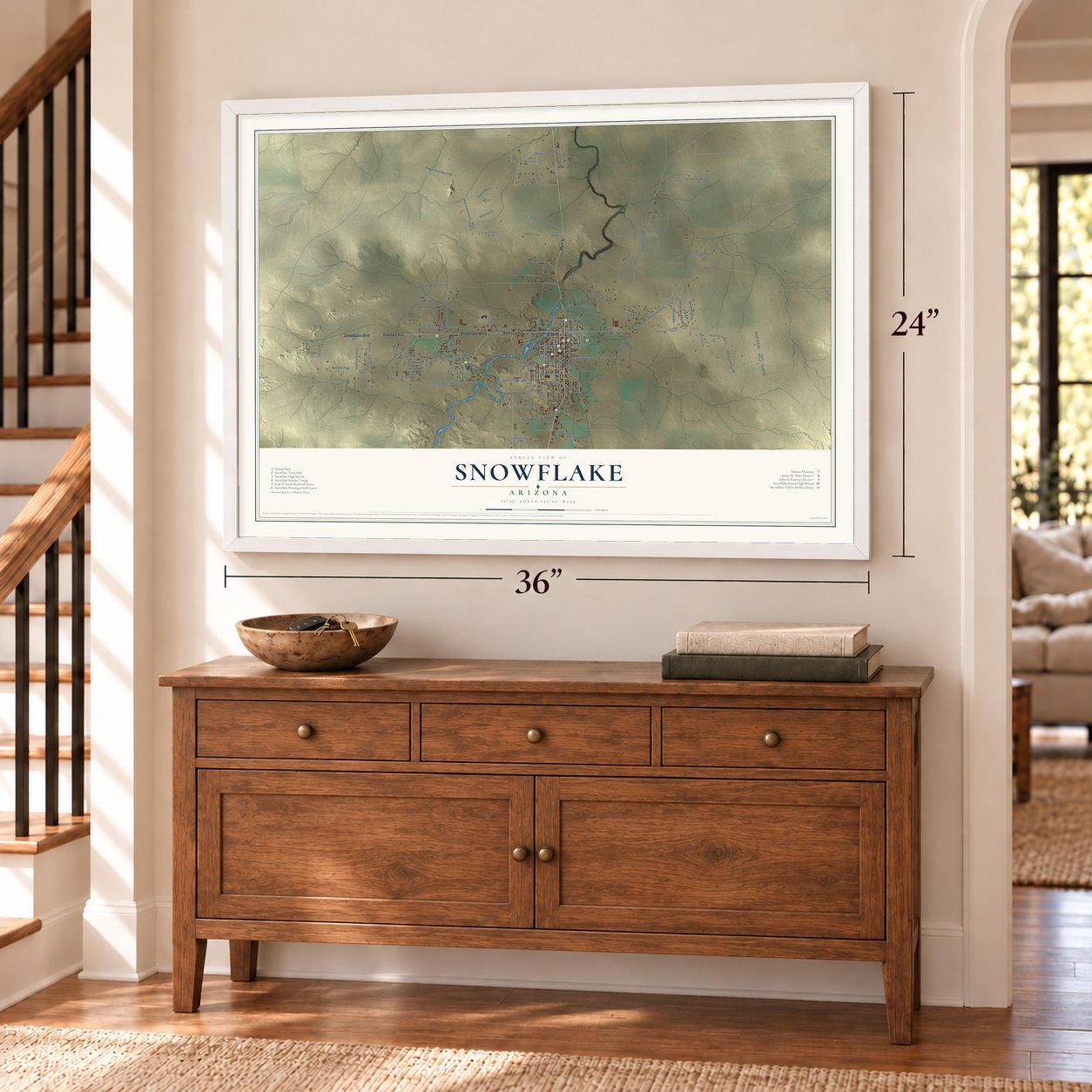
Snowflake, Arizona Map Art
Building by building, with labeled streets and shaded relief.
12" x 18" Archival Matte Print
A Map of Home. A Work of Art.
Explore Snowflake, Arizona from a whole new perspective. Created using aerial imagery and detailed geographic data, this map captures Snowflake building by building, with labeled streets, familiar landmarks, and shaded topographical relief that highlights the natural contours of the landscape.
Combining modern data with the timeless character of a vintage atlas, this map is just as interesting up close as it is beautiful on the wall. Whether you grew up in Snowflake, spent memorable years there, or call it home today, this unique map is a great way to celebrate a place that means something to you. Zoom in on the preview to look for your street, and then order a print to put your memories on the wall.

Three ways to hang it
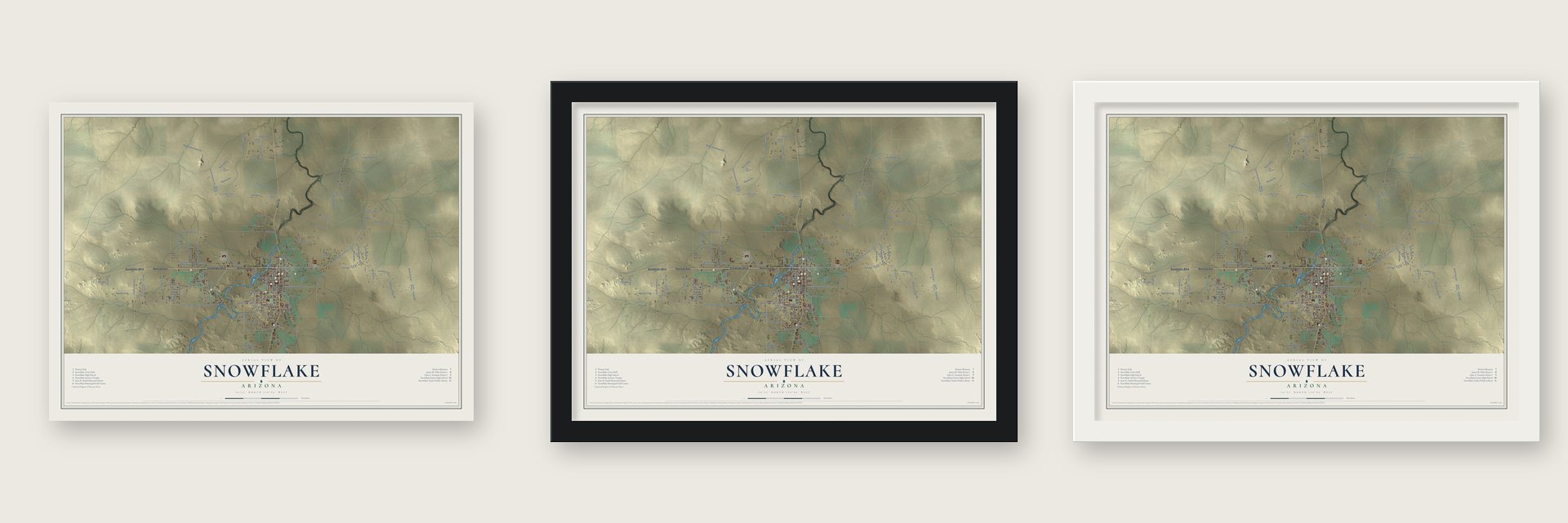
Unframed archival matte, a black wood frame or a white wood frame.
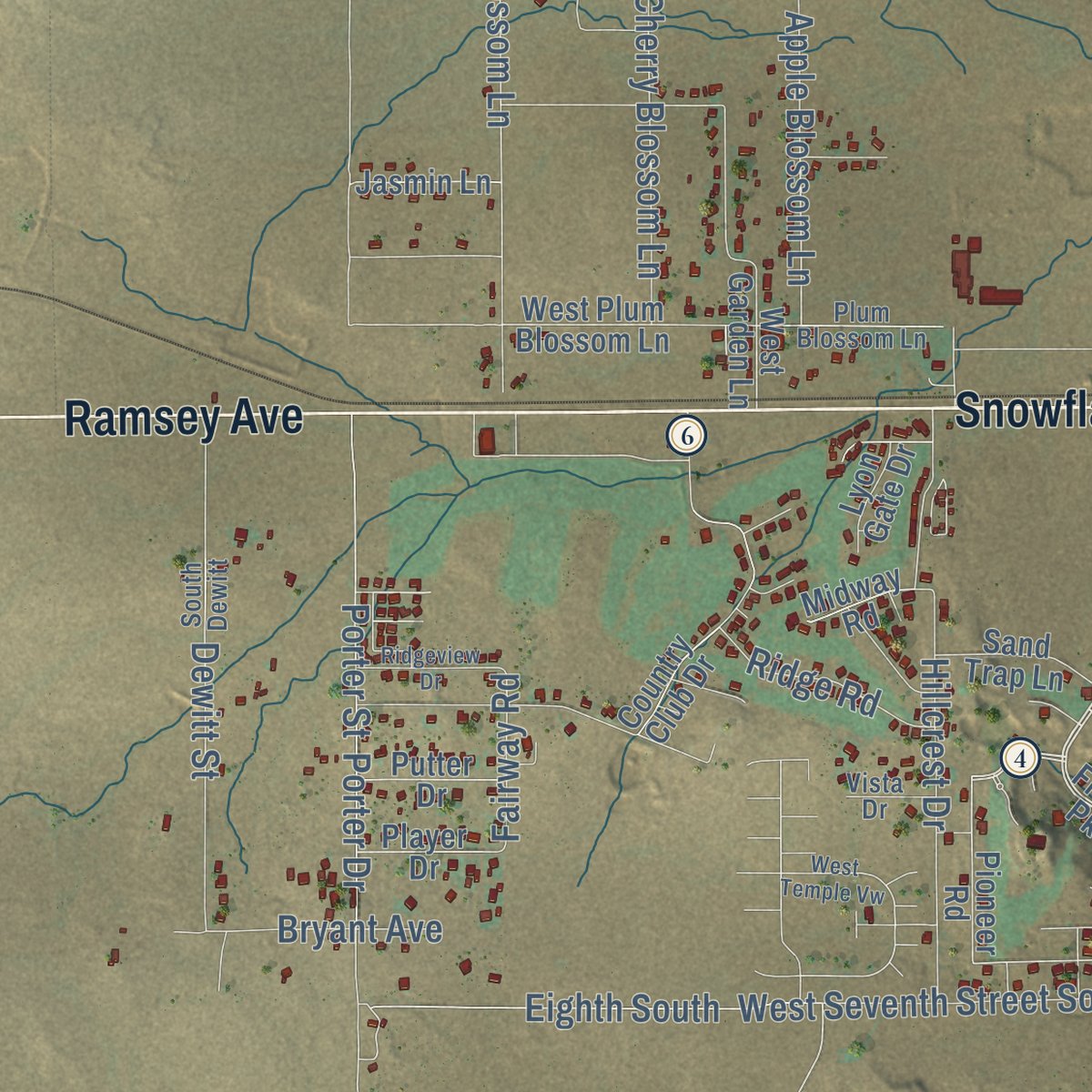
Up close
Geography Worth Displaying
This map was created using accurate cartographic data and authoritative geographic sources, including the U.S. Geological Survey (USGS) and FEMA. The map brings together terrain, waterways, roads, and building detail. The majority of the streets are labeled, houses are accurately depicted, and the topography is derived from government sources. Combining local data with carefully composed color and shading leads to this beautifully detailed Snowflake artwork for your wall.
Rather than simply showing street outlines, we’ve included as many of the street names as we could reasonably fit on the map while keeping their names legible. Zoom in on the high resolution preview to see exactly what’s on the map. We truly set out to create a statement piece for anyone who loves Snowflake. So whether it’s for you, or a gift for someone you love, we hope this map of Snowflake brings back fond memories.
Explore the full map of Snowflake, Arizona and read about the local places it shows.

Find your street
Names on the Snowflake map
Every name below is printed on this map. Look for your street, your school, the park where you played, or the pond down the road.
Streets and roads129
- Ramsey Avenue
- Snowflake Boulevard
- Main Street
- Concho Highway
- First Street East
- South Hoyt Road
- South McLaws Avenue
- Snowflake Heights Boulevard
- Willis Ranch Lane
- No 26 East
- Ramsey Lane
- Larson Lane
- Snowflake Boulevard East
- 2300 North
- Clyde Road
- Freeman Hollow
- Cooper Lane
- Eighth South
- Apple Blossom Lane
- Sunset Drive
- Reidhead Avenue
- Apricot Blossom Lane
- Peach Blossom Lane
- Hillside Drive
- Runway Drive
- Old Woodruff Road
- West Seventh Street South
- Ridgeview Ranch Drive
- Ridge View Ranch Drive
- Sundown Drive
Show all 129 streets
- Rutledge Drive
- Otto Drive
- Hillcrest Drive
- Dewitt Street
- Seventh South
- Rencher Avenue
- Porter Drive
- Porter Street
- Cherry Blossom Lane
- Despain Avenue
- El Rancho Boulevard
- Rodeo Road
- East Ninth South
- Tharp Road
- Riggs Street
- East Belly Button Lane
- West Sixth Street South
- Fourth West
- Antelope Ridge Road
- Greer Avenue
- Fish Lane
- Eager Avenue
- South Staley Road
- West Center Street
- Savage Street
- Flake Avenue
- F-Bar Lane
- Golden Horse Lane
- North 36 East
- Hoyt Road
- Ridge Road
- Bryant Avenue
- Hatch Avenue
- Ranch Way
- Fairway Road
- Sierra Drive
- Webb Lane
- Contreras
- Pear Street
- West Third Street North
- East Third Street North
- Frontier Parkway
- Antelope Ridge Lane
- Pioneer Road
- Snowflake Taylor Boulevard
- West Eighth Street South
- Old Bypass Road
- Country Club Drive
- 23rd North
- South 36 East
- Fourth Street West
- West 2300 North
- West Garden Lane
- Second Street West
- North Ranchview Road
- West Fourth Street South
- West Plum Blossom Lane
- 20th East
- West Darlene Lane
- North Riggs Street
- West 19th Street South
- Oak Canyon Trail
- East 24th North
- Industrial Way
- Sand Trap Lane
- Savage Lane
- Ranch View Drive
- Highland Drive
- Jasmin Lane
- Putter Drive
- Brown Street
- Lobo Lane
- South Otto Drive
- Player Drive
- Lyon Gate Drive
- Midway Road
- Navel Lane
- Snowflake Taylor
- Pvt Property
- Mountain View Drive
- First Street West
- Pinion Avenue
- Parkway Drive
- First North
- East Sixth Street North
- Plum Blossom Lane
- Gonsalves Way
- North East 650
- Raven Way
- South Dewitt
- Vista Drive
- Asante Drive
- 35th North
- West Temple Vw
- East Ninth Street South
- Chaparral Lane
- Mountain Highlands Boulevard
- Ridgeview Drive
- Corona Lane
Names are listed as they appear on the printed map. Zoom into the product photos to find them.
About Snowflake, Arizona
Snowflake is a town of 6,104 people in Navajo County. It lies 25 miles south of Interstate 40, reached by Highway 77. In 1877 Brigham Young, head of the Latter-day Saints church, sent William Jordan Flake to found a settlement in the northern part of Arizona Territory. Flake drove a wagon train and herds of cattle to the Little Colorado River country and reached the site in January 1878. The settlers spent their first winter in stables and wagons, and the settlement held on.
That fall the church apostle Erastus Snow came to visit. "Snow for me and Flake for you" was how the two men joined their surnames when they named the settlement. Flake kept raising cattle here until his death in 1932, at age 93. In 1959 the National Cowboy & Western Heritage Museum added him to its Hall of Great Westerners, honoring him as a colonizer and cattleman.
- A Smith cousin takes chargeJesse N. Smith, whose first cousin was Joseph Smith, toured the new Arizona settlements in 1878. After his report, church leader John Taylor asked him to move there, so he brought his family to Snowflake. He presided over the Eastern Arizona Stake between 1879 and 1887, then led the newly named Snowflake Stake from 1887 until he died in 1906, and he also sat in the 19th Arizona Territorial Legislature. The Jesse N. Smith House is on the National Register.
- School past eighth grade, 1888In 1888 the church opened the Snowflake Stake Academy for anyone who wanted to keep studying after the eighth grade. It closed in 1924, when the Snowflake Union High School District was formed. Snowflake High School, which now serves both Snowflake and Taylor, counts itself among the oldest schools in Arizona. The Snowflake Stake Academy Building is listed on the National Register.
- A temple on Temple HillThe church announced the Snowflake Arizona Temple, its second in Arizona, on April 2, 2000. Builders cut about eight feet off the top of a knoll, since known as Temple Hill, to set the two-level building into it. The open house in February 2002 drew 94,416 visitors, and the church dedicated the building on March 3, 2002. Inside are designs taken from pioneer quilt blocks and Native American art, and a mural by Linda Turley-Christensen.
- Rails from Holbrook in 1918The Apache Railway's line from Holbrook reached Snowflake in 1918, giving the town's farms and ranches a rail connection. The railway still hauls freight here.
- Fire in the SkyTravis Walton, who said he was taken by space aliens, lives in Snowflake, as do some members of the logging crew that was with him. Several events in the case took place in town, and the 1993 film Fire in the Sky retold them, with D. B. Sweeney playing Walton.
Keep exploring Arizona
Snowflake is one of 519 Arizona towns we've mapped. Every dot on the map is a print of its own.
The search covers every state, Arizona first.
Near Snowflake
Order 2 or more town maps and save 10%. Shown in the size and finish you picked above, so they hang as a set.
- Taylor 12" x 18" / Archival Matte Print $39.99
- Shumway 12" x 18" / Archival Matte Print $39.99
- White Mountain Lake 12" x 18" / Archival Matte Print $39.99


More maps nearby: Clay Springs, Pinedale, Linden, Show Low and Woodruff.
The art of mapping a place
How This Map Was Made
Real places. Remarkable detail. Discover the layers that turn geographic data into a map of home.

The view from above
Aerial imagery reveals the character of the land: woodland, open fields, and the patterns of a place.

The shape of the land
Elevation data brings hills, valleys, and subtle changes in the landscape into view.

The details of home
Roads, waterways, and building footprints come together to make the map feel unmistakably local.

Geography becomes art
Considered color, shading, and typography bring the layers together in a map made for your wall.


Process illustrated with Mendon, Massachusetts. Aerial imagery: USDA NAIP. Terrain: USGS 3D Elevation Program. Map details and finished artwork: KNOWOL.
The Details
About This Print
Choose an archival matte print, or a black or white Ayous wood frame. The archival matte print is unframed.
Select your size and finish above to see the matching product image and price.
Materials & Craftsmanship
A contemporary map with the character of a classic atlas, printed on archival matte paper. Optional frames are made from Ayous wood.
Your printed map does not include the watermark shown in the full-map preview.
Shipping & Delivery
Free shipping within the United States. Every print is made to order in the USA.
Buying a gift? Add a note in your cart and we'll include it. We never put prices in the package.
Prints ship within 2 to 3 business days. Allow 7 to 10 days total from ordering for delivery. Timing may vary during holidays or periods of high order volume.
Read our shipping policy.
Returns and damaged prints
Each print is made to order. Change-of-mind refunds are not available after production.
If your print arrives damaged, misprinted or incorrect, contact support@knowol.com within 30 days of receiving it. Include your order number, photos and a description of the issue.
Read our full refund and replacement policy. For questions about your order, email support@knowol.com.