


Search for another town





Free U.S. delivery 7 to 10 days after you order
Holden, Massachusetts Map Art
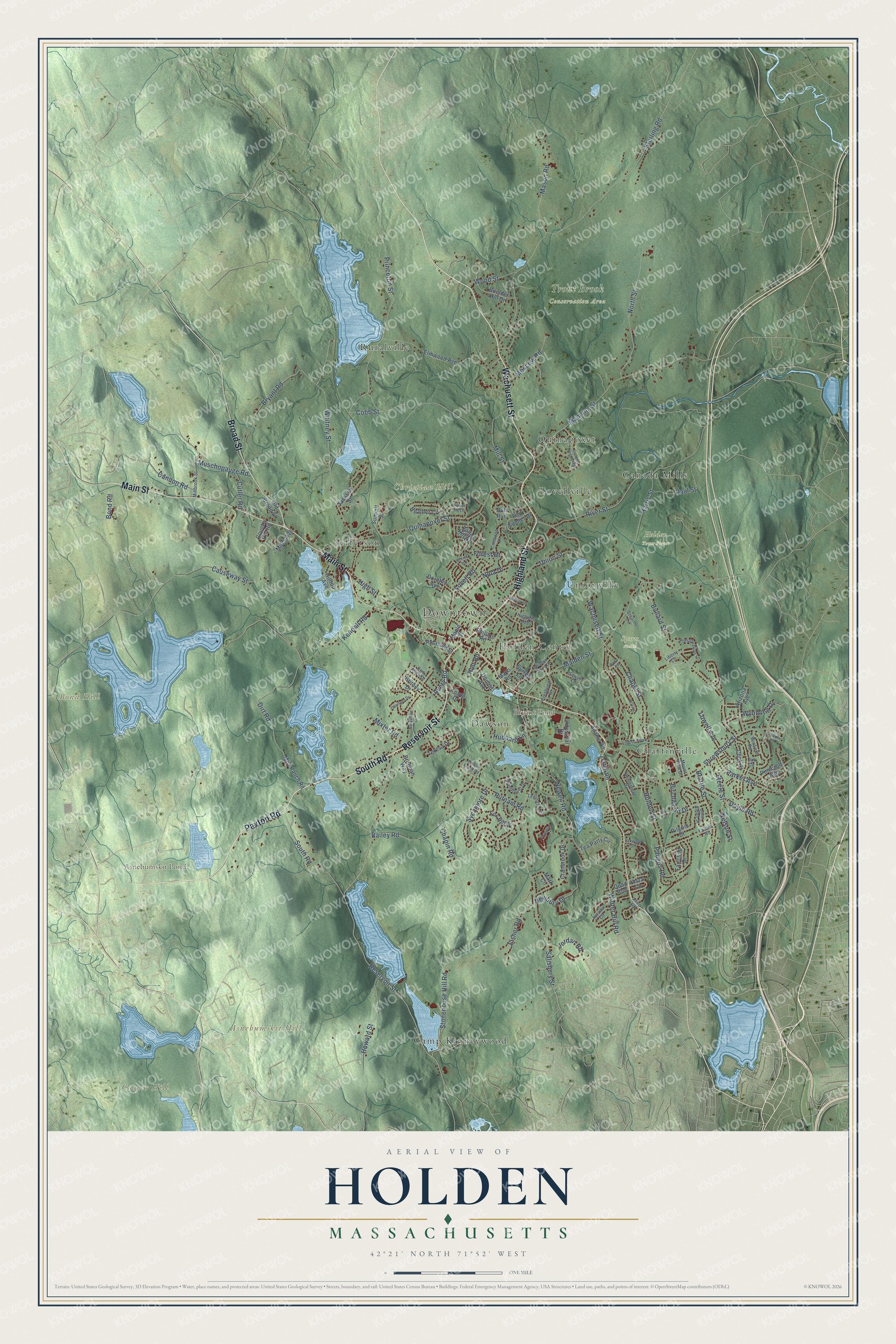
Building by building, with labeled streets and shaded relief.
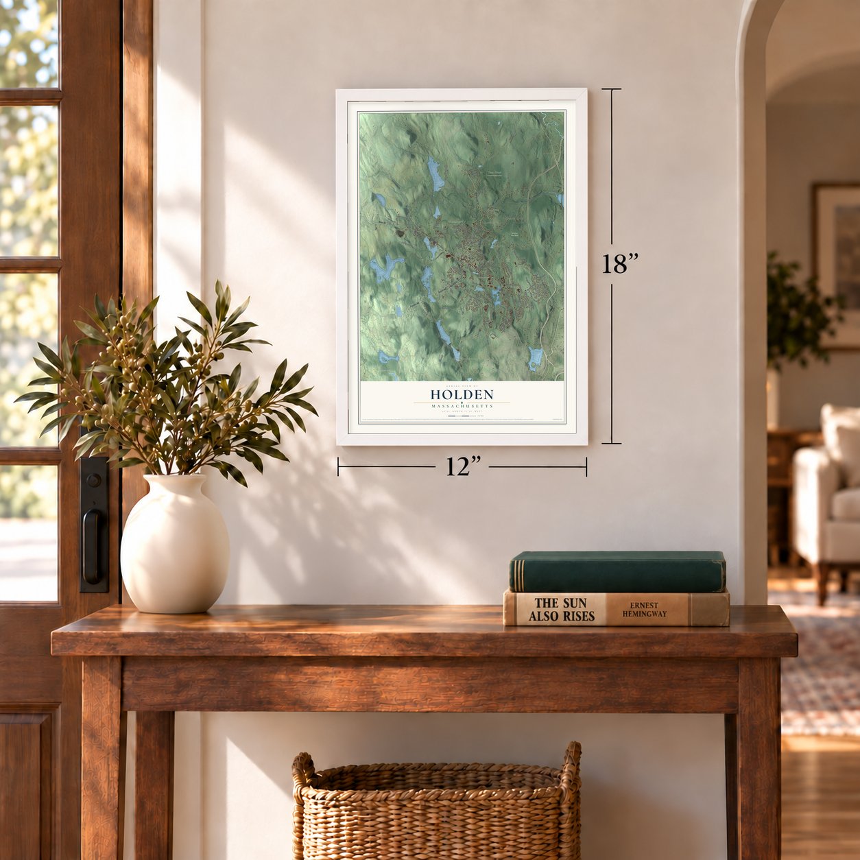
12" x 18" Archival Matte Print
A Map of Home. A Work of Art.
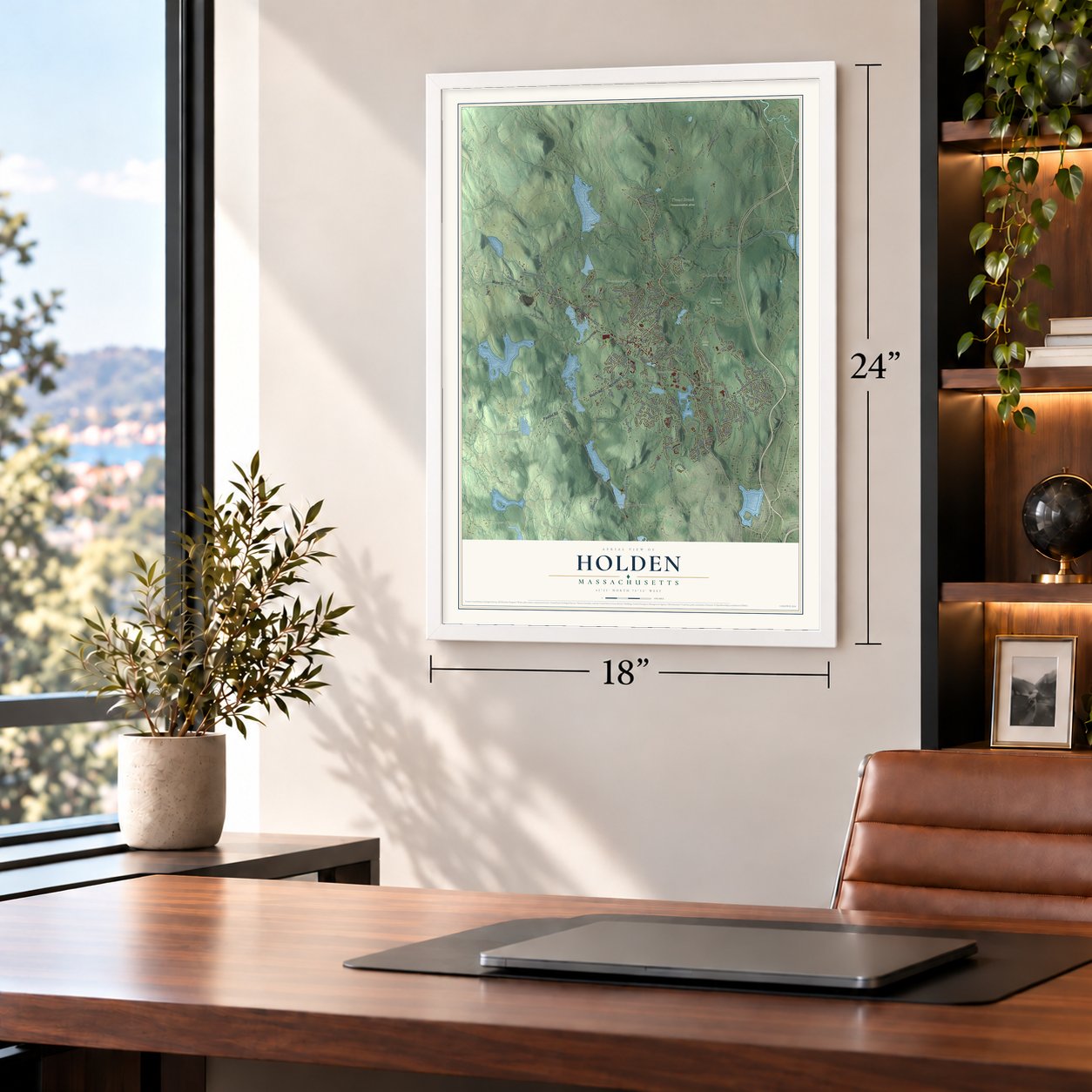
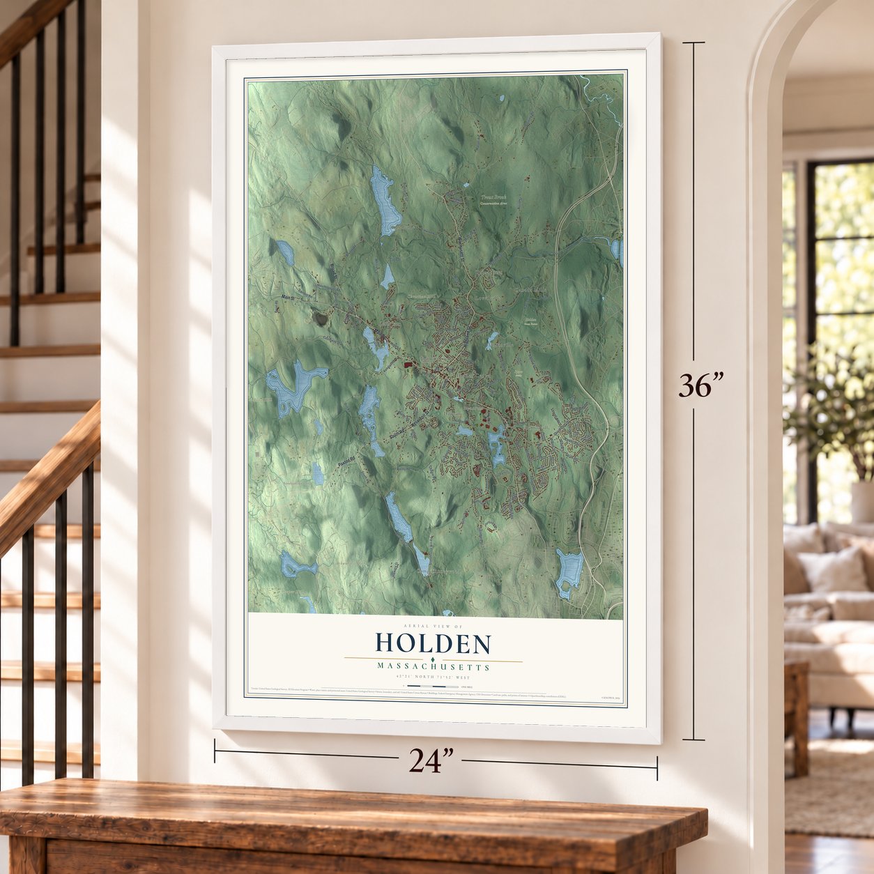
Explore Holden, Massachusetts from a whole new perspective. Created using aerial imagery and detailed geographic data, this map captures Holden building by building, with labeled streets, familiar landmarks, and shaded topographical relief that highlights the natural contours of the landscape.
Combining modern data with the timeless character of a vintage atlas, this map is just as interesting up close as it is beautiful on the wall. Whether you grew up in Holden, spent memorable years there, or call it home today, this unique map is a great way to celebrate a place that means something to you. Zoom in on the preview to look for your street, and then order a print to put your memories on the wall.
Three ways to hang it
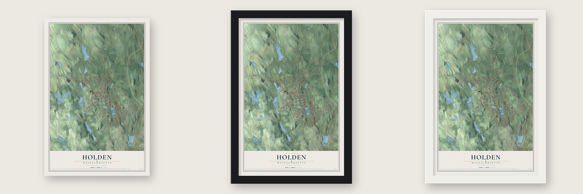
Unframed archival matte, a black wood frame or a white wood frame.
Up close
Geography Worth Displaying
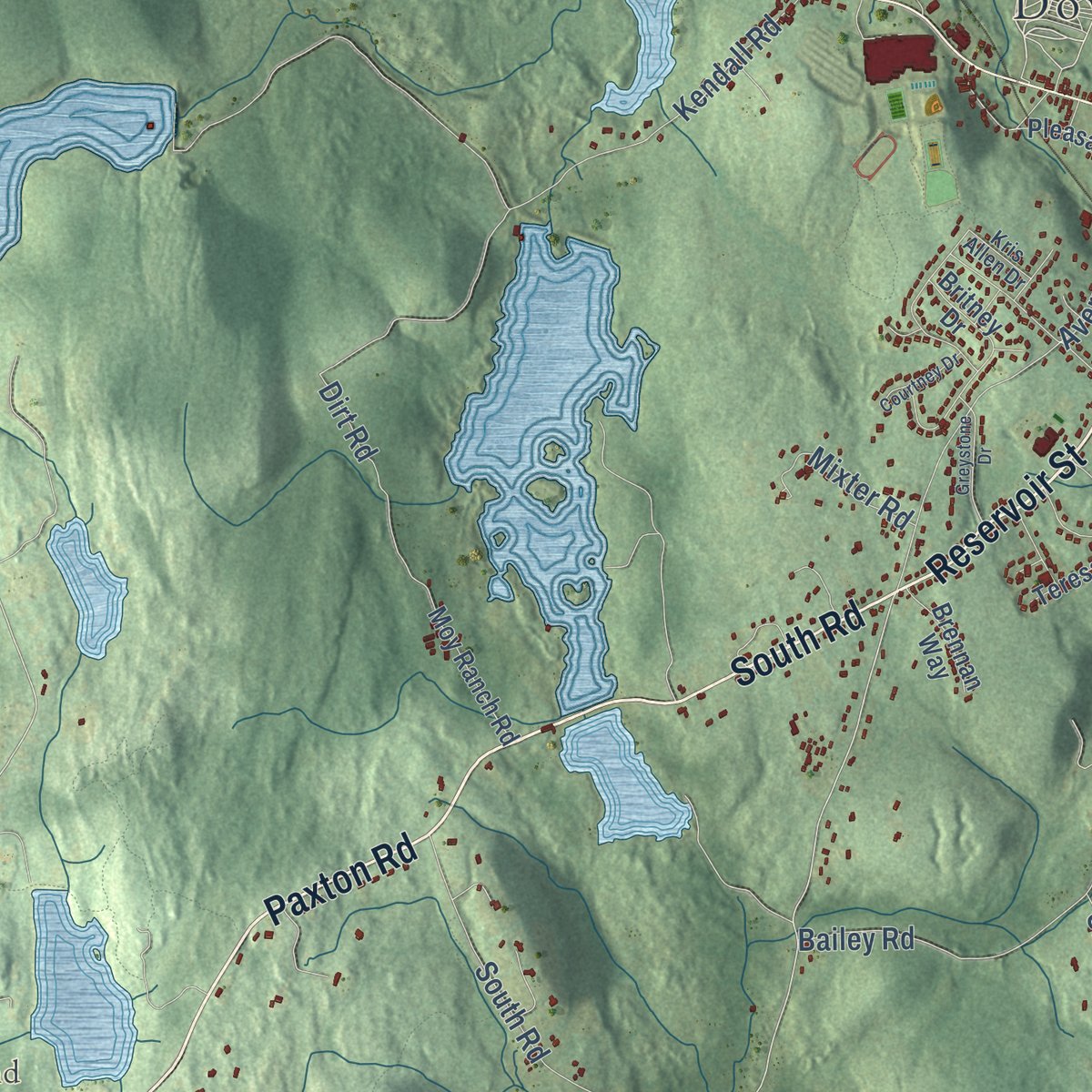
This map was created using accurate cartographic data and authoritative geographic sources, including the U.S. Geological Survey (USGS) and FEMA. The map brings together terrain, waterways, roads, and building detail. The majority of the streets are labeled, houses are accurately depicted, and the topography is derived from government sources. Combining local data with carefully composed color and shading leads to this beautifully detailed Holden artwork for your wall.
Rather than simply showing street outlines, we’ve included as many of the street names as we could reasonably fit on the map while keeping their names legible. Zoom in on the high resolution preview to see exactly what’s on the map. We truly set out to create a statement piece for anyone who loves Holden. So whether it’s for you, or a gift for someone you love, we hope this map of Holden brings back fond memories.
Explore the full map of Holden, Massachusetts and read about the local places it shows.

Find your street
Names on the Holden map
Every name below is printed on this map. Look for your street, your school, the park where you played, or the pond down the road.
Places and landmarks20
- Downtown
- Asnebumskit Hill
- Bond Hill
- Christian Hill
- Cooper Hill
- Asnebumskit Pond
- Bryant Pond
- Holden Town Forest
- Sports Fields
- Trout Brook Conservation Area
- Camp Kinneywood
- Quinapoxet
Show all 20 places
- Chaffinville
- Canada Mills
- Lovellville
- Jefferson
- Unionville
- Dawson
- Holden Center
- Ruralville
Streets and roads136
- Highland Street
- Reservoir Street
- South Road
- Paxton Road
- Wachusett Street
- Main Street
- Broad Street
- Princeton Street
- Salisbury Street
- Malden Street
- Bullard Street
- Mason Road
- Bailey Road
- Causeway Street
- Shrewsbury Street
- River Street
- Manning Street
- Quinapoxet Street
- Sterling Road
- Whitney Street
- Newell Road
- Kendall Road
- Chapel Street
- North Street
- Sycamore Drive
- Bryant Road
- Holden Street
- Harris Street
- Lovell Road
- Stonehouse Hill Road
Show all 136 streets
- Howard Street
- Mill Street
- Muschopauge Road
- Brattle Street
- Doyle Road
- Newbury Drive
- Parker Avenue
- Fisher Road
- Paul Street
- Union Street
- Jordan Road
- High Street
- Nola Drive
- Winter Hill Road
- Dirt Road
- Birchwood Drive
- Mixter Road
- Putnam Road
- Moscow Road
- Cobb Street
- Chapin Road
- Cannon Road
- Wood Street
- Bond Road
- Forest Drive
- Paugus Road
- Lowell Avenue
- Cutler Road
- Nelson Street
- Wyoming Drive
- Hubbard Lane
- Steele Street
- Avery Road
- Holt Road
- Elmwood Avenue
- Cranbrook Drive
- Jackson Street
- Britney Drive
- Cook Street
- Fox Hill Drive
- Tea Party Circle
- Heather Circle
- Industrial Drive
- Arizona Avenue
- Boulder Hill Drive
- Bull Run
- Valley Hill Drive
- Fort Sumter Drive
- Pinecroft Avenue
- Vista Circle
- Moy Ranch Road
- Fairchild Drive
- Phillips Road
- Pleasant Street
- Dorothy Avenue
- Surrey Lane
- Miles Avenue
- Brennan Way
- Country Hill Road
- Adams Road
- Quail Run
- Teresa Drive
- Zottoli Road
- Towle Drive
- Old Broad Street
- Mark Circle
- Summit Street
- Pilgrim Drive
- Donald Avenue
- Hilltop Avenue
- Mayo Road
- Maple Street
- Autumn Circle
- Lexington Circle
- Highland Avenue
- Preservation Lane
- Mount View Drive
- Millbrook Street
- Homestead Road
- Lincoln Avenue
- Sawyer Lane
- Wyndhurst Drive
- Crestview Drive
- Winfield Road
- Cimarron Lane
- Oak Circle
- Kris Allen Drive
- John Alden Street
- Stearns Lane
- Liberty Circle
- Fairhill Road
- Allen Road
- General Hobbs Road
- Blair Drive
- Meadow Wood Drive
- Willow Brook Road
- Fireside Lane
- Greystone Drive
- Scenic Drive
- Courtney Drive
- Slipper Hill Lane
- Appletree Lane
- Oakwood Street
- Juniper Lane
- Ann Street
- Brice Circle
Names are listed as they appear on the printed map. Zoom into the product photos to find them.
About Holden, Massachusetts
Holden is a town of 19,905 people in Worcester County, on the northwest edge of Worcester. It began as the north half of Worcester, and Jonas Rice discovered limestone there during the spring of 1723. Worcester's proprietors encouraged him to burn lime, and the first settlers built their homes near the lime lot. On January 9, 1741, the governor signed the act that made the north half a separate town, named for Samuel Holden, a London merchant who became governor of the Bank of England after serving as one of its directors.
At their first business meeting, the new town's voters agreed that the gospel should be preached and that a school would teach reading and writing. In 1789 John Hancock gave the town an acre of land for its meetinghouse and common. When the meetinghouse frame was raised that year, a town committee bought rum and sugar for the spectators who gathered to see it go up.
“It is no exaggeration to state that Abbott's Hotel was known from the Pacific to the Atlantic Ocean.”
- The Sixth Massachusetts TurnpikeChartered in 1799, the Sixth Massachusetts Turnpike was finished in a single summer. Its 43 miles ran from Shrewsbury to Amherst by way of Holden Center, and travelers from Vermont, New Hampshire and northwestern Massachusetts rode it toward Boston. Many of them broke the trip at the Abbott Tavern in the center of town.
- The Abbott Tavern, 1763Built in 1763, the Abbott Tavern stayed in the Abbott family for three generations, well over a hundred years. The Worcester County Knights Templar held their meetings in its hall from 1824 to 1831. When they came back in 1875 to mark their fiftieth anniversary, they carried the tavern's old chandelier home with them to Worcester.
- Cotton around the CapeHolden's first factory work began in 1809, when Eleazar Rider and Sons started spinning cotton yarn at Unionville. In 1824 the mill shipped nineteen bales of its sheeting to Batavia, said at the time to be the first American cotton cloth carried around the Cape of Good Hope. Other villages grew along the streams. Jefferson, once called Drydenville, became eight times larger after Howe and Jefferson enlarged its woolen mill into two mills with 250 workers.
- A house from before 1733The Rogers House on Boyden Road, a one-and-a-half-story Cape, was standing by 1733 and may be the oldest building in Holden. Tradition dates it to 1722, but no firm evidence backs that year. It is the best-preserved local example of a house style that was once common in the area, and it joined the National Register in 1982.
- A water lab since 1894In 1894 Worcester Polytechnic Institute opened a hydraulic testing laboratory in Holden, where a woolen mill once stood, on land given by Stephen Salisbury III. In 1911 the lab mounted a rotating steel boom over a pond, and engineers used it to check current meters and, in later years, airplane propellers. The boom is now a historic landmark of the American Society of Mechanical Engineers, and the lab, known today as the Alden Research Laboratory, has never stopped working.
Keep exploring Massachusetts
Holden is one of 470 Massachusetts towns we've mapped. Every dot on the map is a print of its own.
The search covers every state, Massachusetts first.
Near Holden
Order 2 or more town maps and save 10%. Shown in the size and finish you picked above, so they hang as a set.
- Dawson 12" x 18" / Archival Matte Print $39.99
- West Boylston 12" x 18" / Archival Matte Print $39.99
- Paxton 12" x 18" / Archival Matte Print $39.99
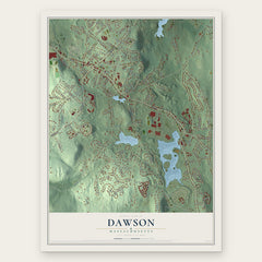

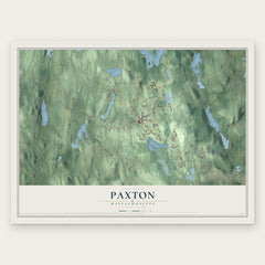
More maps nearby: Rutland, Worcester, Princeton, Boylston and Sterling.
The art of mapping a place
How This Map Was Made
Real places. Remarkable detail. Discover the layers that turn geographic data into a map of home.

The view from above
Aerial imagery reveals the character of the land: woodland, open fields, and the patterns of a place.

The shape of the land
Elevation data brings hills, valleys, and subtle changes in the landscape into view.

The details of home
Roads, waterways, and building footprints come together to make the map feel unmistakably local.

Geography becomes art
Considered color, shading, and typography bring the layers together in a map made for your wall.


Process illustrated with Mendon, Massachusetts. Aerial imagery: USDA NAIP. Terrain: USGS 3D Elevation Program. Map details and finished artwork: KNOWOL.
The Details
About This Print
Choose an archival matte print, or a black or white Ayous wood frame. The archival matte print is unframed.
Select your size and finish above to see the matching product image and price.
Materials & Craftsmanship
A contemporary map with the character of a classic atlas, printed on archival matte paper. Optional frames are made from Ayous wood.
Your printed map does not include the watermark shown in the full-map preview.
Shipping & Delivery
Free shipping within the United States. Every print is made to order in the USA.
Buying a gift? Add a note in your cart and we'll include it. We never put prices in the package.
Prints ship within 2 to 3 business days. Allow 7 to 10 days total from ordering for delivery. Timing may vary during holidays or periods of high order volume.
Read our shipping policy.
Returns and damaged prints
Each print is made to order. Change-of-mind refunds are not available after production.
If your print arrives damaged, misprinted or incorrect, contact support@knowol.com within 30 days of receiving it. Include your order number, photos and a description of the issue.
Read our full refund and replacement policy. For questions about your order, email support@knowol.com.