
Search for another town




Free U.S. delivery 7 to 10 days after you order
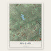
Holland, Pennsylvania Map Art
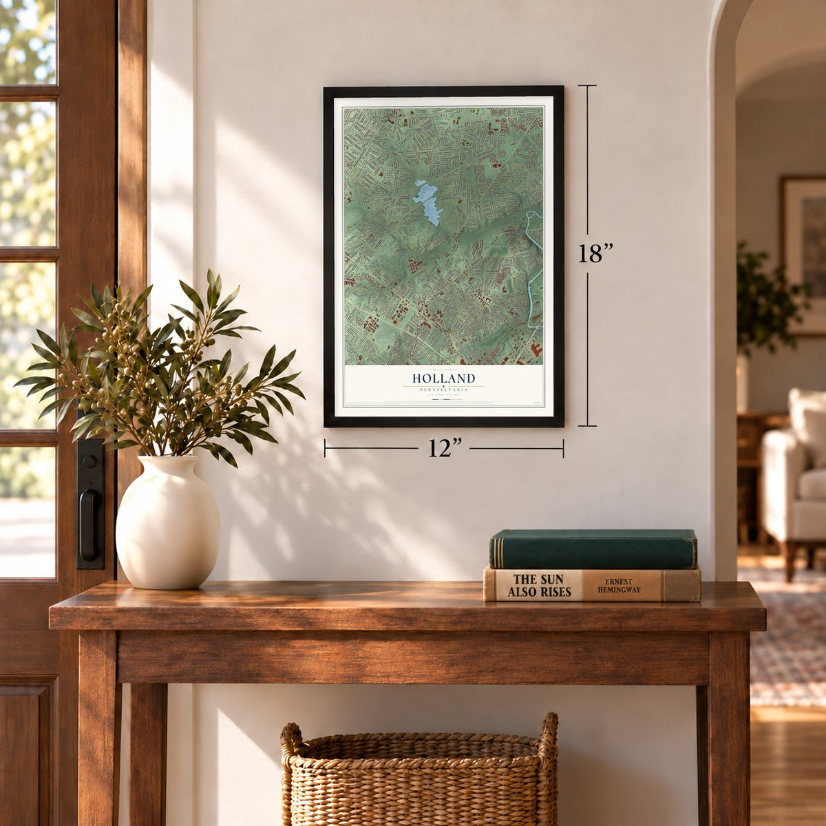
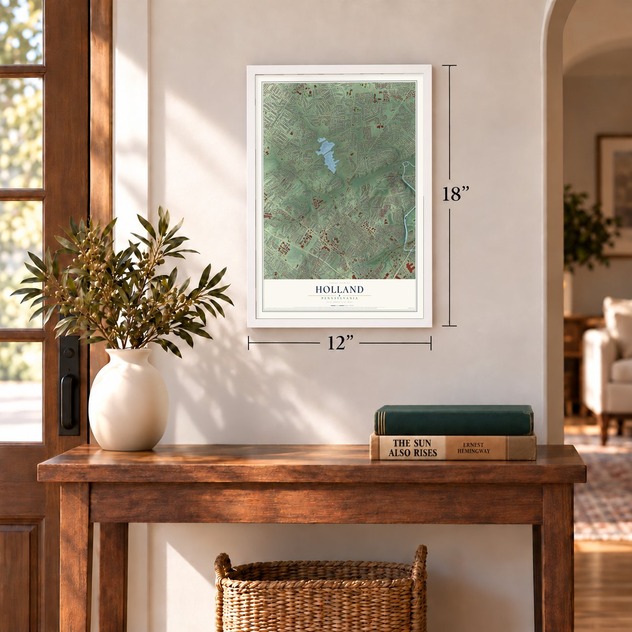
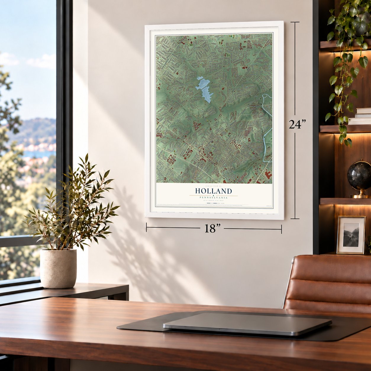
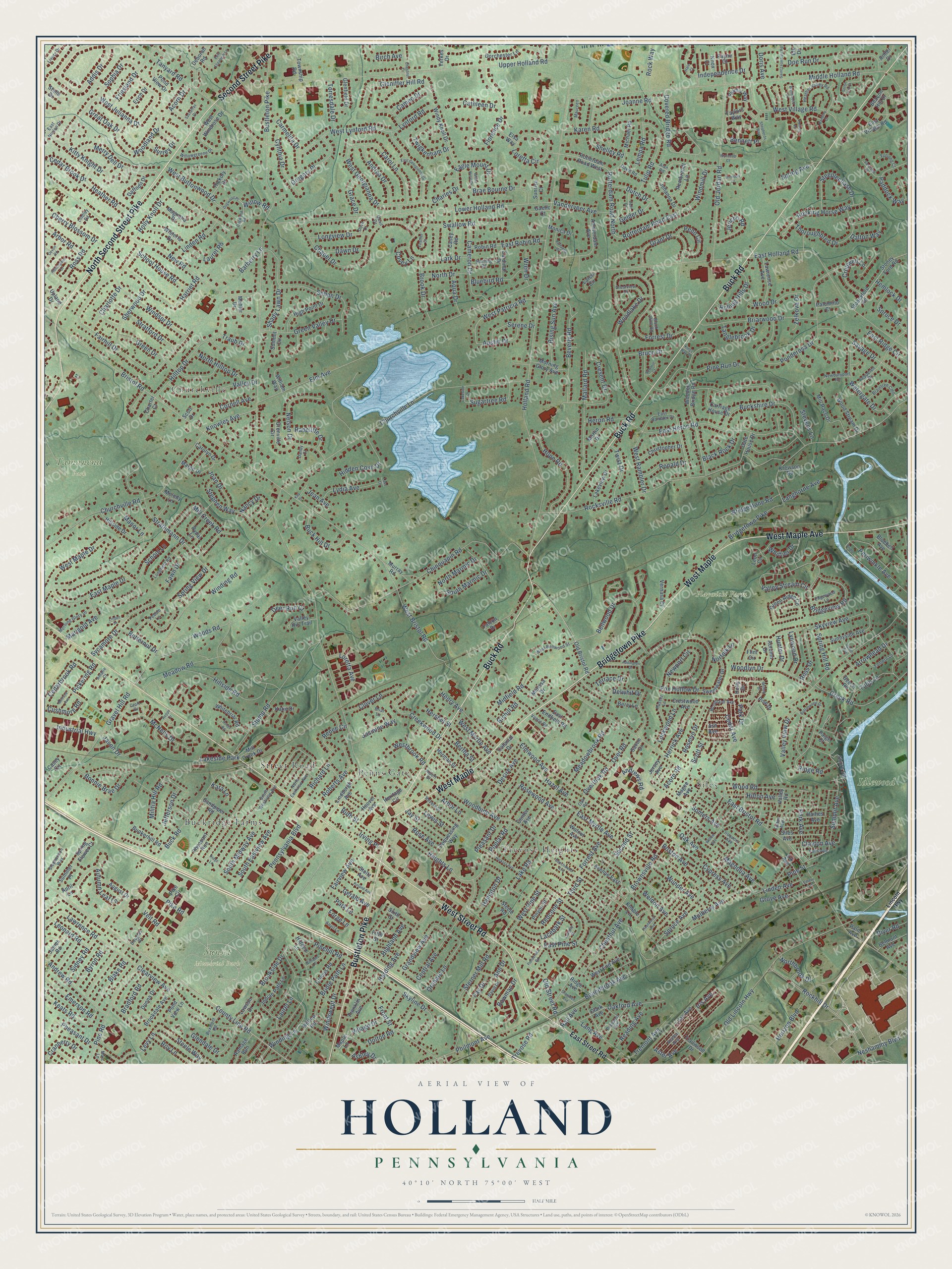
A new map of Holland, Pennsylvania, made in 2026 and printed to order on thick archival matte paper.
12" x 18" Archival Matte Print
A Map of Home. A Work of Art.
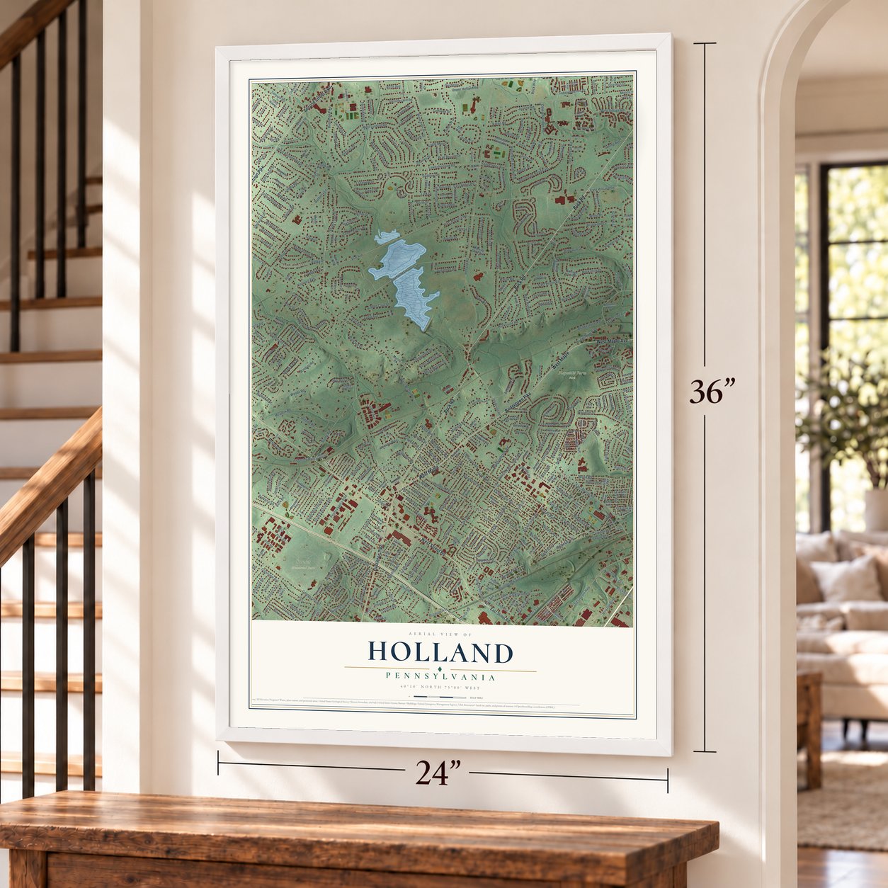
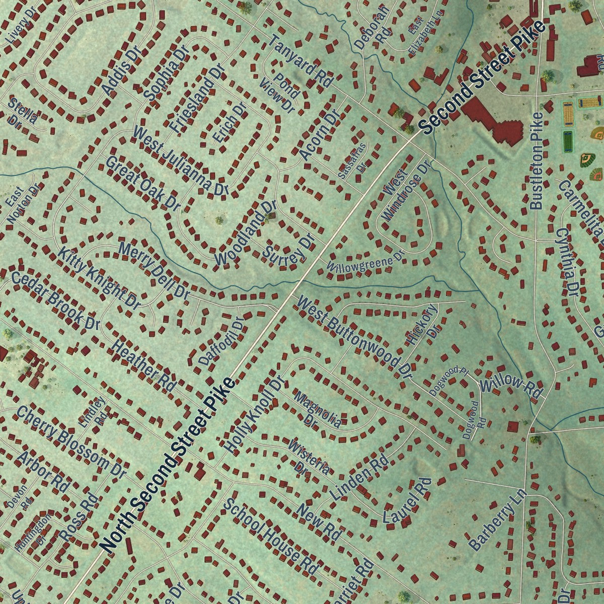
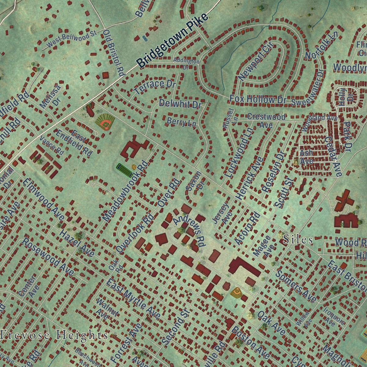
Explore Holland, Pennsylvania from a whole new perspective. Created using aerial imagery and detailed geographic data, this map captures Holland building by building, with labeled streets, familiar landmarks, and shaded topographical relief that highlights the natural contours of the landscape.
Combining modern data with the timeless character of a vintage atlas, this map is just as interesting up close as it is beautiful on the wall. Whether you grew up in Holland, spent memorable years there, or call it home today, this unique map is a great way to celebrate a place that means something to you. Zoom in on the preview to look for your street, and then order a print to put your memories on the wall.
Three ways to hang it
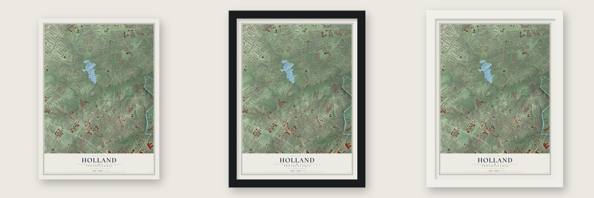
Unframed archival matte, a black wood frame or a white wood frame.
Up close
Geography Worth Displaying
This map was created using accurate cartographic data and authoritative geographic sources, including the U.S. Geological Survey and the Census Bureau. The map brings together terrain, waterways, roads, and building detail. The majority of the streets are labeled, houses are accurately depicted, and the topography is derived from government sources. Combining local data with carefully composed color and shading leads to this beautifully detailed Holland artwork for your wall.
Rather than simply showing street outlines, we’ve included as many of the street names as we could reasonably fit on the map while keeping their names legible. Zoom in on the high resolution preview to see exactly what’s on the map. We truly set out to create a statement piece for anyone who loves Holland. So whether it’s for you, or a gift for someone you love, we hope this map of Holland brings back fond memories.
Read the story behind this map: Detailed Map of Holland, Pennsylvania.
Find your street
Names on the Holland map
Every name below is printed on this map. Look for your street, your school, the park where you played, or the pond down the road.
Places and landmarks11
- Idlewood
- Playwicki Farm Park
- Sunset Memorial Park
- Tamanend Park
- Trevose Heights
- Churchville
- Street Road
- Siles
- Penns Gate
- Buckridge Farms
- Lakeside Park
Streets and roads583
- North Second Street Pike
- Buck Road
- West Street Road
- Bridgetown Pike
- West Maple
- Bustleton Pike
- Second Street Pike
- West Maple Avenue
- Hemlock Drive
- Trevose Road
- Rotterdam Road East
- Rotterdam Road North
- Chestnut Avenue
- Spruce Drive
- Acorn Road
- Covered Bridge Road
- Oak Avenue
- Old Street Road
- West Buttonwood Drive
- Watergate Drive
- Bristol Road
- Bellwood Drive
- Merry Dell Drive
- Linden Avenue
- Willow Road
- West Village Road
- Levy Lane
- Brownsville Road
- Holland Road
- East Holland Road
Show all 583 streets
- Gravel Hill Road
- East Bristol Road
- Old Lincoln Highway
- Elm Avenue
- Middle Holland Road
- Upper Holland Road
- County Line Road
- Rockhill Drive
- Lower Holland Road
- Churchville Lane
- Fairhill Drive
- Rocksville Road
- Brookside Drive
- Churchville Road
- Chinquapin Road
- New Road
- Ponderosa Drive
- Hazel Avenue
- Mallard Road
- Central Avenue
- Meadowbrook Road
- Manor Lane
- Elmwood Avenue
- Fox Hollow Drive
- Clearview Avenue
- East Heron Road
- East Myrtle Avenue
- Forrest Drive
- Rose Avenue
- Creek Road
- Old Jordan Road
- Skyview Avenue
- Tanyard Road
- Chapel Drive
- Mill Creek Road
- Woodbine Avenue
- Meadow Road
- Spruce Avenue
- Strathmann Drive
- Valley Stream Circle
- Schan Drive
- Philmont Avenue
- Sterner Mill Road
- Florence Drive
- Stump Road
- Rosewood Avenue
- Woodland Drive
- Second Street
- Hilltop Drive
- Gleniffer Hill Road
- Woods Road
- Green Drive
- West Bristol Road
- Arrowhead Drive
- Shelley Road
- Somers Avenue
- Buck Hill Drive
- Tremont Avenue
- Heather Road
- Woodlake Drive
- Winding Road
- Addis Drive
- Holly Knoll Drive
- Third Street
- Horizon Boulevard
- Magnolia Avenue
- Harding Avenue
- Heights Lane
- Sycamore Drive
- Pine Road
- East Pine Street
- Winding Lane
- Andrews Road
- Kitty Knight Drive
- Thoroughbred Drive
- Briarwood Drive
- Windsor Drive
- Spring View Drive
- Forrest Avenue
- Dolton Road
- Lark Drive
- Oakford Avenue
- Independence Drive
- Nelson Drive
- South Eastview Avenue
- Bonnie Brae Drive
- West Maple Drive
- School Lane
- Front Street
- Orchard Lane
- East Maple Drive
- Buckshire Drive
- Hillside Road
- Savage Drive
- West Georgianna Drive
- Eagle Mount Drive
- Pine Run Drive
- Hope Road
- Loretta Circle
- Newport Circle
- Aster Avenue
- Harriet Road
- West Lynford Road
- Bridgeview Road
- Rocking Horse Way
- Cedar Avenue
- Grant Drive
- Skyline Drive
- Carol Lane
- Cresent Drive
- Valley Drive
- Lake Road
- Beverly Road
- Hilton Avenue
- West Pine Street
- Grandview Avenue
- Poplar Road
- Green Valley Drive
- Bridle Path Lane
- Lawrence Road
- Lynford Road
- Cameron Drive
- Summit Avenue
- Iris Avenue
- Brae Bourne Drive
- Nancy Drive
- West Patricia Road
- Cypress Avenue
- Boundbrook Avenue
- Sherwood Drive
- Roberts Avenue
- Woodlyn Drive
- Periwinkle Avenue
- Wood Road
- Pennsylvania Boulevard
- Pike Road
- Tulip Road
- Steeplechase Drive
- Bennett Place
- Andrew Road
- Creekwood Drive
- Wunder Avenue
- Karen Road
- Stephen Way
- Hershel Street
- Boston Avenue
- Pleasant Drive
- Spring Avenue
- Stratford Drive
- West Myrtle Avenue
- Rising Sun Avenue
- Wood Drive
- Pheasant Drive
- Swallow Road
- McNelis Drive
- Henry Avenue
- Ruth Street
- Desire Avenue
- Cynthia Drive
- Twigkenham Drive
- Hidden Cove Drive
- Mulberry Avenue
- Hampton Drive
- Austin Drive
- Blake Road
- Joanne Road
- Lempa Road
- Militia Hill Road
- Park Avenue
- Neshaminy Boulevard
- Village Drive
- Paddock Way
- Cherry Blossom Drive
- Glendale Drive
- Cropwell Lane
- Gregory Place
- Ross Road
- Weldon Avenue
- Cedarbrook Road
- Brook Drive
- Dalton Way
- Windmill Drive
- Andrea Drive
- Dutch Drive
- Loretta Avenue
- Herrick Avenue
- West Julianna Drive
- Jericho Road
- Lydia Avenue
- Midfield Road
- Autumn Leaf Lane
- Carmelita Drive
- Bridgestone Road
- Fawn Drive
- Highland Avenue
- School House Road
- West Rambler Drive
- Pinehill Road
- Roy Lane
- Doe Run Drive
- Sophia Drive
- Friesland Drive
- Reading Avenue
- Scott Street
- Forge Lane
- Lacebark Street
- Rolling Hills Drive
- Vanderveer Avenue
- Longview Drive
- Twist Drive
- Emerson Road
- Clayton Avenue
- Jefferson Drive
- South Midway Avenue
- Deer Run Court
- Grove Avenue
- Clover Lane
- Knowles Avenue
- Marigold Avenue
- Steele Way
- Windswept Drive
- Barberry Lane
- Roselyn Drive
- Jason Drive
- North Hilltop Drive
- Bluebird Road
- Fairview Avenue
- Penn Circle
- Linden Road
- Industrial Highway
- Delwhit Drive
- Tulip Lane
- Redcone Street
- Cranberry Drive
- South Marmic Drive
- Rail Avenue
- Langhorne Avenue
- Serene Drive
- Ashley Drive
- Ross Drive
- Ridge Road
- River Road
- Northbrook Drive
- Keats Road
- Byron Road
- Charlotte Drive
- Westbrook Road
- Torresdale Drive
- Tanglebrook Drive
- Jay Street
- Doris Avenue
- Sidney Road
- North Marmic Drive
- Jasmine Way
- Lockwood Lane
- Valley View Drive
- Bruce Drive
- Richard Lane
- Cathleen Drive
- East Ridge Circle
- Cedar Brook Drive
- Bowman Drive
- Veit Road
- Radcliffe Drive
- Ronald Drive
- North Drive
- Lewis Street
- Shady Lawn Drive
- Black Rock Drive
- Bradford Road
- Bertha Street
- Rock Way
- Joan Drive
- Spring Hill Road
- Laurel Road
- Birch Avenue
- Park Drive
- Leonard Road
- Arbor Road
- Butternut Drive
- Cornell Avenue
- Grace Drive
- Lynwood Drive
- East Robin Road
- Gelder Drive
- Park Lane
- Heron Road
- Renee Circle
- Dawn Drive
- Cameo Drive
- Acorn Drive
- Sugartree Road
- Cushmore Road
- Whittier Drive
- Pickering Road
- Aqua Drive
- Lang Avenue
- Charles Drive
- Overlook Road
- Gerald Avenue
- Great Oak Drive
- Zelkova Drive
- Irving Place
- Arbor Lane
- Fay Drive
- Stevens Lane
- Covey Lane
- Terrace Drive
- Laurel Lane
- Surrey Drive
- Hunter Drive
- Traub Drive
- Wren Drive
- Pine Street
- Jean Avenue
- Norfolk Lane
- Ann Drive
- Over Road
- Richill Road
- Kara Lane
- East Street Road
- Rotterdam Road West
- Johanna Drive
- Ash Avenue
- Trailwood Drive
- Poquessing Way
- Wooden Bridge Road
- Stoneyford Road
- East Village Road
- Walnut Avenue
- Green Ridge Circle
- Center Avenue
- Indian Path Lane
- Charter Court
- Ridge Avenue
- Brookdale Avenue
- Donna Drive
- Windy Knoll Drive
- Stoney Ford Road
- Lindbergh Avenue
- Michael Road
- Old Bristol Road
- Grenville Circle
- High Point Drive
- Mill Race Drive
- Morning Glory Avenue
- Lilac Avenue
- Amsterdam Avenue
- Hillside Drive
- Magnolia Drive
- Pheasant Run
- Plumly Way
- Hilltop Road
- Falcon Drive
- West Windrose Drive
- Hoover Avenue
- Rydal Lane
- Lakeview Drive
- Sweetwater Drive
- Murray Road
- Siles Avenue
- Lawrence Avenue
- Colonial Drive
- Beacon Hill Drive
- Crestwood Avenue
- Wisteria Drive
- Haines Avenue
- Franklin Avenue
- Deborah Road
- Casey Road
- Christopher Drive
- Sixth Street
- Sunnyside Avenue
- Glenfield Drive
- Spring Flower Court
- Carriage House Drive
- Fifth Street
- Dorchester Lane
- Yerkes Drive
- Wood Stream Drive
- Taylors Way
- Bunkerhill Road
- Leon Circle
- Steele Road
- Herman Street
- Rembrandt Lane
- Valley Hill Trail
- William Way
- Township Road
- Avenue East
- Pinyon Street
- Crocus Road
- Bluebell Avenue
- Katie Drive
- Carolyn Drive
- West End Avenue
- Ramage Run
- James Road
- Sandpiper Road
- Hidden Lane
- Belmont Avenue
- August Drive
- Cardinal Drive
- Whitebriar Road
- Martin Drive
- Pond View Drive
- Sunrise Court
- Lawson Drive
- East Endfield Road
- Valley Road
- Robin Road
- Marge Drive
- Stoltz Avenue
- Summer Place
- Hickory Drive
- Daffodil Drive
- Vernasa Drive
- Clark Avenue
- Mill Creek Drive
- Autumn Drive
- Elk Avenue
- Shore Road
- Upland Drive
- Palomino Court
- Monica Drive
- Magee Avenue
- Jersey Avenue
- Krewson Road
- Heritage Circle
- Gate House Drive
- Antler Drive
- Elsa Way
- Larch Circle
- Casey Circle
- Pike Circle
- Stella Drive
- Berry Lane
- Saxon Drive
- Summit Circle
- Erich Drive
- Melody Lane
- Pine Drive
- Beech Road
- Knable Lane
- Melissa Drive
- Pond View Lane
- Knox Court
- Gaelic Court
- Palm Avenue
- Paige Court
- Payne Court
- April Lane
- Maple Lane
- Mehler Drive
- Elk Drive
- Scott Drive
- Holly Drive
- Flint Circle
- Lincoln Highway
- Croft Drive
- South Westview Avenue
- East Rambler Drive
- Heather Valley Road
- Prospect Avenue
- Pepperell Drive
- Stephenson Way
- Woodland Avenue
- Edgewood Lane
- Azalea Avenue
- North Eastview Avenue
- West Bellwood Street
- Longfield Road
- Revere Street
- Morning Glory Drive
- Anvil Lane
- Braintree Cmn
- Willowgreene Drive
- Buxmont Road
- Oak Road
- Lantern Lane
- Russet Lane
- Starling Road
- Falls Avenue
- Crestview Drive
- Briar Lane
- Black Pine Road
- Newburyport Road
- David Road
- Albert Street
- East Norton Drive
- Livery Drive
- Furlong Court
- Lindley Road
- Vance Road
- Fulton Avenue
- David Drive
- Quail Drive
- Marc Lane
- Maureen
- Iroquois Avenue
- Amalie Court
- Douglas Drive
- Pebble Lane
- Alan Road
- Danby Court
- Dove Court
- Willow Drive
- Dogwood Place
- Buttonwood Drive
- East Georgianna Drive
- Bridle Drive
- Willow Avenue
- Hickory Avenue
- Saint Leonards Road
- Dogwood Road
- Fleetwood Avenue
- Loblolly Street
- Beechwood Avenue
- East Elizabeth Lane
- Addington Drive
- Shepherds Way
- Huntingdon Drive
- Chestnut Drive
- Roland Avenue
- Raffaella Drive
- Brendan Court
- Devon Road
- Dover Road
- Banbury Court
- Williams Lane
- Saratoga Court
- Kings Way Drive
- Delft Drive
- White Hurst Drive
- Ponderosa Road
- Seton Hill Court
- Brentwood Place
- Melrose Avenue
- Potters Place
- Heppe Drive
- Wyncoop Court
- Sawmill Court
- Sassafras Drive
- Kay Drive
- Feather Court
- Uphill Avenue
- Growden Avenue
- Emery Lane
- Lakeside Drive
- Linden Drive
- Hale Court
- Ridge Lane
- Lake Drive
Names are listed as they appear on the printed map. Zoom into the product photos to find them.
The art of mapping a place
How This Map Was Made
Real places. Remarkable detail. Discover the layers that turn geographic data into a map of home.

The view from above
Aerial imagery reveals the character of the land: woodland, open fields, and the patterns of a place.

The shape of the land
Elevation data brings hills, valleys, and subtle changes in the landscape into view.

The details of home
Roads, waterways, and building footprints come together to make the map feel unmistakably local.

Geography becomes art
Considered color, shading, and typography bring the layers together in a map made for your wall.


Process illustrated with Mendon, Massachusetts. Aerial imagery: USDA NAIP. Terrain: USGS 3D Elevation Program. Map details and finished artwork: KNOWOL.
The Details
About This Print
Choose an archival matte print, or a black or white Ayous wood frame. The archival matte print is unframed.
Select your size and finish above to see the matching product image and price.
Materials & Craftsmanship
A contemporary map with the character of a classic atlas, printed on archival matte paper. Optional frames are made from Ayous wood.
Your printed map does not include the watermark shown in the full-map preview.
Shipping & Delivery
Free shipping within the United States. Every print is made to order in the USA.
Buying a gift? Add a note in your cart and we'll include it. We never put prices in the package.
Prints ship within 2 to 3 business days. Allow 7 to 10 days total from ordering for delivery. Timing may vary during holidays or periods of high order volume.
Read our shipping policy.
Returns and damaged prints
Each print is made to order. Change-of-mind refunds are not available after production.
If your print arrives damaged, misprinted or incorrect, contact support@knowol.com within 30 days of receiving it. Include your order number, photos and a description of the issue.
Read our full refund and replacement policy. For questions about your order, email support@knowol.com.
Find your town
Looking for another city?
Find a map of home in our Pennsylvania collection, or any town in the country.
Nearby
Maps of towns near Holland
Know someone from one of these towns? Their map makes a great gift.
 Lower Southampton
, Pennsylvania
From $39.99See the map
 Feasterville
, Pennsylvania
From $39.99See the map
 Churchville
, Pennsylvania
From $39.99See the map
More maps nearby: Trevose, Upper Southampton, Village Shires, Northampton and Parkland.