
Search for another town





Free U.S. delivery 7 to 10 days after you order
Homer Glen, Illinois Map Art
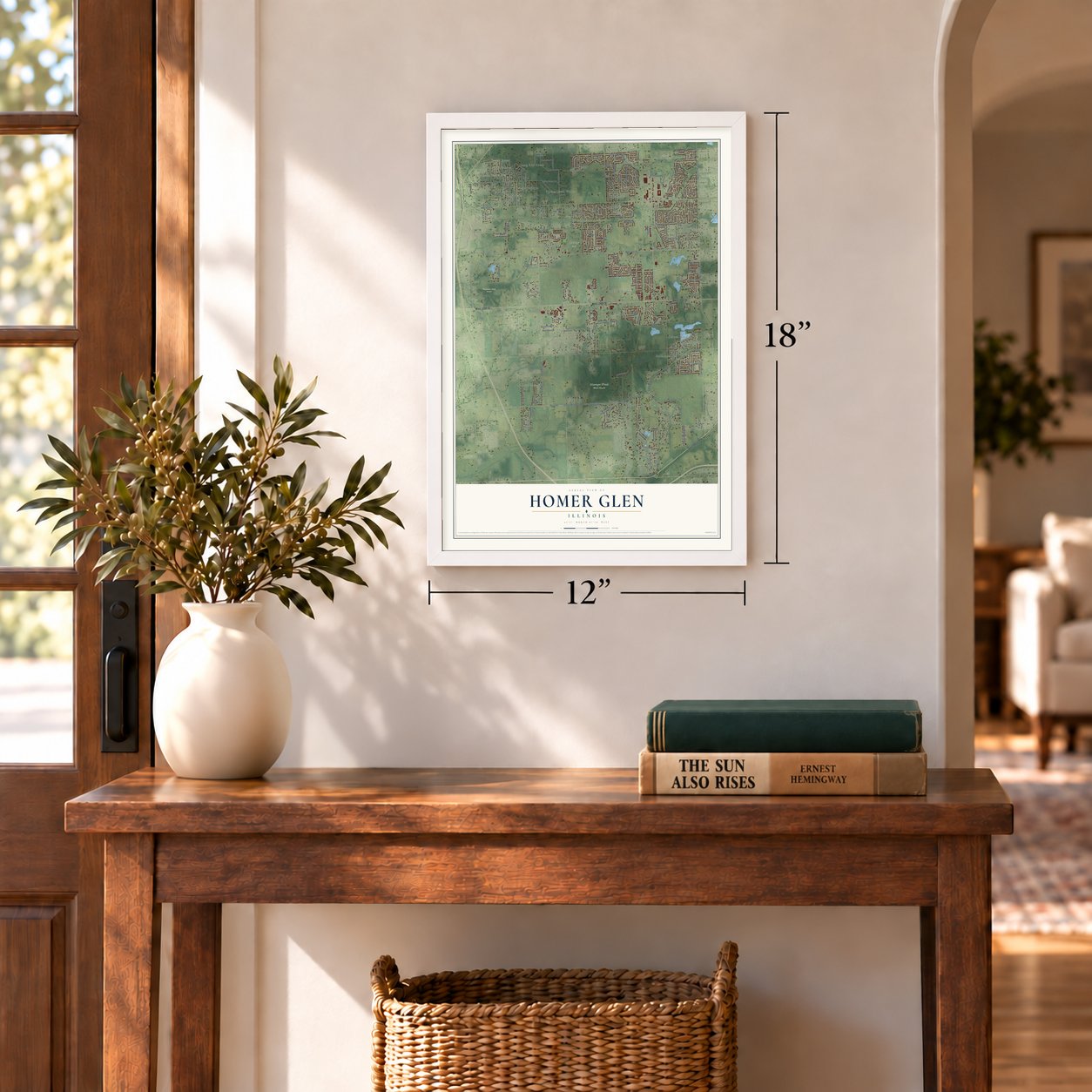
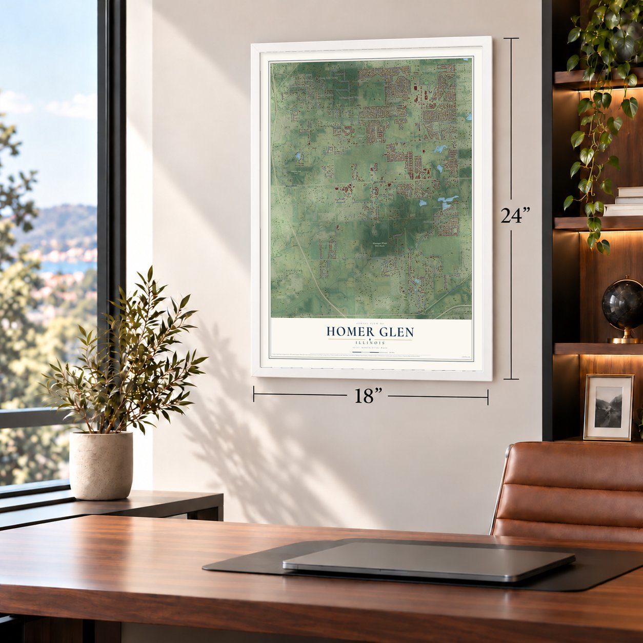
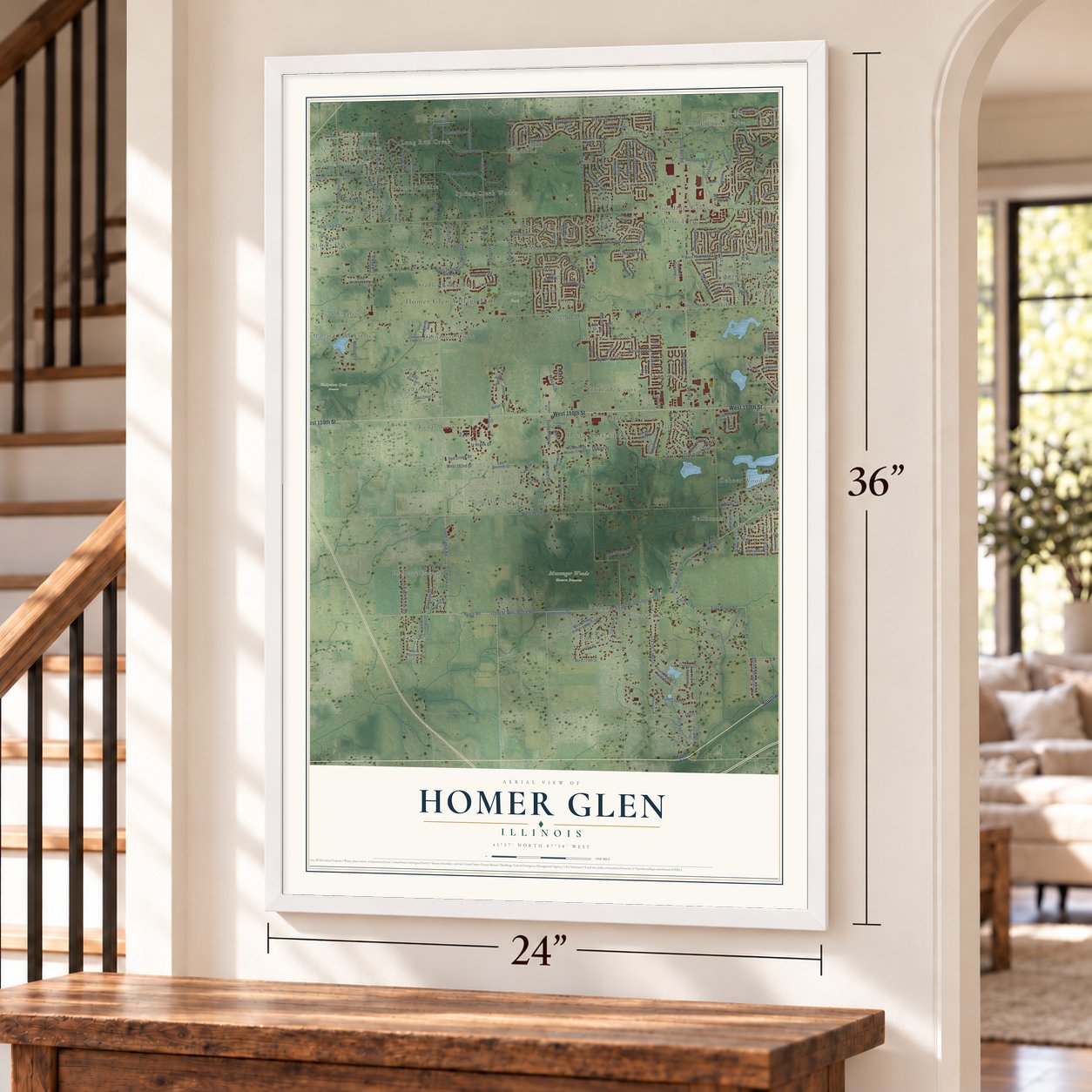
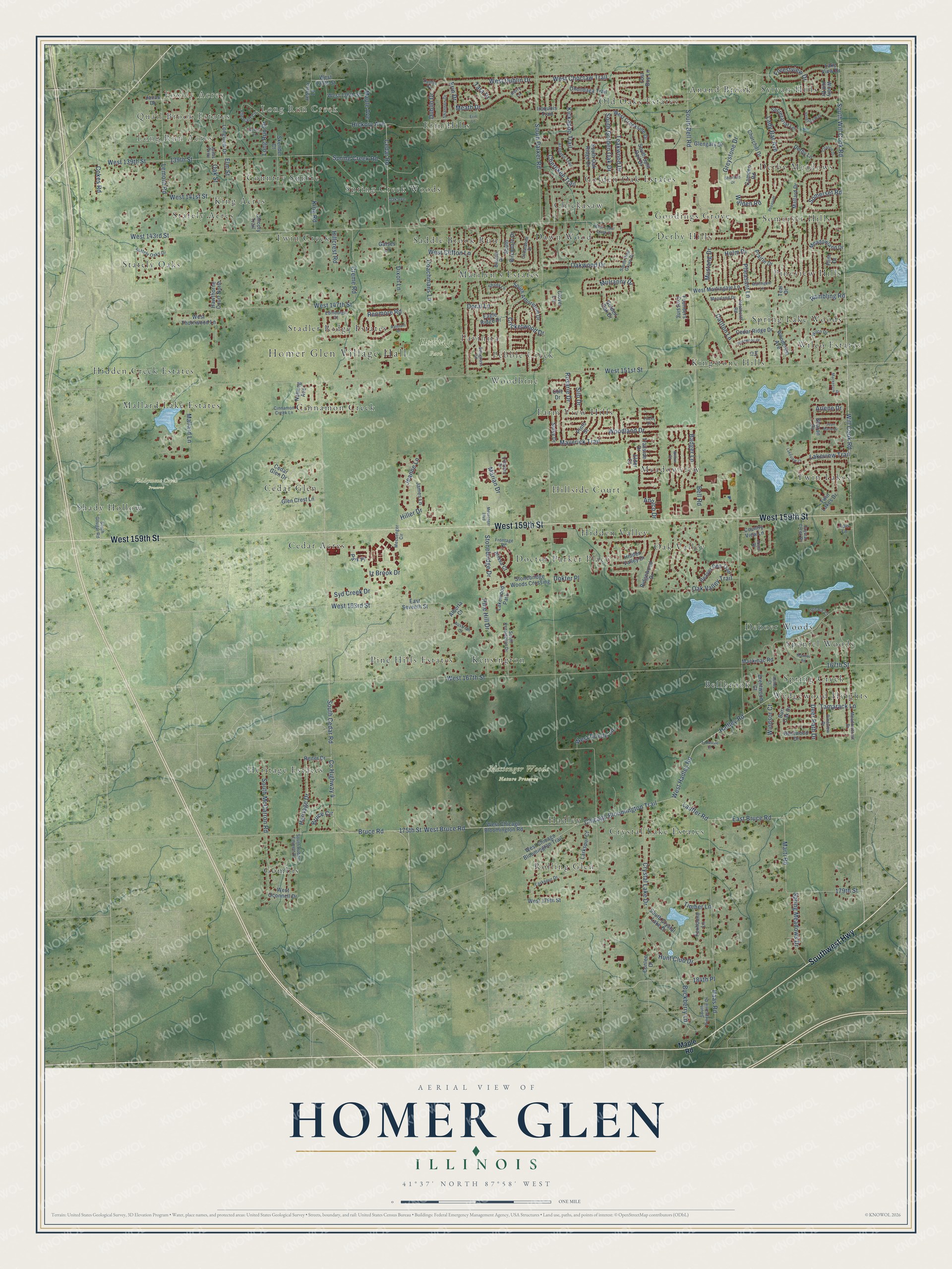
A new map of Homer Glen, Illinois, made in 2026 and printed to order on thick archival matte paper.
12" x 18" Archival Matte Print
A Map of Home. A Work of Art.
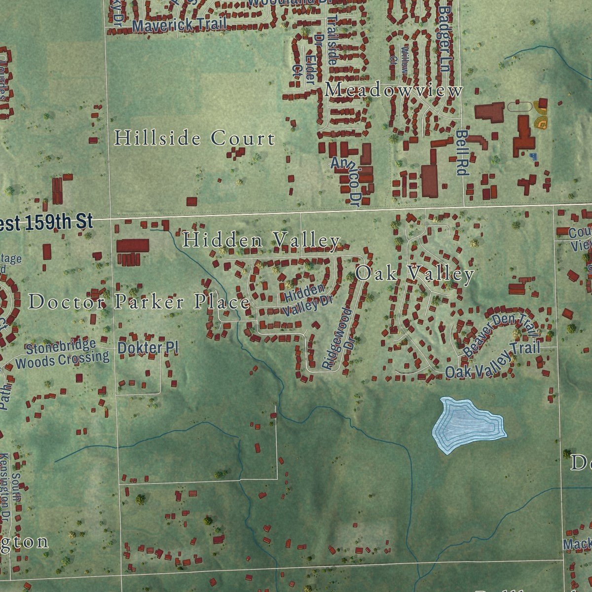
Explore Homer Glen, Illinois from a whole new perspective. Created using aerial imagery and detailed geographic data, this map captures Homer Glen building by building, with labeled streets, familiar landmarks, and shaded topographical relief that highlights the natural contours of the landscape.
Combining modern data with the timeless character of a vintage atlas, this map is just as interesting up close as it is beautiful on the wall. Whether you grew up in Homer Glen, spent memorable years there, or call it home today, this unique map is a great way to celebrate a place that means something to you. Zoom in on the preview to look for your street, and then order a print to put your memories on the wall.
Three ways to hang it
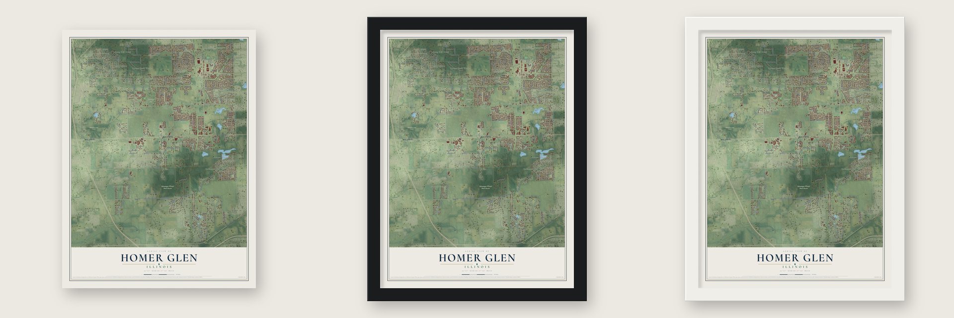
Unframed archival matte, a black wood frame or a white wood frame.
Up close
Geography Worth Displaying
This map was created using accurate cartographic data and authoritative geographic sources, including the U.S. Geological Survey and the Census Bureau. The map brings together terrain, waterways, roads, and building detail. The majority of the streets are labeled, houses are accurately depicted, and the topography is derived from government sources. Combining local data with carefully composed color and shading leads to this beautifully detailed Homer Glen artwork for your wall.
Rather than simply showing street outlines, we’ve included as many of the street names as we could reasonably fit on the map while keeping their names legible. Zoom in on the high resolution preview to see exactly what’s on the map. We truly set out to create a statement piece for anyone who loves Homer Glen. So whether it’s for you, or a gift for someone you love, we hope this map of Homer Glen brings back fond memories.
Read the story behind this map of Homer Glen, Illinois from 2026.

About Homer Glen, Illinois
Homer Glen is an Illinois village located mainly in Will County, with a small section extending into Cook County. Once called Goodings Grove, the community incorporated in 2001 and had 24,543 residents at the 2020 census.
- Village BeginningsHomer Glen incorporated on April 17, 2001, after the area had been known as Goodings Grove.
- Timber and FarmingIn the early 1800s, settlers cleared wooded land for farms and used the timber to construct houses, barns, and fences.
- Township LibraryEstablished in 1982, the Homer Township Public Library serves the entire township.
- Local SchoolsDistrict 33C serves most of Homer Glen, District 92 serves the remainder, and District 205 operates the public high school.
Find your street
Names on the Homer Glen map
Every name below is printed on this map. Look for your street, your school, the park where you played, or the pond down the road.
Places and landmarks60
- Homer Glen Village Hall
- Foxley Acres
- Long Run Acres
- Quail Brook Estates
- Long Run Creek
- Fiddyment Creek Preserve
- Heritage Park
- Messenger Woods Nature Preserve
- Anand Brook
- Bellbrook
- Cedar Acres
- Cedar Glen
Show all 60 places
- Chickasaw
- Cinnamon Creek
- Country Squire
- Crystal Lake Estates
- Dawn Wood
- Deboer Woods
- Derby Hills
- Derby Meadows
- Doctor Parker Place
- Erin Hills
- Farm View Hills
- Golden Oak Estates
- Gombis
- Goodings Grove
- Hadley
- Heritage Estates
- Hidden Creek Estates
- Hidden Valley
- Hillside Court
- Kensington
- King Acres
- Kingstone Hills
- Mallard Lake Estates
- Marilyn's Estates
- Meadowview
- Oak Valley
- Old Oaks Estates
- Pavinita
- Pebble Creek
- Pine Hills Estates
- Pineview Hills
- Rolling Glen
- Saddle Brook Run
- Shady Hollow
- Somerset Hills
- Spaniel Woods
- Spring Creek
- Spring Creek Woods
- Spring Lake Woods
- Stadler Ridge Estates
- Stately Acres
- Stately Oaks
- Sylvan Hills
- Twin Creek
- Twin Lakes
- Wedgewood Heights
- Wilco Estates
- Woodbine
Streets and roads225
- Southwest Highway
- West 159th Street
- Will Cook Road
- South Will Cook Road
- Hadley Road
- Lauffer Road
- Bruce Road
- East Bruce Road
- County Highway 4
- Mallard Lane
- Marti Road
- 179th Street
- Buckberry Lane
- West Bruce Road
- West 167th Street
- West Hadley Road
- West Dublin Drive
- 167th Street
- West 143rd Street
- South Bell Road
- Cedar Road
- Doral Lane
- Hiller Drive
- South Parker Road
- West 151st Street
- South Cedar Road
- Bell Road
- Lemont Road
- West 147th Street
- West 139th Street
Show all 225 streets
- 175th Street
- Haas Road
- Crystal Lake Drive
- South Golden Oak Drive
- Pheasant Lane
- Chicago Bloomington Trail
- Creme Road
- South McCarron Road
- Oak Valley Trail
- Hickory Avenue
- Spring Creek Road
- West Choctaw Trail
- Hunt Club Drive
- Kickapoo Trail
- Woodland Drive
- Dixon Lane
- King Road
- West 163rd Street
- Syd Creek Drive
- Pine Hill Drive
- Meath Drive
- Forestview Drive
- Oakwood Drive
- Greystone Drive
- 139th Street
- Rambling Road
- Heritage Drive
- Oak Street
- Elm Street
- Spring Meadows Drive
- Mustang Drive
- Rosarie Drive
- Lakeview Trail
- Carlton Lane
- Cricketwood Drive
- Maverick Trail
- Cherokee Trail
- Stonebridge Drive
- Lady Bar Avenue
- Teakwood Drive
- Jeanne Lane
- West 141st Street
- Erin Drive
- Deer Path Drive
- Coachmans Lane
- Badger Lane
- Renmore Road
- Dublin Drive
- West Doede Lane
- Somerset Road
- Marian Drive
- Maple Avenue
- West Clifton Lane
- Mulranny Drive
- Hillcrest Road
- Tamarack Lane
- Walden Road
- Windsor Court
- Long Run Drive
- Cokes Road
- Bruce Circle
- 184th Place
- Silo Drive
- Iz Brook Drive
- Annico Drive
- Timber Lane
- Tara Drive
- Dokter Place
- Arlene Drive
- Holm Drive
- Maple Road
- Sulky Drive
- Ridgewood Drive
- Teal Drive
- West Chicago Bloomington Road
- South Crystal Lake Drive
- West Chicago Bloomington Trail
- South Arboretum Drive
- Mackinac Road
- Mallard Drive
- Derby Lane
- Eagle Ridge Drive
- Twin Lakes Drive
- West Creekside Drive
- Meadowland Drive
- West Martingale Lane
- Lake View Drive
- Woodcrest Avenue
- East Seventh Street
- Trailside Drive
- Chicory Trail
- Stonebridge Woods Crossing
- Churchill Drive
- South Oak Ridge Drive
- Longview Drive
- Cedar Glen Drive
- Secretariat Lane
- Founders Crossing
- South Birchdale Drive
- South Split Rail Drive
- James Lane
- Cedar Ridge Drive
- Beaver Den Trail
- Hidden Valley Drive
- West Thornwood Lane
- Glengary Drive
- Onondaga Trail
- Burr Oak Drive
- Camden Road
- West 136th Street
- Golden Oak Drive
- West 179th Street
- Larkspur Court
- Glen Crest Lane
- Foxhound Lane
- Jessica Lane
- Pinto Street
- Alberta Court
- Prairie Drive
- Brentwood Court
- Country View Lane
- Iroquois Trail
- Clover Lane
- Bentwood Drive
- Lost Boy Lane
- West Oconnell Drive
- Hawthorne Court North
- Flint Drive
- Lakewood Path
- Nutmeg Avenue
- Park Place
- Reiter Drive
- Sharon Drive
- Conlee Drive
- Wooly Hill Drive
- West 135th Street
- Alissa Court
- Skender Court
- Gatses Lane
- Colt Drive
- Elder Court
- Janas Drive
- Lois Lane
- Wilco Drive
- Heathcliff Road
- Janas Parkway
- Messenger Circle
- South Robert Emmett Drive
- Cinnamon Creek Lane
- Meadowcrest Drive
- Larkspur Drive
- South Pineprairie Drive
- Pineview Drive
- South Kensington Drive
- South Pine Grove Drive
- South Gougar Road
- Pheasant Circle
- Lourdes Drive
- Frontage Road
- Boulder Drive
- Shannon Drive
- Cedarbend Drive
- Arapaho Trail
- Stately Oaks Drive
- Moorland Drive
- Shady Lane
- Crystal Creek Drive
- Sawgrass Lane
- Kerry Lane
- Edinburgh Court
- Josef Drive
- Austrian Court
- Ignace Court
- Oak Avenue
- Dublin Court
- Ivy Court
- Martingale Lane
- Venetian Way
- Manitou Road
- Rathfarn Drive
- Sheffield Drive
- Citation Drive
- Mackenzie Drive
- Rosewood Drive
- Lakeview Court
- Erin Lane
- Joan Marie Drive
- Pheasant
- West Cedar Creek Court
- Messenger Boulevard
- Ashley Court
- Taelevale Court
- Willow Court
- Acorn Lane
- Finch Court
Names are listed as they appear on the printed map. Zoom into the product photos to find them.
The art of mapping a place
How This Map Was Made
Real places. Remarkable detail. Discover the layers that turn geographic data into a map of home.

The view from above
Aerial imagery reveals the character of the land: woodland, open fields, and the patterns of a place.

The shape of the land
Elevation data brings hills, valleys, and subtle changes in the landscape into view.

The details of home
Roads, waterways, and building footprints come together to make the map feel unmistakably local.

Geography becomes art
Considered color, shading, and typography bring the layers together in a map made for your wall.


Process illustrated with Mendon, Massachusetts. Aerial imagery: USDA NAIP. Terrain: USGS 3D Elevation Program. Map details and finished artwork: KNOWOL.
The Details
About This Print
Choose an archival matte print, or a black or white Ayous wood frame. The archival matte print is unframed.
Select your size and finish above to see the matching product image and price.
Materials & Craftsmanship
A contemporary map with the character of a classic atlas, printed on archival matte paper. Optional frames are made from Ayous wood.
Your printed map does not include the watermark shown in the full-map preview.
Shipping & Delivery
Free shipping within the United States. Every print is made to order in the USA.
Buying a gift? Add a note in your cart and we'll include it. We never put prices in the package.
Prints ship within 2 to 3 business days. Allow 7 to 10 days total from ordering for delivery. Timing may vary during holidays or periods of high order volume.
Read our shipping policy.
Returns and damaged prints
Each print is made to order. Change-of-mind refunds are not available after production.
If your print arrives damaged, misprinted or incorrect, contact support@knowol.com within 30 days of receiving it. Include your order number, photos and a description of the issue.
Read our full refund and replacement policy. For questions about your order, email support@knowol.com.
Find your town
Looking for another city?
Find a map of home in our Illinois collection, or any town in the country.
Nearby
Maps of towns near Homer Glen
Know someone from one of these towns? Their map makes a great gift.
 Lockport Heights
, Illinois
From $39.99See the map
 Lockport
, Illinois
From $39.99See the map
 Marley
, Illinois
From $39.99See the map
More maps nearby: Bonnie Brae, Lemont, Orland Park, Orland Hills and Mokena.