
Search for another town





Free U.S. delivery 7 to 10 days after you order
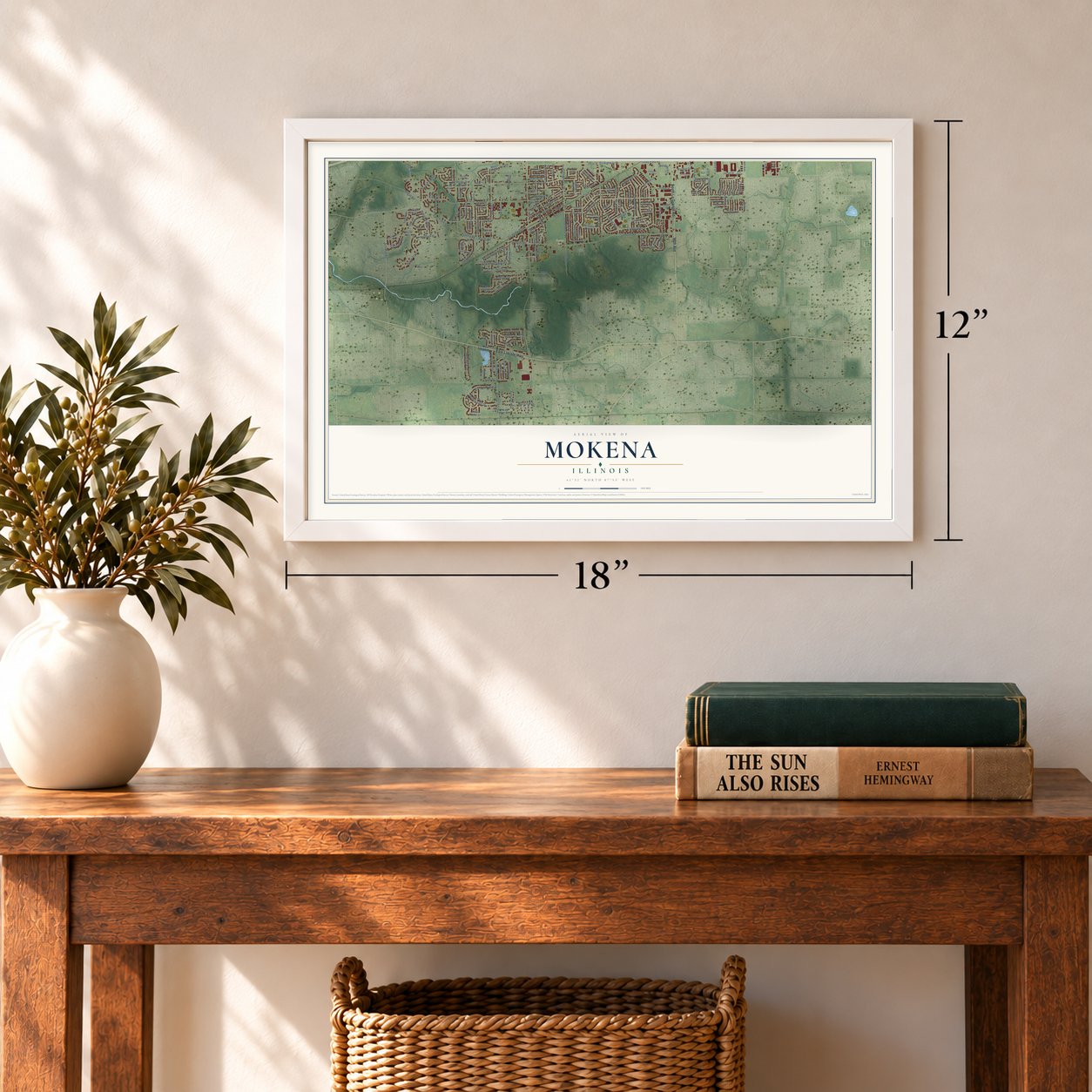
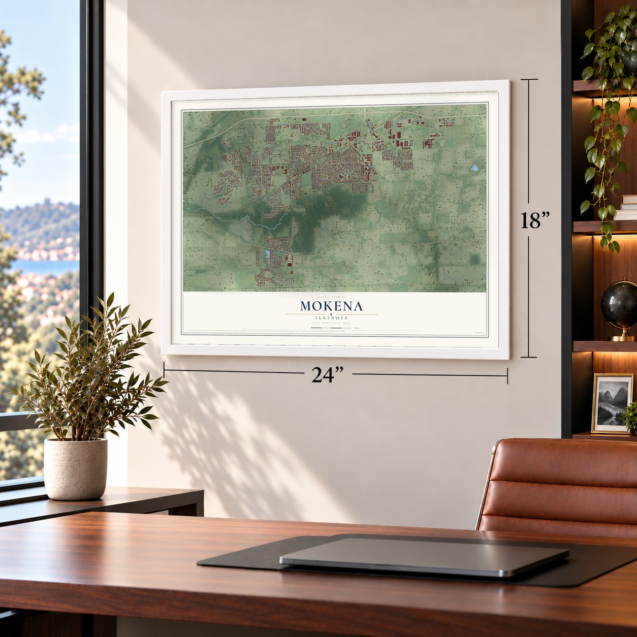
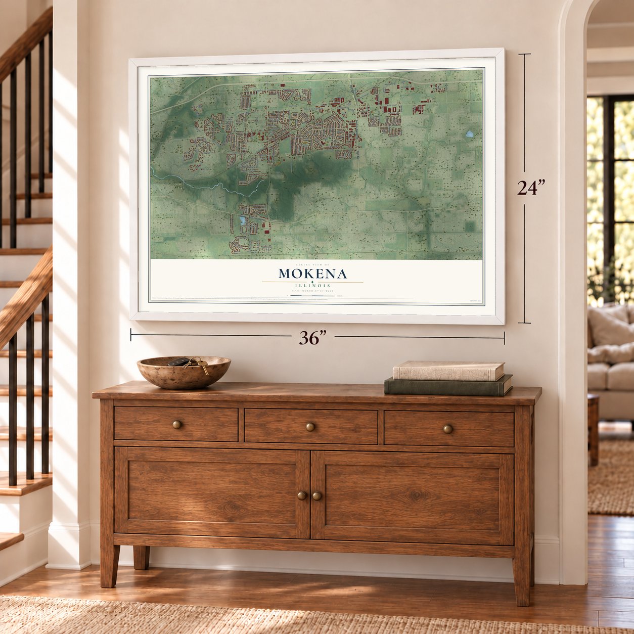
Mokena, Illinois Map Art
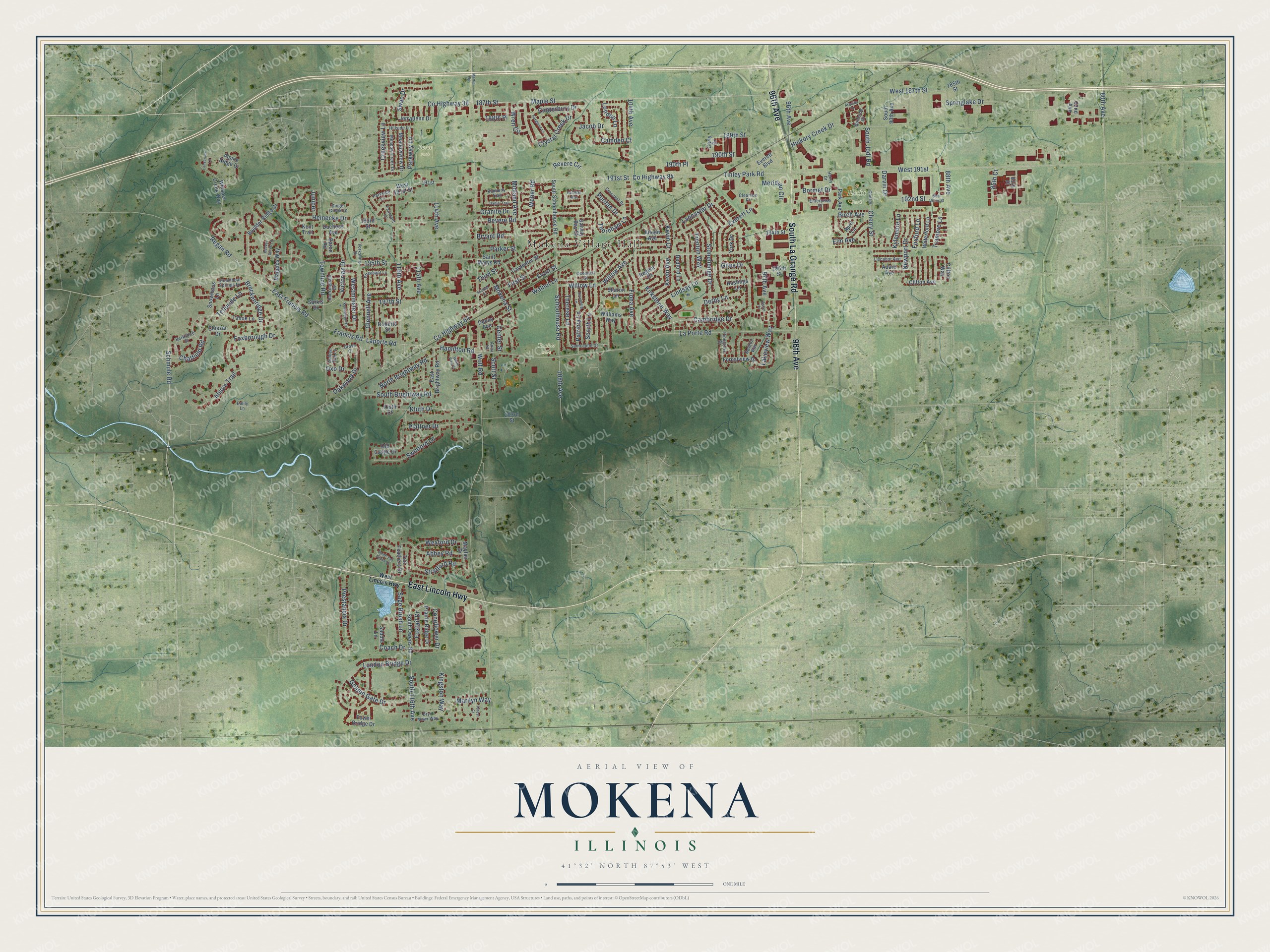
A new map of Mokena, Illinois, made in 2026 and printed to order on thick archival matte paper.
12" x 18" Archival Matte Print
A Map of Home. A Work of Art.
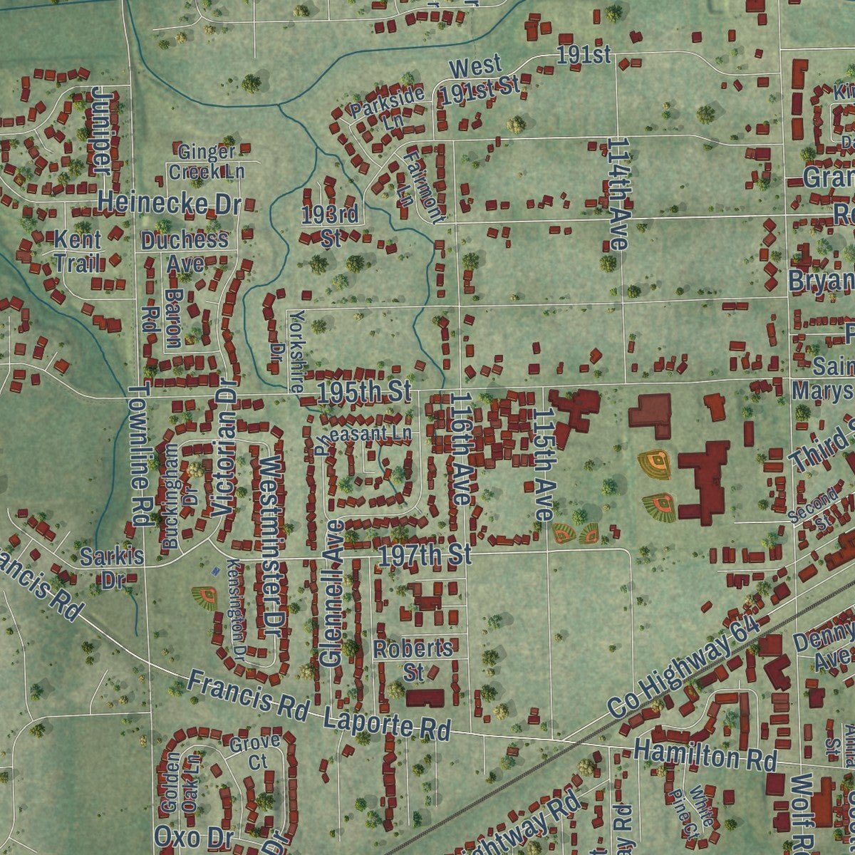
Explore Mokena, Illinois from a whole new perspective. Created using aerial imagery and detailed geographic data, this map captures Mokena building by building, with labeled streets, familiar landmarks, and shaded topographical relief that highlights the natural contours of the landscape.
Combining modern data with the timeless character of a vintage atlas, this map is just as interesting up close as it is beautiful on the wall. Whether you grew up in Mokena, spent memorable years there, or call it home today, this unique map is a great way to celebrate a place that means something to you. Zoom in on the preview to look for your street, and then order a print to put your memories on the wall.
Three ways to hang it
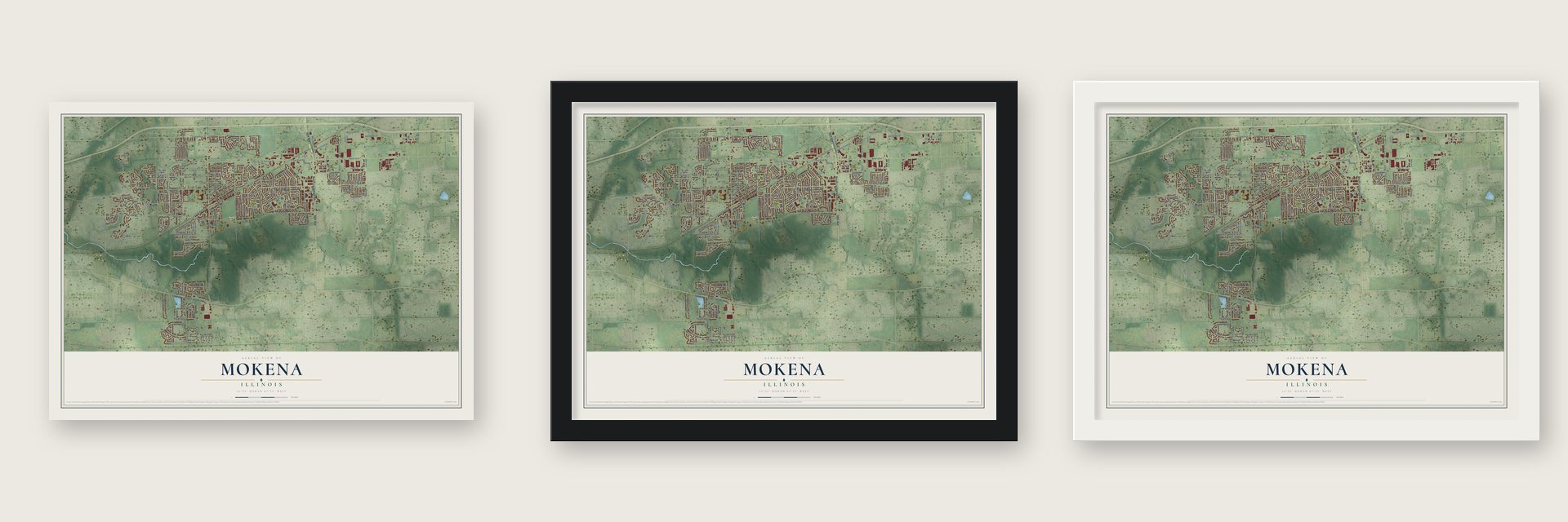
Unframed archival matte, a black wood frame or a white wood frame.
Up close
Geography Worth Displaying
This map was created using accurate cartographic data and authoritative geographic sources, including the U.S. Geological Survey and the Census Bureau. The map brings together terrain, waterways, roads, and building detail. The majority of the streets are labeled, houses are accurately depicted, and the topography is derived from government sources. Combining local data with carefully composed color and shading leads to this beautifully detailed Mokena artwork for your wall.
Rather than simply showing street outlines, we’ve included as many of the street names as we could reasonably fit on the map while keeping their names legible. Zoom in on the high resolution preview to see exactly what’s on the map. We truly set out to create a statement piece for anyone who loves Mokena. So whether it’s for you, or a gift for someone you love, we hope this map of Mokena brings back fond memories.
Read the story behind this map of Mokena, Illinois from 2026.

About Mokena, Illinois
Mokena is a village of 19,887 people in Will County, a southwest suburb of Chicago. Allen Denny laid out the first village in 1852, about ten miles east of Joliet. He platted it on the Chicago & Rock Island Railroad while workers were still finishing the line.
The rail line still cuts across the middle of town from northeast to southwest. Metra trains on the Rock Island District stop at two Mokena stations, Hickory Creek and Front Street, and carry riders to LaSalle Street Station in downtown Chicago.
- Named for the mud turtleThe name Mokena, said moh-KEE-nuh, seems to come from a Native American word for the mud turtle. No record says which language it came from. The likely sources are Potawatomi, which calls the snapping turtle mkenak, and its close relative Anishinaabemowin, which calls it mikinaak. People spoke both languages on this land long before the village was laid out.
- Shoemakers and saloons in 1878The 1878 county history listed the people who made a living in the village. A. and M. Welchlin made shoes, Geo. Werner and John Zohn ran saloons, M. Weber worked as a mason and N. Younger repaired watches. Fredrich Wiggart was a gardener, and Clara Williams taught school.
- A singer and a racerThe singer and writer Exene Cervenka grew up in Mokena. The actress and singer Karla DeVito, the racing driver Bob Strait and the Major League player Dean Anna were all born here. Former big league player Ron Kittle makes his home in the village.
Find your street
Names on the Mokena map
Every name below is printed on this map. Look for your street, your school, the park where you played, or the pond down the road.
Places and landmarks4
- Mokena Village Hall
- Buske Park
- Hecht Park
- Yunker Park
Streets and roads221
- 96th Avenue
- South La Grange Road
- East Lincoln Highway
- County Highway 38
- West 191st
- Revere Circle
- Maple Street
- 197th Street
- Revere Road
- Telluride Lane
- Tinley Park Road
- Schoolhouse Road
- Victorian Drive
- Westminster Drive
- Kingston Way
- 195th Street
- 191st Street
- Wolf Road
- La Porte Road
- Willow Lane
- Townline Road
- County Highway 84
- East Francis Road
- Francis Road
- Laporte Road
- 116th Avenue
- 187th Street
- Everett Lane
- West 187th Street
- 88th Avenue
Show all 221 streets
- 104th Avenue
- Front Street
- Cambridge Drive
- London Bridge Drive
- Kirkstone Way
- Foxborough Drive
- South 116th Avenue
- 192nd Street
- Mokena Street
- Stonehenge Drive
- First Street
- Hickory Creek Drive
- Springlake Drive
- Midland Avenue
- Lancaster Drive
- Cherry Street
- Scarth Lane
- Glennell Avenue
- Lindsay Lane
- Crystal Creek Drive
- Schmule Road
- Third Street
- Kevin Avenue
- Willow Avenue
- 114th Avenue
- Fiona Avenue
- Swinford Lane
- Thornham Lane
- Breckenridge Drive
- Plattner Drive
- Bryant Road
- Prestancia Drive
- Abbey Road
- Patricia Lane
- Golden Gate Drive
- Creekview Lane
- Kluth Drive
- South Brightway Road
- Heinecke Drive
- Jacob Drive
- 189th Street
- Alison Trail
- 97th Avenue
- County Highway 64
- 108th Avenue
- North Brightway Road
- Foxford Lane
- Therese Lane
- Tramore Lane
- Lakeview Way
- Sage Brush Lane
- Coach Drive
- Canterbury Drive
- Oakwood Drive
- Newport Drive
- Stratford Road
- Trenton Way
- Hamilton Road
- Kevin Court
- Coneflower Drive
- Marilyn Way
- Wexford Drive
- Foxtail Drive
- Birch Avenue
- Camden Court
- 190th Street
- 115th Avenue
- London Lane
- Wren Circle
- Elm Avenue
- South Jodi Road
- Derby Lane
- Meridian Circle
- Parkway Lane
- 85th Court
- Granite Drive
- Bormet Drive
- Parker Street
- Scott Street
- Weber Road
- Regan Road
- Puritan Drive
- Giles Drive
- Chatfield Road
- Kylemore Lane
- 80th Avenue
- Center Street
- Swan Drive
- Walnut Lane
- Oxo Drive
- Darvin Drive
- Juniper
- 190th Place
- 188th Place
- South Schoolhouse Road
- Boulder Ridge Drive
- 193rd Street
- Saint Marys Road
- 85th Place
- South Owens Road
- Whisper Creek Way
- Chiszar Drive
- West 191st Street
- Old Castle Drive
- 194th Street
- Aileen Avenue
- Waterford Lane
- Sarkis Drive
- Carpenter Street
- Adare Avenue
- East Brightway Road
- Meadowview Drive
- Prairie Ridge Drive
- Denny Avenue
- Forestview Drive
- Snowmass Lane
- Clifton Way
- Maggies Way
- Tahoe Lane
- Williams Way
- Bedford Lane
- Alpine Ridge Drive
- Jenyglenn Drive
- Tower Bridge Drive
- South 90th Avenue
- Regent Drive
- Tail Feathers Drive
- 196th Street
- Clifton Avenue
- Galway Bay Street
- York Drive
- Park Avenue
- Everett Boulevard
- Hastings Lane
- April Lane
- Sharon Lane
- Duchess Avenue
- Saddle Lane
- Baron Road
- Roberts Street
- Mayfair Drive
- Carly Drive
- 203rd Street
- 185th Street
- 82nd Avenue
- Kent Trail
- Kluth Court
- 191st
- West Lincoln Highway
- Grove Court
- Oconnell Street
- Golden Oak Lane
- Crescent Drive
- Pheasant Lane
- Meadow Creek Drive
- Berkshire Drive
- Parkside Lane
- Liscanor Avenue
- Hillside Lane
- Henry Drive
- Bryn Mawr Way
- Ginger Creek Lane
- Steamboat Springs Drive
- Saint John Drive
- Buckingham Drive
- Pinegrove Drive
- Kimberly Trail
- Cherry
- Enterprise Drive
- Newton Way
- Fairmont Lane
- Burnside Drive
- Yorkshire Drive
- Clearvue Court
- Emily Lane
- Anna Street
- West 192nd Street
- Second Street
- Beaver Creek Lane
- South Tall Grass Drive
- Swanberg Lane
- Kensington Drive
- Foxglove Lane
- Daniel Trail
- White Pine Court
- Martie Road
- Arquilla Drive
- Lansbrook Lane
- Forest Court
- Halligan Way
- Ascot Place
Names are listed as they appear on the printed map. Zoom into the product photos to find them.
The art of mapping a place
How This Map Was Made
Real places. Remarkable detail. Discover the layers that turn geographic data into a map of home.

The view from above
Aerial imagery reveals the character of the land: woodland, open fields, and the patterns of a place.

The shape of the land
Elevation data brings hills, valleys, and subtle changes in the landscape into view.

The details of home
Roads, waterways, and building footprints come together to make the map feel unmistakably local.

Geography becomes art
Considered color, shading, and typography bring the layers together in a map made for your wall.


Process illustrated with Mendon, Massachusetts. Aerial imagery: USDA NAIP. Terrain: USGS 3D Elevation Program. Map details and finished artwork: KNOWOL.
The Details
About This Print
Choose an archival matte print, or a black or white Ayous wood frame. The archival matte print is unframed.
Select your size and finish above to see the matching product image and price.
Materials & Craftsmanship
A contemporary map with the character of a classic atlas, printed on archival matte paper. Optional frames are made from Ayous wood.
Your printed map does not include the watermark shown in the full-map preview.
Shipping & Delivery
Free shipping within the United States. Every print is made to order in the USA.
Buying a gift? Add a note in your cart and we'll include it. We never put prices in the package.
Prints ship within 2 to 3 business days. Allow 7 to 10 days total from ordering for delivery. Timing may vary during holidays or periods of high order volume.
Read our shipping policy.
Returns and damaged prints
Each print is made to order. Change-of-mind refunds are not available after production.
If your print arrives damaged, misprinted or incorrect, contact support@knowol.com within 30 days of receiving it. Include your order number, photos and a description of the issue.
Read our full refund and replacement policy. For questions about your order, email support@knowol.com.
Find your town
Looking for another city?
Find a map of home in our Illinois collection, or any town in the country.
Nearby
Maps of towns near Mokena
Know someone from one of these towns? Their map makes a great gift.
 Frankfort
, Illinois
From $39.99See the map
 Arbury Hills
, Illinois
From $39.99See the map
 Marley
, Illinois
From $39.99See the map
More maps nearby: Frankfort Square, Orland Hills, Tinley Park, New Lenox and Orland Park.