
Search for another town





Free U.S. delivery 7 to 10 days after you order
Howell, Missouri Map Art
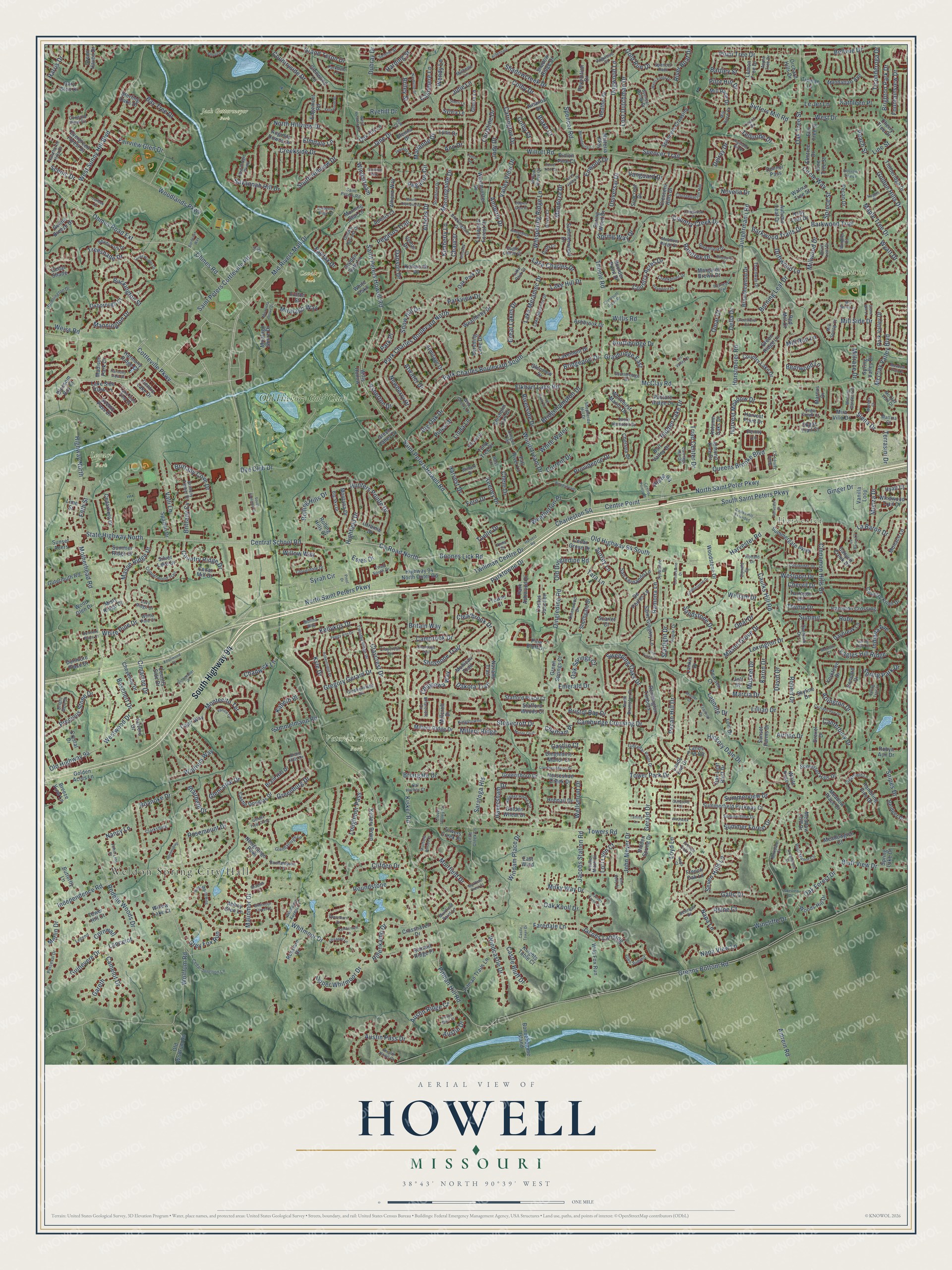
A new map of Howell, Missouri, made in 2026 and printed to order on thick archival matte paper.
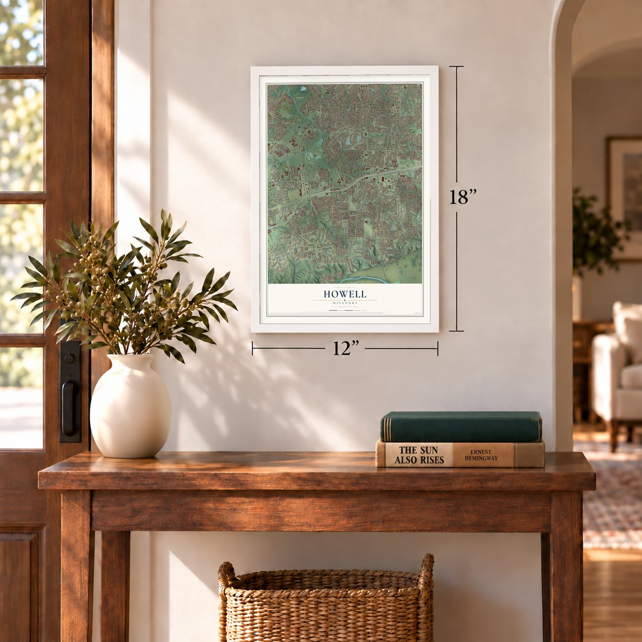
12" x 18" Archival Matte Print
A Map of Home. A Work of Art.
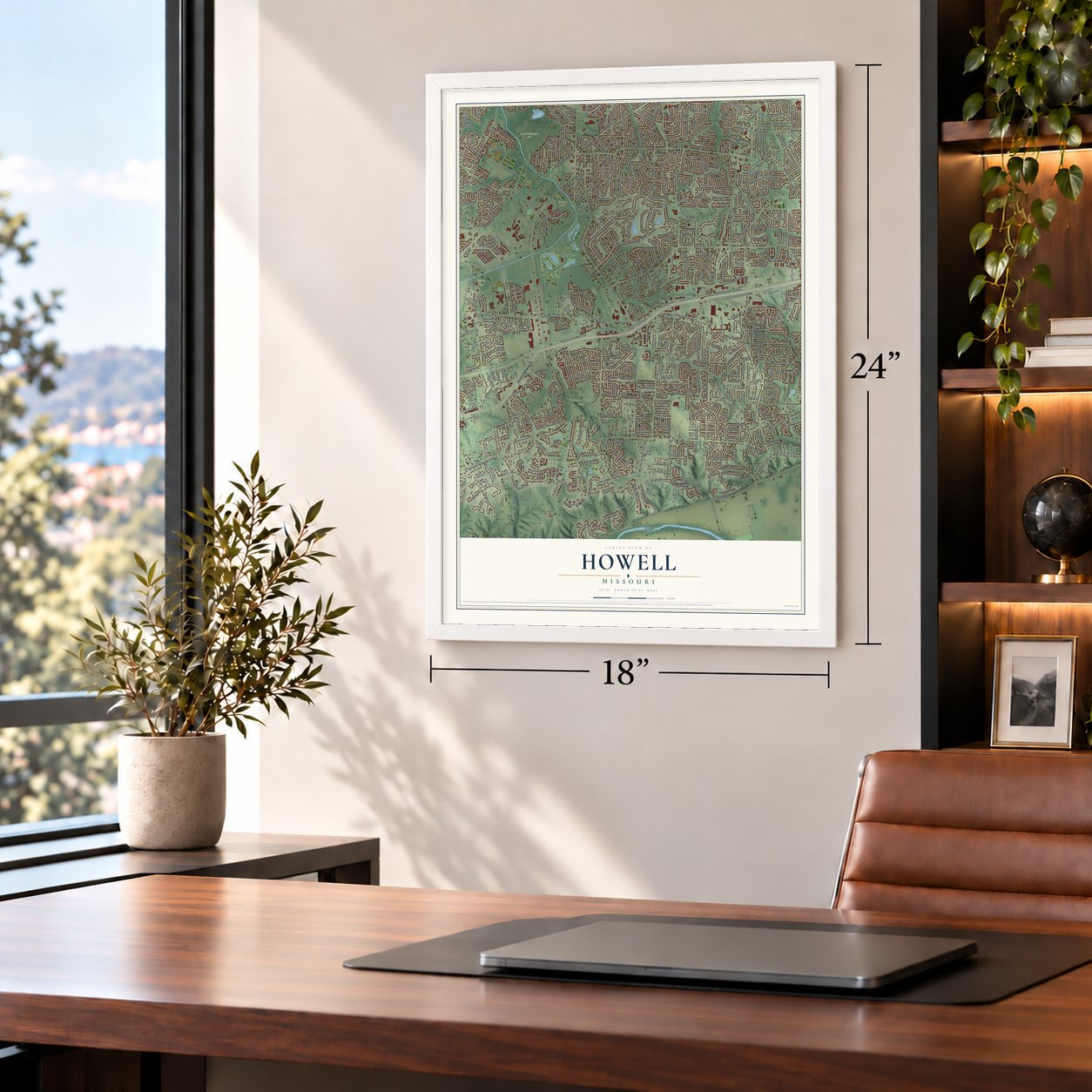
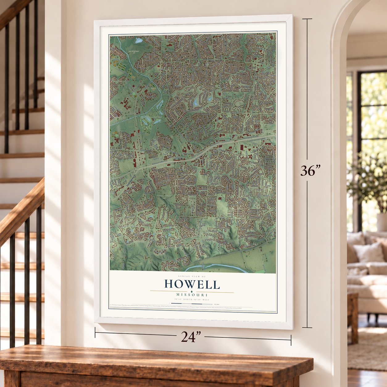
Explore Howell, Missouri from a whole new perspective. Created using aerial imagery and detailed geographic data, this map captures Howell building by building, with labeled streets, familiar landmarks, and shaded topographical relief that highlights the natural contours of the landscape.
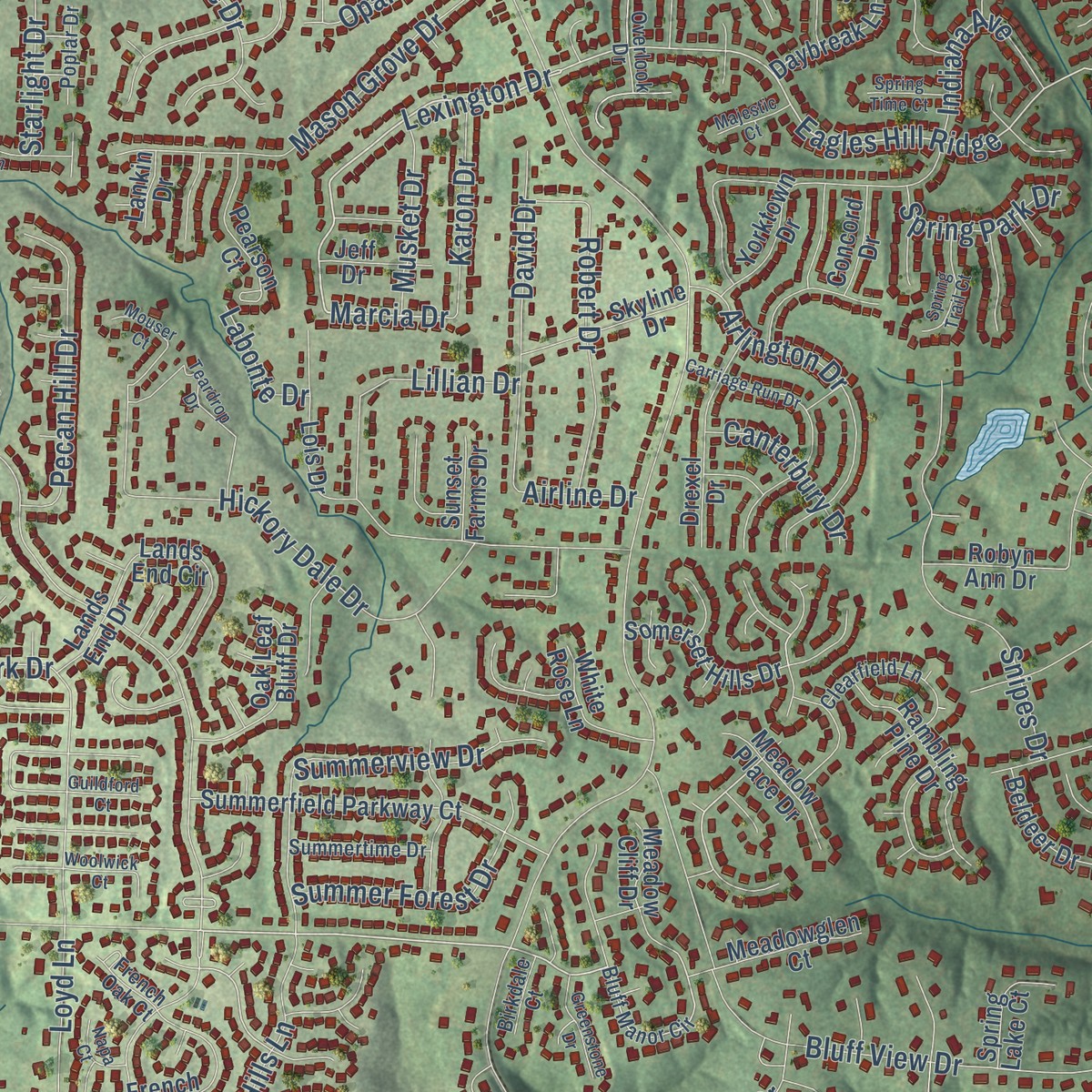
Combining modern data with the timeless character of a vintage atlas, this map is just as interesting up close as it is beautiful on the wall. Whether you grew up in Howell, spent memorable years there, or call it home today, this unique map is a great way to celebrate a place that means something to you. Zoom in on the preview to look for your street, and then order a print to put your memories on the wall.
Three ways to hang it
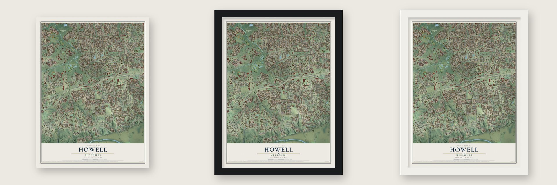
Unframed archival matte, a black wood frame or a white wood frame.
Up close
Geography Worth Displaying
This map was created using accurate cartographic data and authoritative geographic sources, including the U.S. Geological Survey and the Census Bureau. The map brings together terrain, waterways, roads, and building detail. The majority of the streets are labeled, houses are accurately depicted, and the topography is derived from government sources. Combining local data with carefully composed color and shading leads to this beautifully detailed Howell artwork for your wall.
Rather than simply showing street outlines, we’ve included as many of the street names as we could reasonably fit on the map while keeping their names legible. Zoom in on the high resolution preview to see exactly what’s on the map. We truly set out to create a statement piece for anyone who loves Howell. So whether it’s for you, or a gift for someone you love, we hope this map of Howell brings back fond memories.
Read the story behind this map: Detailed Map of Howell, Missouri.

Find your street
Names on the Howell map
Every name below is printed on this map. Look for your street, your school, the park where you played, or the pond down the road.
Places and landmarks8
- Weldon Spring City Hall
- Harvester
- Cavalry Park
- Jack Gettermeyer Park
- Laurel Park
- Legacy Park
- Veterans Tribute Park
- Old Hickory Golf Club
Streets and roads668
- South Highway 94
- Mid Rivers Mall Drive
- Saint Peters Howell Road
- North Saint Peters Parkway
- State Highway North
- Atwater Drive
- Marcia Drive
- Central School Road
- Lexington Drive
- Towers Road
- Woodlands Parkway
- Motherhead Road
- North Saint Peter Parkway
- Eagles Hill Ridge
- Westwood Drive
- Cottleville Parkway
- Toelle Drive
- Pitman Hill Road
- Kellykris Drive
- Fairview Glen Drive
- Austin Ridge Court
- Centre Point
- Highway North
- Horstmeier Road
- Milky Way Drive
- White Pine Drive
- South Saint Peters Parkway
- Jungermann Road
- McClay Road
- Willott Road
Show all 668 streets
- Wolfrum Road
- Greens Bottom Road
- Caulks Hill Road
- Harvester Road
- Whitmoor Drive
- Dingledine Road
- Kimberly Lane
- Park Charles Boulevard North
- Kisker Road
- Park Charles Boulevard South
- Ohmes Road
- Ohmes Road Extension
- Cambridge Crossing Drive
- Spencer Road
- Sutters Mill Road
- Hidden Lake Drive
- Saint Peters Cottleville Road
- Old Highway 94 South
- Barkwood Trails Drive
- Malinmor Drive
- Woodstream Drive
- Millwood Drive
- Ramona Lane
- West Sunny Hill Boulevard
- Whispering Ridge Lane
- Barkwood Trail
- Haversham Drive
- Boones Lick Road
- County Road North
- Independence Road
- Hickory Dale Drive
- Stonecroft Drive
- Colby Drive
- Bluff View Drive
- Rosemount Drive
- North Hillview Drive
- Universal Drive
- Muirfield Drive
- Lost Dutchman Drive
- Treeshade Drive
- Jane Drive
- Cinnamon Hills Drive
- Camelot Drive
- Elkhart Lake Road
- Napa Lane
- Thoele Road
- Wyatt Drive
- Julie Lane
- Briargate Drive
- Mason Ridge Drive
- Greenburg Drive
- Syrah Circle
- Windcastle Drive
- Plum Tree Drive
- Countryside Drive
- Claycrest Drive
- Weiss Road
- Jacobs Station Road
- Hillenkamp Drive
- Dye Club Drive
- Mendoza Drive
- Harvest Drive
- Amrein Road
- Clifden Drive
- Brighton Park Drive
- McClay Valley Boulevard
- Keeney Drive
- Buckington Street
- Valley View Drive
- Spencer Trail
- Mason Grove Drive
- Savannah Hill Drive
- Grand Teton Drive
- Morningside Drive
- Sweeping Oaks Drive
- Snipes Drive
- Tower Park Drive
- Creekside Drive
- Driftwood Lane
- Westport Drive
- Bartley Street
- Snow Hill Drive
- Hunters Pointe Drive
- Summerview Drive
- Circle Way
- Highfield Drive
- Millers Ridge
- Country Creek Drive
- Jacobs Landing
- Dogwood Lane
- Dubray Drive
- Providence Drive
- Pegasus Trail
- Lillian Drive
- Scenic Drive
- Sammelmann Road
- Arlington Drive
- Triad Center Drive
- Peach Street
- Maple Tree Drive
- Burning Leaf Drive
- Golden Hills Drive
- Jody Drive
- Gregory Gerard Drive
- Bridgehampton Drive
- Roanoke Drive
- Shoshone Trail
- Montecito Terrace
- Napa View Lane
- Starlight Drive
- Saratoga Heights
- Oak Forest Drive
- Spring Way Drive
- John Meyer Drive
- Robert Drive
- Country Acres Drive
- Tara Lane
- Miralago Way
- Windam Place Drive
- Nancy Lane
- Cambrook Drive
- Bentwood Lane
- Harvest Meadow Drive
- West Drive
- Loughmor Pass
- Pecan Hill Drive
- Valli Lane
- Britain Way
- Great Lakes Drive
- Twillman Centre Drive
- David Drive
- Lake Meramec Drive
- Pilot Hill Drive
- Austin Pass Drive
- Chervil Drive
- Weatherton Place
- Carrington Drive
- Gallo Drive
- Queens Brooke Boulevard
- Bay Tree Drive
- South Hillview Drive
- Parkview Drive
- Mill Run Lane
- Line Street
- Chippewa Way
- Lancelot
- Kyle Drive
- Canterbury Drive
- Mill Side Drive
- Lake Charles Drive
- Briley Street
- Bridgeport Drive
- Lake Hill Drive
- Old Highway 94
- Estes Drive
- Sandstone Drive
- Big Oak Drive
- Country Ridge Drive
- Precious Stone Drive
- Upper Whitmoor Drive
- Shadowcreek Drive
- Newberry Drive
- Rolling Hills Drive
- Faredale Lane
- Park Place
- Pegasus Circle
- Seven Hills Lane
- Graybridge East
- Oak Tree Street
- Athens Drive
- Cimarron Drive
- Rodelle Woods Drive
- Grey Fox Run
- Brittany Cove Drive
- Emerald Drive
- Mannington Drive
- Parktowne Drive
- Oak Springs Court
- Summer Forest Drive
- Castle Bluff Drive
- Siena Drive
- Ginger Drive
- Danson Drive
- Chele Drive
- Clearbrook Drive
- La Baron Drive
- Cashmere Lane
- Fountainview Drive
- Bellvue Drive
- Ruby
- Christine Drive
- Amberly Drive
- Wolfrum Way
- Old Dingledine Road
- Fifth Street
- Brittany Cv
- Charleston Square
- Ryehill Drive
- Bristol Bay Drive
- Gold Run Drive
- Indiana Avenue
- River Boat Drive
- Wellsmont Drive
- Marianne Drive
- Monza Drive
- Summit
- Linda Lane
- Pines Drive
- Loyd Lane
- Karon Drive
- Ann Drive
- Surrey Lane
- Riverside Drive
- Willow Way
- Opal Drive
- Fairfax Drive
- Roundstone
- Oak Knoll Drive
- Ticonderoga Drive
- Asherton Drive
- Labonte Drive
- Glencorse Drive
- Guinevere Drive
- Musket Drive
- Rhine Court
- Spruce Street
- Chaucer
- Spring Park Drive
- Wendy Lane
- Wincliffe Drive
- Northbridge Drive
- Willis Road
- Lori Lynn Court
- White Water
- Current Drive
- Harding Street
- Vanguard Drive
- Chadwick Lane
- Austin Drive
- Blairbeth Drive
- Kathleen Place
- Enwood Drive
- Thyme Drive
- William Drive
- Dakota Trail
- Della Drive
- Windstream
- Harris Drive
- Boschert Drive
- Millrace Drive
- Chatham Place
- Kabeth Place
- Telluride Drive
- Blake Court
- Gerald Drive
- Terrasini Drive
- Elmdale Lane
- Merlin Drive
- Delray Drive
- Omar Court
- Cornwall
- Raintree Drive
- Colby Court
- Le Jer Lane
- Airline Drive
- Gareth
- Novella Drive
- Fern Drive
- Castlio Court
- Plaza 94
- Donner Pass
- Lake Side View Lane
- Centre Lake Drive
- Woodstone Drive
- Timberidge Drive
- Crescent Hills Drive
- Shadow Ridge Drive
- Weatherby Drive
- Summerfield Parkway Court
- Castle Douglas Drive
- Westminster Drive
- Wood Glen Drive
- Spring Wood Drive
- Park Valley Drive
- Spencers Crossing
- Yorktown Drive
- Glenwood Lane
- Bull Valley Drive
- Evergreen Forest Drive
- Country Knoll Drive
- Saint Gregory Lane
- Pine Bluff Drive
- Sterling Oaks Drive
- Almond Tree Drive
- Southgate Drive
- Fairwood Forest Drive
- Golden Wheat Drive
- De Porres Lane
- Heather Drive
- Oxborough Court
- Summerwood Drive
- Chisholm Trail Drive
- Highway 94 North Outer Road
- Athena Way
- Penny Lane
- Vanilla Loop
- Montana Drive
- Oak Hill Lane
- Reddington Timbers
- Pitman Trails Lane
- Kellery Down
- Monaco Lane
- Rambling Pine Drive
- Braid Hill Drive
- Lakemont Drive
- Madison Park Court
- Green Ridge Lane
- Oak Park Drive
- Pershing Lake Drive
- Chelsea Drive
- Hampton Crossing
- Summergate Parkway
- Miralago Shore Drive
- Golden Gate Lane
- Bonnehomme Island
- Glenna Drive
- Country Lake Drive
- Edgemont Road
- Whitehirst Manor Drive
- Woods Hill Drive
- Revolution Drive
- Mira Villa Drive
- Pearson Court
- Knights Table Court
- San Fernando Lane
- Lois Drive
- Suncrest Drive
- Lands End Circle
- Margaret Brown Court
- French Oak Lane
- Gutermuth Road
- Horseshoe Creek Drive
- Oak Leaf Bluff Drive
- Somerset Hills Drive
- Capri Way
- Venus Drive
- Elm Tree Street
- Park Ashwood Drive
- Millers Ridge Drive
- Kelly Leaf Drive
- Cheyenne Drive
- Old Wolfrum Road
- Bramblewood Drive
- Cedarfield Drive
- Sugar Trail Court
- Stafford Place Court
- Canyon Creek Drive
- Butterfly Lane
- Wild Fox Run
- Skyline Drive
- Silver Lake Drive
- Gloria Lane
- Autumn Leaf Drive
- Dingledine Manor Court
- Drexel Drive
- Sunset Acers
- Armitage Drive
- Stafford Woods Court
- Orchard Hills Drive
- Greensboro Drive
- Rosslare Drive
- Manhattan Avenue
- Cedar Mill Drive
- Summer Ridge Court
- Kenworth Drive
- Cactus Junction
- Lynn Drive
- Rolling Hills Court
- Green Springs Court
- Meadow Cliff Drive
- Gentle Breeze Drive
- Gary Glen Drive
- Mohican Trail
- Tarragon Drive
- Mill Race Drive
- Country Side Drive
- Walnut Tree Street
- Pasture Ridge Drive
- Harvest Point Drive
- Meadowglen Court
- Crosshaven Drive
- White Rose Lane
- Hyatt Court
- Fulton Street
- Cherry Tree Drive
- Windwood Trail Drive
- Misty Ridge Court
- Newgrange Pass
- Daybreak Lane
- Boulder Point Drive
- Lemon Tree Drive
- Meadow Place Drive
- Dunmore Place Drive
- Hobnail Drive
- Willow Lake Court
- Tulip Tree Drive
- Golden Acres Lane
- Valvero Drive
- Beldeer Drive
- Pine Tree Street
- Laramie Drive
- Ashbrook Drive
- Tieman Lane
- Fall River Lane
- Robyn Ann Drive
- Cedar Grove Drive
- Autumn Oaks Drive
- Spring Lake Court
- Spring Valley Drive
- Navaho Trail
- Elmtree Drive
- Millcroft Drive
- Spartan Drive
- Green Haven Drive
- Summit Ridge Place
- Lands End Drive
- Marcus Drive
- Crystal Drive
- Towers Creek Place
- Cedar Shade
- Blossom Bay Court
- Breeze View Lane
- Adonis Court
- Concord Drive
- White Oaks
- Jeff Drive
- Red Mill Court
- Augusta Downs Drive
- Harmony Ridge Court
- Wisteria Way
- Pecan Drive
- Hidden Spring Drive
- Morning Star Lane
- Sunset Farms Drive
- Glenview Drive
- Abbey Glen Lane
- Wills Hollow
- Lime Street
- Amanda Drive
- Green Valley Drive
- Sylvia Lane
- Scenic Pass Drive
- Towne Court
- Tower Hill Court
- East Wind
- Scarlet Court
- Lankin Drive
- Pinion Pine Court
- Lake Side View Drive
- Copperwood Trail
- Bluff Manor Circle
- Brickingham Drive
- Carriage Hill Drive
- Gibraltar Point Drive
- Timothy Ridge Drive
- Stephenridge Drive
- Constellation Hill
- Cloverdale Drive
- Birch Leaf Drive
- Meadow Ridge Drive
- Braid Hills Drive
- Spencer Valley Drive
- Bright Gem Drive
- Cedar Junction Lane
- Lake Superior Drive
- Brinnington Drive
- Clearfield Lane
- Harvest Home Circle
- Greenfield Drive
- North Brampton Drive
- Claycrest Circle
- Shady Path Drive
- Mill Spring Court
- Michelle Lane
- Creekpoint Drive
- Saint Peters Road
- Perceval Drive
- John-Linn Place
- Golden Harvest Drive
- Oregon Trail
- Red Ridge Parkway
- Triad South Drive
- Brittany Timber Drive
- Glendalough Lane
- Big Sky Drive
- Kingstowne
- Strafford Drive
- Summertime Drive
- Glen Summit
- Coach Drive
- Saint James Court
- Coriander Drive
- Southbridge Drive
- Roehampton Lane
- Sugar Creek Court
- South Hampton Drive
- Austin Knoll Court
- McClay Trail Drive
- Apple Tree Drive
- Thornwood Drive
- McClay Gardens Drive
- Selene Street
- Hawthorne Hills Drive
- Thornway Drive
- Overlook Drive
- Clarksburg
- Eagle Chase Court
- Spencer Path
- Concord View Circle
- Sycamore Drive
- Clover Valley Lane
- Shepherds Hill Drive
- Wilbert Drive
- Ashdown Forest Court
- Parkdale Lane
- Pezold Drive
- Leslie Mitch Court
- Poplar Drive
- Wild Cherry Drive
- French Oak Court
- Dogwood Court
- Driver Court
- Beringer Drive
- Willow Grove Court
- Molina Way
- Mill Race Court
- Briarcroft Drive
- Bal Harbor Court
- Little Creek Lane
- Mattina Court
- Lazy Ridge Drive
- Muirfield Point Lane
- Birkdale Court
- White Pine Court
- Legend
- Donald Drive
- Duffy Court
- Windler Court
- Ronald Drive
- Anna Drive
- Lake Park Court
- Ross Lane
- Sue Court
- Illy Drive
- Mount Olympus Drive
- Madeira Court
- Woodstream
- Robertridge Drive
- Briarwick Trail
- Carriage Run Drive
- Amberglen Drive
- La Baron Lane
- West Meath Ring
- Kim Kelly Drive
- Mill Spring Lane
- Farm Valley Drive
- Nashville Street
- Harvest Road
- Stone Mill Lane
- Wells Fargo Drive
- Greenburn Drive
- Cobblestone Drive
- Teardrop Drive
- Lissadell Lane
- Courtney Manor Drive
- Craigwood Drive
- Manor Coye
- Meandering Lane
- Venice Circle
- Fernwood Drive
- Whitmoor Forest Court
- Jacobs Creek Drive
- Peggy Ann Drive
- Pine Forest Lane
- Highland Hill Drive
- Haverford Court
- Lime Rock Drive
- Harmony View Drive
- Pinehurst Court
- Lakeview Drive
- Brooker Court
- Schremmer Place
- South Common Drive
- Gillette Field Close
- Rathfarnum Lane
- Quiet Woods Drive
- West Meadow Drive
- Spring Trail Court
- Harvester Court
- Jaquetta Court
- Fairmount Grove Drive
- Greenstone Drive
- Settlers Circle
- Caulks Hill Extended
- Nugget Drive
- Knollwood Court
- Dunmore Place Court
- Ardennais
- Cornerstone Drive
- Castle Tower Drive
- Lost Valley Court
- Centre Pointe Court
- Woolwick Court
- Greenhurst Court
- Shaelah Court
- Sherri Lane
- Greensburg
- Miravista Grove Drive
- Onondaga Trail
- Muirfield Woods Court
- Dardenne Ridge Drive
- Spring Time Court
- Tammy Lane
- Meadow Trail Drive
- Majestic Court
- Bordeaux Way
- Napa Court
- Blossom Tree Lane
- Guildford Court
- Austin Bluff Court
- Mouser Court
- Muirfield Crest Court
- Forrel Tree Court
- Candice Way
- Outlook Court
- Eagles Glen Court
- Tudor Square
- Pinot Drive
Names are listed as they appear on the printed map. Zoom into the product photos to find them.
The art of mapping a place
How This Map Was Made
Real places. Remarkable detail. Discover the layers that turn geographic data into a map of home.

The view from above
Aerial imagery reveals the character of the land: woodland, open fields, and the patterns of a place.

The shape of the land
Elevation data brings hills, valleys, and subtle changes in the landscape into view.

The details of home
Roads, waterways, and building footprints come together to make the map feel unmistakably local.

Geography becomes art
Considered color, shading, and typography bring the layers together in a map made for your wall.


Process illustrated with Mendon, Massachusetts. Aerial imagery: USDA NAIP. Terrain: USGS 3D Elevation Program. Map details and finished artwork: KNOWOL.
The Details
About This Print
Choose an archival matte print, or a black or white Ayous wood frame. The archival matte print is unframed.
Select your size and finish above to see the matching product image and price.
Materials & Craftsmanship
A contemporary map with the character of a classic atlas, printed on archival matte paper. Optional frames are made from Ayous wood.
Your printed map does not include the watermark shown in the full-map preview.
Shipping & Delivery
Free shipping within the United States. Every print is made to order in the USA.
Buying a gift? Add a note in your cart and we'll include it. We never put prices in the package.
Prints ship within 2 to 3 business days. Allow 7 to 10 days total from ordering for delivery. Timing may vary during holidays or periods of high order volume.
Read our shipping policy.
Returns and damaged prints
Each print is made to order. Change-of-mind refunds are not available after production.
If your print arrives damaged, misprinted or incorrect, contact support@knowol.com within 30 days of receiving it. Include your order number, photos and a description of the issue.
Read our full refund and replacement policy. For questions about your order, email support@knowol.com.
Find your town
Looking for another city?
Find a map of home in our Missouri collection, or any town in the country.
Nearby
Maps of towns near Howell
Know someone from one of these towns? Their map makes a great gift.
 Cottleville
, Missouri
From $39.99See the map
 St. Peters
, Missouri
From $39.99See the map
 Weldon Spring
, Missouri
From $39.99See the map
More maps nearby: Weldon, Weldon Spring Heights, Dardenne Prairie, Chesterfield and St. Charles.