
Search for another town



Free U.S. delivery 7 to 10 days after you order
Hueytown, Alabama Map Art
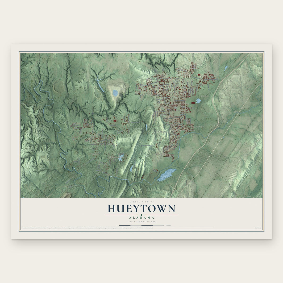
A new map of Hueytown, Alabama, made in 2026 and printed to order on thick archival matte paper.
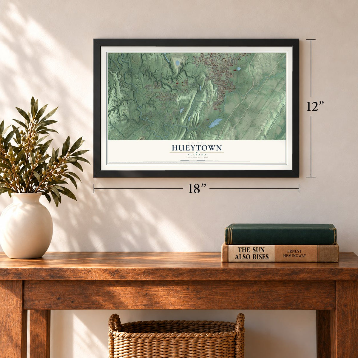
12" x 18" Archival Matte Print
A Map of Home. A Work of Art.
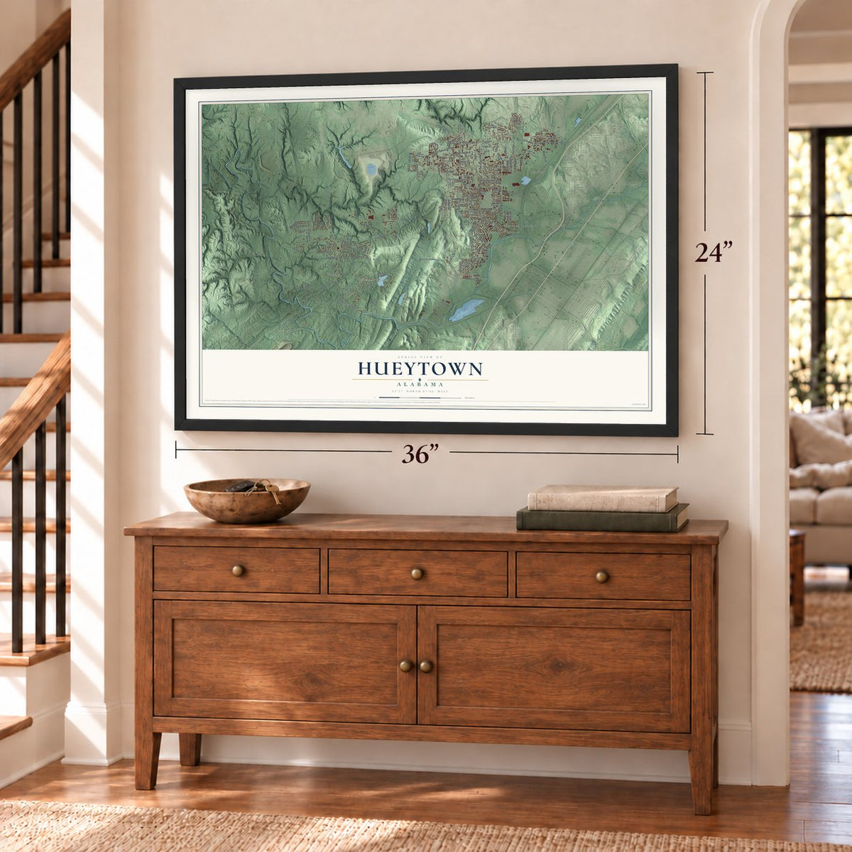
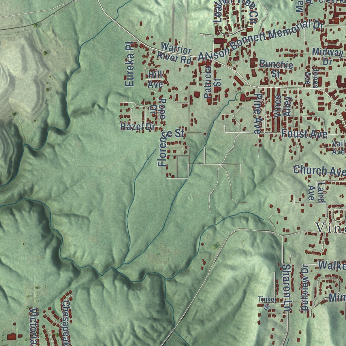
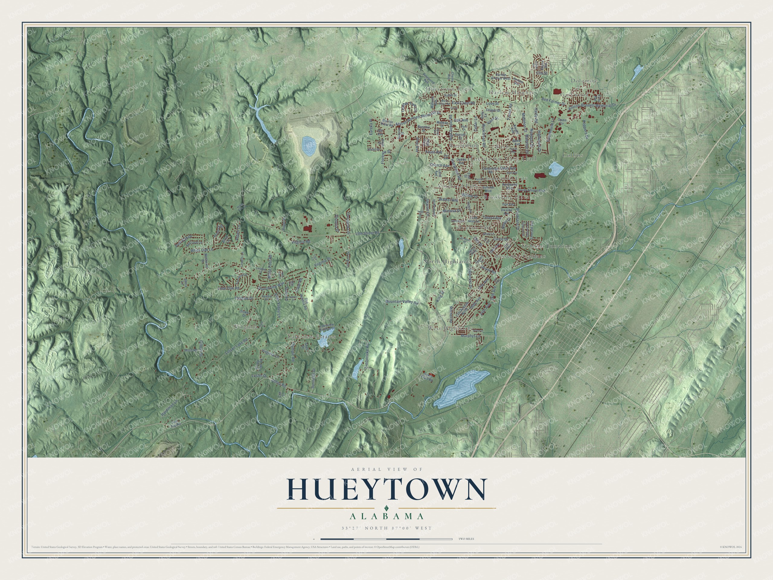
Explore Hueytown, Alabama from a whole new perspective. Created using aerial imagery and detailed geographic data, this map captures Hueytown building by building, with labeled streets, familiar landmarks, and shaded topographical relief that highlights the natural contours of the landscape.
Combining modern data with the timeless character of a vintage atlas, this map is just as interesting up close as it is beautiful on the wall. Whether you grew up in Hueytown, spent memorable years there, or call it home today, this unique map is a great way to celebrate a place that means something to you. Zoom in on the preview to look for your street, and then order a print to put your memories on the wall.
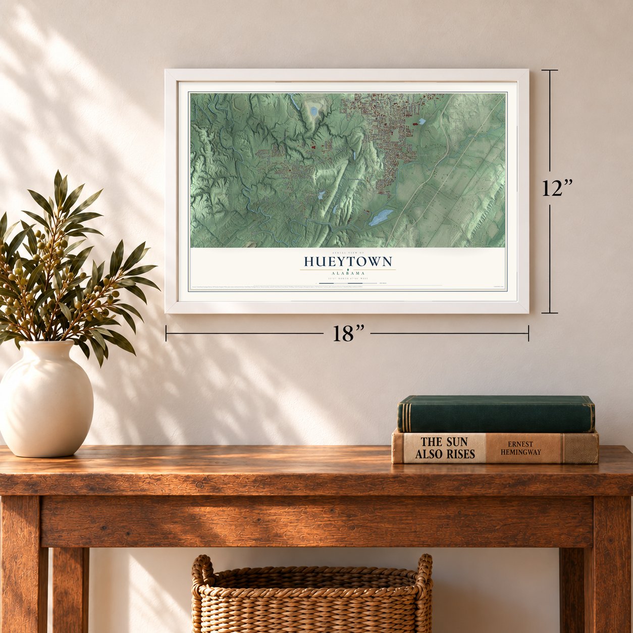
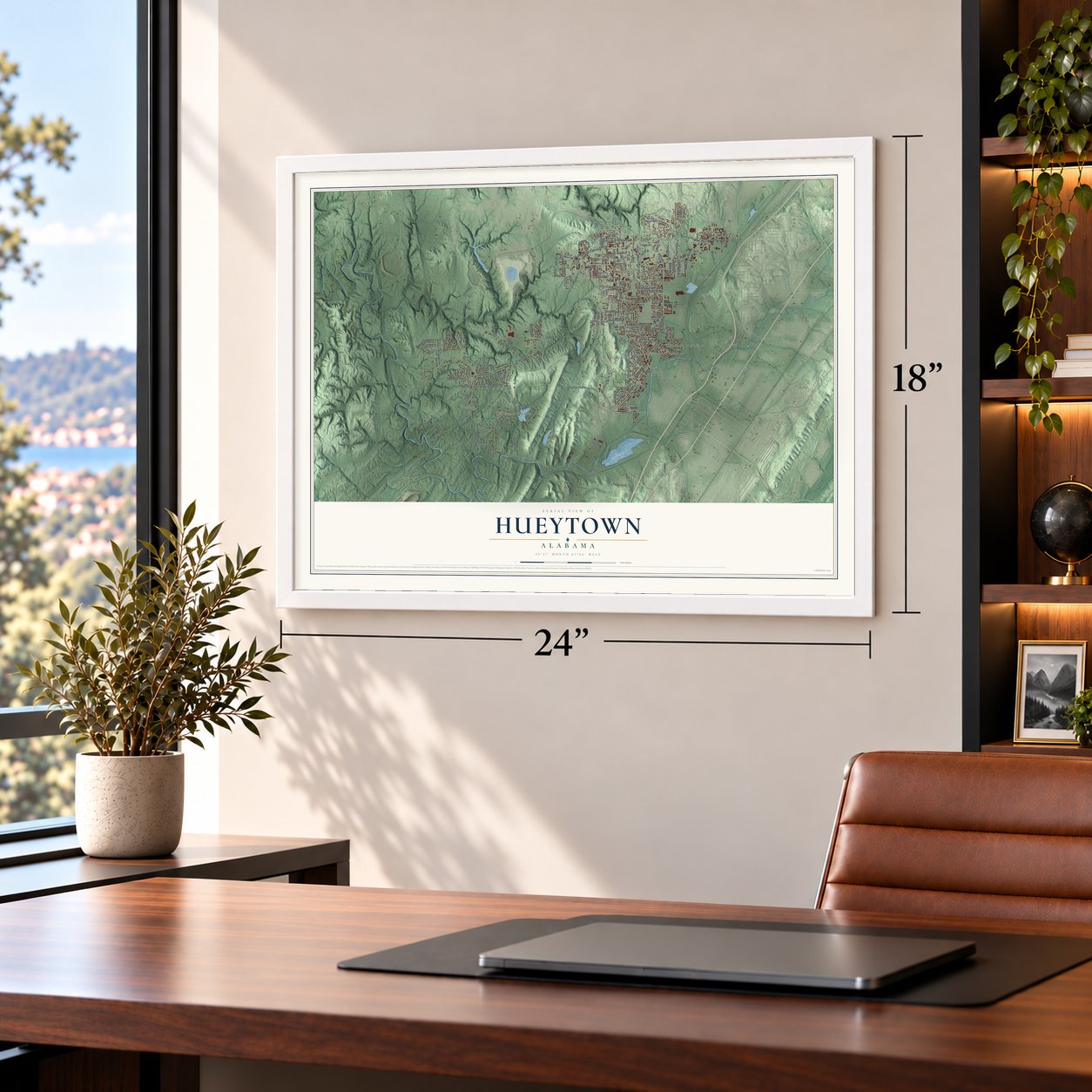
Three ways to hang it
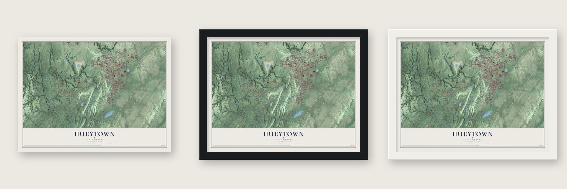
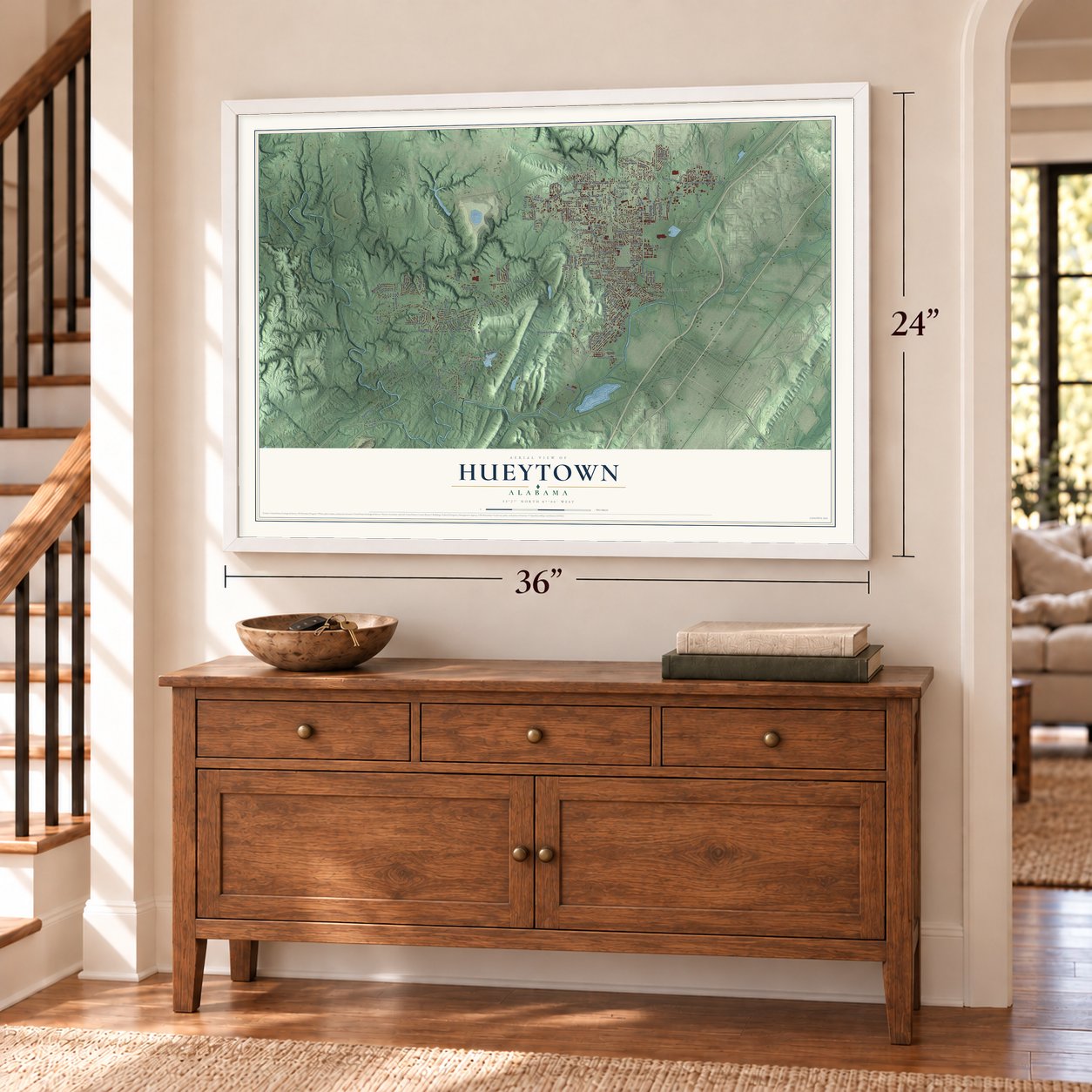
Unframed archival matte, a black wood frame or a white wood frame.
Up close
Geography Worth Displaying
This map was created using accurate cartographic data and authoritative geographic sources, including the U.S. Geological Survey and the Census Bureau. The map brings together terrain, waterways, roads, and building detail. The majority of the streets are labeled, houses are accurately depicted, and the topography is derived from government sources. Combining local data with carefully composed color and shading leads to this beautifully detailed Hueytown artwork for your wall.
Rather than simply showing street outlines, we’ve included as many of the street names as we could reasonably fit on the map while keeping their names legible. Zoom in on the high resolution preview to see exactly what’s on the map. We truly set out to create a statement piece for anyone who loves Hueytown. So whether it’s for you, or a gift for someone you love, we hope this map of Hueytown brings back fond memories.
Read the story behind this map of Hueytown, Alabama from 2026.

About Hueytown, Alabama
Hueytown is a city of 16,776 people in Jefferson County, just southwest of Birmingham. Settlers came around 1816, when the Brown family staked the first land claim. Other families soon followed, among them the Hueys, who gave the town its name. The area stayed mostly farmland until Birmingham's iron and steel boom spread its mills and mines into the countryside.
The first church opened in 1875 and the first school in 1902. People first called the place Huey, and by around 1914 it was Hueytown, which for years ranked among Alabama's biggest unincorporated communities. Residents voted in January 1960, but a court threw out that election after the incorporation was challenged. Hueytown became a city on April 29, 1960, held new elections that June, and opened its city hall in 1963.
- Furnaces in a rose gardenWilliam and Joseph Woodward founded Woodward Iron on New Year's Eve, 1881, and bought Fleming Jordan's cotton plantation, begun by his father Mortimer Jordan in 1828. Furnace No. 1 was lit on August 17, 1883, on the site of Mrs. Jordan's rose garden, and a second came in 1887. By the 1920s the company ranked among the nation's largest pig iron makers. Mead Corporation bought it in 1968, and its last blast furnace closed in 1973.
- The Virginia Mines disasterBrothers George and E. T. Shuler opened the Virginia Mine in 1902, naming it for Virginia City, Nevada, which they had just left. In February 1905 an underground explosion trapped the entire day shift and caved in the entrance. Rescuers found 106 men and 20 mules dead. Republic Steel bought the mine in 1936 and ran it until it closed for good in 1953. Several original buildings survive, and the site is on the Alabama Register of Historic Places.
- Home of the Alabama GangBobby and Donnie Allison came from the Miami area, and Red Farmer, a Nashville native, raced around Miami before he too settled in Hueytown. With Neil Bonnett and the younger Allisons they became the Alabama Gang, one of NASCAR's dominant groups. The city's main road is Allison-Bonnett Memorial Drive, and in 1975 BMW Motorsport picked Hueytown as its first North American base.
- The Hueytown HumStarting in late 1991, residents heard a low droning sound that came and went without warning. The New York Times wrote about it in April 1992. Many people blamed a huge fan that pushed air through a mine for Jim Walter Resources, a machine that cost $7 million and had blades spanning 26 feet, though the company denied it. Studies settled nothing, and the hum faded later that year and never came back.
- A stadium from 1933Hueytown's first high school opened in 1921. Its football stadium was built by Works Progress Administration workers in 1933, and the town still plays games there.
Find your street
Names on the Hueytown map
Every name below is printed on this map. Look for your street, your school, the park where you played, or the pond down the road.
Places and landmarks18
- Hueytown City Hall
- Avalon Park
- Bessemer Gardens
- Brooklane Place
- Bush
- Collins
- Dolomite
- Dolonar Junction
- Garywood
- Harlem Heights
- Hueytown Crest
- Industrial City
Show all 18 places
- Lakeview Estates
- North Highlands
- Vineland Park
- Virginia
- West Highlands
- Woodmont
Streets and roads154
- Allison-Bonnett Memorial Drive
- Allison Bonnett Memorial Drive
- Murphys Lane
- Foust Avenue
- 19th Street
- Johns Road
- 26th Avenue
- Cedar Lane
- Devon Road
- High School Road
- Love Street
- East Crest Road
- Virginia Drive
- 15th Street Road
- Hueytown Road
- Forest Road
- Virginia Lane
- Brooklane Drive
- 27th Avenue
- Mountain Valley Road
- 25th Avenue
- Timberlake Road
- White Oak Lane
- Circle Drive
- Letson Lake Road
- Virginia Road
- Koppers Drive
- Novel Drive
- Faircrest Drive
- Gilbert Drive
Show all 154 streets
- Post Oak Drive
- Red Farmer Drive
- Wickstead Road
- Florence Street
- Leather Tree Circle
- Sharon Lane
- White Post Road
- Churchview Way
- Lone Oak Road
- Townhouse Lane
- Newport Drive
- Olympic Road
- Teresa Avenue
- Eden Valley Lane
- King Street
- Hardiman Lane
- Church Avenue
- Mimosa Drive
- Aspen Lane
- Victoria Drive
- Walker Avenue
- Hardy Road
- Fieldale Drive
- Pine Avenue
- Willow Drive
- Sunnyhill Drive
- Oak Avenue
- Mabelon Court
- Highwood Drive
- Mabelon Drive
- 24th Avenue
- Cape Road
- Eureka Place
- Gwin Avenue
- Luster Drive
- Vann Street
- Clio Street
- Cambridge Road
- Warrior River Road
- Loch Ness Lane
- Dee Hendrix Road
- 27th Avenue North
- Lakeview Estates Drive
- 29th Avenue
- Laird Avenue
- Pinewood Avenue
- Knight Avenue
- Hemlock Drive
- 21st Street
- Cherry Avenue
- Dwaine Avenue
- Westwind Drive
- Sunrise Boulevard
- Owen Circle
- Harlem Avenue
- Davey Allison Boulevard
- Midway Drive
- Hill Avenue
- Stump Town Road
- Sewer Plant Road
- Vines Alley
- Chesapeake Drive
- Moss Road
- Sunset Drive
- Red Leaf Lane
- Fuller Street
- Cox Lane
- Lee Ann Drive
- First Avenue
- Harlem Avenue West
- Emerald Avenue
- Chapel Drive
- Mahone Avenue
- Mitchell Road
- Baker Avenue
- Space Road
- Dabbs Avenue
- Hazel Drive
- Dellview Drive
- Patricia Street
- Kentwood Alley
- Roper Drive
- Shell Drive
- Lovells Lane
- Pope Drive
- Tree Top Road
- Huey Lane
- Bunchie Street
- Shera Lane
- Boyce Avenue
- Birch Lane
- Stoker Drive
- Shady Lane
- Edenwood Drive
- 27th Alley
- Highland Drive
- Edgehill Drive
- Larabee Lane
- Daffodil Avenue
- Hart Avenue
- Andover Road
- West Crest Road
- Opal Alley
- Clyburne Street
- Devon Alley
- Sterling Drive
- Jones Avenue
- Vail Avenue
- Tera Lane
- Park Drive
- Star Circle
- Pruitt Drive
- Coalfire Avenue
- Ashwood Road
- Parsons Drive
- Tinker Street
- 26th Alley
- Galaxy Drive
- Crystal Alley
- Willow Lane
- 31st Avenue
- McBee Farm Road
- Deer Run Lane
- Fair Street
Names are listed as they appear on the printed map. Zoom into the product photos to find them.
The art of mapping a place
How This Map Was Made
Real places. Remarkable detail. Discover the layers that turn geographic data into a map of home.

The view from above
Aerial imagery reveals the character of the land: woodland, open fields, and the patterns of a place.

The shape of the land
Elevation data brings hills, valleys, and subtle changes in the landscape into view.

The details of home
Roads, waterways, and building footprints come together to make the map feel unmistakably local.

Geography becomes art
Considered color, shading, and typography bring the layers together in a map made for your wall.


Process illustrated with Mendon, Massachusetts. Aerial imagery: USDA NAIP. Terrain: USGS 3D Elevation Program. Map details and finished artwork: KNOWOL.
The Details
About This Print
Choose an archival matte print, or a black or white Ayous wood frame. The archival matte print is unframed.
Select your size and finish above to see the matching product image and price.
Materials & Craftsmanship
A contemporary map with the character of a classic atlas, printed on archival matte paper. Optional frames are made from Ayous wood.
Your printed map does not include the watermark shown in the full-map preview.
Shipping & Delivery
Free shipping within the United States. Every print is made to order in the USA.
Buying a gift? Add a note in your cart and we'll include it. We never put prices in the package.
Prints ship within 2 to 3 business days. Allow 7 to 10 days total from ordering for delivery. Timing may vary during holidays or periods of high order volume.
Read our shipping policy.
Returns and damaged prints
Each print is made to order. Change-of-mind refunds are not available after production.
If your print arrives damaged, misprinted or incorrect, contact support@knowol.com within 30 days of receiving it. Include your order number, photos and a description of the issue.
Read our full refund and replacement policy. For questions about your order, email support@knowol.com.
Find your town
Looking for another city?
Find a map of home in our Alabama collection, or any town in the country.
Nearby
Maps of towns near Hueytown
Know someone from one of these towns? Their map makes a great gift.
 Bessemer
, Alabama
From $39.99See the map
 Concord
, Alabama
From $39.99See the map
 Brighton
, Alabama
From $39.99See the map
More maps nearby: Lipscomb, North Johns, Rock Creek, Pleasant Grove and Midfield.