
Search for another town





Free U.S. delivery 7 to 10 days after you order
Independence, Missouri Map Art
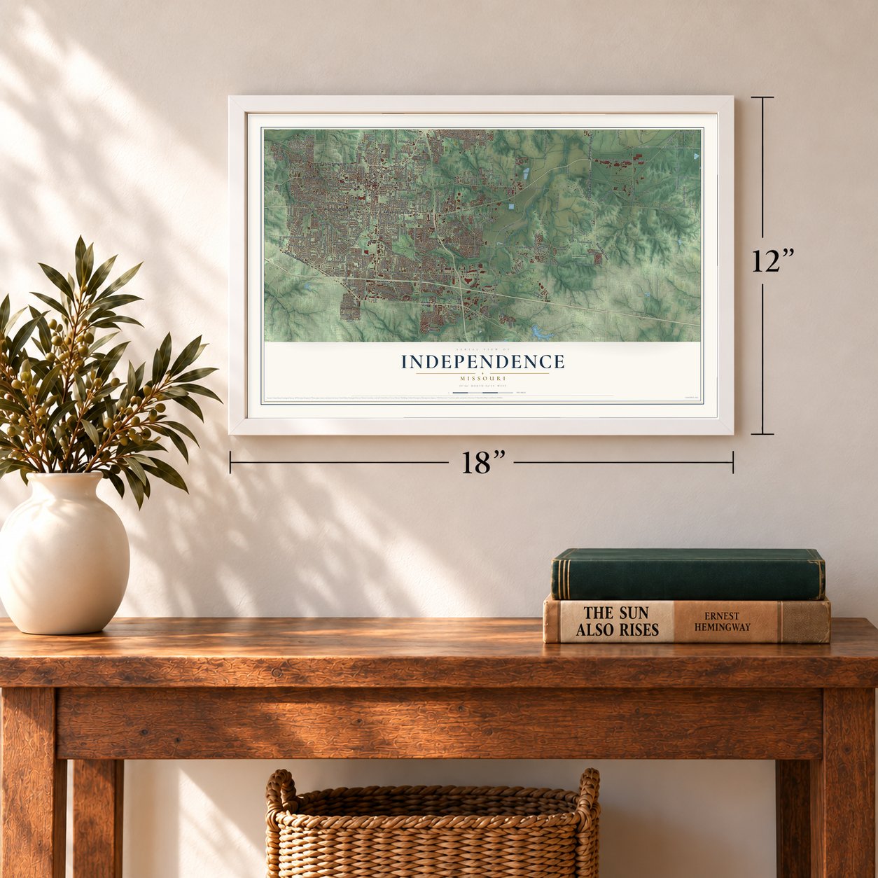
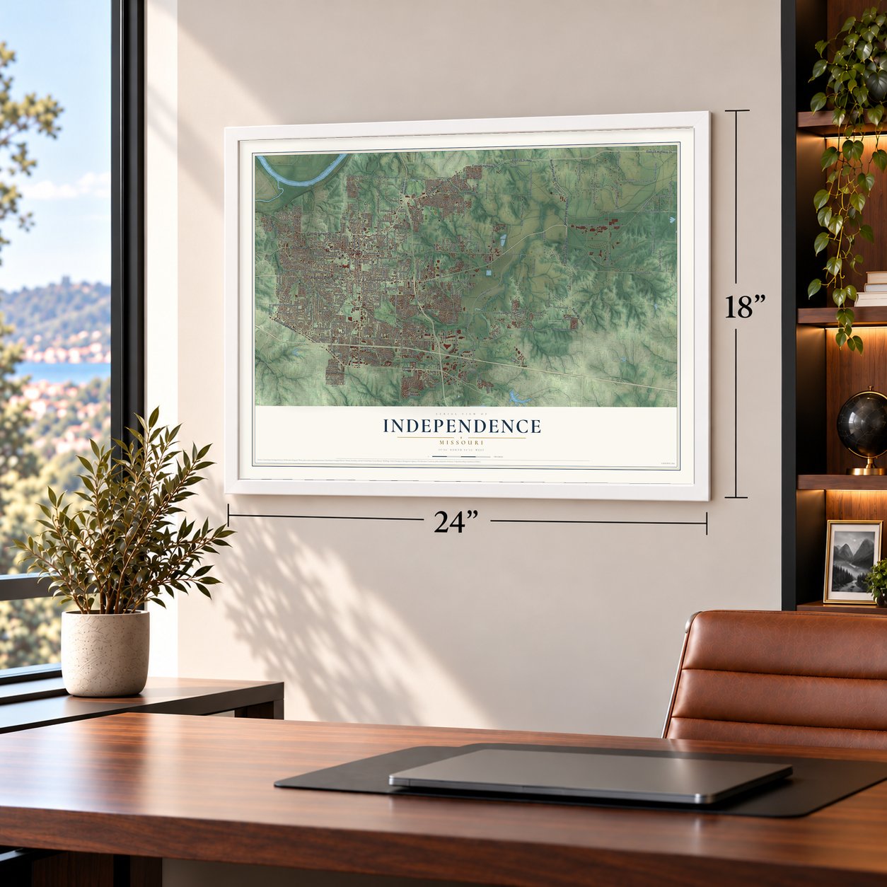
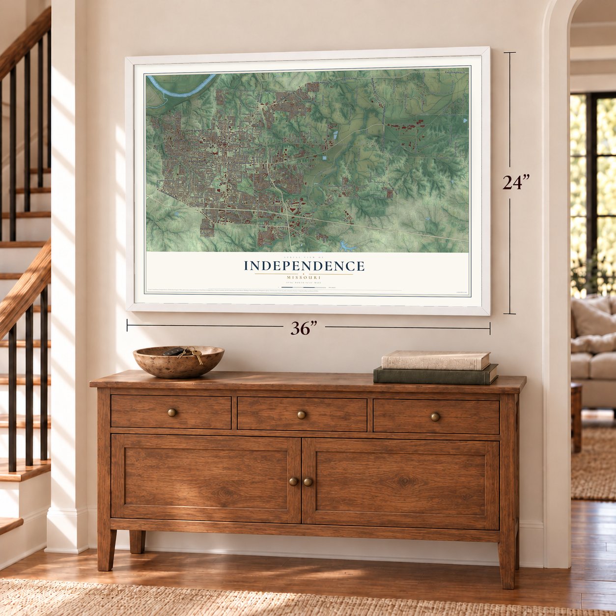
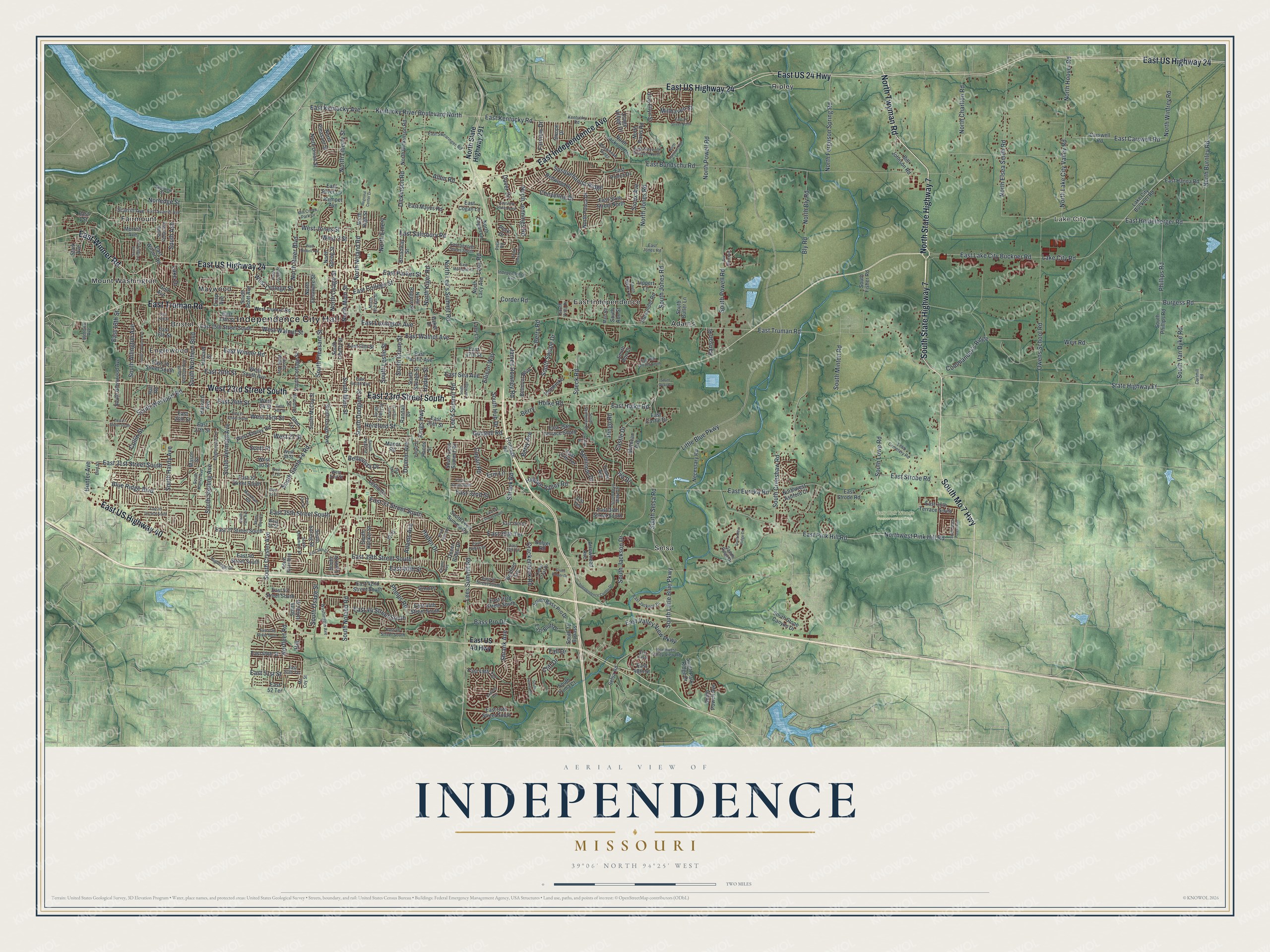
A new map of Independence, Missouri, made in 2026 and printed to order on thick archival matte paper.
12" x 18" Archival Matte Print
A Map of Home. A Work of Art.
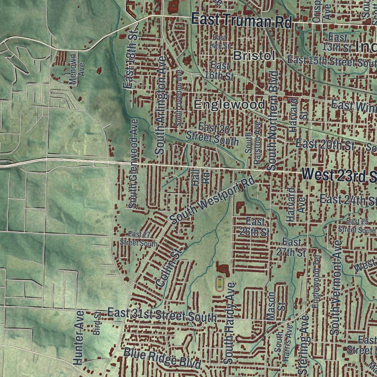
Explore Independence, Missouri from a whole new perspective. Created using aerial imagery and detailed geographic data, this map captures Independence building by building, with labeled streets, familiar landmarks, and shaded topographical relief that highlights the natural contours of the landscape.
Combining modern data with the timeless character of a vintage atlas, this map is just as interesting up close as it is beautiful on the wall. Whether you grew up in Independence, spent memorable years there, or call it home today, this unique map is a great way to celebrate a place that means something to you. Zoom in on the preview to look for your street, and then order a print to put your memories on the wall.
Three ways to hang it
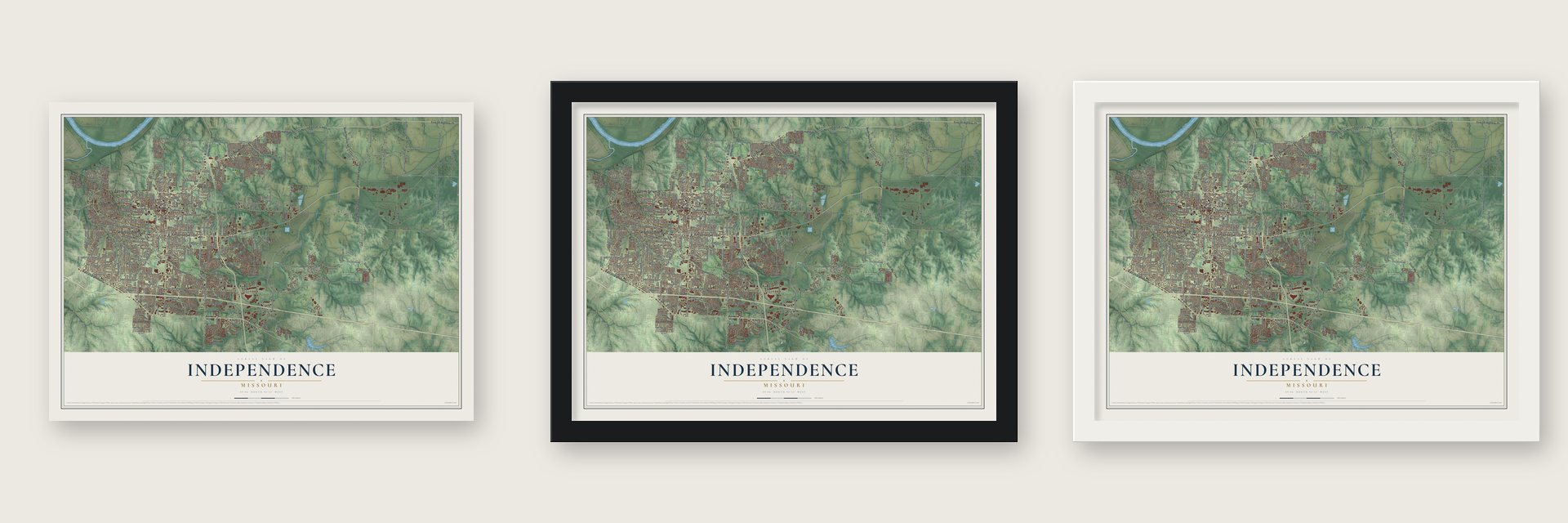
Unframed archival matte, a black wood frame or a white wood frame.
Up close
Geography Worth Displaying
This map was created using accurate cartographic data and authoritative geographic sources, including the U.S. Geological Survey and the Census Bureau. The map brings together terrain, waterways, roads, and building detail. The majority of the streets are labeled, houses are accurately depicted, and the topography is derived from government sources. Combining local data with carefully composed color and shading leads to this beautifully detailed Independence artwork for your wall.
Rather than simply showing street outlines, we’ve included as many of the street names as we could reasonably fit on the map while keeping their names legible. Zoom in on the high resolution preview to see exactly what’s on the map. We truly set out to create a statement piece for anyone who loves Independence. So whether it’s for you, or a gift for someone you love, we hope this map of Independence brings back fond memories.
Read the story behind this map of Independence, Missouri from 2026.

About Independence, Missouri
Independence is a city of 123,011 people on the south bank of the Missouri River, and it is one of the two county seats of Jackson County. Lewis and Clark stopped here in 1804. The town was founded on March 29, 1827, and it took its name from the Declaration of Independence. About six miles to the west, the Kansas River joins the Missouri, and steamboats could go no farther west than Independence. So the young town became the starting point for fur traders and for wagons heading out on the Santa Fe Trail.
Outfitting pioneers made the town rich from the late 1830s through the mid-1840s, and between 1848 and 1868 the town served as a hub for the California Trail. The state legislature granted a home-rule charter on March 8, 1849, and William McCoy became the first mayor on July 18 of that year. The Civil War brought two battles. Confederates took the town on August 11, 1862, and the Union won the second fight in October 1864. Independence never got back its old prosperity, and the growth of Kansas City pushed it into second place in the county.
- Queen City of the TrailsThe Santa Fe, California and Oregon Trails all set out from Independence, and an act of Congress named it the start of the Oregon Trail. The Donner Party stopped here on its way west from Springfield, Illinois. Since 1973 the city has held Santa-Cali-Gon Days every Labor Day to honor all three trails. Before that, the festival had run on and off since 1940.
- The Temple Lot of 1831Latter Day Saints began settling here in 1831, and Joseph Smith chose a spot west of the Courthouse Square for the temple of the New Jerusalem. Their neighbors turned against them and drove them out in 1833, and the conflict led to the Mormon War of 1838. Branches of the movement began coming back in 1867. The Community of Christ and the Church of Christ (Temple Lot) now have their headquarters in the city.
- Truman's hometownHarry S. Truman grew up here. Backed by Kansas City boss Tom Pendergast, he was elected a Jackson County judge in 1922, lost in 1924, won again in 1926 and was reelected in 1930. As judge he built roads for the new car traffic, a new county court building in Independence and 12 Madonna of the Trail monuments, dedicated in 1928 and 1929. After his presidency he came home, and he and Bess, born in the town, are buried here.
- Ginger Rogers, born 1911The actress Ginger Rogers was born in a house that is now the Owens-Rogers Museum. The museum honors her and Lela E. Rogers, a Hollywood screenwriter and producer. The city named the home a Historic Landmark Property in 1994, when Ginger Rogers came back for her birthday.
Find your street
Names on the Independence map
Every name below is printed on this map. Look for your street, your school, the park where you played, or the pond down the road.
Places and landmarks13
- Independence City Hall
- Lake City
- Adair Park
- Burr Oak Woods Conservation Area
- Adams
- Bristol
- East Independence
- Englewood
- Fairmount
- Maywood
- Mount Washington
- Ripley
Show all 13 places
- Selsa
Streets and roads367
- North Twyman Road
- South Mo 7 Highway
- East US Highway 24
- East Independence Avenue
- East 23rd Street South
- North State Highway 7
- West 23rd Street South
- South State Highway 7
- East Truman Road
- East US 24 Highway
- East US Highway 40
- East Winner Road
- East Kentucky Road
- State Highway Ff
- North Liberty Street
- South Crenshaw Road
- Lees Summit Road
- East Lexington Avenue
- North Main Street
- South Ash
- Shrank Avenue
- West Jones Street
- West 25th Street
- Cliff Drive
- Berry Avenue
- Lee's Summit Road
- South Main Street
- East Carswell Road
- Berry Road
- South Santa Fe Road
Show all 367 streets
- South Sterling Avenue
- North Lee's Summit Road
- Shrank Road
- Little Blue Parkway
- East 39th Street South
- East Bundschu Road
- East 35th Street South
- Blue Ridge Boulevard
- East Heidelberger Road
- South Crysler Avenue
- South Noland Road
- Commander's Ridge
- East Lake City Buckner Road
- Lake City Road
- South Hardy Avenue
- South Northern Boulevard
- South Jackson Drive
- East Pink Hill Road
- East Salisbury Road
- East Kentucky Avenue
- Kentucky River Boulevard North
- South Arlington Avenue
- South Vermont Avenue
- South Selsa Road
- East 18th Street
- South Little Blue Parkway
- East 31st Street South
- Holke Road
- North Powell Road
- East Strobe Road
- East 33 Street South
- Northwest Pink Hill Road
- Owens School Road
- North Hoover Road
- North Lake City Valley Road
- South Osage Street
- Dickinson Road
- North Elsea Smith Road
- East 32nd Street
- South Leslie Street
- North Osage Street
- Crackerneck Road
- East 40th Street
- South Crane Street
- Ellison Way
- South Powell Road
- South Pleasant Street
- Phelps Road
- South Dodgion Street
- North Noland Road
- East Sea Avenue
- East 20th Street
- South Westport Road
- East Walnut Avenue
- North River Boulevard
- Burgess Road
- East Valley View Parkway
- Allen Road
- East Holke Road
- Susquehanna Ridge
- North Burnley Road
- North Jones Road
- South Swope Drive
- North Ferguson Spring Road
- Cheyenne Drive
- East 44 Street South
- West Walnut Street
- West College Street
- North Kiger Road
- Drumm Avenue
- South Van Dyke Road
- North Charlton Road
- Sioux Avenue
- Phillips Road
- North Winfrey Road
- South Jones Road
- North Jennings Road
- Weir Road
- Seminole Drive
- South Minton Road
- Bass Pro Drive
- Kings Highway
- Norfleet Road
- East 24th Street
- West 27 Street
- Adams Avenue
- North Bly Road
- East College Street
- James Downey Road
- Lacy Road
- East 35th Terrace
- Speck Road
- Castle Drive
- Lake Drive
- Millhaven Street
- Dover Drive
- East Eureka Road
- Bly Road
- East 51st Street
- South Hub Drive
- Hidden Valley Road
- Haden Drive
- Hereford Street
- Erin Lane
- East Parker Street
- Ringo Road
- South Lowe Road
- Scott Place
- Bellevista Drive
- Farview Drive
- Gudgell Road
- Norledge Street
- North Emery
- Iva Drive
- Corder Road
- Hunter Avenue
- Cogan Road
- Haden Street
- Ranson Place
- West 2 Street
- Collin Street
- Fall Drive
- Berry
- Hill
- North State Highway 291
- East US 40 Highway
- Morrell Avenue
- East 49th Terrace
- South Bass Pro Drive
- Glen Ellyn Street
- Glen Lane
- South Lees Summit Road
- South Scott Avenue
- East 43rd Street South
- East 32 Street South
- East Strode Road
- South Osage Avenue
- South Glenwood Avenue
- East 40 Street South
- East 43 Street South
- East 34th Street South
- South Hocker Street
- South Liberty Street
- South Spring Street
- East 15th Street South
- East 44th Street South
- East 37 Street South
- South Lee's Summit Road
- East 42nd Street South
- North Spring Street
- East 20 Street South
- North Pleasant Street
- Queen Ridge Drive
- North Dickinson Road
- Harvard Avenue
- Harvard Street
- East Wilson Road
- East 25th Street
- East Pacific Avenue
- East 30th Terrace South
- North Delaware Street
- East 25th Terrace South
- Redwood Drive
- East 27th Street
- North Union Street
- South Cottage Street
- North Ponca Drive
- West South Avenue
- South McCoy Street
- Necessary Road
- East 16th Street
- South Union Street
- Carswell Road
- East 27th Terrace
- North Jackson Drive
- Swope Drive
- North Rogers Street
- Scarritt Avenue
- East Sixth Street North
- Crisp Avenue
- East 17th Street
- North Lacy Avenue
- East Mayes Road
- North Davis Road
- Lake City Buckner Road
- South Lynn Street
- Randall Drive
- East Elm Street
- East 49th Street
- East Cogan Lane
- South Savage Street
- East 48th Street
- Frontage Road
- South Fisher Road
- East 54th Street South
- Alexander Road
- East 13th Street
- East Hanna Road
- South Phillips Road
- Bill Johnson Road
- Peck Drive
- Belmont Boulevard
- North High Street
- Bolger Road
- Osage Village Drive
- Pembroke
- Kemper Avenue
- South Stone Canyon Drive
- West Sheley Road
- East Bluff Drive
- East Ponca Drive
- South Ann Street
- South Park Ridge Drive
- West 24 Street
- Manor Road
- Northwest Ashford Court
- South Powell Avenue
- North Cogan Lane
- West 30 Street
- Broadway Street
- South Butler Lane
- South Yuma Court
- Hall Road
- Mohican Avenue
- East Silver Lane
- South Ann Court
- Arrowhead Avenue
- Leslie Drive
- East Castle Drive
- East 26th Street
- South 71 Bypass
- Selsa Road
- Windsor Street
- Baker Drive
- Tepee Avenue
- Hands Street
- East 52 Terrace
- Stark Avenue
- Lippert Lane
- Bedford Avenue
- Mason Street
- Golf Avenue
- 42nd Place
- Lacy Lane
- East 1 Street
- 31st Terrace
- 37 Street
- South Cedar Avenue
- East Jones Road
- East 35th Street
- East 41 Street South
- South Harris Avenue
- South Pearl Street
- South Ralston Avenue
- South Willis Avenue
- East South Avenue
- South Emery Street
- South Delaware Street
- South River Boulevard
- South Seminole Drive
- Englewood Terrace
- Lobb Cemetery Road
- East Second Street South
- East 46 Street South
- East Scarritt Avenue
- South Bryn Mawr Drive
- North Hocker Street
- Cedar Crest Drive
- Northwest Valley View Road
- East Swearingen Road
- Washington Avenue
- South Kisner Drive
- Kentucky Road
- East Jackson Drive
- Arrowhead Ridge
- West 29 Street
- East Eleventh Terrace North
- Independence Avenue
- Mill Creek Park Drive
- Highridge Drive
- Main Road
- East Debra Street
- Markham Road
- Saddle Ridge Drive
- Parkview Street
- Menown Avenue
- Cartmill Road
- East 50th Terrace
- South Vista Drive
- Grant Avenue
- Bird Street
- West 31st Street
- Mc Coy Street
- Peck Road
- West 36 Street
- West Truman Road
- Downey Avenue
- East 14 Street North
- North Hanover Avenue
- East 35 Terrace South
- South Shrank Avenue
- East Fifth Street North
- South Overton Avenue
- East 27 Street South
- East 31 Street South
- East 33rd Street
- East 25 Street South
- East 34 Street South
- Independence Center Drive
- South Trail Ridge
- South Arlington Street
- South Tierney Drive
- East 14th Street
- South Logan Street
- South Park Avenue
- Cochise Drive
- East Mechanic Street
- Shady Bend Drive
- North Crysler Street
- West Nickell Avenue
- East 47th Street South
- East 18th Terrace South
- South Kiger Road
- South Bolger Drive
- West 24th Street
- South Black Forest Avenue
- East 39th Court
- South Mize Ridge Court
- Regional Center Drive
- West 31 Street
- East 47th Street
- Pollard Street
- Sue Ellen Avenue
- East 37th Terrace
- South Quail Drive
- Lake Terrace
- West 33 Street
Names are listed as they appear on the printed map. Zoom into the product photos to find them.
The art of mapping a place
How This Map Was Made
Real places. Remarkable detail. Discover the layers that turn geographic data into a map of home.

The view from above
Aerial imagery reveals the character of the land: woodland, open fields, and the patterns of a place.

The shape of the land
Elevation data brings hills, valleys, and subtle changes in the landscape into view.

The details of home
Roads, waterways, and building footprints come together to make the map feel unmistakably local.

Geography becomes art
Considered color, shading, and typography bring the layers together in a map made for your wall.


Process illustrated with Mendon, Massachusetts. Aerial imagery: USDA NAIP. Terrain: USGS 3D Elevation Program. Map details and finished artwork: KNOWOL.
The Details
About This Print
Choose an archival matte print, or a black or white Ayous wood frame. The archival matte print is unframed.
Select your size and finish above to see the matching product image and price.
Materials & Craftsmanship
A contemporary map with the character of a classic atlas, printed on archival matte paper. Optional frames are made from Ayous wood.
Your printed map does not include the watermark shown in the full-map preview.
Shipping & Delivery
Free shipping within the United States. Every print is made to order in the USA.
Buying a gift? Add a note in your cart and we'll include it. We never put prices in the package.
Prints ship within 2 to 3 business days. Allow 7 to 10 days total from ordering for delivery. Timing may vary during holidays or periods of high order volume.
Read our shipping policy.
Returns and damaged prints
Each print is made to order. Change-of-mind refunds are not available after production.
If your print arrives damaged, misprinted or incorrect, contact support@knowol.com within 30 days of receiving it. Include your order number, photos and a description of the issue.
Read our full refund and replacement policy. For questions about your order, email support@knowol.com.
Find your town
Looking for another city?
Find a map of home in our Missouri collection, or any town in the country.
Nearby
Maps of towns near Independence
Know someone from one of these towns? Their map makes a great gift.
 Sugar Creek
, Missouri
From $39.99See the map
 Lake Tapawingo
, Missouri
From $39.99See the map
 River Bend
, Missouri
From $39.99See the map
More maps nearby: Blue Springs, Blue Summit, Birmingham, Raytown and Grain Valley.