
Search for another town





Free U.S. delivery 7 to 10 days after you order
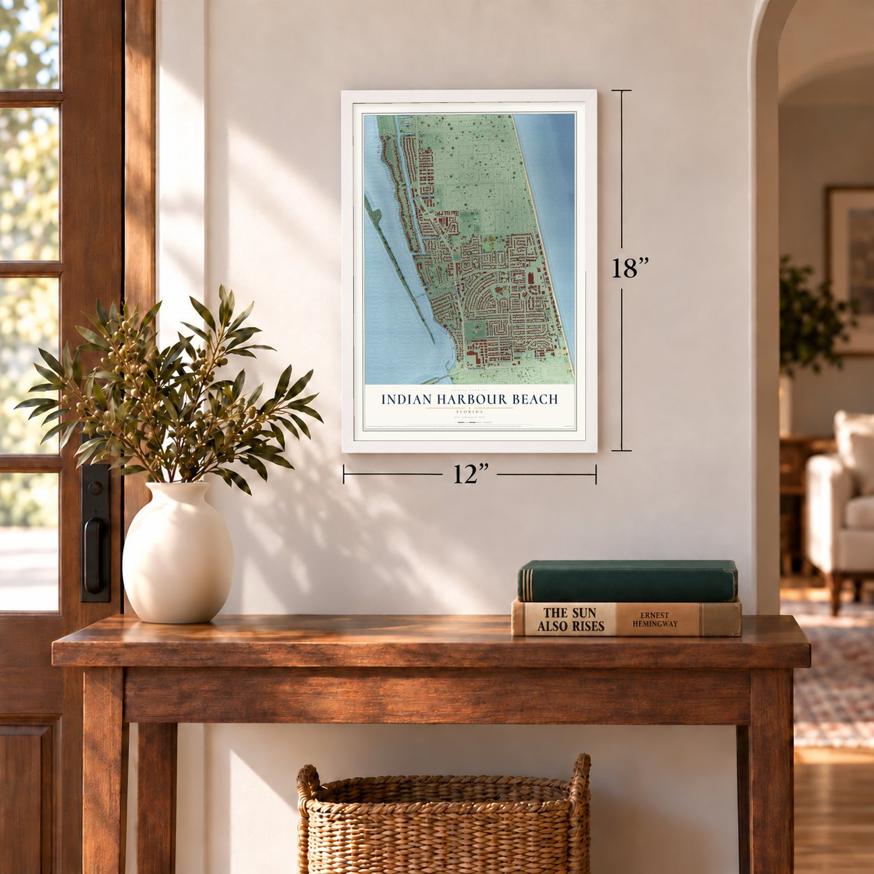
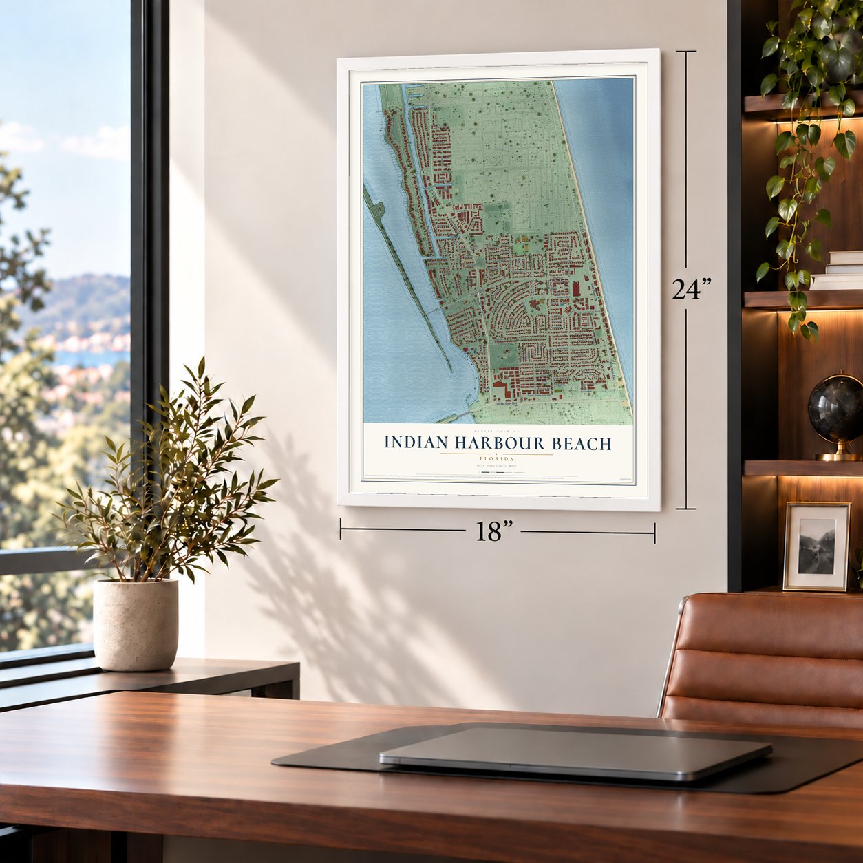
Indian Harbour Beach, Florida Map Art
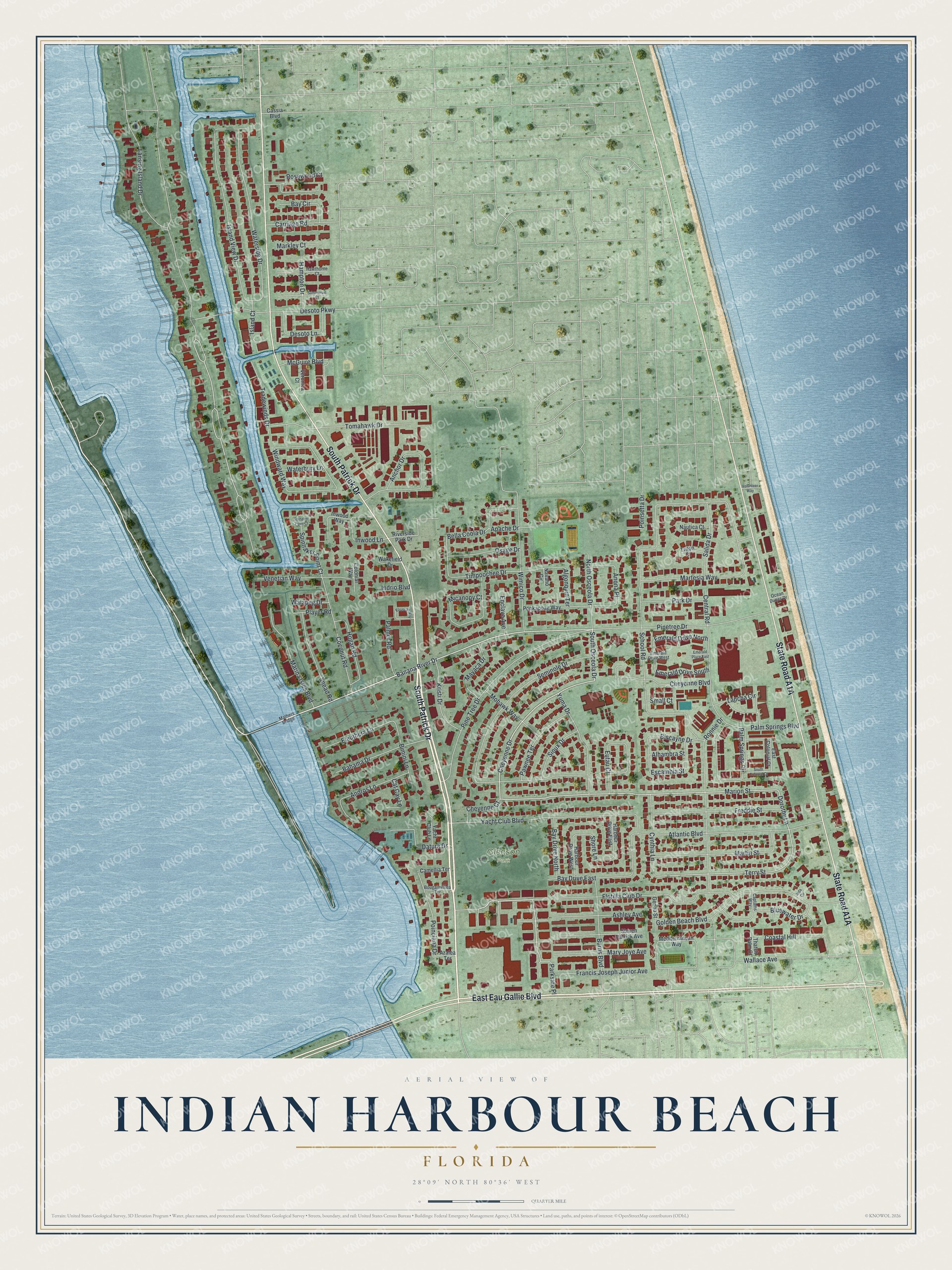
A new map of Indian Harbour Beach, Florida, made in 2026 and printed to order on thick archival matte paper.
12" x 18" Archival Matte Print
A Map of Home. A Work of Art.
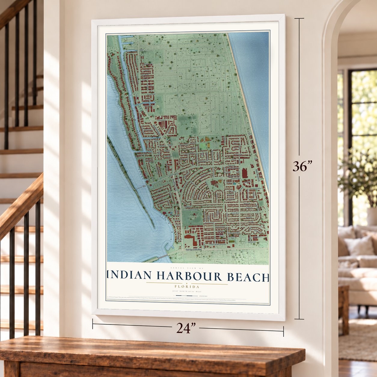
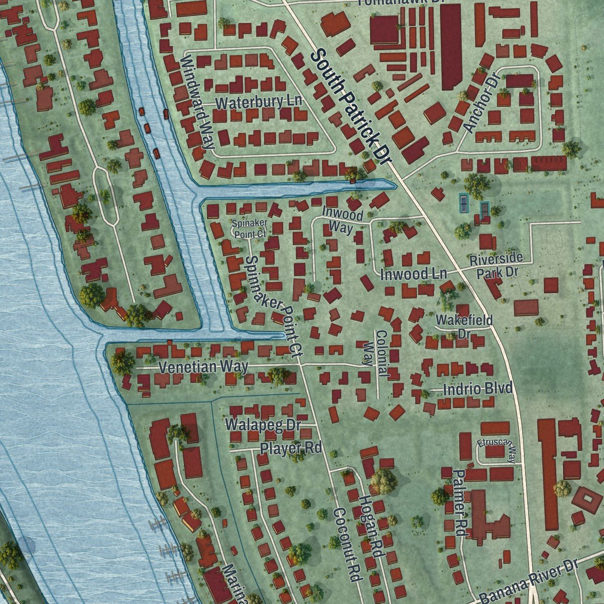
Explore Indian Harbour Beach, Florida from a whole new perspective. Created using aerial imagery and detailed geographic data, this map captures Indian Harbour Beach building by building, with labeled streets, familiar landmarks, and shaded topographical relief that highlights the natural contours of the landscape.
Combining modern data with the timeless character of a vintage atlas, this map is just as interesting up close as it is beautiful on the wall. Whether you grew up in Indian Harbour Beach, spent memorable years there, or call it home today, this unique map is a great way to celebrate a place that means something to you. Zoom in on the preview to look for your street, and then order a print to put your memories on the wall.
Three ways to hang it
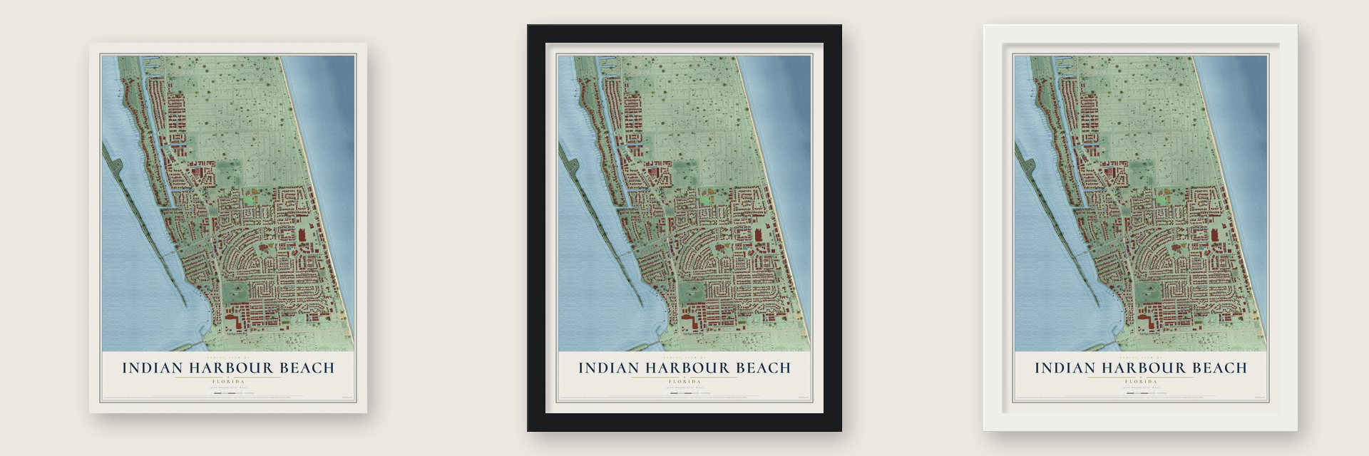
Unframed archival matte, a black wood frame or a white wood frame.
Up close
Geography Worth Displaying
This map was created using accurate cartographic data and authoritative geographic sources, including the U.S. Geological Survey (USGS) and FEMA. The map brings together terrain, waterways, roads, and building detail. The majority of the streets are labeled, houses are accurately depicted, and the topography is derived from government sources. Combining local data with carefully composed color and shading leads to this beautifully detailed Indian Harbour Beach artwork for your wall.
Rather than simply showing street outlines, we’ve included as many of the street names as we could reasonably fit on the map while keeping their names legible. Zoom in on the high resolution preview to see exactly what’s on the map. We truly set out to create a statement piece for anyone who loves Indian Harbour Beach. So whether it’s for you, or a gift for someone you love, we hope this map of Indian Harbour Beach brings back fond memories.
Explore the full map of Indian Harbour Beach, Florida and read about the local places it shows.

About Indian Harbour Beach, Florida
Indian Harbour Beach is a coastal city of 9,019 people in Brevard County, three miles north of Indialantic, with Satellite Beach on its northern side. Its founders, Louis S. Henry, John H. Neafie and W. Lansing Gleason, set it up as a city on June 6, 1955. It grew from 8,225 residents in 2010 to its 2020 count.
The city covers 2.6 square miles between the Banana River and the Atlantic Ocean, and 0.5 square miles of that is water. Two parallel roads carry most of its traffic. State Road A1A runs close to the ocean, while South Patrick Drive follows the river side. In 2024 the A1A stretch through this area took the name Jimmy Buffett Memorial Highway, after the singer died in 2023.
- Florida's first tsunami-ready cityThe first Florida city to earn the National Weather Service's tsunami-ready status was Indian Harbour Beach. The city has its own fire department, run entirely by volunteers. More than 30 members staff it, and they work from three Class-A pumpers, one of them a 75-foot ladder truck.
- Coquina and fossil crabsWhen the tide goes out, about 10 acres of coquina rock appear along the ocean beach. This kind of rock is found in only a few places on the East Coast, and the National Marine Fisheries Service has protected it as essential fish habitat. The same beach holds fossilized Atlantic ghost crabs. They died in their burrows perhaps 110,000 years ago, and an unusual set of conditions preserved them there.
- Tortoises on Samsons IslandA local developer created 12 acres of wetland on Samsons Island to offset building elsewhere, and the marsh became a fish nursery and bird feeding ground. The city later turned the island into a nature park, the barrier island's only site that accepts relocated gopher tortoises. It holds 42 moved there and three that lived there before development. Young ospreys have also fledged from five nesting platforms the city installed.
- Gleason Park's fall showGleason Park covers 27 acres at South Patrick Drive and Yacht Club Boulevard, and the city's recreation center and heated competition pool stand there. The pool is open every day of the year. Each year on the third Saturday in November, the city holds its Art and Crafts Show.
Find your street
Names on the Indian Harbour Beach map
Every name below is printed on this map. Look for your street, your school, the park where you played, or the pond down the road.
Places and landmarks1
- Gleason Park
Streets and roads132
- South Patrick Drive
- East Eau Gallie Boulevard
- Banana River Drive
- Parkside Place
- Cheyenne Drive
- South Osceola Drive
- Marion Street
- Dorothy Lane
- Terry Street
- Lansing Island Drive
- Escambia Street
- Tradewinds Drive
- Timpoochee Drive
- Lancha Circle
- Shore Lane
- Martesia Way
- Pinetree Drive
- Seminole Drive
- Island View Drive
- Yacht Club Boulevard
- Windward Way
- Golden Beach Boulevard
- School Road
- Atlantic Boulevard
- Flotilla Club Drive
- Waterside Drive
- Ronnie Drive
- Palm Springs Boulevard
- Anchor Drive
- Martin Street
Show all 132 streets
- Wimico Drive
- Palm Springs Circle
- Freddie Street
- Micanopy Court
- Bay Drive East
- Coconut Road
- Burns Boulevard
- Eutau Court
- Rosewood Court
- Marina Isles Boulevard
- Yuma Drive
- Bluewater Drive
- Bahama Drive
- Venetian Way
- Andros Lane
- Cheyenne Boulevard
- Pine Tree Drive
- Tomahawk Drive
- Snead Road
- Mary Joye Avenue
- Francis Joseph Junior Avenue
- Coastal Hill
- Bella Coola Drive
- Anona Place
- Ashley Avenue
- Pawnee Terrace
- Algonquin Terrace
- Cynthia Lane
- Hogan Road
- McGuire Boulevard
- Desoto Lane
- Kristi Drive
- Inwood Lane
- Datura Drive
- Eleuthera Lane
- North Osceola Drive
- Salida Drive
- Osage Drive
- Emerald Drive South
- Emerald Drive North
- Bay Drive North
- Mohawk Way
- Mayaca Drive
- Poinciana Drive
- Hampton Drive
- Bimini Lane
- Desoto Parkway
- Park Drive
- Carriage Road
- Sioux Drive
- Wallace Avenue
- Spinnaker Point Court
- Biscayne Drive
- Bay Circle
- Palmer Road
- Poinsetta Drive
- Cheyenne Court
- Island Court
- Markley Court
- Cat Cay Lane
- Waterbury Lane
- Enclave Avenue
- Player Road
- Walapeg Drive
- Alhambra Street
- Central Road
- Indrio Boulevard
- Apache Drive
- Small Court
- East Colonial Court
- Mediterranean Way
- Steven Patrick Avenue
- Ponkapoag Way
- Riverside Park Drive
- Inwood Way
- Harbour Drive West
- Harbour Drive East
- Genoa Street
- Camellia Terrace
- Yacht Club Lane
- Thatch Palm Court
- Nautica Court
- Colonial Way
- Veronica Court
- Triton Court
- Wakefield Drive
- Cassia Boulevard
- Azalea Terrace
- Navaho Circle
- Mathers Bridge
- Hawthorne Court
- Bougainvillea Terrace
- Emerald Drive West
- Captains Way
- Ocean Dunes Drive
- South Colonial Court
- Etruscan Way
- Summerset Court
- Spinaker Point Court
- Emerald Place East
- Volunteer Way
- Aida Circle
Names are listed as they appear on the printed map. Zoom into the product photos to find them.
The art of mapping a place
How This Map Was Made
Real places. Remarkable detail. Discover the layers that turn geographic data into a map of home.

The view from above
Aerial imagery reveals the character of the land: woodland, open fields, and the patterns of a place.

The shape of the land
Elevation data brings hills, valleys, and subtle changes in the landscape into view.

The details of home
Roads, waterways, and building footprints come together to make the map feel unmistakably local.

Geography becomes art
Considered color, shading, and typography bring the layers together in a map made for your wall.


Process illustrated with Mendon, Massachusetts. Aerial imagery: USDA NAIP. Terrain: USGS 3D Elevation Program. Map details and finished artwork: KNOWOL.
The Details
About This Print
Choose an archival matte print, or a black or white Ayous wood frame. The archival matte print is unframed.
Select your size and finish above to see the matching product image and price.
Materials & Craftsmanship
A contemporary map with the character of a classic atlas, printed on archival matte paper. Optional frames are made from Ayous wood.
Your printed map does not include the watermark shown in the full-map preview.
Shipping & Delivery
Free shipping within the United States. Every print is made to order in the USA.
Buying a gift? Add a note in your cart and we'll include it. We never put prices in the package.
Prints ship within 2 to 3 business days. Allow 7 to 10 days total from ordering for delivery. Timing may vary during holidays or periods of high order volume.
Read our shipping policy.
Returns and damaged prints
Each print is made to order. Change-of-mind refunds are not available after production.
If your print arrives damaged, misprinted or incorrect, contact support@knowol.com within 30 days of receiving it. Include your order number, photos and a description of the issue.
Read our full refund and replacement policy. For questions about your order, email support@knowol.com.
Find your town
Looking for another city?
Find a map of home in our Florida collection, or any town in the country.
Nearby
Maps of towns near Indian Harbour Beach
Know someone from one of these towns? Their map makes a great gift.
 Satellite Beach
, Florida
From $39.99See the map
 South Patrick Shores
, Florida
From $39.99See the map
 Palm Shores
, Florida
From $39.99See the map
More maps nearby: Melbourne, Patrick AFB, Indialantic, Melbourne Village and Melbourne Beach.