
Search for another town




Free U.S. delivery 7 to 10 days after you order
Iona, Florida Map Art
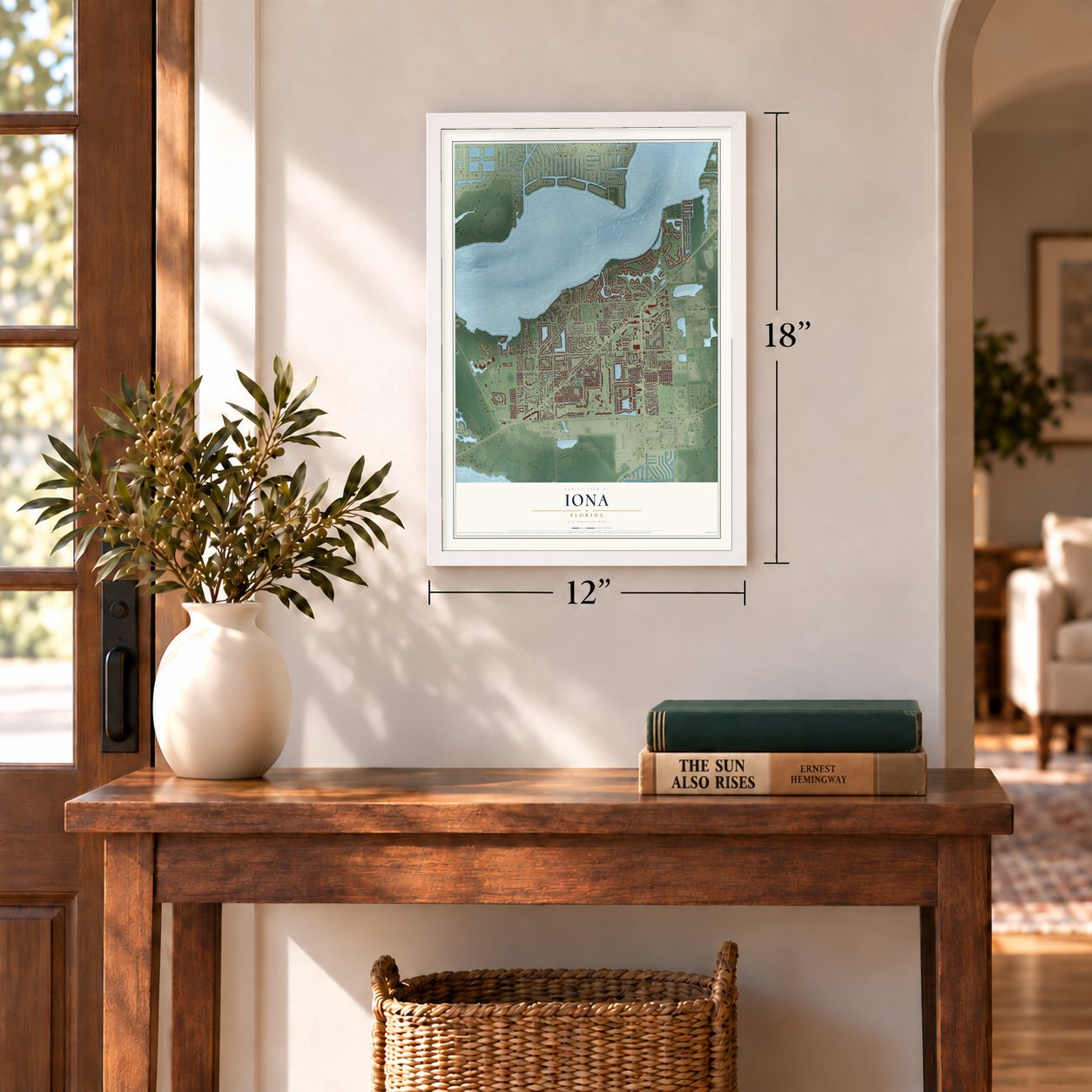
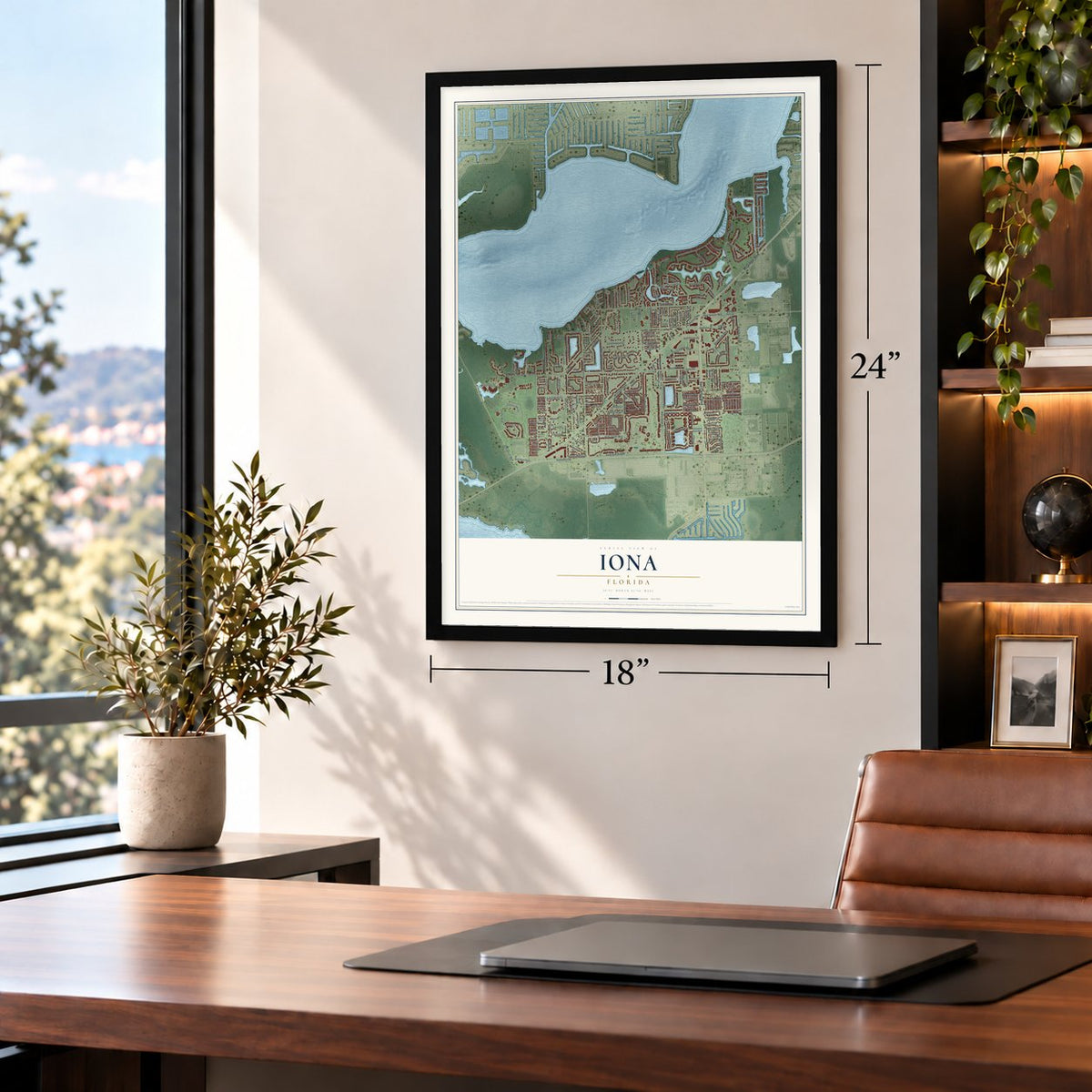
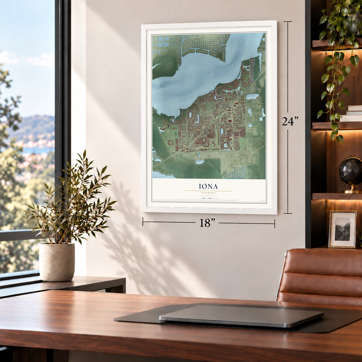
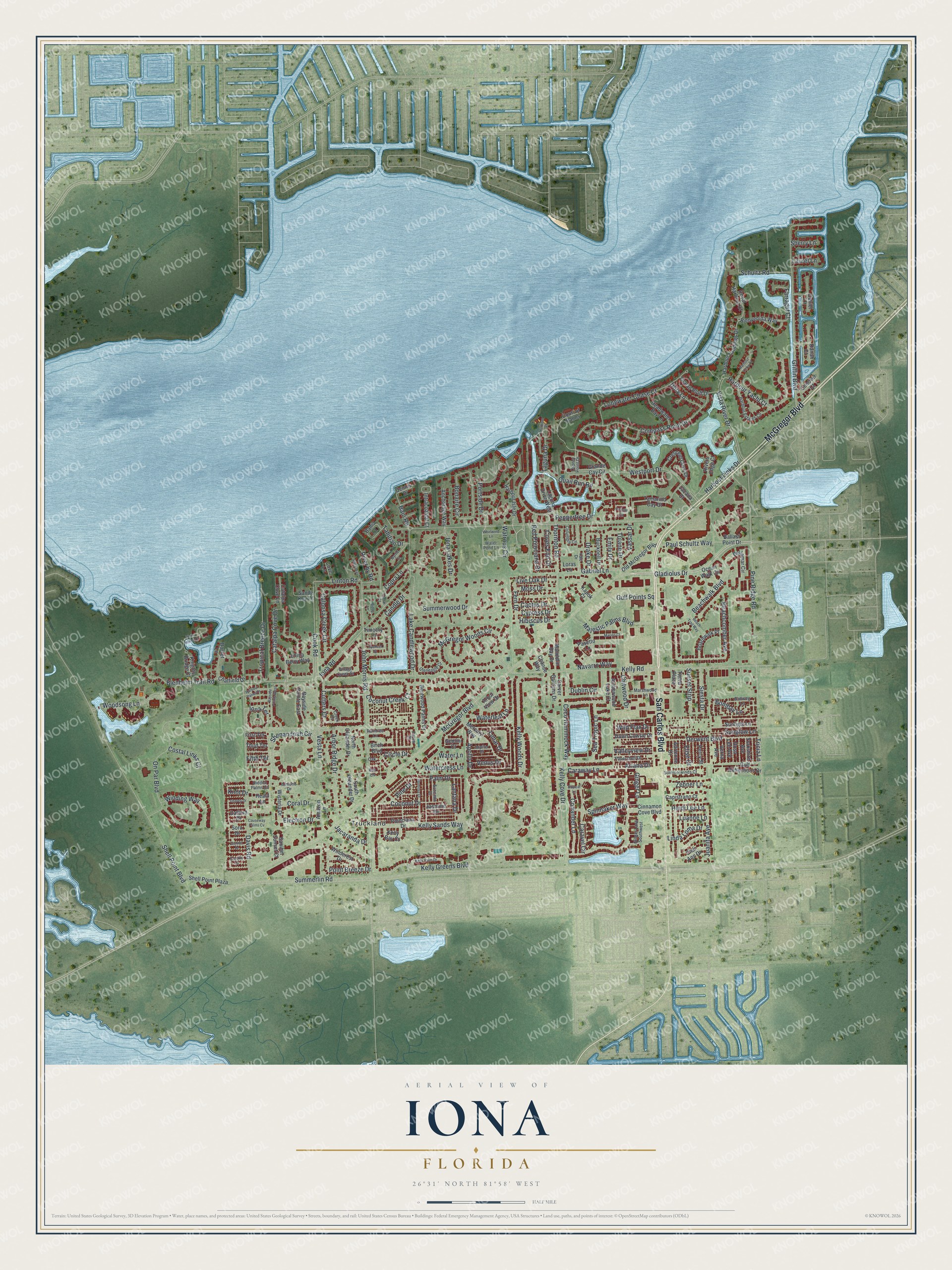
A new map of Iona, Florida, made in 2026 and printed to order on thick archival matte paper.
12" x 18" Archival Matte Print
A Map of Home. A Work of Art.
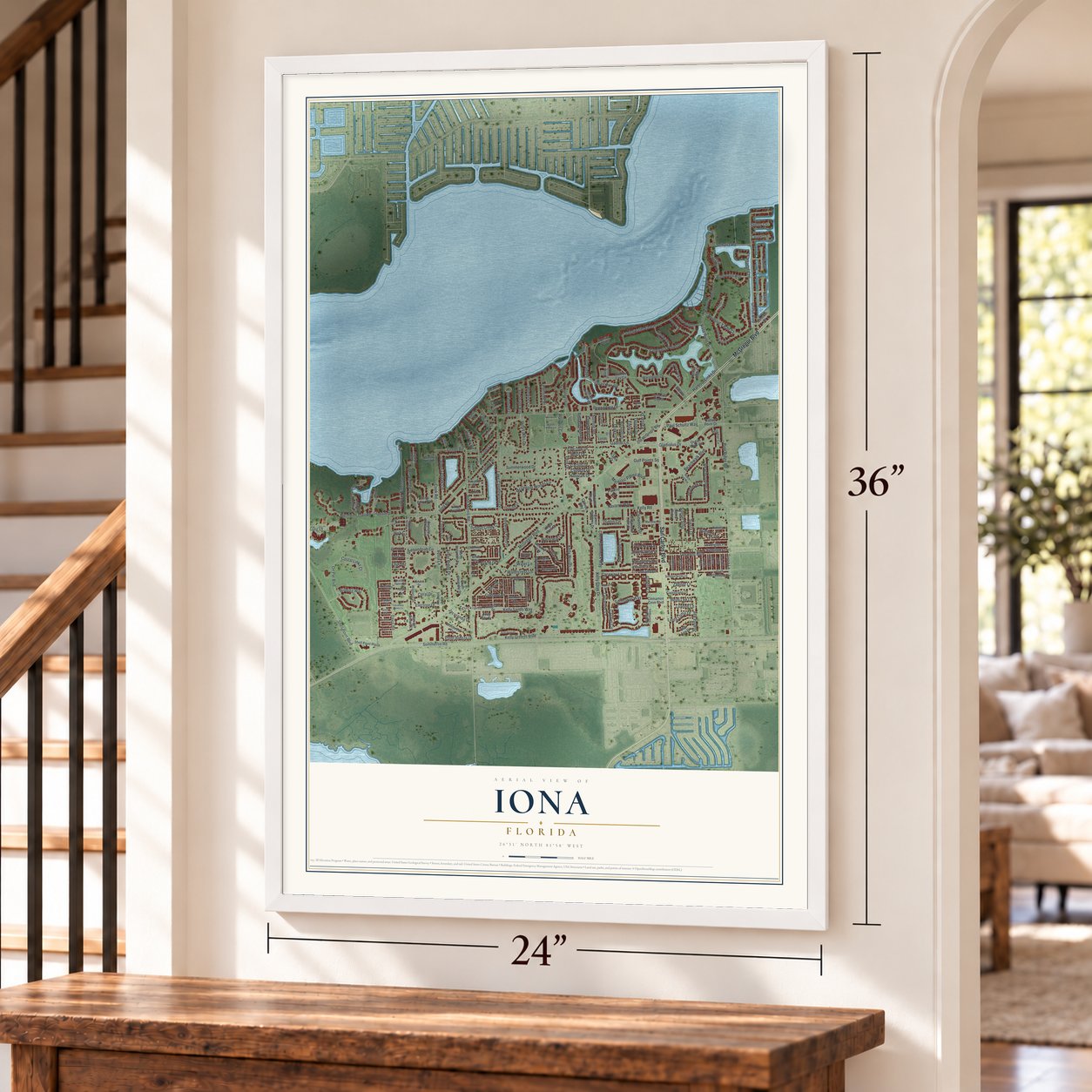
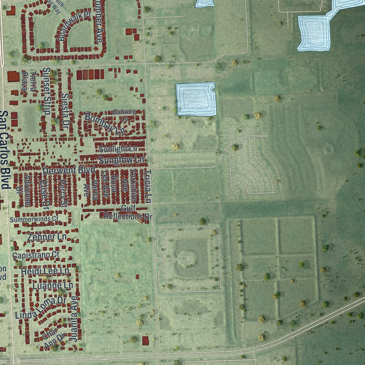
This beautifully detailed map of Iona, Florida was created in 2026 using aerial imagery combined with modern topographical, census, street and landmark data. It's a modern aerial view of Iona in Lee County, Florida, that combines modern data with a vintage aesthetic. Zoom in on the preview and look for your block.
Three ways to hang it
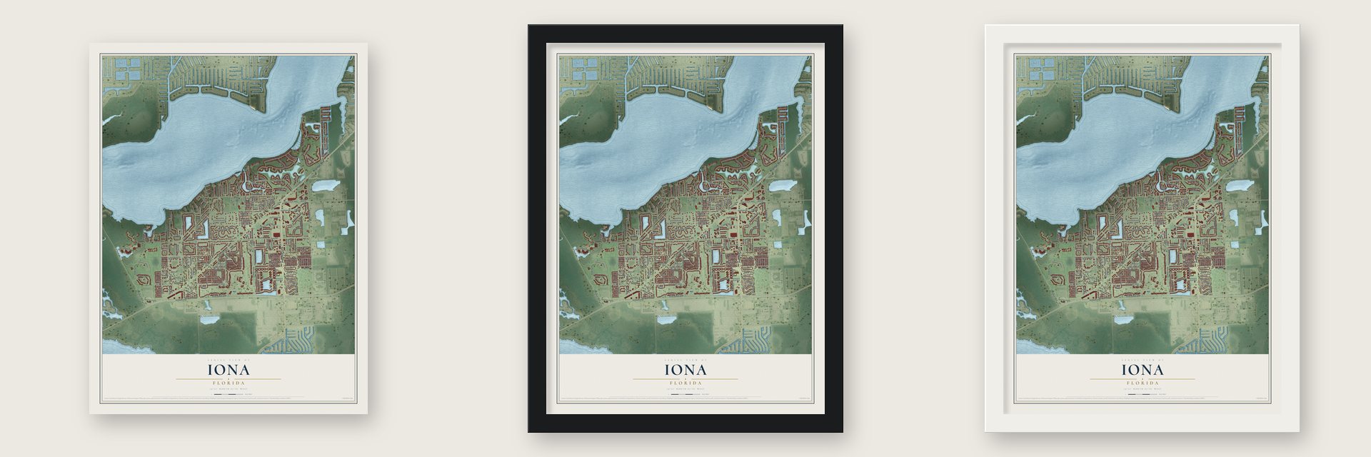
Unframed archival matte, a black wood frame or a white wood frame.
Up close
Real geography. Art worth displaying.
This map was created using accurate cartographic data and authoritative geographic sources, including the U.S. Geological Survey and the Census Bureau. The map brings together terrain, waterways, roads, and building detail. The majority of the streets are labeled, houses are accurately depicted, and the topography is derived from government sources. Combining local data with carefully composed color and shading leads to this beautifully detailed Iona artwork for your wall.
Rather than simply showing street outlines, we’ve included as many of the street names as we could reasonably fit on the map while keeping their names legible. Zoom in on the high resolution preview to see exactly what’s on the map. We truly set out to create a statement piece for anyone who loves Iona. So whether it’s for you, or a gift for someone you love, we hope this map of Iona brings back fond memories.

Find your street
Names on the Iona map
Every name below is printed on this map. Look for your street, your school, the park where you played, or the pond down the road.
Places and landmarks1
- Truckland
Streets and roads234
- San Carlos Boulevard
- McGregor Boulevard
- Watrous Circle
- Portside Drive
- Electron Drive
- Caraway Lane
- Sunglow Lane
- Heidi Lee Lane
- Ariana Drive
- Kelly Greens Boulevard
- Gabriel Lane
- Ginger Lane
- Palm Drive
- Harbour Yacht Court
- Fern Drive
- Summerlin Road
- Iona Road
- Pine Ridge Road
- John Morris Road
- Kelly Sands Way
- Shell Point Boulevard
- Kelly Road
- Caravel Circle
- Gladiolus Drive
- Griffin Boulevard
- Kelly Cove Drive
- On Par Boulevard
- McGregor Woods Circle
- Cook Road
- Davis Road
Show all 234 streets
- Cutters Court
- Coconut Creek Court
- Caloosa Creek Circle
- Vista River Drive
- Summerwood Drive
- Laguna Drive
- Compass Point Drive
- Apollo Drive
- Woodsong Lane
- Chitwood Drive
- Westport Drive
- Iona Lakes Drive
- Beachcomber Avenue
- Shenandoah Circle
- Catalpa Cove Drive
- Coco Hammock Way
- Bonaire Circle
- Lake Candlewood Drive
- Kelly Woods Drive
- Winding Way
- Blenheim Trail Road
- Longwater Chase Court
- Quail Run Road
- Beachwalk Boulevard
- Tropical Breeze Drive
- Thornton Road
- Candle Drive
- Derwent Boulevard
- Iona Terrace
- Arbor Ridge Drive
- Majestic Palms Boulevard
- Dublin Circle
- Schultz Road
- Navarro Way
- Harbour Links Drive
- Coral Drive
- Coconut Drive
- Red Poinciana Drive
- Coriander Lane
- Water Lane
- Paul Schultz Way
- Sea Tropic Lane
- Waterleaf Lane
- Bombay Lane
- Copra Lane
- Juanita Avenue
- Emily Drive
- Spinnaker Way
- Gulf Points Square
- Circle Drive
- Watercress Lane
- Farragut Court
- River by Road
- Linton Road
- Linda Loma Drive
- Tahitian Drive
- Peppertree Drive
- Siesta Drive
- Coves End Drive
- Sunset Strip
- Vesta Lane
- Tulane Drive
- Zehner Lane
- Cactus Drive
- Point Breeze Drive
- Cypress Drive
- Live Oak Drive
- Costal Links Court
- Hibiscus Drive
- Vassar Drive
- Jacaranda Drive
- Dory Lane
- Valleyview Drive
- Bain Road
- Lantana Drive
- Lunar Drive
- Wild Flax Drive
- Drake Drive
- Venus Drive
- Tricia Lane
- Luanne Lane
- Moss Drive
- Elise Drive
- Sherry Lane
- Laurel Lane
- Pine Drive
- Fifth Terrace
- Knot Drive
- Harbour Isle Drive
- Amazon Lane
- Wisteria Drive
- Harbour Landings Drive
- Grande Cay Circle
- Bienvenida Way
- Poinciana Drive
- Kapok Court
- Bahia Court
- Ocean Walk Circle
- Ballast Point Drive
- Mercury Way
- Bellamar Circle
- Tamarind Cay Court
- China Berry Way
- Cinnamon Cove Boulevard
- Chatfield Drive
- Gemini Court
- Bayside Pointe East
- Shell Point Plaza
- Intracoastal Court
- Court of Palms
- Bentwood Palms Drive
- Rivers Edge Court
- Crescent Cove Drive
- Old McGregor Boulevard
- Danah Court
- Daniel Court
- Boardwalk Place
- Ocean Bluff Drive
- Birch Boulevard
- Gulf Reflections Drive
- Headwater Bay Lane
- Royal Harbour Court
- Laguna Drive West
- Dawn Cowrie Drive
- Anchorage Way
- Amberwood Lake Court
- Sunlight Lane
- Chance Way
- Mandolin Bay Drive
- Windcrest Drive
- Bucknell Drive
- Knights Bridge Court
- Capistrano Court
- Kelly Bay Court
- Catalpa Cove Lane
- South Oleander Drive
- Pasetto Lane
- Carver Gardens Drive
- North Oleander Drive
- Char Ann Drive
- Yorkshire Avenue
- Arbor View Drive
- Jasmine Drive
- Sandy Key Lane
- Rosa Lee Avenue
- Verna Avenue
- Adrienne Drive
- Percy Street
- Conover Court
- Sanibel Sunset Court
- Third Terrace
- Heald Lane
- Sora Drive
- Catbird Drive
- Tierra Plaza
- First Terrace
- Cove Lane
- Timothy Lane
- Jacana Court
- Dennis Drive
- Dorset Lane
- Loras Lane
- Yale Drive
- Harbour Estates Circle
- Osprey Point Drive
- Gleneagle Court
- Ginger Lane Southwest
- Columbia Circle
- Village Creek Drive
- Omai Court
- Papershell Drive
- Summerwinds Court
- Ballweg Lane
- Marshwood Lane
- Pointe Circle
- Raintree Lane
- Avocado Drive
- Water Pond Lane
- Hidden Palms Cv
- Jupiter Drive
- Creek Court
- Almond Drive
- Poplar Place
- Oak
- Ash Lane
- Bayside Pointe West
- Harbour Links Court
- Waite Island Drive
- Plumosa Drive
- Kelly Palm Drive
- Marino Court
- Spencer Street
- Bayleaf Lane
- Harbour Palms Drive
- Beach Trail Way
- Biddy Lane
- Whirlwind Lane
- Allen Way
- Grackle Drive
- Myrtle Street
- Osprey Drive
- Gannet Drive
- Causeway Palms Cv
- Harbour Place
Names are listed as they appear on the printed map. Zoom into the product photos to find them.
The art of mapping a place
How This Map Was Made
Real places. Remarkable detail. Discover the layers that turn geographic data into a map of home.

The view from above
Aerial imagery reveals the character of the land: woodland, open fields, and the patterns of a place.

The shape of the land
Elevation data brings hills, valleys, and subtle changes in the landscape into view.

The details of home
Roads, waterways, and building footprints come together to make the map feel unmistakably local.

Geography becomes art
Considered color, shading, and typography bring the layers together in a map made for your wall.


Process illustrated with Mendon, Massachusetts. Aerial imagery: USDA NAIP. Terrain: USGS 3D Elevation Program. Map details and finished artwork: KNOWOL.
The Details
About This Print
Choose an archival matte print, or a black or white Ayous wood frame. The archival matte print is unframed.
Select your size and finish above to see the matching product image and price.
Materials & Craftsmanship
A contemporary map with the character of a classic atlas, printed on archival matte paper. Optional frames are made from Ayous wood.
Your printed map does not include the watermark shown in the full-map preview.
Shipping & Delivery
Free shipping within the United States. Every print is made to order in the USA.
Buying a gift? Add a note in your cart and we'll include it. We never put prices in the package.
Prints ship within 2 to 3 business days. Allow 7 to 10 days total from ordering for delivery. Timing may vary during holidays or periods of high order volume.
Read our shipping policy.
Returns and damaged prints
Each print is made to order. Change-of-mind refunds are not available after production.
If your print arrives damaged, misprinted or incorrect, contact support@knowol.com within 30 days of receiving it. Include your order number, photos and a description of the issue.
Read our full refund and replacement policy. For questions about your order, email support@knowol.com.
Find your town
Looking for another city?
Find a map of home in our Florida collection.
Nearby
Maps of towns near Iona
Know someone from one of these towns? Their map makes a great gift.
 Harlem Heights
, Florida
From $39.99See the map
 Punta Rassa
, Florida
From $39.99See the map
 Cypress Lake
, Florida
From $39.99See the map
More maps nearby: McGregor, Whiskey Creek, Villas, Pine Manor and Fort Myers Beach.