


Search for another town



Free U.S. delivery 7 to 10 days after you order
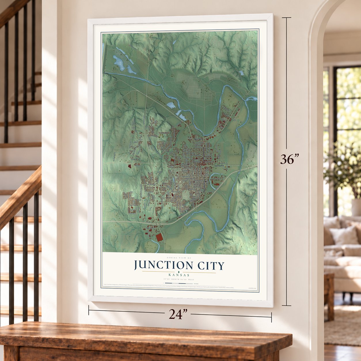
Junction City, Kansas Map Art
Building by building, with labeled streets and shaded relief.
12" x 18" Archival Matte Print
A Map of Home. A Work of Art.
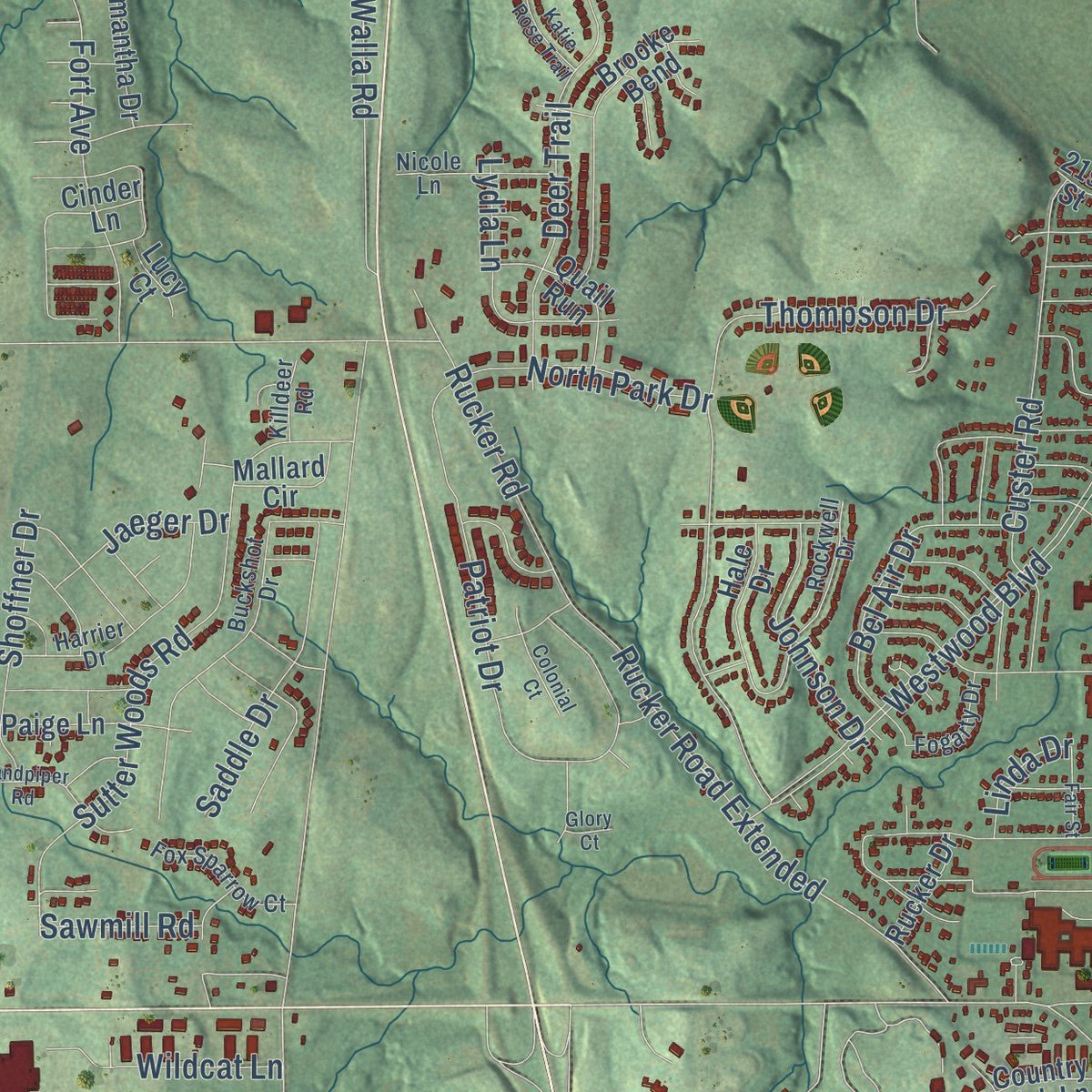
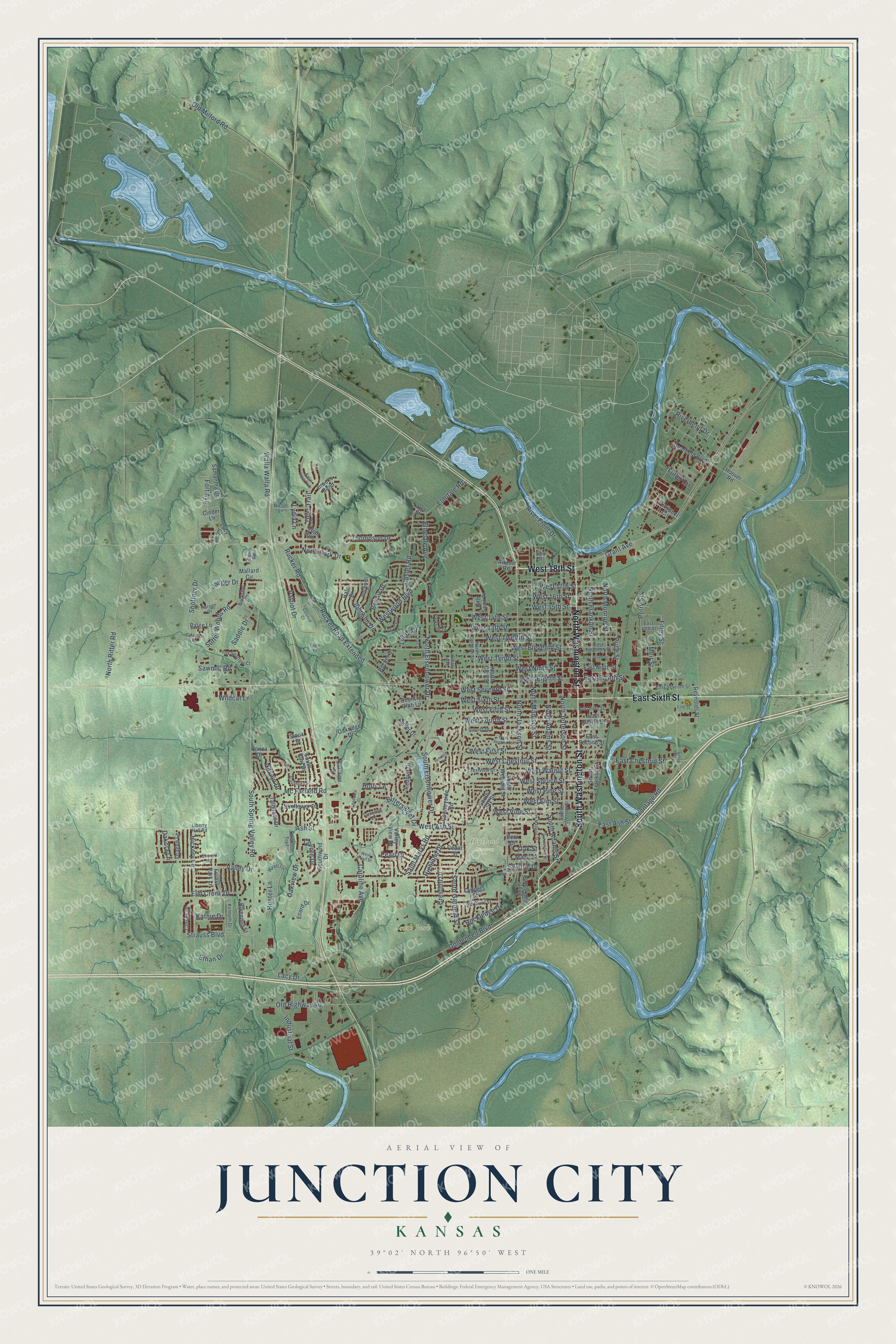
Explore Junction City, Kansas from a whole new perspective. Created using aerial imagery and detailed geographic data, this map captures Junction City building by building, with labeled streets, familiar landmarks, and shaded topographical relief that highlights the natural contours of the landscape.
Combining modern data with the timeless character of a vintage atlas, this map is just as interesting up close as it is beautiful on the wall. Whether you grew up in Junction City, spent memorable years there, or call it home today, this unique map is a great way to celebrate a place that means something to you. Zoom in on the preview to look for your street, and then order a print to put your memories on the wall.
Three ways to hang it
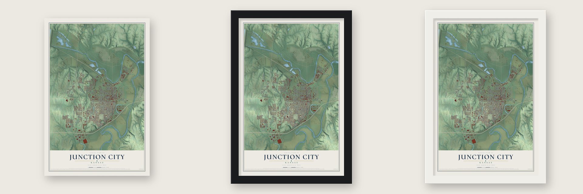
Unframed archival matte, a black wood frame or a white wood frame.
Up close
Geography Worth Displaying
This map was created using accurate cartographic data and authoritative geographic sources, including the U.S. Geological Survey and the Census Bureau. The map brings together terrain, waterways, roads, and building detail. The majority of the streets are labeled, houses are accurately depicted, and the topography is derived from government sources. Combining local data with carefully composed color and shading leads to this beautifully detailed Junction City artwork for your wall.
Rather than simply showing street outlines, we’ve included as many of the street names as we could reasonably fit on the map while keeping their names legible. Zoom in on the high resolution preview to see exactly what’s on the map. We truly set out to create a statement piece for anyone who loves Junction City. So whether it’s for you, or a gift for someone you love, we hope this map of Junction City brings back fond memories.
Read the story behind this map of Junction City, Kansas from 2026.

Find your street
Names on the Junction City map
Every name below is printed on this map. Look for your street, your school, the park where you played, or the pond down the road.
Places and landmarks2
- Highland Cemetery
- South Park
Streets and roads186
- North Washington Street
- West 18th Street
- South Washington Street
- East Sixth Street
- West Elm Street
- West Twelfth Street
- West Eighth Street
- East Eighth Street
- Price Street
- West Vine Street
- North Jackson Street
- West Sixth Street
- West Seventh Street
- West Ash Street
- Rucker Road Extended
- North Adams Street
- Custer Road
- Riverbend Drive
- South Eisenhower Drive
- East Ash Street
- Grant Avenue
- South Spring Valley Road
- Mc Farland Road
- Westwood Boulevard
- Caroline Avenue
- West 14th Street
- West Eleventh Street
- North Madison Street
- North Jefferson Street
- North Franklin Street
Show all 186 streets
- Goldenbelt Boulevard
- West Spruce Street
- West Ninth Street
- North Monroe Street
- South Garfield Street
- North Eisenhower Drive
- Thompson Drive
- Rucker Road
- West Chestnut Street
- Skyline Drive
- West Tenth Street
- West Fifth Street
- Saint Marys Road
- Sutter Woods Road
- West 13th Street
- West Fourth Street
- West 17th Street
- West Pine Street
- Old Highway 40
- Patriot Drive
- South Adams Street
- West First Street
- Hickory Lane
- Deer Trail
- Perry Street
- Highland Drive
- East Chestnut Street
- Filley Street
- Lacy Drive
- West 16th Street
- Elm Creek Drive
- River Front Drive
- Fort Avenue
- Bel Air Drive
- Walla Walla Road
- West 15th Street
- Ash Street
- West Walnut Street
- North Ritter Road
- Frontage Road
- Ethan Drive
- Valley Drive
- Bittersweet Drive
- Strauss Boulevard
- Saddle Drive
- Lydia Lane
- Shoffner Drive
- Oakview Drive
- Fuller Circle
- Meir Street
- Rockledge Drive
- North Park Drive
- Johnson Drive
- Elmdale Avenue
- Wildcat Lane
- Cresthill Drive
- Industrial Street
- Elmdale Road
- Old Milford Road
- Navajo Drive
- Jaeger Drive
- Coyote Drive
- Pearl Drive
- Hunter Lane
- Holly Lane
- Sawmill Road
- Dakota Lane
- Kathie Drive
- Linda Drive
- Oak Street
- South Clay Street
- South Franklin Street
- Caroline Court
- Reynolds Street
- South Jackson Street
- North Clay Street
- South Webster Street
- Oakridge Drive
- Southwind Drive
- 14th Saint Place
- Prospect Circle
- Cypress Street
- Brooke Bend
- Cedar Street
- East Ninth Street
- Miller Drive
- Countryside Road
- East Fourth Street
- Redbud Drive
- Ecord Drive
- Cinder Lane
- Paige Lane
- Sunflower Drive
- South Kaw Drive
- Hale Drive
- Quail Run
- Hoover Road
- Deerfield Boulevard
- Clover Drive
- Tallgrass Drive
- Samantha Drive
- Rivendell Street
- Rucker Drive
- Country Club Lane
- Dragen Lane
- Valley View Drive
- Mallard Circle
- East Second Street
- Forest Park Lane
- Maple Street
- Lucy Court
- Airport Road
- Sioux Street
- Ponca Drive
- Beck Drive
- 21st Street
- East 13th Street
- North Calhoun Street
- Buckshot Drive
- East Seventh Street
- South Jefferson Street
- Tamerisk Drive
- East Eleventh Street
- Harrier Drive
- Mc Clure Street
- Liberty Hall Road
- Rockwell Drive
- Crestview Drive
- Parkside Drive
- Wyatt Lane
- Fox Sparrow Court
- Nicole Lane
- Kenneth Drive
- Sunset Drive
- East Fifth Street
- Fogarty Drive
- Chisholm Trail
- Cleary Avenue
- Killdeer Road
- 19th Street
- South Madison Street
- West Second Street
- Oakwood Drive
- East Tenth Street
- Arapahoe Court
- Sunrise Hill Drive
- Sandpiper Road
- Rimrock Drive
- Katie Rose Trail
- Colonial Court
- West Pearl Drive
- Chadwick Court
- Fifth Street
- Fair Street
- South East Street
- Glory Court
Names are listed as they appear on the printed map. Zoom into the product photos to find them.
About Junction City, Kansas
Junction City is a city of 22,932 people and the county seat of Geary County, close to the Army post at Fort Riley. Its name comes from its place where the Smoky Hill and Republican rivers meet and form the Kansas River. In 1854 a Free State group led by Andrew J. Mead of New York planned a town called Manhattan on this ground. Low water stopped their steamship, the Hartford, before it got this far, so the settlers stayed 20 miles east, at today's Manhattan.
The site was renamed Millard City on October 3, 1855, after the Hartford's Captain Millard. Local farmers called it Humboldt for a short time in 1857, and later that year it took the name Junction City. The town was incorporated in 1859 and named the county seat in 1860, and the arrival of the Union Pacific Railroad in 1866 helped it grow.
- A town company in 1857Five men, Robert Wilson, J. R. McClure, John T. Price, F. N. Blake and P. Z. Taylor, formed a town company in 1857 and picked the site. Their survey waited until the spring of 1858. The first building rose that May, and within a few months a village had grown up around it.
- George Smith's libraryA bequest from George Smith founded the city's library. The 1912 Kansas cyclopedia said a town ten times Junction City's size would be proud of the library and its building, which held nearly 8,000 volumes in 1911.
- Ninth Street on filmFilm director Kevin Wilmott, a Junction City resident, sets his movies here. His film Ninth Street is named for a bawdy stretch of town where Fort Riley soldiers went in the 1960s. In the 1980s the city launched a major push to clean up the Ninth Street area.
Keep exploring Kansas
Junction City is one of 764 Kansas towns we've mapped. Every dot on the map is a print of its own.
The search covers every state, Kansas first.
Near Junction City
Order 2 or more town maps and save 10%. Shown in the size and finish you picked above, so they hang as a set.
- Grandview Plaza 12" x 18" / Archival Matte Print $39.99
- Fort Riley 12" x 18" / Archival Matte Print $39.99
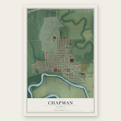
- Chapman 12" x 18" / Archival Matte Print $39.99


More maps nearby: Ogden, Milford, Keats, Wakefield and Detroit.
The art of mapping a place
How This Map Was Made
Real places. Remarkable detail. Discover the layers that turn geographic data into a map of home.

The view from above
Aerial imagery reveals the character of the land: woodland, open fields, and the patterns of a place.

The shape of the land
Elevation data brings hills, valleys, and subtle changes in the landscape into view.

The details of home
Roads, waterways, and building footprints come together to make the map feel unmistakably local.

Geography becomes art
Considered color, shading, and typography bring the layers together in a map made for your wall.


Process illustrated with Mendon, Massachusetts. Aerial imagery: USDA NAIP. Terrain: USGS 3D Elevation Program. Map details and finished artwork: KNOWOL.
The Details
About This Print
Choose an archival matte print, or a black or white Ayous wood frame. The archival matte print is unframed.
Select your size and finish above to see the matching product image and price.
Materials & Craftsmanship
A contemporary map with the character of a classic atlas, printed on archival matte paper. Optional frames are made from Ayous wood.
Your printed map does not include the watermark shown in the full-map preview.
Shipping & Delivery
Free shipping within the United States. Every print is made to order in the USA.
Buying a gift? Add a note in your cart and we'll include it. We never put prices in the package.
Prints ship within 2 to 3 business days. Allow 7 to 10 days total from ordering for delivery. Timing may vary during holidays or periods of high order volume.
Read our shipping policy.
Returns and damaged prints
Each print is made to order. Change-of-mind refunds are not available after production.
If your print arrives damaged, misprinted or incorrect, contact support@knowol.com within 30 days of receiving it. Include your order number, photos and a description of the issue.
Read our full refund and replacement policy. For questions about your order, email support@knowol.com.