
Search for another town





Free U.S. delivery 7 to 10 days after you order
Kent, Connecticut Map Art
Building by building, with labeled streets and shaded relief.
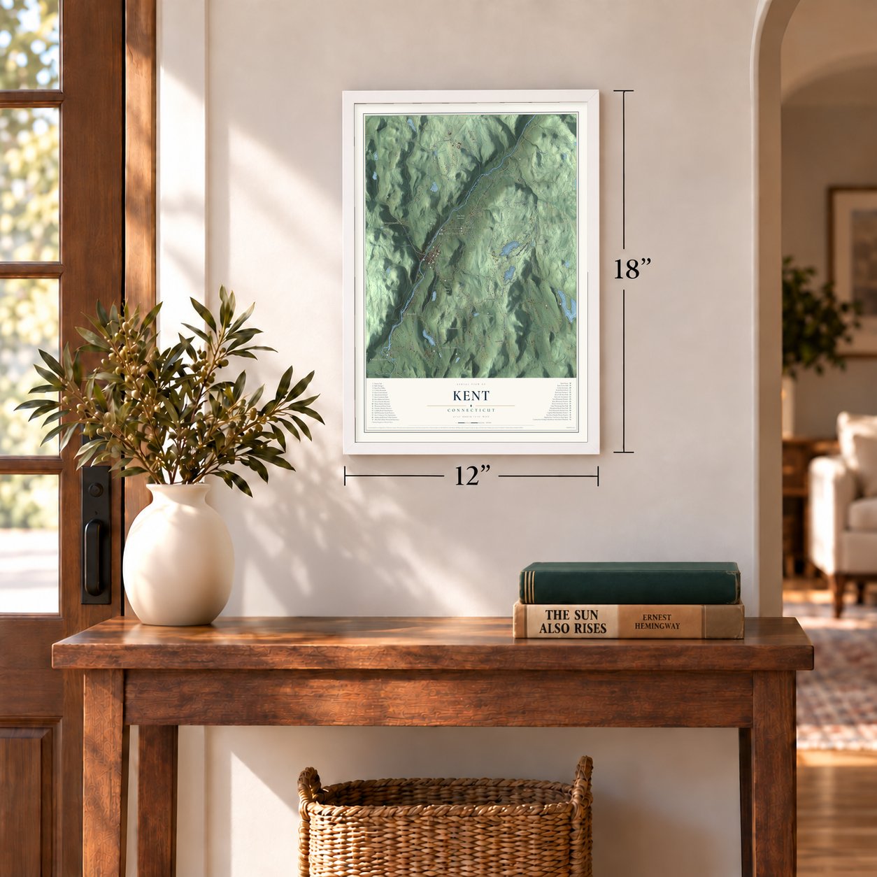
12" x 18" Archival Matte Print
A Map of Home. A Work of Art.
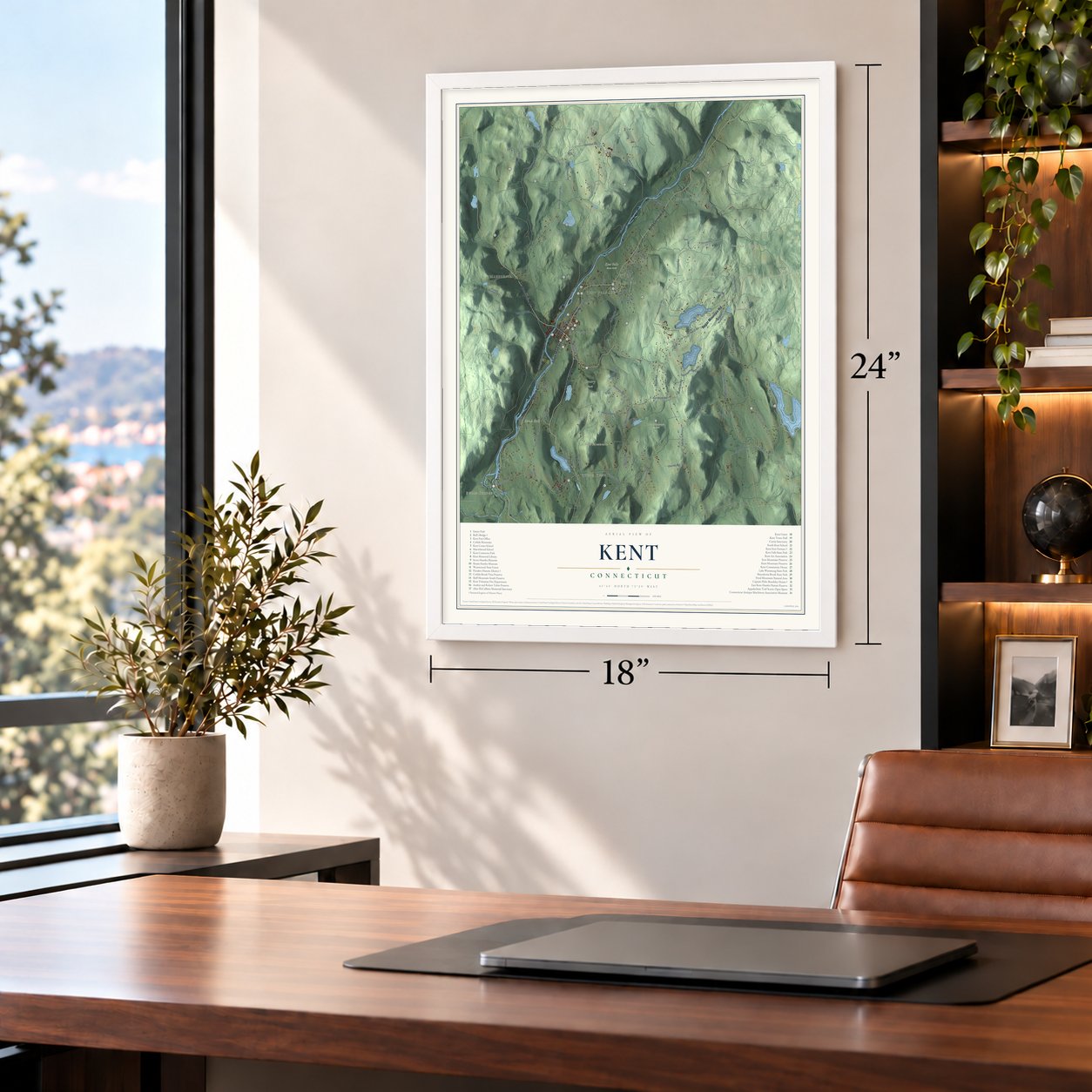
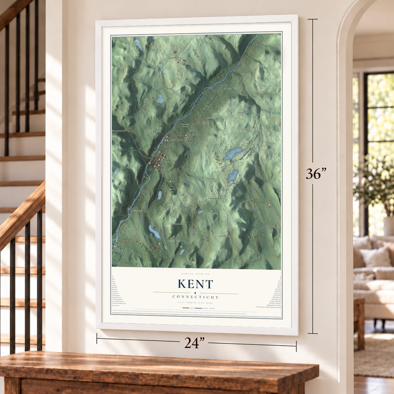
Explore Kent, Connecticut from a whole new perspective. Created using aerial imagery and detailed geographic data, this map captures Kent building by building, with labeled streets, familiar landmarks, and shaded topographical relief that highlights the natural contours of the landscape.
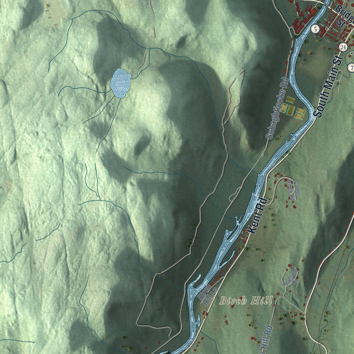
Combining modern data with the timeless character of a vintage atlas, this map is just as interesting up close as it is beautiful on the wall. Whether you grew up in Kent, spent memorable years there, or call it home today, this unique map is a great way to celebrate a place that means something to you. Zoom in on the preview to look for your street, and then order a print to put your memories on the wall.

Three ways to hang it
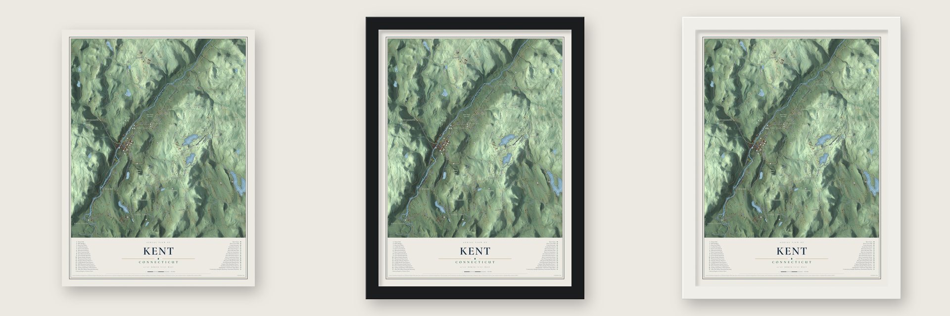
Unframed archival matte, a black wood frame or a white wood frame.
Up close
Geography Worth Displaying
This map was created using accurate cartographic data and authoritative geographic sources, including the U.S. Geological Survey (USGS) and FEMA. The map brings together terrain, waterways, roads, and building detail. The majority of the streets are labeled, houses are accurately depicted, and the topography is derived from government sources. Combining local data with carefully composed color and shading leads to this beautifully detailed Kent artwork for your wall.
Rather than simply showing street outlines, we’ve included as many of the street names as we could reasonably fit on the map while keeping their names legible. Zoom in on the high resolution preview to see exactly what’s on the map. We truly set out to create a statement piece for anyone who loves Kent. So whether it’s for you, or a gift for someone you love, we hope this map of Kent brings back fond memories.
Explore the full map of Kent, Connecticut and read about the local places it shows.

Find your street
Names on the Kent map
Every name below is printed on this map. Look for your street, your school, the park where you played, or the pond down the road.
Places and landmarks18
- Downtown
- Bulls Bridge
- South Kent
- North Kent
- East Kent
- Macedonia
- Bald Hill
- Birch Hill
- Bromica Mountain
- Bull Mountain
- Beaman Pond
- Blatz Pond
Show all 18 places
- Emery Park
- Iron Mountain Preserve
- Kent Falls State Park
- Wyantenock State Forest
- Kent Furnace
- Flanders
Streets and roads82
- Macedonia Road
- South Main Street
- Segar Mountain Road
- Kent Road
- South Kent Road
- Kent Cornwall Road
- Chippewalla Road
- Treasure Hill Road
- Flat Rock Road
- Jennings Road
- Skiff Mountain Road
- Kent Hollow Road
- Schaghticoke Road
- Bulls Bridge Road
- Fuller Mountain Road
- River Road
- Gorham Road
- Kenmont Road
- Dugan Road
- Cobble Road
- Geer Mountain Road
- Carter Road
- Ore Hill Road
- Camps Flat Road
- Upper Kent Hollow Road
- Mountain Road
- Spooner Hill Road
- Anderson Road
- Richards Road
- Beardsley Road
Show all 82 streets
- Dolldorf Road
- Davis Road
- Tanguay Road
- Spectacle Ridge Road
- South Road
- Cobble Lane
- Henderson Road
- Howland Road
- Kenico Road
- Studio Hill Road
- Peet Hill Road
- Old Barn Road
- Camps Road
- Appalchian Road
- Keeler Road
- Halls Lane
- Studio Hill Circle
- Botsford Road
- Weber Road
- Muller Road
- Ten Rod Road
- Yuzi-Mini Lane
- Pond Road
- Eber Road
- Bridge Street
- Macedonia Brook Road
- Preston Mountain Road
- North Kent No 1 Road
- Anderson Acres Road
- Maple Street Extended
- North Kent No 2 Road
- Hidden Meadow Lane
- Summer Road
- Berkshire Road
- Brown Road
- Straight Road
- Birch Hill Lane
- Spaulding Farm Lane
- Flanders Lane
- Stonewall Lane
- Johnson Road
- Kelly Drive
- North Main Street
- West Woods Road
- Saddle Ridge Road
- Highland Road
- Nodine Pasture Road
- Bald Hill Road
- Hidden Hollow Road
- Mud Pond Road
- Ward Road
- Chase Hill Road
Names are listed as they appear on the printed map. Zoom into the product photos to find them.
About Kent, Connecticut
Kent is a town of 3,019 people in Litchfield County, on the New York line, and the Housatonic River splits it in two. The colony sold the township before anyone lived here, auctioning its shares at the court house in Windham in 1738, the same year the Assembly named it Kent. A buyer's deed held only after he had put up a house no smaller than eighteen feet on a side and cleared six acres, and the first settlers came in 1739.
Those settlers first worshiped in an upstairs room of Daniel Comstock's building, which served as his home and his store. Eleven men organized the church in 1741, and in April 1742, with the frame of the first meetinghouse finished, the town voted six gallons of rum for the raising. That meetinghouse stood in Flanders, the first center, until the 1840s, when a railroad stop opened farther south and business shifted to where the village stands now.
“We are very glad that we are all united in one covenant chain; we are resolved that it shall not rust, and will therefore wind it with beaver skins.”
- Scatacook on the HousatonicThe Schaghticoke came before the town. From a mountain west of the river, the Pequot leader Gideon Mauwehu spotted a valley thick with fish and game, so he settled his family in it, and others followed. Moravian missionaries came in 1742 and baptized him and over a hundred of his followers. After settlers took almost all their planting grounds, the colony reserved about two hundred acres in 1752. Today the state holds the reservation, about 400 acres, in trust.
- Iron for ironclad shipsIn 1826 a blast furnace rose at the Bulls Bridge falls, employing probably 200 men there and on the roads. Teams brought ore fifteen miles from Clove in Dutchess County, and carts took the pig iron to Poughkeepsie at $5 a ton. Its Civil War iron went into ironclads, earning it the name Monitor Iron Works. By 1897 the furnace was a ruin, and the local school had shrunk from about sixty children to twelve.
- A bridge since 1760In 1760 Jacob Bull and his son Isaac put up the first bridge where the river runs narrowest, letting iron from Bull's foundry cross, and George Washington passed over the river close by in 1781. The covered bridge that stands on the site today dates from 1842, and its sides are framed in a Town lattice truss. It is one of only two covered bridges in Connecticut still open to cars, and Bull's Bridge joined the National Register in 1972.
- Pig iron until 1892In 1826 the Kent Iron Furnace began making iron on a rise above the river. Its 32-foot stack, built of rough granite blocks without mortar, was converted to a hot blast furnace in 1846 and made larger in 1870, and railroads took most of its iron. It went out of blast for the last time in 1892, and by 1898 tobacco was drying in its old buildings.
- Captain Beardsley's saltboxIn 1781 Josiah Beardsley handed his farm to his son Philo, a militia captain, with a saltbox house already on it. The Capt. Philo Beardsley House still keeps its central chimney, oak floorboards and paneled parlor.
Keep exploring Connecticut
Kent is one of 382 Connecticut towns we've mapped. Every dot on the map is a print of its own.
The search covers every state, Connecticut first.
Near Kent
Order 2 or more town maps and save 10%. Shown in the size and finish you picked above, so they hang as a set.
- Warren 12" x 18" / Archival Matte Print $39.99
- Gaylordsville 12" x 18" / Archival Matte Print $39.99
- Cornwall Bridge 12" x 18" / Archival Matte Print $39.99

More maps nearby: New Preston, Northville, Washington, New Milford and Sharon.
The art of mapping a place
How This Map Was Made
Real places. Remarkable detail. Discover the layers that turn geographic data into a map of home.

The view from above
Aerial imagery reveals the character of the land: woodland, open fields, and the patterns of a place.

The shape of the land
Elevation data brings hills, valleys, and subtle changes in the landscape into view.

The details of home
Roads, waterways, and building footprints come together to make the map feel unmistakably local.

Geography becomes art
Considered color, shading, and typography bring the layers together in a map made for your wall.


Process illustrated with Mendon, Massachusetts. Aerial imagery: USDA NAIP. Terrain: USGS 3D Elevation Program. Map details and finished artwork: KNOWOL.
The Details
About This Print
Choose an archival matte print, or a black or white Ayous wood frame. The archival matte print is unframed.
Select your size and finish above to see the matching product image and price.
Materials & Craftsmanship
A contemporary map with the character of a classic atlas, printed on archival matte paper. Optional frames are made from Ayous wood.
Your printed map does not include the watermark shown in the full-map preview.
Shipping & Delivery
Free shipping within the United States. Every print is made to order in the USA.
Buying a gift? Add a note in your cart and we'll include it. We never put prices in the package.
Prints ship within 2 to 3 business days. Allow 7 to 10 days total from ordering for delivery. Timing may vary during holidays or periods of high order volume.
Read our shipping policy.
Returns and damaged prints
Each print is made to order. Change-of-mind refunds are not available after production.
If your print arrives damaged, misprinted or incorrect, contact support@knowol.com within 30 days of receiving it. Include your order number, photos and a description of the issue.
Read our full refund and replacement policy. For questions about your order, email support@knowol.com.