
Search for another town





Free U.S. delivery 7 to 10 days after you order
New Milford, Connecticut Map Art
Building by building, with labeled streets and shaded relief.
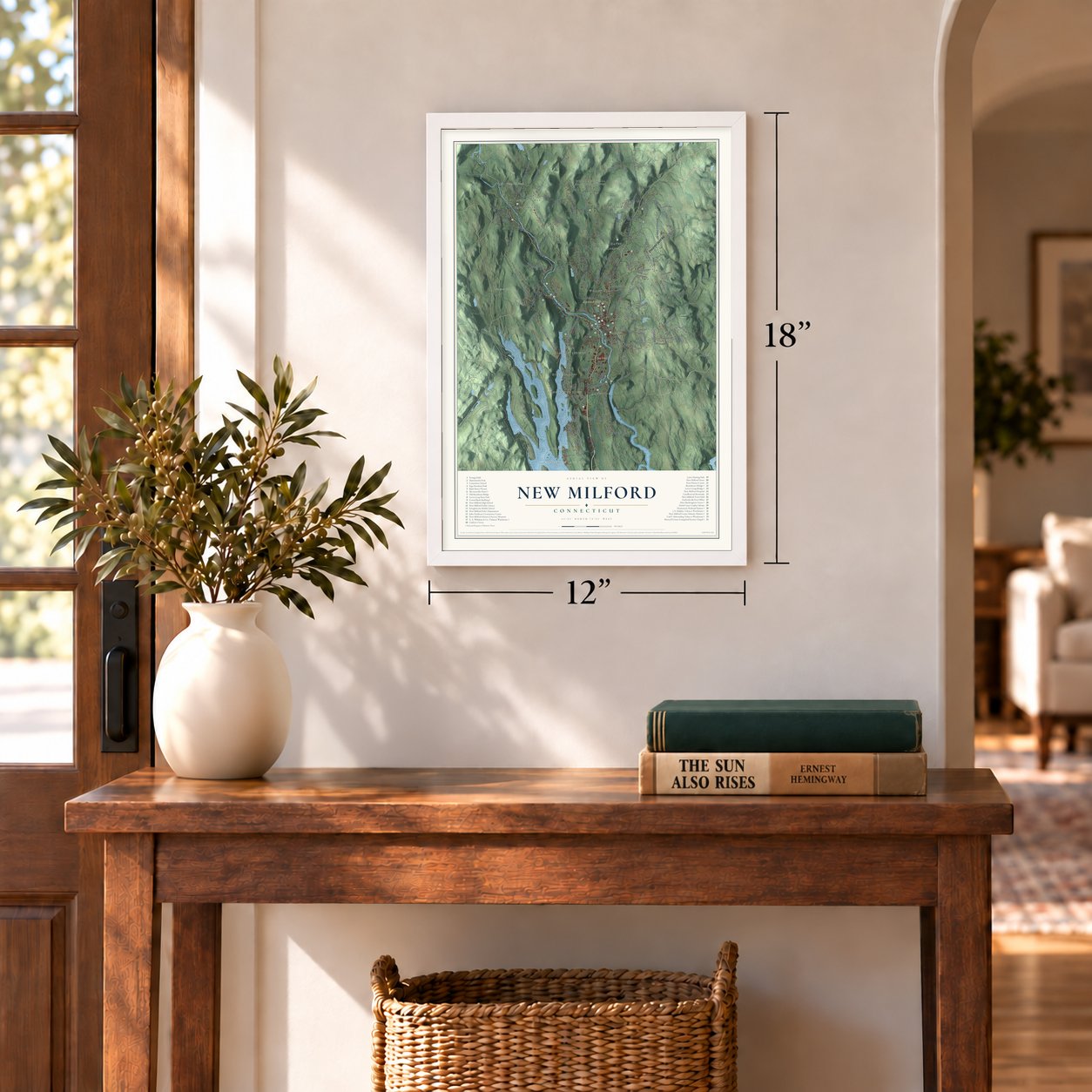
12" x 18" Archival Matte Print
A Map of Home. A Work of Art.
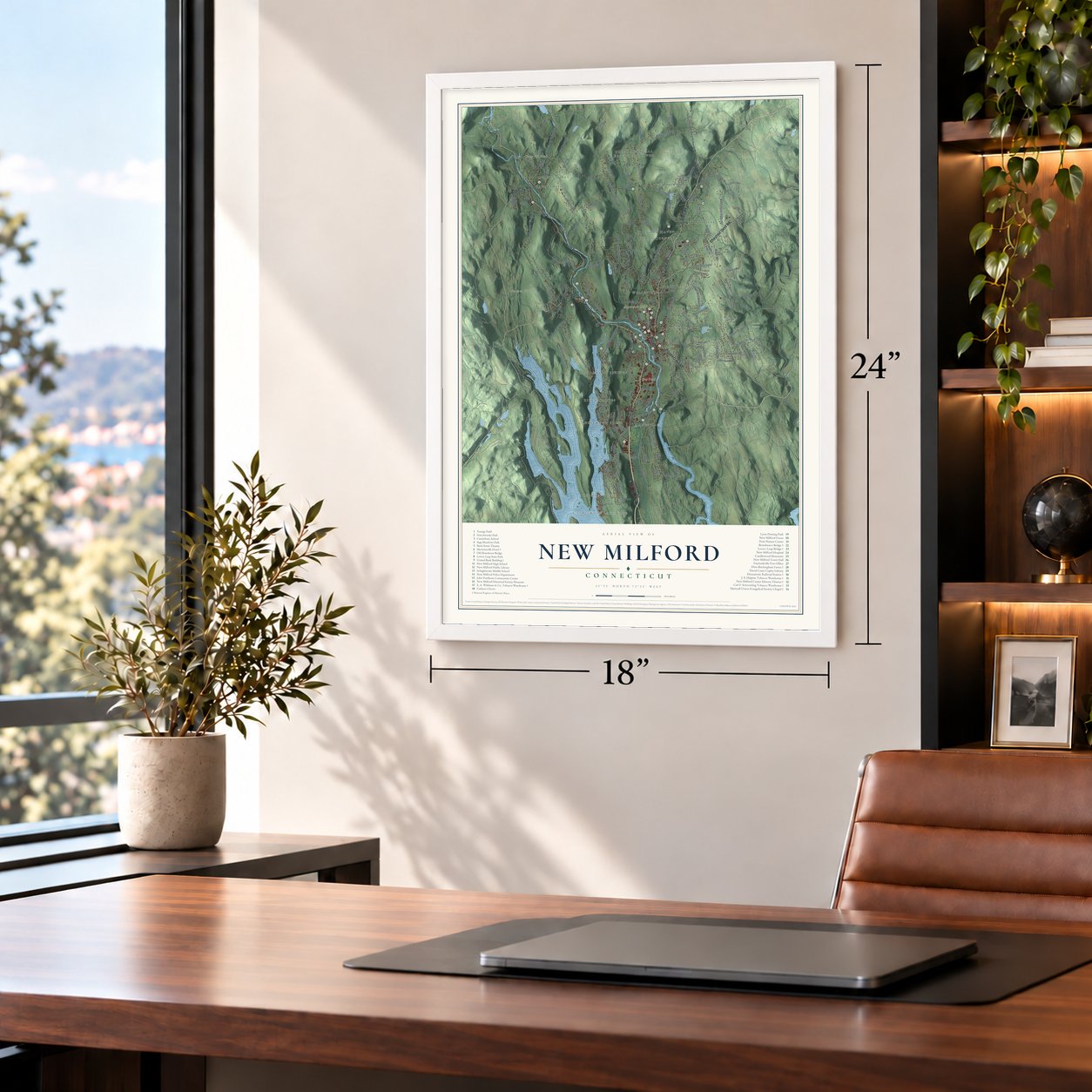
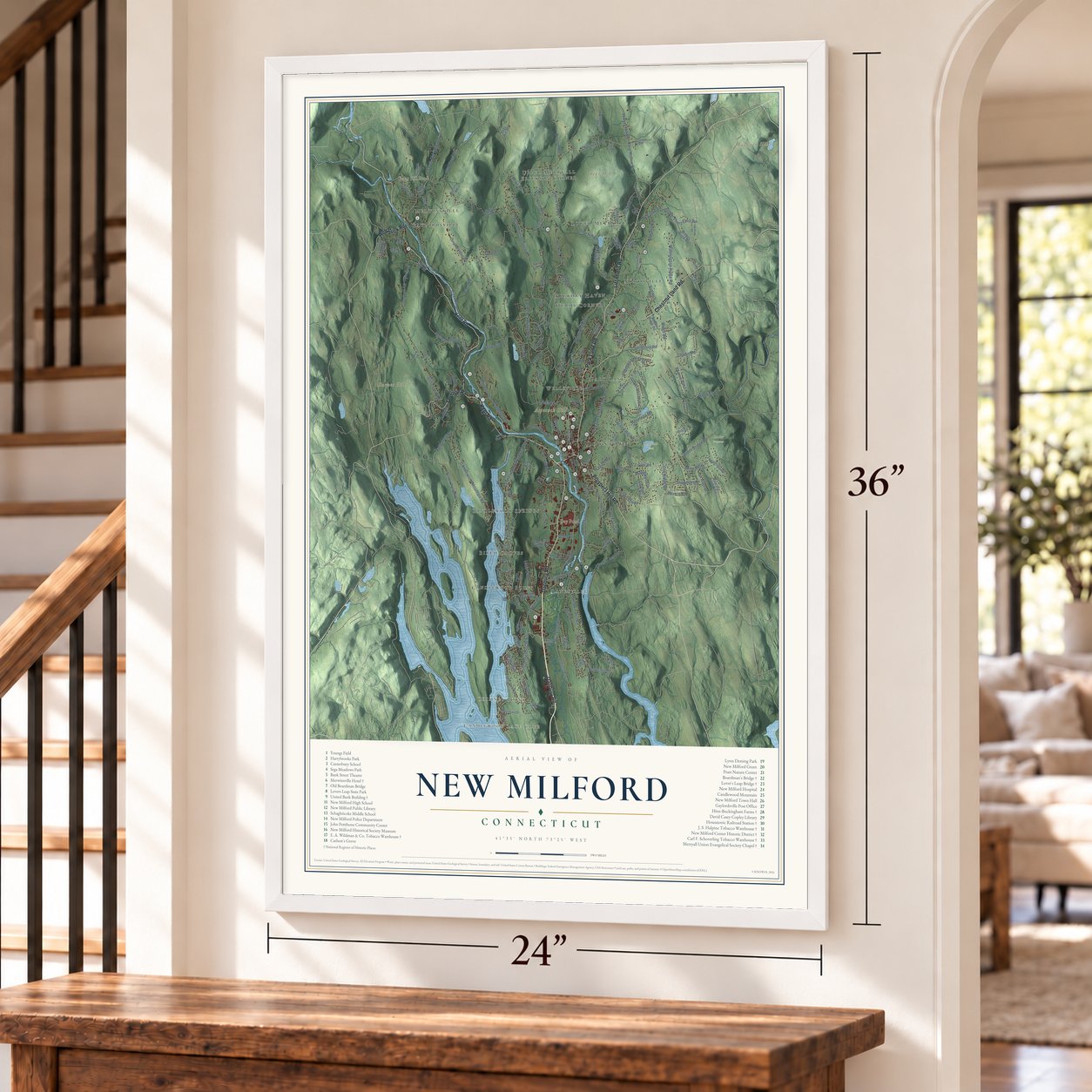
Explore New Milford, Connecticut from a whole new perspective. Created using aerial imagery and detailed geographic data, this map captures New Milford building by building, with labeled streets, familiar landmarks, and shaded topographical relief that highlights the natural contours of the landscape.
Combining modern data with the timeless character of a vintage atlas, this map is just as interesting up close as it is beautiful on the wall. Whether you grew up in New Milford, spent memorable years there, or call it home today, this unique map is a great way to celebrate a place that means something to you. Zoom in on the preview to look for your street, and then order a print to put your memories on the wall.

Three ways to hang it
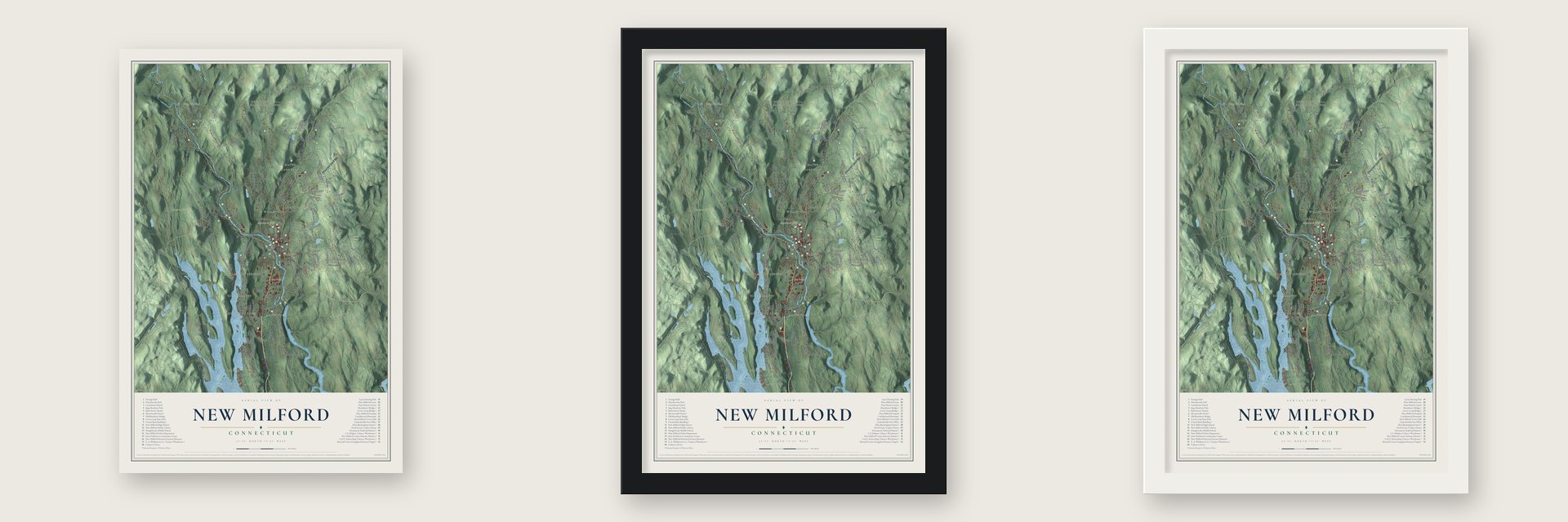
Unframed archival matte, a black wood frame or a white wood frame.
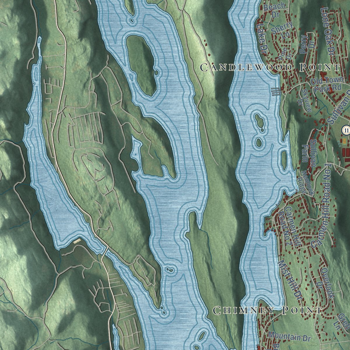
Up close
Geography Worth Displaying
This map was created using accurate cartographic data and authoritative geographic sources, including the U.S. Geological Survey (USGS) and FEMA. The map brings together terrain, waterways, roads, and building detail. The majority of the streets are labeled, houses are accurately depicted, and the topography is derived from government sources. Combining local data with carefully composed color and shading leads to this beautifully detailed New Milford artwork for your wall.
Rather than simply showing street outlines, we’ve included as many of the street names as we could reasonably fit on the map while keeping their names legible. Zoom in on the high resolution preview to see exactly what’s on the map. We truly set out to create a statement piece for anyone who loves New Milford. So whether it’s for you, or a gift for someone you love, we hope this map of New Milford brings back fond memories.
Explore the full map of New Milford, Connecticut and read about the local places it shows.

Find your street
Names on the New Milford map
Every name below is printed on this map. Look for your street, your school, the park where you played, or the pond down the road.
Places and landmarks25
- Downtown
- Candlewood Lake Club
- Aspetuck Hill
- Baldwin Hill
- Barnes Hill
- Bear Hill
- Cedar Hill Pond
- Day Pond
- Carter Preserve
- Reservoir Park
- Hickory Haven
- Candlewood Point
Show all 25 places
- Hurds Corner
- Lower Merryall
- Gaylordsville
- Park Lane
- Upper Merryall
- Birch Groves
- Candlewood Springs
- Lanesville
- Chimney Point
- Wellsville
- Northville
- Merwinsville
- Erickson Corner
Streets and roads191
- Danbury Road
- Park Lane Road
- Litchfield Road
- Kent Road
- Webatuck Road
- Sherman Road
- Chestnut Land Road
- Prospect Hill Road
- Second Hill Road
- Judds Bridge Road
- Mine Hill Road
- Grove Street
- Pumpkin Hill Road
- Town Farm Road
- Heacock Crossbrook Road
- Merryall Road
- Bear Hill Road
- South Old Stone Road
- Kent Hollow Road
- Cherniske Road
- River Road
- West Meetinghouse Road
- Candlewood Lake Road North
- Candlewood Mountain Road
- Ridge Road
- Aspetuck Ridge Road
- Paper Mill Road
- Sawyer Hill Road
- Stilson Hill Road
- Squash Hollow Road
Show all 191 streets
- Gaylord Road
- Bucks Rock Road
- Chapin Road
- Erickson Road
- Taylor Road
- Boardman Road
- Upland Road
- Hine Road
- North Road
- Squire Hill Road
- Mud Pond Road
- Washington Ridge Road
- Hartwell Road
- Lower Grove Street
- Old Ridge Road
- Reservoir Road
- Green Pond Road
- Bass Road
- Wheaton Road
- Aldrich Road
- Dorwin Hill Road
- Housatonic Avenue
- Littlefield Road
- Upper Church Hill Road
- Still River Drive
- Carmen Hill Road No 1
- Sullivan Road
- Legion Road
- Upper Reservoir Road
- Burnett Road
- Fort Hill Road
- Maplewood Drive
- Bonnie Vue Lane
- Standish Road
- Grove Road
- Lovers Leap Road
- West Street
- McNulty Drive
- Mist Hill Drive
- Advance Drive
- Bullymuck Road
- Lone Oak Drive
- Sawmill Road
- Hall Lane
- Lake Drive
- Revere Road
- Wells Road
- Sand Road
- Dodd Road
- Vista Drive
- Mine Road
- Mine Hill Road West
- Wellsville Avenue
- Walker Brook Road
- Sherry Lane
- Long Mountain Road
- South Kent Road
- Pickett District Road
- Indian Trail Road
- Sunny Valley Road
- Carmen Hill Road No 2
- Church Road
- Little Bear Hill Road
- Bostwick Road
- Perry Drive
- Beardsley Road
- Colonial Ridge Drive
- Big Bear Hill Road
- Hipp Road
- Sullivan Farm
- Crossmon Road
- Tamarack Road
- Old Town Park Road
- Putnam Road
- Geiger Road
- Hine Hill Road
- Frenchmans Road
- Pleasant View Road
- Cortland Drive
- Taylor Terrace
- Turkey Trot Road
- Old Mill Road
- Ferris Estates Road
- Stephanie Drive
- Fox Ridge Drive
- Van Car Road
- Overlook Drive
- Morey Road
- Bridle Road
- Park Lane East
- Cedar Hill Road
- New Bridge Road
- Gaffney Road
- Mountain Drive
- Executive Center Drive
- Mount Tom Road
- Concord Way
- Cornwall Drive
- Dorset Drive
- Rolling Glen Drive
- Fox Run
- Saddle Ridge Road
- Peet Hill Road
- Cedar Vale Drive
- Echo Drive
- Day Lane
- Cross Road
- Norton Lane
- Birch Lane
- Arcadia Lane
- Unicorn Drive
- Beach Drive
- Lester Lane
- Gretl Lane
- Ash Lane
- Mare Lane
- Aspetuck Avenue
- Lillis Road
- Connelly Road
- Mallett Lane
- Mountain View Drive
- McMahon Road
- Meredith Lane
- Maple Drive
- Everwood Drive
- Halpine Road
- Great Brook Road
- Greenview Road
- Stonecastle Road
- Bayberry Lane
- Heritage Drive
- Newton Road
- Skyview Drive
- Amanda Lane
- Hemlock Ridge
- Silver Birch Road
- Pine Drive
- Fogarty Lane
- Avery Road
- Carl's Lane
- Lesh Lane
- Mill Lane
- Rooster Tail Hollow
- Browns Forge Road
- Dean Road
- Old Stone Road
- Wood Creek Road
- Wieting Road
- Walker Brook Drive
- New Preston Hill Road
- Hawthorne Lane
- Chinmoy Lane
- Stone Oak Drive
- Lily Pond Trail
- Cathryn Street
- South Main Street
- Fordyce Court
- Rocky River Road
- Kemp Drive
- Dahle Road
- Bear Lane
Names are listed as they appear on the printed map. Zoom into the product photos to find them.
About New Milford, Connecticut
New Milford is a town of 28,115 people in Litchfield County, on the Housatonic River, and it covers more land than any other town in Connecticut. In 1703 buyers from Milford paid Papetoppe and other native owners sixty pounds in money and twenty in goods for the township. John Noble Sr. left Westfield, Massachusetts, in 1707 and settled here with his daughter Sarah, who was eight. On October 17, 1711, twelve families of about 70 people petitioned the General Assembly, and the town was organized in 1712.
The settlers ordained Daniel Boardman as their Congregational minister in 1716. The Housatonic Railroad reached town in 1840, and stores soon filled the blocks between the long green and the tracks. In the northwest, Sylvanus Merwin bought land where the line would run and persuaded the railroad to halt there so passengers could eat at his hotel, which opened in 1843 and served as a station until 1915. In 1871 residents founded a Village Improvement Society, and more than three hundred others later copied it.
“The village of New Milford consists of about 60 dwelling houses and 5 mercantile stores.”
- The falls at MetichawonBefore the English came, the native people called this part of the Housatonic Wyantenock. At its heart was a waterfall, Metichawon. Each spring lamprey eels crowded up the river but could not climb it, so the falls made a prime fishing spot. The sachem Weraumaug kept a great bark wigwam nearby, painted inside with animals, birds and fish. Long after the native families moved to Stockbridge, they came back every year to fish for lampreys there.
- Roger Sherman's shoemaker yearsRoger Sherman, a shoemaker's son trained in that trade, came in 1743. In 1761 he moved to New Haven, and he later signed the Declaration of Independence and the U.S. Constitution. Town Hall stands on the site of his house, where the Roger Sherman Chapter placed a tablet in his honor in 1897.
- 285 men for the RevolutionThe 7th Connecticut Regiment, also called the 19th Continental, was raised in New Milford on September 16, 1776. Its men fought at Brandywine, Germantown and Monmouth. Out of 2,776 residents, the town sent 285 men to the war.
- Leaf for cigar wrappersBy World War I, twelve New Milford packing and warehouse firms readied leaf for cigar wrappers. Farmers grew a few acres from April to September, and the warehouses sorted and packed the crop through fall and winter. The oldest left, E. A. Wildman & Co.'s on Bridge Street, dates from 1870. Carl F. Schoverling's 1897 Flatiron Building was called one of the nation's most advanced, and J. S. Halpine's, from about 1900, cured leaf until the late 1930s.
- The fire of May 5, 1902Fire swept the corner of Bank and Main Streets on May 5, 1902, destroying the New England House and the buildings of two banks. The banks hired Wilson Potter, who designed a Classical Revival building for them. It went up from 1902 to 1904 at the head of Bank Street, looking out over the green. The United Bank Building joined the National Register in 1982.
Keep exploring Connecticut
New Milford is one of 382 Connecticut towns we've mapped. Every dot on the map is a print of its own.
The search covers every state, Connecticut first.
Near New Milford
Order 2 or more town maps and save 10%. Shown in the size and finish you picked above, so they hang as a set.
- Northville 12" x 18" / Archival Matte Print $39.99
- Gaylordsville 12" x 18" / Archival Matte Print $39.99
- Sherman 12" x 18" / Archival Matte Print $39.99

More maps nearby: Lakeside Woods, Sail Harbor, Inglenook, Bridgewater and Bogus Hill.
The art of mapping a place
How This Map Was Made
Real places. Remarkable detail. Discover the layers that turn geographic data into a map of home.

The view from above
Aerial imagery reveals the character of the land: woodland, open fields, and the patterns of a place.

The shape of the land
Elevation data brings hills, valleys, and subtle changes in the landscape into view.

The details of home
Roads, waterways, and building footprints come together to make the map feel unmistakably local.

Geography becomes art
Considered color, shading, and typography bring the layers together in a map made for your wall.


Process illustrated with Mendon, Massachusetts. Aerial imagery: USDA NAIP. Terrain: USGS 3D Elevation Program. Map details and finished artwork: KNOWOL.
The Details
About This Print
Choose an archival matte print, or a black or white Ayous wood frame. The archival matte print is unframed.
Select your size and finish above to see the matching product image and price.
Materials & Craftsmanship
A contemporary map with the character of a classic atlas, printed on archival matte paper. Optional frames are made from Ayous wood.
Your printed map does not include the watermark shown in the full-map preview.
Shipping & Delivery
Free shipping within the United States. Every print is made to order in the USA.
Buying a gift? Add a note in your cart and we'll include it. We never put prices in the package.
Prints ship within 2 to 3 business days. Allow 7 to 10 days total from ordering for delivery. Timing may vary during holidays or periods of high order volume.
Read our shipping policy.
Returns and damaged prints
Each print is made to order. Change-of-mind refunds are not available after production.
If your print arrives damaged, misprinted or incorrect, contact support@knowol.com within 30 days of receiving it. Include your order number, photos and a description of the issue.
Read our full refund and replacement policy. For questions about your order, email support@knowol.com.