
Search for another town





Free U.S. delivery 7 to 10 days after you order
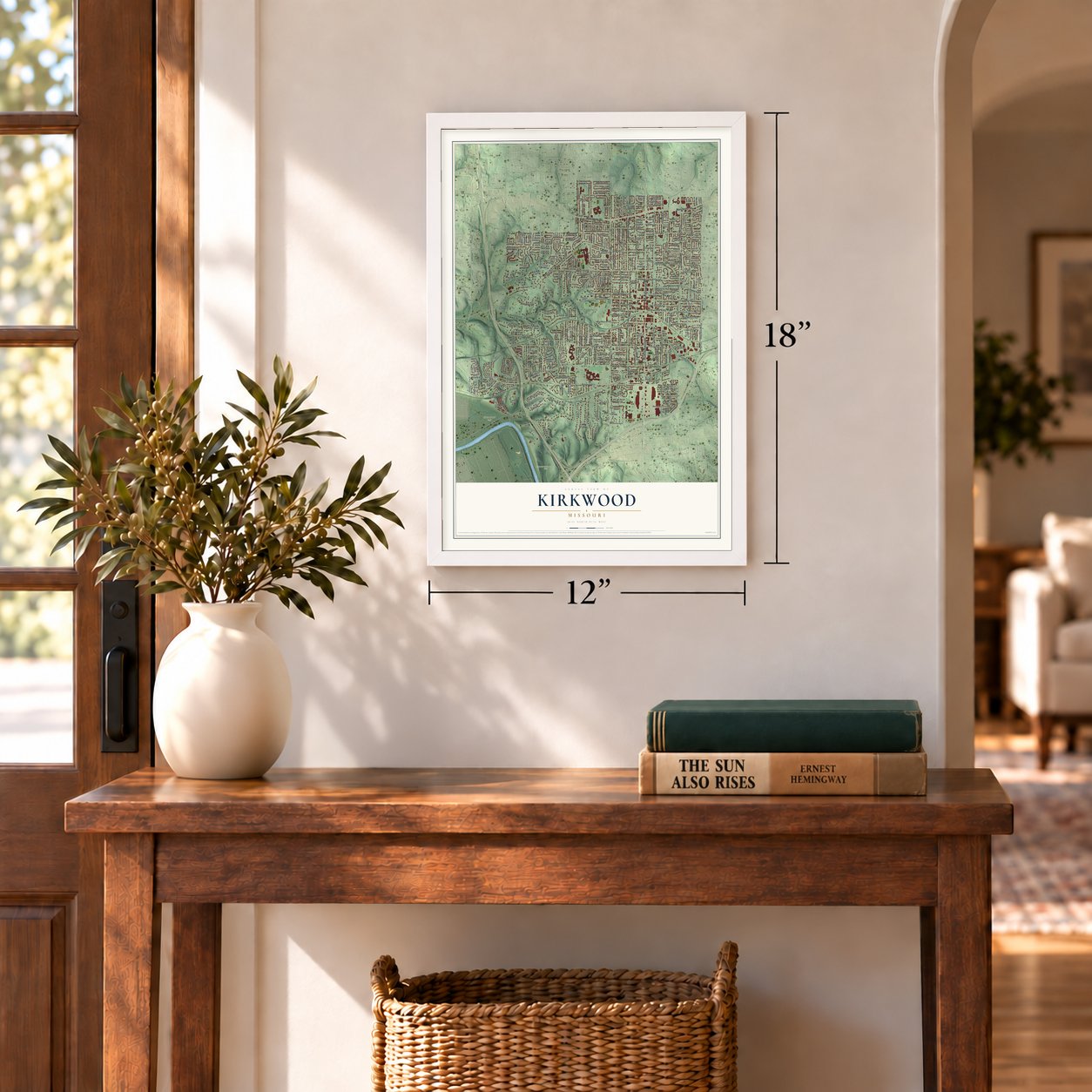
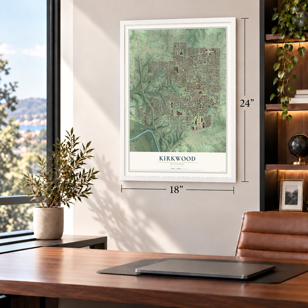
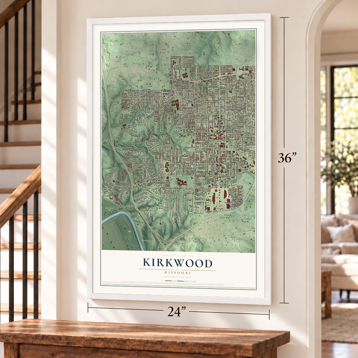
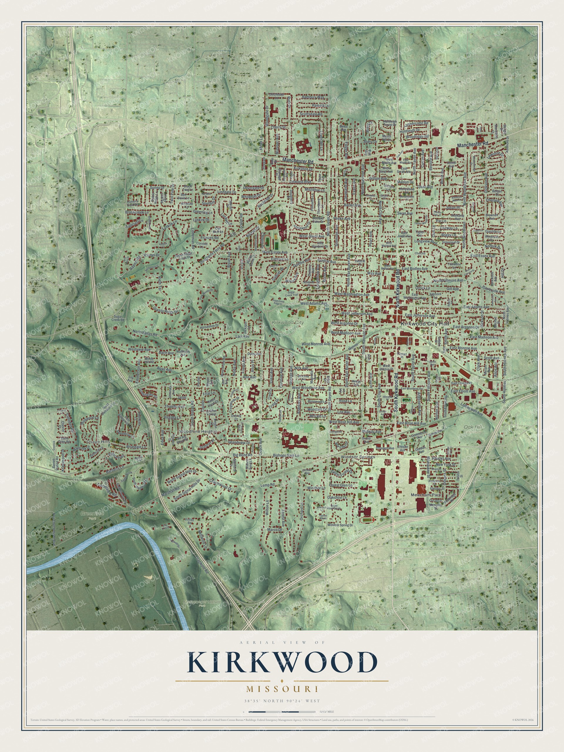
Kirkwood, Missouri Map Art
Building by building, with labeled streets and shaded relief.
12" x 18" Archival Matte Print
A Map of Home. A Work of Art.
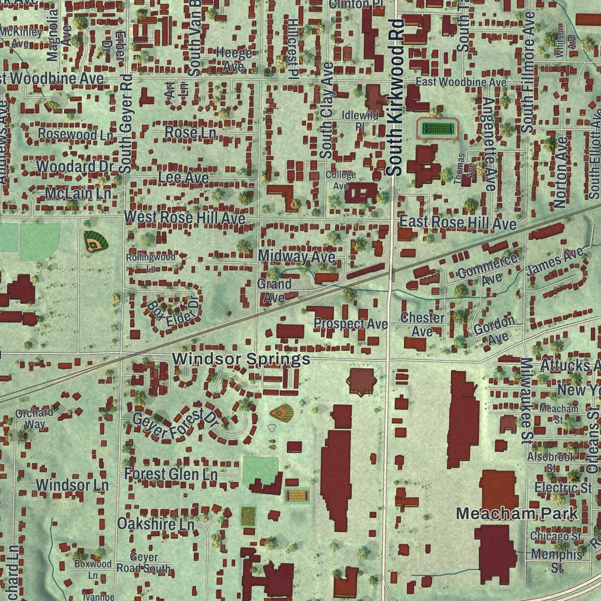
Explore Kirkwood, Missouri from a whole new perspective. Created using aerial imagery and detailed geographic data, this map captures Kirkwood building by building, with labeled streets, familiar landmarks, and shaded topographical relief that highlights the natural contours of the landscape.
Combining modern data with the timeless character of a vintage atlas, this map is just as interesting up close as it is beautiful on the wall. Whether you grew up in Kirkwood, spent memorable years there, or call it home today, this unique map is a great way to celebrate a place that means something to you. Zoom in on the preview to look for your street, and then order a print to put your memories on the wall.
Three ways to hang it
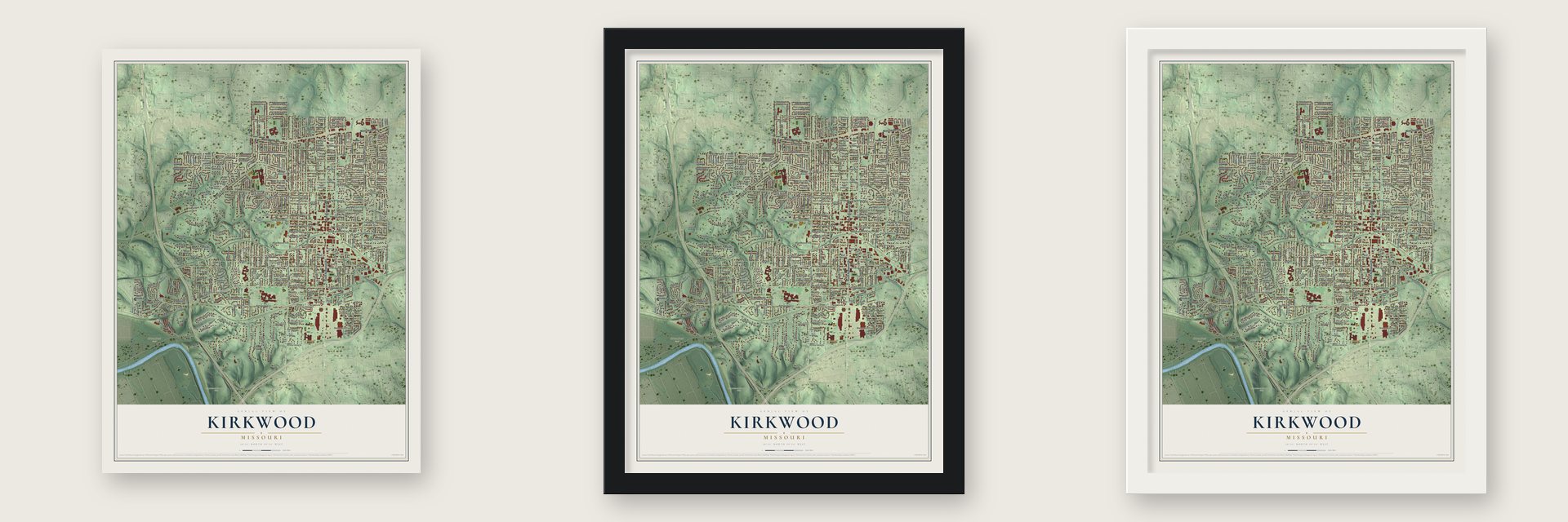
Unframed archival matte, a black wood frame or a white wood frame.
Up close
Geography Worth Displaying
This map was created using accurate cartographic data and authoritative geographic sources, including the U.S. Geological Survey and the Census Bureau. The map brings together terrain, waterways, roads, and building detail. The majority of the streets are labeled, houses are accurately depicted, and the topography is derived from government sources. Combining local data with carefully composed color and shading leads to this beautifully detailed Kirkwood artwork for your wall.
Rather than simply showing street outlines, we’ve included as many of the street names as we could reasonably fit on the map while keeping their names legible. Zoom in on the high resolution preview to see exactly what’s on the map. We truly set out to create a statement piece for anyone who loves Kirkwood. So whether it’s for you, or a gift for someone you love, we hope this map of Kirkwood brings back fond memories.
Read the story behind this map of Kirkwood, Missouri from 2026.

Find your street
Names on the Kirkwood map
Every name below is printed on this map. Look for your street, your school, the park where you played, or the pond down the road.
Places and landmarks9
- Kirkwood City Hall
- Osage Hills
- Emmeneger Nature Park
- Greentree Park
- Kirkwood City Park
- Oak Hill Cemetery
- Meacham Park
- Windsor Springs
- Woodhine Heights
Streets and roads361
- South Kirkwood Road
- North Kirkwood Road
- Manchester Road
- Hill Drive
- East Adams Avenue
- West Adams Avenue
- West Argonne Drive
- East Essex Avenue
- East Argonne Drive
- Timberview Road
- North Geyer Road
- South Geyer Road
- Longview Boulevard
- Bishops Gate Lane
- Dickson Avenue
- Dickson Street
- Briargate Lane
- Cragwold Road
- South Holmes Avenue
- South Holmes
- Rayner Road
- West Madison Avenue
- Twin Pine Drive
- Big Bend Road
- Dougherty Ferry Road
- Marshall Road
- North Woodlawn Avenue
- West Woodbine Avenue
- North Harrison Avenue
- North Clay Avenue
Show all 361 streets
- Couch Avenue
- North Ballas Road
- West Essex Avenue
- North Taylor Avenue
- West Rose Hill Avenue
- Lemp Road
- Simmons Avenue
- South Harrison Avenue
- Lindeman Road
- South Fillmore Avenue
- South Ballas Road
- Evans Avenue
- West Jewel Avenue
- East Madison Avenue
- East Jefferson Avenue
- Leffingwell Avenue
- North Woodlawn
- Craig Drive
- West Washington Avenue
- East Monroe Avenue
- South Clay Avenue
- West Monroe Avenue
- Woodgate Drive
- Forest Avenue
- Orchard Lane
- Clark Avenue
- Wilton Lane
- South Taylor Avenue
- Scott Avenue
- North Fillmore Avenue
- Cleveland Avenue
- Boaz Avenue
- Wood Avenue
- Edna Avenue
- North Van Buren Avenue
- Peeke Avenue
- Wilson Avenue
- Ann Avenue
- East Bodley Avenue
- Nirk Avenue
- West Jefferson Avenue
- Bach Avenue
- Neffwold Lane
- Lark Avenue
- Ruth Drive
- South Van Buren Avenue
- Milwaukee Street
- Barberry Lane
- Rayner Drive
- Central Avenue
- Rieth Terrace
- Gabriel Drive
- Sunny Drive
- Barter Avenue
- Lindgate Drive
- Kirkshire Drive
- Quan Avenue
- Lynkirk Lane
- Linwood Boulevard
- Orleans Street
- Way Avenue
- Brookcreek Lane
- Oakshire Lane
- Lockett Road
- Westview Avenue
- Laven del Lane
- Ponca Trail
- Thursby Avenue
- Frieda Avenue
- Wildwood Lane
- Rochdale Drive
- Greening Lane
- Grandview Drive
- East Elliott Avenue
- Goethe Avenue
- Missouri Avenue
- New York Street
- North Signal Hills Drive
- Wilcox Avenue
- Geyer Forest Drive
- Bernice Avenue
- Grassy Ridge Drive
- Crest Avenue
- Curran Avenue
- Nelda Avenue
- Lockett Lane
- Altus Place
- Attucks Avenue
- Avery Court
- Emmerson Avenue
- Par Lane
- Caroline Avenue
- Charmwood Drive
- Elmtree Lane
- South Signal Hills Drive
- East Rose Hill Avenue
- Angenette Avenue
- Midway Avenue
- George Avenue
- Frances Road
- Krauswood Drive
- Andrews Avenue
- Coulter
- Chopin Drive
- Longfellow Avenue
- Lee Avenue
- Gill Avenue
- Folger Avenue
- Huntleigh Drive
- Bambury Way
- Bogey Lane
- Fairway Lane
- Culloden Road
- Whitecliff Drive
- Scottsdale Road
- Pamela Lane
- Forest Glen Lane
- Janet
- Virginia Lane
- Meier Lane
- Timbercrest Road
- Woodridge Road
- Bryan Avenue
- Lewiston Drive
- McLain Lane
- Southlin Drive
- Smith Avenue
- Trailcrest Lane
- Rose Lane
- Iris Lane
- Pearl Avenue
- Windsor Lane
- Norton Avenue
- Hawbrook Avenue
- Dovergate Drive
- Norfolk Drive
- Mistletoe Lane
- Burns Avenue
- Julian Place
- Woodard Drive
- Chelsea Avenue
- Cherry Street
- Greenglen Drive
- Club Lane
- Friar Lane
- Alice Avenue
- Sommet Place
- Marco Drive
- Mozart Drive
- Lynkirk Drive
- Avery Drive
- Manlyn Drive
- Swan Avenue
- Gaslite Lane
- Orrick Lane
- Porter
- Bedford Oaks Drive
- Timberbrook Drive
- Claridge Place
- East Clinton Place
- Old Big Bend Road
- East Glenwood Lane
- Horseshoe Drive
- West Glenwood Lane
- South Glenwood Lane
- Central Place
- Applewood Drive
- Thorncliff Lane
- Parkwood Avenue
- Arminda Avenue
- Maybrook Lane
- Monroe Place
- Sweetbriar Lane
- Tree Court Industrl Boulevard
- South Elliott Avenue
- Sugar Creek Road
- East Sarah Avenue
- East Washington Avenue
- Cheviot Court
- Craigwoods Drive
- Knierim Place
- North Holmes Avenue
- Dougherty Place
- Windsor Spring Drive
- Sherilin Drive
- Brownell Avenue
- Dickens Avenue
- Electric Street
- Pointe Essex Court
- Grand Avenue
- Wind Grove Road
- Stone Ridge Trails Drive
- Kings Cliff Road
- Seekamp Avenue
- Stable Ridge Lane
- Poinsetta Lane
- Rosewood Lane
- Greenleaf Drive
- Robin Hood Court
- Delchester Lane
- Gilbert Street
- Ben Davis Lane
- Rockridge Place
- Box Elder Drive
- Commerce Avenue
- Black Twig Lane
- Winesap Lane
- Windy Hill Road
- Prospect Avenue
- Station Bend Lane
- Magnolia Avenue
- Oak Bluff Lane
- Kenmore Drive
- West Sarah Avenue
- Hunters Field Road
- West Maple Avenue
- Miriam Avenue
- Duley Avenue
- Coulter Forest
- James Avenue
- Glenford Court
- East Jewel Avenue
- Hollywood Lane
- Barrett Station Road
- Saint Giles Road
- Larkspur Lane
- West Clinton Place
- Heege Avenue
- Villa Gardens Drive
- Ferncliff Lane
- Fairwood Lane
- Hillcrest Place
- Memphis Street
- Belson Court
- Windrush Drive
- Huntleigh Forest Drive
- Thornberry Lane
- Mariedale Court
- Cornhill Lane
- Hoffman Avenue
- Maple Hill Lane
- Fillmore Lane
- Garden Lane
- Chester Avenue
- Sturgis Drive
- Kinyon Court
- Alfred Avenue
- Pitman Place
- Sylvan Place
- Belva Avenue
- Erber Drive
- Crest Court
- Mitchell Place
- Pinegate
- Gordon Avenue
- Tolstoi Street
- Plaza Terrace
- Repetto Drive
- Gate Drive
- Dubray Court
- Meyer Avenue
- Taylor Est
- Joe Avenue
- Lily Avenue
- Finlay Road
- Earl Avenue
- Art Lane
- Jill Court
- Cragwold Drive
- Taylor Woods Drive
- East Woodbine Avenue
- Bridlebrook Lane
- Alsobrook Street
- Meadowridge Drive
- Smith Street
- Gabriel Court
- Craig Forest Lane
- View Woods Drive
- Northlin Drive
- Beethoven Drive
- Timber Brook
- Morningside Drive
- West Mermod Avenue
- Silver Lane
- McKinley Avenue
- Idlewild Place
- West Bodley Avenue
- Chicago Street
- Sugar Creek Trail
- East Maple Avenue
- Orchard Way
- Dorchester Avenue
- Geyer Road South
- Huntwood Lane
- Barry Court
- Churchill Lane
- Adams Lane
- Girard Place
- Modoc Trail
- Sante Avenue
- Parkwoods Avenue
- Meacham Street
- Cranbrook Drive
- Thomas Avenue
- Romine Drive
- Doerwood Court
- Taylor Young Drive
- Craigvale Court
- Springhouse Drive
- South Crescent Drive
- Hickory Hollow Lane
- Woodview Manor Lane
- Sugar Creek Ridge Court
- Rollingwood Lane
- Monclay Court
- Harvey Street
- Reedway Drive
- Greenock Lane
- Weston Oaks Court
- Boxwood Lane
- Kimkirk Court
- Carriage Circle Lane
- Kirkwood
- Pullman Place
- Trossock Lane
- Whitson Avenue
- Crag Knob Drive
- Ivanhoe Woods
- College Avenue
- Ascot Lane
- Essex Court
Names are listed as they appear on the printed map. Zoom into the product photos to find them.
About Kirkwood, Missouri
Kirkwood is a city of 29,461 people in St. Louis County. In 1849 a great fire burned through St. Louis, and cholera outbreaks before and after it killed one-tenth of the people living downtown. Those disasters started talk of a new town outside the city, so in 1850 Richard Smith Elliott and Hiram W. Leffingwell bought a tract 14 miles from downtown.
The railroad's chief engineer, James P. Kirkwood, was mapping the route of the line at the same time, and the town platted beside it in 1852 took his name. When the tracks arrived in 1853, the developers began selling lots for the Kirkwood Association. A family could buy a whole block of 5 acres, and deed rules kept out factories, so Kirkwood became the first planned suburb anywhere west of the Mississippi.
- The depot of 1893Kirkwood's railroad station was built in 1893 in the Richardsonian Romanesque style and has become the symbol of the town. The Kirkwood Missouri Pacific Depot joined the National Register in 1985. Amtrak's Missouri River Runner still stops there, and it is the only Amtrak station in the St. Louis area outside the central city.
- The Turkey Day GameEvery Thanksgiving, the Kirkwood High School Pioneers and the Webster Groves Statesmen take turns hosting a football game. No high school Thanksgiving rivalry west of the Mississippi is older, and the two schools marked its 100th anniversary in 2007. The winner takes home the Frisco Bell, and the losing team gets the Little Brown Jug.
- Greentree Festival since 1961The Greentree Festival began in 1961 to raise money for new trees in Kirkwood Park after drought killed the old ones. It still fills the park for three days every September, and its parade on Saturday morning usually draws big crowds.
- Quinette Cemetery, 1866Quinette Cemetery was laid out in Kirkwood in 1866. It is one of five historic African American burial grounds in and around St. Louis.
- A poet and a governorThe poet Marianne Moore, Benjamin Gratz Brown, who served as a U.S. Senator and as the 20th governor of Missouri, and the actor Scott Bakula are among the well-known people tied to Kirkwood.
Keep exploring Missouri
Kirkwood is one of 1,207 Missouri towns we've mapped. Every dot on the map is a print of its own.
The search covers every state, Missouri first.
Near Kirkwood
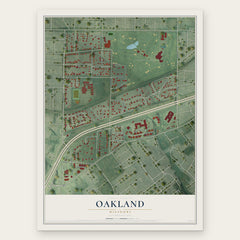
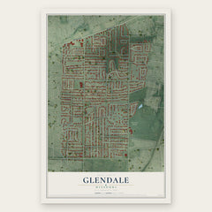
Order 2 or more town maps and save 10%. Shown in the size and finish you picked above, so they hang as a set.
- Des Peres 12" x 18" / Archival Matte Print $39.99
- Oakland 12" x 18" / Archival Matte Print $39.99
- Glendale 12" x 18" / Archival Matte Print $39.99

More maps nearby: Huntleigh, Warson Woods, Barretts, Crestwood and Crystal Lake Park.
The art of mapping a place
How This Map Was Made
Real places. Remarkable detail. Discover the layers that turn geographic data into a map of home.

The view from above
Aerial imagery reveals the character of the land: woodland, open fields, and the patterns of a place.

The shape of the land
Elevation data brings hills, valleys, and subtle changes in the landscape into view.

The details of home
Roads, waterways, and building footprints come together to make the map feel unmistakably local.

Geography becomes art
Considered color, shading, and typography bring the layers together in a map made for your wall.


Process illustrated with Mendon, Massachusetts. Aerial imagery: USDA NAIP. Terrain: USGS 3D Elevation Program. Map details and finished artwork: KNOWOL.
The Details
About This Print
Choose an archival matte print, or a black or white Ayous wood frame. The archival matte print is unframed.
Select your size and finish above to see the matching product image and price.
Materials & Craftsmanship
A contemporary map with the character of a classic atlas, printed on archival matte paper. Optional frames are made from Ayous wood.
Your printed map does not include the watermark shown in the full-map preview.
Shipping & Delivery
Free shipping within the United States. Every print is made to order in the USA.
Buying a gift? Add a note in your cart and we'll include it. We never put prices in the package.
Prints ship within 2 to 3 business days. Allow 7 to 10 days total from ordering for delivery. Timing may vary during holidays or periods of high order volume.
Read our shipping policy.
Returns and damaged prints
Each print is made to order. Change-of-mind refunds are not available after production.
If your print arrives damaged, misprinted or incorrect, contact support@knowol.com within 30 days of receiving it. Include your order number, photos and a description of the issue.
Read our full refund and replacement policy. For questions about your order, email support@knowol.com.