
Search for another town





Free U.S. delivery 7 to 10 days after you order
Lakeland, Florida Map Art
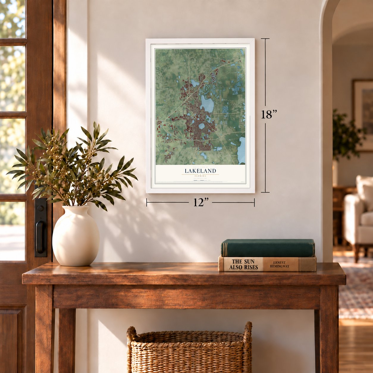
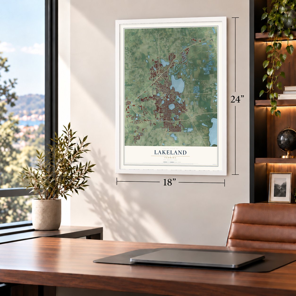
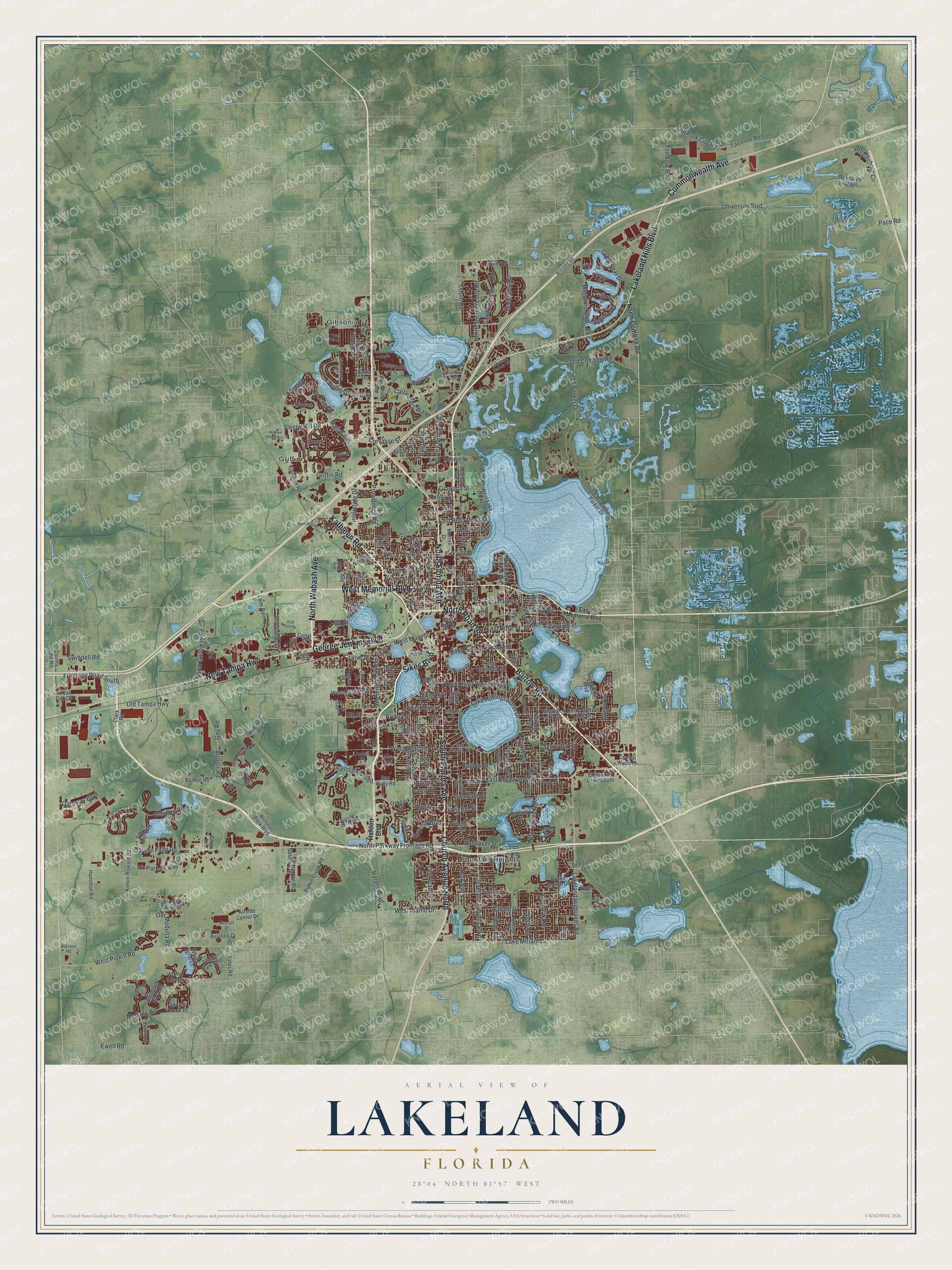
A new map of Lakeland, Florida, made in 2026 and printed to order on thick archival matte paper.
12" x 18" Archival Matte Print
A Map of Home. A Work of Art.
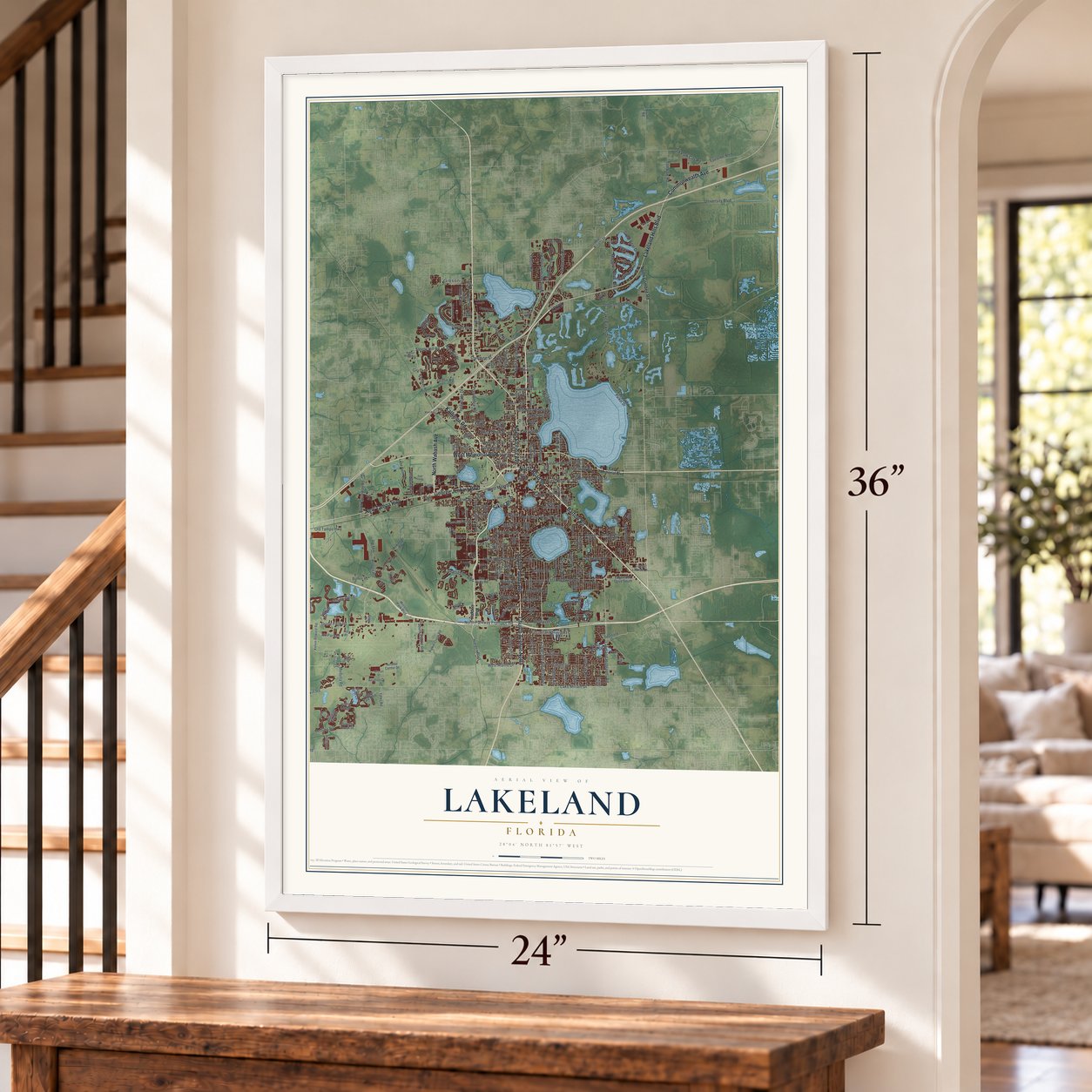
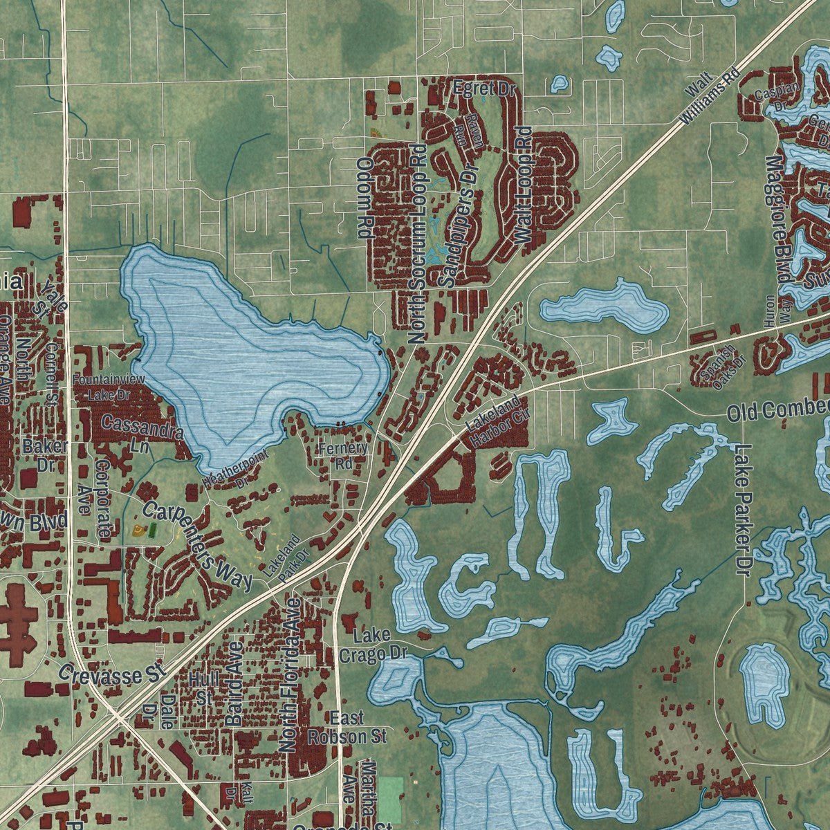
Explore Lakeland, Florida from a whole new perspective. Created using aerial imagery and detailed geographic data, this map captures Lakeland building by building, with labeled streets, familiar landmarks, and shaded topographical relief that highlights the natural contours of the landscape.
Combining modern data with the timeless character of a vintage atlas, this map is just as interesting up close as it is beautiful on the wall. Whether you grew up in Lakeland, spent memorable years there, or call it home today, this unique map is a great way to celebrate a place that means something to you. Zoom in on the preview to look for your street, and then order a print to put your memories on the wall.
Three ways to hang it
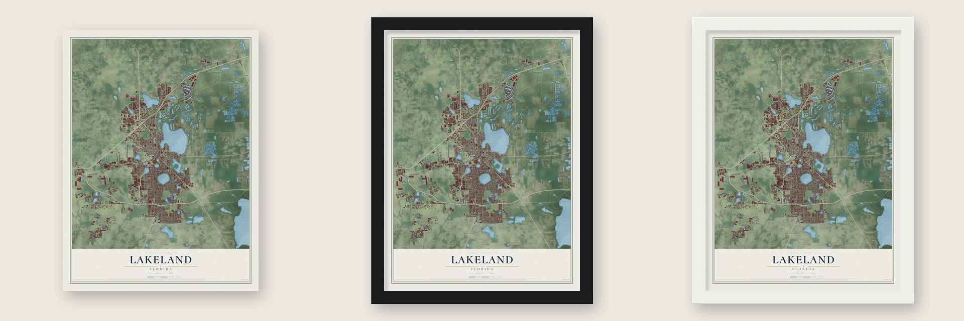
Unframed archival matte, a black wood frame or a white wood frame.
Up close
Geography Worth Displaying
This map was created using accurate cartographic data and authoritative geographic sources, including the U.S. Geological Survey (USGS) and FEMA. The map brings together terrain, waterways, roads, and building detail. The majority of the streets are labeled, houses are accurately depicted, and the topography is derived from government sources. Combining local data with carefully composed color and shading leads to this beautifully detailed Lakeland artwork for your wall.
Rather than simply showing street outlines, we’ve included as many of the street names as we could reasonably fit on the map while keeping their names legible. Zoom in on the high resolution preview to see exactly what’s on the map. We truly set out to create a statement piece for anyone who loves Lakeland. So whether it’s for you, or a gift for someone you love, we hope this map of Lakeland brings back fond memories.
Explore the full map of Lakeland, Florida and read about the local places it shows.

About Lakeland, Florida
Lakeland is a city of 112,641 people and the largest in Polk County. Settlers from Missouri, Kentucky, Tennessee, Georgia and South Carolina began arriving in the 1870s, and freed Black railway workers came in 1883, starting the neighborhood later called Moorehead. Abraham Munn of Louisville, Kentucky, had bought 80 acres of today's downtown in 1882. He laid out a town there in 1884 as the railroad arrived, and he named it for the lakes all around it. Lakeland was incorporated on January 1, 1885, and J. W. Trammell served as its first mayor.
The Spanish-American War began in April 1898, and the small town suddenly became a staging ground for more than 9,000 troops headed for the fighting. The 10th Cavalry, one of the first Buffalo Soldier regiments, camped beside Lake Wire, and its Black soldiers soon clashed with white residents. When a druggist refused to serve them, the quarrel grew until he drew a pistol. The soldiers shot him before he could fire, and two of them were arrested.
“out of the ground, into the light, a child of the sun.”
- The Queen's swansSwans first appeared on Lakeland's lakes around 1923. Alligators and pets had wiped them all out by 1954, so a resident who longed for them sent a letter to Queen Elizabeth II. In 1957 the royal family allowed two of its own swans to be caught and shipped to the city, and every swan in Swan City today comes from that royal pair.
- A campus by Frank Lloyd WrightFlorida Southern College's president, Ludd Spivey, asked Frank Lloyd Wright in 1938 to design a campus. The work kept Wright busy for over 20 years, while Spivey found money and builders through World War II and students put up many of the walls themselves. Of Wright's 30 designs, 12 were completed. It is the largest collection of his buildings on a single site anywhere, and in 2012 the campus was named a National Historic Landmark.
- Stars over the Polk TheatreThe Polk Theatre opened in 1928 at 121 South Florida Avenue, in the years of the Florida land boom. Its 1,400 seats looked out on a Venetian piazza scene beneath a ceiling of projected stars, and water from an artesian well cooled the hall, giving the county its first air conditioning. When the theater was threatened with demolition in 1982, residents set up a nonprofit, and the group paid $300,000 to save it.
- Home of PublixIn 1930 George W. Jenkins opened the first Publix, and in 1940 he built Florida's first supermarket. He bought the Lakeland Grocery Company in 1945 and moved the Publix offices to the city. Publix is still headquartered here, and no one in Lakeland employs more people.
- Flight school at the airportFrom 1940 to 1945, the Lodwick School of Aeronautics at the Lakeland Municipal Airport taught more than 8,000 American Army cadets to fly in Stearman biplanes. Britain sent 1,327 Royal Air Force cadets to train there between June 1941 and October 1942. After the school closed in 1945, the old airfield became Tiger Town, spring training home of the Detroit Tigers, who had first come to Lakeland in 1934.
Find your street
Names on the Lakeland map
Every name below is printed on this map. Look for your street, your school, the park where you played, or the pond down the road.
Places and landmarks3
- Fountain Heights
- Gibsonia
- Griffin
Streets and roads268
- Bartow Road
- South Florida Avenue
- Sikes Boulevard
- North Florida Avenue
- Lakeland Hills Boulevard
- George Jenkins Boulevard
- West Memorial Boulevard
- Commonwealth Avenue
- New Tampa Highway
- Kathleen Road
- Church Avenue North
- North Road 98
- North Wabash Avenue
- Cleveland Heights Boulevard
- South Central Avenue
- West Main Street
- East Main Street
- East Edgewood Drive
- North Socrum Loop Road
- Grasslands Boulevard
- Lake Miriam Drive
- Lakeland Highlands Road
- Old Polk City Road
- West Tenth Street
- Prado Place
- East Lime Street
- West Beacon Road
- Carleton Street
- University Boulevard
- Drane Field Road
Show all 268 streets
- West Pipkin Road
- North Parkway Frontage Road
- Lake Hollingsworth Drive
- Medulla Road
- Airport Road
- New Jersey Road
- Griffin Road
- Old Combee Road
- Old Tampa Highway
- Lake Parker Drive
- Providence Road
- Ariana Street
- Swindell Road
- Mall Hill Drive
- Polytechnic Circle
- Hallam Drive
- Frontage Road South
- Sleepy Hill Road
- Olive Street
- Walt Loop Road
- Glendale Street
- Old Medulla Road
- Williamstown Boulevard
- Harden Boulevard
- Crevasse Street
- Carpenters Way
- East Parker Street
- Easton Drive
- Carillon Boulevard
- West Fifth Street
- Polk Avenue
- Interstate Drive
- Sandpipers Drive
- Frank Lloyd Wright Way
- Odom Road
- Westover Street
- Sylvester Road
- Via Lago Drive
- Old Road 37
- West Alamo Drive
- Air Park Drive
- Lowry Avenue
- Maggiore Boulevard
- Live Oak Road
- East Rose Street
- North Galloway Road
- South Pipkin Road
- East Gary Road
- Great Bear Drive
- Granada Street
- East Bella Vista Street
- Howard Avenue
- Tomkow Road
- Baird Avenue
- Pace Road
- Gateway Boulevard
- Ewell Road
- Gay Road
- Imperial Boulevard
- Hunter Street
- Nevada Road
- Lakehurst Street
- Superior Drive
- Luce Road
- Carey Place
- Deter Road
- Collins Lane
- Oppitz Lane
- Antilla Street
- Lisa Street
- Bb Street
- North Combee Road
- Lime Street
- Pinellas Street
- North Lake Parker Avenue
- West Highland Street
- San Gully Road
- East Orange Street
- Cresap Street
- Arlington River Drive
- County Line Road
- Winston Park Boulevard
- Research Way
- South Lincoln Avenue
- West Lake Parker Drive
- North Gilmore Avenue
- East Lake Parker Drive
- Egret Drive
- West 14th Street
- Kelvin Howard Road
- North Crystal Lake Drive
- Epicenter Boulevard
- Airside Center Drive
- Bunker Road
- Edgewood Drive South
- Pipkin Creek Road
- West Belmar Street
- Quincy Street
- Longfellow Boulevard
- King Avenue
- Newport Avenue
- East Palmetto Street
- West 13th Street
- Clark Road
- Wilkinson Road
- Lone Palm Drive
- Hamilton Road
- Rocky Pointe Drive
- Deerfield Drive
- White Egret Lane
- Crystal Lake Drive
- East Elm Road
- Fiddle Leaf Way
- South Boulevard
- Towne Park Boulevard
- Ruby Street
- Ashling Drive
- Aviation Drive
- Hull Street
- Forest Park Street
- Spruce Creek Drive
- Crystal Wood Drive
- Ruth Avenue
- Cassandra Lane
- Parkview Place
- East Robson Street
- Lakeshore Drive
- East Bay Street
- North Orange Avenue
- Corporate Avenue
- Oakpark Drive
- Sunset Lake Drive
- Lake Crago Drive
- Oak Drive
- Pear Street
- White Ibis Road
- Morrell Drive
- Jonila Avenue
- Tahoe Drive
- Yates Road
- Great Oak Drive
- Martha Avenue
- Jaffa Street
- Yale Street
- Park Drive
- Aspen Drive
- Bryant Road
- Druid Street
- Lenox Street
- Danes Court
- Rex Lane
- Corral Drive
- Canal Street
- Baker Drive
- Dmg Drive
- Aero Place
- Dale Drive
- East Memorial Boulevard
- West Ninth Street
- Lake Morton Drive
- Dolostone Drive
- West Second Street
- Altavista Circle
- Lakeland Harbor Circle
- Carolina Avenue
- Geneva Drive
- Laird Boulevard
- Rickenberry Lane
- Shore Acres Drive
- Camphor Drive
- Dakeman Road
- Village Center Drive
- East Beacon Road
- Walt Williams Road
- Plum Street
- Ralston Road
- Candyce Avenue
- Pablo Street
- Cornell Street
- Modest Street
- Gachet Boulevard
- Fernery Road
- Aircraft Drive
- Lanier Street
- Miami Street
- Dana Place
- Lark Drive
- Azalea Road
- Jeff Street
- Edith Avenue
- Owen Street
- Mario Trail
- Filly Lane
- West Lime Street
- North Gary Road
- North Virginia Avenue
- Fountainview Lake Drive
- East Highland Drive
- Siltstone Street
- Prescott Loop
- Caspian Drive
- West Bella Vista Street
- Lakeland Park Drive
- Heatherpoint Drive
- Grandbury Grove Road
- Bridgefield Drive
- Innisbrook Drive
- Rocky Road
- Blue Highlands Drive
- Woodward Street
- Huron Way
- Atlanta Avenue
- Dorothy Street
- Ariana Village Place
- Lagoon Road
- Winterset Drive
- Firstpark Bl
- Handley Boulevard
- Spanish Oaks Drive
- Quail Hill Drive
- Waterlute Way
- Buena Vis
- William Booth Way
- Gilmore Avenue
- Hunt Avenue
- Willow Avenue
- Neville Avenue
- Palmola Street
- Pinehurst Street
- Mabel Avenue
- Golf Palm Drive
- Laura Road
- Imperial Drive
- Lyndol Street
- Raven Run
- Sugar Place
- Jean Avenue
- Kalt Drive
Names are listed as they appear on the printed map. Zoom into the product photos to find them.
The art of mapping a place
How This Map Was Made
Real places. Remarkable detail. Discover the layers that turn geographic data into a map of home.

The view from above
Aerial imagery reveals the character of the land: woodland, open fields, and the patterns of a place.

The shape of the land
Elevation data brings hills, valleys, and subtle changes in the landscape into view.

The details of home
Roads, waterways, and building footprints come together to make the map feel unmistakably local.

Geography becomes art
Considered color, shading, and typography bring the layers together in a map made for your wall.


Process illustrated with Mendon, Massachusetts. Aerial imagery: USDA NAIP. Terrain: USGS 3D Elevation Program. Map details and finished artwork: KNOWOL.
The Details
About This Print
Choose an archival matte print, or a black or white Ayous wood frame. The archival matte print is unframed.
Select your size and finish above to see the matching product image and price.
Materials & Craftsmanship
A contemporary map with the character of a classic atlas, printed on archival matte paper. Optional frames are made from Ayous wood.
Your printed map does not include the watermark shown in the full-map preview.
Shipping & Delivery
Free shipping within the United States. Every print is made to order in the USA.
Buying a gift? Add a note in your cart and we'll include it. We never put prices in the package.
Prints ship within 2 to 3 business days. Allow 7 to 10 days total from ordering for delivery. Timing may vary during holidays or periods of high order volume.
Read our shipping policy.
Returns and damaged prints
Each print is made to order. Change-of-mind refunds are not available after production.
If your print arrives damaged, misprinted or incorrect, contact support@knowol.com within 30 days of receiving it. Include your order number, photos and a description of the issue.
Read our full refund and replacement policy. For questions about your order, email support@knowol.com.
Find your town
Looking for another city?
Find a map of home in our Florida collection, or any town in the country.
Nearby
Maps of towns near Lakeland
Know someone from one of these towns? Their map makes a great gift.
 Griffin
, Florida
From $39.99See the map
 Combee Settlement
, Florida
From $39.99See the map
 Crystal Lake
, Florida
From $39.99See the map
More maps nearby: Winston, Fussels Corner, Lakeland Highlands, Kathleen and Medulla.