
Search for another town



Free U.S. delivery 7 to 10 days after you order
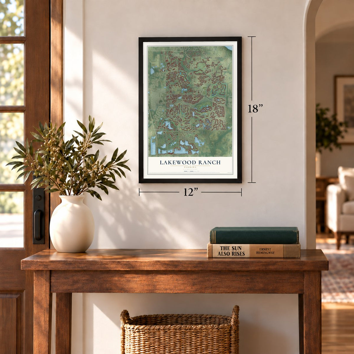
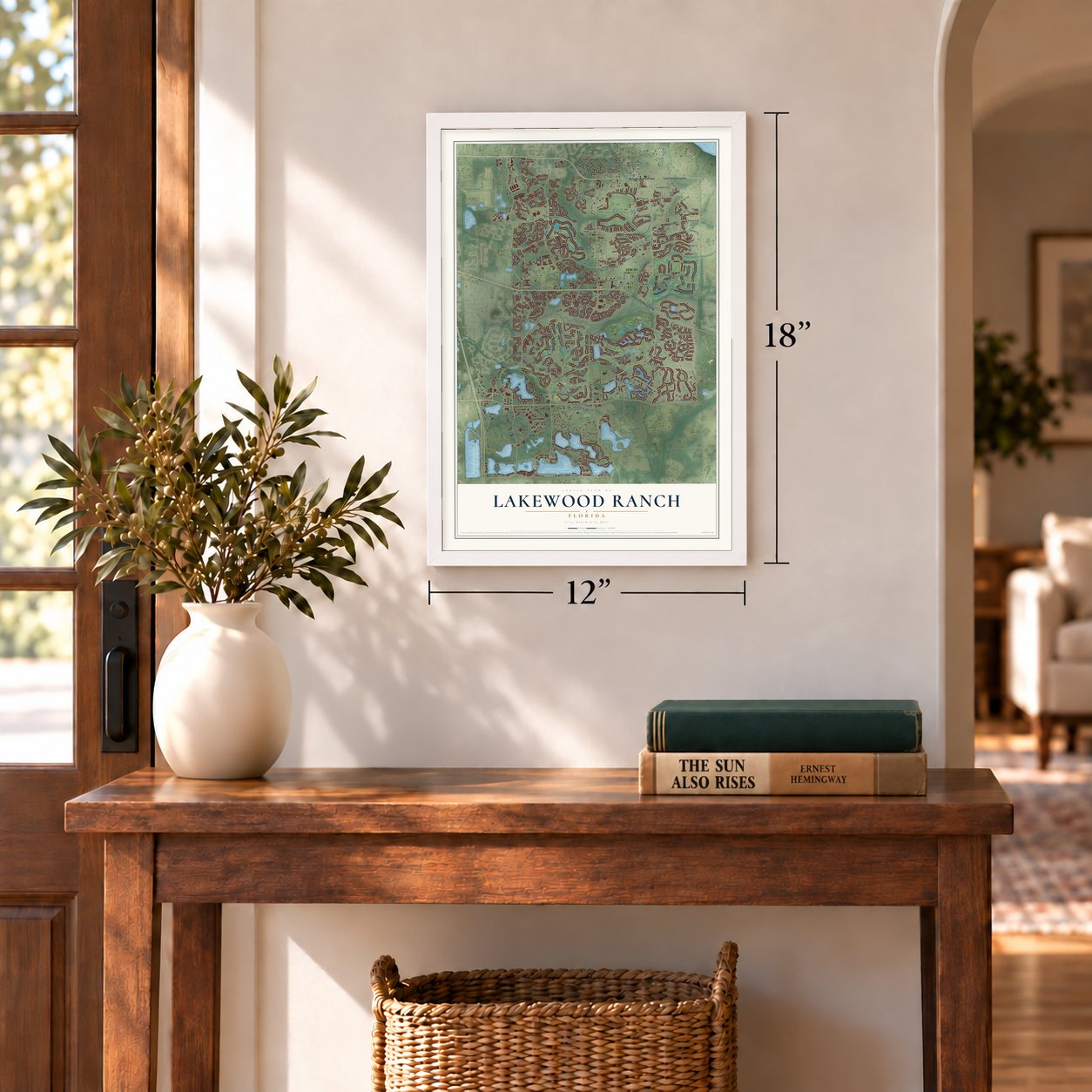
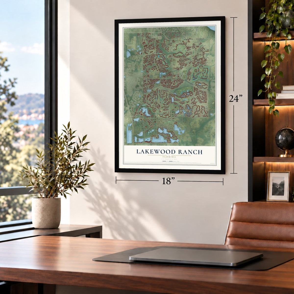
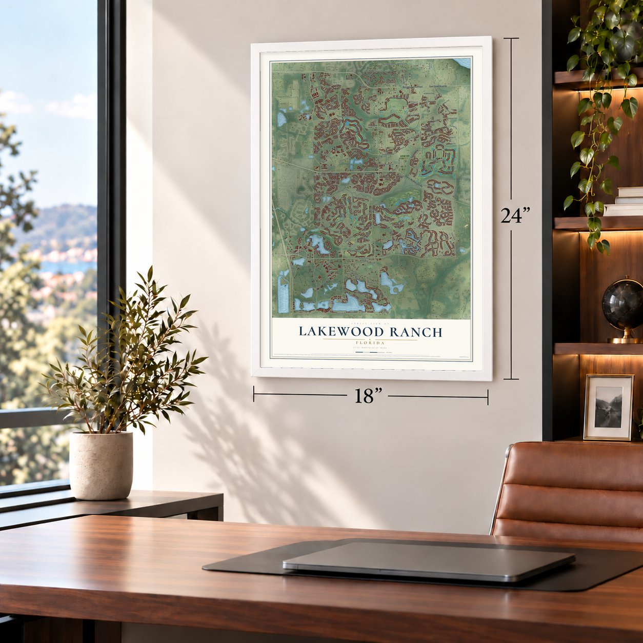
Lakewood Ranch, Florida Map Art
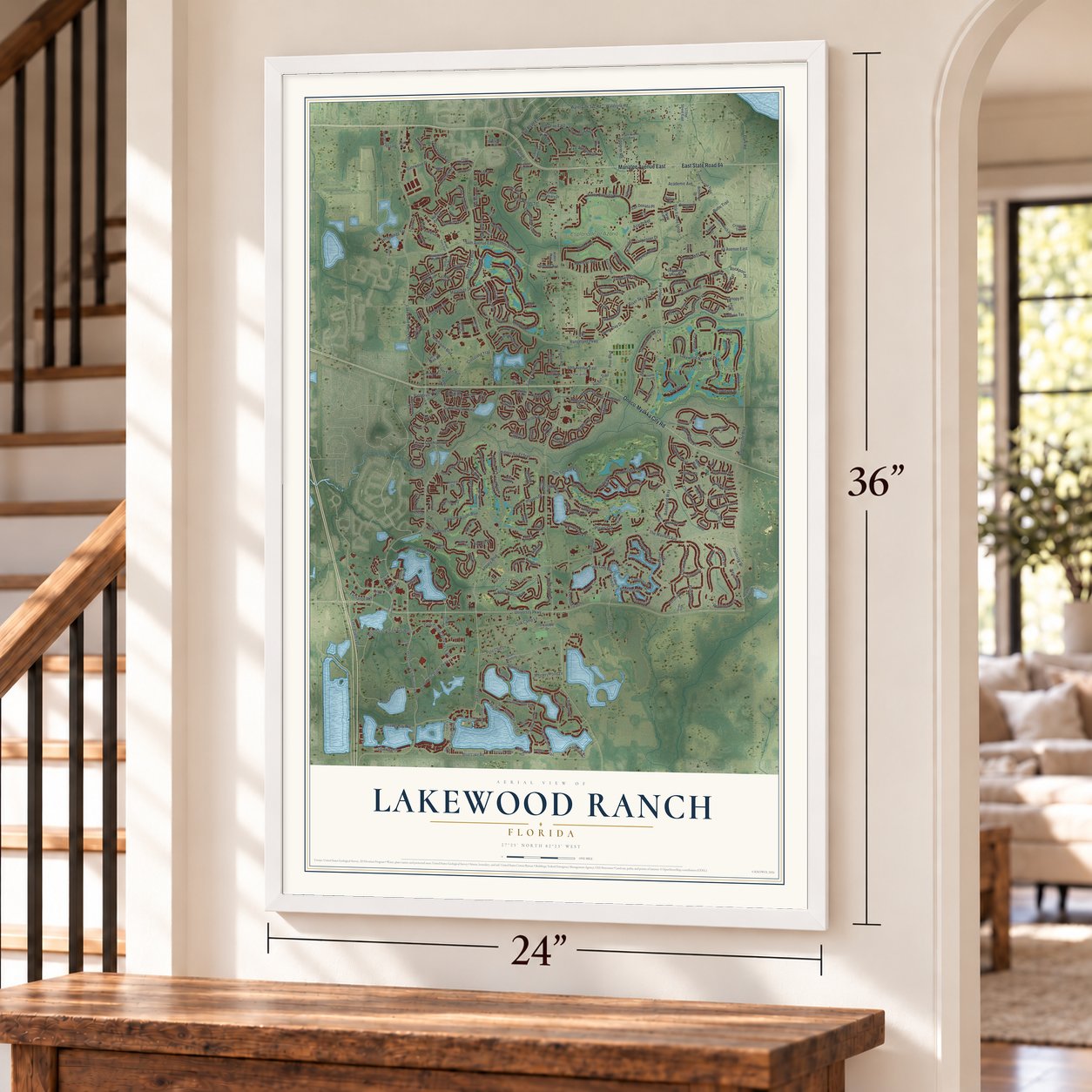
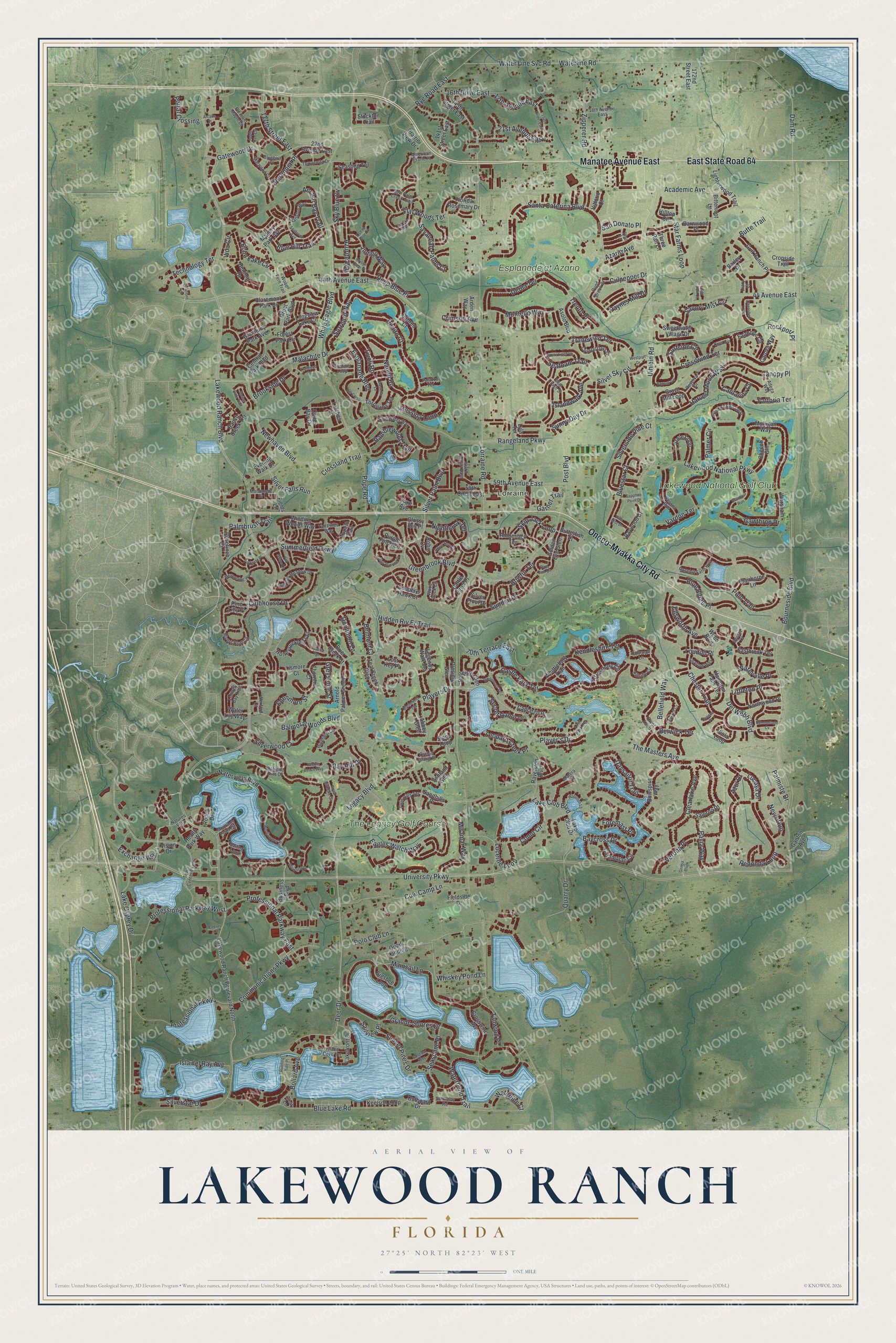
A new map of Lakewood Ranch, Florida, made in 2026 and printed to order on thick archival matte paper.
12" x 18" Archival Matte Print
A Map of Home. A Work of Art.
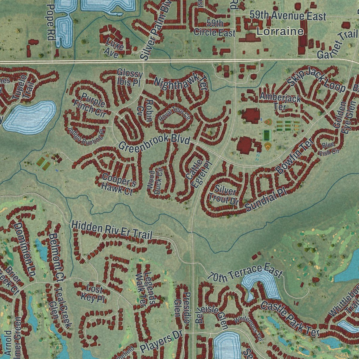
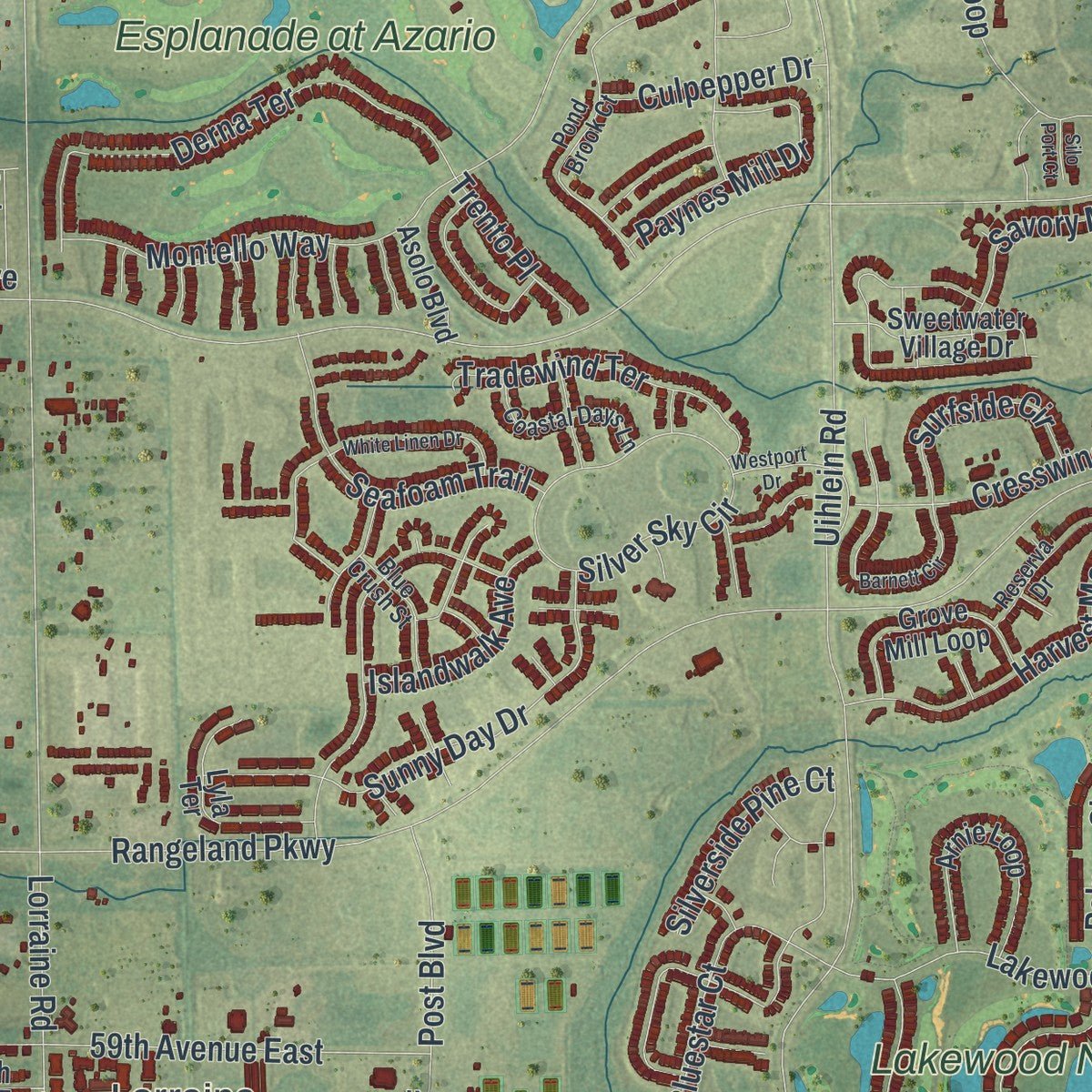
Explore Lakewood Ranch, Florida from a whole new perspective. Created using aerial imagery and detailed geographic data, this map captures Lakewood Ranch building by building, with labeled streets, familiar landmarks, and shaded topographical relief that highlights the natural contours of the landscape.
Combining modern data with the timeless character of a vintage atlas, this map is just as interesting up close as it is beautiful on the wall. Whether you grew up in Lakewood Ranch, spent memorable years there, or call it home today, this unique map is a great way to celebrate a place that means something to you. Zoom in on the preview to look for your street, and then order a print to put your memories on the wall.
Three ways to hang it
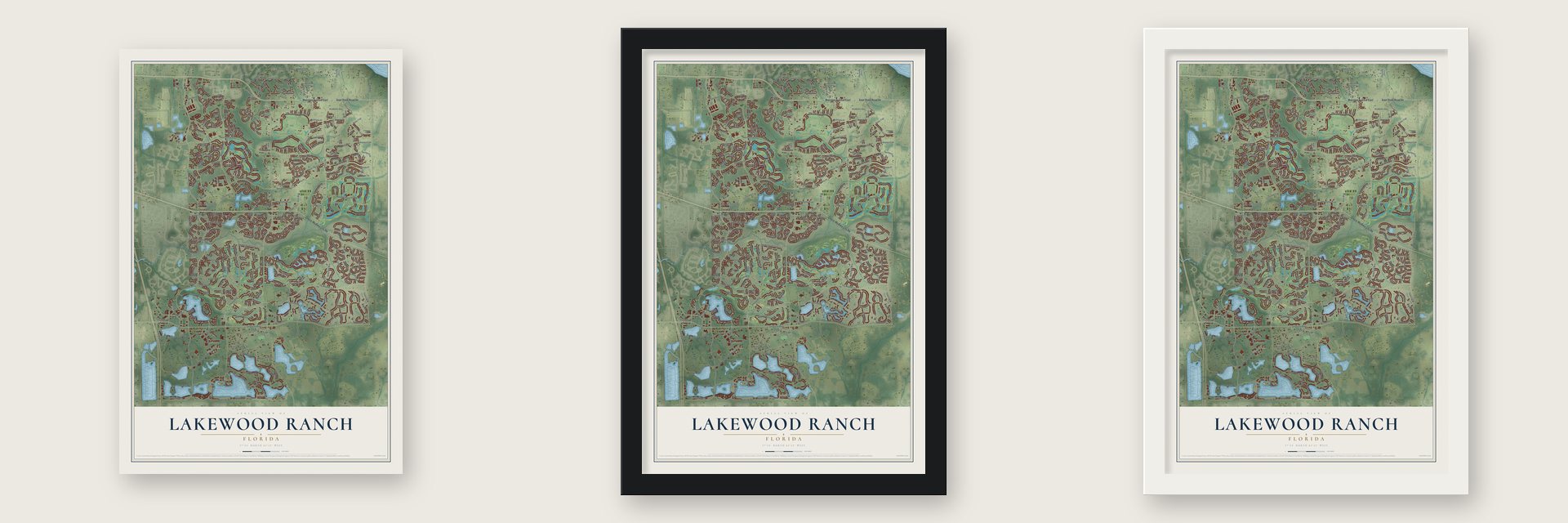
Unframed archival matte, a black wood frame or a white wood frame.
Up close
Geography Worth Displaying
This map was created using accurate cartographic data and authoritative geographic sources, including the U.S. Geological Survey (USGS) and FEMA. The map brings together terrain, waterways, roads, and building detail. The majority of the streets are labeled, houses are accurately depicted, and the topography is derived from government sources. Combining local data with carefully composed color and shading leads to this beautifully detailed Lakewood Ranch artwork for your wall.
Rather than simply showing street outlines, we’ve included as many of the street names as we could reasonably fit on the map while keeping their names legible. Zoom in on the high resolution preview to see exactly what’s on the map. We truly set out to create a statement piece for anyone who loves Lakewood Ranch. So whether it’s for you, or a gift for someone you love, we hope this map of Lakewood Ranch brings back fond memories.
Explore the full map of Lakewood Ranch, Florida and read about the local places it shows.

About Lakewood Ranch, Florida
Lakewood Ranch is a planned community of 34,877 people that spans southeastern Manatee County and northeastern Sarasota County. John Schroeder pieced its land together in 1905 as the Schroeder-Manatee Ranch, and in 1922 members of the Uihlein family of Milwaukee bought the property and worked it for cattle and timber.
In 1977 the Sarasota Manatee Airport Authority proposed a new airport near the county line, close to where Interstate 75 would soon run. The authority gave up that plan in 1985 and enlarged its existing airport instead, but the proposal and the new highway led the ranch's board to build a planned community. Manatee County rejected the ranch's plans in 1987, then approved them in December 1989, and work on Summerfield, the first neighborhood, was complete in 1995.
- Cypress Banks, never builtDuring the 1980s the ranch drew up a resort called Cypress Banks. It called for 5,000 homes on 1,800 acres, along with three golf courses and a hotel of 300 rooms. The resort never broke ground, but the ranch held on to its rights to the land.
- A turpentine town in 1915The Tampa financier G.A. McLeod formed the Lorraine Turpentine Company in 1915 and built a company town for it, and both were probably named for the French region then in the news. The Schroeder Mill & Timber Company also ran a sawmill there. When the turpentine trade faded in the mid-1920s, Lorraine Farms was platted in 1926 as farm plots of several acres each. Lorraine has been considered part of the wider Lakewood Ranch since the 1990s.
- A brewer who played poloRobert Uihlein Jr., born in Milwaukee in 1916, took the title at the U.S. Open Polo Championship in 1951. In 1961 he captured it again, and that same year he became head of the Joseph Schlitz Brewing Company. Lakewood Ranch, the Lakewood Ranch Golf & Country Club and the Sarasota Polo Club all sit within his family's Schroeder-Manatee Ranch.
- The Mustangs' double crownLakewood Ranch High School opened in 1998. During the 2011 to 2012 school year, the Florida High School Athletic Association gave the Mustangs two honors: its Academic Team Champions title and its Floyd E. Lay Sunshine Cup. No other public school in Florida has won both.
Find your street
Names on the Lakewood Ranch map
Every name below is printed on this map. Look for your street, your school, the park where you played, or the pond down the road.
Places and landmarks4
- Lorraine
- Esplanade at Azario
- Lakewood National Golf Club
- The Legacy Golf Course
Streets and roads349
- Manatee Avenue East
- Oneco-Myakka City Road
- East State Road 64
- Player's Drive
- Legacy Boulevard
- Deer Drive
- Waterview Boulevard
- University Parkway
- Lakewood Ranch Boulevard
- Bourneside Boulevard
- Dam Road
- 44th Avenue East
- Palmer Circle
- Players Drive
- Balmoral Woods Boulevard
- Greenbrook Boulevard
- Grande Shores Drive
- Anchor Bay Trail
- Gawthrop Drive
- Lucaya Drive
- Echo Lake Circle
- Vida Circle
- Blue Hill Trail
- Lorraine Road
- The Masters Avenue
- Rangeland Parkway
- Uihlein Road
- 44 Avenue East
- Blue Lake Road
- Star Farms Loop
Show all 349 streets
- Pope Road
- White Eagle Boulevard
- Santa Caterina Boulevard
- Clearlake Avenue
- Polo Trail
- Redonda Loop
- Hidden Riv Er Trail
- Water Line Svc Road
- Waterline Road
- Malachite Drive
- Cresswind Terrace
- Pavia Way
- Castle Park Terrace
- Polo Club Lane
- Lakewood National Parkway
- Chester Trail
- Del Webb Boulevard
- Mainsail Lane
- Lake Club Boulevard
- Professional Parkway
- Como Circle
- Savannah Palms Court
- Summerfield Parkway
- Sorrento Way
- Professional Parkway West
- Benito Court
- Cow Camp Lane
- Eagles Watch Way
- Newhaven Boulevard
- Communications Parkway
- Sundial Place
- Baycross Drive
- Savory Mist Circle
- Palmiste Drive
- Silverside Pine Court
- Daysailor Trail
- 17th Avenue East
- Derna Terrace
- Silver Sky Circle
- Clubhouse Drive
- Lake Osprey Drive
- Bellefield Way
- Sunny Day Drive
- Kendleshire Terrace
- Professional Parkway East
- Waterbend Trail
- Isla del Ray Avenue
- Harvest Moon Way
- 70th Terrace East
- Flat Woods Terrace
- Bluestar Court
- Miramar Way
- Skip Jack Loop
- Cantarina Cv
- Deep Blue Place
- Crossland Trail
- Whiskey Pond Lane
- Seascape Place
- 21st Avenue East
- Butte Trail
- Messina Loop
- 59th Avenue East
- Zipperer Road
- Verona Place
- Greystone Street
- Post Boulevard
- Seafoam Trail
- Esplanade Boulevard
- Canopy Place
- Rye Road East
- Montello Way
- Perennial Place
- Crimson Avenue
- Tradewind Terrace
- Azurite Way
- Blue Ridge Place
- Paynes Mill Drive
- 16th Drive East
- Indigo Way
- 117th Street East
- Rockport Place
- Quarry Drive
- Silverstar Drive
- Gatewood Drive
- Bollard Avenue
- Nevis Run
- Sky Blue Cv
- Technology Terrace
- Nighthawk Terrace
- Academic Avenue
- Bowfin Terrace
- Sailview Place
- Ramblewood Trail
- Silverwood Court
- Silver Falls Run
- Brookside Drive
- Berwick Terrace
- Lucerne Loop
- Sunset Pines Drive
- Napoli Rn
- Edenmore Street
- Surfside Circle
- Silver Palm Boulevard
- Islandwalk Avenue
- Tailwind Place
- Palmbrush Trail
- Leopard Creek Place
- Waterline Court
- Ellsworth Avenue
- Culpepper Drive
- Littleton Place
- Portal Crossing
- Azario Avenue
- Dominion Lane
- Secret Habor Place
- Garnet Trail
- Exchange Way
- Vardon Terrace
- Waterville Place
- Fattoria Terrace
- San Donato Place
- Trento Place
- Belmont Court
- Tivoli Rn
- Foremast Place
- Loudon Place
- Azul Drive
- Bay Hill Drive
- Lakewood Ranch Boulevard North
- Water Lily Way
- Crosswind Avenue
- Bennett Drive
- Vision Drive
- Worsham Lane
- Arnold Palmer Green
- Forest Park Circle
- Mulligan Way
- Longview Lake Circle
- Bowspirit Way
- Winding Woods Way
- Hampton Falls Terrace
- Northwood Place
- Thornhill Court
- Luxe Avenue
- Sigsbee Loop
- Gulf Ranch Place
- Whittlebury Trail
- Cades Bay Circle
- 22nd Avenue East
- Ranch Creek Terrace
- Purple Finch Circle
- Claremont Park Drive
- 59th Circle East
- Lakefront Drive
- Fairhope Circle
- Arnie Loop
- Barnwood Place
- Siena Loop
- Honeysuckle Trail
- Central Park Boulevard
- Lighterwood Trail
- Ganton Avenue
- Ravelston Boulevard
- Hilltop Circle
- Golden Eye Glen
- Camargo Place
- Pine Lilly Place
- Grove Mill Loop
- Cooper's Hawk Court
- Catamaran Circle
- Great Park Boulevard
- Lyla Terrace
- Baywood Court
- Sweetwater Village Drive
- Florida Rosemary Drive
- Gramercy Park Avenue
- Cattle Egret Place
- Keelson Loop
- 141st Street East
- Tupelo Trail
- Lismore Court
- Viola Loop
- Brier Creek Court
- Clairborne Lane
- Eastbrook Terrace
- Evening Walk Drive
- Prestbury Circle
- Ashland Glen
- Carova Way
- Webb Boulevard
- Belleisle Glen
- Legends Walk Terrace
- Cheech Gln
- Stockton Trail
- Torresina Terrace
- 145th Street East
- Teal Creek Glen
- Business Boulevard
- Seasong Terrace
- Amberjack Terrace
- Prairie View Drive
- Salerno Drive
- Mallory Park Avenue
- Cabreo Court
- Cropside Trail
- 172nd Street East
- Outboard Drive
- Fieldside Drive
- Rosefinch Court
- Arden Way
- Sandhills Place
- Butterfish Place
- Asolo Boulevard
- Fields Lane
- Presidio Glen
- Rodeo Drive
- Health Park Way
- Latches Lane
- Bitterroot Lane
- Quail Landing
- Glossy Ibis Place
- Lake Club Drive
- Barley Drive
- Vittorio Court
- Lost Key Place
- Silver Trout Drive
- Three Rail Lane
- Robin Cv
- Abbey Glen
- Natures Way
- Sailing Loop
- Town Center Parkway
- Moorings Point Circle
- Cranston Way
- Wexford Court
- Wood Fern Trail
- Swiftwater Way
- Pond Brook Court
- Highfield Circle
- Matera Court
- Saw Palm Creek Trail
- Rivers Bluff Circle
- Starwood Court
- Linn Park Terrace
- Wood Duck Circle
- American Prarie Place
- Cessna Run
- Fontana Loop
- Oakland Hills Drive
- Hickok Belt Loop
- Summer Meadow Drive
- Divot Loop
- 18th Avenue East
- Rosehill Farm Run
- Coastal Days Lane
- Kiva Circle
- Reserva Drive
- Island Cove Terrace
- Terracotta Drive
- Twin Hills Terrace
- Tall Pines Way
- Seaford Way
- Blue Crush Street
- Hillside Circle
- Loblolly Bay Trail
- 143rd Court East
- Orchid Island Place
- Sternway Road
- Adega Way
- Monument Drive
- Pleasant Maple Court
- Cornwall Lane
- Bluebird Place
- Palazzo Terrace
- Vigo Lane
- Dorset Court
- Cleat Lane
- Diary Court
- Brandon Run
- Genoa Boulevard
- Summerland Cv
- Royal Birkdale Circle
- Meandering Way
- Seabrook Avenue
- White Linen Drive
- Sandstar Way
- Royal Tern Circle
- Big Sky Way
- Del Corso Loop
- Spring Gate Trail
- Windjammer Place
- Barnett Circle
- Apple Tree Circle
- Trailhead Drive
- Pebble Beach Way
- Cherished Loop
- Seacroft Cv
- Indigo Bunting Place
- Blue Fish Circle
- 154th Street East
- Whitemoss Terrace
- Parkside Place
- Crystal Clear Place
- Running Tide Place
- Lobelia Terrace
- Blythefield Terrace
- Waterton Lane
- Solutions Lane
- Fox Grape Lane
- Idlewood Drive
- Castello Lane
- Sapphire Point Drive
- Pine Mist Drive
- Westport Drive
- Ocean Blue Cv
- Corinna Place
- Energy Court
- Arcade Place
- Silo Port Court
Names are listed as they appear on the printed map. Zoom into the product photos to find them.
The art of mapping a place
How This Map Was Made
Real places. Remarkable detail. Discover the layers that turn geographic data into a map of home.

The view from above
Aerial imagery reveals the character of the land: woodland, open fields, and the patterns of a place.

The shape of the land
Elevation data brings hills, valleys, and subtle changes in the landscape into view.

The details of home
Roads, waterways, and building footprints come together to make the map feel unmistakably local.

Geography becomes art
Considered color, shading, and typography bring the layers together in a map made for your wall.


Process illustrated with Mendon, Massachusetts. Aerial imagery: USDA NAIP. Terrain: USGS 3D Elevation Program. Map details and finished artwork: KNOWOL.
The Details
About This Print
Choose an archival matte print, or a black or white Ayous wood frame. The archival matte print is unframed.
Select your size and finish above to see the matching product image and price.
Materials & Craftsmanship
A contemporary map with the character of a classic atlas, printed on archival matte paper. Optional frames are made from Ayous wood.
Your printed map does not include the watermark shown in the full-map preview.
Shipping & Delivery
Free shipping within the United States. Every print is made to order in the USA.
Buying a gift? Add a note in your cart and we'll include it. We never put prices in the package.
Prints ship within 2 to 3 business days. Allow 7 to 10 days total from ordering for delivery. Timing may vary during holidays or periods of high order volume.
Read our shipping policy.
Returns and damaged prints
Each print is made to order. Change-of-mind refunds are not available after production.
If your print arrives damaged, misprinted or incorrect, contact support@knowol.com within 30 days of receiving it. Include your order number, photos and a description of the issue.
Read our full refund and replacement policy. For questions about your order, email support@knowol.com.
Find your town
Looking for another city?
Find a map of home in our Florida collection, or any town in the country.
Nearby
Maps of towns near Lakewood Ranch
Know someone from one of these towns? Their map makes a great gift.
 The Meadows
, Florida
From $39.99See the map
 Tatum Ridge
, Florida
From $39.99See the map
 Desoto Lakes
, Florida
From $39.99See the map
More maps nearby: Tatum, Fruitville, Kensington Park, Desoto Acres and Lake Sarasota.