
Search for another town





Free U.S. delivery 7 to 10 days after you order
Lawnside, New Jersey Map Art
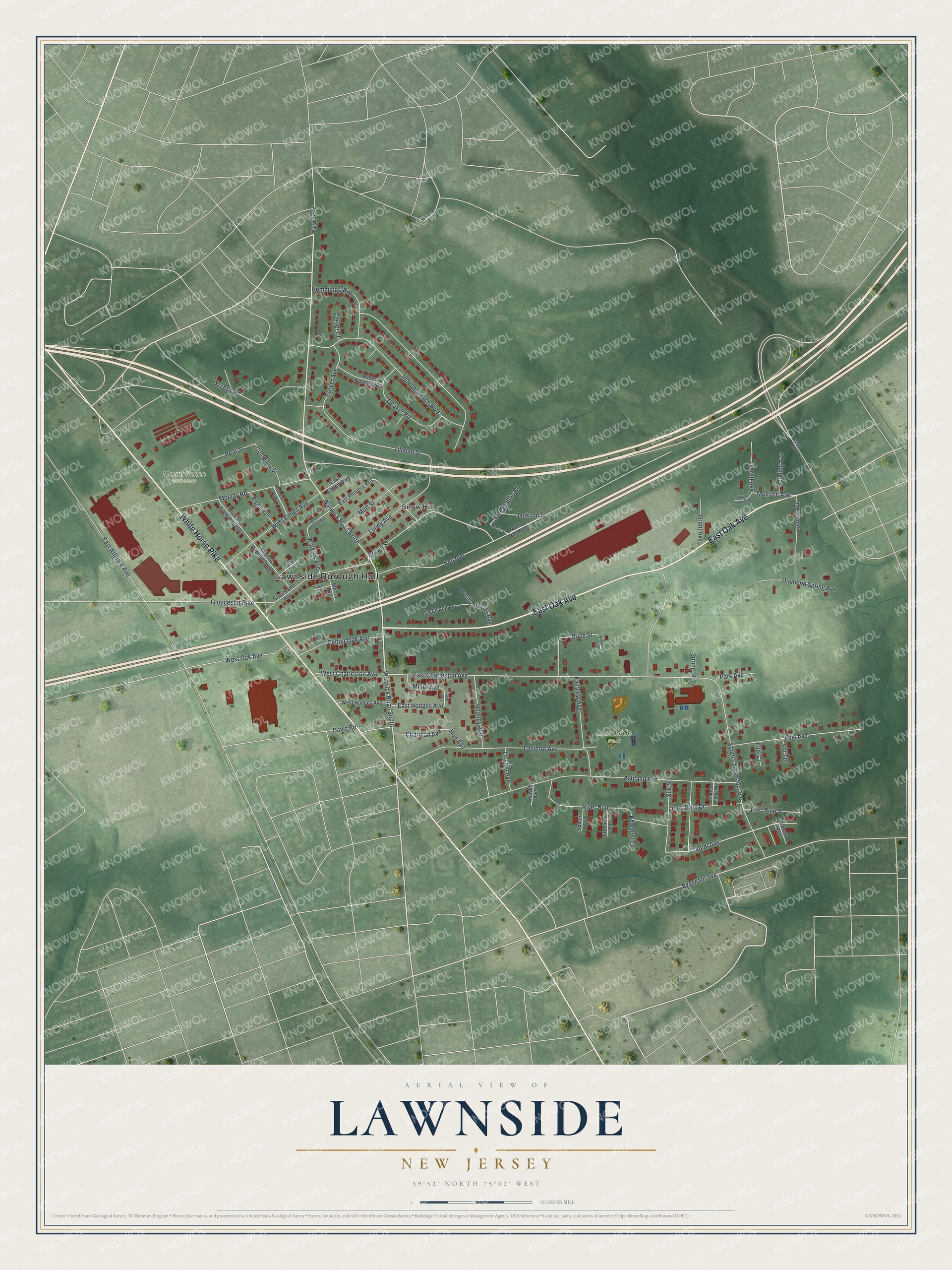
Building by building, with labeled streets and shaded relief.
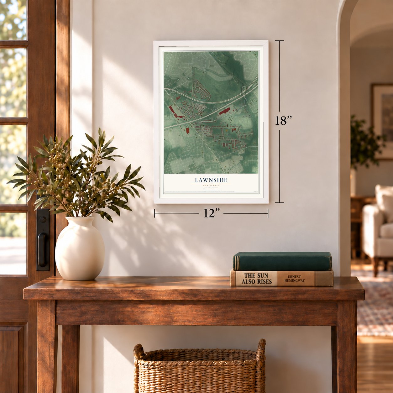
12" x 18" Archival Matte Print
A Map of Home. A Work of Art.
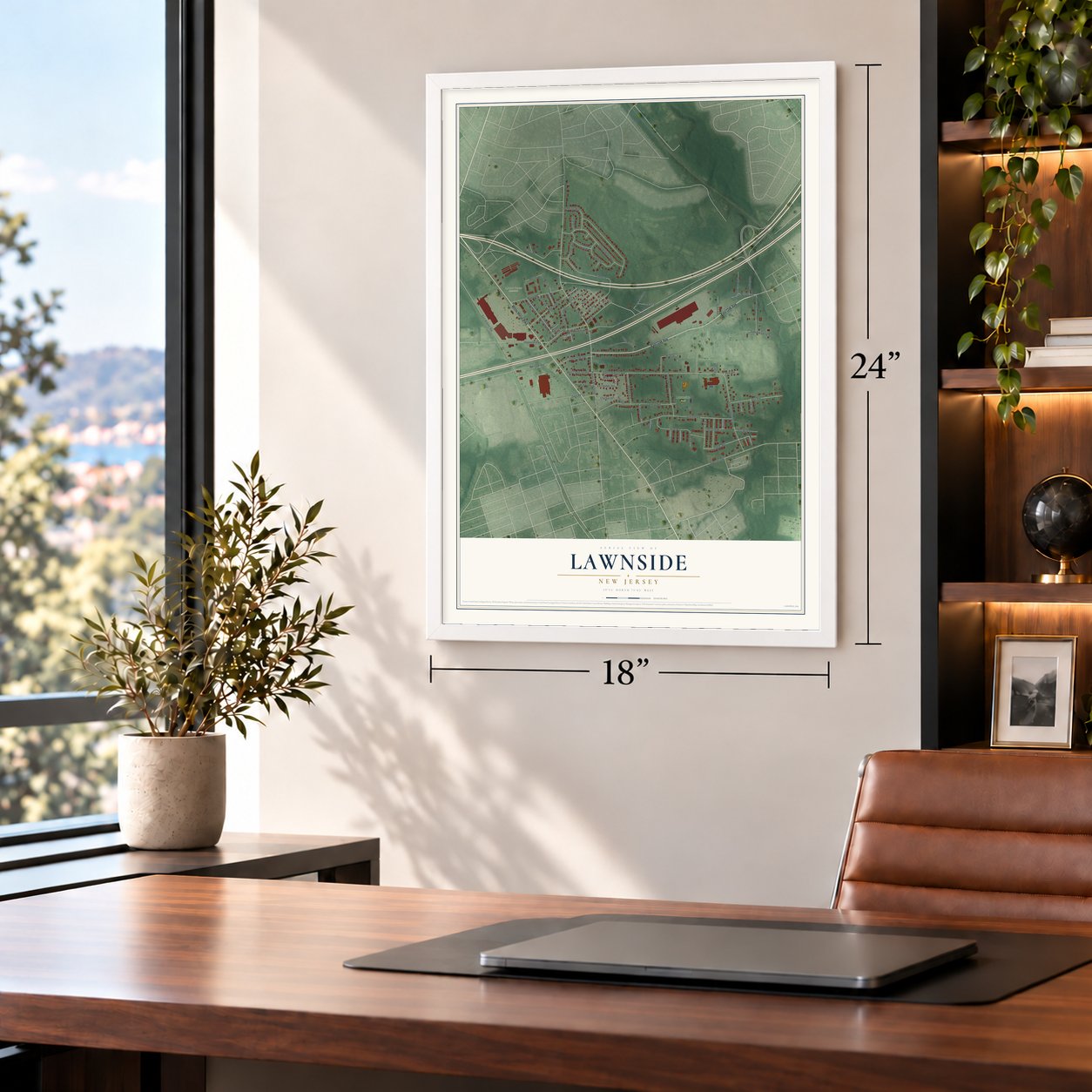
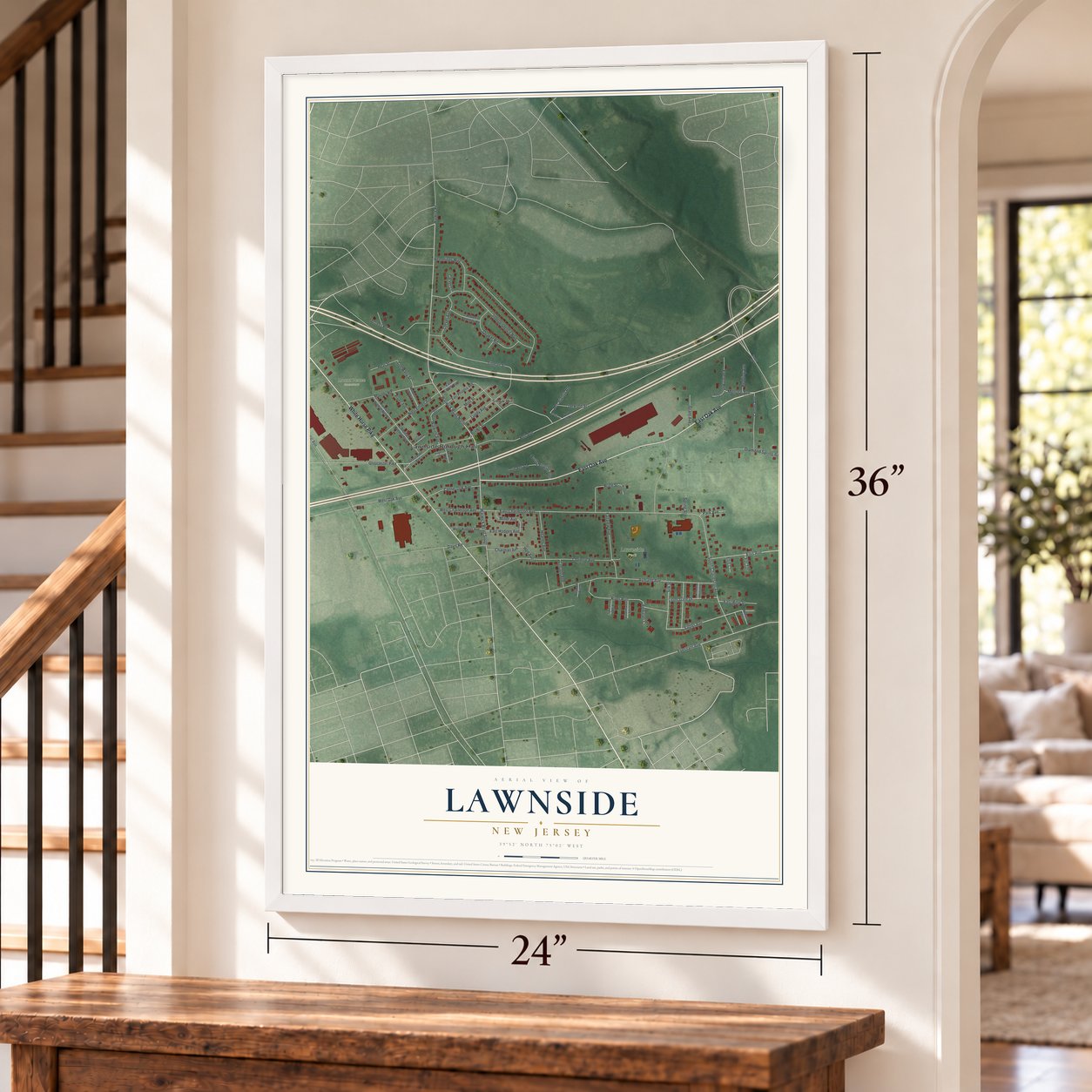
Explore Lawnside, New Jersey from a whole new perspective. Created using aerial imagery and detailed geographic data, this map captures Lawnside building by building, with labeled streets, familiar landmarks, and shaded topographical relief that highlights the natural contours of the landscape.
Combining modern data with the timeless character of a vintage atlas, this map is just as interesting up close as it is beautiful on the wall. Whether you grew up in Lawnside, spent memorable years there, or call it home today, this unique map is a great way to celebrate a place that means something to you. Zoom in on the preview to look for your street, and then order a print to put your memories on the wall.
Three ways to hang it
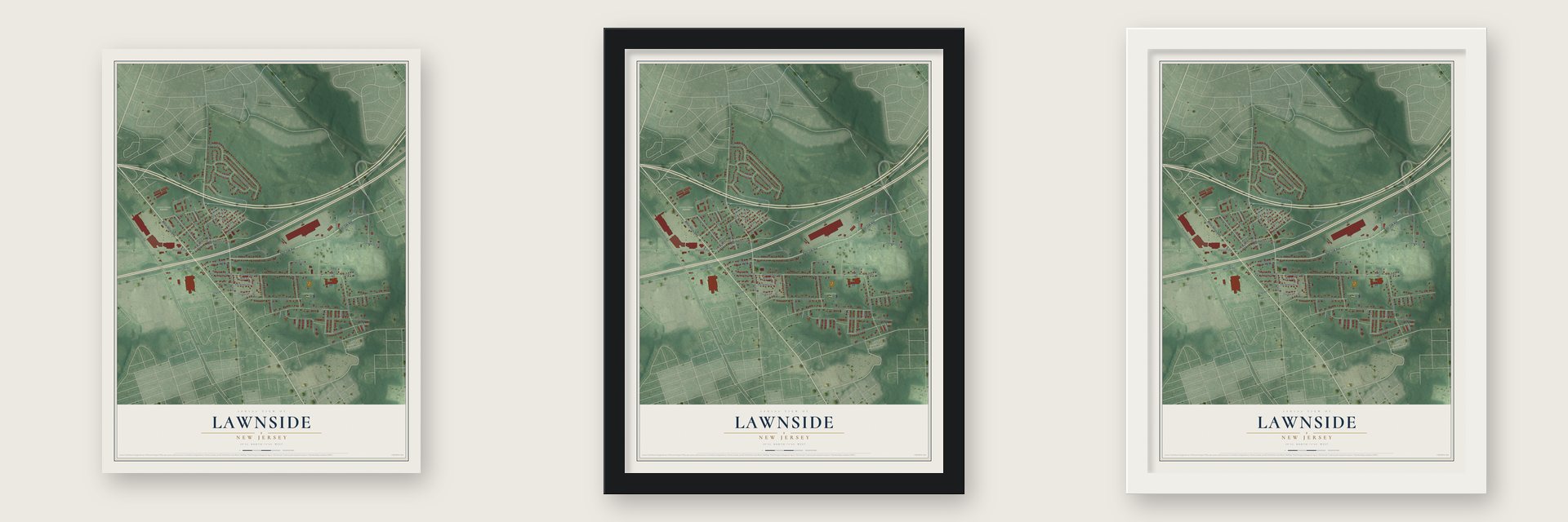
Unframed archival matte, a black wood frame or a white wood frame.
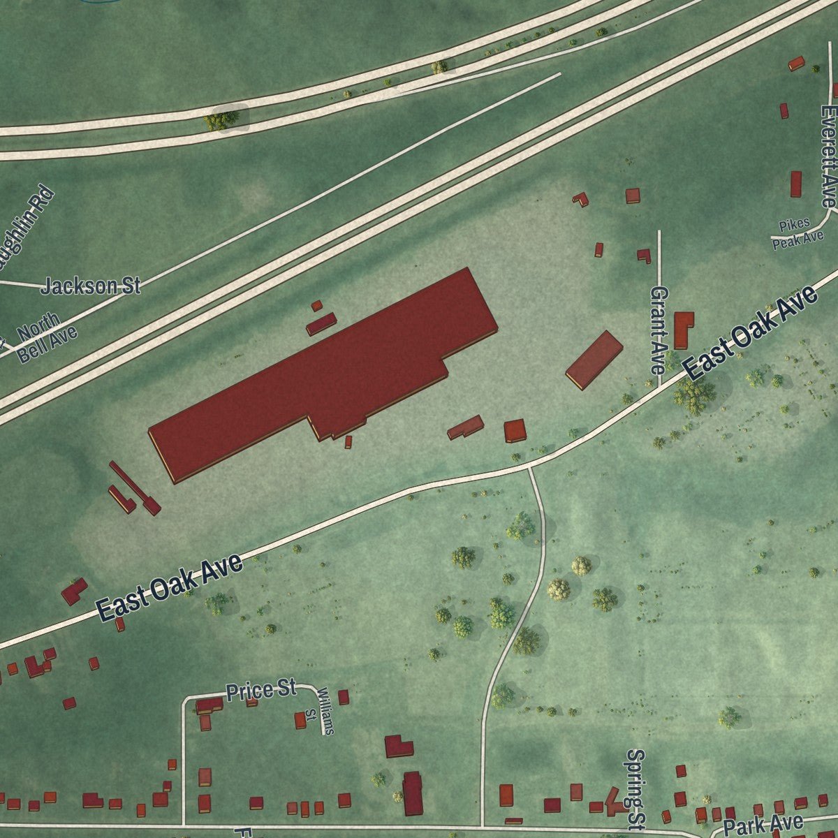
Up close
Geography Worth Displaying
This map was created using accurate cartographic data and authoritative geographic sources, including the U.S. Geological Survey (USGS) and FEMA. The map brings together terrain, waterways, roads, and building detail. The majority of the streets are labeled, houses are accurately depicted, and the topography is derived from government sources. Combining local data with carefully composed color and shading leads to this beautifully detailed Lawnside artwork for your wall.
Rather than simply showing street outlines, we’ve included as many of the street names as we could reasonably fit on the map while keeping their names legible. Zoom in on the high resolution preview to see exactly what’s on the map. We truly set out to create a statement piece for anyone who loves Lawnside. So whether it’s for you, or a gift for someone you love, we hope this map of Lawnside brings back fond memories.
Explore the full map of Lawnside, New Jersey and read about the local places it shows.

Find your street
Names on the Lawnside map
Every name below is printed on this map. Look for your street, your school, the park where you played, or the pond down the road.
Places and landmarks4
- Lawnside Borough Hall
- Lawnside Park
- Mount Peace Cemetery
- Snow Hill
Streets and roads85
- East Oak Avenue
- White Horse Pike
- Warwick Road North
- Warwick Road South
- Evesham Avenue
- Charman Avenue
- Melrose Avenue
- Tillman Street
- Sadler Avenue
- Brown Street
- Bell Avenue
- Gloucester Pike
- East Hodges Avenue
- East Charleston Avenue
- Price Street
- East Atlantic Avenue
- Ashland Avenue
- Independence Boulevard
- South Charleston Avenue
- Lapierre Avenue
- River Run
- Fairview Avenue
- Davis Road
- Mouldy Road
- Ellis Avenue
- West Emlen Avenue
- West Oak Avenue
- Quaker Road
- Lundy Avenue
- Access Road
Show all 85 streets
- Hemmings Way
- Center Oak Avenue
- Heaney Avenue
- Center Avenue
- Diamond Spring Avenue
- Lions Gate Drive
- West Charleston Avenue
- Silk Street
- Company Street
- Carver Avenue
- Mott Street
- East Pine Street
- North Douglas Avenue
- Everett Avenue
- McLaughlin Road
- Grant Avenue
- Jackson Street
- Watkins Avenue
- Pear Street
- Miller Avenue
- Lincoln Avenue
- Redding Avenue
- Park Avenue
- Edwards Court
- Holt Avenue
- Carver Court
- Fdr Terrace
- Spring Street
- Ellis Court
- North Bell Avenue
- Gloucester Avenue
- East Phoenix Avenue
- Thomas Avenue South
- Thomas Avenue North
- Bryant Avenue
- West Hodges Avenue
- Robert Kennedy Road
- South Bell Avenue
- Robert Avenue
- East Emlen Avenue
- Warwick Road
- Moore Avenue
- Freeman Terrace
- Spicer Place
- Nelson Terrace
- Boswell Avenue
- Holl Avenue
- Garrett Morgan Drive
- Essex Road
- Manliff Street
- West Phoenix Avenue
- Elizabeth Avenue
- Pikes Peak Avenue
- Kings Court
- Williams Street
Names are listed as they appear on the printed map. Zoom into the product photos to find them.
About Lawnside, New Jersey
Lawnside is a borough of 2,955 people in Camden County, and in 1926 it became the first Black town north of the Mason-Dixon line to govern itself as an independent municipality. Black families have lived on this land since the late 18th century, and Methodists were holding meetings here by 1797. Philadelphia's Bishop Richard Allen organized the local African Methodist Episcopal church in 1811, and it grew into Mount Pisgah AME Church.
In 1840 abolitionists bought land near their Haddonfield Quaker allies and divided it into cheap lots for African Americans. The settlement was first called Free Haven because it was a stop, and for some a final destination, on several Underground Railroad routes. After the Civil War people called it Snow Hill and then Lawnton. In 1907 the Reading opened a depot on its Atlantic City line, and the town took the name Lawnside, either for a wide lawn at the station or for the Lawnton side of the tracks.
- Wagon rides to the QuakersPeter Mott, a Black farmer, carpenter and pastor likely born enslaved in Delaware, escaped and settled nearby around 1830. He bought a Free Haven lot in 1844 and built a house about 1845, enlarging it about 1870. By local oral history he hid freedom seekers there and drove them by wagon to Quaker friends in Haddonfield and Moorestown. Residents formed the Lawnside Historical Society in 1992 to save it from demolition, and it is now a museum.
- Self-governing since 1926Governor A. Harry Moore signed Assembly Bill 561 on March 24, 1926, breaking up Centre Township and creating the Borough of Lawnside. A special election on April 20, 1926, gave the new borough its own government. Banks often refused loans to African Americans, so two local lenders filled the gap and helped residents buy their own homes: the Lawnside Mutual Building and Loan Association, started in 1915, and the older Home Mutual Investment Company, from 1909.
- Jazz clubs of the 1930sAfter Prohibition ended, Lawnside's jazz and barbecue spots, among them Club Harlem, the Cotton Club, Dreamland Cafe and the Hi-Hat Club, drew crowds from all over the Northeast. Ella Fitzgerald, Billie Holiday, Sarah Vaughan and Duke Ellington played here at a time when white clubs would not book them, and the boxing champions Joe Louis and Jersey Joe Walcott came too.
- The first King holiday, 1968In the 1960s Lawnside's teenagers led sit-ins, marches and media campaigns against the discrimination they met at Haddon Heights High School, and they won changes in the school's leadership and new Black studies courses. On April 9, 1968, only days after Martin Luther King Jr. was killed, Lawnside's leaders made his birthday a holiday, the first government in the country to do so.
- A Medal of Honor sailorJohn Lawson, born free in Philadelphia, served in the Navy during the Civil War. He was wounded aboard the USS Hartford at the Battle of Mobile Bay in 1864 but refused to leave his post, and he received the Medal of Honor for it. He was laid to rest in Lawnside's Mount Peace Cemetery in 1919, and a new headstone was dedicated at his grave on April 24, 2004.
Keep exploring New Jersey
Lawnside is one of 990 New Jersey towns we've mapped. Every dot on the map is a print of its own.
The search covers every state, New Jersey first.
Near Lawnside
Order 2 or more town maps and save 10%. Shown in the size and finish you picked above, so they hang as a set.
- Tavistock 12" x 18" / Archival Matte Print $39.99
- Magnolia 12" x 18" / Archival Matte Print $39.99
- Barrington 12" x 18" / Archival Matte Print $39.99


More maps nearby: Ashland, Somerdale, Haddonfield, Haddon Heights and Hi-Nella.
The art of mapping a place
How This Map Was Made
Real places. Remarkable detail. Discover the layers that turn geographic data into a map of home.

The view from above
Aerial imagery reveals the character of the land: woodland, open fields, and the patterns of a place.

The shape of the land
Elevation data brings hills, valleys, and subtle changes in the landscape into view.

The details of home
Roads, waterways, and building footprints come together to make the map feel unmistakably local.

Geography becomes art
Considered color, shading, and typography bring the layers together in a map made for your wall.


Process illustrated with Mendon, Massachusetts. Aerial imagery: USDA NAIP. Terrain: USGS 3D Elevation Program. Map details and finished artwork: KNOWOL.
The Details
About This Print
Choose an archival matte print, or a black or white Ayous wood frame. The archival matte print is unframed.
Select your size and finish above to see the matching product image and price.
Materials & Craftsmanship
A contemporary map with the character of a classic atlas, printed on archival matte paper. Optional frames are made from Ayous wood.
Your printed map does not include the watermark shown in the full-map preview.
Shipping & Delivery
Free shipping within the United States. Every print is made to order in the USA.
Buying a gift? Add a note in your cart and we'll include it. We never put prices in the package.
Prints ship within 2 to 3 business days. Allow 7 to 10 days total from ordering for delivery. Timing may vary during holidays or periods of high order volume.
Read our shipping policy.
Returns and damaged prints
Each print is made to order. Change-of-mind refunds are not available after production.
If your print arrives damaged, misprinted or incorrect, contact support@knowol.com within 30 days of receiving it. Include your order number, photos and a description of the issue.
Read our full refund and replacement policy. For questions about your order, email support@knowol.com.