


Search for another town





Free U.S. delivery 7 to 10 days after you order
Lawrence, Kansas Map Art
Building by building, with labeled streets and shaded relief.
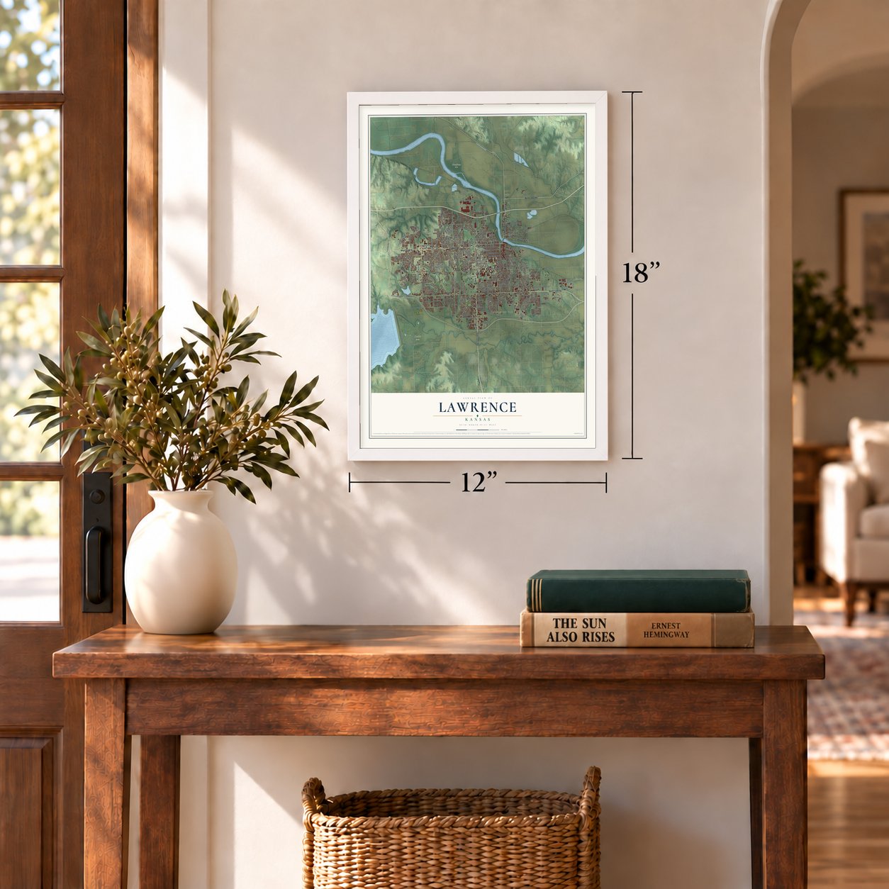
12" x 18" Archival Matte Print
A Map of Home. A Work of Art.
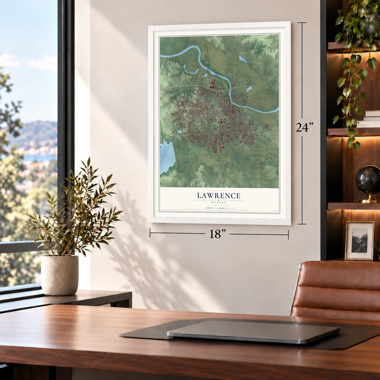
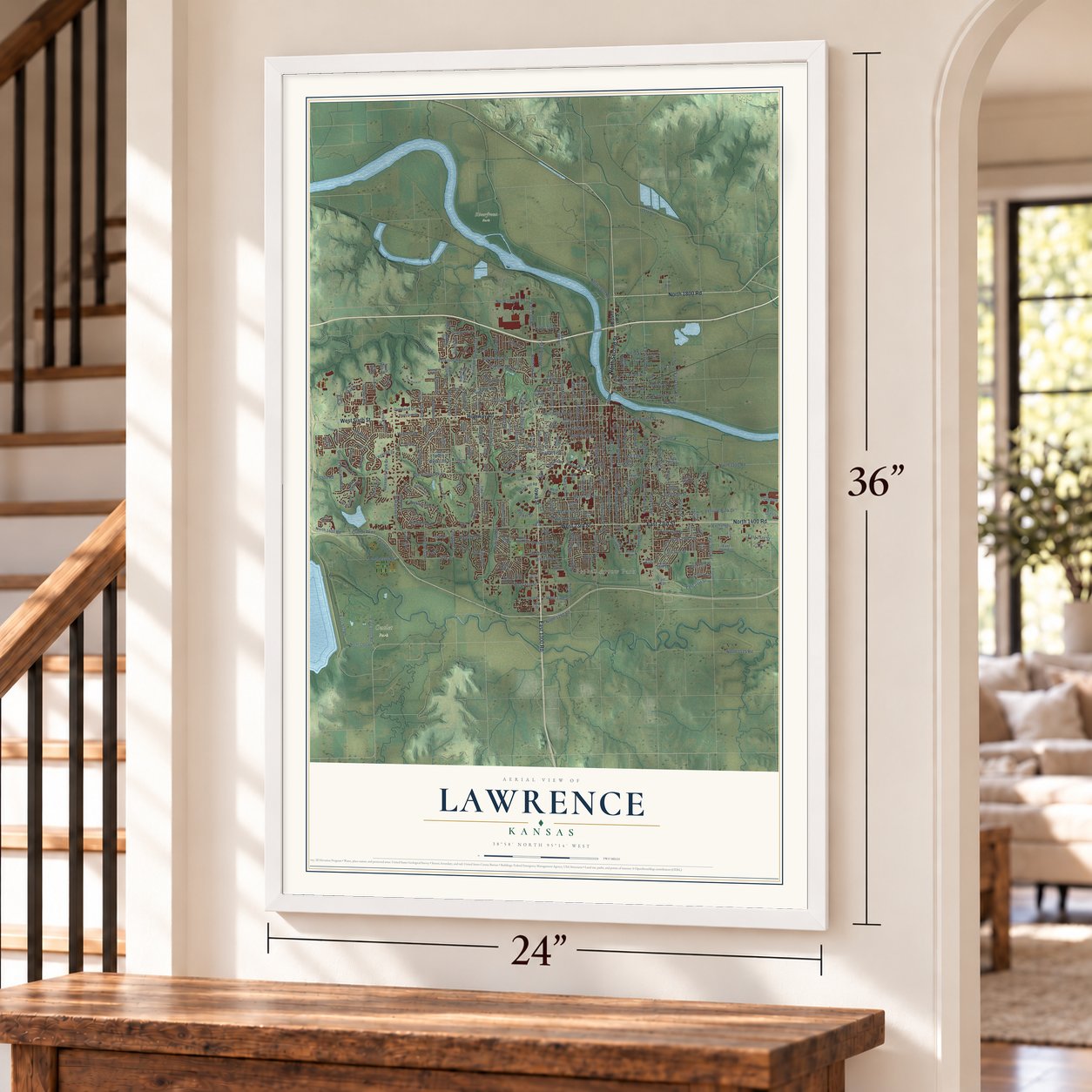
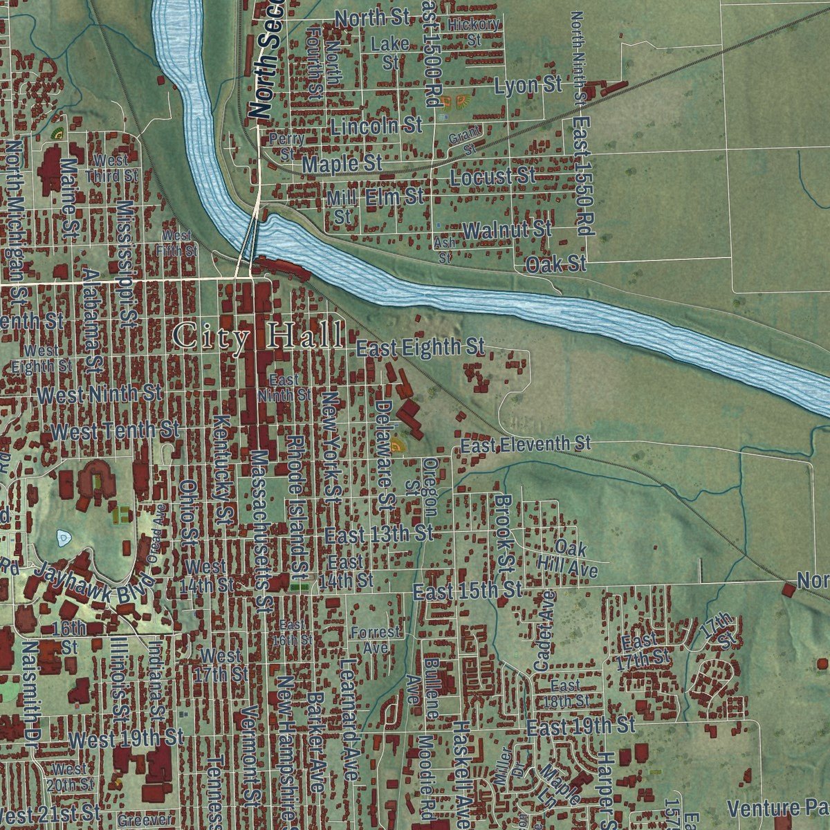
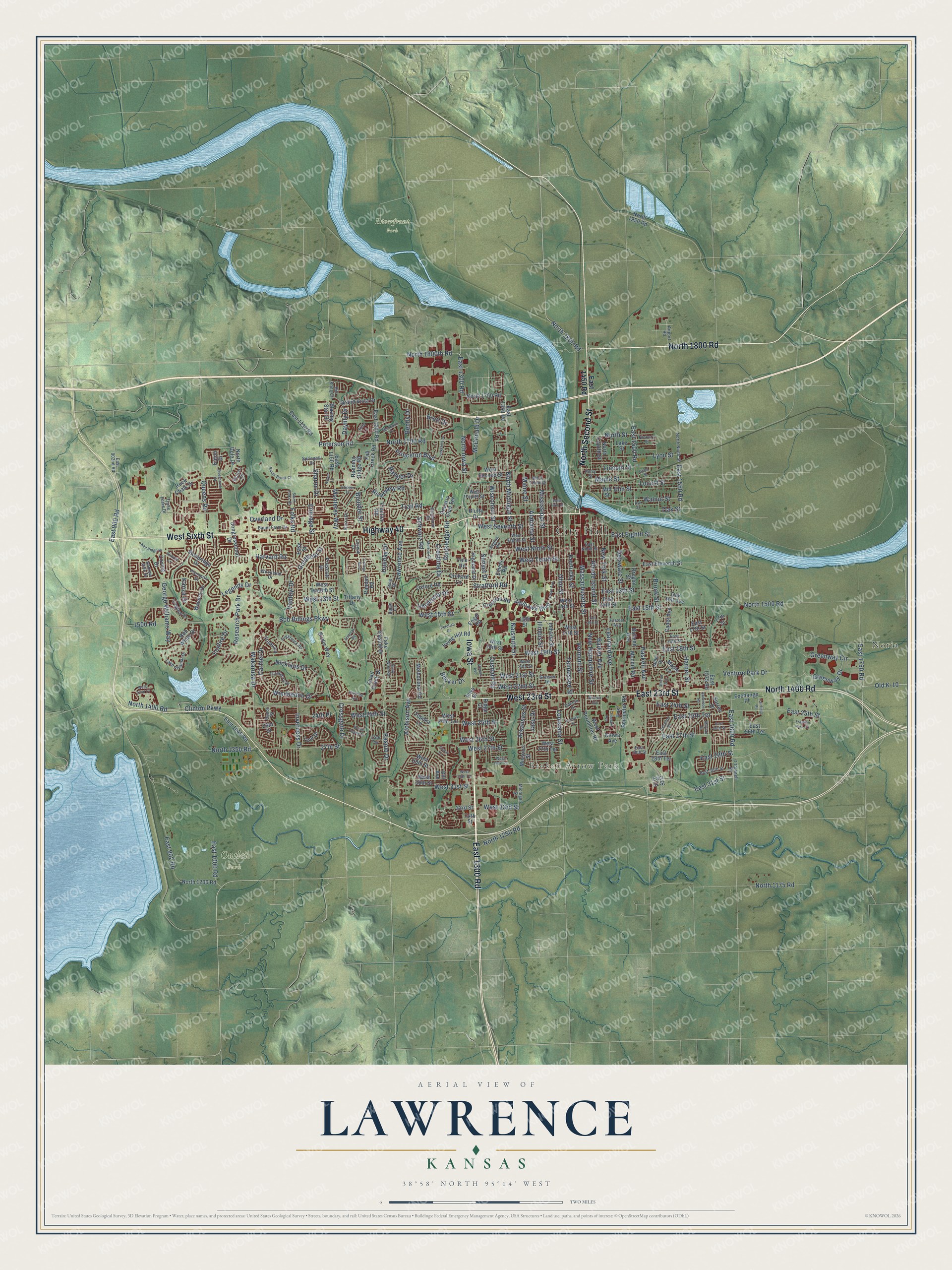
Explore Lawrence, Kansas from a whole new perspective. Created using aerial imagery and detailed geographic data, this map captures Lawrence building by building, with labeled streets, familiar landmarks, and shaded topographical relief that highlights the natural contours of the landscape.
Combining modern data with the timeless character of a vintage atlas, this map is just as interesting up close as it is beautiful on the wall. Whether you grew up in Lawrence, spent memorable years there, or call it home today, this unique map is a great way to celebrate a place that means something to you. Zoom in on the preview to look for your street, and then order a print to put your memories on the wall.
Three ways to hang it
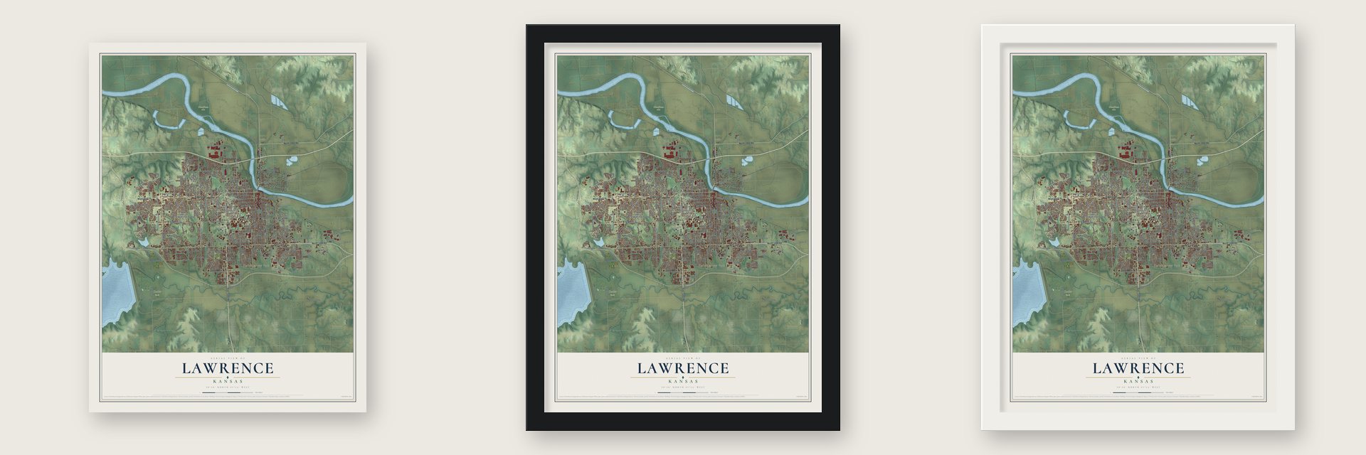
Unframed archival matte, a black wood frame or a white wood frame.
Up close
Geography Worth Displaying
This map was created using accurate cartographic data and authoritative geographic sources, including the U.S. Geological Survey and the Census Bureau. The map brings together terrain, waterways, roads, and building detail. The majority of the streets are labeled, houses are accurately depicted, and the topography is derived from government sources. Combining local data with carefully composed color and shading leads to this beautifully detailed Lawrence artwork for your wall.
Rather than simply showing street outlines, we’ve included as many of the street names as we could reasonably fit on the map while keeping their names legible. Zoom in on the high resolution preview to see exactly what’s on the map. We truly set out to create a statement piece for anyone who loves Lawrence. So whether it’s for you, or a gift for someone you love, we hope this map of Lawrence brings back fond memories.
Read the story behind this map of Lawrence, Kansas from 2026.

Find your street
Names on the Lawrence map
Every name below is printed on this map. Look for your street, your school, the park where you played, or the pond down the road.
Places and landmarks5
- City Hall
- Noria
- Broken Arrow Park
- Outlet Park
- Riverfront Park
Streets and roads289
- West Sixth Street
- Iowa Street
- North Second Street
- North 1800 Road
- East 1300 Road
- Highway 40
- East 23rd Street
- West 23rd Street
- North 1400 Road
- Massachusetts Street
- Naismith Drive
- Jayhawk Boulevard
- Crossgate Drive
- Sharon Drive
- North Michigan Street
- West 13th Street
- Crestline Drive
- West 31st Street
- West 19th Street
- Kasold Drive
- North Iowa Street
- Atchison Avenue
- Maple Street
- East 13th Street
- North 1350 Road
- Haskell Avenue
- North 1800th Road
- Goldfield Street
- 27th Street
- Clinton Parkway
Show all 289 streets
- West 15th Street
- Lawrence Avenue
- Harvard Road
- Wakarusa Drive
- Louisiana Street
- North 1700 Road
- West 27th Street
- Bob Billings Parkway
- East 1600 Road
- Alabama Street
- Monterey Way
- Harper Street
- West Ninth Street
- Vermont Street
- Inverness Drive
- East 902 Road
- Ohio Street
- Tennessee Street
- Overland Drive
- Princeton Boulevard
- Ousdahl Road
- Kentucky Street
- McDonald Drive
- Trail Road
- George Williams Way
- New Hampshire Street
- Mississippi Street
- Rhode Island Street
- Arkansas Street
- West Seventh Street
- West 22nd Street
- Peterson Road
- East 15th Street
- Barker Avenue
- East 19th Street
- West 24th Street
- Delaware Street
- East 25th Terrace
- East 31st Street
- Maine Street
- West 21st Street
- Illinois Street
- North 1500 Road
- Folks Road
- West 26th Street
- Lyon Street
- East 1500 Road
- North 1175 Road
- University Drive
- West 25th Street
- Locust Street
- Elm Street
- Learnard Avenue
- Lincoln Street
- West Tenth Street
- New York Street
- East 900 Road
- Venture Park Drive
- Greenway Circle
- Walnut Street
- East 27th Street
- East Eighth Street
- East 1550 Road
- Stratford Road
- Research Park Drive
- Eldridge Street
- Wimbledon Drive
- North Street
- East 24th Street
- Rockledge Road
- Queens Road
- Schwarz Road
- 24th Place
- Legends Drive
- Riverview Road
- Carmel Drive
- East 25th Street
- Sunset Drive
- Wisconsin Street
- East 29th Street
- Foxfire Drive
- Becker Drive
- Nicklaus Drive
- Brook Street
- East 1750 Road
- North 1250 Road
- Greenway Drive
- West 33rd Street
- East 1000 Road
- Kanza Drive
- Old K-10
- Vantuyl Drive
- Brett Drive
- Daylily Drive
- Jasu Drive
- Boulder Street
- Bently Drive
- Ranger Drive
- Holiday Drive
- 1500 Road
- Oak Street
- East 1450 Road
- West Perimeter Road
- West Second Street
- Kiowa Avenue
- East 1200 Road
- Bullene Avenue
- Exchange Place
- Troon Lane
- Missouri Street
- West 18th Street
- Indiana Street
- East Eleventh Street
- West 27th Terrace
- Stoneridge Drive
- West Twelfth Street
- Irving Hill Road
- Oxford Road
- Maple Lane
- East 1150 Road
- Ridge Court
- Yale Road
- North Fourth Street
- West 28th Street
- West 14th Street
- North 1200 Road
- East 14th Street
- East 1048 Road
- Engel Road
- Quail Creek Drive
- West 17th Street
- Randall Road
- Fall Creek Road
- Bob White Drive
- 16th Street
- Rock Chalk Drive
- Emery Road
- Prescott Drive
- Birdie Way
- Highland Drive
- East 26th Terrace
- Lake Street
- North 1750 Road
- East Perimeter Road
- Congressional Drive
- East 17th Street
- Orchard Lane
- Melholland Road
- Grand Vista Drive
- Blazing Star Drive
- East 1350 Road
- Fake Kasold Drive
- Oregon Street
- Frontier Road
- East 1130 Road
- Waverly Drive
- Oak Hill Avenue
- Crescent Road
- West 24th Terrace
- Country Club Terrace
- West 30th Street
- North 1950 Road
- Bluffs Drive
- Cadet Avenue
- Moodie Road
- East 28th Terrace
- Gill Avenue
- Running Ridge Road
- Topeka Lane
- Tiffany Drive
- East 1575 Road
- Coving Drive
- Teal Drive
- North Dole Drive
- Surrey Drive
- Easy Street
- 25th Street
- 33rd Street
- East 31 Street
- Eaton Drive
- 34th Street
- 17th Street
- Mill Street
- West Third Street
- Turnberry Drive
- West Eighth Street
- West Fourth Street
- O'Connell Road
- North Ninth Street
- Lake Alvamar Drive
- East 902nd Road
- West 20th Street
- Jana Drive
- Perry Street
- Michigan Street
- Airport Road
- Bauer Farm Drive
- East Ninth Street
- Avalon Road
- East 28th Street
- Miller Drive
- Longleaf Drive
- East 18th Street
- Prestwick Drive
- Earhart Circle
- East 30th Street
- Woodland Drive
- Forrest Avenue
- Plymouth Drive
- Dakota Street
- Sierra Drive
- Graystone Drive
- Hickory Street
- Springhill Drive
- Hill Song Circle
- Greever Terrace
- Simple Lane
- Three Forks Drive
- Andrew John Drive
- Joseph Drive
- Ranch Street
- Apple Lane
- 25th Terrace
- Ellie Lane
- Jenny Wren Road
- Eisenhower Drive
- Grant Street
- West Fifth Street
- East 26th Street
- West 29th Terrace
- Alvamar Drive
- Brush Creek Drive
- Stetson Drive
- West 28th Terrace
- East 16th Street
- Franklin Park Circle
- South Folks Road
- Bauer Brook Court
- West 22nd Court
- Yorkshire Drive
- Sherwood Drive
- Kansas Street
- Ash Street
- Ken Ridge Drive
- Stewart Avenue
- Oread Avenue
- Murrow Court
- Grand Circle
- Fairfield Street
- Cimarron Drive
- Silicon Avenue
- Anderson Road
- Hartford Avenue
- Mayfair Drive
- Choctaw Avenue
- College Boulevard
- Winona Avenue
- Petefish Drive
- Aspen Lane
Names are listed as they appear on the printed map. Zoom into the product photos to find them.
About Lawrence, Kansas
Lawrence is a city of 94,934 people and the county seat of Douglas County, between the Kansas and Wakarusa rivers. In 1854 Congress passed the Kansas-Nebraska Act, which let the settlers of each new territory vote on whether to allow slavery. The New England Emigrant Aid Company responded by sending antislavery settlers west, and its agents, Charles Robinson and Charles H. Branscomb, picked this spot beside the Oregon Trail for the first colony.
A pioneer party of 29 men left Massachusetts on July 17, 1854. They took the steamer Polar Star to Kansas City and then set out across the prairie on foot, traveling mostly at night to avoid the heat. A second party of 67 left Worcester on August 31 and had grown to about 114 people by the time it arrived in September. On October 1 the settlers chose the name Lawrence over Wakarusa and New Boston, and on October 17 they drew lots for homes and shops.
“The first party of emigrants arrived on July 31. Not a house had been erected and 25 tents were pitched on the north end of Mount Oread, where the state university now stands, to afford shelter while the first rude cabins were being built.”
- Named for Amos A. LawrenceThe town honors Amos A. Lawrence, an abolitionist businessman and one of the first wealthy backers of the Emigrant Aid Company. Some settlers hoped the name would lead him to send money, and it did. Settlers from Missouri mocked the place as "Yankee Town" for its New England roots.
- Hogback Ridge becomes Mount OreadOregon Trail travelers used this hill as a landmark and lookout. The pioneer party ate its first meal on the ridge at about noon on August 1, 1854, and it was soon renamed for the Oread Institute in Worcester, Massachusetts. The University of Kansas, founded in 1865, now stands on it, and Haskell Indian Nations University followed in 1884.
- At the heart of Bleeding KansasAs a center of free-state politics, Lawrence was the scene of the Wakarusa War in 1855 and the Sacking of Lawrence in 1856. During the Civil War it was the site of the Lawrence massacre of 1863.
- Kansas's first homicideAt the first election, held on November 29, 1854, to choose a delegate to Congress, a fight broke out about two miles south of town. Henry Davis attacked a free-state man, Lucius Kibbee, with a knife, and Kibbee shot and killed him.
Keep exploring Kansas
Lawrence is one of 764 Kansas towns we've mapped. Every dot on the map is a print of its own.
The search covers every state, Kansas first.
Near Lawrence
Order 2 or more town maps and save 10%. Shown in the size and finish you picked above, so they hang as a set.
- Williamstown 12" x 18" / Archival Matte Print $39.99
- Lecompton 12" x 18" / Archival Matte Print $39.99
- Eudora 12" x 18" / Archival Matte Print $39.99


More maps nearby: Perry, Linwood, Baldwin City, Tonganoxie and De Soto.
The art of mapping a place
How This Map Was Made
Real places. Remarkable detail. Discover the layers that turn geographic data into a map of home.

The view from above
Aerial imagery reveals the character of the land: woodland, open fields, and the patterns of a place.

The shape of the land
Elevation data brings hills, valleys, and subtle changes in the landscape into view.

The details of home
Roads, waterways, and building footprints come together to make the map feel unmistakably local.

Geography becomes art
Considered color, shading, and typography bring the layers together in a map made for your wall.


Process illustrated with Mendon, Massachusetts. Aerial imagery: USDA NAIP. Terrain: USGS 3D Elevation Program. Map details and finished artwork: KNOWOL.
The Details
About This Print
Choose an archival matte print, or a black or white Ayous wood frame. The archival matte print is unframed.
Select your size and finish above to see the matching product image and price.
Materials & Craftsmanship
A contemporary map with the character of a classic atlas, printed on archival matte paper. Optional frames are made from Ayous wood.
Your printed map does not include the watermark shown in the full-map preview.
Shipping & Delivery
Free shipping within the United States. Every print is made to order in the USA.
Buying a gift? Add a note in your cart and we'll include it. We never put prices in the package.
Prints ship within 2 to 3 business days. Allow 7 to 10 days total from ordering for delivery. Timing may vary during holidays or periods of high order volume.
Read our shipping policy.
Returns and damaged prints
Each print is made to order. Change-of-mind refunds are not available after production.
If your print arrives damaged, misprinted or incorrect, contact support@knowol.com within 30 days of receiving it. Include your order number, photos and a description of the issue.
Read our full refund and replacement policy. For questions about your order, email support@knowol.com.