
Search for another town


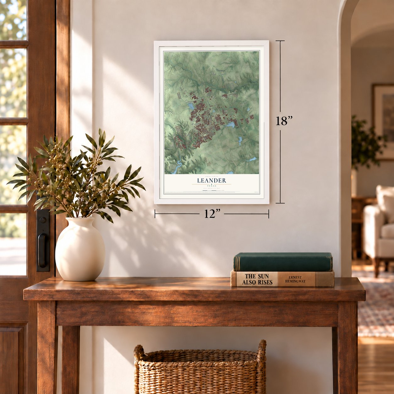

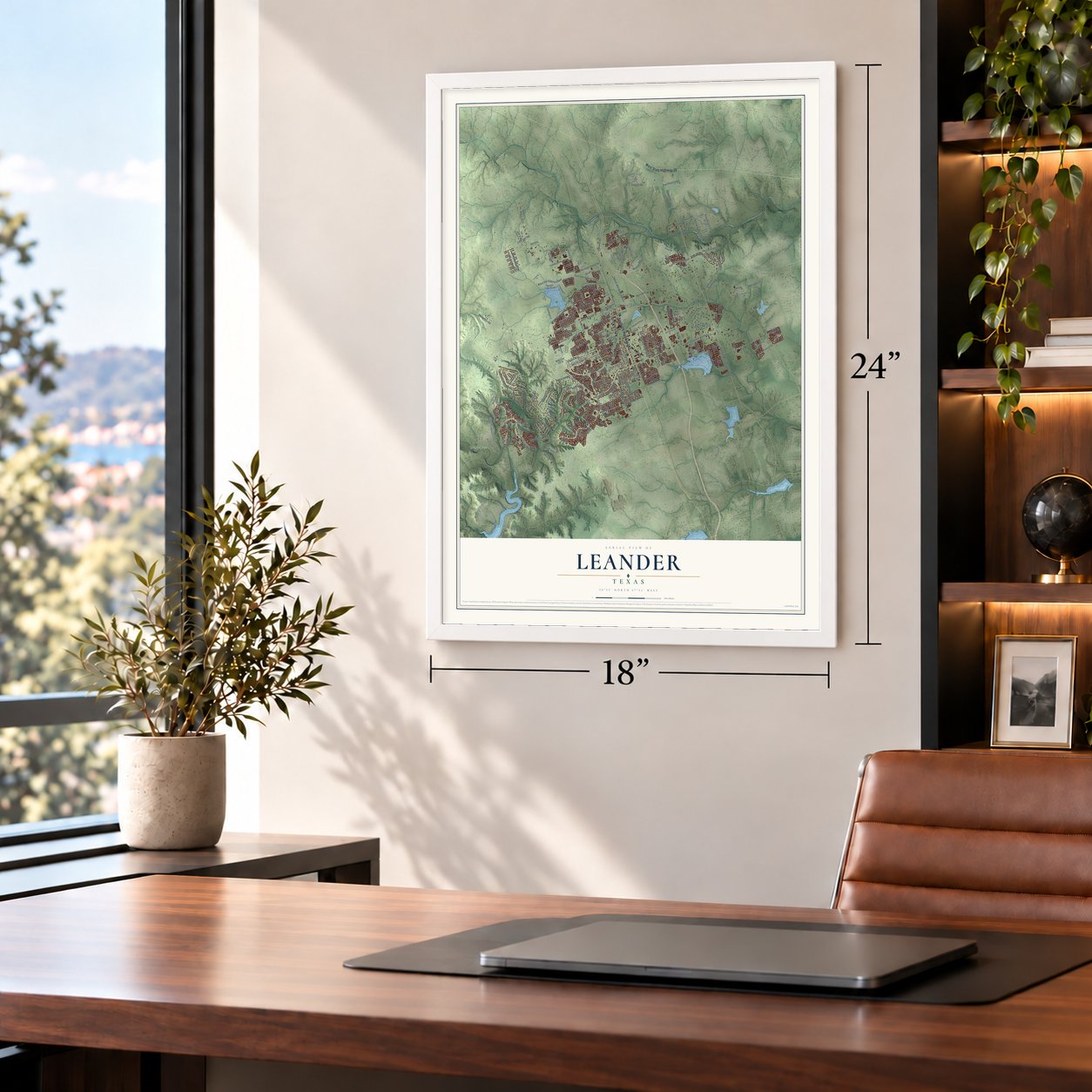

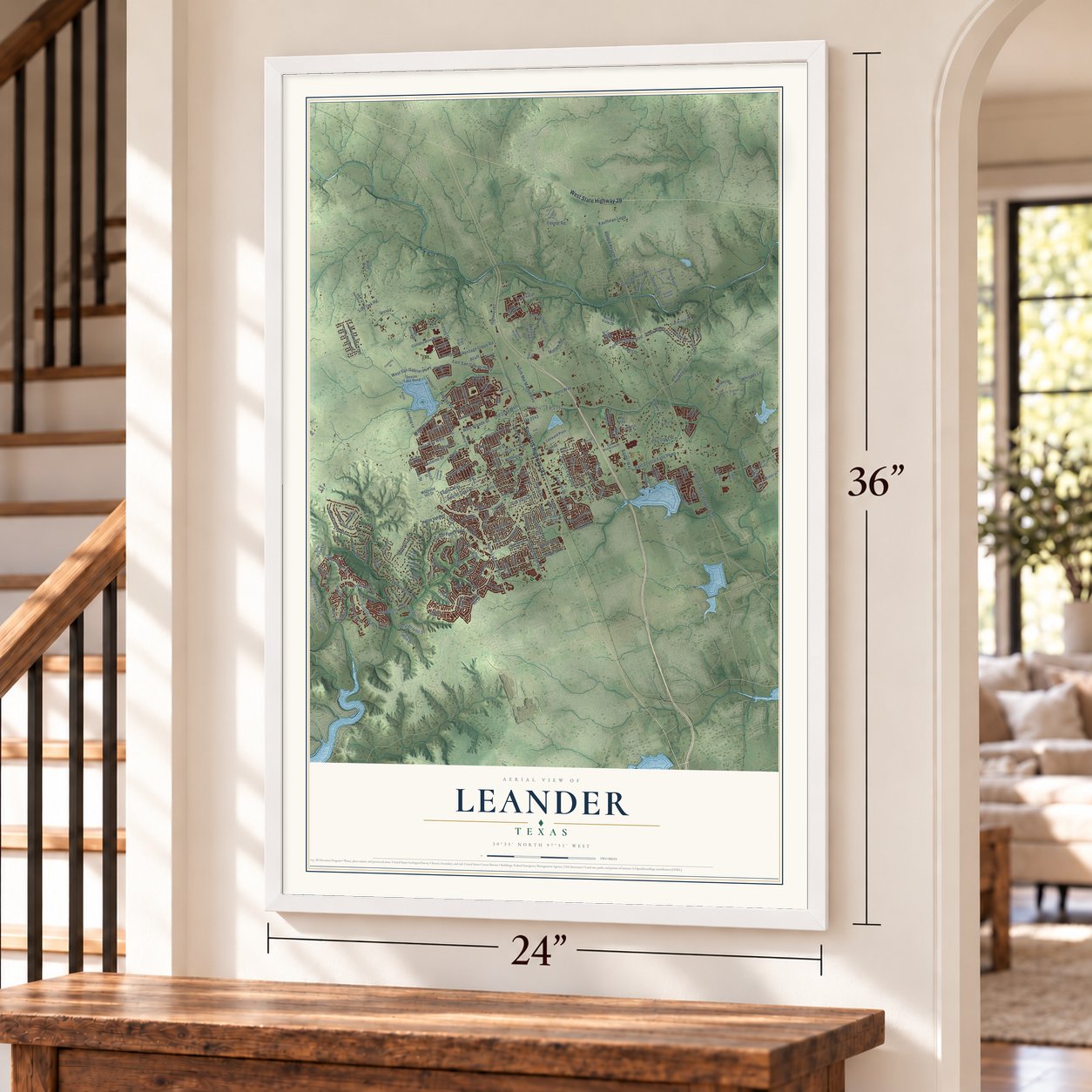

Free U.S. delivery 7 to 10 days after you order
Leander, Texas Map Art
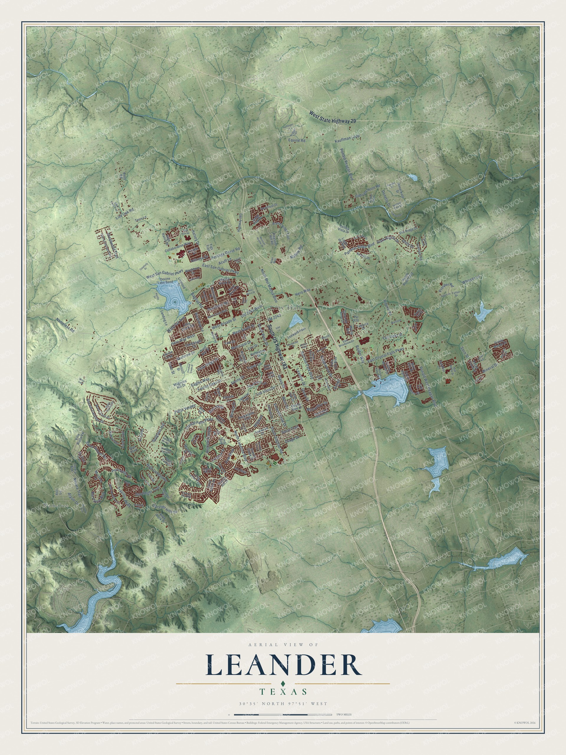
A new map of Leander, Texas, made in 2026 and printed to order on thick archival matte paper.
12" x 18" Archival Matte Print
A Map of Home. A Work of Art.
This beautifully detailed map of Leander, Texas was created in 2026 using aerial imagery combined with modern topographical, census, street and landmark data. It's a modern aerial view of Leander in Williamson County, Texas, that combines modern data with a vintage aesthetic. Zoom in on the preview and look for your block.
Three ways to hang it
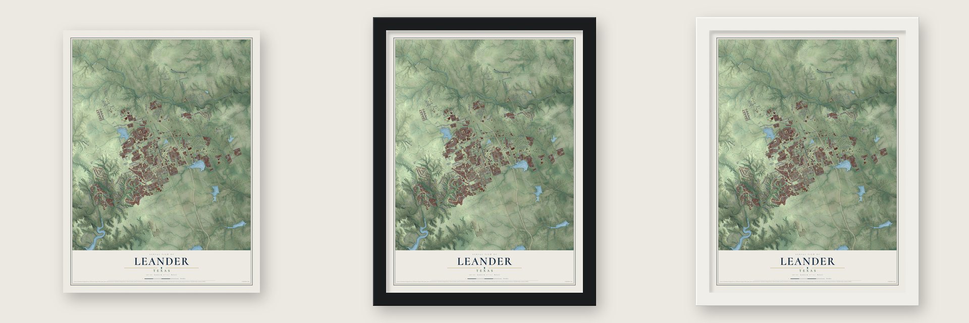
Unframed archival matte, a black wood frame or a white wood frame.
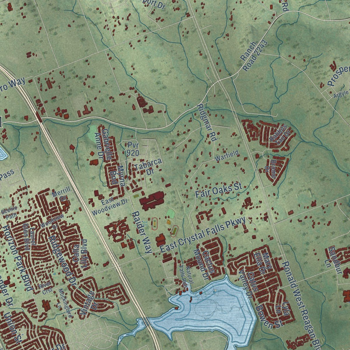
Up close
Real geography. Art worth displaying.
This map was created using accurate cartographic data and authoritative geographic sources, including the U.S. Geological Survey and the Census Bureau. The map brings together terrain, waterways, roads, and building detail. The majority of the streets are labeled, houses are accurately depicted, and the topography is derived from government sources. Combining local data with carefully composed color and shading leads to this beautifully detailed Leander artwork for your wall.
Rather than simply showing street outlines, we’ve included as many of the street names as we could reasonably fit on the map while keeping their names legible. Zoom in on the high resolution preview to see exactly what’s on the map. We truly set out to create a statement piece for anyone who loves Leander. So whether it’s for you, or a gift for someone you love, we hope this map of Leander brings back fond memories.

About Leander, Texas
Within Williamson County, Texas, Leander is classified as a city. Its population was 59,202 in the 2020 census. The community record connects that present-day count with the places and history residents recognize locally.
- 59,202 residentsThe Census Bureau recorded this population in 2020.
- Williamson CountyThe source record classifies Leander as a city within Williamson County.
- The nameThe community took its name from Karl Leander.
Find your street
Names on the Leander map
Every name below is printed on this map. Look for your street, your school, the park where you played, or the pond down the road.
Places and landmarks2
- City Hall
- Nameless
Streets and roads229
- South US Highway 183
- West State Highway 29
- Osage Drive
- FM 2243
- Hero Way West
- West Broade Street
- South Bagdad Road
- Old 2243 West
- Bagdad Road
- South West Drive
- Siena Sunset Road
- Hillrose Drive
- West Drive
- Mallow Road
- Ronald West Reagan Boulevard
- North Lakeline Boulevard
- Crystal Falls Parkway
- Travisso Parkway
- High Lonesome
- East Crystal Falls Parkway
- East San Gabriel Parkway
- Ronald Reagan Boulevard
- Horizon Park Boulevard
- Nameless Road
- Sonny Drive
- Gabriels Horn Road
- Palos Verdes
- West South Street
- Halsey Drive
- Eagles Way
Show all 229 streets
- Hero Way
- Vista Ridge Drive
- West San Gabriel Parkway
- Novara Trail
- Goodnight Trail
- North Mel Mathis Blvo
- Waterfall Avenue
- Falcon Oaks Drive
- Leander Drive
- Dream Catcher Drive
- Raider Way
- Kauffman Loop
- Municipal Drive
- Durango Hills Drive
- Heritage Grove Road
- Spyglass Hill
- Glass Drive
- Sauterne Drive
- Ambush Canyon
- Bel Paese Bnd
- Palmera Ridge Boulevard
- Vista Hights Drive
- Alasio Drive
- Union Street
- Donetto Drive
- El Cielo
- Greatwood Trail
- Ridgewood Drive
- Wigwam
- Emerald Isle Drive
- Unity Drive
- Mineral Drive
- Ranchero Road
- Los Vista Drive
- Portobello Road
- Lion's Lair
- Fair Oaks Street
- McCarthur Drive
- Prosper Road
- Live Oak Road
- Bovina Drive
- Riverway Lane
- Pow Wow
- Whisper Lane
- Bowen Street
- Topaz Lane
- Burr Parkway
- Equine Road
- Sioux Trail
- Acuff Lane
- Lee Drive
- Tinto Street
- Saco Street
- Bryson Ridge Trail
- South Brook Drive
- Pleasant Hill Road
- Granite Hill Drive
- Longbow Drive
- Middle Brook Drive
- Deepwoods Trail
- Long Bow
- Ranch Road 2243
- Ridgmar Road
- Villa Rialto Vw
- Vista Rock Drive
- Devine Lake Bend
- County Glen Drive
- Logan del Way
- Collaborative Way
- Landing Lane
- Tall Chief
- First Vw
- Brave Face Street
- Northern Trail
- Lajitas
- Long Lasso Pass
- Calla Lily Boulevard
- Mira Vis
- Pvr 920
- American Trail
- Elm Ridge Drive
- Lucera Bnd
- Vintage Drive
- Da Vinci Trail
- Airport Drive
- Pasa Tiempo
- Leeward Pass
- Cactus Mound Drive
- Volente Lane
- Granite Creek Drive
- Sage Ranch Drive
- Sidewinder
- Flintlock Road
- Tamarac Trail
- Murando Lane
- Lion Drive
- Plano Lane
- Candlelight Drive
- Highway 183
- Heartleaf Drive
- Hinterwald Street
- Lauren Loop
- Oakwood Drive
- Linwood Street
- Horseshoe Drive
- Little Creek Road
- Remington Drive
- Abruzzi Street
- Pecan Creek Drive
- Coral Valley Drive
- Trinity Woods Street
- Myrna Bnd
- Bellisa Vista Drive
- Mazarro Drive
- Sandbur Lane
- Lone Oak Drive
- Judge Fisk Drive
- Washburn Drive
- Ireland Drive
- Tigs Trail
- Pinot Noir Street
- Tabarca Drive
- Catus Valley Drive
- Magnolia Hill Drive
- Gabrielle Anne Drive
- Arvada Drive
- Terry Lane
- Lyla Lane
- Tula Trail
- Mary Ella Drive
- Rolls Road
- Bear Claw
- Asti Lane
- Venezia Vw
- Peregrine Way
- Laurel Glen Boulevard
- Council Springs Pass
- Milan Meadows Drive
- Speaking Rock
- North Creek Boulevard
- Painted Sky Bnd
- Deep Pocket Drive
- Washington Square Drive
- East Woodview Drive
- Julian Lane
- Big Tree Trail
- Pueblo Pass
- Rabbits Tail Drive
- Humble Live Drive
- Tswana Drive
- Bull Nettle Drive
- Trigger Trail
- Warfield
- Aiken Drive
- Ventana Canyon
- Euless Lane
- Brome Drive
- Fulton Drive
- Piana Place
- Tulum Terrace
- Legend Hill Drive
- Merrill Drive
- Snow Goose
- Aven Way
- Flag Lane
- North Bagdad Road
- Harvest Dance Drive
- Champions Corner Drive
- Roaring Fork
- Azul Lagoon Drive
- Whitt Creek Trail
- Woodview Drive
- Hudson Lane
- Mexican Heather Drive
- Juniper Rim Road
- Deer Rim Road
- Mockingbird Lane
- Argyle Lane
- Crooked Creek Street
- Mondello Path
- Hazelwood Street
- Vestland Fjord Street
- Henderson Drive
- Overland Drive
- Halflinger Lane
- Mesa Drive
- Creativity Drive
- Charade Drive
- Natural Falls Run
- Branding Iron Lane
- West Metro Drive
- Annassa Court
- Aquilla Drive
- Rancho Mirage
- Scenic Path
- River Crst
- Inlet Lane
- Joppa Road
- Mesa Oaks
Names are listed as they appear on the printed map. Zoom into the product photos to find them.
The art of mapping a place
How This Map Was Made
Real places. Remarkable detail. Discover the layers that turn geographic data into a map of home.

The view from above
Aerial imagery reveals the character of the land: woodland, open fields, and the patterns of a place.

The shape of the land
Elevation data brings hills, valleys, and subtle changes in the landscape into view.

The details of home
Roads, waterways, and building footprints come together to make the map feel unmistakably local.

Geography becomes art
Considered color, shading, and typography bring the layers together in a map made for your wall.


Process illustrated with Mendon, Massachusetts. Aerial imagery: USDA NAIP. Terrain: USGS 3D Elevation Program. Map details and finished artwork: KNOWOL.
The Details
About This Print
Choose an archival matte print, or a black or white Ayous wood frame. The archival matte print is unframed.
Select your size and finish above to see the matching product image and price.
Materials & Craftsmanship
A contemporary map with the character of a classic atlas, printed on archival matte paper. Optional frames are made from Ayous wood.
Your printed map does not include the watermark shown in the full-map preview.
Shipping & Delivery
Free shipping within the United States. Every print is made to order in the USA.
Buying a gift? Add a note in your cart and we'll include it. We never put prices in the package.
Prints ship within 2 to 3 business days. Allow 7 to 10 days total from ordering for delivery. Timing may vary during holidays or periods of high order volume.
Read our shipping policy.
Returns and damaged prints
Each print is made to order. Change-of-mind refunds are not available after production.
If your print arrives damaged, misprinted or incorrect, contact support@knowol.com within 30 days of receiving it. Include your order number, photos and a description of the issue.
Read our full refund and replacement policy. For questions about your order, email support@knowol.com.
Find your town
Looking for another city?
Find a map of home in our Texas collection.
Nearby
Maps of towns near Leander
Know someone from one of these towns? Their map makes a great gift.
 Cedar Park
, Texas
From $39.99See the map
 Santa Rita Ranch
, Texas
From $39.99See the map
 Liberty Hill
, Texas
From $39.99See the map
More maps nearby: Jonestown, Brushy Creek, Volente, Lago Vista and Georgetown.