
Search for another town




Free U.S. delivery 7 to 10 days after you order
Lemay, Missouri Map Art
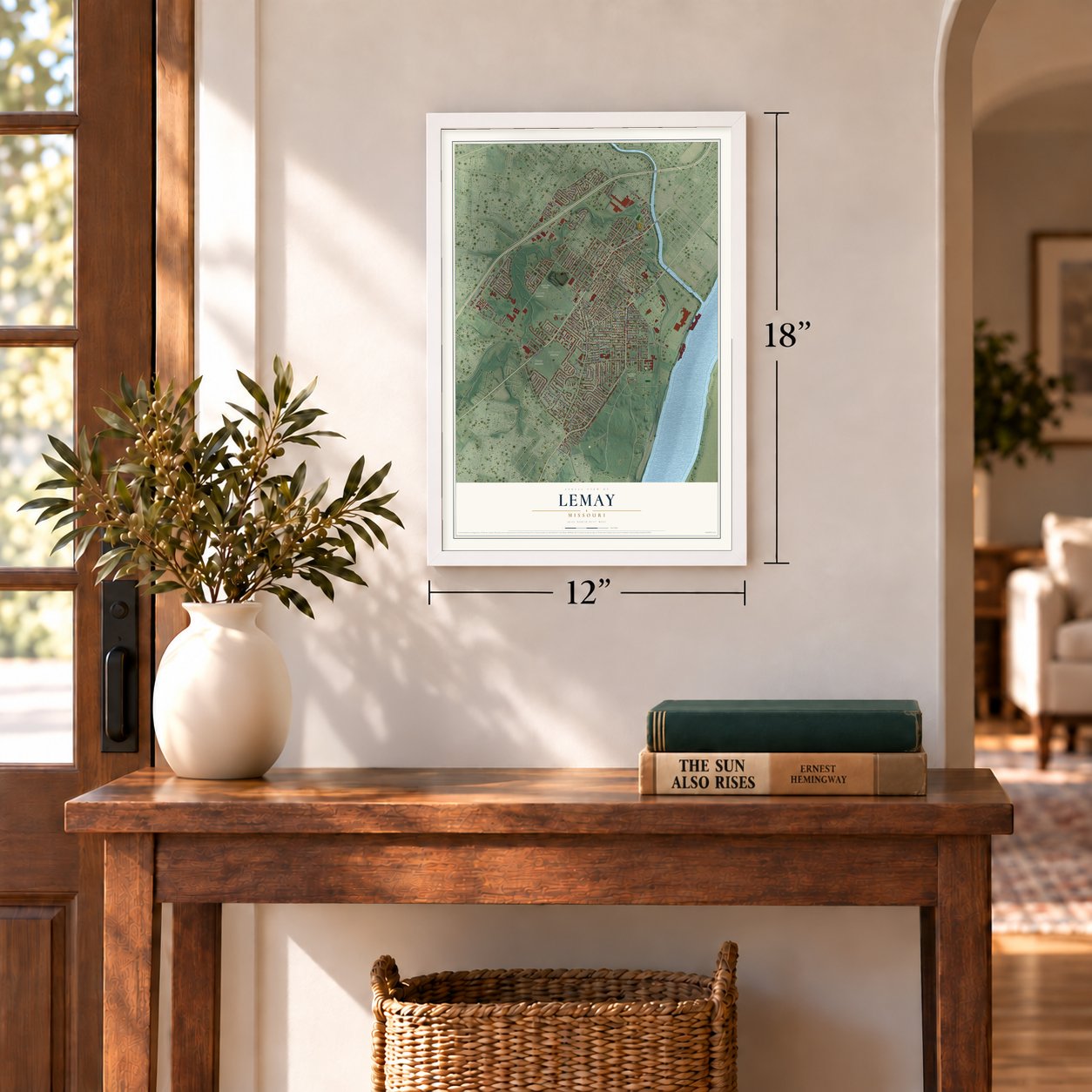
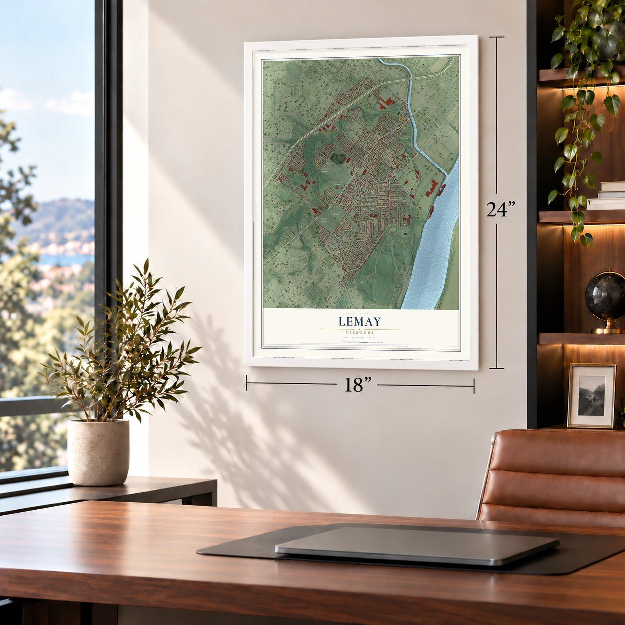
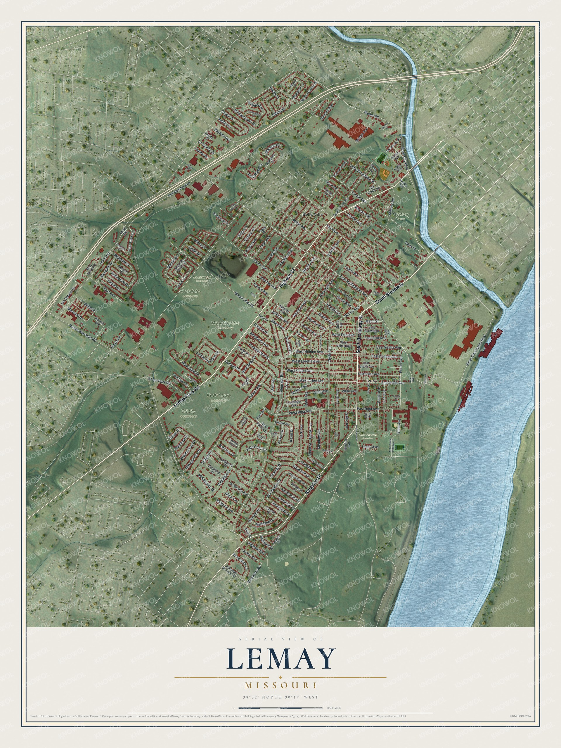
A new map of Lemay, Missouri, made in 2026 and printed to order on thick archival matte paper.
12" x 18" Archival Matte Print
A Map of Home. A Work of Art.
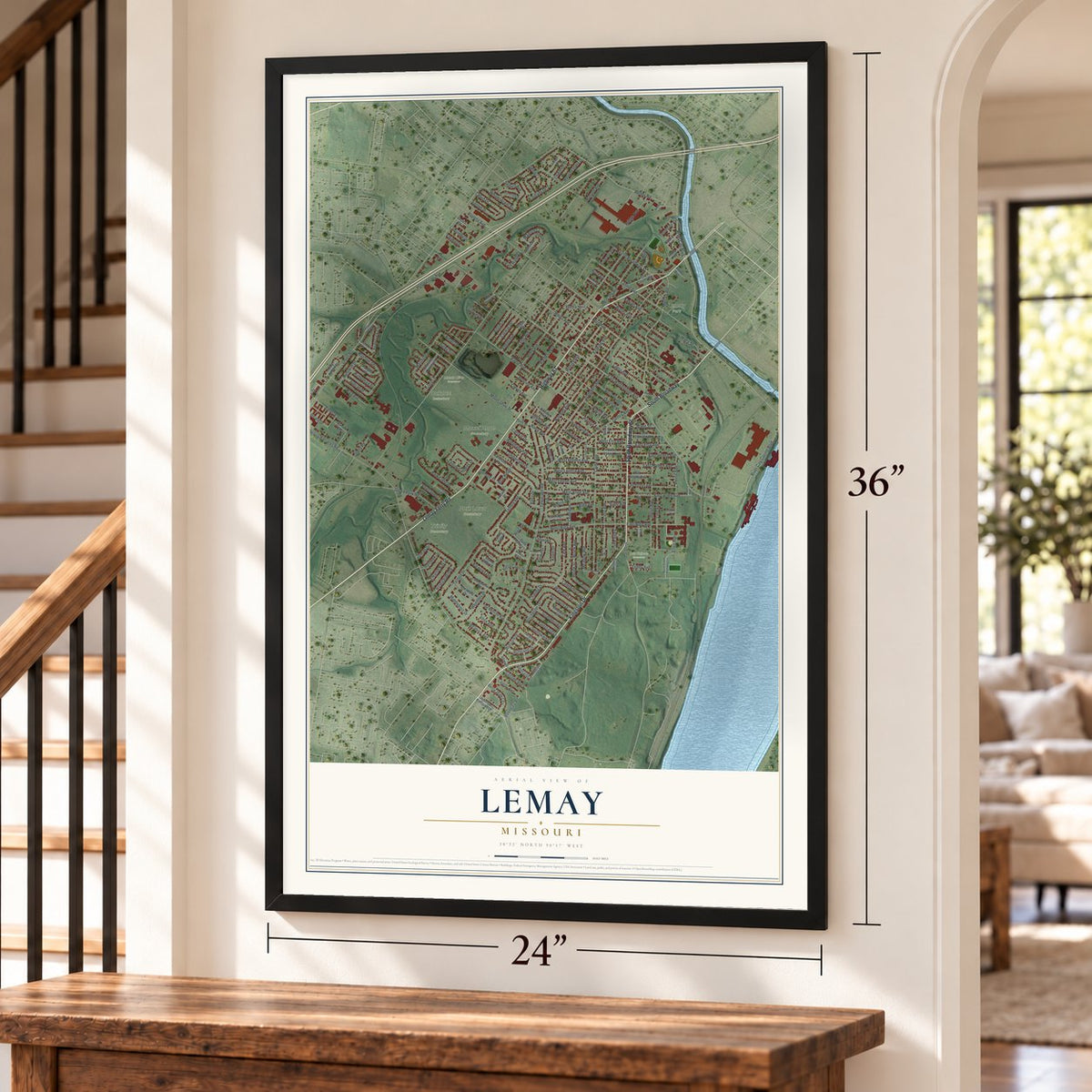
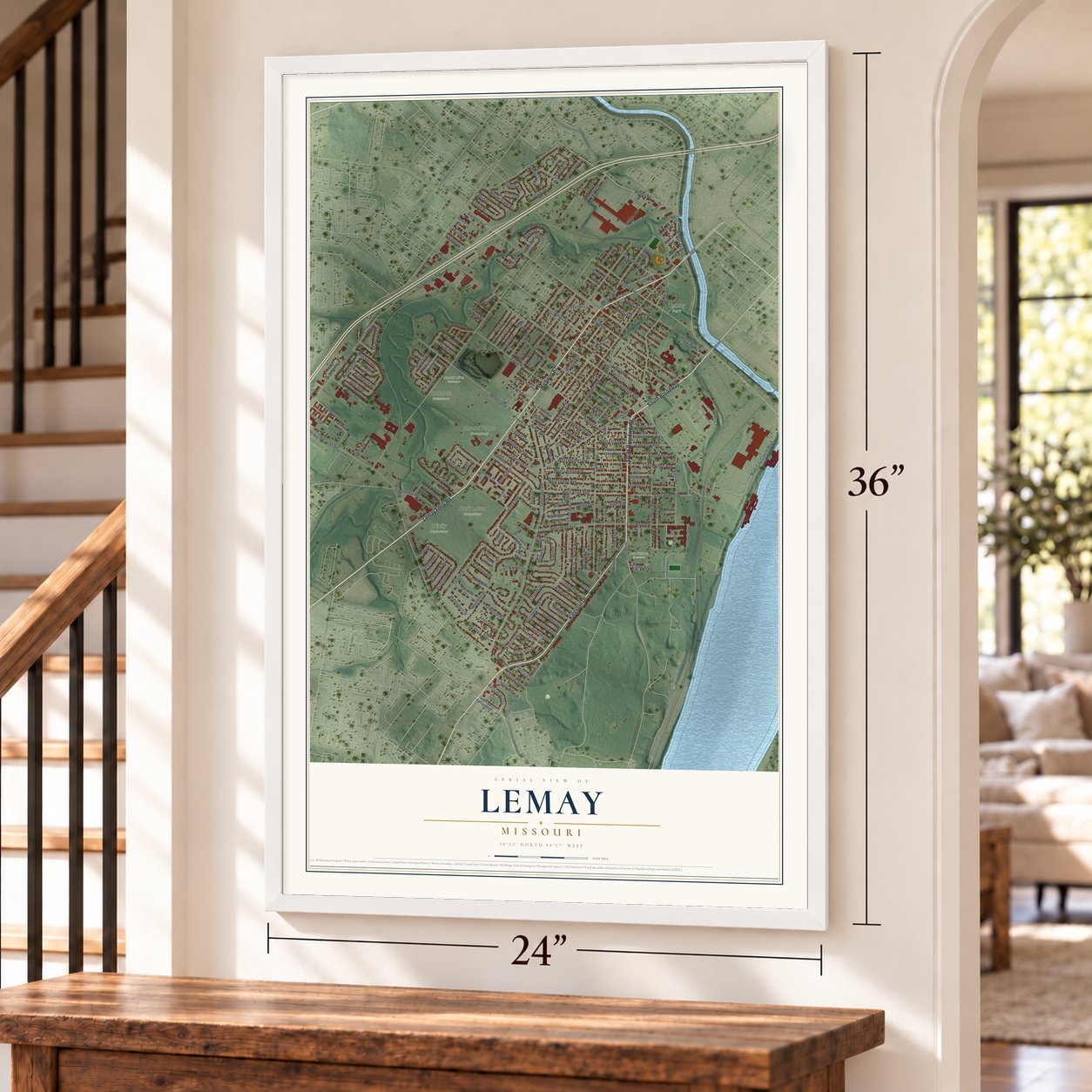
If you grew up in Lemay or still drive Lemay Ferry Road to get home, this map is for you. It's a modern aerial view of Lemay, made from modern data with a vintage feel, in St. Zoom in on the preview and look for your block.
Three ways to hang it
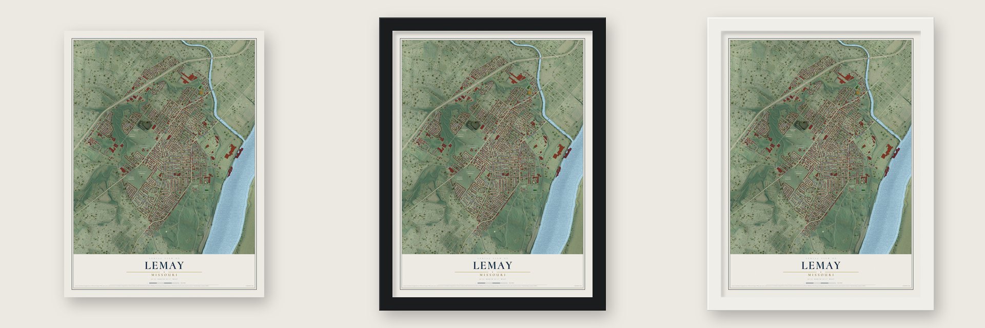
Unframed archival matte, a black wood frame or a white wood frame.
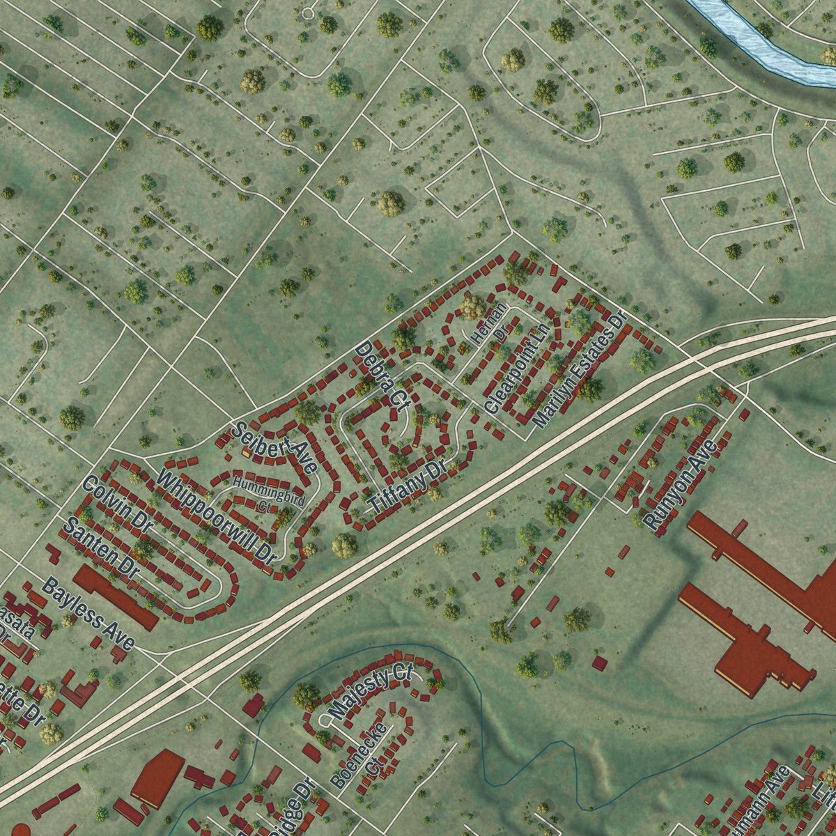
Up close
Real geography. Art worth displaying.
This map was created using accurate cartographic data and authoritative geographic sources, including the U.S. Geological Survey and the Census Bureau. The map brings together terrain, waterways, roads, and building detail. The majority of the streets are labeled, houses are accurately depicted, and the topography is derived from government sources. Combining local data with carefully composed color and shading leads to this beautifully detailed Lemay artwork for your wall.
Rather than simply showing street outlines, we’ve included as many of the street names as we could reasonably fit on the map while keeping their names legible. Zoom in on the high resolution preview to see exactly what’s on the map. We truly set out to create a statement piece for anyone who loves Lemay. So whether it’s for you, or a gift for someone you love, we hope this map of Lemay brings back fond memories.
Read the story behind this map of Lemay, Missouri from 2026.

About Lemay, Missouri
Lemay is a census_designated_place in St. Louis County, Missouri, and the 2020 census recorded 17,117 residents. Its documented milestones and familiar places connect the present-day community with earlier generations. Together, those records give Lemay a distinct place in the story of St. Louis County.
- 17,117 peopleThe 2020 census recorded 17,117 residents in Lemay.
- St. Louis CountyLemay is a census_designated_place in St. Louis County, Missouri.
- The nameLemay took its name from Francois Lemai, who operated a ferry boat across the Meramec River in the early 19th century.
- 4.5 square milesThe Census Bureau reports a total area of 4.5 square miles.
- National Register landmarkStone Houses entered the National Register in 1980.
Find your street
Names on the Lemay map
Every name below is printed on this map. Look for your street, your school, the park where you played, or the pond down the road.
Places and landmarks9
- Lemay Park
- Mount Hope Cemetery
- Mount Olive Cemetery
- Oakdale Cemetery
- Park Lawn Cemetery
- Trinity Cemetery
- Odd Fellows Cemetery
- Bella Villa
- Ivory
Streets and roads210
- Lemay Ferry Road
- Highway 67
- South Broadway
- South Broadway Street
- Kingston Drive
- River City Boulevard
- East Hoffmeister Avenue
- River City Casino Boulevard
- Telford Avenue
- Hoffmeister Avenue
- East Arlee Avenue
- Friar Tuck Lane
- East Ripa Avenue
- Little Broadway Street
- Boundary Road
- Fannie Avenue
- Porchester Drive
- Union Road
- Reavis Barracks Road
- Telegraph Road
- Pardella Avenue
- Bayless Avenue
- Wachtel Avenue
- Paule Avenue
- Clyde Avenue
- Telford Drive
- Military Road
- Dammert Avenue
- Weiss Avenue
- Mount Olive Street
Show all 210 streets
- Orient Avenue
- Gentry Avenue
- Weber Road
- West Ripa Avenue
- Horn Avenue
- Reed Avenue
- West Arlee Avenue
- Joplin Avenue
- Zeiss Avenue
- Regina Avenue
- Wembley Drive
- West Loretta Avenue
- West Felton Avenue
- Morris Avenue
- Erskine Avenue
- Lagro Avenue
- Lemay Gardens Drive
- West Holden Avenue
- Marchi Drive
- Kayser Avenue
- Perrin Avenue
- Waller Avenue
- Walworth Drive
- Lark Avenue
- Lambeth Lane
- Cumberland Drive
- East Velma Avenue
- Linn Avenue
- Blue Ridge Drive
- Ripa Avenue
- Brook Avenue
- Brook Street
- Luna Avenue
- Ruthland Drive
- Mansard Drive
- Park Crest Drive
- Green Park Road
- East Holden Avenue
- Via Veneto Drive
- Sigsbee Avenue
- Meadow Avenue
- Naert Avenue
- Sadie Avenue
- Vista Conn Drive
- Earlsfield Lane
- Vida Avenue
- Alleghany Avenue
- Malcolm Drive
- Tracy Lane
- Majesty Court
- Bridge Avenue
- Rosegarden Drive
- Santen Drive
- East Etta Avenue
- Vegas Avenue
- Betty Jean Lane
- Meredith Drive
- Cormar Drive
- Virgo Lane
- Colvin Drive
- Ellen Avenue
- Placid Avenue
- Conn Avenue
- Bobring Avenue
- Whippoorwill Drive
- Tiffany Drive
- Eleanor Kay Drive
- Runyon Avenue
- Laredo Avenue
- West Etta Avenue
- Southwark Lane
- Rutherford Drive
- Rain Ridge Drive
- Fabian Drive
- Winston Drive
- Rauhut Avenue
- Catskill Drive
- Dumont Place
- Cleves Avenue
- Middleboro Drive
- Beatrice Avenue
- Eiffel Drive
- Wachtel Drive
- Dolbil Drive
- Allen Avenue
- Barnsley Drive
- Bilron Drive
- Mann Street
- Rainbow Drive
- Gloria Road
- Seibert Avenue
- Hans Street
- Kaske Drive
- Jeffords Avenue
- La Salette Drive
- Shetland Drive
- Viehl Avenue
- Charing Drive
- Teddy Avenue
- Debra Court
- Fatima Drive
- Kevin Drive
- Doran Drive
- Basil Drive
- Jefferson Barracks Drive
- Saint Martins Lane
- Union Avenue
- South Grand Avenue
- Camborne Drive
- Southampton Drive
- East Felton Avenue
- Karlsruhe Place
- Park Lawn Drive
- Vegas Drive
- Degenhardt Avenue
- East Loretta Avenue
- Shannon County Drive
- Burnett Avenue
- Forbes Avenue
- Marilyn Estates Drive
- Pentonville Drive
- West Velma Avenue
- Tacoma Drive
- Woolwich Lane
- Carthage Avenue
- East Cartwright
- Risch Avenue
- Baumann Avenue
- Brentford Drive
- Rexford Drive
- Clearpoint Lane
- Old County Road
- Herault Place
- Erie Avenue
- Erie Drive
- De Merville Avenue
- Tennessee Avenue
- Lenhardt Avenue
- Birchwood Place
- Kay Lane
- Shoss Avenue
- Chapel Road
- Boenecke Court
- Bartolet Avenue
- Appian Drive
- Idaho Avenue
- Stella Avenue
- Point Drive
- Alaska Avenue
- Mary Hubert Court
- Rees Avenue
- Viking Avenue
- Adelia Avenue
- Winding Avenue
- Lasata Drive
- Atlas Drive
- Leeshore Drive
- West Goetz Avenue
- Notre Dame Parkway Lane
- Vescovo Drive
- Hernan Drive
- Jett Avenue
- Carrington Lane
- Windsor Hill Drive
- Autumn Ridge Court
- Shady Ridge Court
- Linda Lane
- Ruby Avenue
- Perrin Court
- Elias
- Adair Avenue
- Luna Court
- Hummingbird Court
- Longwood Avenue
- Choquette Drive
- Franke Avenue
- Mark Sharon Court
- Riverside Lane
- Holden Avenue
- Deering Court
Names are listed as they appear on the printed map. Zoom into the product photos to find them.
The art of mapping a place
How This Map Was Made
Real places. Remarkable detail. Discover the layers that turn geographic data into a map of home.

The view from above
Aerial imagery reveals the character of the land: woodland, open fields, and the patterns of a place.

The shape of the land
Elevation data brings hills, valleys, and subtle changes in the landscape into view.

The details of home
Roads, waterways, and building footprints come together to make the map feel unmistakably local.

Geography becomes art
Considered color, shading, and typography bring the layers together in a map made for your wall.


Process illustrated with Mendon, Massachusetts. Aerial imagery: USDA NAIP. Terrain: USGS 3D Elevation Program. Map details and finished artwork: KNOWOL.
The Details
About This Print
Choose an archival matte print, or a black or white Ayous wood frame. The archival matte print is unframed.
Select your size and finish above to see the matching product image and price.
Materials & Craftsmanship
A contemporary map with the character of a classic atlas, printed on archival matte paper. Optional frames are made from Ayous wood.
Your printed map does not include the watermark shown in the full-map preview.
Shipping & Delivery
Free shipping within the United States. Every print is made to order in the USA.
Buying a gift? Add a note in your cart and we'll include it. We never put prices in the package.
Prints ship within 2 to 3 business days. Allow 7 to 10 days total from ordering for delivery. Timing may vary during holidays or periods of high order volume.
Read our shipping policy.
Returns and damaged prints
Each print is made to order. Change-of-mind refunds are not available after production.
If your print arrives damaged, misprinted or incorrect, contact support@knowol.com within 30 days of receiving it. Include your order number, photos and a description of the issue.
Read our full refund and replacement policy. For questions about your order, email support@knowol.com.
Find your town
Looking for another city?
Find a map of home in our Missouri collection.
Nearby
Maps of towns near Lemay
Know someone from one of these towns? Their map makes a great gift.
 Bella Villa
, Missouri
From $39.99See the map
 St. George
, Missouri
From $39.99See the map
 Wilbur Park
, Missouri
From $39.99See the map
More maps nearby: Affton, Mehlville, Lakeshire, Green Park and Marlborough.