
Search for another town





Free U.S. delivery 7 to 10 days after you order
Liberty Lake, Washington Map Art
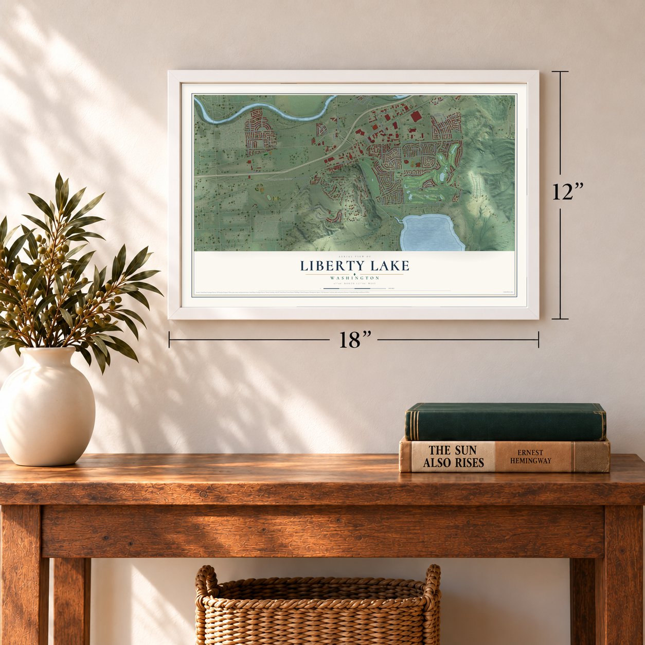
A new map of Liberty Lake, Washington, made in 2026 and printed to order on thick archival matte paper.
12" x 18" Archival Matte Print
A Map of Home. A Work of Art.
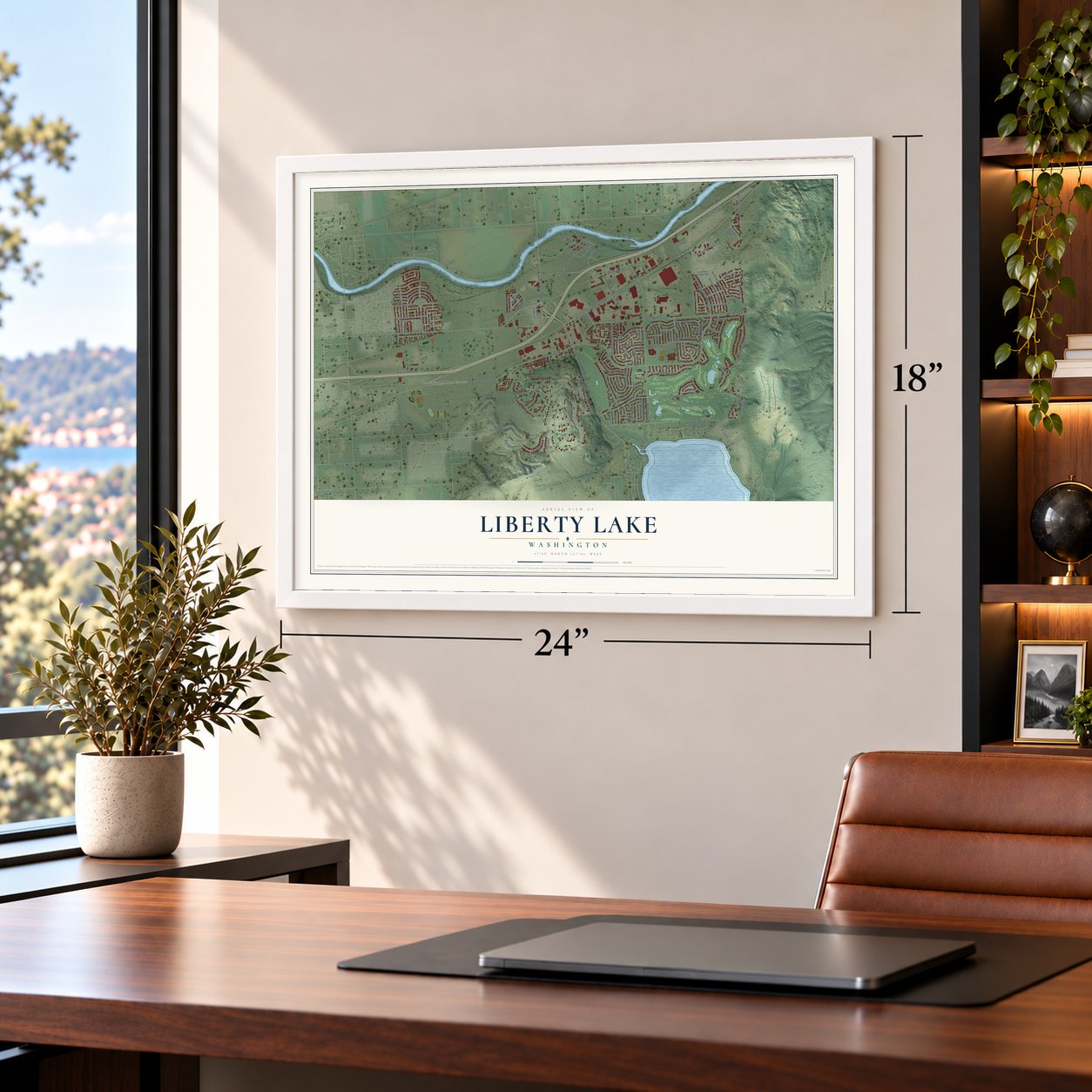
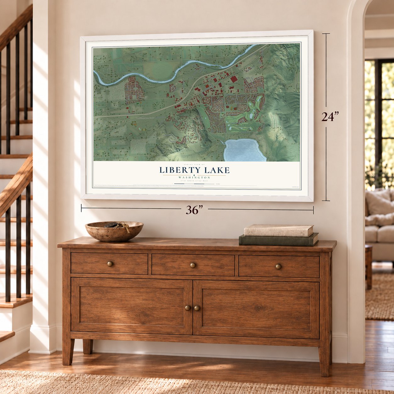
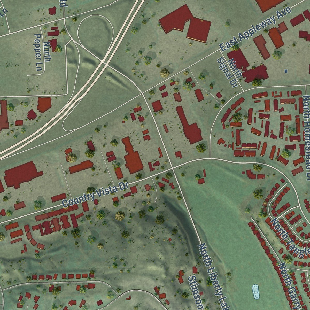
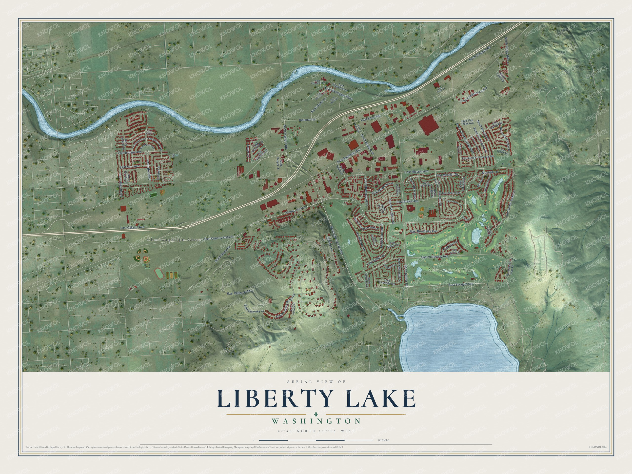
Explore Liberty Lake, Washington from a whole new perspective. Created using aerial imagery and detailed geographic data, this map captures Liberty Lake building by building, with labeled streets, familiar landmarks, and shaded topographical relief that highlights the natural contours of the landscape.
Combining modern data with the timeless character of a vintage atlas, this map is just as interesting up close as it is beautiful on the wall. Whether you grew up in Liberty Lake, spent memorable years there, or call it home today, this unique map is a great way to celebrate a place that means something to you. Zoom in on the preview to look for your street, and then order a print to put your memories on the wall.
Three ways to hang it
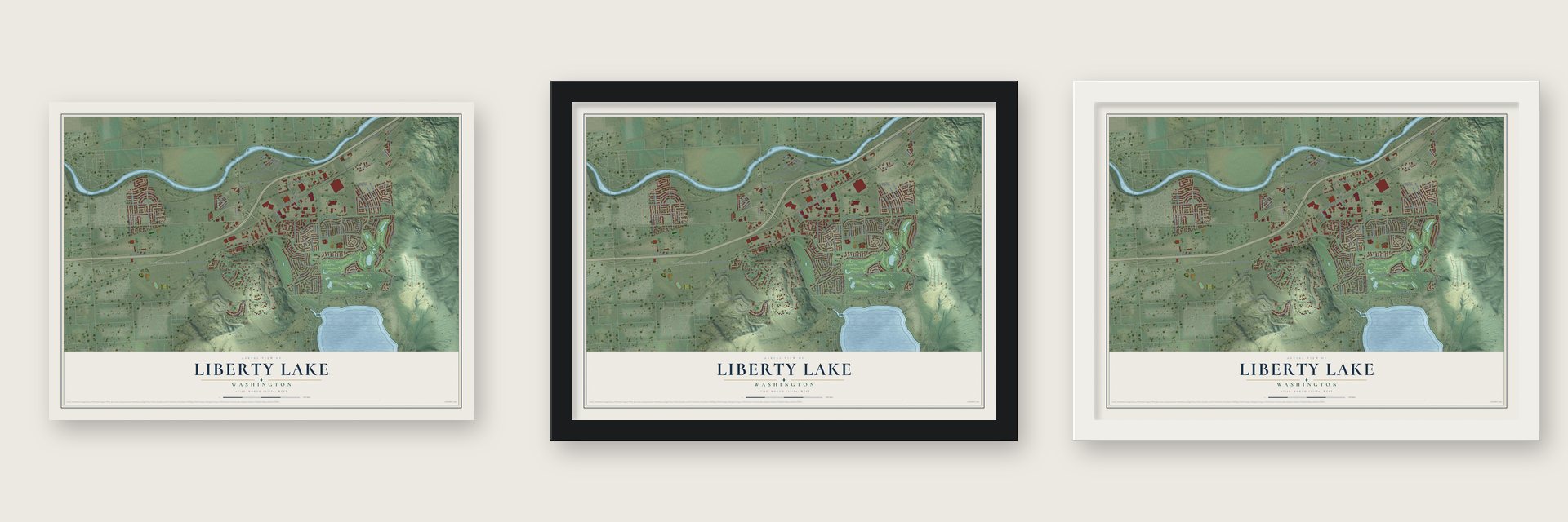
Unframed archival matte, a black wood frame or a white wood frame.
Up close
Geography Worth Displaying
This map was created using accurate cartographic data and authoritative geographic sources, including the U.S. Geological Survey and the Census Bureau. The map brings together terrain, waterways, roads, and building detail. The majority of the streets are labeled, houses are accurately depicted, and the topography is derived from government sources. Combining local data with carefully composed color and shading leads to this beautifully detailed Liberty Lake artwork for your wall.
Rather than simply showing street outlines, we’ve included as many of the street names as we could reasonably fit on the map while keeping their names legible. Zoom in on the high resolution preview to see exactly what’s on the map. We truly set out to create a statement piece for anyone who loves Liberty Lake. So whether it’s for you, or a gift for someone you love, we hope this map of Liberty Lake brings back fond memories.
Read the story behind this map of Liberty Lake, Washington from 2026.

About Liberty Lake, Washington
Liberty Lake is a city of 12,003 people in Spokane County, about a mile from the Idaho line. In 1858 Colonel George Wright named the lake Lake Grier, after Major William N. Grier, one of his officers in the Battle of the Four Lakes. In 1871 Etienne Laliberté, a Quebec-born fur trader and mail carrier, settled on the western shore with his wife Christine. There they planted 25 acres of fruit trees and kept livestock, and he later took the name Stephen Liberty.
In 1903 the Spokane and Inland Empire Railroad started running electric trains out from Spokane. The ride took 45 minutes and cost 75 cents round-trip, and a horse-drawn stage carried riders the rest of the way to the water for 25 cents more. Hotels, roadhouses and dance halls went up around the shore. The trains stopped in 1926 as more people drove cars. The city was incorporated on August 31, 2001, though the lake itself sits just outside its limits.
“Many spent the night to listen to Tecomtee's beautiful lyric tenor voice echo across the lake as he sang the Prophecy Songs of Circling Raven”
- Chief Seltice's summer feastAndrew Seltice, chief of the Coeur d'Alene tribe, held a celebration on the lakeshore every July 1. Some 500 guests came for horse races, foot races, canoe races and other contests, with prizes for the winners. Three steers were cooked for the crowd, served with bread, camas, fruit and dried huckleberries.
- A lake renamed for a friendNeighbors Stephen Liberty and Chief Seltice became friends. Liberty had learned several Native languages and wrote the chief's letters about treaties and a reservation. In 1887 they and others went to Washington, D.C., to see President Grover Cleveland about the reservation's boundaries. The treaty was never ratified, so Liberty made several more trips for the tribe. After his death in 1911 the lake took his name, and a monument went up at its north end in 2011.
- Spokane's Inland SeashoreIn 1909 the railroad opened Liberty Lake Park on the northwest side of the lake and advertised it as Spokane's "Inland Seashore." On Sundays and holidays in 1913, trains of five cars left for the park twice an hour. The Fourth of July drew the biggest crowds: in 1924 about 14,000 people came, 9,000 of them by train.
- Room for 628 couplesThe park's dance pavilion stood on a pier reaching 200 feet out over the water, and its maple floor was said to hold 628 couples. The Phil Sheridan Orchestra, Mann Brothers' Music and Dutch Groshoff's orchestra all played there. It ran until 1962, when fire destroyed it. The 14.2-acre Pavillion Park, built in 1995 on land given by founding families, recalls the old pavilions with its amphitheater and picnic shelter.
- The Zephyr's fresh startCharles Traeger opened the lake's first dance hall in 1902 as part of his Zephyr roadhouse, which was known for gambling and liquor. After he married in 1908, his wife pushed him to run a more respectable place, and the roadhouse became the Zephyr Hotel. It stayed a hotel until 1946, when the Disciples of Christ church bought it for $20,000.
Find your street
Names on the Liberty Lake map
Every name below is printed on this map. Look for your street, your school, the park where you played, or the pond down the road.
Places and landmarks3
- Chatnwaqhi'łpm Grove
- Pavilion Park
- Liberty Lake Golf Course
Streets and roads92
- East Mission Avenue
- North Liberty Lake Road
- East Country Vista Drive
- East Maxwell Drive
- Country Vista Drive
- North Country Vista Boulevard
- East Sprague Avenue
- North Harvard Road
- North Simpson Road
- South Legacy Ridge Drive
- North Winchester Street
- East Appleway Avenue
- North Molter Road
- East Valleyway Avenue
- East Valley Vista Drive
- East Knox Avenue
- East Boone Avenue
- North Holl Boulevard
- East Hawkstone Loop
- Dunbarton Oaks Lane
- East Broadway Avenue
- North Homestead Drive
- Malvern Street
- North Henry Road
- East Wellington Parkway
- East Settler Drive
- North Garry Drive
- East Maxwell Avenue
- Indiana Avenue
- North Madson Street
Show all 92 streets
- North Wright Boulevard
- East Indiana Avenue
- Stimson Lane
- East Chimney Lane
- North Winrock Street
- East Nora Avenue
- North Knudson Street
- North Tanglewood Lane
- North Aladdin Road
- North Rydal Lane
- Maxwell Lane
- North Rocky Hill Lane
- East Cataldo Avenue
- North Mitchell Drive
- Cirque Lane
- East Alki Lane
- Sedge Lane
- North Oakland Road
- North Bella Lago Lane
- North Cavalier Road
- East Bitterroot Lane
- East Reston Avenue
- North Forest Ridge Street
- East Sharp Avenue
- East Sinto Avenue
- East Autumn Crossing Avenue
- East Blue Ridge Avenue
- East Riverside Avenue
- Murray Lane
- North Ormond Road
- East Edgewater Lane
- North Eagle Street
- North Cavalier Court
- Winchester Lane
- North Pepper Lane
- East Olive Lane
- East Rockrose Lane
- North McKinzie Drive
- North Signal Drive
- East Colony Court
- North Talon Road
- North Drury Court
- East Glenbrook Avenue
- East Caufield Avenue
- North Heton Lane
- East Desmet Road
- East Meyers Avenue
- East Clairmont Lane
- East Main Avenue
- South Parkview Court
- East Ludlow Avenue
- East Penrose Lane
- North Mitchell Road
- North Madson Court
- King James Lane
- East Knox Lane
- East Knox Court
- North Malvern Road
- North Wolfe Penn Street
- Pinehurst Lane
- North Carson Range Street
- North Madson Road
Names are listed as they appear on the printed map. Zoom into the product photos to find them.
The art of mapping a place
How This Map Was Made
Real places. Remarkable detail. Discover the layers that turn geographic data into a map of home.

The view from above
Aerial imagery reveals the character of the land: woodland, open fields, and the patterns of a place.

The shape of the land
Elevation data brings hills, valleys, and subtle changes in the landscape into view.

The details of home
Roads, waterways, and building footprints come together to make the map feel unmistakably local.

Geography becomes art
Considered color, shading, and typography bring the layers together in a map made for your wall.


Process illustrated with Mendon, Massachusetts. Aerial imagery: USDA NAIP. Terrain: USGS 3D Elevation Program. Map details and finished artwork: KNOWOL.
The Details
About This Print
Choose an archival matte print, or a black or white Ayous wood frame. The archival matte print is unframed.
Select your size and finish above to see the matching product image and price.
Materials & Craftsmanship
A contemporary map with the character of a classic atlas, printed on archival matte paper. Optional frames are made from Ayous wood.
Your printed map does not include the watermark shown in the full-map preview.
Shipping & Delivery
Free shipping within the United States. Every print is made to order in the USA.
Buying a gift? Add a note in your cart and we'll include it. We never put prices in the package.
Prints ship within 2 to 3 business days. Allow 7 to 10 days total from ordering for delivery. Timing may vary during holidays or periods of high order volume.
Read our shipping policy.
Returns and damaged prints
Each print is made to order. Change-of-mind refunds are not available after production.
If your print arrives damaged, misprinted or incorrect, contact support@knowol.com within 30 days of receiving it. Include your order number, photos and a description of the issue.
Read our full refund and replacement policy. For questions about your order, email support@knowol.com.
Find your town
Looking for another city?
Find a map of home in our Washington collection, or any town in the country.
Nearby
Maps of towns near Liberty Lake
Know someone from one of these towns? Their map makes a great gift.
 Otis Orchards-East Farms
, Washington
From $39.99See the map
 Spokane Valley
, Washington
From $39.99See the map
 Millwood
, Washington
From $39.99See the map
More maps nearby: Green Bluff, Mead, Rockford, Spokane and Town and Country.