
Search for another town




Free U.S. delivery 7 to 10 days after you order
Spokane, Washington Map Art
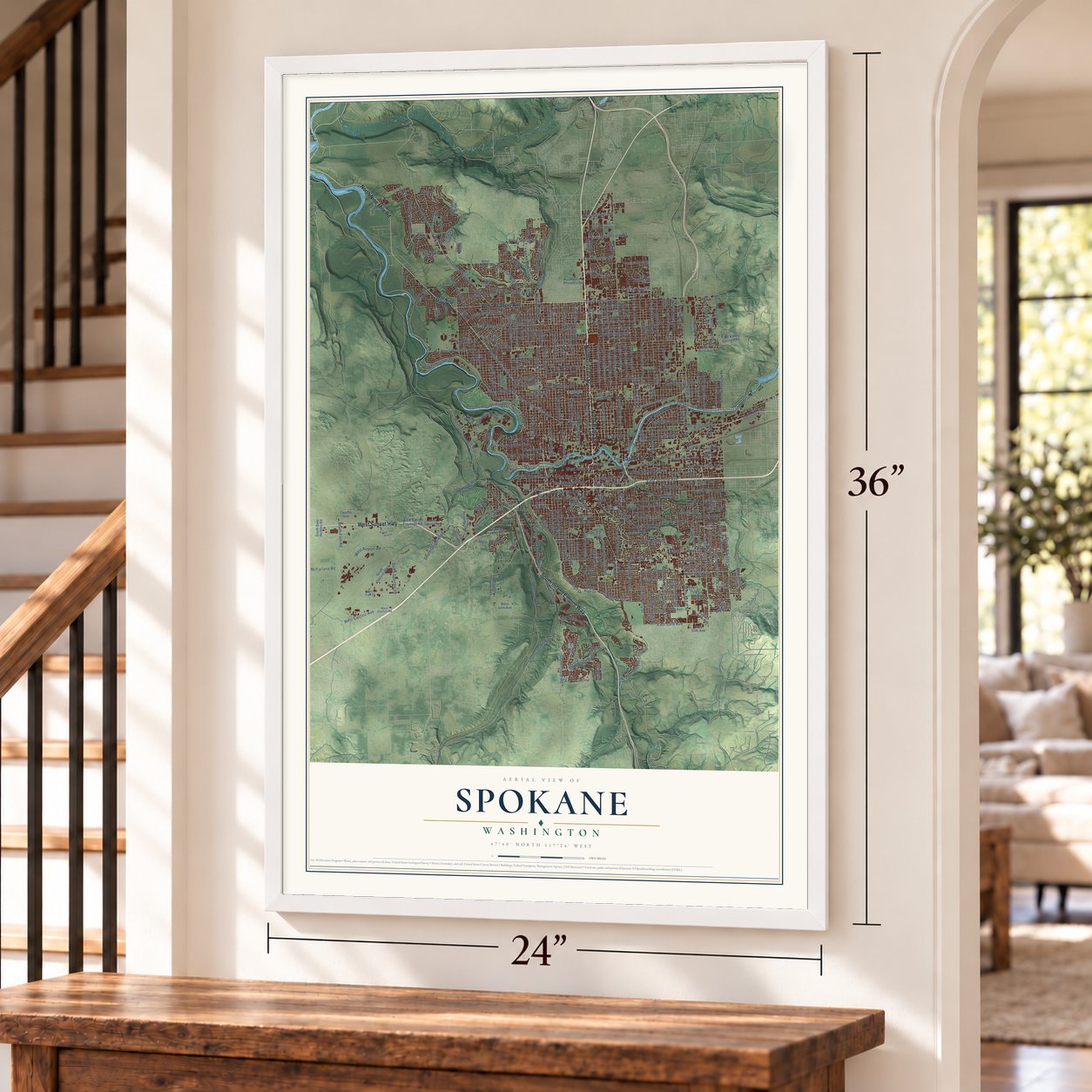
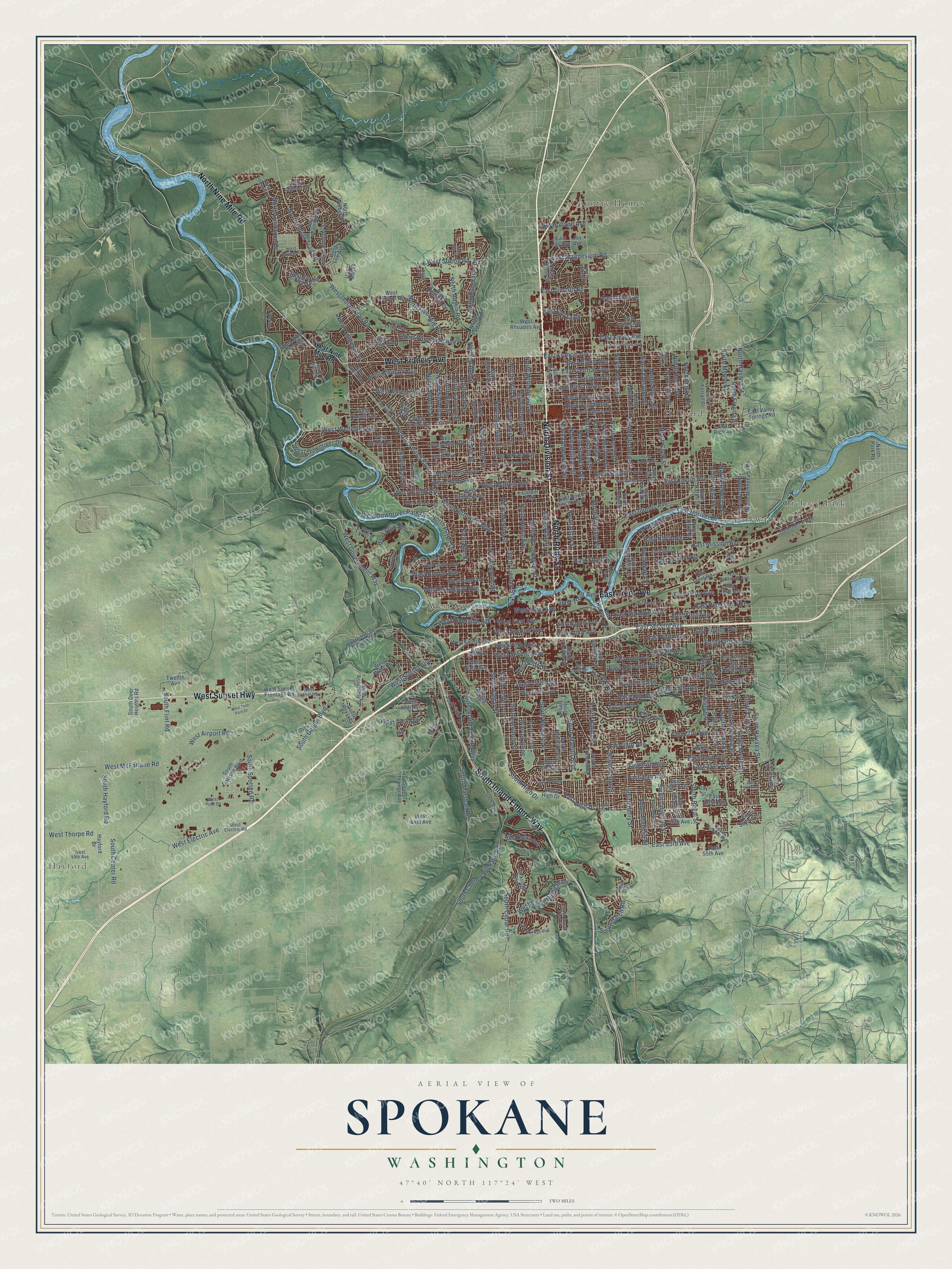
A new map of Spokane, Washington, made in 2026 and printed to order on thick archival matte paper.
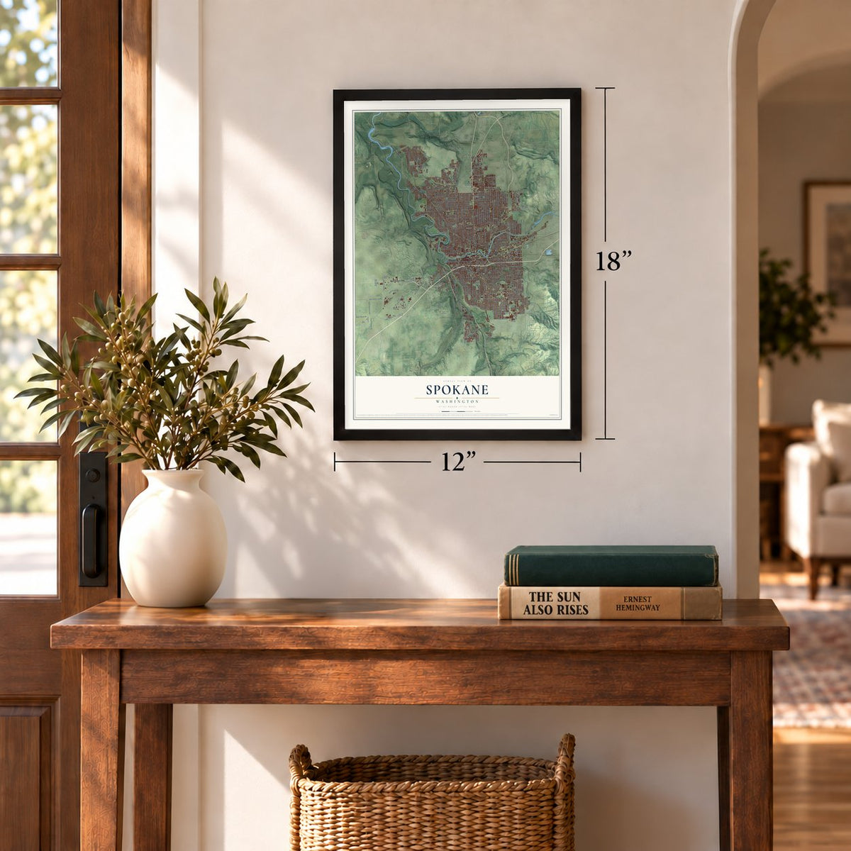
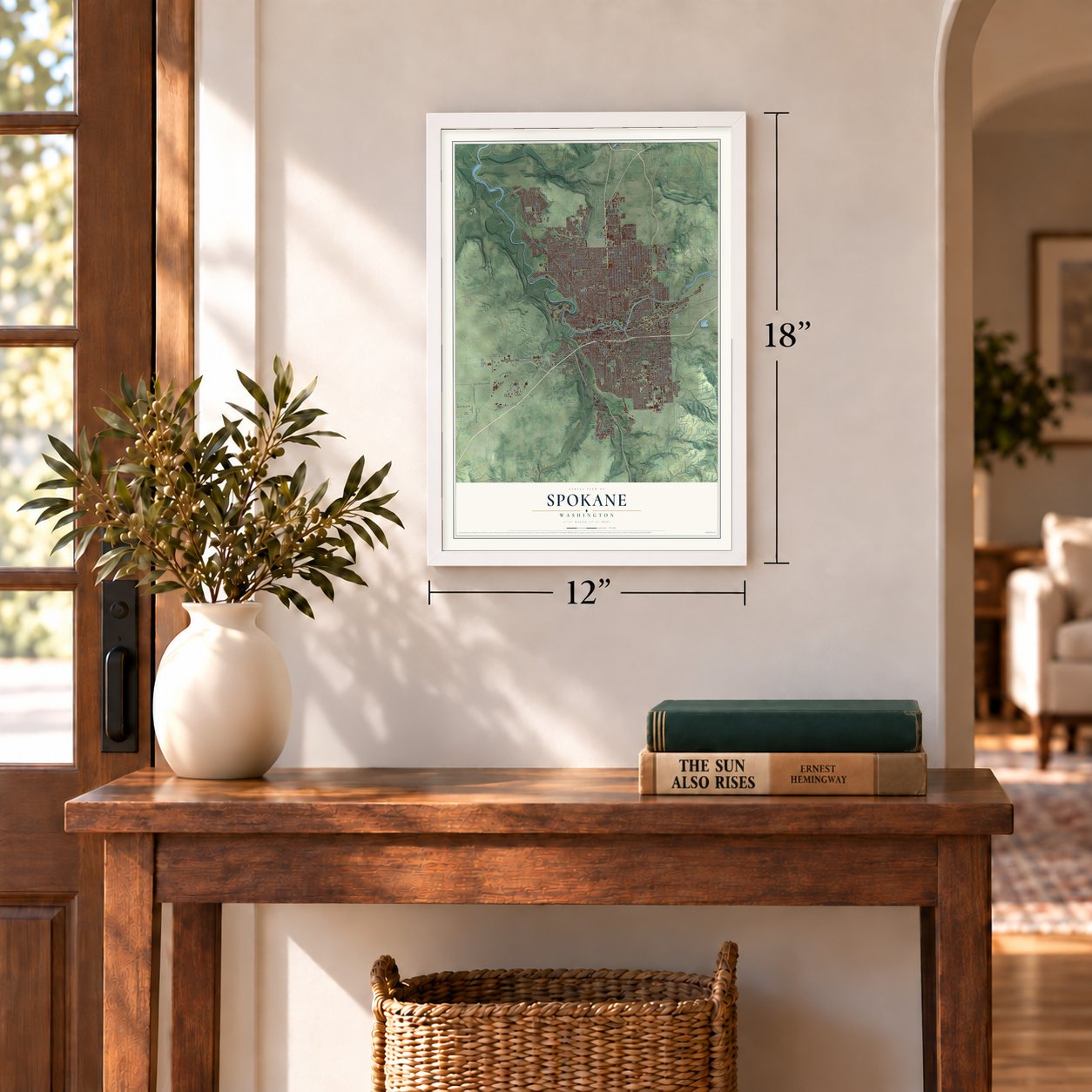
12" x 18" Archival Matte Print
A Map of Home. A Work of Art.
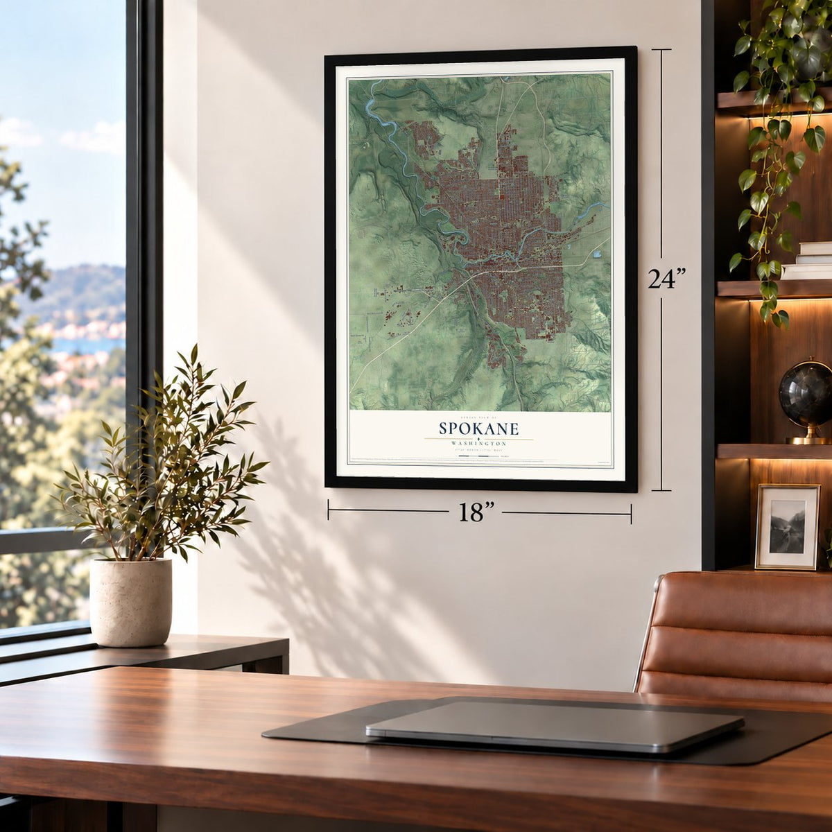
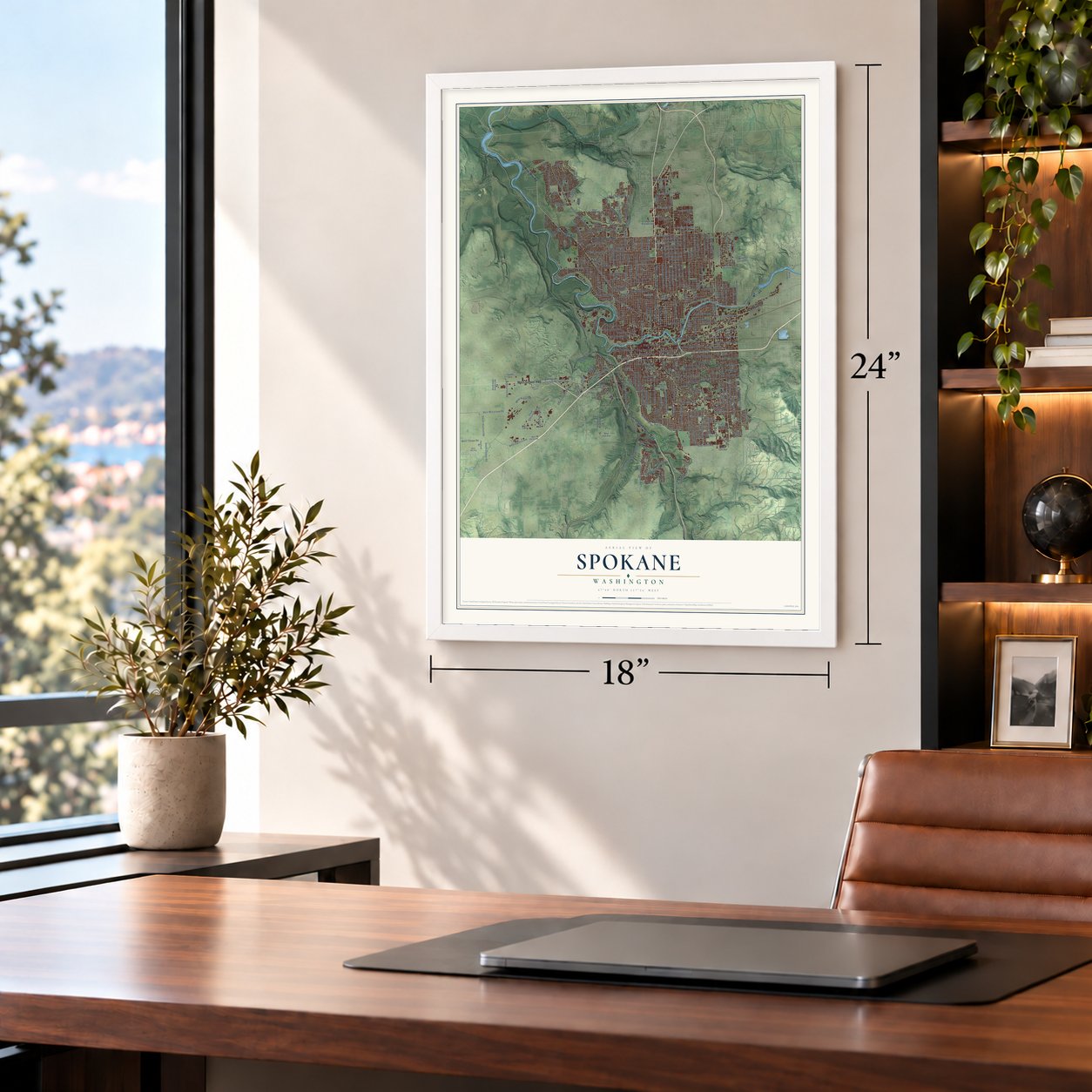
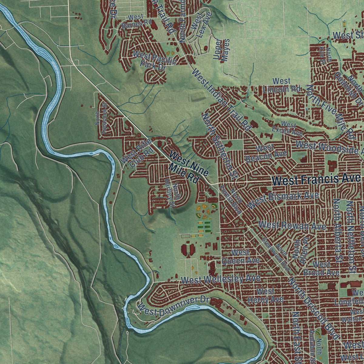
Explore Spokane, Washington from a whole new perspective. Created using aerial imagery and detailed geographic data, this map captures Spokane building by building, with labeled streets, familiar landmarks, and shaded topographical relief that highlights the natural contours of the landscape.
Combining modern data with the timeless character of a vintage atlas, this map is just as interesting up close as it is beautiful on the wall. Whether you grew up in Spokane, spent memorable years there, or call it home today, this unique map is a great way to celebrate a place that means something to you. Zoom in on the preview to look for your street, and then order a print to put your memories on the wall.
Three ways to hang it
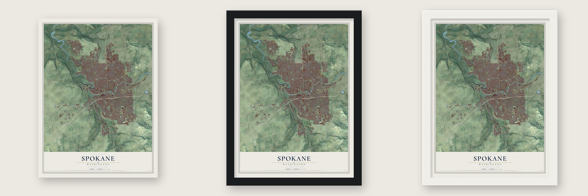
Unframed archival matte, a black wood frame or a white wood frame.
Up close
Geography Worth Displaying
This map was created using accurate cartographic data and authoritative geographic sources, including the U.S. Geological Survey and the Census Bureau. The map brings together terrain, waterways, roads, and building detail. The majority of the streets are labeled, houses are accurately depicted, and the topography is derived from government sources. Combining local data with carefully composed color and shading leads to this beautifully detailed Spokane artwork for your wall.
Rather than simply showing street outlines, we’ve included as many of the street names as we could reasonably fit on the map while keeping their names legible. Zoom in on the high resolution preview to see exactly what’s on the map. We truly set out to create a statement piece for anyone who loves Spokane. So whether it’s for you, or a gift for someone you love, we hope this map of Spokane brings back fond memories.
Read the story behind this map of Spokane, Washington from 2026.

About Spokane, Washington
Spokane is a city of 228,989 people and the county seat of Spokane County, built beside the falls of the Spokane River. Salmon filled the river, and the Spokanes fished at the falls, where other tribes joined them during the runs to trade and celebrate. Their name is most often said to mean "Children of the Sun." In 1871 James J. Downing and Seth R. Scranton put up a sawmill on the south bank.
In 1873 two men from Oregon, James N. Glover and Jasper N. Matheney, saw the power in the falls. Without saying what they planned, they bought Downing's mill and his 160 acres. Glover then added Scranton's claim and bought out Matheney in 1877. He talked the German-born miller Frederick Post into building a gristmill, enlarged the sawmill and opened a store. Lumber, flour and supplies drew families, and Glover came to be called the "Father of Spokane." The town, then Spokane Falls, was incorporated in 1881 with about 1,000 people, the year the Northern Pacific reached it. In 1891 the name was cut to Spokane.
“From the late 1890s to about 1912, a great flurry of construction created a modern urban profile of office buildings, banks, department stores, hotels and other commercial institutions”
- 32 blocks burned in 1889The Great Fire broke out on August 4, 1889. A pump station had failed, so there was no water pressure, and firefighters blew up buildings with dynamite to stop the flames. When the wind died down, 32 blocks of downtown were gone and one person was dead. Businesses carried on in tents, and owners rebuilt in brick and stone, much of it designed by Kirtland K. Cutter. Spokane soon earned a name as the finest city between Minneapolis and Seattle.
- The fight for the county seatSpokane County was formed from part of Stevens County in 1879, and Spokane was made the temporary seat. Nearby Cheney wanted the seat too, and the county's records were even stolen, but Spokane won in the end. Architect Willis Ritchie finished the French chateau-style Spokane County Courthouse in 1895.
- Mining money and new mansionsThe Panic of 1893 ruined early leaders such as Glover. A Dutch mortgage bank that had paid for many post-fire buildings foreclosed and owned much of the city's valuable property for years. In the recovery, mining and railroad men took their place, among them Amasa B. Campbell, Patrick Clark, D. C. Corbin, John H. Finch and Levi Hutton. Many built mansions designed by Kirtland Cutter, and by 1909 Spokane was said to have 26 millionaires.
- Father's Day and Expo '74Spokane is called the birthplace of Father's Day, and people here know it as the Lilac City. It hosted Expo '74, the first world's fair with an environmental theme. Each year the city also stages Hoopfest, a 3-on-3 basketball tournament that draws more players than any other on Earth, and the event gave Spokane its official nickname, Hooptown USA.
Find your street
Names on the Spokane map
Every name below is printed on this map. Look for your street, your school, the park where you played, or the pond down the road.
Places and landmarks7
- Hayford
- Country Homes
- Hillyard
- Orchard Park
- Parkwater
- West Spokane
- Corbin Park
Streets and roads303
- North Division Street
- North Ruby Street
- South Inland Empire Way
- East Trent Avenue
- West Francis Avenue
- West Sunset Highway
- North Nine Mile Road
- North Ash Street
- North Perry Street
- West Wellesley Avenue
- East Eleventh Avenue
- West 21st Avenue
- East 16th Avenue
- South Jefferson Street
- South High Drive
- North Indian Trail Road
- East Magnesium Road
- West Airport Road
- West Downriver Drive
- North Nettleton Street
- West Electric Avenue
- West Fifth Avenue
- West Bismark Avenue
- North Panorama Drive
- North Crestline Street
- North Standard Street
- North Nevada Street
- North Maple Street
- North Cincinnati Street
- North Monroe Street
Show all 303 streets
- North Napa Street
- North Pittsburg Street
- North Cedar Street
- East Upriver Drive
- East Mission Avenue
- North Washington Street
- West Northwest Boulevard
- North Howard Street
- North Post Street
- North Helena Street
- North Freya Street
- South Freya Street
- North Lincoln Street
- North Stone Street
- North Belt Street
- North Oak Street
- North Madison Street
- East 37th Avenue
- North Cook Street
- North Lidgerwood Street
- North Regal Street
- North Addison Street
- North Wall Street
- South Myrtle Street
- East Second Avenue
- South Perry Street
- North Adams Street
- West Sunset Boulevard
- East Third Avenue
- East 29th Avenue
- East Francis Avenue
- East Sprague Avenue
- North Atlantic Street
- North Alberta Street
- North Elm Street
- North Driscoll Boulevard
- East 17th Avenue
- North Cannon Street
- West Riverside Avenue
- East Queen Avenue
- North Morton Street
- East Rowan Avenue
- South Crestline Street
- West Rowan Avenue
- East 35th Avenue
- East Central Avenue
- South Havana Street
- South Manito Boulevard
- East Euclid Avenue
- East Fifth Avenue
- North Stevens Street
- South Rebecca Street
- East 33rd Avenue
- North Market Street
- South Geiger Boulevard
- East Everett Avenue
- West Boone Avenue
- South Regal Street
- East 18th Avenue
- East 34th Avenue
- West Thorpe Road
- East Boone Avenue
- East 27th Avenue
- South Thor Street
- South Bernard Street
- East Hartson Avenue
- East Joseph Avenue
- West Glass Avenue
- South Hatch Road
- South Arthur Street
- East First Avenue
- West Euclid Avenue
- North Havana Street
- East Dalke Avenue
- West Woodside Avenue
- West Seventh Avenue
- South Cheney Spokane Road
- East Sharp Avenue
- South Monroe Street
- North Hamilton Street
- East Fourth Avenue
- North Rebecca Street
- West 14th Avenue
- East Riverside Avenue
- West Second Avenue
- South Cuba Street
- South Hatch Street
- West McFarlane Road
- East Nora Avenue
- North Myrtle Street
- East Illinois Avenue
- West Dalton Avenue
- South Hayford Road
- West Indian Trail Road
- South Spotted Road
- East 15th Avenue
- West Strong Road
- West Downriver Park Drive
- South Cedar Street
- North East Street
- West First Avenue
- East Lincoln Road
- North Whitehouse Street
- North Austin Road
- South Flint Road
- West Broadway Avenue
- South Cedar Road
- East Lyons Avenue
- North Five Mile Road
- South Marshall Road
- North Florida Street
- North Sutherlin Street
- South Madelia Street
- West Main Avenue
- West Government Way
- North Astor Street
- East Ferry Avenue
- North Sundance Drive
- West Eagle Ridge Boulevard
- South Post Street
- East 53rd Avenue
- West Elliot Drive
- East Cozza Drive
- South Center Road
- East Holland Avenue
- North Pettet Drive
- West Cliff Drive
- East High Drive
- West Nine Mile Road
- East Rockwood Boulevard
- South Garfield Street
- West Ninth Avenue
- West 33rd Avenue
- West Pacific Park Drive
- North Walnut Street
- North Jefferson Street
- North Lacey Street
- West Longfellow Avenue
- East Bridgeport Avenue
- East Rich Avenue
- East Pacific Avenue
- West Garland Avenue
- East Ninth Avenue
- East 42nd Avenue
- South Ray Street
- West Queen Avenue
- South Grand Boulevard
- East 39th Avenue
- North Magnolia Street
- West 16th Avenue
- North Lee Street
- North Mayfair Street
- North Cedar Road
- West Sinto Avenue
- East 14th Avenue
- West Heroy Avenue
- East Twelfth Avenue
- North Ralph Street
- West Fourth Avenue
- South Cook Street
- South Davison Boulevard
- North Ferrall Street
- West 17th Avenue
- West Fairview Avenue
- North Madelia Street
- North Colton Street
- East North Foothills Drive
- North Hogan Street
- Park Boundary
- South Division Street
- West Dean Avenue
- East Seventh Avenue
- North Fiske Street
- West Broad Avenue
- North Wieber Drive
- North Farmdale Street
- West Beacon Avenue
- East 46th Avenue
- East Olive Avenue
- South Ash Street
- East Calkins Drive
- North Minnehaha Pk
- Parkridge Boulevard
- West High Drive
- North Quamish Drive
- East Weile Avenue
- South Assembly Street
- South Cowley Street
- South Indian Canyon Drive
- West Liberty Avenue
- East Commerce Avenue
- 44th Avenue
- West Bolan Avenue
- North Cuba Street
- West Lincoln Road
- West Sunset Frontage Road
- South Deer Heights Road
- South Club Drive
- West 44th Avenue
- East Valley Springs Road
- South Trainor Avenue
- East 55th Avenue
- West Rhoades Avenue
- South Royal Street
- West West Drive
- East Sumac Drive
- North Allen Place
- Milton Drive
- West Rifle Club Road
- East Trent Road
- West Lex Avenue
- East Jay Avenue
- North Park Road
- Hayford Br
- Twelfth Avenue
- Ray Street
- Upper Mayes
- Jay Avenue
- South Palouse Highway
- North Forest Boulevard
- West Walton Avenue
- East 30th Avenue
- South Napa Street
- East Wabash Avenue
- West Kiernan Avenue
- East 19th Avenue
- South Southeast Boulevard
- East Sinto Avenue
- West Sixth Avenue
- East 20th Avenue
- North Audubon Street
- East Main Avenue
- West Grace Avenue
- South Tekoa Street
- West Barnes Road
- North Martin Street
- West Excell Avenue
- East Broadway Avenue
- North Woodridge Drive
- East Houston Avenue
- North Hartley Street
- North Iroquois Drive
- East Pratt Avenue
- West Custer Drive
- South Lloyd Street
- West Bedford Avenue
- South Moran View Street
- West 49th Avenue
- West Electric Road
- West Pilot Drive
- East Hills Court
- East Gordon Avenue
- East 40th Avenue
- East 13th Avenue
- North Julia Street
- North Smith Street
- North Greenwood Boulevard
- East Dalton Avenue
- East Tenth Avenue
- South Howard Street
- South Parkridge Boulevard
- East 43rd Avenue
- North Wilding Drive
- North Superior Street
- West 37th Avenue
- North Elm Lane
- North Tucannon Street
- North River Vista Street
- West Tech Park Drive
- Katy Court
- Verona Lane
- North Kyle Street
- Lloyd Road
Names are listed as they appear on the printed map. Zoom into the product photos to find them.
The art of mapping a place
How This Map Was Made
Real places. Remarkable detail. Discover the layers that turn geographic data into a map of home.

The view from above
Aerial imagery reveals the character of the land: woodland, open fields, and the patterns of a place.

The shape of the land
Elevation data brings hills, valleys, and subtle changes in the landscape into view.

The details of home
Roads, waterways, and building footprints come together to make the map feel unmistakably local.

Geography becomes art
Considered color, shading, and typography bring the layers together in a map made for your wall.


Process illustrated with Mendon, Massachusetts. Aerial imagery: USDA NAIP. Terrain: USGS 3D Elevation Program. Map details and finished artwork: KNOWOL.
The Details
About This Print
Choose an archival matte print, or a black or white Ayous wood frame. The archival matte print is unframed.
Select your size and finish above to see the matching product image and price.
Materials & Craftsmanship
A contemporary map with the character of a classic atlas, printed on archival matte paper. Optional frames are made from Ayous wood.
Your printed map does not include the watermark shown in the full-map preview.
Shipping & Delivery
Free shipping within the United States. Every print is made to order in the USA.
Buying a gift? Add a note in your cart and we'll include it. We never put prices in the package.
Prints ship within 2 to 3 business days. Allow 7 to 10 days total from ordering for delivery. Timing may vary during holidays or periods of high order volume.
Read our shipping policy.
Returns and damaged prints
Each print is made to order. Change-of-mind refunds are not available after production.
If your print arrives damaged, misprinted or incorrect, contact support@knowol.com within 30 days of receiving it. Include your order number, photos and a description of the issue.
Read our full refund and replacement policy. For questions about your order, email support@knowol.com.
Find your town
Looking for another city?
Find a map of home in our Washington collection, or any town in the country.
Nearby
Maps of towns near Spokane
Know someone from one of these towns? Their map makes a great gift.
 Town and Country
, Washington
From $39.99See the map
 Country Homes
, Washington
From $39.99See the map
 Airway Heights
, Washington
From $39.99See the map
More maps nearby: Millwood, Mead, Spokane Valley, Four Lakes and Fairchild AFB.