
Search for another town





Free U.S. delivery 7 to 10 days after you order
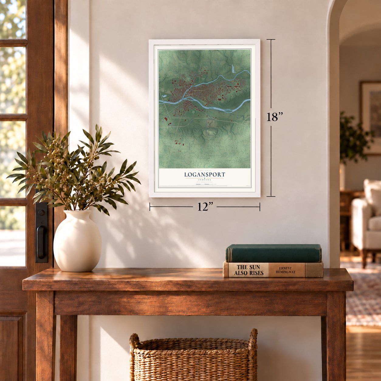
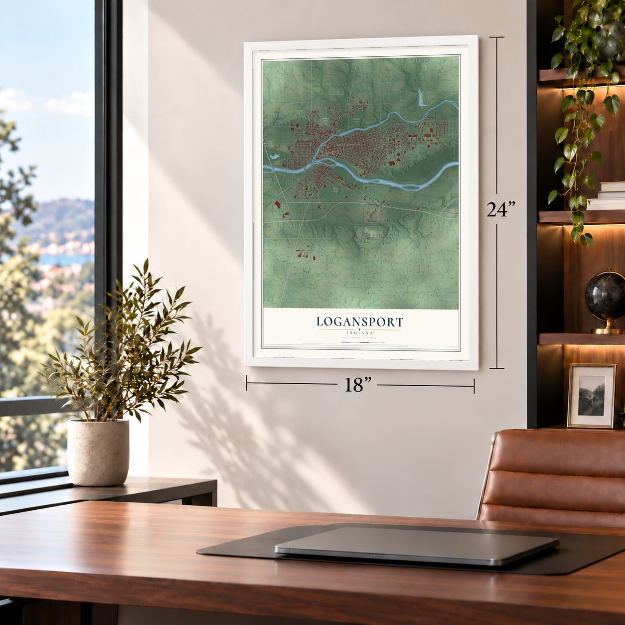
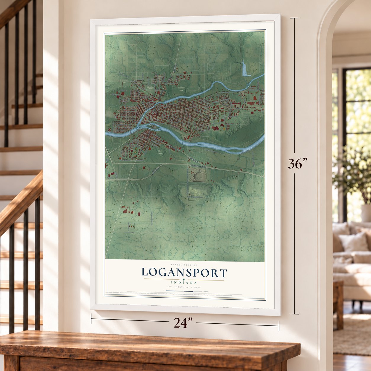
Logansport, Indiana Map Art
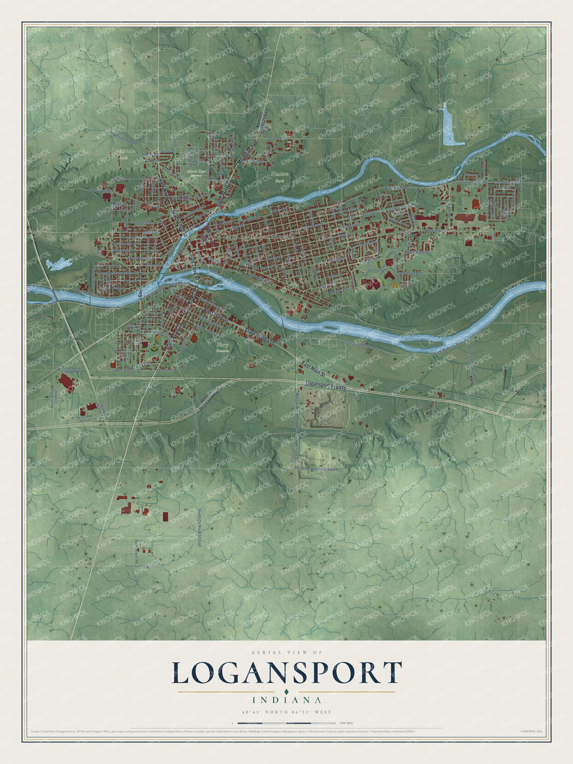
Building by building, with labeled streets and shaded relief.
12" x 18" Archival Matte Print
A Map of Home. A Work of Art.
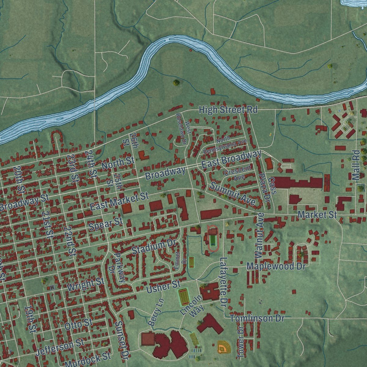
Explore Logansport, Indiana from a whole new perspective. Created using aerial imagery and detailed geographic data, this map captures Logansport building by building, with labeled streets, familiar landmarks, and shaded topographical relief that highlights the natural contours of the landscape.
Combining modern data with the timeless character of a vintage atlas, this map is just as interesting up close as it is beautiful on the wall. Whether you grew up in Logansport, spent memorable years there, or call it home today, this unique map is a great way to celebrate a place that means something to you. Zoom in on the preview to look for your street, and then order a print to put your memories on the wall.
Three ways to hang it
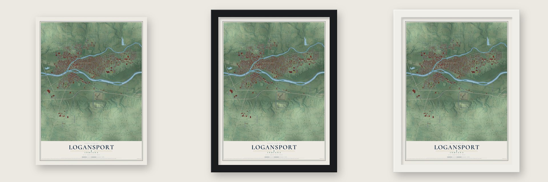
Unframed archival matte, a black wood frame or a white wood frame.
Up close
Geography Worth Displaying
This map was created using accurate cartographic data and authoritative geographic sources, including the U.S. Geological Survey and the Census Bureau. The map brings together terrain, waterways, roads, and building detail. The majority of the streets are labeled, houses are accurately depicted, and the topography is derived from government sources. Combining local data with carefully composed color and shading leads to this beautifully detailed Logansport artwork for your wall.
Rather than simply showing street outlines, we’ve included as many of the street names as we could reasonably fit on the map while keeping their names legible. Zoom in on the high resolution preview to see exactly what’s on the map. We truly set out to create a statement piece for anyone who loves Logansport. So whether it’s for you, or a gift for someone you love, we hope this map of Logansport brings back fond memories.
Read the story behind this map of Logansport, Indiana from 2026.

Find your street
Names on the Logansport map
Every name below is printed on this map. Look for your street, your school, the park where you played, or the pond down the road.
Places and landmarks5
- City of Logansport
- Dykeman Park
- Flory Preserve
- Huston Park
- Mount Hope Cemetery
Streets and roads186
- State Road 29
- State Road 329
- State Road 25
- State Road 17
- North Third Street
- South Third Street
- South Cicott Street
- Logansport Bypass
- East Main Street
- State Road 435
- Michigan Avenue
- Memorial Drive
- Lytle
- 24th Street
- High Street Road
- West Street
- East Broadway
- East Market Street
- East Broadway Street
- Broadway
- Woodlawn Avenue
- East Division Road
- West Clinton Street
- Kloenne Street
- General Street
- West Wabash Avenue
- Royal Center Pike
- Pollard Street
- East County Road 300 South
- Tomlinson Drive
Show all 186 streets
- East Colfax Street
- Division Line Road
- Hampshire Drive
- North Street
- High Street
- George Street
- 18th Street
- Erie Avenue
- East South River Road
- East Wabash River Road
- Spear Street
- Usher Street
- Market Street
- Morgan Hill Road
- South County Road 150 East
- Humphrey Street
- Water Street
- 17th Street
- Eberts Road
- 19th Street
- 16th Street
- Wheatland Avenue
- 15th Street
- Smead Street
- West Linden Avenue
- 20th Street
- 21st Street
- 22nd Street
- Wright Street
- West Melbourne Avenue
- 14th Street
- West Miami Avenue
- Holland Street
- Cliff Drive
- South 17th Street
- South County Road 325 East
- West Cliff Drive
- Clifton Avenue
- Smith Street
- 13th Street
- South County Road 50 East
- 23rd Street
- Twelfth Street
- Pleasant Hill
- Biddle Street
- Sunset Drive
- Tenth Street
- Chase Road
- Bates Street
- Ninth Street
- Grove Street
- Helm Street
- Stadium Drive
- West Broadway
- Yorktown Road
- Mall Road
- Eighth Street
- Jefferson Street
- Liberty Street
- East Ottawa Street
- Grant Street
- Johnson Street
- Anthony Street
- Meadlawn Avenue
- East Tipton Street
- East Clay Street
- Lafayette Drive
- Maplewood Drive
- Otto Street
- Sherman Street
- Garfield Avenue
- Treen Street
- Vine Street
- Seventh Street
- Brown Street
- Front Street
- Van Tower Drive
- Race Street
- Fourth Street
- Chicago Street
- Park Avenue
- Western Avenue
- Princeton Lane
- Parkwood Drive
- Kingsmill Drive
- State Street
- Miles Street
- Pink Street
- Georgian Lane
- Walnut Avenue
- Daisy Street
- Delaware Road
- Garden Street
- Murdock Street
- Summit Avenue
- Lux Street
- Silver Street
- North Sixth Street
- North County Road 125 East
- Hoosier Heartland Highway
- West Main Street
- West County Road 200 South
- Eel River Avenue
- Eleventh Street
- Barron Street
- South County Road 125 West
- Ivy Tech Drive
- Logansport Bypass Road
- East Miami Avenue
- Commerce Court
- Riverside Drive
- East Columbia Street
- South Airport Road
- 26th Street
- 25th Street
- Lincoln Way
- Day Street
- Parkway Drive
- Seybold Street
- East Clinton Street
- North Fifth Street
- Fulton Street
- Berry Lane
- Cass Plaza Drive
- Tower Drive
- Seaton Street
- Center Avenue
- Henry Street
- Frank Street
- First Street
- Aster Street
- Plum Street
- Franklin Street
- College Street
- Van Buren Street
- Parkmont Drive
- Kensington Drive
- Frederick Street
- Crescent Avenue
- Golfview Drive
- Shaw Street
- East Linden Avenue
- East Wabash Avenue
- Monroe Street
- Tanguy Street
- Emmet Drive
- West Roselawn Drive
- West County Road 400 South
- West County Road 250 South
- North Pennsylvania Avenue
- Hanna Street
- Dividend Drive
- Second Street
- Russell Street
- Mobley Street
- King Street
Names are listed as they appear on the printed map. Zoom into the product photos to find them.
About Logansport, Indiana
Logansport is a city of 18,366 people and the seat of Cass County, where the Eel River flows into the Wabash. Settlers arrived around 1826. The town was named for James Logan, a Shawnee warrior known as Captain Logan, who scouted for American troops in this area during the War of 1812. On the first day of May, 1829, the new county's commissioners held their first court session in the old seminary building in town.
In 1837 the Wabash and Erie Canal arrived in Logansport, and the canal gave the town the "port" in its name, as in Logan's port. The county history lists the city's officers from its incorporation in 1838. The Historic Michigan Road, one of Indiana's first roads, also runs through the city on its way from Madison to Michigan City.
- Grab the brass ringA Dentzel carousel turns in Riverside Park on the bank of the Eel River. It is counted among the three oldest Dentzel menagerie carousels that survive nearly whole. Riders still reach for a brass ring as they go around, and the game inspired the local slogan "Grab the brass ring." The carousel joined the National Register in 1987 as the Spencer Park Dentzel Carousel.
- Felix the Cat since 1925Logansport High School adopted Felix the Cat as its mascot sometime between 1925 and 1926. Three rival legends explain how it happened. No high school in Indiana is known to have kept a mascot longer than Felix. The teams are called the Berries, a pun on the loganberry, and they play basketball in the Berry Bowl.
- Indiana's oldest art groupA Neighborhood Art Club started meeting in 1894, and it became the Logansport Art Association in February 1911. It is the oldest art organization in Indiana. Today it runs an art center with classes and shows, including a Black & White Show in February and a photography contest in October.
- A four-cylinder pioneerEarly in the 20th century, the Rutenber automobile company moved here from Chicago and took the name Western Motor Company. Its founder, Edwin Rutenber, invented the first four-cylinder engine for an automobile and held dozens of patents, from a distributor cap system to electric home appliances.
- Where two railroads crossedWabash trains between St. Louis and Detroit crossed Pennsylvania Railroad lines between Chicago and Cincinnati here. The Wabash Cannon Ball stopped in town until the last Wabash train ran in 1971. The large Pan Handle Depot came down in 1962, but two railroads and a switch yard still work in Logansport.
Keep exploring Indiana
Logansport is one of 1,023 Indiana towns we've mapped. Every dot on the map is a print of its own.
The search covers every state, Indiana first.
Near Logansport
Order 2 or more town maps and save 10%. Shown in the size and finish you picked above, so they hang as a set.
- Anoka 12" x 18" / Archival Matte Print $39.99
- Walton 12" x 18" / Archival Matte Print $39.99
- Lucerne 12" x 18" / Archival Matte Print $39.99
More maps nearby: Onward, Deer Creek, Burrows, Lake Cicott and Twelve Mile.
The art of mapping a place
How This Map Was Made
Real places. Remarkable detail. Discover the layers that turn geographic data into a map of home.

The view from above
Aerial imagery reveals the character of the land: woodland, open fields, and the patterns of a place.

The shape of the land
Elevation data brings hills, valleys, and subtle changes in the landscape into view.

The details of home
Roads, waterways, and building footprints come together to make the map feel unmistakably local.

Geography becomes art
Considered color, shading, and typography bring the layers together in a map made for your wall.


Process illustrated with Mendon, Massachusetts. Aerial imagery: USDA NAIP. Terrain: USGS 3D Elevation Program. Map details and finished artwork: KNOWOL.
The Details
About This Print
Choose an archival matte print, or a black or white Ayous wood frame. The archival matte print is unframed.
Select your size and finish above to see the matching product image and price.
Materials & Craftsmanship
A contemporary map with the character of a classic atlas, printed on archival matte paper. Optional frames are made from Ayous wood.
Your printed map does not include the watermark shown in the full-map preview.
Shipping & Delivery
Free shipping within the United States. Every print is made to order in the USA.
Buying a gift? Add a note in your cart and we'll include it. We never put prices in the package.
Prints ship within 2 to 3 business days. Allow 7 to 10 days total from ordering for delivery. Timing may vary during holidays or periods of high order volume.
Read our shipping policy.
Returns and damaged prints
Each print is made to order. Change-of-mind refunds are not available after production.
If your print arrives damaged, misprinted or incorrect, contact support@knowol.com within 30 days of receiving it. Include your order number, photos and a description of the issue.
Read our full refund and replacement policy. For questions about your order, email support@knowol.com.