
Search for another town





Free U.S. delivery 7 to 10 days after you order
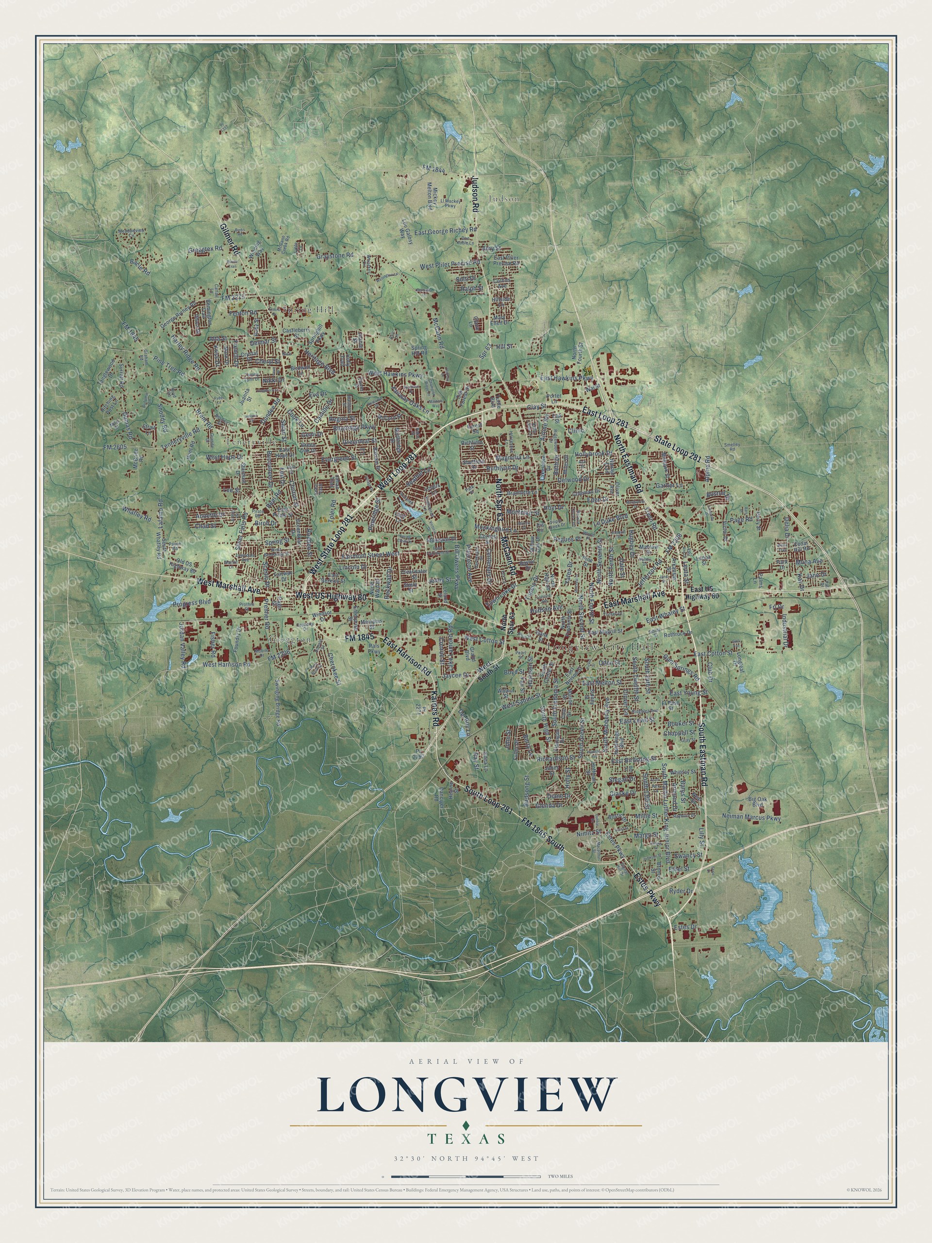
Longview, Texas Map Art
Building by building, with labeled streets and shaded relief.
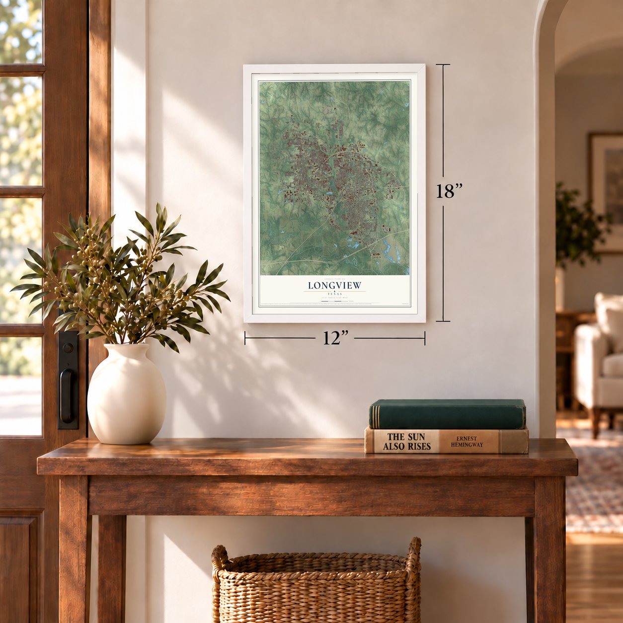
12" x 18" Archival Matte Print
A Map of Home. A Work of Art.
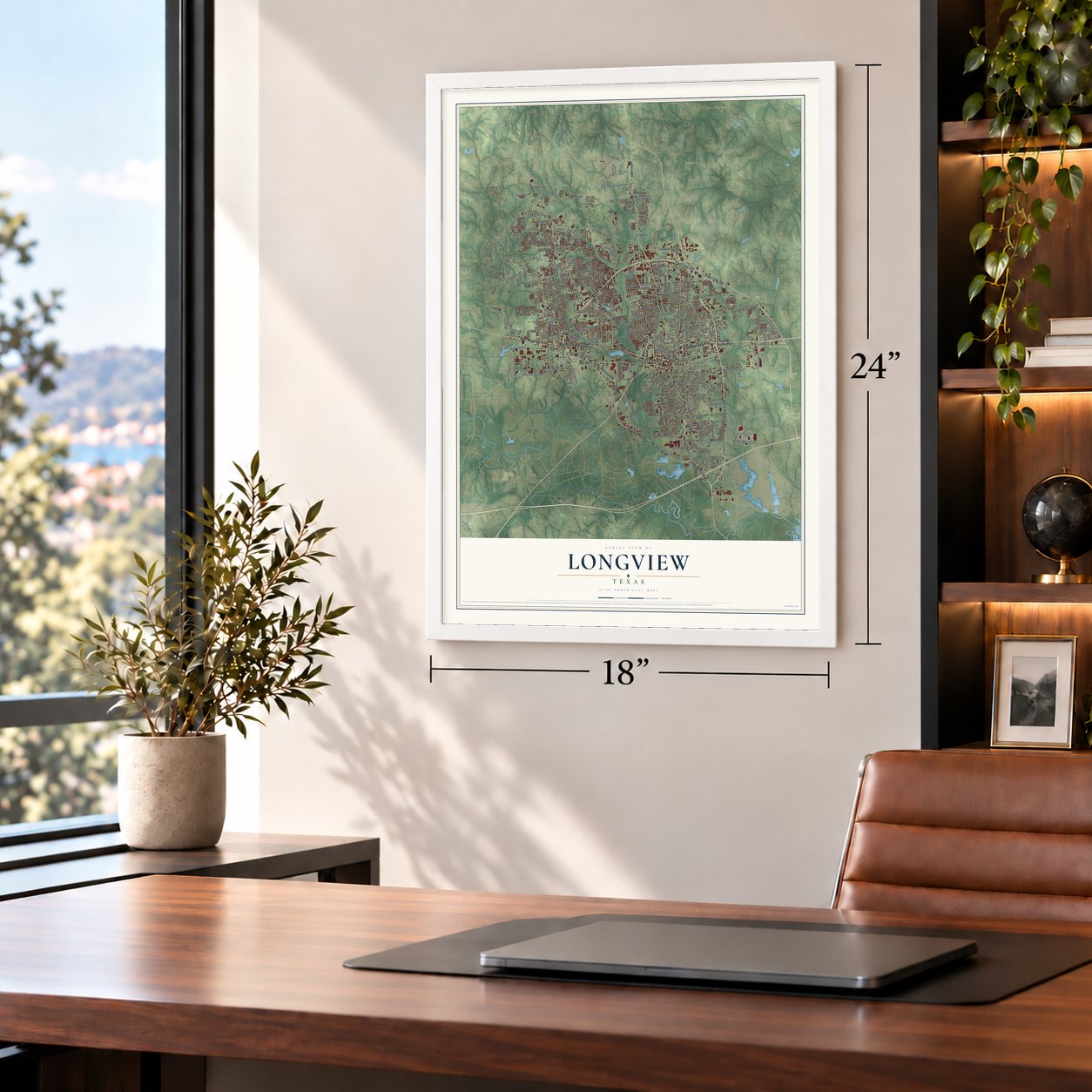
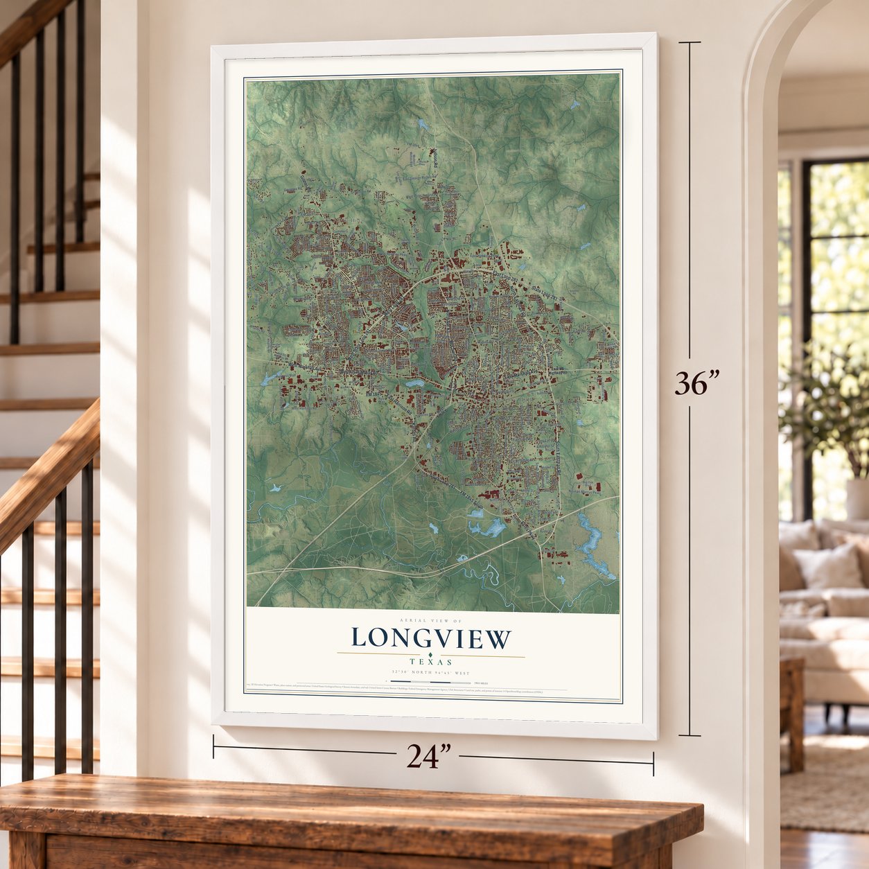
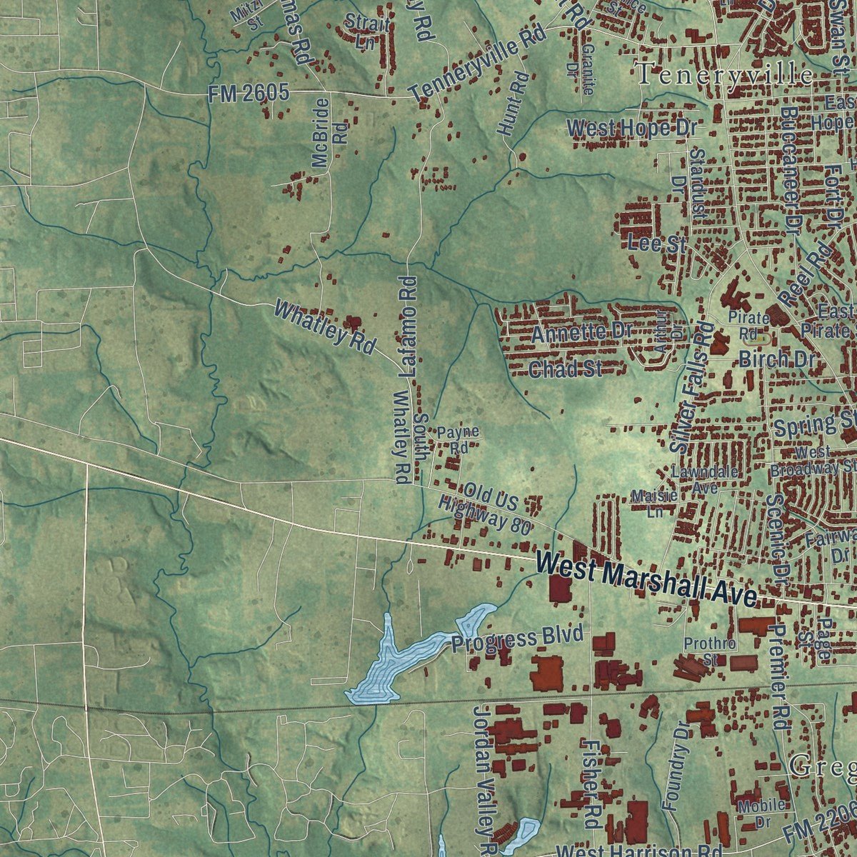
Explore Longview, Texas from a whole new perspective. Created using aerial imagery and detailed geographic data, this map captures Longview building by building, with labeled streets, familiar landmarks, and shaded topographical relief that highlights the natural contours of the landscape.
Combining modern data with the timeless character of a vintage atlas, this map is just as interesting up close as it is beautiful on the wall. Whether you grew up in Longview, spent memorable years there, or call it home today, this unique map is a great way to celebrate a place that means something to you. Zoom in on the preview to look for your street, and then order a print to put your memories on the wall.
Three ways to hang it
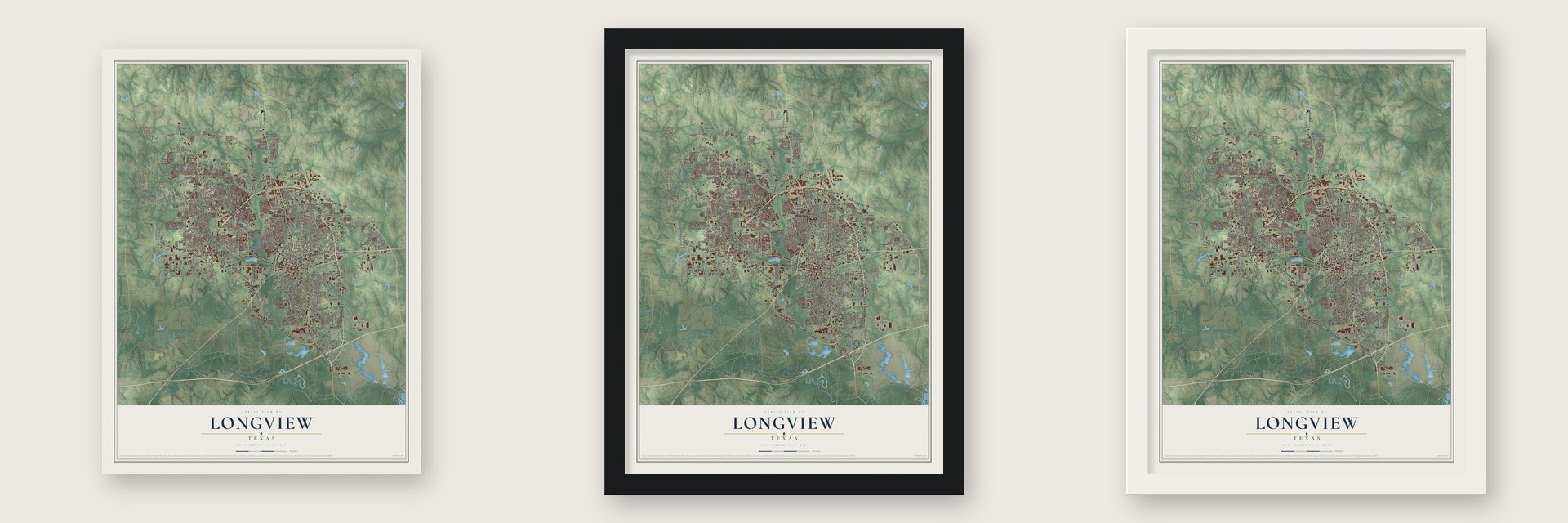
Unframed archival matte, a black wood frame or a white wood frame.
Up close
Geography Worth Displaying
This map was created using accurate cartographic data and authoritative geographic sources, including the U.S. Geological Survey and the Census Bureau. The map brings together terrain, waterways, roads, and building detail. The majority of the streets are labeled, houses are accurately depicted, and the topography is derived from government sources. Combining local data with carefully composed color and shading leads to this beautifully detailed Longview artwork for your wall.
Rather than simply showing street outlines, we’ve included as many of the street names as we could reasonably fit on the map while keeping their names legible. Zoom in on the high resolution preview to see exactly what’s on the map. We truly set out to create a statement piece for anyone who loves Longview. So whether it’s for you, or a gift for someone you love, we hope this map of Longview brings back fond memories.
Read the story behind this map of Longview, Texas from 2026.

Find your street
Names on the Longview map
Every name below is printed on this map. Look for your street, your school, the park where you played, or the pond down the road.
Places and landmarks6
- Longview City Hall
- Judson
- Lear Park
- Greggton
- Spring Hill
- Teneryville
Streets and roads390
- Estes Parkway
- FM 1845 South
- South Loop 281
- Karnes Road
- McCann Road
- North Spr 63
- West Loop 281
- Judson Road
- East Marshall Avenue
- East Harrison Road
- State Loop 281
- East Loop 281
- West State Loop 281
- South Eastman Road
- Gilmer Road
- North Eastman Road
- West Marshall Avenue
- West US Highway 80
- FM 1845
- South High Street
- Jaycee Drive
- West Harrison Road
- East Hawkins Parkway
- West Sabine Street
- Heritage Boulevard
- West Hawkins Parkway
- FM 2206
- Pine Tree Road
- Bill Owens Parkway
- North Fourth Street
Show all 390 streets
- South Martin Luther King Junior Boulevard
- East Cotton Street
- East George Richey Road
- South Green Street
- Eden Drive
- West Cotton Street
- FM 2275
- South Twelfth Street
- Graystone Road
- Lilly Street
- Alpine Road
- FM 2208
- Jefferson Road
- FM 2605
- Tenneryville Road
- South Mobberly Avenue
- Hollybrook Drive
- Tryon Road
- Greggtex Road
- Brent Road
- East Whaley Street
- East Young Street
- Airline Road
- East Birdsong Street
- Centenary Drive
- South 14th Street
- Harley Ridge Road
- Page Road
- Evergreen Street
- Reel Road
- FM 1844
- Fairmont Street West
- North Seventh Street
- Blueridge Parkway
- Silver Falls Road
- Cherokee Street
- Toler Road
- Neiman Marcus Parkway
- South Fredonia Street
- Cheryl Street
- North Tenth Street
- Clinton Street
- Fisher Road
- North Second Street
- Premier Road
- Lafamo Road
- East Melton Street
- South 13th Street
- West Pliler Precise Road
- Delia Drive
- Rodden Street
- Greenleaf Street
- Pegues Place
- Jordan Valley Road
- Delwood Drive
- Richardson Street
- Ruthlynn Drive
- Whatley Road
- Clover Lane
- Spring Street
- Yates Drive
- Alta Street
- Scenic Drive
- Hughey Drive
- Lake Lamond Road
- Gum Springs Road
- Montclair Street
- Swan Street
- Dundee Road
- Buccaneer Drive
- Frj Drive
- Fairway Oaks Lane
- Ray Street
- Garner Lane
- Dumas Road
- Mockingbird Lane
- Industrial Drive
- Birdsong Street
- Oden Street
- Annette Drive
- Hoyt Drive
- Fenton Road
- Le Duke Boulevard
- Camille Drive
- Leota Street
- Tupelo Drive
- Progress Boulevard
- East Level Street
- Snoddy Road
- Nimitz Street
- Harrison Street
- Holly Street
- Lincoln Drive
- Rockwall Drive
- Princeton Avenue
- Millie Street
- Bates Street
- Heather Lane
- Gemi Drive
- Mona Avenue
- Town Lake Drive
- Cook Lane
- West Hope Drive
- Conroe Street
- Diane Drive
- Magnolia Lane
- Glenda Drive
- Pineridge Street
- Stegall Drive
- Berry Lane
- Birch Drive
- Glaske Drive
- Chappell Street
- Swancy Street
- Ralph Street
- Booker Street
- Amy Street
- Hudson Avenue
- Armond Drive
- Eva Drive
- Kay Drive
- Del Roy Lane
- Lee Street
- Chad Street
- Regina Street
- French Drive
- Bacle Road
- Kriss Drive
- Delmar Street
- Margo Street
- Boston Drive
- Jenny Street
- Club Drive
- Ethel Street
- Estes Drive
- Beth Drive
- Jane Drive
- Hill Street
- Boyd Street
- Dale Street
- Ryder Drive
- John Street
- Nikki Drive
- Solti Drive
- Clay Street
- Fort Drive
- Clinic
- Spr 63
- North Spur 63
- East US Highway 80
- West South Street
- North High Street
- North Fredonia Street
- Surratt Road
- South Center Street
- Spring Hill Road
- George Richey Road
- Swinging Bridge Road
- Hutchings Boulevard
- Baylor Drive
- South Whatley Road
- Old US Highway 80
- Balsam Street
- Tanglewood Drive
- Pine Street
- Flanagan Drive
- Birdwell Lane
- Foundry Drive
- Arkansas Street
- Fairway Drive
- Mickey Melton Boulevard
- Pals Parkway
- East Magrill Street
- Jones Street
- East Nelson Street
- Coleman Drive
- Leona Street
- Crystal Drive
- Bank Street
- Marion Drive
- East Hope Drive
- Walnut Street
- East Pliler Precise Road
- Enterprise Street
- Springhill Parkway
- Lovers Lane
- Hunt Road
- McBride Road
- Grand Boulevard
- Whitney Street
- Northridge Drive
- Bramlette Lane
- Neal Street
- East Berkley Street
- Stardust Drive
- Castleberry Street
- Winding Way
- Lou Galosy Way
- Mohawk Street
- Remington Trail
- Sheffield Drive
- Fuller Drive
- El Paso Street
- Hitching Post Lane
- Rothrock Drive
- Stonewall Drive
- Juanita Street
- Danciger Road
- East Pirate Street
- Bostic Drive
- Shely Street
- Oak Street
- Perry Street
- Greenbriar Drive
- Memphis Street
- Cole Drive
- Green Oak Drive
- McCord Street
- Clearwater Street
- Willow Oak Drive
- Mark Drive
- Mahlow Drive
- Sidney Street
- Lakeshore Drive
- Collins Avenue
- Iris Circle
- Miles Drive
- Ruby Street
- Longleaf Drive
- Mary Ellen Drive
- Navajo Trail
- Tuttle Boulevard
- Oak Forest Drive
- Oliver Avenue
- Leland Street
- Hillside Lane
- Windsor Drive
- Bronco Street
- Park Drive
- Cedar Hill Road
- Victor Drive
- Cornell Street
- Richfield Street
- Fair Street
- Hoffman Street
- Ithica Drive
- Claire Lane
- Jahan Trail
- Holly Trail
- Big Oak Boulevard
- Edna Lane
- North Ward Drive
- Joanie Street
- Hearne Street
- Palms Lane
- Page Street
- Wal Street
- Lazy Lane
- Pr 2271
- Porter Lane
- Forest Square
- Pr 2297
- Strait Lane
- Prothro Street
- East Fairmont Street
- Ridgelea Avenue
- Wood Place
- Triple Creek Drive
- Whitaker Circle
- McCann Creek Road
- Ll Mackey Parkway
- Donald Street
- Meadowview Circle
- Syble Lane
- West Broadway Street
- Tammy Lynn Drive
- Enchanted Lane
- Bernice Street
- Rayburn Drive
- Arthur Drive
- Horseshoe Lane
- Graham Road
- Ridgewood Drive
- Jonquil Drive
- Lawndale Avenue
- Dartmouth Street
- Marlboro Street
- Payne Road
- Granite Drive
- Pirate Road
- Turner Drive
- Don Koble Lane
- Ivy Lane
- Valley Drive
- Autumn Lane
- Signal Hill Drive
- Mitzi Street
- Smelley Road
- Capacity Drive
- Mobile Drive
- Gray Street
- Kelly Lynn Lane
- Palmer Street
- Fox Lane
- Maisie Lane
- Rex Lane
- Cattail Lane
- Sibley Street
- Pat Drive
- Kelso Track
- Pearl Street
- Ash Street
- Boyd Road
- Patio Street
- Hale Street
- Park Place
- Rice
- Eric Lane
- Warwick Circle East
- Helane Lane
- Hillcrest Drive
- Johnson Street
- Macarthur Street
- Wellington Lane
- Jane Street
- Beverly Street
- Pine Bluff Drive
- Masters Way
- Champion Ridge Lane
- Marguerite Drive
- Humble Avenue
- Lomond Avenue
- East Ann Drive
- Village Drive
- Victoria Drive
- Longmorn Lane
- Burks Road
- Elmira Drive
- Restview Street
- Vesta Street
- Secluded Lane
- Spyglass Drive
- Gene Drive
- Dunbar Drive
- Brown Street
- Spring Creek Place
- Lafayette Drive
- Bermuda Lane
- Blaine Trail
- Celess Street
- Hobson Drive
- Aars Drive
- Pickle Street
- Bell Street
- Bison Trail
- Asaff
- Ryder Lane
- Essie Drive
- Pr 1337
- Golf Avenue
Names are listed as they appear on the printed map. Zoom into the product photos to find them.
About Longview, Texas
Longview is a city in Gregg County, Texas. Its population was 81,638 in the 2020 census.
- 81,638 residentsThe Census Bureau recorded this population in 2020.
- Formal incorporationLocal incorporation took effect on May 17, 1871.
Keep exploring Texas
Longview is one of 2,049 Texas towns we've mapped. Every dot on the map is a print of its own.
The search covers every state, Texas first.
Near Longview
Order 2 or more town maps and save 10%. Shown in the size and finish you picked above, so they hang as a set.
- White Oak 12" x 18" / Archival Matte Print $39.99
- East Mountain 12" x 18" / Archival Matte Print $39.99
- Clarksville City 12" x 18" / Archival Matte Print $39.99
More maps nearby: Lakeport, Warren City, Union Grove, Kilgore and Gladewater.
The art of mapping a place
How This Map Was Made
Real places. Remarkable detail. Discover the layers that turn geographic data into a map of home.

The view from above
Aerial imagery reveals the character of the land: woodland, open fields, and the patterns of a place.

The shape of the land
Elevation data brings hills, valleys, and subtle changes in the landscape into view.

The details of home
Roads, waterways, and building footprints come together to make the map feel unmistakably local.

Geography becomes art
Considered color, shading, and typography bring the layers together in a map made for your wall.


Process illustrated with Mendon, Massachusetts. Aerial imagery: USDA NAIP. Terrain: USGS 3D Elevation Program. Map details and finished artwork: KNOWOL.
The Details
About This Print
Choose an archival matte print, or a black or white Ayous wood frame. The archival matte print is unframed.
Select your size and finish above to see the matching product image and price.
Materials & Craftsmanship
A contemporary map with the character of a classic atlas, printed on archival matte paper. Optional frames are made from Ayous wood.
Your printed map does not include the watermark shown in the full-map preview.
Shipping & Delivery
Free shipping within the United States. Every print is made to order in the USA.
Buying a gift? Add a note in your cart and we'll include it. We never put prices in the package.
Prints ship within 2 to 3 business days. Allow 7 to 10 days total from ordering for delivery. Timing may vary during holidays or periods of high order volume.
Read our shipping policy.
Returns and damaged prints
Each print is made to order. Change-of-mind refunds are not available after production.
If your print arrives damaged, misprinted or incorrect, contact support@knowol.com within 30 days of receiving it. Include your order number, photos and a description of the issue.
Read our full refund and replacement policy. For questions about your order, email support@knowol.com.