
Search for another town



Free U.S. delivery 7 to 10 days after you order
Manassas, Virginia Map Art
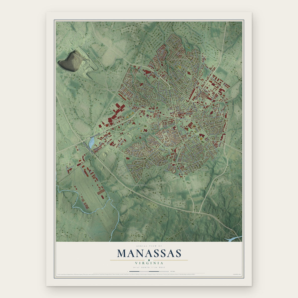
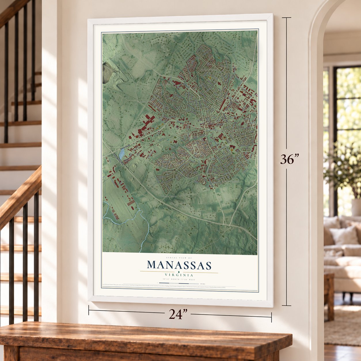
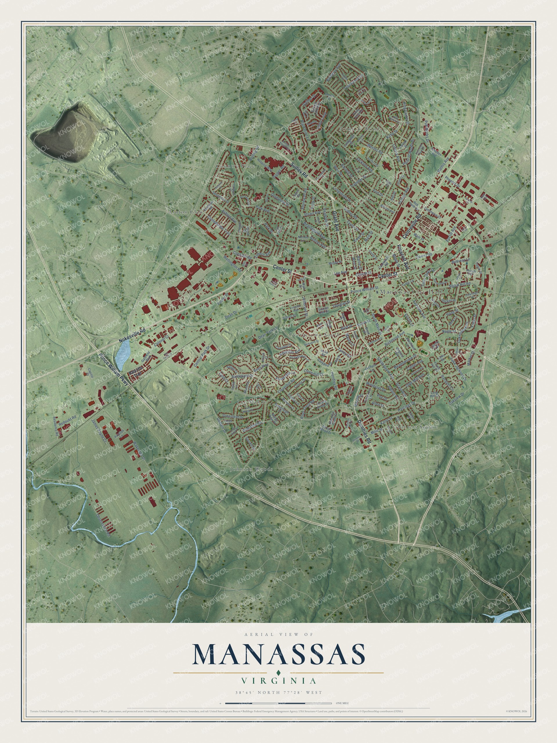
A new map of Manassas, Virginia, made in 2026 and printed to order on thick archival matte paper.
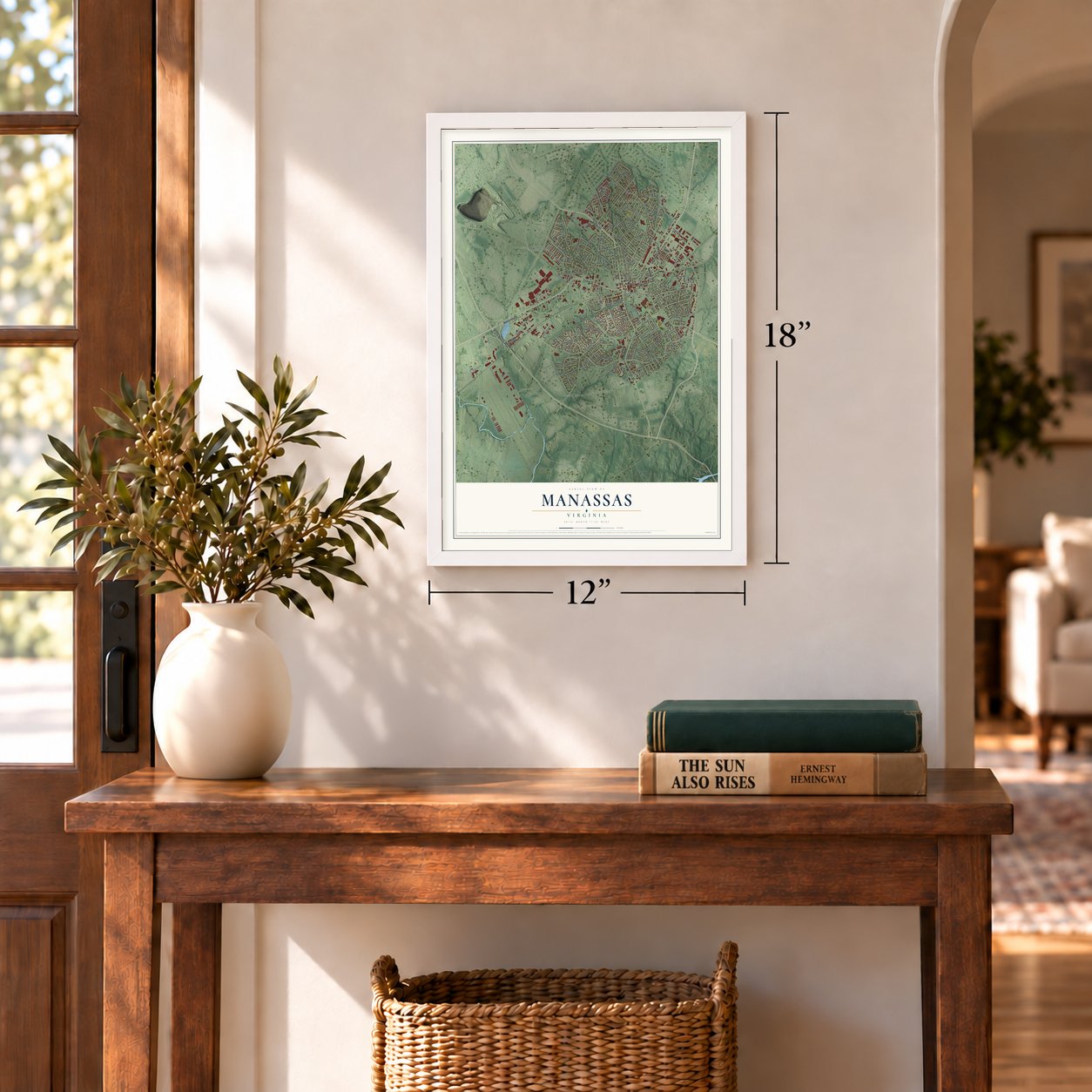
12" x 18" Archival Matte Print
A Map of Home. A Work of Art.
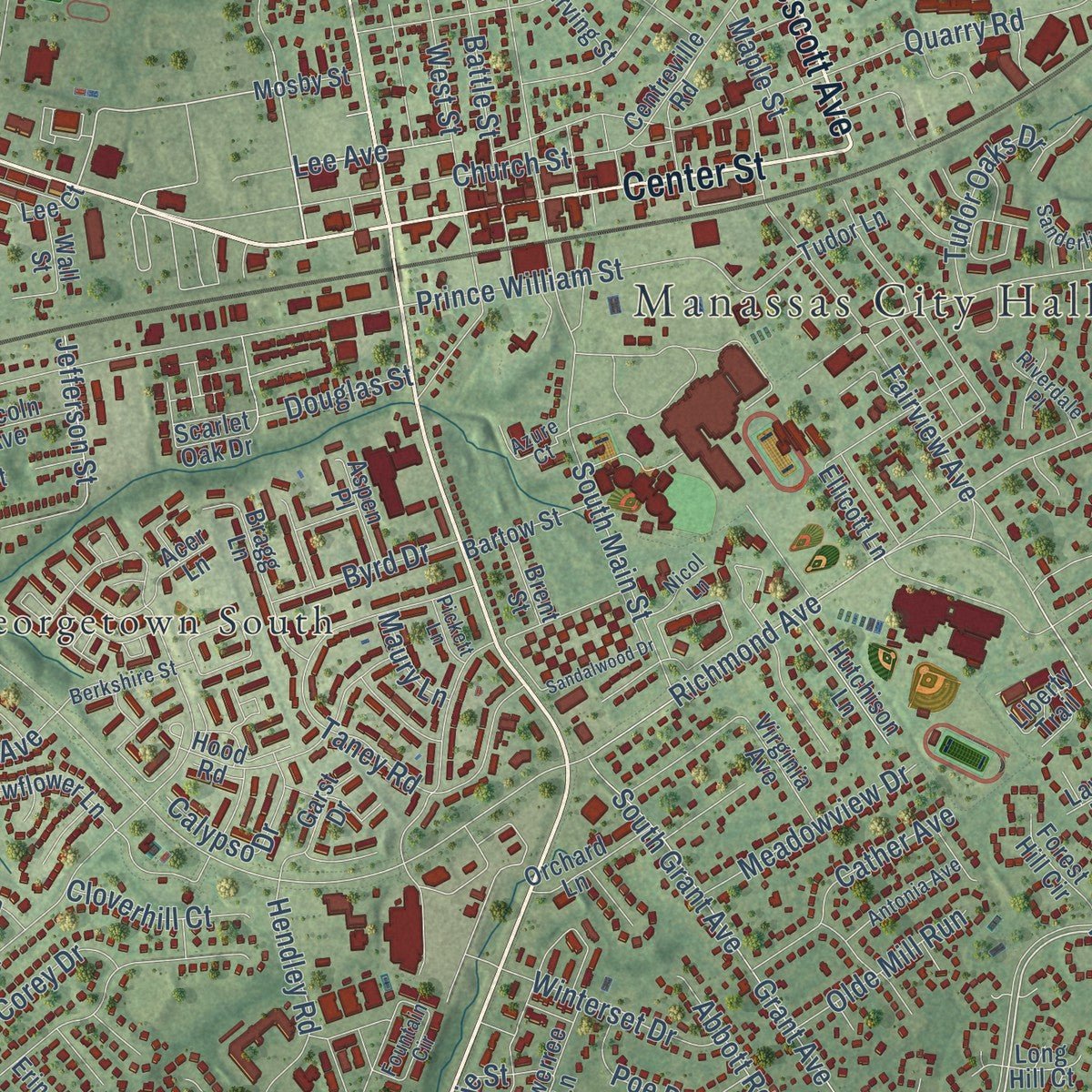
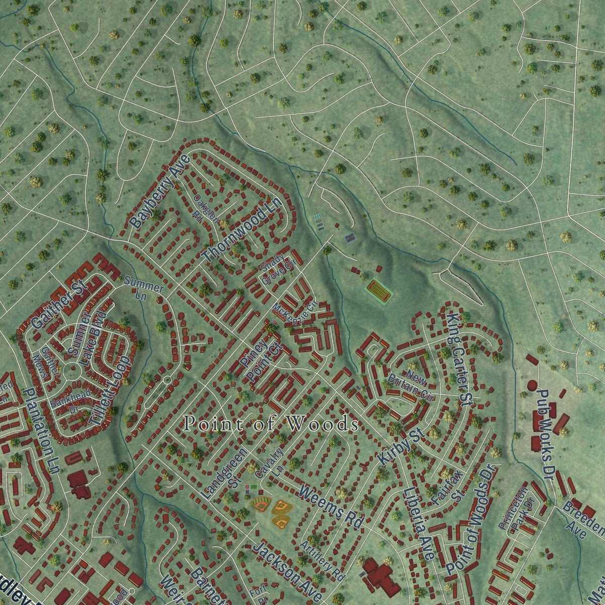
Explore Manassas, Virginia from a whole new perspective. Created using aerial imagery and detailed geographic data, this map captures Manassas building by building, with labeled streets, familiar landmarks, and shaded topographical relief that highlights the natural contours of the landscape.
Combining modern data with the timeless character of a vintage atlas, this map is just as interesting up close as it is beautiful on the wall. Whether you grew up in Manassas, spent memorable years there, or call it home today, this unique map is a great way to celebrate a place that means something to you. Zoom in on the preview to look for your street, and then order a print to put your memories on the wall.
Three ways to hang it
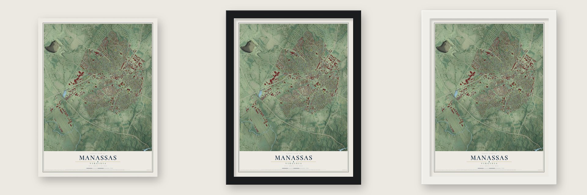
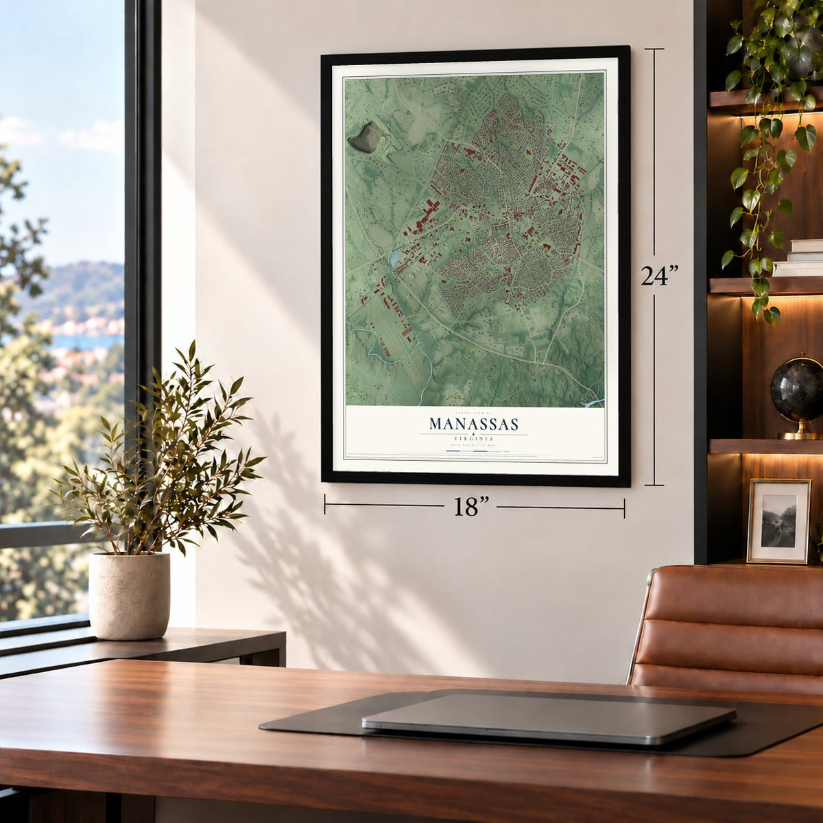
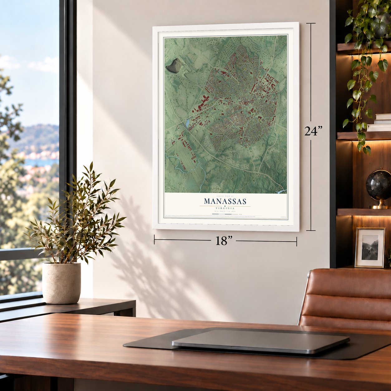
Unframed archival matte, a black wood frame or a white wood frame.
Up close
Geography Worth Displaying
This map was created using accurate cartographic data and authoritative geographic sources, including the U.S. Geological Survey and the Census Bureau. The map brings together terrain, waterways, roads, and building detail. The majority of the streets are labeled, houses are accurately depicted, and the topography is derived from government sources. Combining local data with carefully composed color and shading leads to this beautifully detailed Manassas artwork for your wall.
Rather than simply showing street outlines, we’ve included as many of the street names as we could reasonably fit on the map while keeping their names legible. Zoom in on the high resolution preview to see exactly what’s on the map. We truly set out to create a statement piece for anyone who loves Manassas. So whether it’s for you, or a gift for someone you love, we hope this map of Manassas brings back fond memories.
Read the story behind this map of Manassas, Virginia from 2026.
About Manassas, Virginia
Manassas is an independent city of 42,772 people in Northern Virginia and the county seat of Prince William County. It began in 1851, when a post office and a stop on the Orange and Alexandria Railroad opened at a place called Tudor Hall, after a plantation house nearby. Work soon started on the Manassas Gap Railroad, which branched west from the O&A toward the Shenandoah Valley, and by 1854 it reached Strasburg. In the early 1860s the meeting of the two lines gave the village a new name, Manassas Junction.
That junction had tracks to Richmond, Washington and the Shenandoah Valley, so the small crossing became a prize in the Civil War. The First Battle of Bull Run, the war's first major land battle, was fought nearby in July 1861. The second battle came on August 28 to 30, 1862. The Confederates won both, yet Union forces held the junction for most of the war. Afterward the crossroads grew into a town, which was incorporated in 1873. In 1894 it took the county seat from Brentsville, and in 1975 Manassas became an independent city.
“According to tradition the name Manassas was derived either from an Indian source or from Manasseh, a Jewish innkeeper at Manassas Gap (35 miles west).”
- The Peace Jubilee of 1911From July 16 to July 22, 1911, veterans of both armies came back to Manassas to mark 50 years since the first battle. On July 21 they met and shook hands on Henry House Hill and shared a picnic on the old battlefield. Then they gathered again at the new Prince William County Courthouse to hear President William Howard Taft speak.
- Annaburg, built in 1892Robert Portner built Annaburg in 1892 as his summer home. It is thought to be among the first houses in the United States cooled by mechanical air conditioning. The City of Manassas bought the house in July 2019 to restore it as a public park.
- Manassas Run in 1737The name Manassas first appears on a 1737 land survey, as Manassas Run, and its origin is still uncertain. One idea ties it to Massanutten. Another ties it to the Manahoac, a people who lived in this region.
- A station on an album coverArmies first used railroads on a large scale at Manassas. Its station still sits on the old junction lines, now owned by Norfolk Southern, and serves Virginia Railway Express commuters and three Amtrak routes. Stephen Stills used a photo of the station on the cover of his album Manassas.
Find your street
Names on the Manassas map
Every name below is printed on this map. Look for your street, your school, the park where you played, or the pond down the road.
Places and landmarks8
- Manassas City Hall
- Ashton Glen
- Country Place
- Georgetown South
- Hunters Square
- Johnson Woods
- Lee Manor
- Point of Woods
Streets and roads223
- Grant Avenue
- Center Street
- Prince William Parkway
- Dumfries Road
- Centreville Road
- Nokesville Road
- Prescott Avenue
- Sudley Road
- Peabody Street
- Lee Avenue
- Hastings Drive
- Liberia Avenue
- Fairview Avenue
- Godwin Drive
- Richmond Avenue
- Wellington Road
- Ashton Avenue
- Signal Hill Road
- Stonewall Road
- Observation Road
- Cloverhill Road
- Portner Avenue
- Mathis Avenue
- Prince William Street
- Weems Road
- Quarry Road
- Jackson Avenue
- Waterford Drive
- Park Avenue
- Wakemen Drive
Show all 223 streets
- Weir Street
- Park Street
- West Street
- Confederate Trail
- South Grant Avenue
- Rolling Road
- Euclid Avenue
- Beauregard Avenue
- Taney Road
- Traveller Street
- Fort Drive
- Longstreet Drive
- Oakenshaw Drive
- Plantation Lane
- Foster Drive
- Kirby Street
- Dean Drive
- Battle Street
- Battlefield Drive
- Main Street
- Bayberry Avenue
- Tillett Loop
- South Main Street
- Zimbro Avenue
- Barnett Street
- Lake Jackson Drive
- Church Street
- Hendley Road
- Gaither Street
- Flowerden Lane
- Stuart Avenue
- King Carter Street
- Maple Street
- Yoder Street
- Digges Road
- Abbott Road
- Racquet Circle
- Tudor Oaks Drive
- Greenleaf Drive
- Central Park Drive
- Thornwood Lane
- Cockrell Road
- Cather Avenue
- Dean Park Lane
- Point of Woods Drive
- James Payne Court
- Robnel Avenue
- Meadowview Drive
- Pub Works Drive
- Winterset Drive
- Massie Street
- Karlo Street
- Bens Way
- Haag Street
- Poe Drive
- Corey Drive
- Amaryllis Avenue
- Olde Mill Run
- Early Street
- Calypso Drive
- Oakview Drive
- Byrd Drive
- Nagle Street
- Cloverhill Court
- Gladstone Street
- Colonel Court
- River Crest Road
- Redoubt Road
- Ewell Street
- Jefferson Street
- Trinity Lane
- Milic Street
- Weir Place
- Taylor Street
- Douglas Street
- Buttress Lane
- Phoenix Drive
- Sorrell Drive
- Allen Street
- Market Street
- Field Court
- Maury Lane
- Hill Place
- Ratcliffe Trail
- Mosby Street
- Lee Court
- Sumner Lake Boulevard
- Gateway Boulevard
- Shannon Lane
- Tudor Lane
- Sweetbriar Street
- Landgreen Street
- Virginia Avenue
- Hood Road
- Tapok Drive
- Hospital Way
- Breeden Avenue
- Fairfax Street
- Bragg Lane
- Strawflower Lane
- Nelson Lane
- Magnolia Grove Drive
- Reb Yank Drive
- Residency Road
- Flowerree Lane
- Oliver Court
- School Street
- Azalea Grove Drive
- Hutchison Lane
- Commerce Court
- Scarlet Oak Drive
- Lincoln Avenue
- Kao Circle
- Orchard Lane
- Bartow Street
- Garst Drive
- Forest Hill Circle
- Camphor Court
- Deckert Place
- Hazel Drive
- Amberleigh Court
- Janja Court
- Wilson Avenue
- Sandy Court
- Malvern Court
- Aspen Place
- Liberty Trail
- Placid Street
- Justin Lane
- Spruce Wood Drive
- Burnside Road
- Ellicott Lane
- Vinnia Court
- Manor View Place
- Capitol Court
- Brent Street
- Laws Drive
- Acer Lane
- Aviation Lane
- Irving Street
- Piney Point Court
- Beck Lane
- Wall Street
- Long Hill Court
- Erin Court
- Donner Drive
- Artillery Road
- Fountain Circle
- Libeau Drive
- Cavalry Lane
- Bruton Parish Court
- Forestwood Lane
- Princeton Park Drive
- New Britain Circle
- Sanderling Drive
- Lee Manor Drive
- Metcalf Boulevard
- Antonia Avenue
- Berkshire Street
- Rosewood Street
- Clearridge Lane
- Azure Court
- Riverdale Place
- Broz Court
- Tarragon Court
- Tall Oaks Court
- Summer Lane
- Nicol Lane
- Candy Court
- Sills Court
- Pickett Lane
- Anita Court
- Cedar Ridge Drive
- Sandalwood Drive
- Robson Drive
- Jayhawk Terrace
- Oakglen Road
- Bankhead Drive
- McKenzie Circle
- Shady Grove Circle
- Jerrys Circle
- Manassas Mill Road
- Greengate Court
- Bond Court
- Butternut Street
- Center Point Lane
- Sarajevo Court
- Felsted Lane
- Bus Center Court
- Gaither Mews
- Carmel Way
- Bucyrus Court
- Fort Place
Names are listed as they appear on the printed map. Zoom into the product photos to find them.
The art of mapping a place
How This Map Was Made
Real places. Remarkable detail. Discover the layers that turn geographic data into a map of home.

The view from above
Aerial imagery reveals the character of the land: woodland, open fields, and the patterns of a place.

The shape of the land
Elevation data brings hills, valleys, and subtle changes in the landscape into view.

The details of home
Roads, waterways, and building footprints come together to make the map feel unmistakably local.

Geography becomes art
Considered color, shading, and typography bring the layers together in a map made for your wall.


Process illustrated with Mendon, Massachusetts. Aerial imagery: USDA NAIP. Terrain: USGS 3D Elevation Program. Map details and finished artwork: KNOWOL.
The Details
About This Print
Choose an archival matte print, or a black or white Ayous wood frame. The archival matte print is unframed.
Select your size and finish above to see the matching product image and price.
Materials & Craftsmanship
A contemporary map with the character of a classic atlas, printed on archival matte paper. Optional frames are made from Ayous wood.
Your printed map does not include the watermark shown in the full-map preview.
Shipping & Delivery
Free shipping within the United States. Every print is made to order in the USA.
Buying a gift? Add a note in your cart and we'll include it. We never put prices in the package.
Prints ship within 2 to 3 business days. Allow 7 to 10 days total from ordering for delivery. Timing may vary during holidays or periods of high order volume.
Read our shipping policy.
Returns and damaged prints
Each print is made to order. Change-of-mind refunds are not available after production.
If your print arrives damaged, misprinted or incorrect, contact support@knowol.com within 30 days of receiving it. Include your order number, photos and a description of the issue.
Read our full refund and replacement policy. For questions about your order, email support@knowol.com.
Find your town
Looking for another city?
Find a map of home in our Virginia collection, or any town in the country.
Nearby
Maps of towns near Manassas
Know someone from one of these towns? Their map makes a great gift.
 Buckhall
, Virginia
From $39.99See the map
 Innovation
, Virginia
From $39.99See the map
 Loch Lomond
, Virginia
From $39.99See the map
More maps nearby: Manassas Park, Sudley, Bull Run, Yorkshire and Linton Hall.