
Search for another town





Free U.S. delivery 7 to 10 days after you order
Mansfield, Texas Map Art
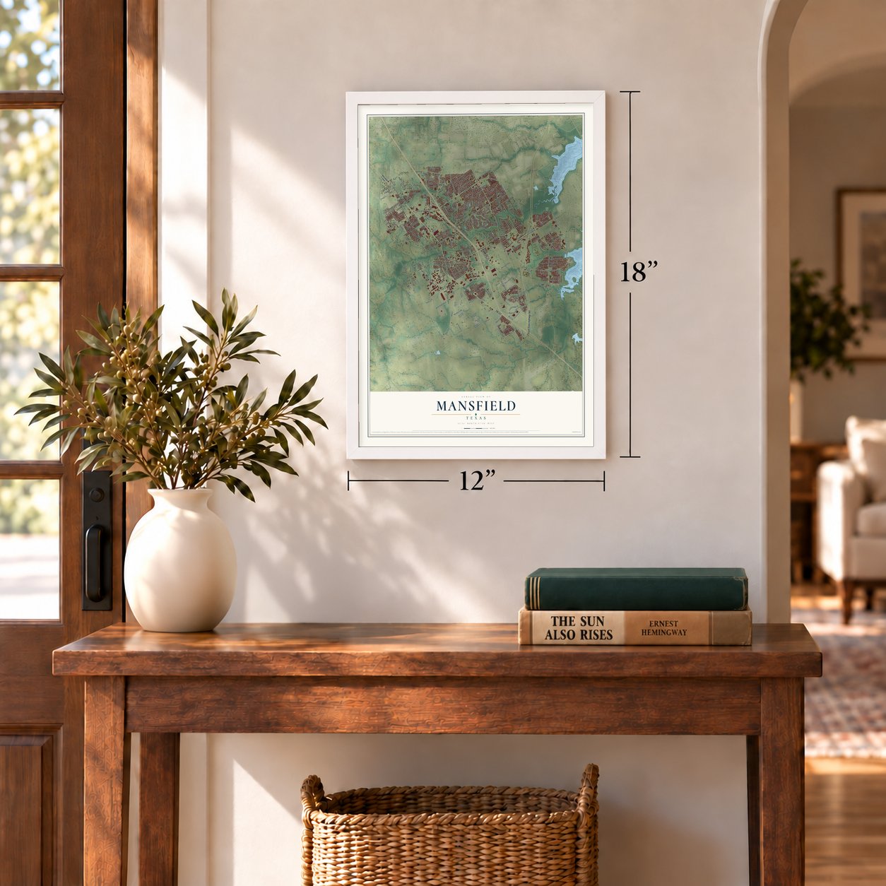
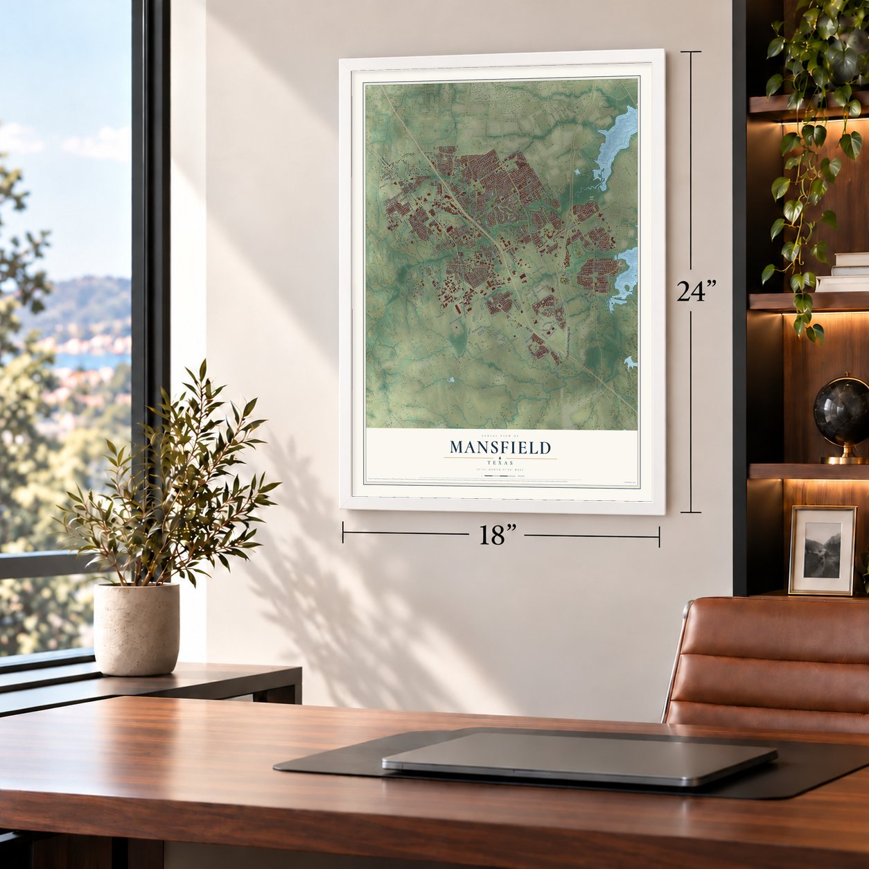
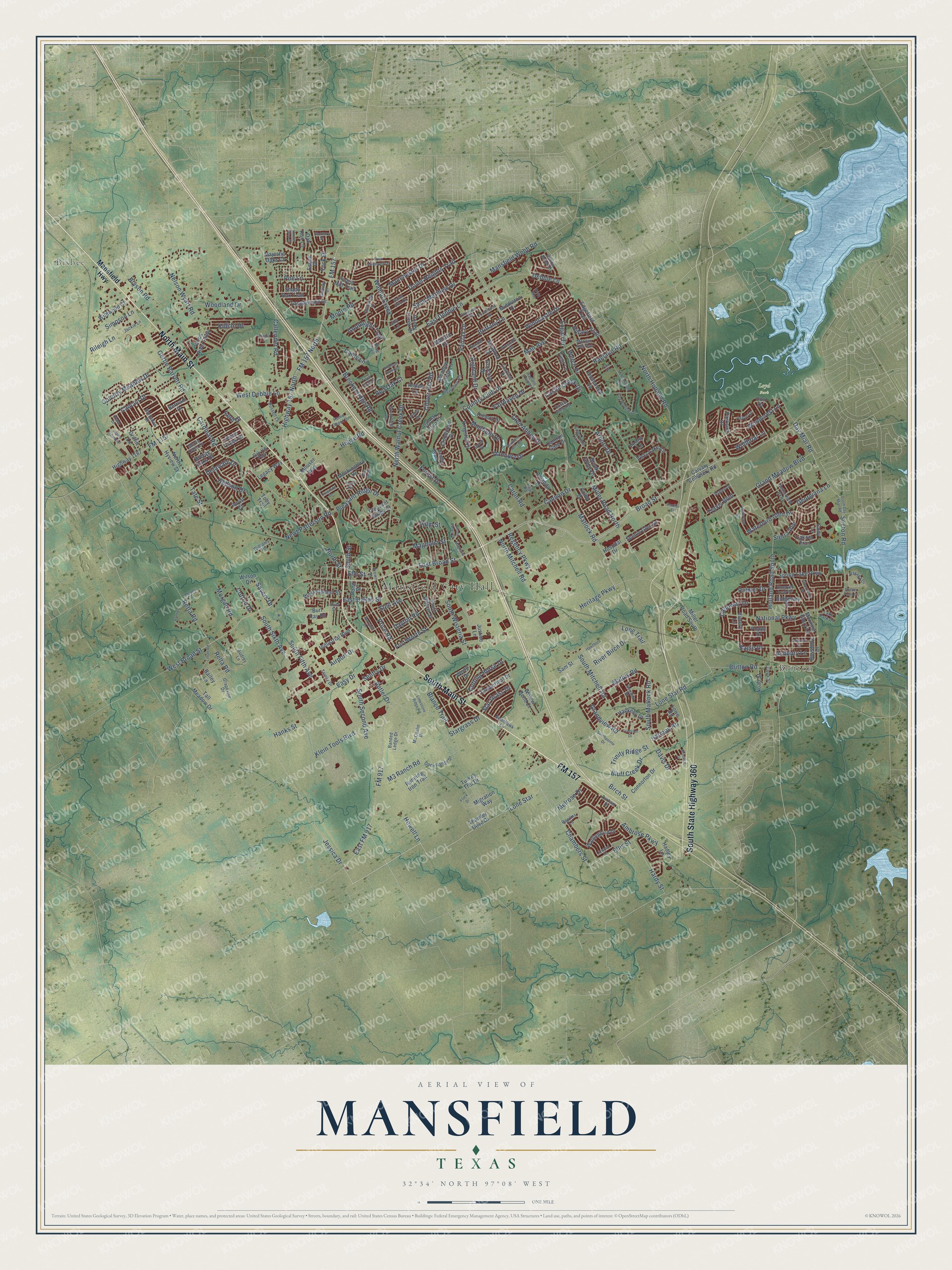
A new map of Mansfield, Texas, made in 2026 and printed to order on thick archival matte paper.
12" x 18" Archival Matte Print
A Map of Home. A Work of Art.
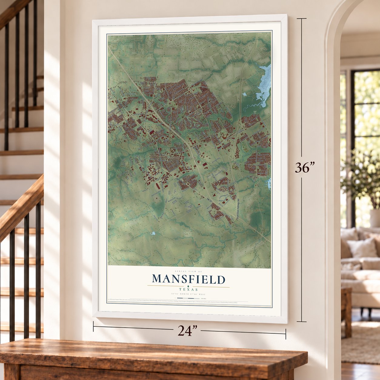
This beautifully detailed map of Mansfield, Texas was created in 2026 using aerial imagery combined with modern topographical, census, street and landmark data. It's a modern aerial view of Mansfield in Tarrant County, Texas, that combines modern data with a vintage aesthetic. Zoom in on the preview and look for your block.
Three ways to hang it
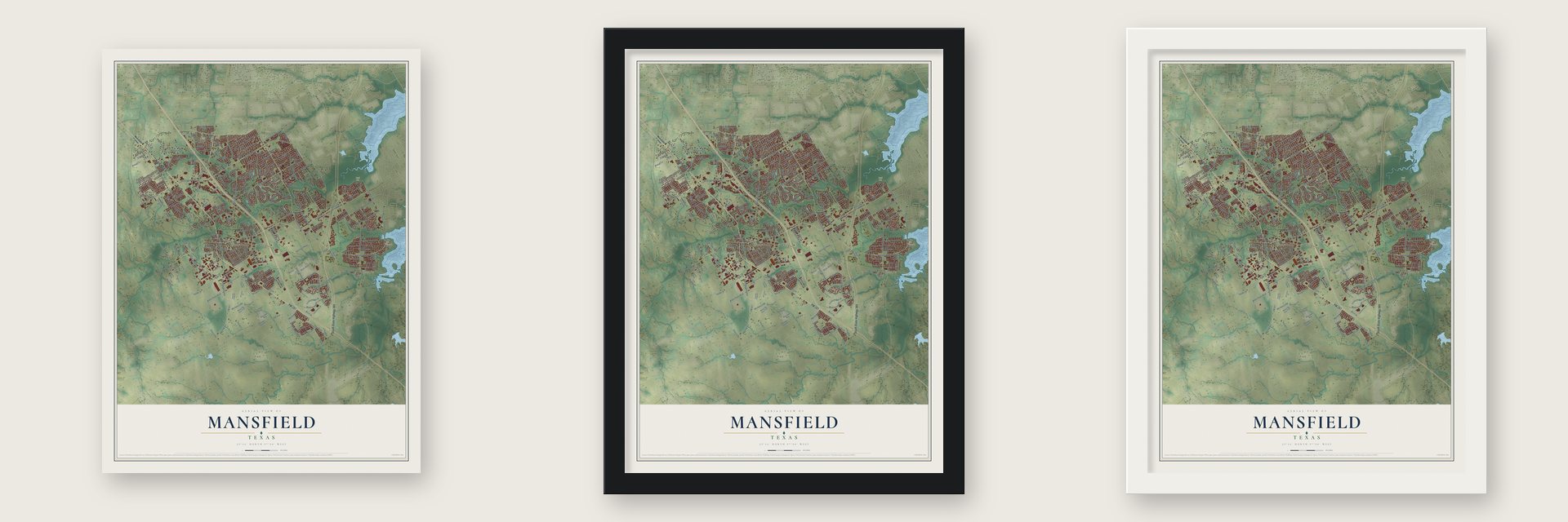
Unframed archival matte, a black wood frame or a white wood frame.
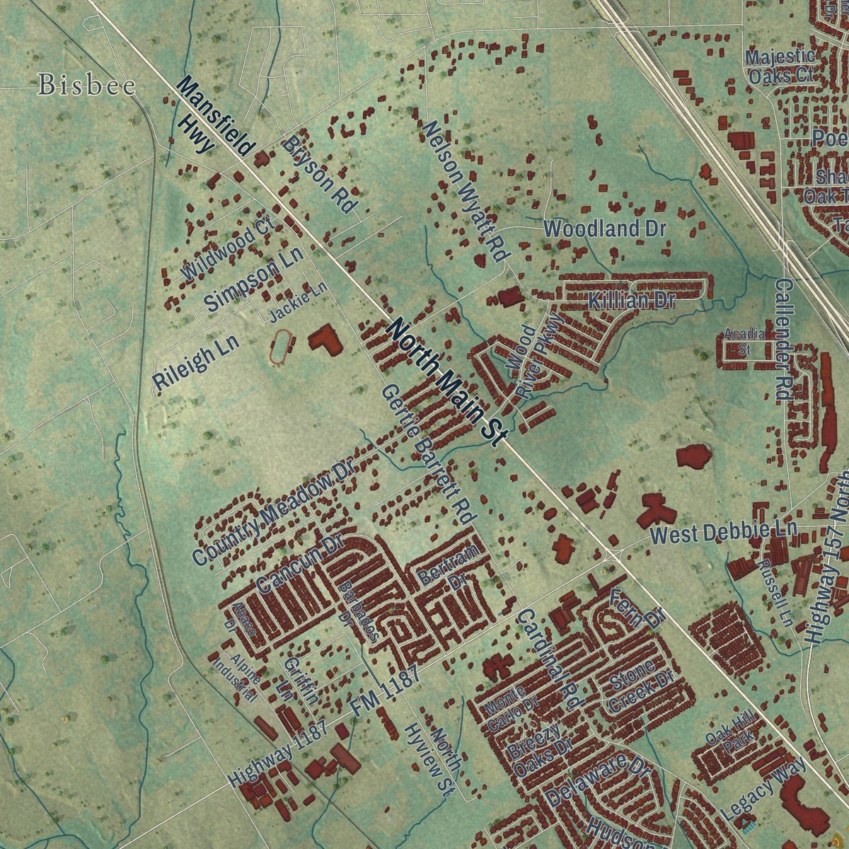
Up close
Real geography. Art worth displaying.
This map was created using accurate cartographic data and authoritative geographic sources, including the U.S. Geological Survey and the Census Bureau. The map brings together terrain, waterways, roads, and building detail. The majority of the streets are labeled, houses are accurately depicted, and the topography is derived from government sources. Combining local data with carefully composed color and shading leads to this beautifully detailed Mansfield artwork for your wall.
Rather than simply showing street outlines, we’ve included as many of the street names as we could reasonably fit on the map while keeping their names legible. Zoom in on the high resolution preview to see exactly what’s on the map. We truly set out to create a statement piece for anyone who loves Mansfield. So whether it’s for you, or a gift for someone you love, we hope this map of Mansfield brings back fond memories.
Read the story behind this map of Mansfield, Texas from 2026.
About Mansfield, Texas
Within Tarrant County, Texas, Mansfield is classified as a city. Its population was 72,602 in the 2020 census. The community record connects that present-day count with the places and history residents recognize locally.
- 72,602 residentsThe Census Bureau recorded this population in 2020.
- Railroad connectionThe Fort Worth and New Orleans Railroad helped shape the community's development.
- Formal incorporationLocal incorporation took effect on August 23, 1890.
- Incorporated in 1890The community formally incorporated in 1890.
Find your street
Names on the Mansfield map
Every name below is printed on this map. Look for your street, your school, the park where you played, or the pond down the road.
Places and landmarks5
- Mansfield City Hall
- Bisbee
- Britton
- Loyd Park
- Oak Hill Park
Streets and roads297
- North Main Street
- South Main Street
- FM 157
- South State Highway 360
- Matlock Road
- East Broad Street
- Broad Street
- Highway 157 North
- Cannon Drive
- West Broad Street
- Jessica Drive
- Miller Road North
- Easy Drive
- Lone Star Road
- Davis Drive
- South Sixth Avenue
- Lone Star
- Ragland Road
- Windcastle Drive
- Harmon Road
- East Debbie Lane
- FM 1187
- Heritage Parkway
- FM 917
- Newt Patterson Road
- South Second Avenue
- North Holland Road
- North Walnut Creek Drive
- Country Club Drive
- Gertie Barrett Road
Show all 297 streets
- South Mitchell Road
- Seeton Road
- Cardinal Road
- Ambrose Parkway
- National Parkway
- Callender Road
- M3 Ranch Road
- Clover Hill Road
- East Dallas Street
- Nelson Wyatt Road
- Holland Road South
- Debbie Lane
- Regency Parkway
- Day Miar Road
- Dover Heights Trail
- West Debbie Lane
- South Fifth Avenue
- Manchester Drive
- Woodcrest Lane
- Birch Street
- Chambers Street
- Cancun Drive
- South Matlock Road
- Airport Drive
- House Road
- South Wisteria Street
- Grand Meadow Boulevard
- North Street
- Fairhaven Drive
- Walnut Creek
- Danbury Drive
- Stargrass Drive
- River Birch Drive
- Carlin Road
- Britton Road
- Mathis Road
- Country Meadow Drive
- Waterford Glen Drive
- FM 157 North
- Klein Tools Boulevard
- Cutting Horse Drive
- Pleasant Ridge Drive
- Mansfield Webb Road
- North Mitchell Road
- Killian Drive
- Stell Avenue
- Retta Road
- Magnolia Street
- Highland Drive
- Glen Abbey Drive
- Fairfax Drive
- Price Road
- Fort Worth Street
- Brittany Lane
- East FM 917
- Muirfield Drive
- Hardy Street
- Ellis Street
- Logan Drive
- Calloway Drive
- Breckenridge Road
- Antler Drive
- Hillary Trail
- Delaware Drive
- Trinity Ridge Street
- Bluff Creek Drive
- Woodland Drive
- Arbors Drive
- Saint Matthew Drive
- Goodnight Trail
- Morgan Road
- Sierra Avenue
- Dayton Road
- Sentry Drive
- Ashbury Lane
- Howell Lane
- Moore Road
- Castle Creek Drive
- Georgiana Lane
- Fern Drive
- Blanco Trail
- Simpson Lane
- Grandview Road
- Wildbriar Lane
- Hudson Drive
- Star Grass Drive
- Bryson Road
- Relta Road
- Poe Lane
- Hanks Street
- Travis Boulevard
- Cotton Drive
- Smith Street
- Man Avenue
- Palmer Drive
- Melrose Drive
- Red Oak Court
- Long Trail
- Sayers Drive
- Eagle Drive
- Forest Drive
- Cains Lane
- Welch Place
- Rileigh Lane
- York Drive
- Tate Street
- Palm Street
- Elm Street
- Mansfield Highway
- Miller Road South
- Penny Lane
- Essex Drive
- Highway 1187
- Rocky Creek Drive
- Spring Lake Parkway
- Calvary Cemetery Road
- Meadow Crest Lane
- Riviera Drive
- Brook Arbor Drive
- Clubhouse Drive
- Mallard Circle
- Connorton Drive
- Kingston Drive
- Vista Lake Circle
- Stratford Drive
- Wallingford Drive
- North Hyview Street
- Shady Oak Trail
- Bertram Drive
- West Kimball Street
- Morning Glory Lane
- Wood River Parkway
- Copperleaf Drive
- Willow Bend Court
- South Willow Street
- Griffin Lane
- Running Iron Trail
- Scenic Glen Drive
- Industrial Boulevard
- Breezy Oaks Drive
- Tanglewood Drive
- Wildwood Court
- Parkside Drive
- Victory Lane
- Hadley Lane
- Poppy Drive
- Hackney Drive
- Migration Way
- Edgefield Trail
- Concord Drive
- Enchanted Lane
- Colby Drive
- Mockingbird Drive
- Amanda Drive
- Forest Mill Trail
- Stone Creek Drive
- Legacy Way
- Thunder Dove Drive
- Wood Drive
- Tall Meadow Drive
- Hospital Drive
- Sam Street
- Field Lane
- Ridgeway Drive
- Lakota Trail
- Noah Street
- Lowe Road
- Aspen Lane
- Wilson Drive
- Bayshore Drive
- Middleton Drive
- Mouser Way
- Pleasant Ridge Court
- Oak Run Lane
- Majestic Oaks Court
- Country Club Court
- Don Drive
- Justice Lane
- Burl Ray Road
- Royal Court
- Pond Street
- Cannon Gate Drive
- Bailey Lane
- Joy Lane
- Turkey Trot Drive
- Toby Trail
- Cody Lane
- Russell Lane
- Rendon Place
- Open Range Drive
- Saint Eric Drive
- Pebble Beach Drive
- Brookfield Lane
- Inverness Road
- Netherfield Parkway
- Morgan Ann Avenue
- Barbados Drive
- Fox Hollow Drive
- Nighthawk Lane
- Willow Brook Drive
- Monte Carlo Drive
- Havana Drive
- Doral Drive
- Paul Road
- McCaslin Drive
- Prescott Drive
- Eastfield Drive
- Trinity Drive
- Grapevine Drive
- Jackie Lane
- Aston Lane
- Williams Place
- Home Depot Drive
- Bent Trail
- Emerald Leaf Drive
- Alamo Drive
- Kendal Drive
- Galway Drive
- Banded Ledge Drive
- Castle View Road
- Lake Park Drive
- Rawlins Lane
- Durham Drive
- Cook Street
- Audrey Lane
- Twin Creek
- Hunt Street
- Brown Street
- Pinon Drive
- South Day Miar Road
- Friedrich Drive
- Rock Meadow Trail
- Southpointe Drive
- Hawthorn Lane
- Limestone Ridge Road
- Alpine Industrial
- Gristmill Drive
- Forestridge Drive
- Waterlane Drive
- Southern Hills Drive
- Berryhill Drive
- Lillian Road
- Valleywood Trail
- Bonner
- McCampbell Road
- Silverwood Drive
- Flock Drive
- Farmington Drive
- Quail Terrace
- Cheyenne Trail
- Ervin Way
- Shady Valley Drive
- Blue Jay Drive
- Magnolia Court
- Yosemite Drive
- Ragland Extended
- Shannon Creek Drive
- Acadia Street
- Moody Drive
- Sailboat Drive
- Linwood Drive
- Stanbury Street
- Hunter Glen Drive
- Abaco Drive
- Conifer Street
- Shelter Point Court
- Park Place
Names are listed as they appear on the printed map. Zoom into the product photos to find them.
The art of mapping a place
How This Map Was Made
Real places. Remarkable detail. Discover the layers that turn geographic data into a map of home.

The view from above
Aerial imagery reveals the character of the land: woodland, open fields, and the patterns of a place.

The shape of the land
Elevation data brings hills, valleys, and subtle changes in the landscape into view.

The details of home
Roads, waterways, and building footprints come together to make the map feel unmistakably local.

Geography becomes art
Considered color, shading, and typography bring the layers together in a map made for your wall.


Process illustrated with Mendon, Massachusetts. Aerial imagery: USDA NAIP. Terrain: USGS 3D Elevation Program. Map details and finished artwork: KNOWOL.
The Details
About This Print
Choose an archival matte print, or a black or white Ayous wood frame. The archival matte print is unframed.
Select your size and finish above to see the matching product image and price.
Materials & Craftsmanship
A contemporary map with the character of a classic atlas, printed on archival matte paper. Optional frames are made from Ayous wood.
Your printed map does not include the watermark shown in the full-map preview.
Shipping & Delivery
Free shipping within the United States. Every print is made to order in the USA.
Buying a gift? Add a note in your cart and we'll include it. We never put prices in the package.
Prints ship within 2 to 3 business days. Allow 7 to 10 days total from ordering for delivery. Timing may vary during holidays or periods of high order volume.
Read our shipping policy.
Returns and damaged prints
Each print is made to order. Change-of-mind refunds are not available after production.
If your print arrives damaged, misprinted or incorrect, contact support@knowol.com within 30 days of receiving it. Include your order number, photos and a description of the issue.
Read our full refund and replacement policy. For questions about your order, email support@knowol.com.
Find your town
Looking for another city?
Find a map of home in our Texas collection.
Nearby
Maps of towns near Mansfield
Know someone from one of these towns? Their map makes a great gift.
 Rendon
, Texas
From $39.99See the map
 The Homesteads
, Texas
From $39.99See the map
 Kennedale
, Texas
From $39.99See the map
More maps nearby: Dalworthington Gardens, Arlington, Cedar Hill, Grand Prairie and Pantego.