
Search for another town



Free U.S. delivery 7 to 10 days after you order
Marysville, Washington Map Art
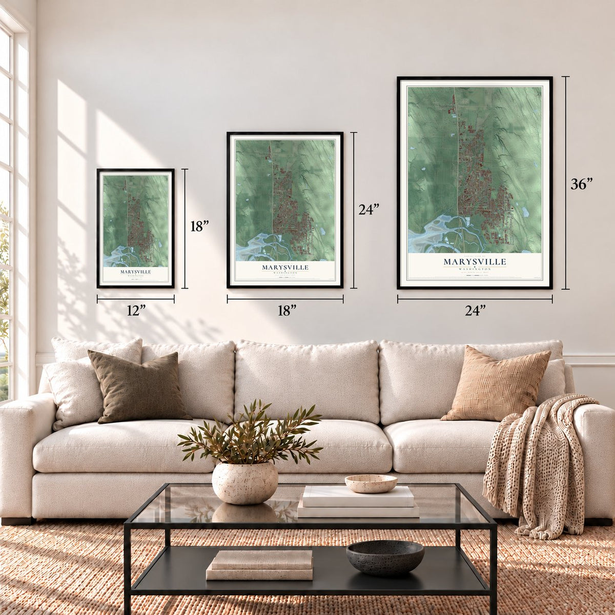
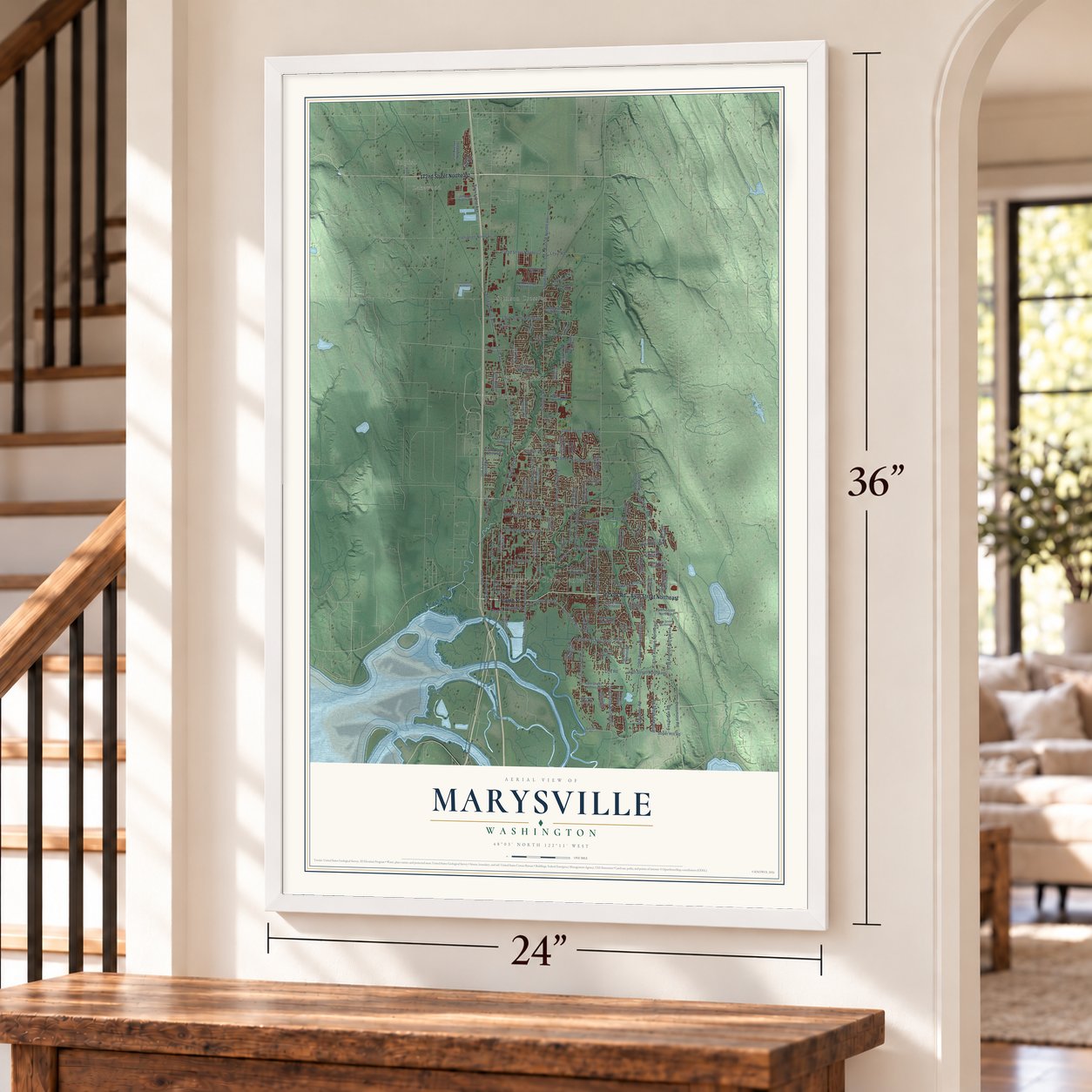
A new map of Marysville, Washington, made in 2026 and printed to order on thick archival matte paper.
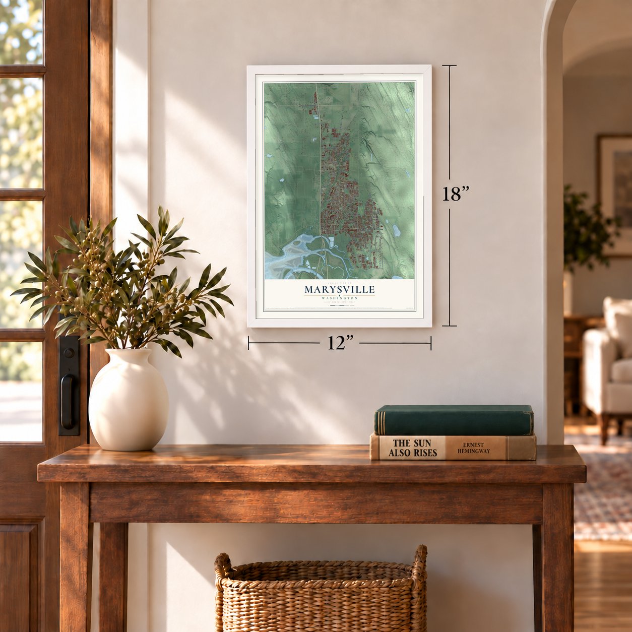
12" x 18" Archival Matte Print
A Map of Home. A Work of Art.
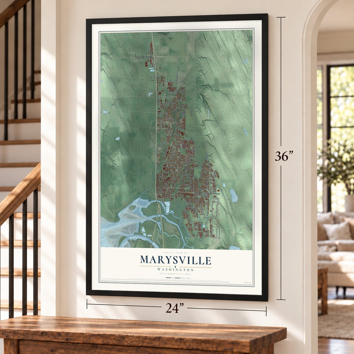
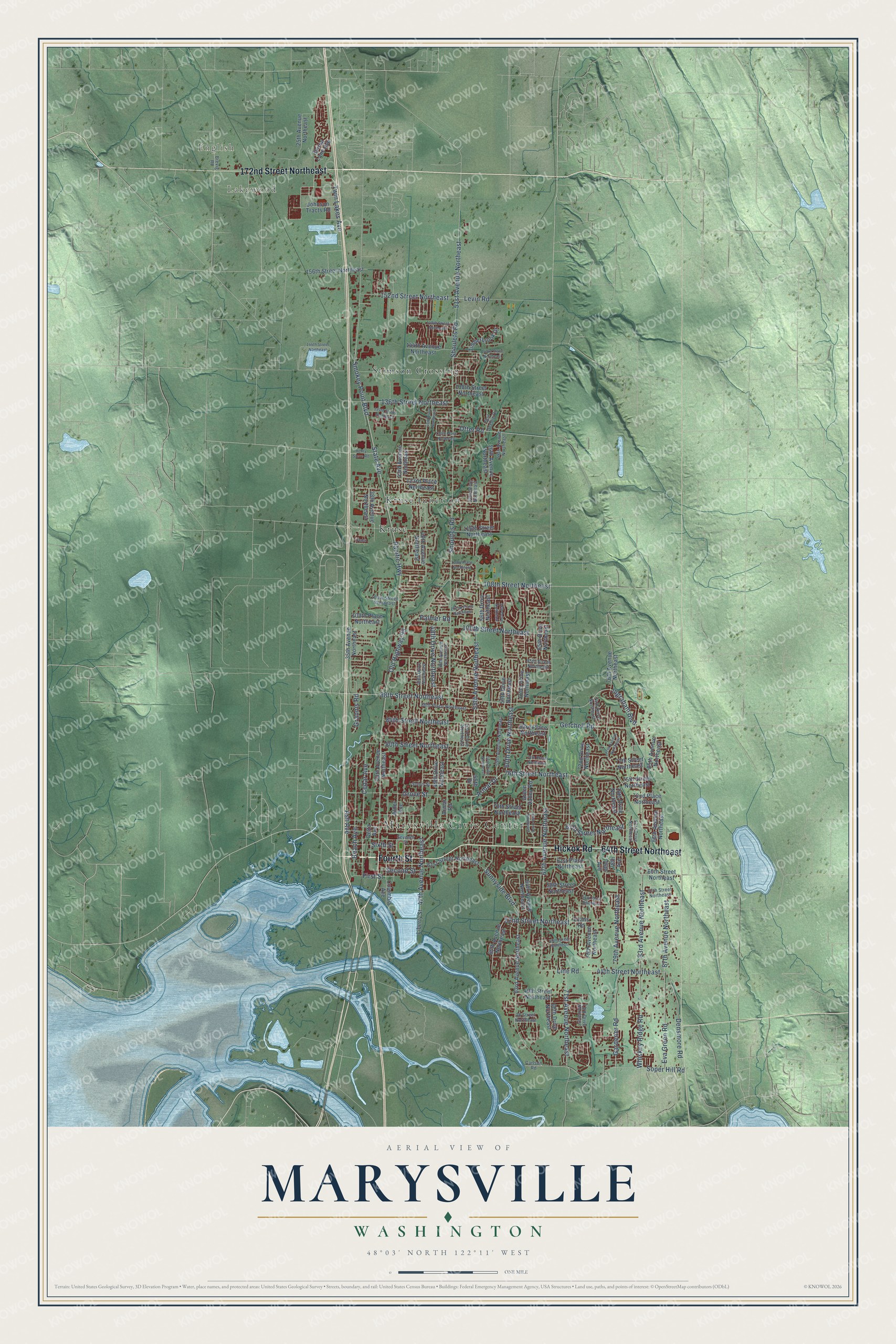
Explore Marysville, Washington from a whole new perspective. Created using aerial imagery and detailed geographic data, this map captures Marysville building by building, with labeled streets, familiar landmarks, and shaded topographical relief that highlights the natural contours of the landscape.
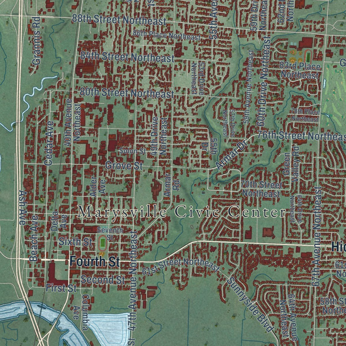
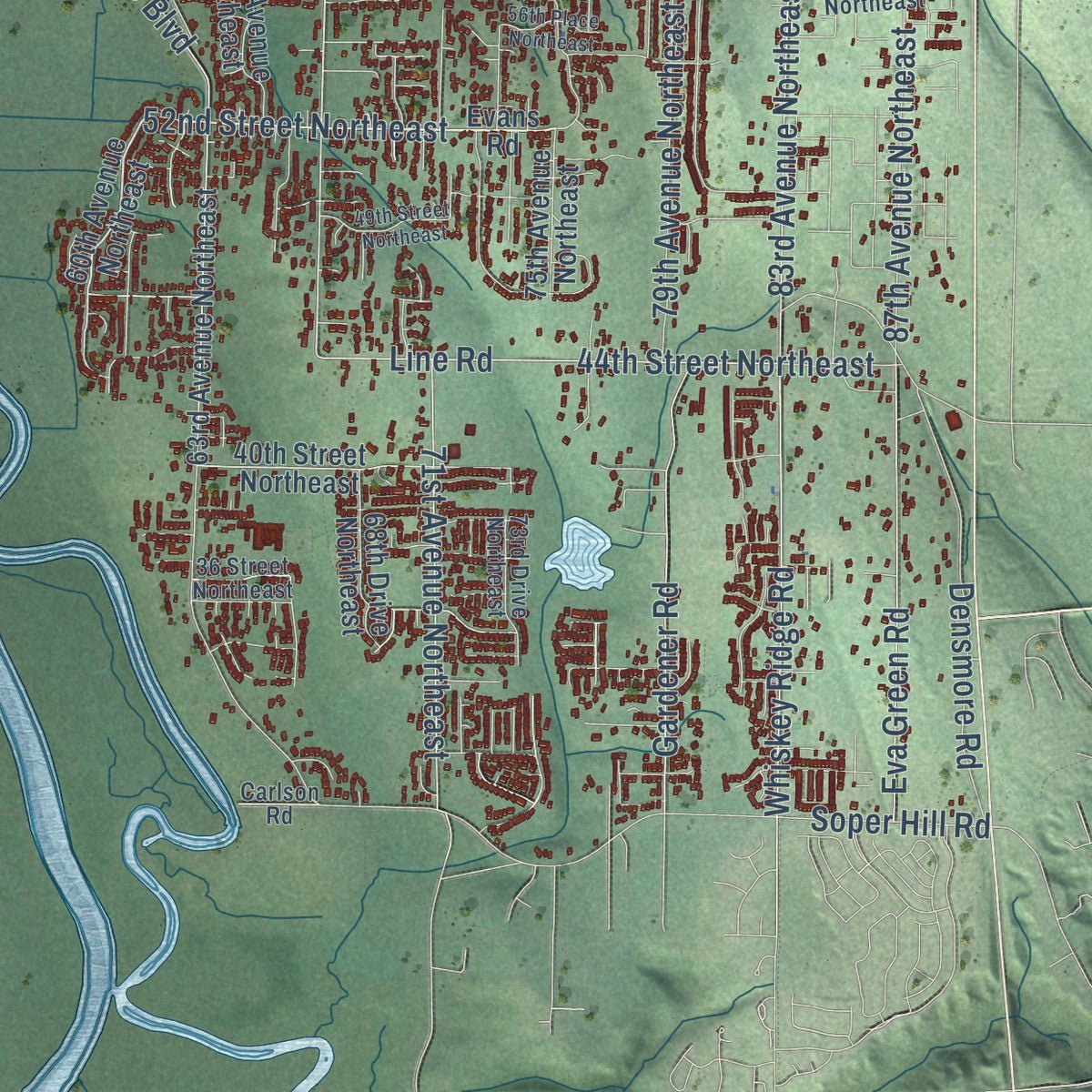
Combining modern data with the timeless character of a vintage atlas, this map is just as interesting up close as it is beautiful on the wall. Whether you grew up in Marysville, spent memorable years there, or call it home today, this unique map is a great way to celebrate a place that means something to you. Zoom in on the preview to look for your street, and then order a print to put your memories on the wall.
Three ways to hang it
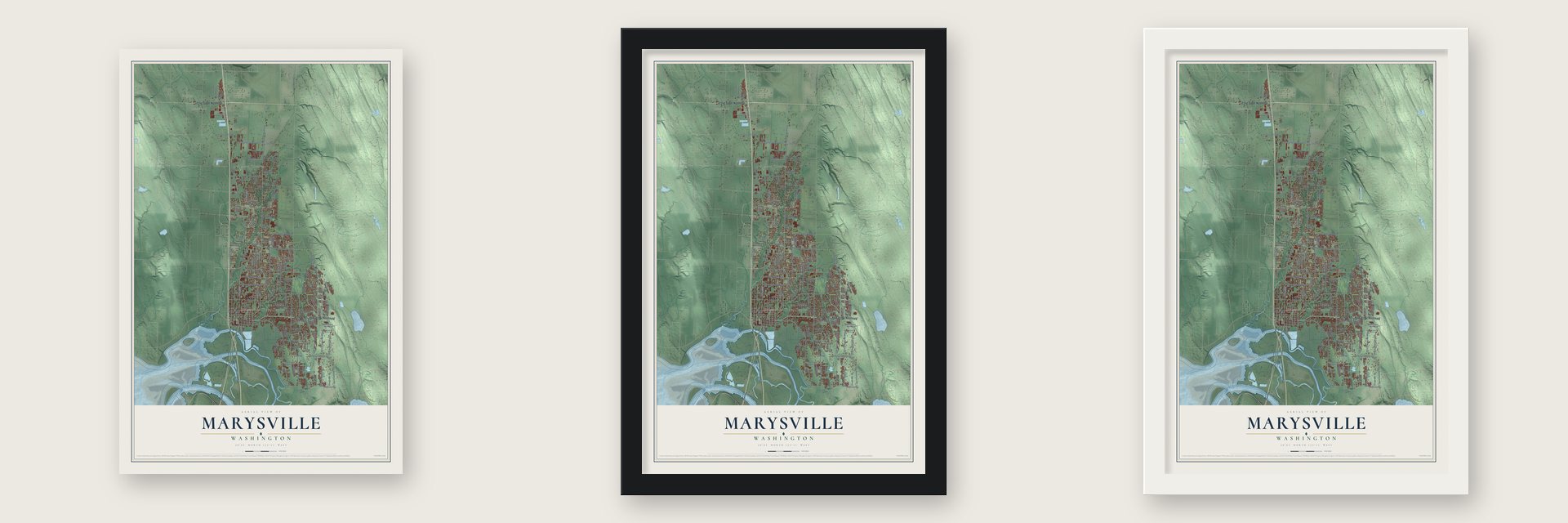
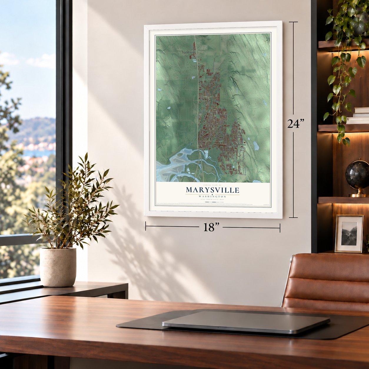
Unframed archival matte, a black wood frame or a white wood frame.
Up close
Geography Worth Displaying
This map was created using accurate cartographic data and authoritative geographic sources, including the U.S. Geological Survey and the Census Bureau. The map brings together terrain, waterways, roads, and building detail. The majority of the streets are labeled, houses are accurately depicted, and the topography is derived from government sources. Combining local data with carefully composed color and shading leads to this beautifully detailed Marysville artwork for your wall.
Rather than simply showing street outlines, we’ve included as many of the street names as we could reasonably fit on the map while keeping their names legible. Zoom in on the high resolution preview to see exactly what’s on the map. We truly set out to create a statement piece for anyone who loves Marysville. So whether it’s for you, or a gift for someone you love, we hope this map of Marysville brings back fond memories.
Read the story behind this map of Marysville, Washington from 2026.

About Marysville, Washington
Marysville is a city of 70,714 people in Snohomish County, five miles north-northeast of Everett. The Point Elliott Treaty, signed at Mukilteo in January 1855, created the Tulalip Indian Reservation just west of here. In the spring of 1872 James Comeford took a government job at the reservation's trading post, where his store did business with the Tulalip people and with the logging camps near the mouth of the Snohomish River.
Around 1874 Comeford paid $450 for 1,280 acres east of the post, logged it for three years, and moved there in the spring of 1878. He built a store, a hotel, a warehouse and a small dock on Ebey Slough, and the Marysville post office opened that year with John Comeford as postmaster. Most now agree the town is named for his wife, Maria. Comeford was its only settler until 1883. The town was platted on February 25, 1885, and on March 20, 1891, Marysville became a city with Mark Swinnerton as its first mayor.
“The earliest berries rode in on the coattails of the earliest pioneers.”
- Ten mills on Ebey SloughE. J. Anderson built the first sawmill in 1887, and three more were running by 1890. By 1906 at least 10 mills were sawing more than a million board feet daily and shipping it from docks on Ebey Slough. The town grew from 728 people in 1900 to 1,239 in 1910.
- The Strawberry CityPeople first saw James Bedford's berries on Getchell Hill as a novelty. By 1910, though, farmers had learned how well strawberries grew in the fertile soil. In the 1920s small family farms planted well over 2,000 acres, and the growers formed a co-op, the Snohomish County Berry Growers Association, to sell the crop. A great freeze in 1955 ruined many of them, and the industry never fully came back.
- Strawberry Festival since 1932The festival started in 1932 as a one-day event to promote the town and its berry fields. By 2007 it ran 10 days during the third week of June and ended with a twilight grand parade. It was called off from 1942 to 1945 for World War II and in 1949 for a polio outbreak.
- A wooden traffic copIn 1917 and 1918 one of Marysville's first traffic officers was made of wood. Pranksters stole him from his post twice, and several cars hit him. Once he was thrown into the Snohomish River to drift with the tide.
- The depot crash of 1969On June 6, 1969, a Great Northern freight train slammed into several loose cars in front of the Marysville depot. The engineer was blamed for ignoring the speed limit. The crash killed two men in an engine on a siding, hurt two others and caused $1 million in damage. The depot had served the town since 1891, and it was torn down and never rebuilt.
Find your street
Names on the Marysville map
Every name below is printed on this map. Look for your street, your school, the park where you played, or the pond down the road.
Places and landmarks6
- Marysville Civic Center
- English
- Lakewood
- Kruse
- Kruse Junction
- Stimson Crossing
Streets and roads140
- Fourth Street
- 64th Street Northeast
- Hickok Road
- 172nd Street Northeast
- State Avenue
- 55th Avenue Northeast
- 88th Street Northeast
- Cedar Avenue
- 76th Street Northeast
- Ingraham Boulevard
- Armar Drive
- 52nd Street Northeast
- 67th Avenue Northeast
- Getchell Road
- 71st Avenue Northeast
- 80th Street Northeast
- Twin Lakes Avenue
- Line Road
- Otter Road
- 51st Avenue Northeast
- Smokey Point Boulevard
- Old Highway 99
- 83rd Avenue Northeast
- Grove Street
- 47th Avenue Northeast
- Pacific Highway
- Shoultes Road
- 60th Drive Northeast
- 87th Avenue Northeast
- Sunnyside Boulevard
Show all 140 streets
- 84th Street Northeast
- 79th Avenue Northeast
- 48th Drive Northeast
- Whiskey Ridge Road
- Eva Green Road
- Shoulets Road
- 152nd Street Northeast
- 100th Street Northeast
- 108th Street Northeast
- 44th Street Northeast
- Soper Hill Road
- Beach Avenue
- 67th Street Northeast
- Ash Avenue
- 136th Street Northeast
- Levin Road
- Gardener Road
- Densmore Road
- First Street
- Sixth Street
- Second Street
- Grannis Road
- Palmer Road
- 60th Avenue Northeast
- 70th Street Northeast
- Evans Road
- 56th Drive Northeast
- 59th Drive Northeast
- 40th Avenue Northeast
- 65th Drive Northeast
- 49th Drive Northeast
- 85th Avenue Northeast
- 61st Street Northeast
- Liberty Street
- 62nd Drive Northeast
- 116th Street Northeast
- Columbia Avenue
- 64th Avenue Northeast
- 63rd Avenue Northeast
- 56th Avenue Northeast
- 72nd Drive Northeast
- 43rd Avenue Northeast
- 86th Avenue Northeast
- 76th Avenue Northeast
- 40th Street Northeast
- Alder Avenue
- 58th Street Northeast
- Armar Road
- 75th Avenue Northeast
- 123rd Place Northeast
- 25th Avenue Northeast
- 68th Drive Northeast
- 38th Avenue Northeast
- 46th Avenue Northeast
- 35th Avenue Northeast
- 83rd Place Northeast
- 156th Street Northeast
- 138th Street Northeast
- 75th Street Northeast
- Johnson Tracts Road
- Spring Lane Avenue
- 78th Drive Northeast
- 144th Avenue Northeast
- 72nd Place Northeast
- 61st Place Northeast
- 76th Avenue
- Timberbrook Drive
- 100th Place Northeast
- 60th Street Northeast
- Green Valley Road
- Delta Avenue
- 77th Street Northeast
- 78th Avenue
- 55th Drive
- Carlson Road
- 54th Drive Northeast
- 74th Drive Northeast
- 81st Drive Northeast
- 46th Drive Northeast
- 73rd Drive Northeast
- 57th Street Northeast
- 53rd Drive Northeast
- 95th Street Northeast
- 50th Avenue Northeast
- 86th Place Northeast
- 59th Avenue Northeast
- Seventh Street
- 58th Avenue Northeast
- 104th Street Northeast
- 36 Street Northeast
- Brevig Road
- Quil Scenic Drive
- Solon Street
- 58th Drive Northeast
- 57th Drive Northeast
- 148th Street Northeast
- 144th Street Northeast
- 47th Drive Northeast
- 77th Avenue Northeast
- 64th Drive Northeast
- 56th Place Northeast
- 78th Place Northeast
- 49th Street Northeast
- 130th Place Northeast
- Henry Steve Road
- 143rd Place Northeast
- 110th Place Northeast
- 102nd Place Northeast
- 134th Street Northeast
- Cedar
Names are listed as they appear on the printed map. Zoom into the product photos to find them.
The art of mapping a place
How This Map Was Made
Real places. Remarkable detail. Discover the layers that turn geographic data into a map of home.

The view from above
Aerial imagery reveals the character of the land: woodland, open fields, and the patterns of a place.

The shape of the land
Elevation data brings hills, valleys, and subtle changes in the landscape into view.

The details of home
Roads, waterways, and building footprints come together to make the map feel unmistakably local.

Geography becomes art
Considered color, shading, and typography bring the layers together in a map made for your wall.


Process illustrated with Mendon, Massachusetts. Aerial imagery: USDA NAIP. Terrain: USGS 3D Elevation Program. Map details and finished artwork: KNOWOL.
The Details
About This Print
Choose an archival matte print, or a black or white Ayous wood frame. The archival matte print is unframed.
Select your size and finish above to see the matching product image and price.
Materials & Craftsmanship
A contemporary map with the character of a classic atlas, printed on archival matte paper. Optional frames are made from Ayous wood.
Your printed map does not include the watermark shown in the full-map preview.
Shipping & Delivery
Free shipping within the United States. Every print is made to order in the USA.
Buying a gift? Add a note in your cart and we'll include it. We never put prices in the package.
Prints ship within 2 to 3 business days. Allow 7 to 10 days total from ordering for delivery. Timing may vary during holidays or periods of high order volume.
Read our shipping policy.
Returns and damaged prints
Each print is made to order. Change-of-mind refunds are not available after production.
If your print arrives damaged, misprinted or incorrect, contact support@knowol.com within 30 days of receiving it. Include your order number, photos and a description of the issue.
Read our full refund and replacement policy. For questions about your order, email support@knowol.com.
Find your town
Looking for another city?
Find a map of home in our Washington collection, or any town in the country.
Nearby
Maps of towns near Marysville
Know someone from one of these towns? Their map makes a great gift.
 Sisco Heights
, Washington
From $39.99See the map
 Lake Cassidy
, Washington
From $39.99See the map
 Lochsloy
, Washington
From $39.99See the map
More maps nearby: Lake Stevens, Arlington, Lake Goodwin, Machias and Everett.