
Search for another town



Free U.S. delivery 7 to 10 days after you order
Middletown, Ohio Map Art
A new map of Middletown, Ohio, made in 2026 and printed to order on thick archival matte paper.
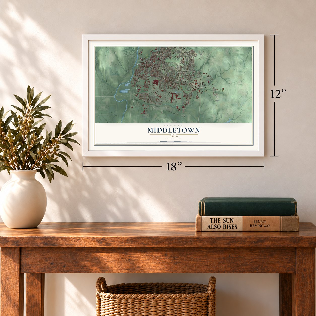
12" x 18" Archival Matte Print
A Map of Home. A Work of Art.
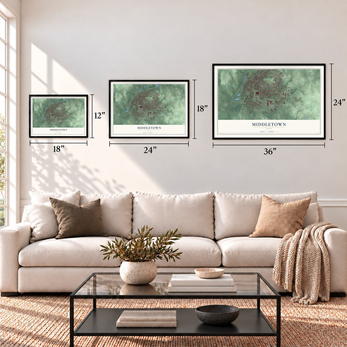
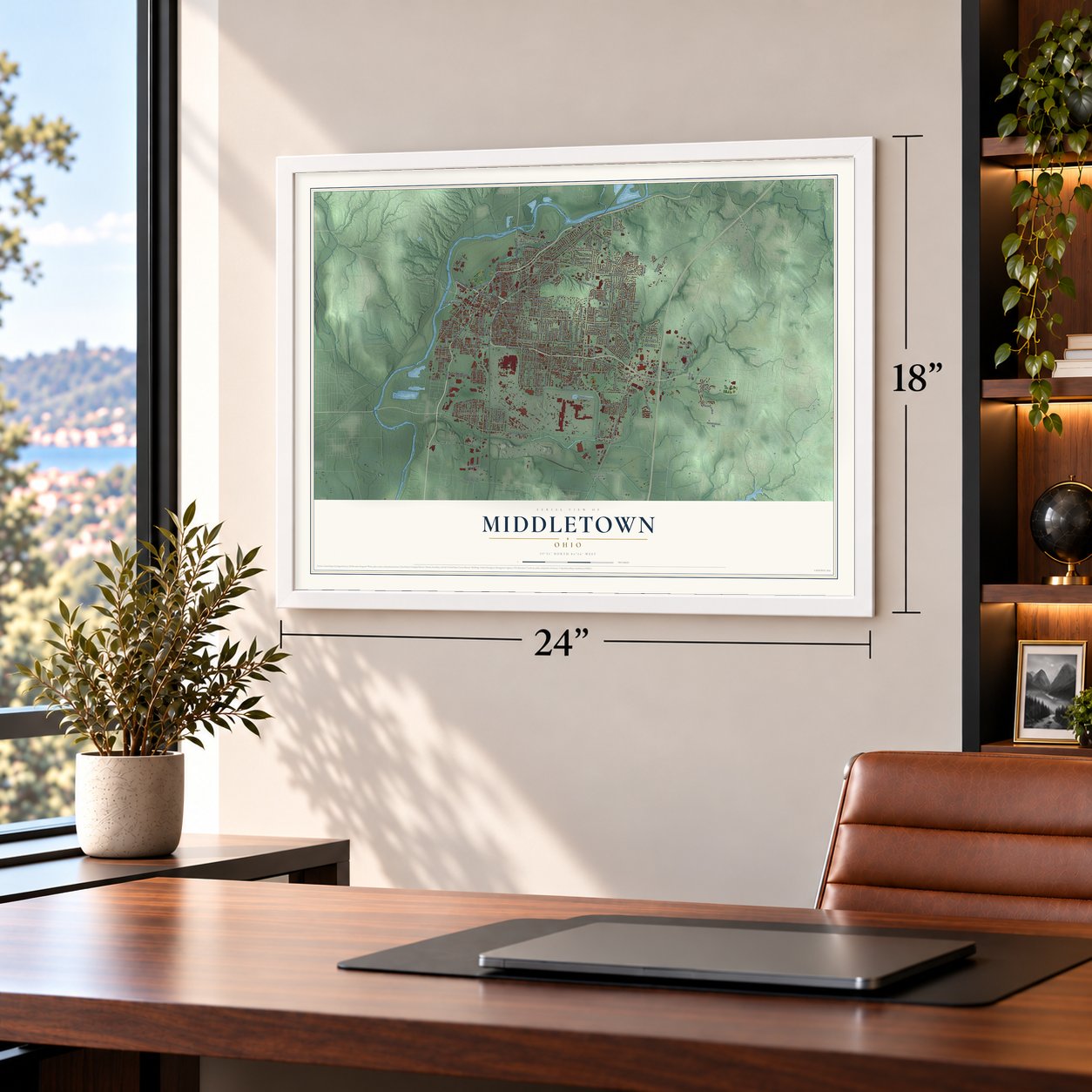
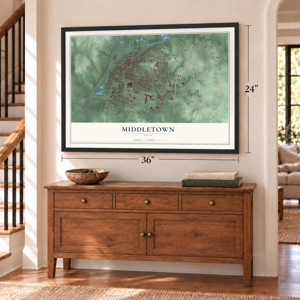
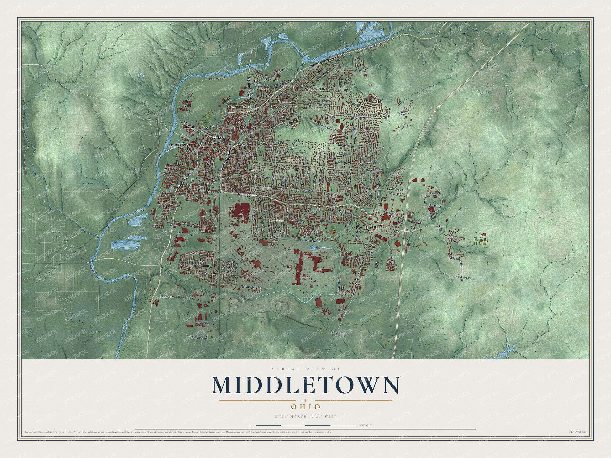
Explore Middletown, Ohio from a whole new perspective. Created using aerial imagery and detailed geographic data, this map captures Middletown building by building, with labeled streets, familiar landmarks, and shaded topographical relief that highlights the natural contours of the landscape.
Combining modern data with the timeless character of a vintage atlas, this map is just as interesting up close as it is beautiful on the wall. Whether you grew up in Middletown, spent memorable years there, or call it home today, this unique map is a great way to celebrate a place that means something to you. Zoom in on the preview to look for your street, and then order a print to put your memories on the wall.
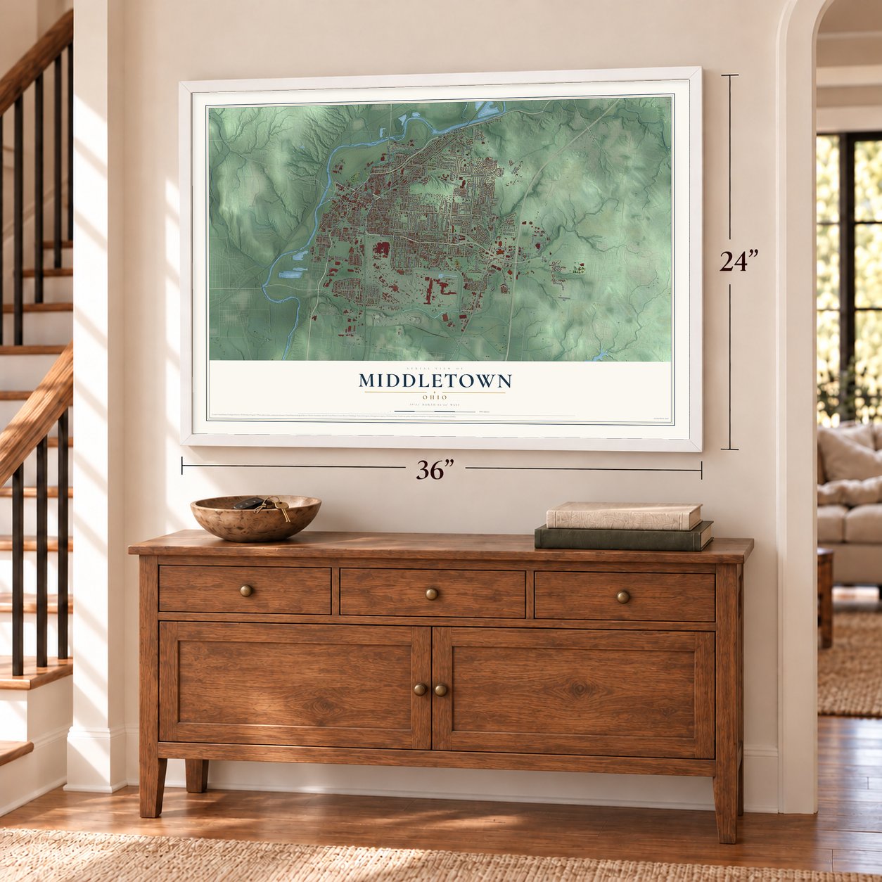
Three ways to hang it
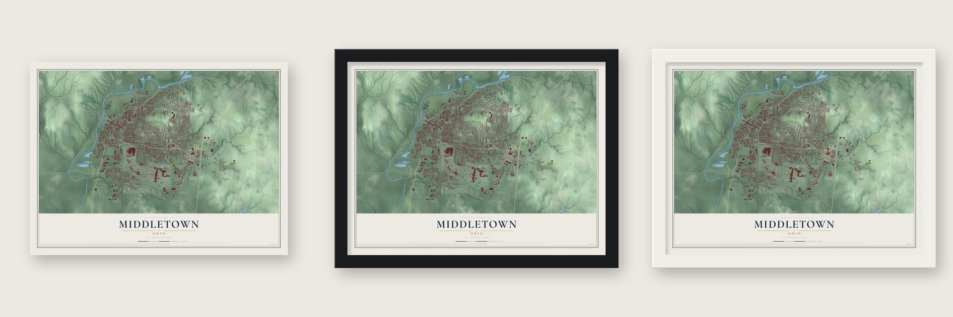
Unframed archival matte, a black wood frame or a white wood frame.
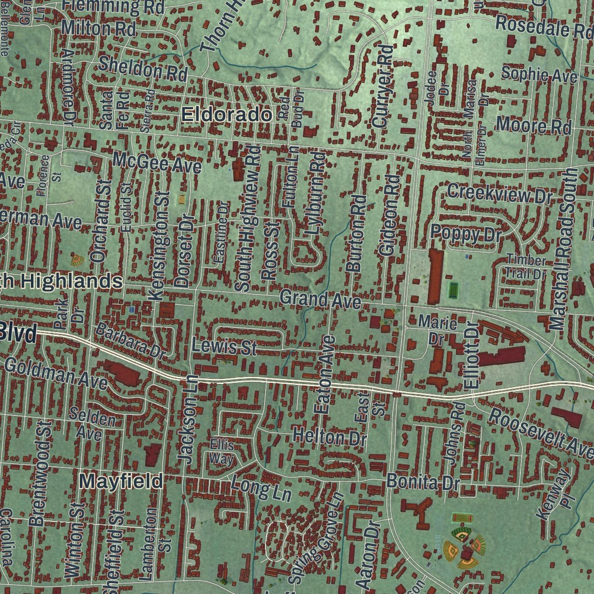
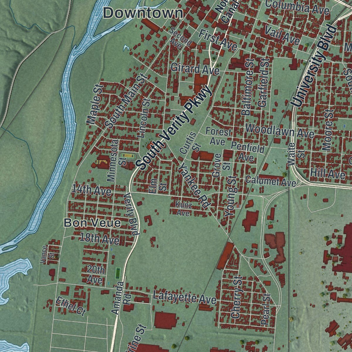
Up close
Geography Worth Displaying
This map was created using accurate cartographic data and authoritative geographic sources, including the U.S. Geological Survey and the Census Bureau. The map brings together terrain, waterways, roads, and building detail. The majority of the streets are labeled, houses are accurately depicted, and the topography is derived from government sources. Combining local data with carefully composed color and shading leads to this beautifully detailed Middletown artwork for your wall.
Rather than simply showing street outlines, we’ve included as many of the street names as we could reasonably fit on the map while keeping their names legible. Zoom in on the high resolution preview to see exactly what’s on the map. We truly set out to create a statement piece for anyone who loves Middletown. So whether it’s for you, or a gift for someone you love, we hope this map of Middletown brings back fond memories.
Read the story behind this map of Middletown, Ohio from 2026.

About Middletown, Ohio
Middletown is a city of 50,987 people in Butler County, on the east bank of the Great Miami River. Its ground was part of the Symmes Purchase, which Judge John Cleves Symmes of New Jersey bought from the Continental Congress in 1788. Stephen Vail Jr. bought land from Symmes and laid out 52 village lots in 1802. Symmes turned out not to own all of the land he had sold, and the Ohio Supreme Court let the sales stand only after Vail's death.
On July 21, 1825, crews broke the first ground for the Miami and Erie Canal right here, and the finished waterway joined Cincinnati on the Ohio River with Toledo on Lake Erie. Farm goods from the region could now reach distant markets, and new settlers and businesses followed. Middletown was incorporated in 1833 and became a city in 1886. Railroads had been pulling trade off the canal since the 1860s, and it finally closed on November 2, 1929, in the same town where it began.
- Named by Stephen VailVail is believed to have chosen the name, but nobody is sure why. One local historian said Vail came from Middletown, New Jersey. Another writer thought it marked the halfway point for boats on the Great Miami, which people then believed could be navigated, and a third idea is that the town sits about halfway between Dayton and Cincinnati. Daniel Doty, one of the first settlers, also came from New Jersey, in the late 18th century.
- A steel town since 1900Middletown was first known for its farms and paper mills. That changed in 1900, when George Verity, founder of the American Rolling Mill Company, or ARMCO, opened a plant here to roll sheet steel. The company later became AK Steel, and the Middletown works still runs today as part of Cleveland-Cliffs. The city won the All-America City award in 1957.
- From canal bed to parkwayA 20-mile branch, the Warren County Canal, carried boats from Middletown to Lebanon from 1830 until floods on Shaker Run wrecked it in 1852. The Great Flood of 1913 ruined most of the main canal around town. Its old bed was paved over to become Verity Parkway, and an Ohio historical marker near Tytus Avenue tells the story. The city opened its Canal Museum in 1982.
- Ohio's first satellite campusMiami University, based in Oxford, opened its Middletown campus in 1966, the first branch campus of any university in Ohio. About 1,500 students enroll there each year.
- Hillbilly Elegy in 2016JD Vance, later Vice President, wrote about his years in Middletown in Hillbilly Elegy, published in 2016. His family had come to the city from Jackson, Kentucky, and the book tells how they struggled as local industry changed and jobs disappeared.
Find your street
Names on the Middletown map
Every name below is printed on this map. Look for your street, your school, the park where you played, or the pond down the road.
Places and landmarks15
- Downtown
- Avalon
- Blue Ball
- Bon Veue
- Eldorado
- Harlan Park
- Lemon
- Mayfield
- North Middletown
- Oakland
- Oneida
- Rose Lawn
Show all 15 places
- South Excello
- South Highlands
- South Middletown
Streets and roads242
- North Verity Parkway
- Reinartz Boulevard
- South Verity Parkway
- Germantown Road
- University Boulevard
- Roosevelt Boulevard
- Dixie Highway
- South Dixie Highway
- Cincinnati Dayton Road
- Manchester Road
- Oxford State Road
- South Sutphin Street
- Central Avenue
- Carmody Boulevard
- Columbia Avenue
- Maple Street
- Breiel Boulevard
- Yankee Road
- Grand Avenue
- Tytus Avenue
- Lefferson Road
- South Main Street
- Rosedale Road
- Riverview Avenue
- Towne Boulevard
- Sherman Avenue
- Bonita Drive
- Wilbraham Road
- Baltimore Street
- Highland Street
Show all 242 streets
- Union Road
- Manchester Avenue
- Jackson Lane
- Lafayette Avenue
- Roosevelt Avenue
- Flemming Road
- Vannest Avenue
- Riviera Drive
- Marshall Road South
- 14th Avenue
- Miller Road
- First Avenue
- Kensington Street
- Orchard Street
- Woodlawn Avenue
- Jewell Avenue
- Young Street
- Lewis Street
- Pendleton Circle
- Finley Street
- Brentwood Street
- Garfield Street
- Fisher Avenue
- Kenec Drive
- Wildwood Road
- Sheffield Street
- Charles Street
- Terry Drive
- Shafor Street
- Aspen Street
- Creekview Drive
- Winona Drive
- Curryer Road
- Moore Street
- Pershing Avenue
- North Main Street
- McGee Avenue
- Todhunter Road
- North Avenue
- Goldman Avenue
- Wicklow Drive
- Holly Avenue
- Forest Hills Drive
- Thorn Hill Lane
- Ronald Drive
- Hill Avenue
- Locust Lane
- Milton Road
- Caprice Drive
- Girard Avenue
- Seneca Street
- Navaho Street
- Omaha Street
- Bernice Avenue
- South Highview Road
- Burton Road
- Gideon Road
- Superior Avenue
- Trine Street
- Eaton Avenue
- Mohawk Street
- Rachel Lane
- Winton Street
- Wellington Road
- Nelson Road
- Victoria Avenue
- Sheldon Road
- Elmo Place
- Moore Road
- Lisa Lane
- Auburn Street
- Ross Street
- Park Lane
- Vail Avenue
- Dorset Drive
- Dix Road
- 18th Avenue
- Commerce Drive
- Gage Drive
- Lylburn Road
- Cherry Street
- Helton Drive
- Atrium Drive
- Hook Drive
- Aaron Drive
- Naldo Lane
- Bexley Drive
- Jennifer Lane
- Elliott Drive
- Poppy Drive
- Judy Drive
- Tullis Drive
- Long Lane
- Nelbar Street
- Atco Avenue
- Kay Drive
- Campus Loop Road
- Marshall Road North
- Curtis Street
- Renaissance Boulevard
- Hendrickson Road
- Jewell Street
- Carolina Street
- Minnesota Street
- Lamberton Street
- Calumet Avenue
- Village Drive
- Arcadia Drive
- Quail Run Road
- Park Drive
- Queen Avenue
- Selden Avenue
- Henry Avenue
- Ardmore Drive
- Spring Grove Lane
- Lincoln Street
- Sunset Street
- Catalpa Drive
- Linden Avenue
- Johns Road
- Fulton Lane
- Grove Street
- Forest Oaks Street
- Pearl Street
- Santa Fe Road
- Stratford Drive
- Forest Avenue
- Made Industrial Drive
- Longford Drive
- Bavarian Drive
- Innovation Drive
- Kilkerry Court
- Sawyer's Mill Drive
- Verity Boulevard
- Waite Street
- Brell Drive
- Eldora Drive
- Glenn Avenue
- Arbor Pointe Drive
- Barbara Drive
- Kenway Place
- Tara Oaks Drive
- Sophie Avenue
- Sharon Court
- Panama Avenue
- Amanda Road
- Penfield Avenue
- Atrium Boulevard
- Market Avenue
- Lesley Lane
- Inland Drive
- Marie Drive
- Autumn Drive
- Audubon Drive
- East Street
- Ohio Avenue
- Elm Street
- Deer Creek
- Ethel Court
- Edith Drive
- Oxford Avenue
- Keays Avenue
- Vinny Drive
- Oaks Circle
- 20th Avenue
- North Canal Street
- Ellen Drive
- Stanley Street
- Euclid Street
- Second Avenue
- Morgan Street
- Ottawa Street
- Oneka Avenue
- Willow Knoll Circle
- Renaissance Park Drive
- Culbertson Road
- Talton Drive
- Timber Trail Drive
- Canterbury Drive
- Henrick Drive
- Kunz Avenue
- Eastline Drive
- Lefferson
- Oakview Drive
- Red Bud Drive
- Enoch Drive
- Whittier Street
- Dover Avenue
- Shafor
- Glen Lane
- Ellis Way
- Coles Road
- Jodee Drive
- Marisa Drive
- Florence Street
- Bellemonte Street
- Berwick Lane
- Shannon Way
- Sierra Road
- Armco Drive
- Pennswood Drive
- Windsor Road
- Richardson Drive
- Alameda Circle
- Barnitz Street
- Emerald Way
- Lowell Street
- Summit Drive
- Harkie Street
- North Elmer Drive
- Vance Street
- Earl Avenue
Names are listed as they appear on the printed map. Zoom into the product photos to find them.
The art of mapping a place
How This Map Was Made
Real places. Remarkable detail. Discover the layers that turn geographic data into a map of home.

The view from above
Aerial imagery reveals the character of the land: woodland, open fields, and the patterns of a place.

The shape of the land
Elevation data brings hills, valleys, and subtle changes in the landscape into view.

The details of home
Roads, waterways, and building footprints come together to make the map feel unmistakably local.

Geography becomes art
Considered color, shading, and typography bring the layers together in a map made for your wall.


Process illustrated with Mendon, Massachusetts. Aerial imagery: USDA NAIP. Terrain: USGS 3D Elevation Program. Map details and finished artwork: KNOWOL.
The Details
About This Print
Choose an archival matte print, or a black or white Ayous wood frame. The archival matte print is unframed.
Select your size and finish above to see the matching product image and price.
Materials & Craftsmanship
A contemporary map with the character of a classic atlas, printed on archival matte paper. Optional frames are made from Ayous wood.
Your printed map does not include the watermark shown in the full-map preview.
Shipping & Delivery
Free shipping within the United States. Every print is made to order in the USA.
Buying a gift? Add a note in your cart and we'll include it. We never put prices in the package.
Prints ship within 2 to 3 business days. Allow 7 to 10 days total from ordering for delivery. Timing may vary during holidays or periods of high order volume.
Read our shipping policy.
Returns and damaged prints
Each print is made to order. Change-of-mind refunds are not available after production.
If your print arrives damaged, misprinted or incorrect, contact support@knowol.com within 30 days of receiving it. Include your order number, photos and a description of the issue.
Read our full refund and replacement policy. For questions about your order, email support@knowol.com.
Find your town
Looking for another city?
Find a map of home in our Ohio collection, or any town in the country.
Nearby
Maps of towns near Middletown
Know someone from one of these towns? Their map makes a great gift.
 Monroe
, Ohio
From $39.99See the map
 Hunter
, Ohio
From $39.99See the map
 Franklin
, Ohio
From $39.99See the map
More maps nearby: Trenton, Carlisle, Jacksonburg, Woodsdale and Springboro.