
Search for another town





Free U.S. delivery 7 to 10 days after you order
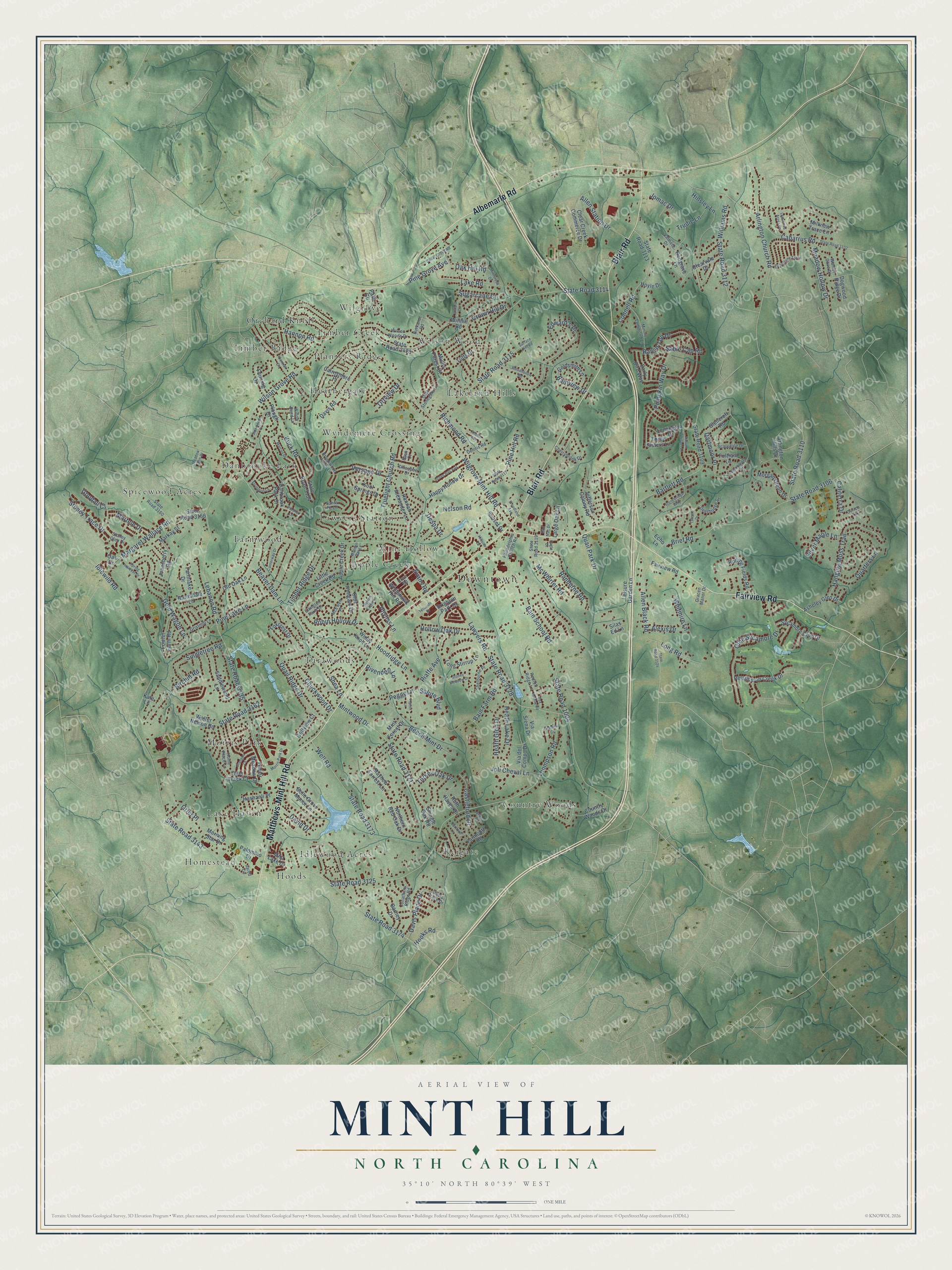
Mint Hill, North Carolina Map Art
Building by building, with labeled streets and shaded relief.
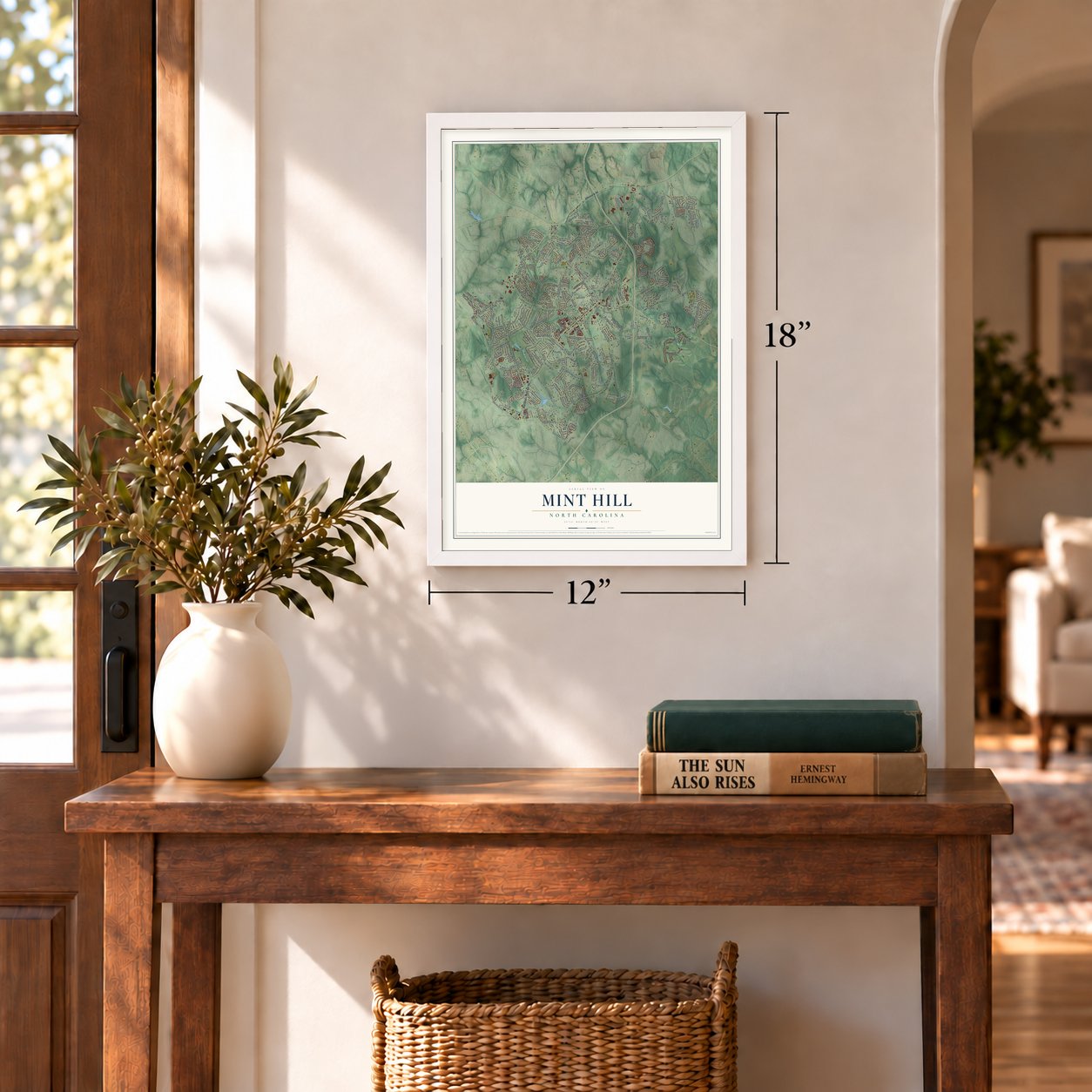
12" x 18" Archival Matte Print
A Map of Home. A Work of Art.
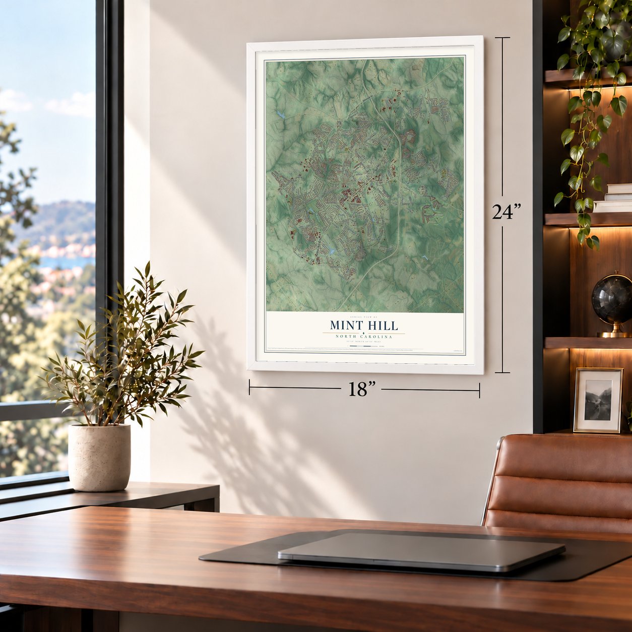
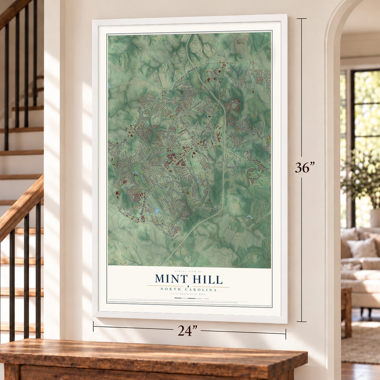
Explore Mint Hill, North Carolina from a whole new perspective. Created using aerial imagery and detailed geographic data, this map captures Mint Hill building by building, with labeled streets, familiar landmarks, and shaded topographical relief that highlights the natural contours of the landscape.
Combining modern data with the timeless character of a vintage atlas, this map is just as interesting up close as it is beautiful on the wall. Whether you grew up in Mint Hill, spent memorable years there, or call it home today, this unique map is a great way to celebrate a place that means something to you. Zoom in on the preview to look for your street, and then order a print to put your memories on the wall.
Three ways to hang it
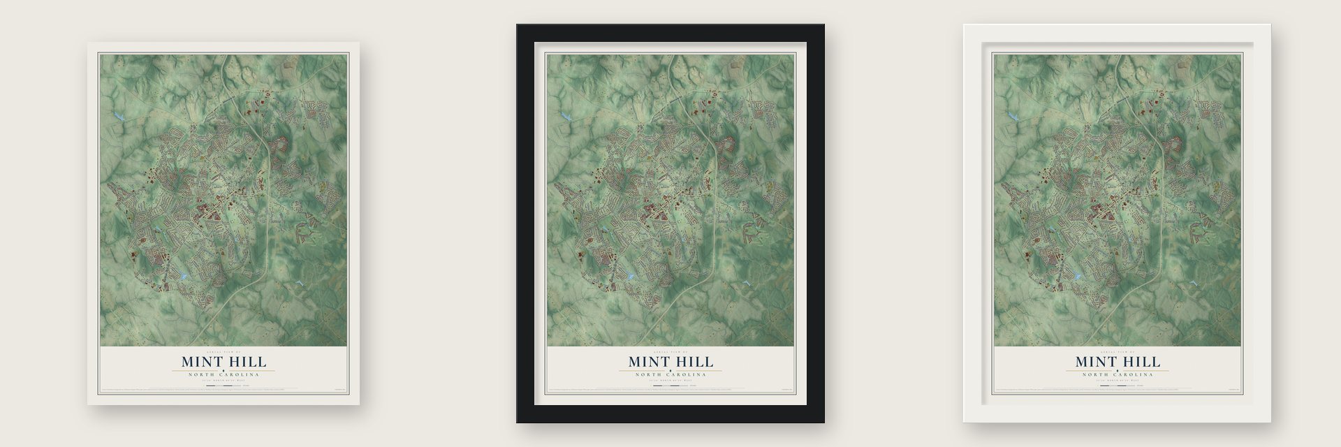
Unframed archival matte, a black wood frame or a white wood frame.
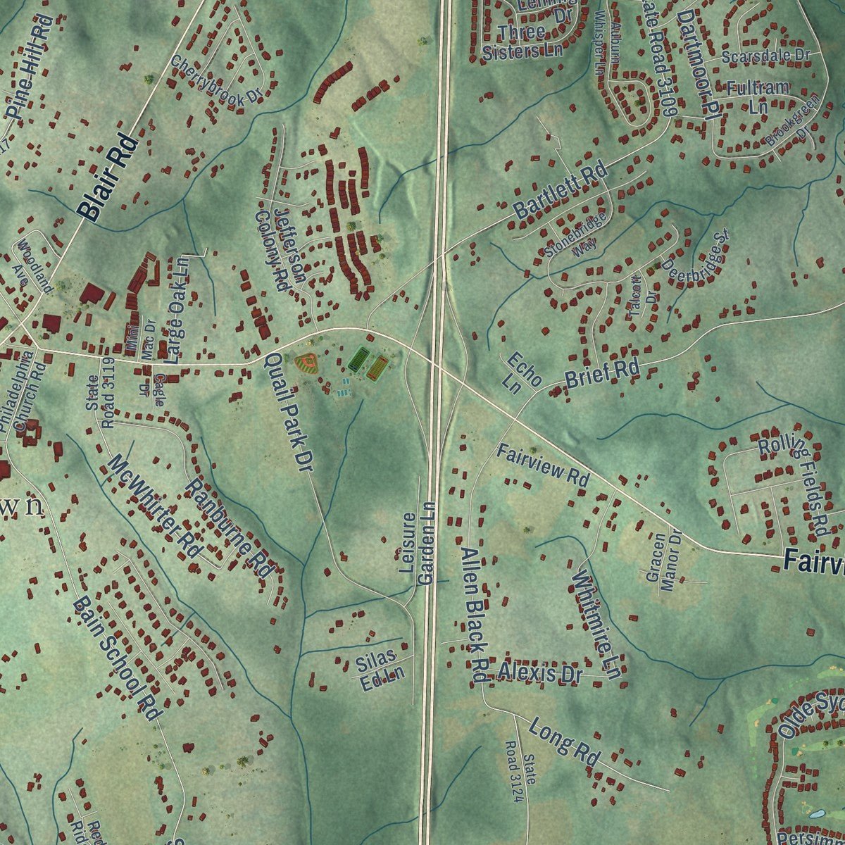
Up close
Geography Worth Displaying
This map was created using accurate cartographic data and authoritative geographic sources, including the U.S. Geological Survey and the Census Bureau. The map brings together terrain, waterways, roads, and building detail. The majority of the streets are labeled, houses are accurately depicted, and the topography is derived from government sources. Combining local data with carefully composed color and shading leads to this beautifully detailed Mint Hill artwork for your wall.
Rather than simply showing street outlines, we’ve included as many of the street names as we could reasonably fit on the map while keeping their names legible. Zoom in on the high resolution preview to see exactly what’s on the map. We truly set out to create a statement piece for anyone who loves Mint Hill. So whether it’s for you, or a gift for someone you love, we hope this map of Mint Hill brings back fond memories.
Read the story behind this map of Mint Hill, North Carolina from 2026.

Find your street
Names on the Mint Hill map
Every name below is printed on this map. Look for your street, your school, the park where you played, or the pond down the road.
Places and landmarks24
- Downtown
- Apple Creek
- Country Woods
- Danbrooke Park
- Farmwood
- Heathergate
- Homestead
- Hoods
- Idlewood Acres
- Lake Haven
- Lakeland Hills
- Lawyers Station
Show all 24 places
- Mint Hollow
- Morris Park
- Orchard Knoll
- Planters Ridge
- Reigate
- Spicewood Acres
- Tarawoods
- Timber Creek
- Timber Ridge
- Wilgrove
- Wilson Wood
- Wyndemere Crossing
Streets and roads250
- Matthews-Mint Hill Road
- Blair Road
- Fairview Road
- Albemarle Road
- State Road 1004
- Lawyers Road
- Idlewild Road
- State Road 3135
- State Road 3128
- State Road 3114
- Truelight Church Road
- State Road 3143
- Lebanon Road
- State Road 3125
- Thompson Road
- Wilgrove Mint Hill Road
- Arlington Church Road
- State Road 3110
- Bain School Road
- Wilson Grove Road
- Bartlett Road
- Brief Road
- State Road 3106
- State Road 3174
- Cabarrus Road
- Edward's Place
- Joli Cheval Lane
- Raven Top Drive
- Gold Wagon Lane
- State Road 3112
Show all 250 streets
- Williams Road
- Olde Sycamore Drive
- Quail Ridge Drive
- Pine Lake Lane
- Well Road
- Piaffe Avenue
- Allen Black Road
- Margaret Wallace Road
- Quail Park Drive
- Hollow Oak Drive
- Mintwood Drive
- Kuck Road
- Connell Road
- State Road 3173
- Hanging Moss Trail
- State Road 3171
- Nelson Road
- Pumpkin Way Drive
- Robin Hollow Drive
- Beaver Dam Lane
- Lake Road
- Allen Station Drive
- Crown Hill Drive
- Silver Maple Lane
- Ranburne Road
- Peggy Lane
- McWhirter Road
- Davis Place Drive
- State Road 3162
- Castleford Drive
- Singletree Road
- Meadow Hollow Drive
- Heath Lake Drive
- Timber Ridge Drive
- Oak Hill Road
- Phyliss Lane
- Hannon Road
- Turkey Oak Drive
- State Road 3115
- Chuckwood Drive
- Heath Glen Drive
- Pine Hill Road
- Beech Mint Drive
- Dartmoor Place
- Whitmire Lane
- Versage Drive
- Quarters Lane
- Shea Lane
- Stoney Trace Drive
- Hinsley Lane
- Pine Grove Avenue
- Bain Farm Road
- Bainview Drive
- Long Road
- Trudie Lane
- Hoodridge Lane
- Birchill Road
- Richmond Road
- Salute Boulevard
- Evans Road
- Sable Cap Road
- Sugarcane Court
- Martele Drive
- David Drive
- Alexis Drive
- Goodall Court
- Caliterra Drive
- Rivendell Lane
- Jomac Drive
- Orrview Drive
- Hooks Road
- Despa Drive
- Grier Place
- State Road 3109
- State Road 3156
- State Road 3428
- Willhill Road
- State Road 3134
- State Road 3113
- Clear Creek Commerce Drive
- Old Oak Lane
- Davis Road
- Danbrook Park Drive
- Walter Nelson Road
- Rolling Fields Road
- Foxcrest Drive
- Hashanli Place
- Jefferson Colony Road
- Redgrave Lane
- Apple Creek Drive
- Park Circle
- Millview Trace Lane
- Clearvale Drive
- Saddlewood Lane
- Yarmouth Road
- Whitehawk Hill Road
- Arlington Hills Drive
- Belle Grove Manor Lane
- Long Stirrup Lane
- Brighton Park Drive
- Happy Hollow Drive
- Persimmon Creek Drive
- Telfair Meadow Drive
- Sycamore Club Drive
- Via Siena Drive
- Windy Knoll Lane
- Early Bird Way
- Country Woods Drive
- Goldsmith Lane
- Tufts Drive
- Morgan Glenn Drive
- Asheley Glen Drive
- Northern Red Oak Drive
- Little Creek Road
- Glencroft Road
- Large Oak Lane
- Fowler Farm Road
- Kool Springs Drive
- Leisure Garden Lane
- Jonesberry Road
- Markay Street
- Shingle Oak Road
- Sunset Drive
- Three Sisters Lane
- Fenning Drive
- Mint Lake Drive
- Via del Compo Drive
- Olde Irongate Lane
- Morning Star Drive
- Hannah Alexander Lane
- Cairnsmore Place
- Ruth Haven Drive
- Mayhew Forrest Lane
- Barnsdale Lane
- Barney Drive
- Fultram Lane
- Farmlake Drive
- Plough Drive
- Golfview Court
- Deer Track Court
- Palomino Drive
- Mullis Forest Court
- Lemington Drive
- Mint Forest Drive
- Dogwood Ridge Drive
- Oak Drive
- Hoyle Drive
- Silas Ed Lane
- Kale Lane
- Echo Lane
- Minnie Lemmond Lane
- State Road 3119
- Davis Trace Drive
- Wilson Woods Drive
- Stoney Glen Drive
- Cherrybrook Drive
- Olde Stonegate Lane
- Home Place Lane
- Gristmill Lane
- Brookwood Valley Lane
- Shelburne Place
- Walnut Cove Drive
- State Road 3160
- McEwen Place
- Jonathans Ridge Road
- Scarsdale Drive
- Hove Road
- Deerbridge Street
- Philadelphia Church Road
- Chicopee Drive
- Dennis Road
- Curico Lane
- Redfox Ridge Lane
- Willow Bend Lane
- Gracen Manor Drive
- Valmere Drive
- Santa Fe Lane
- Burkandt Road
- Ellington Farm Lane
- Jared Circle
- Bask Court
- State Road 3102
- Stonebridge Way
- Surface Hill Road
- Auburn Whisper Lane
- State Road 3117
- Central Drive
- State Road 3124
- Marcus Drive
- Mintbrook Drive
- Cedar Grove Road
- Woodhollow Road
- Grove Hall Avenue
- Canterway Drive
- Morris Park Drive
- Lemmond Acres Drive
- Woodland Avenue
- Brookgreen Drive
- Belleglade Trail
- Stoxmeade Drive
- Julliard Drive
- Bexley Place
- Stoney Meadow Drive
- Brangus Lane
- Helena Circle
- Spring Harvest Drive
- Wooden Rail Lane
- Anette Avenue
- Dartford Lane
- Errington Lane
- Fox Hollow Road
- Plashet Lane
- Lipton Lane
- Telluride Drive
- Meadow Glen Drive
- Golden Eagle Lane
- Talcott Drive
- Mini Mac Drive
- Hillside Drive
- Cagle Drive
Names are listed as they appear on the printed map. Zoom into the product photos to find them.
About Mint Hill, North Carolina
Mint Hill is a town of 26,450 people in Mecklenburg County, and a small piece of it reaches southeast into Union County. Scottish-Irish pioneers founded it around 1750, which made it the first town created in Mecklenburg County. Today it sits on the edge of Charlotte, about 11 miles east of Uptown.
Nobody knows exactly when Mint Hill got its first charter. In 1910 its officials gave the charter up, and in return Mecklenburg County agreed to build a road through the town. Mint Hill then went without any elected town government until 1971, when it decided to incorporate once again.
- A ridge between two riversThe center of Mint Hill sits on a ridge. Water on the west side runs toward McAlpine Creek and the Catawba River. On the east side it flows into Clear Creek, Crooked Creek and Goose Creek, then on to the Rocky River and the Pee Dee.
- From 22,722 to 26,450Mint Hill had 22,722 people in the 2010 census and 26,450 in 2020. Two high schools stand inside the town: Independence High School and Rocky River High School.
Keep exploring North Carolina
Mint Hill is one of 952 North Carolina towns we've mapped. Every dot on the map is a print of its own.
The search covers every state, North Carolina first.
Near Mint Hill
Order 2 or more town maps and save 10%. Shown in the size and finish you picked above, so they hang as a set.
- Clear Creek 12" x 18" / Archival Matte Print $39.99
- Stallings 12" x 18" / Archival Matte Print $39.99
- Matthews 12" x 18" / Archival Matte Print $39.99


More maps nearby: Hemby Bridge, Lake Park, Fairview, Indian Trail and Midland.
The art of mapping a place
How This Map Was Made
Real places. Remarkable detail. Discover the layers that turn geographic data into a map of home.

The view from above
Aerial imagery reveals the character of the land: woodland, open fields, and the patterns of a place.

The shape of the land
Elevation data brings hills, valleys, and subtle changes in the landscape into view.

The details of home
Roads, waterways, and building footprints come together to make the map feel unmistakably local.

Geography becomes art
Considered color, shading, and typography bring the layers together in a map made for your wall.


Process illustrated with Mendon, Massachusetts. Aerial imagery: USDA NAIP. Terrain: USGS 3D Elevation Program. Map details and finished artwork: KNOWOL.
The Details
About This Print
Choose an archival matte print, or a black or white Ayous wood frame. The archival matte print is unframed.
Select your size and finish above to see the matching product image and price.
Materials & Craftsmanship
A contemporary map with the character of a classic atlas, printed on archival matte paper. Optional frames are made from Ayous wood.
Your printed map does not include the watermark shown in the full-map preview.
Shipping & Delivery
Free shipping within the United States. Every print is made to order in the USA.
Buying a gift? Add a note in your cart and we'll include it. We never put prices in the package.
Prints ship within 2 to 3 business days. Allow 7 to 10 days total from ordering for delivery. Timing may vary during holidays or periods of high order volume.
Read our shipping policy.
Returns and damaged prints
Each print is made to order. Change-of-mind refunds are not available after production.
If your print arrives damaged, misprinted or incorrect, contact support@knowol.com within 30 days of receiving it. Include your order number, photos and a description of the issue.
Read our full refund and replacement policy. For questions about your order, email support@knowol.com.