
Search for another town





Free U.S. delivery 7 to 10 days after you order
Stallings, North Carolina Map Art
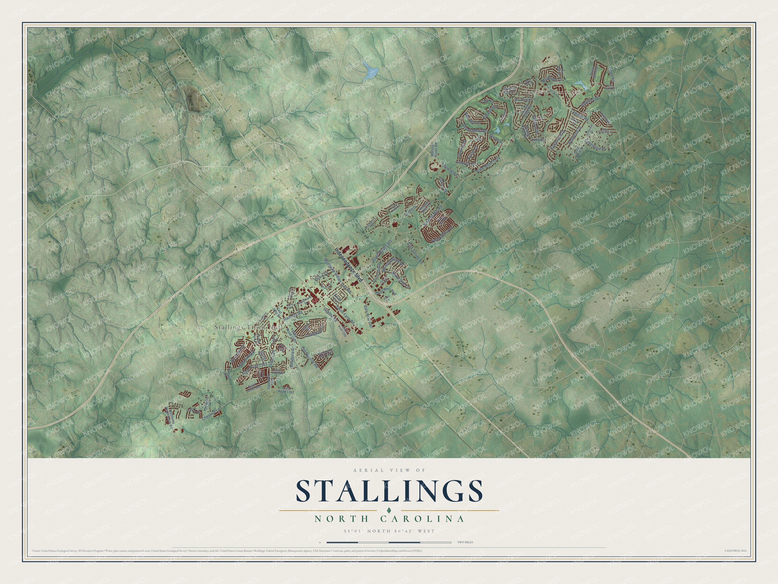
Building by building, with labeled streets and shaded relief.
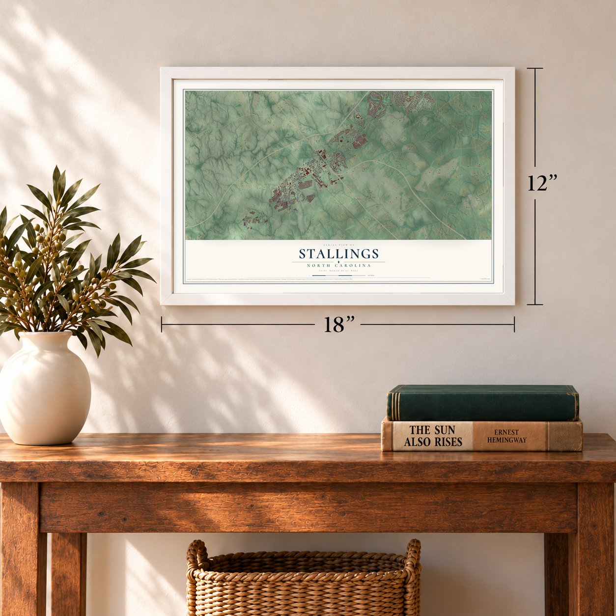
12" x 18" Archival Matte Print
A Map of Home. A Work of Art.
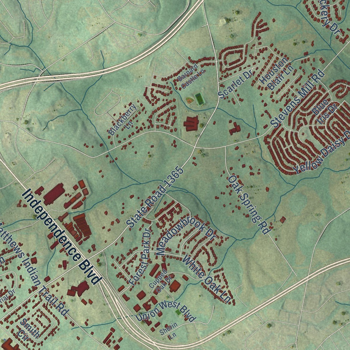
Explore Stallings, North Carolina from a whole new perspective. Created using aerial imagery and detailed geographic data, this map captures Stallings building by building, with labeled streets, familiar landmarks, and shaded topographical relief that highlights the natural contours of the landscape.
Combining modern data with the timeless character of a vintage atlas, this map is just as interesting up close as it is beautiful on the wall. Whether you grew up in Stallings, spent memorable years there, or call it home today, this unique map is a great way to celebrate a place that means something to you. Zoom in on the preview to look for your street, and then order a print to put your memories on the wall.
Three ways to hang it
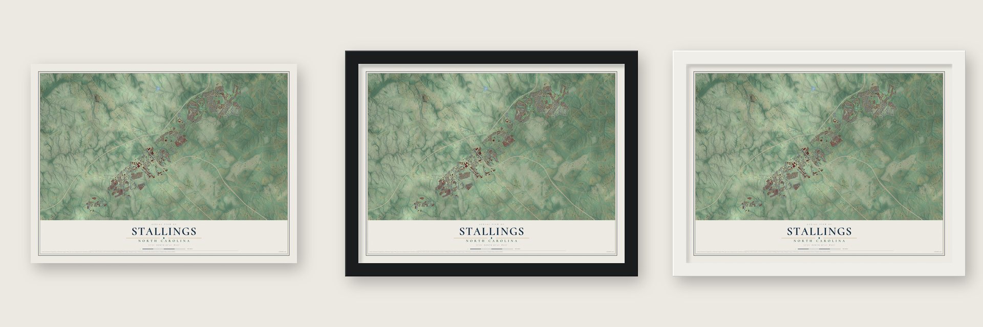
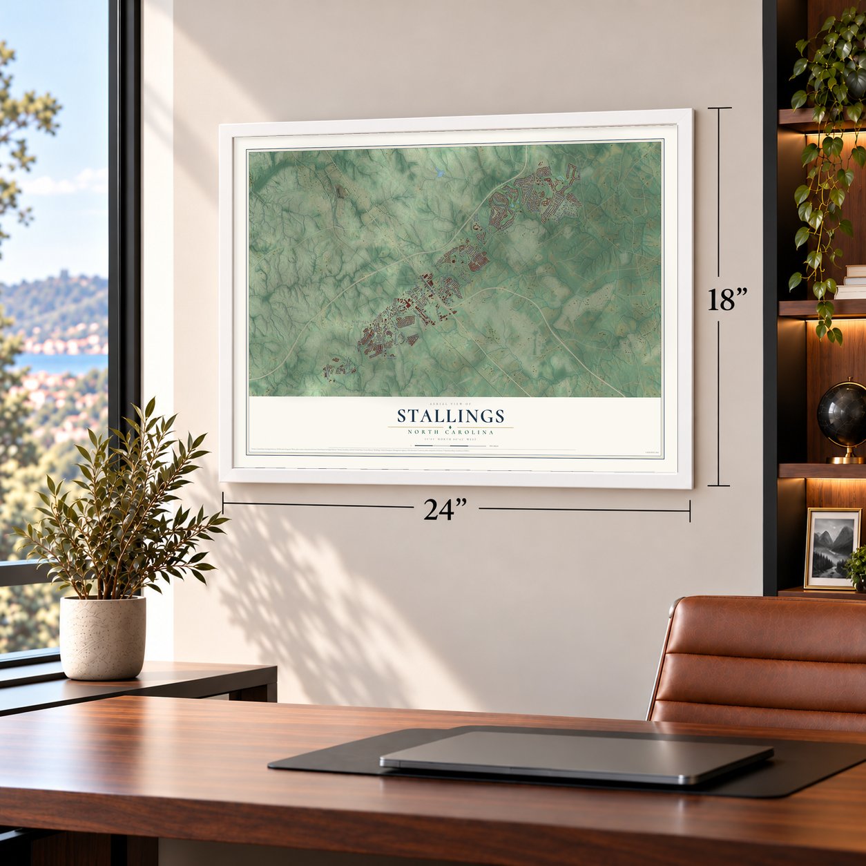
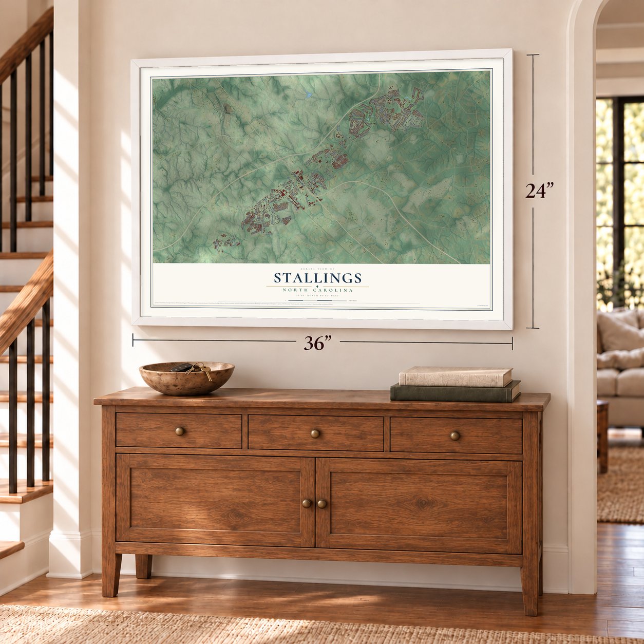
Unframed archival matte, a black wood frame or a white wood frame.
Up close
Geography Worth Displaying
This map was created using accurate cartographic data and authoritative geographic sources, including the U.S. Geological Survey and the Census Bureau. The map brings together terrain, waterways, roads, and building detail. The majority of the streets are labeled, houses are accurately depicted, and the topography is derived from government sources. Combining local data with carefully composed color and shading leads to this beautifully detailed Stallings artwork for your wall.
Rather than simply showing street outlines, we’ve included as many of the street names as we could reasonably fit on the map while keeping their names legible. Zoom in on the high resolution preview to see exactly what’s on the map. We truly set out to create a statement piece for anyone who loves Stallings. So whether it’s for you, or a gift for someone you love, we hope this map of Stallings brings back fond memories.
Read the story behind this map of Stallings, North Carolina from 2026.

Find your street
Names on the Stallings map
Every name below is printed on this map. Look for your street, your school, the park where you played, or the pond down the road.
Places and landmarks2
- Stallings Town Hall
- Fairfield Plantation
Streets and roads91
- Independence Boulevard
- Stallings Road
- State Road 1365
- Stevens Mill Road
- State Road 1524
- Shannamara Drive
- Lawyers Road
- Matthews Indian Trail Road
- Old Monroe Road
- Smith Farm Road
- Potters Road
- Chestnut Lane
- Yellow Daisy Drive
- Hawthorne Drive
- Hammond Drive
- Kidwelly Lane
- White Oak Lane
- Redwood Drive
- Flagstick Drive
- Gribble Road
- Oak Spring Road
- Deepwood Place
- Sarandon Drive
- Coatsdale Lane
- Idlewild Road
- Vickie Lane
- Clonmel Drive
- Meadowbrook Drive
- Killian Court
- State Road 1363
Show all 91 streets
- Fairfield Drive
- Abergele Lane
- Rhoderia Drive
- Divide Drive
- Vickery Drive
- Millwright Lane
- Limerick Drive
- Union Road
- Lake Drive
- Matthews Weddington Road
- East John Street
- State Road 1367
- State Road 1009
- State Road 1357
- State Road 1362
- Mill House Lane
- Hunley Ridge Road
- Stoney Ridge Road
- Gold Crest Drive
- Forest Park Drive
- Spring Hill Road
- Marshall Hooks Road
- Seaboard Drive
- Three Wood Drive
- Smith Circle
- Union West Boulevard
- Yarrow Street
- Saint Johns Avenue
- Suttle Place
- Blue Iris Drive
- Fairforest Drive
- Curry Way
- Aringill Lane
- Privett Park Place
- Azteca Drive
- Shadow Lake Lane
- Tenby Lane
- Scarlet Drive
- Houston Blair Lane
- Leicester Drive
- Birch Court
- State Road 1368
- Four Wood Drive
- Morningside Meadow Lane
- Bent Oak Drive
- Blackberry Lane
- Goldcrest Drive
- Slate Ridge Road
- Mill Race Lane
- Carls Road
- Friendship Drive
- State Road 1004
- Greenbriar Drive
- Cupped Oak Drive
- Community Park Drive
- Glamorgan Lane
- Clifden Drive
- Cedar Point Avenue
- Sherin Lane
- Barnard Castle Lane
- April Lane
Names are listed as they appear on the printed map. Zoom into the product photos to find them.
About Stallings, North Carolina
Stallings is a town of 16,112 people in Union County, with a few small pieces reaching into Mecklenburg County. Its namesake, Matthew Thomas Stallings, came into the world on January 10, 1867, in Cabarrus County, where he farmed and kept a store near Harrisburg. In the early 1900s he moved here and bought 200 acres of timber on the Mecklenburg line, northwest of Indian Trail. He built a house and opened a country store beside the Seaboard Railway track.
Mark Conder's sawmill gave the settlement its first industry, and its lumber went out by rail to Charlotte. About a year later Martin Stallings, M. T.'s brother, came from Cabarrus County to farm his own tract, and people began calling the place Stallings. By 1912 it had a school with about 75 pupils and some twenty families. Growth came quickly after U.S. 74 was built through town. Stallings was incorporated on June 24, 1975, and Martin's son Carl "Tip" Stallings became its first mayor.
“Every year after crops were laid by, Mr. Stallings would have a regular picnic long about August. And have foot races, sack races, egg races, and all kinds of games.”
- Blair's Mill on Goose CreekWilliam Blair's gristmill on Goose Creek was running by December 1789. The last mill, raised in 1826 on a heavy stone foundation, was a four-story wooden building with a water wheel about thirty feet across. On February 3, 1849, James G. Blair sold it with 610 acres to Amos Stevens, and his family ran Stevens Mill for almost 100 years. The ruins now sit in Mint Hill, but most of the old mill land is in Stallings.
- A depot from 1910The Seaboard Railway built a Stallings depot in 1910 and ran both passenger and freight trains for several years. The stop closed early, because a train that halted here couldn't build enough steam to climb the grade to Matthews. When the Depression came, the trains quit running altogether.
- Mr. Jim's Country StoreJim Smith ran the store from 1916 until 1948, selling groceries, feed and notions by day and hosting neighbors at night. Cotton farmers came from miles around, and a resident recalled 50 bales sitting in the store yard. Smith also grew big Bradford watermelons for Charlotte and New York until blight and boll weevils struck in the Depression. His farm still runs as Smith Brothers Farm.
- A church rebuilt in 1919P. D. and Margaret Drye did much of the work to start Stallings Methodist Church around 1911, with Rev. L. W. Self as its first pastor. A new church went up in 1912, but lightning set it on fire in 1919, and a bucket brigade couldn't save it. The congregation rebuilt right away, and that building still stands.
- Two counties since 2001In 2001 the town annexed land along Stevens Mill Road and Lawyers Road, and that one step nearly doubled both its people and its land. Later annexations reached into Mecklenburg County, so Stallings became the first Union County town to sit in two counties. It is now the third largest municipality in Union County.
Keep exploring North Carolina
Stallings is one of 952 North Carolina towns we've mapped. Every dot on the map is a print of its own.
The search covers every state, North Carolina first.
Near Stallings
Order 2 or more town maps and save 10%. Shown in the size and finish you picked above, so they hang as a set.
- Hemby Bridge 12" x 18" / Archival Matte Print $39.99
- Lake Park 12" x 18" / Archival Matte Print $39.99
- Matthews 12" x 18" / Archival Matte Print $39.99


More maps nearby: Indian Trail, Mint Hill, Weddington, Wesley Chapel and Clear Creek.
The art of mapping a place
How This Map Was Made
Real places. Remarkable detail. Discover the layers that turn geographic data into a map of home.

The view from above
Aerial imagery reveals the character of the land: woodland, open fields, and the patterns of a place.

The shape of the land
Elevation data brings hills, valleys, and subtle changes in the landscape into view.

The details of home
Roads, waterways, and building footprints come together to make the map feel unmistakably local.

Geography becomes art
Considered color, shading, and typography bring the layers together in a map made for your wall.


Process illustrated with Mendon, Massachusetts. Aerial imagery: USDA NAIP. Terrain: USGS 3D Elevation Program. Map details and finished artwork: KNOWOL.
The Details
About This Print
Choose an archival matte print, or a black or white Ayous wood frame. The archival matte print is unframed.
Select your size and finish above to see the matching product image and price.
Materials & Craftsmanship
A contemporary map with the character of a classic atlas, printed on archival matte paper. Optional frames are made from Ayous wood.
Your printed map does not include the watermark shown in the full-map preview.
Shipping & Delivery
Free shipping within the United States. Every print is made to order in the USA.
Buying a gift? Add a note in your cart and we'll include it. We never put prices in the package.
Prints ship within 2 to 3 business days. Allow 7 to 10 days total from ordering for delivery. Timing may vary during holidays or periods of high order volume.
Read our shipping policy.
Returns and damaged prints
Each print is made to order. Change-of-mind refunds are not available after production.
If your print arrives damaged, misprinted or incorrect, contact support@knowol.com within 30 days of receiving it. Include your order number, photos and a description of the issue.
Read our full refund and replacement policy. For questions about your order, email support@knowol.com.