
Search for another town





Free U.S. delivery 7 to 10 days after you order
Monrovia, Maryland Map Art
Building by building, with labeled streets and shaded relief.
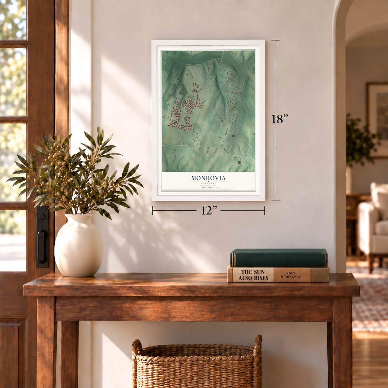
12" x 18" Archival Matte Print
A Map of Home. A Work of Art.
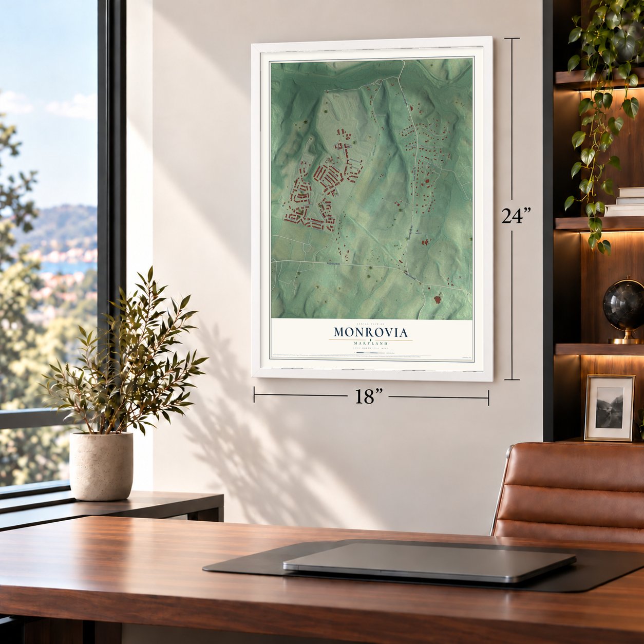
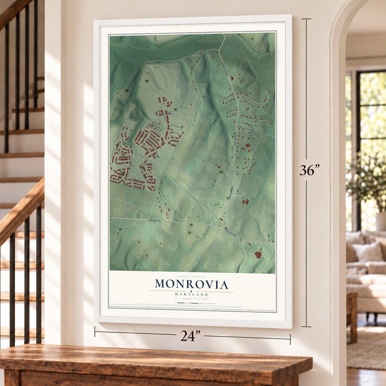
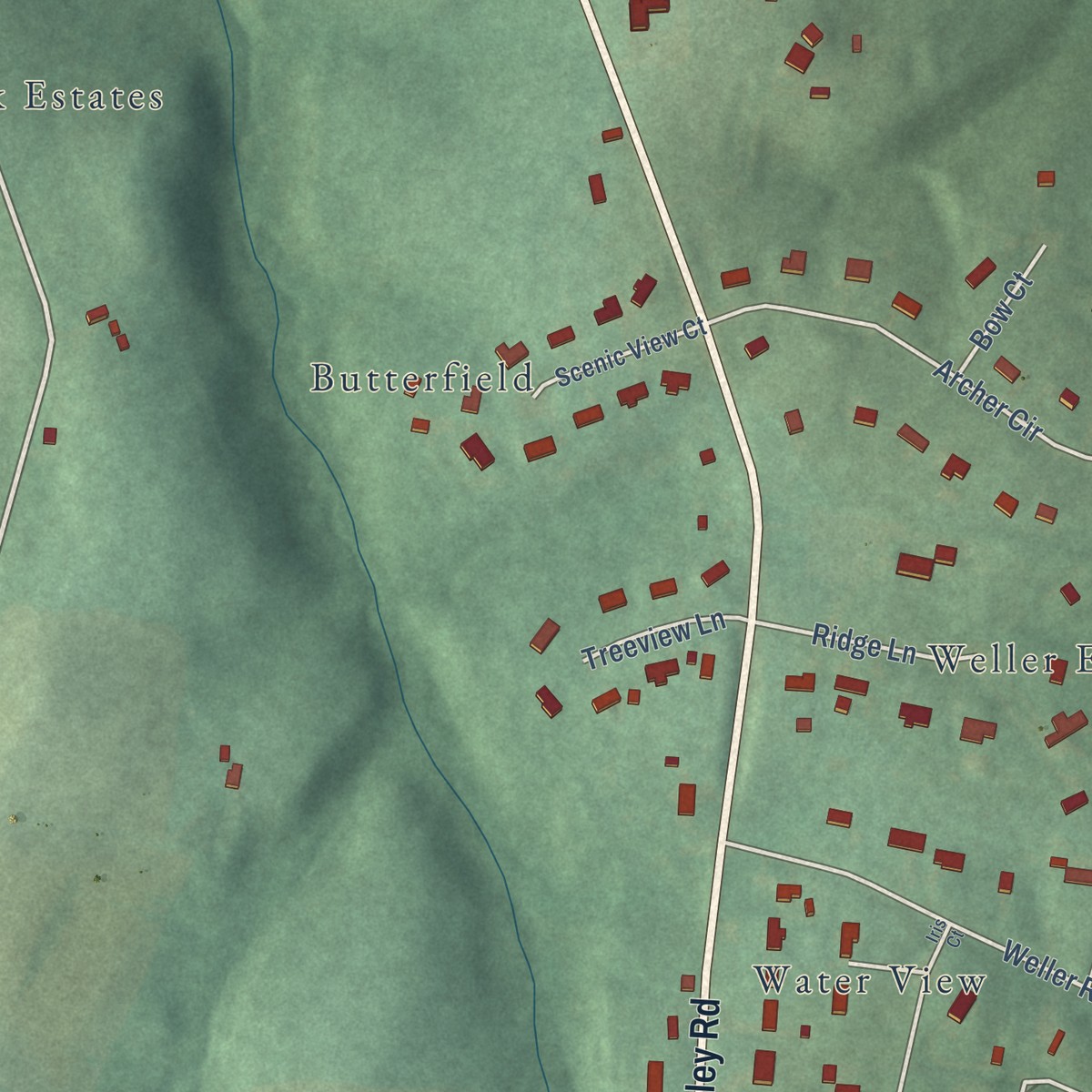
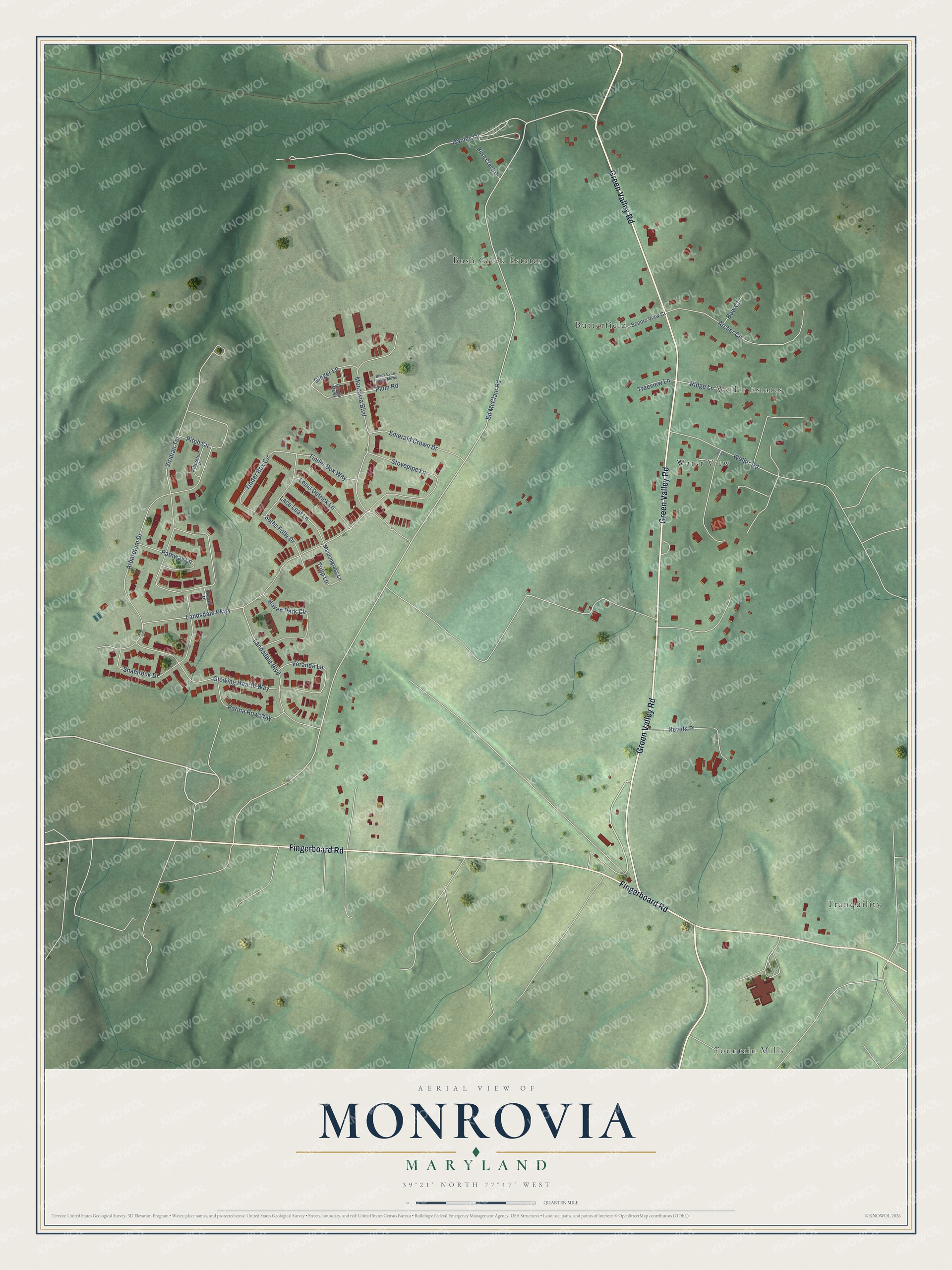
Explore Monrovia, Maryland from a whole new perspective. Created using aerial imagery and detailed geographic data, this map captures Monrovia building by building, with labeled streets, familiar landmarks, and shaded topographical relief that highlights the natural contours of the landscape.
Combining modern data with the timeless character of a vintage atlas, this map is just as interesting up close as it is beautiful on the wall. Whether you grew up in Monrovia, spent memorable years there, or call it home today, this unique map is a great way to celebrate a place that means something to you. Zoom in on the preview to look for your street, and then order a print to put your memories on the wall.
Three ways to hang it
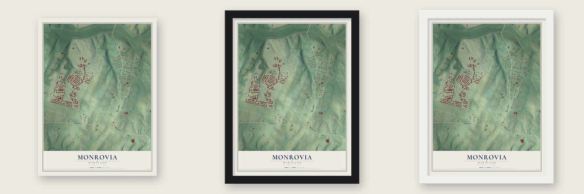
Unframed archival matte, a black wood frame or a white wood frame.
Up close
Geography Worth Displaying
This map was created using accurate cartographic data and authoritative geographic sources, including the U.S. Geological Survey and the Census Bureau. The map brings together terrain, waterways, roads, and building detail. The majority of the streets are labeled, houses are accurately depicted, and the topography is derived from government sources. Combining local data with carefully composed color and shading leads to this beautifully detailed Monrovia artwork for your wall.
Rather than simply showing street outlines, we’ve included as many of the street names as we could reasonably fit on the map while keeping their names legible. Zoom in on the high resolution preview to see exactly what’s on the map. We truly set out to create a statement piece for anyone who loves Monrovia. So whether it’s for you, or a gift for someone you love, we hope this map of Monrovia brings back fond memories.
Read the story behind this map of Monrovia, Maryland from 2026.

Find your street
Names on the Monrovia map
Every name below is printed on this map. Look for your street, your school, the park where you played, or the pond down the road.
Places and landmarks6
- Tranquility
- Bush Creek Estates
- Fountain Mills
- Water View
- Butterfield
- Weller Estates
Streets and roads40
- Green Valley Road
- Fingerboard Road
- Ed McClain Road
- Viridian Terrace
- Arboretum Drive
- Monrovia Boulevard
- Landsdale Parkway
- Ganley Lane
- Nevets Place
- Weller Road
- Archer Circle
- Stovepipe Lane
- Glowing Hearth Way
- Landsdale Boulevard
- Shamrock Drive
- Seths Folly Drive
- Haven Park Circle
- Veranda Lane
- Tinder Box Circle
- Pitch Circle
- Emerald Crown Drive
- Pathway Lane
- Plum Road
- Patina Row Way
- Louis Detrick Lane
- Tinder Box Way
- Lace Leaf Lane
- Ginger Lane
- Ridge Lane
- Treeview Lane
Show all 40 streets
- Tulip Lane
- Bow Court
- Maidengrass Lane
- Scenic View Court
- Bush Creek Drive
- Weald Place
- Ginger Mews
- Arboretum Place
- Black Eyed Susan Mews
- Iris Court
Names are listed as they appear on the printed map. Zoom into the product photos to find them.
About Monrovia, Maryland
Monrovia is a community of 2,702 people in Frederick County, about a mile south of New Market along Bush Creek. In the 1820s the place went by Hall Towne, most likely for Nicholas Hall, one of New Market's founders. The Baltimore and Ohio Railroad made it a station in 1831, serving nearby mills and passengers bound for New Market. A post office opened on January 15, 1833, and a water stop for the locomotives followed in 1840.
The Civil War reached the village more than once. In 1862, The New York Herald reported on September 16 that rebel cavalry had wrecked the post office and other federal property before falling back to New Market. After the Battle of Monocacy, Confederate troops looted the Monrovia General Store, which sold dry goods for decades. By 1880 no community in the New Market election district was bigger than Monrovia. Hard times came later: the Monrovia Central Trust Bank closed in 1929, and in the 1930s the town lost its biggest employer, a cannery, along with the Nicodemus Mill.
“In the child's hand was a small but very pretty American flag, which she was waving with all the ardor and enthusiasm of a youthful patriot. The men cheered until they were husky, and most of the officers, as they passed, took off their caps and saluted the national emblem.”
- A body in a barrelNobody knows when Monrovia got its name; it may honor President James Monroe. The Reverend Herbert Austin Cooper's 1997 account differs. Two local men failed in the 1848 California Gold Rush, then tried mines at Monrovia, Liberia, where one died. His body came home in a fish barrel of alcohol, around Cape Horn to Baltimore and by rail to the general store. The alcohol went into Bush Creek and Elder Walker led the funeral. Cooper believed this named the town.
- Bush Creek BrethrenAmong the area's Brethren congregations, only the Beaver Dam and Pipe Creek groups came before Bush Creek. Its members first worshiped in the woods or in private homes. In 1848 they built a wooden meetinghouse, the Pleasant Hill Church, on the same ground the church occupies today, and in 1907 a brick church took its place. David Rinehart and Howard Hillary were its first two ministers.
- The 75-80 DragwayThe 75-80 Dragway opened in 1960. It shut down on October 30, 2005, but the public outcry led to renovations starting in 2007, and racing returned on April 3, 2009. The track closed for good on September 28, 2013, to make way for houses. MotorWeek, which had tested cars there since 1982, kept filming on the remaining pavement into its 40th season in 2021 before moving to the Mason-Dixon Dragway in Boonsboro.
- A plan for a town centerA developer proposed Monrovia Town Center, with 930 single-family homes, 580 townhomes and stores. A revised plan cut the homes from 1,510 to 1,250, set half aside for residents 55 and older, and shrank the site from 457 to 392 acres.
- Residents took on a town centerNeighbors told the county planning commission that Monrovia Town Center would crowd roads and schools and change the area's rural character. The county commissioners rezoned the land in 2014, but Residents Against Landsdale Expansion sued and won in Frederick County Circuit Court in 2017. The ruling held on appeal in 2019 and again before Maryland's Court of Appeals in 2020.
Keep exploring Maryland
Monrovia is one of 881 Maryland towns we've mapped. Every dot on the map is a print of its own.
The search covers every state, Maryland first.
Near Monrovia
Order 2 or more town maps and save 10%. Shown in the size and finish you picked above, so they hang as a set.
- New Market 12" x 18" / Archival Matte Print $39.99
- Green Valley 12" x 18" / Archival Matte Print $39.99
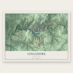
- Linganore 12" x 18" / Archival Matte Print $39.99
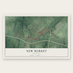
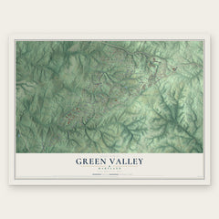
More maps nearby: Urbana, Bartonsville, Spring Ridge, Mount Airy and Damascus.
The art of mapping a place
How This Map Was Made
Real places. Remarkable detail. Discover the layers that turn geographic data into a map of home.

The view from above
Aerial imagery reveals the character of the land: woodland, open fields, and the patterns of a place.

The shape of the land
Elevation data brings hills, valleys, and subtle changes in the landscape into view.

The details of home
Roads, waterways, and building footprints come together to make the map feel unmistakably local.

Geography becomes art
Considered color, shading, and typography bring the layers together in a map made for your wall.


Process illustrated with Mendon, Massachusetts. Aerial imagery: USDA NAIP. Terrain: USGS 3D Elevation Program. Map details and finished artwork: KNOWOL.
The Details
About This Print
Choose an archival matte print, or a black or white Ayous wood frame. The archival matte print is unframed.
Select your size and finish above to see the matching product image and price.
Materials & Craftsmanship
A contemporary map with the character of a classic atlas, printed on archival matte paper. Optional frames are made from Ayous wood.
Your printed map does not include the watermark shown in the full-map preview.
Shipping & Delivery
Free shipping within the United States. Every print is made to order in the USA.
Buying a gift? Add a note in your cart and we'll include it. We never put prices in the package.
Prints ship within 2 to 3 business days. Allow 7 to 10 days total from ordering for delivery. Timing may vary during holidays or periods of high order volume.
Read our shipping policy.
Returns and damaged prints
Each print is made to order. Change-of-mind refunds are not available after production.
If your print arrives damaged, misprinted or incorrect, contact support@knowol.com within 30 days of receiving it. Include your order number, photos and a description of the issue.
Read our full refund and replacement policy. For questions about your order, email support@knowol.com.