
Search for another town





Free U.S. delivery 7 to 10 days after you order
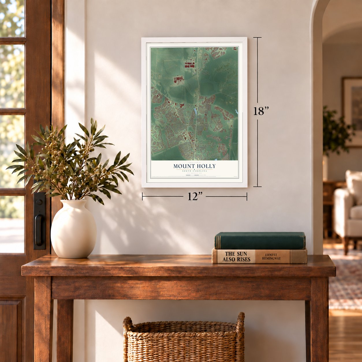
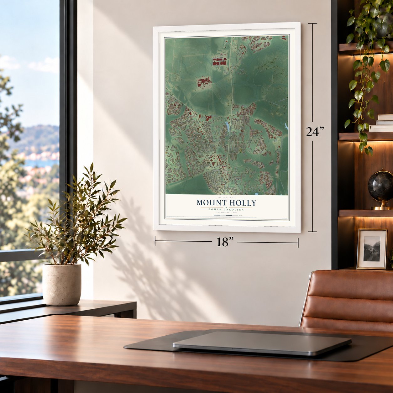
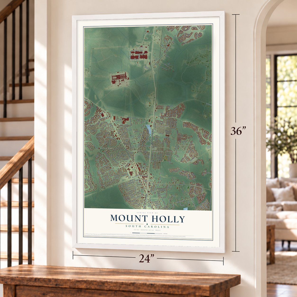
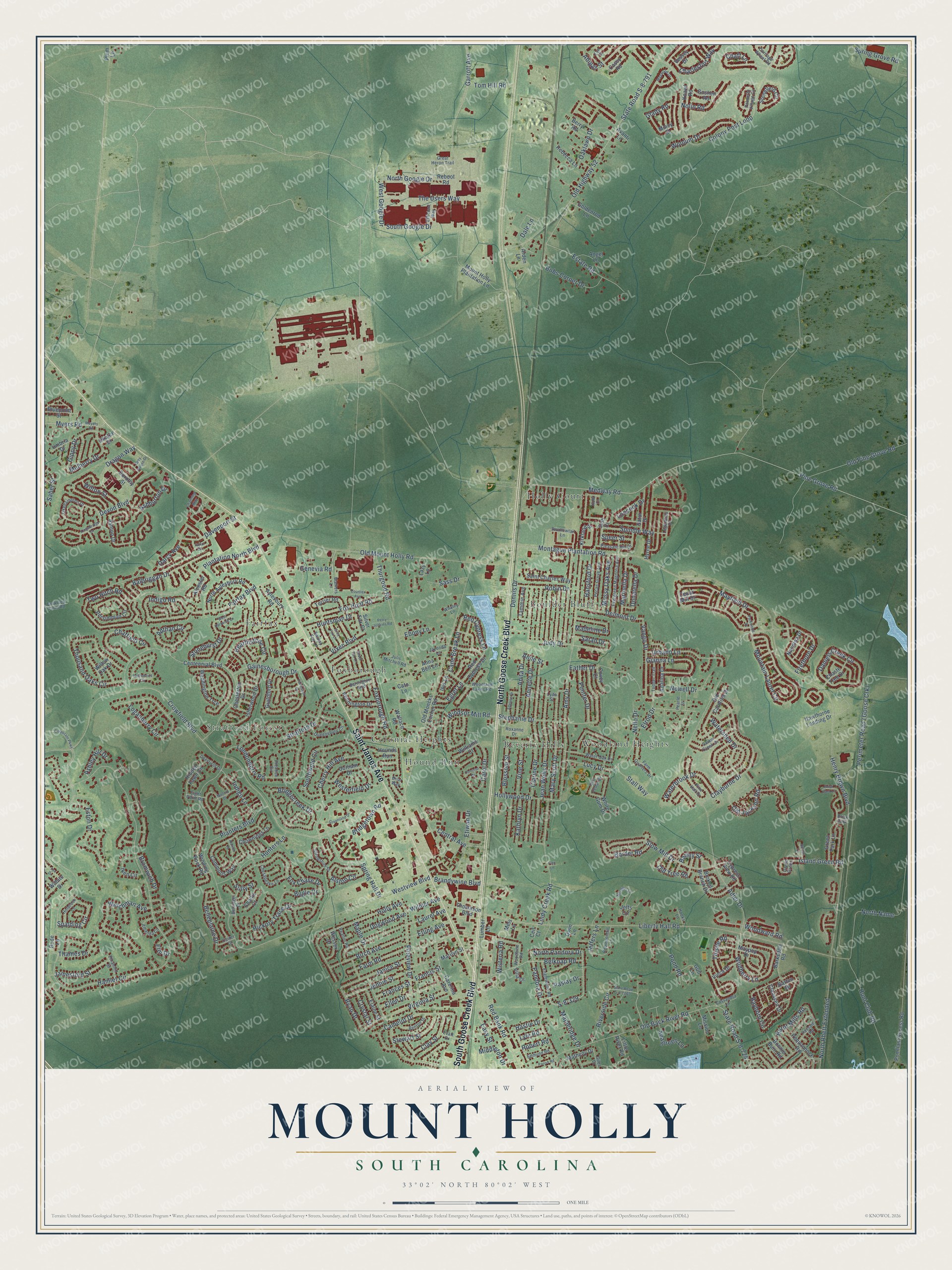
Mount Holly, South Carolina Map Art
Building by building, with labeled streets and shaded relief.
12" x 18" Archival Matte Print
A Map of Home. A Work of Art.
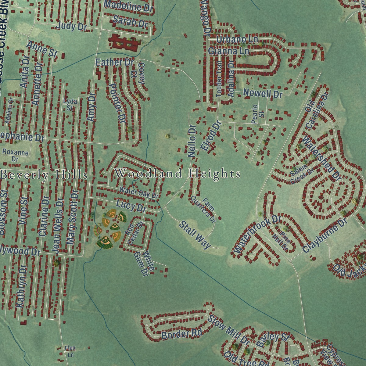
Explore Mount Holly, South Carolina from a whole new perspective. Created using aerial imagery and detailed geographic data, this map captures Mount Holly building by building, with labeled streets, familiar landmarks, and shaded topographical relief that highlights the natural contours of the landscape.
Combining modern data with the timeless character of a vintage atlas, this map is just as interesting up close as it is beautiful on the wall. Whether you grew up in Mount Holly, spent memorable years there, or call it home today, this unique map is a great way to celebrate a place that means something to you. Zoom in on the preview to look for your street, and then order a print to put your memories on the wall.
Three ways to hang it
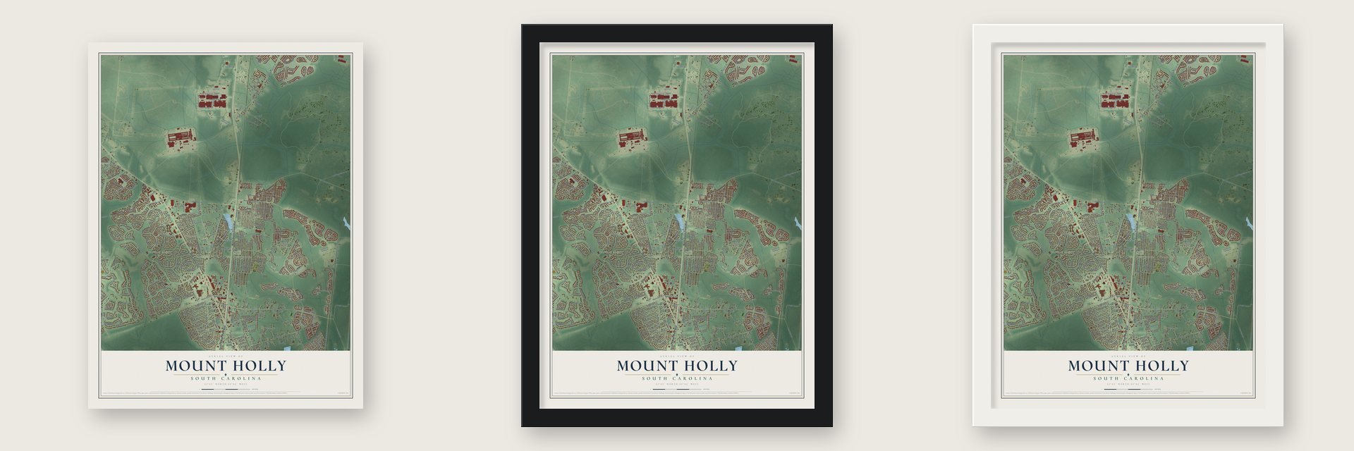
Unframed archival matte, a black wood frame or a white wood frame.
Up close
Geography Worth Displaying
This map was created using accurate cartographic data and authoritative geographic sources, including the U.S. Geological Survey and the Census Bureau. The map brings together terrain, waterways, roads, and building detail. The majority of the streets are labeled, houses are accurately depicted, and the topography is derived from government sources. Combining local data with carefully composed color and shading leads to this beautifully detailed Mount Holly artwork for your wall.
Rather than simply showing street outlines, we’ve included as many of the street names as we could reasonably fit on the map while keeping their names legible. Zoom in on the high resolution preview to see exactly what’s on the map. We truly set out to create a statement piece for anyone who loves Mount Holly. So whether it’s for you, or a gift for someone you love, we hope this map of Mount Holly brings back fond memories.
Read the story behind this map: Detailed Map of Mount Holly, South Carolina.

Find your street
Names on the Mount Holly map
Every name below is printed on this map. Look for your street, your school, the park where you played, or the pond down the road.
Places and landmarks10
- Stratford Forest
- Holly Court
- Woodland Heights
- Boulder Bluff
- Foxborough
- Colonial Heights
- Beverly Hills
- Fairfax
- Hound Run
- Brick Park
Streets and roads364
- South Goose Creek Boulevard
- North Goose Creek Boulevard
- Saint James Avenue
- Indigo Road
- Bridgetown Road
- Fairfax Boulevard
- Belknap Road
- Red Cypress Lane
- Cane Break Lane
- S-8-329
- Crowfield Boulevard
- North Pandora Drive
- Pandora Drive
- Garrott Avenue
- Loganberry Circle
- Estate Road
- Spindle Way
- Lindy Creek Road
- Cherry Hill Avenue
- Windsor Mill Road
- Ellen Drive
- Indigo Lane
- Oaklawn Drive
- Mary Scott Drive
- Elrod Drive
- Nello Drive
- Planters Boulevard
- Hamlet Circle
- Medway Road
- Pine Grove Road
Show all 364 streets
- Westview Boulevard
- Liberty Hall Road
- Henry Brown Boulevard
- Adler Drive
- Montague Plantation Road
- Old Highway 52
- Old Mount Holly Road
- Old Back River Road
- Plantation North Boulevard
- Amy Drive
- Colony Post Loop
- Clarine Drive
- Jean Wells Drive
- North Name
- Foxborough Road
- Mayfield Drive
- Thurgood Road
- Camelot Drive
- Old Pine Grove Road
- Mountain Laurel Circle
- State Road S-8-791
- Stephanie Drive
- Spring Hall Drive
- Two Hitch Road
- Clayburne Drive
- Bayboro Circle
- Thousand Oaks Circle
- Holly Avenue
- Darcy Avenue
- Bridgecreek Drive
- Londonderry Road
- Anita Drive
- Pineview Drive
- Fox Chase Drive
- Wildberry Lane
- Slow Mill Drive
- Riverside Circle
- Welchman Avenue
- Daniels Creek Circle
- Laurel Avenue
- Hunt Club Road
- Farm Road
- Annette Drive
- Dennis Drive
- North Rhett Extended
- Southwold Circle
- Hickory Trace Drive
- Red Bank Road
- Blossom Street
- Balbriggan Drive
- Mulberry Drive
- Burnt Mills Road
- Virginia Street
- Hunters Lane
- Bobs Corner Drive
- Gainesborough Drive
- Alston Circle
- Eather Drive
- Sarah Drive
- Old Jackson Road
- Chatfield Circle
- Gianna Lane
- Vango Drive
- Urbano Lane
- Westerfield Drive
- Birch Avenue
- Judy Drive
- Eston Drive
- Devon Boulevard
- The Users Way
- Firethorn Drive
- Stratford Drive
- Adthan Circle
- Frances Street
- Francis Street
- Pond Road
- Brandywine Boulevard
- Central Avenue
- Genevia Road
- Woolum Drive
- Chaff Lane
- State Road S-8-724
- Etiwan Drive
- Hearthstone Circle
- Janice Street
- Huntsman Drive
- Spring Grove Road
- Madeline Drive
- Hastie Drive
- Watershed Drive
- Carol Drive
- North Google Drive
- Jennie Street
- Waterbrook Drive
- Delmont Drive
- Old Tree Road
- Hollywood Drive
- Charlesfort Way
- Fox Hunt Road
- Spalding Circle
- Vixen Boulevard
- Belleplaine Drive
- Myers Road
- Davenport Street
- Clay Street
- Marinella Drive
- Wisteria Road
- Loocock Drive
- Jamesford Street
- Gippy Drive
- Donatella Drive
- Nolin Road
- Mossy Oaks Avenue
- Border Road
- Middleton Drive
- Dragon Way
- Stewart Street
- Hansford Drive
- Pointer Drive
- Bugle Drive
- Newell Drive
- Vine Street
- Robin Drive
- Island Green Road
- Dogwood Avenue
- West Google Drive
- South Google Drive
- Barley Street
- Lucy Drive
- Stonehurst Drive
- Stall Way
- Bromwich Drive
- Kathryn Drive
- Thistle Road
- Ryan Drive
- Seagreen Lane
- Wilton Street
- Thames Drive
- Tom Hill Road
- Etling Avenue
- Maple Drive
- Ashley Hill Drive
- Sass Drive
- Jeffers Lane
- Mapleridge Drive
- Woodward Road
- Abigail Street
- Glady Road
- Ashburton Drive
- Robert Road
- Paslay Drive
- Saber Street
- Wilmer Avenue
- Crystal Street
- Easy Street
- Egret Lane
- Ebony Lane
- Dale Lane
- Speer Street
- Sully Street
- Elm Drive
- Lyle Road
- Anne Street
- Winding Rock Road
- Red Cypress Drive
- Broken Branch Drive
- Cypress View Road
- North Aylesbury Road
- Bonnie Burn Road
- Old Moncks Corner Road
- Centennial Boulevard
- Commons Way
- Pomflant Access Road
- Mount Holly Plantation Lane
- Aylesbury Road
- Kennington Drive
- Persimmon Circle
- Isherwood Drive
- Carolina Avenue
- Green Park Lane
- Ashton Drive
- Old Carolina Drive
- Maypop Drive
- Kirkland Street
- Pequannock Road
- Marilyn Street
- Stonefield Circle
- Adalina Drive
- Hawthorne Landing Drive
- Guildford Drive
- Hidden Fawn Circle
- Nandina Drive
- Saint Charles Way
- Waddington Trce
- Iken Circle
- Terrier Road
- Lazy Lane
- Anna Bell Lane
- Satur Drive
- Tammie Avenue
- Matheny Drive
- Casey Road
- Chaste Tree Drive
- Rebecca Lane
- Knawl Road
- Thomason Boulevard
- Mincy Street
- Barksdale Road
- Dorothy Street
- Chownings Lane
- Wessex Drive
- Elaine Street
- Wallace Road
- Durham Drive
- Chesterton Drive
- Claussen Drive
- Alcester Road
- Cedar Mill Drive
- Hounds Run
- Vinca Drive
- Goldenrod Lane
- Angel Lane
- Williams Court
- Goshen Road
- Gull Lane
- Hyrne Drive
- Wilhite Drive
- Barton Drive
- Bluepoint Street
- Mission Lane
- Silver Fox Court
- Covey Court
- Lumber Lane
- Vessey Drive
- Challis Court
- Umbria Drive
- Jeffs Circle
- Bude Lane
- Berry Road
- Little River Road
- Reboot Road
- Ibis Lane
- Plum Lane
- Okatee Drive
- Villa Drive
- Arden Lane
- White Gum Drive
- Seth Court
- Willow Oak Drive
- Avanti Lane
- Cato Lane
- Mels Lane
- Ceil Court
- Qwin Lane
- Woodbine Road
- Water Oak Drive
- Okehampton Drive
- Queensbury Circle
- Farm Quarters Drive
- Red Cedar Drive
- Evergreen Magnolia Avenue
- Palmetto Village Circle
- Pecan Grove Avenue
- Woodland Lakes Road
- Salem Creek Drive
- Pleasant Hill Drive
- Barrington Boulevard
- Walkers Lane
- Pearle Street
- Chesapeake Lane
- Swallowtail Lane
- Pine Hall Drive
- Englewood Road
- Benton Street
- Amanda Circle
- Island Green
- Robinsonhill Lane
- Berringer Drive
- Todder Trail
- Swamp Fox Lane
- Roxanne Drive
- Shropshire Street
- Efficient Way
- Ethanhill Street
- Holbrook Lane
- Passaic Road
- Edmund Road
- Deerfield Drive
- Evatt Drive
- Great Heron Trail
- Carriage Wheel Road
- Eva Street
- Legendres Drive
- Julis Mitchell Road
- Berkeley Farm Road
- Cassandra Lane
- Realtor Road
- Eight Point Road
- Carter Drive
- Giles Drive
- Jayonda Lane
- Prentice Circle
- Hooks Lane
- Whaley Lane
- Briar Way
- Lyda Street
- Kolb Court
- Channing Way
- State Road S-8-1063
- Kingsbridge Drive
- Haleswood Circle
- Maywood Drive
- Corporate Parkway
- Fairhaven Drive
- West Hartwick Lane
- Margaret Lane
- Brick Barn Lane
- Colonial Drive
- Courtier Avenue
- Adeline Drive
- Taylor Circle
- Greenland Drive
- Parish Road
- Meyers Road
- Gray Fox Lane
- Silver Fox Lane
- Parkwood Drive
- Perry Jenkins Road
- Lyn Drive
- Mallory Drive
- Grey Goose Drive
- Burton Court
- Aldrich Place
- Flex Lane
Names are listed as they appear on the printed map. Zoom into the product photos to find them.
About Mount Holly, South Carolina
Mount Holly took its name from a plantation close by. The village is home to Medway Plantation, built around 1694. Its house may be the oldest in South Carolina. The Mount Holly post office served from 1853 until 1990.
Keep exploring South Carolina
Mount Holly is one of 540 South Carolina towns we've mapped. Every dot on the map is a print of its own.
The search covers every state, South Carolina first.
Near Mount Holly
Order 2 or more town maps and save 10%. Shown in the size and finish you picked above, so they hang as a set.
- Goose Creek 12" x 18" / Archival Matte Print $39.99
- Sedgefield 12" x 18" / Archival Matte Print $39.99
- Ladson 12" x 18" / Archival Matte Print $39.99

More maps nearby: Deer Park, Sangaree, Pimlico, Lincolnville and Hanahan.
The art of mapping a place
How This Map Was Made
Real places. Remarkable detail. Discover the layers that turn geographic data into a map of home.

The view from above
Aerial imagery reveals the character of the land: woodland, open fields, and the patterns of a place.

The shape of the land
Elevation data brings hills, valleys, and subtle changes in the landscape into view.

The details of home
Roads, waterways, and building footprints come together to make the map feel unmistakably local.

Geography becomes art
Considered color, shading, and typography bring the layers together in a map made for your wall.


Process illustrated with Mendon, Massachusetts. Aerial imagery: USDA NAIP. Terrain: USGS 3D Elevation Program. Map details and finished artwork: KNOWOL.
The Details
About This Print
Choose an archival matte print, or a black or white Ayous wood frame. The archival matte print is unframed.
Select your size and finish above to see the matching product image and price.
Materials & Craftsmanship
A contemporary map with the character of a classic atlas, printed on archival matte paper. Optional frames are made from Ayous wood.
Your printed map does not include the watermark shown in the full-map preview.
Shipping & Delivery
Free shipping within the United States. Every print is made to order in the USA.
Buying a gift? Add a note in your cart and we'll include it. We never put prices in the package.
Prints ship within 2 to 3 business days. Allow 7 to 10 days total from ordering for delivery. Timing may vary during holidays or periods of high order volume.
Read our shipping policy.
Returns and damaged prints
Each print is made to order. Change-of-mind refunds are not available after production.
If your print arrives damaged, misprinted or incorrect, contact support@knowol.com within 30 days of receiving it. Include your order number, photos and a description of the issue.
Read our full refund and replacement policy. For questions about your order, email support@knowol.com.