
Search for another town




Free U.S. delivery 7 to 10 days after you order
Nesconset, New York Map Art
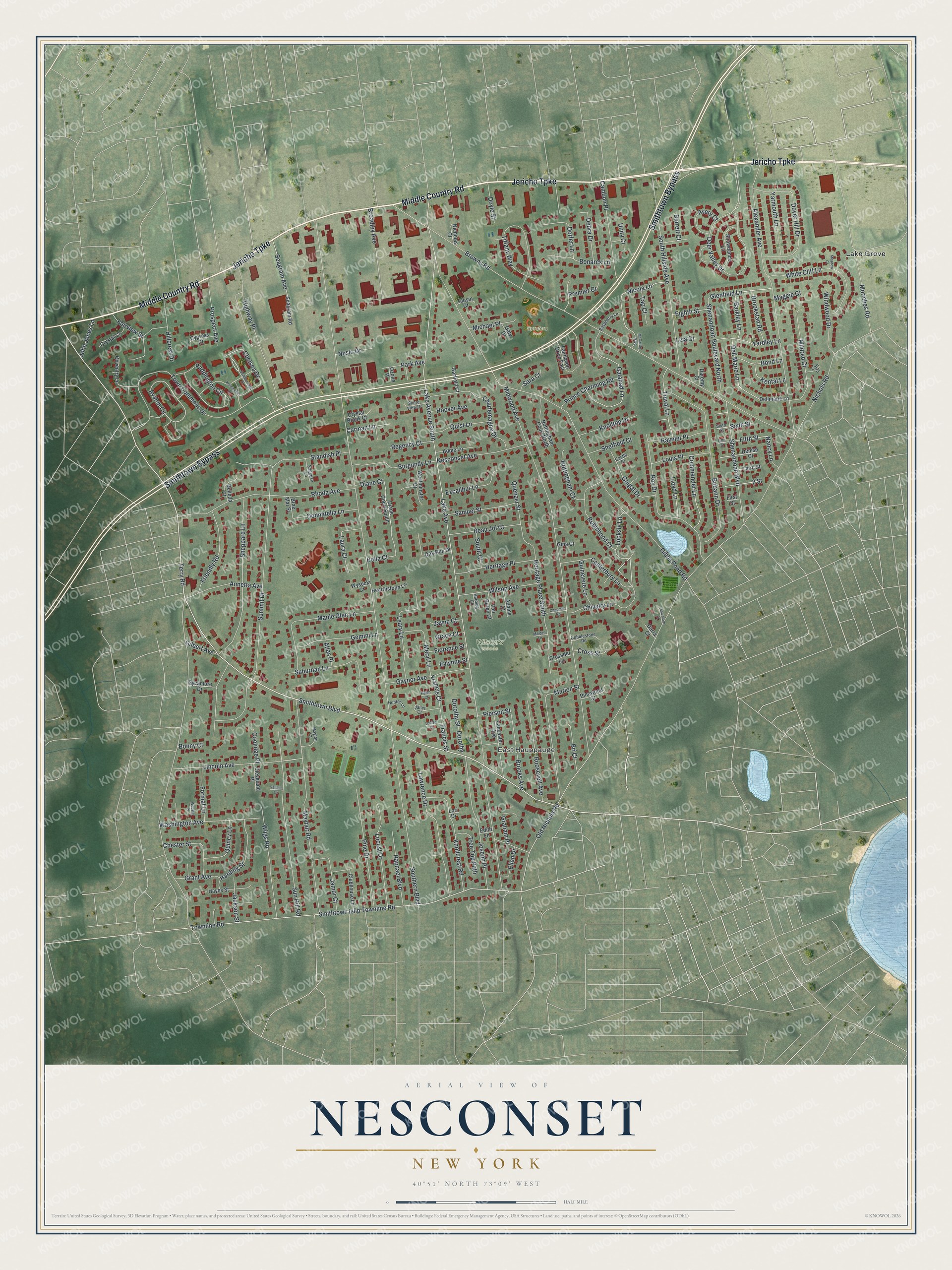
A new map of Nesconset, New York, made in 2026 and printed to order on thick archival matte paper.
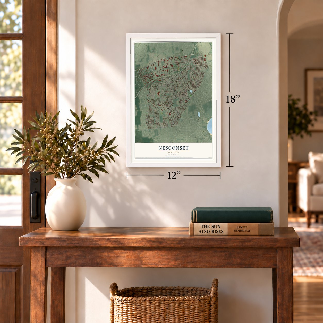
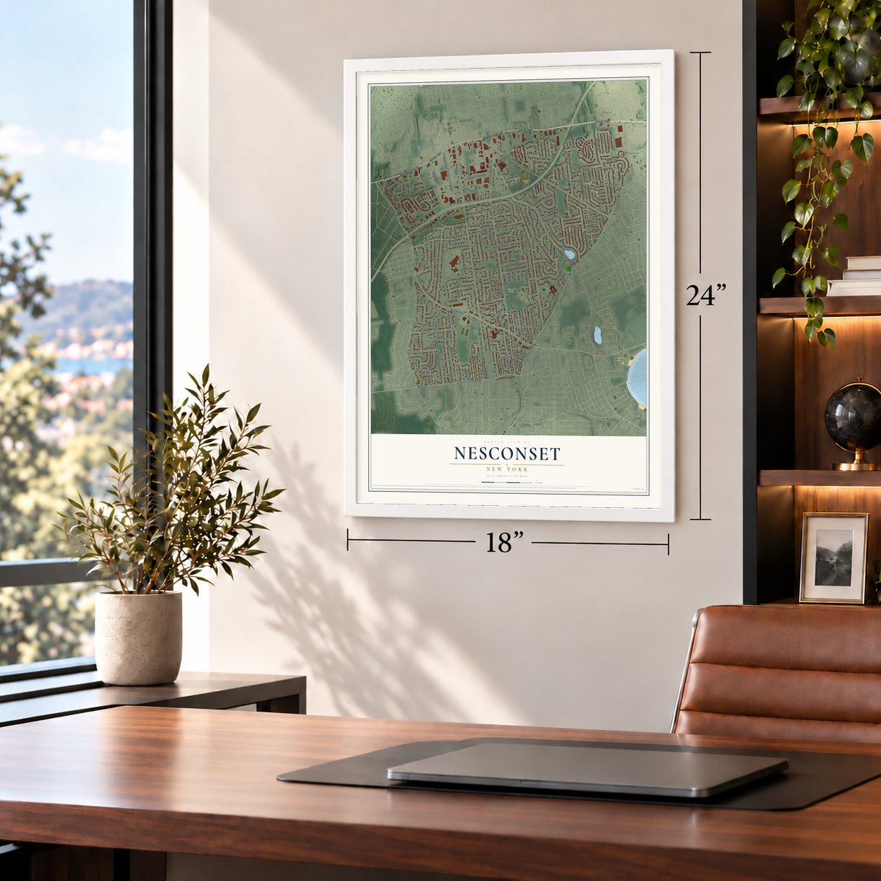
12" x 18" Archival Matte Print
A Map of Home. A Work of Art.
Bring a piece of Nesconset home. Whether it’s where you grew up, your current home, or simply a moment in your life, this Nesconset, New York map print brings those memories to your wall. Antique-inspired styling and modern geographic detail combine to create artwork that’s beautiful from across the room, with plenty to study and explore when you get up close.
Three ways to hang it
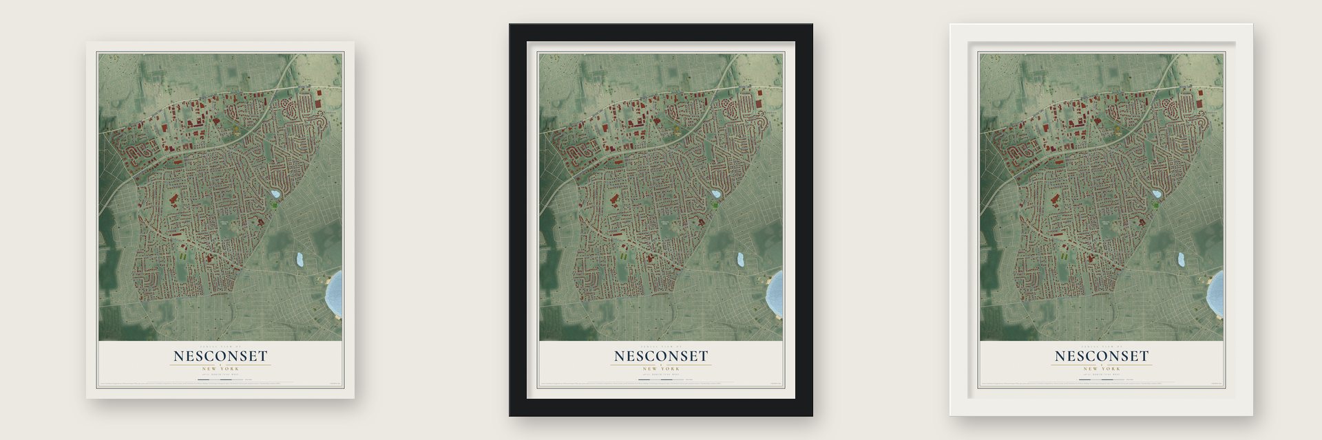
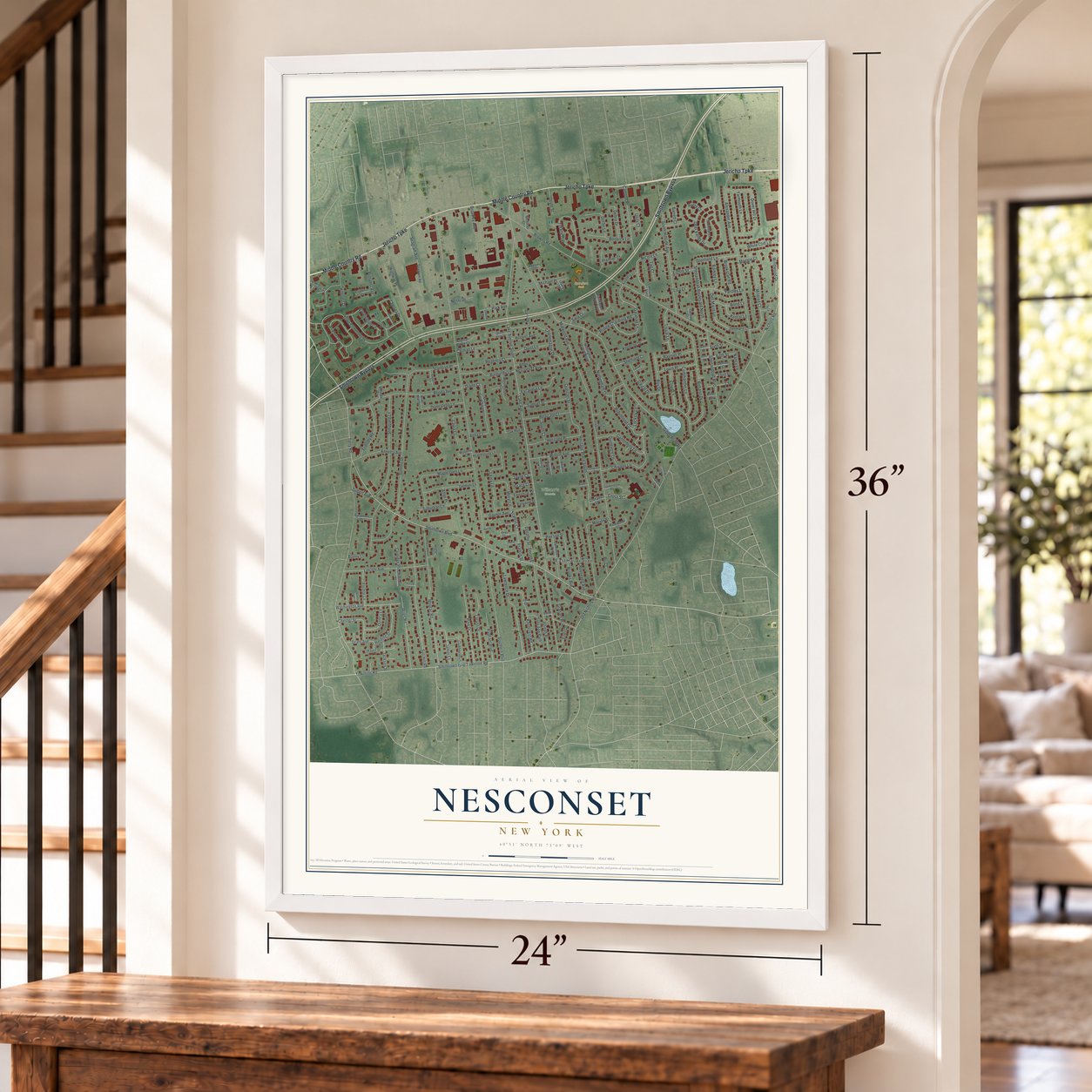
Unframed archival matte, a black wood frame or a white wood frame.
Up close
Real geography. Art worth displaying.
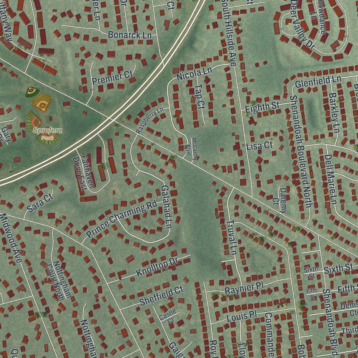
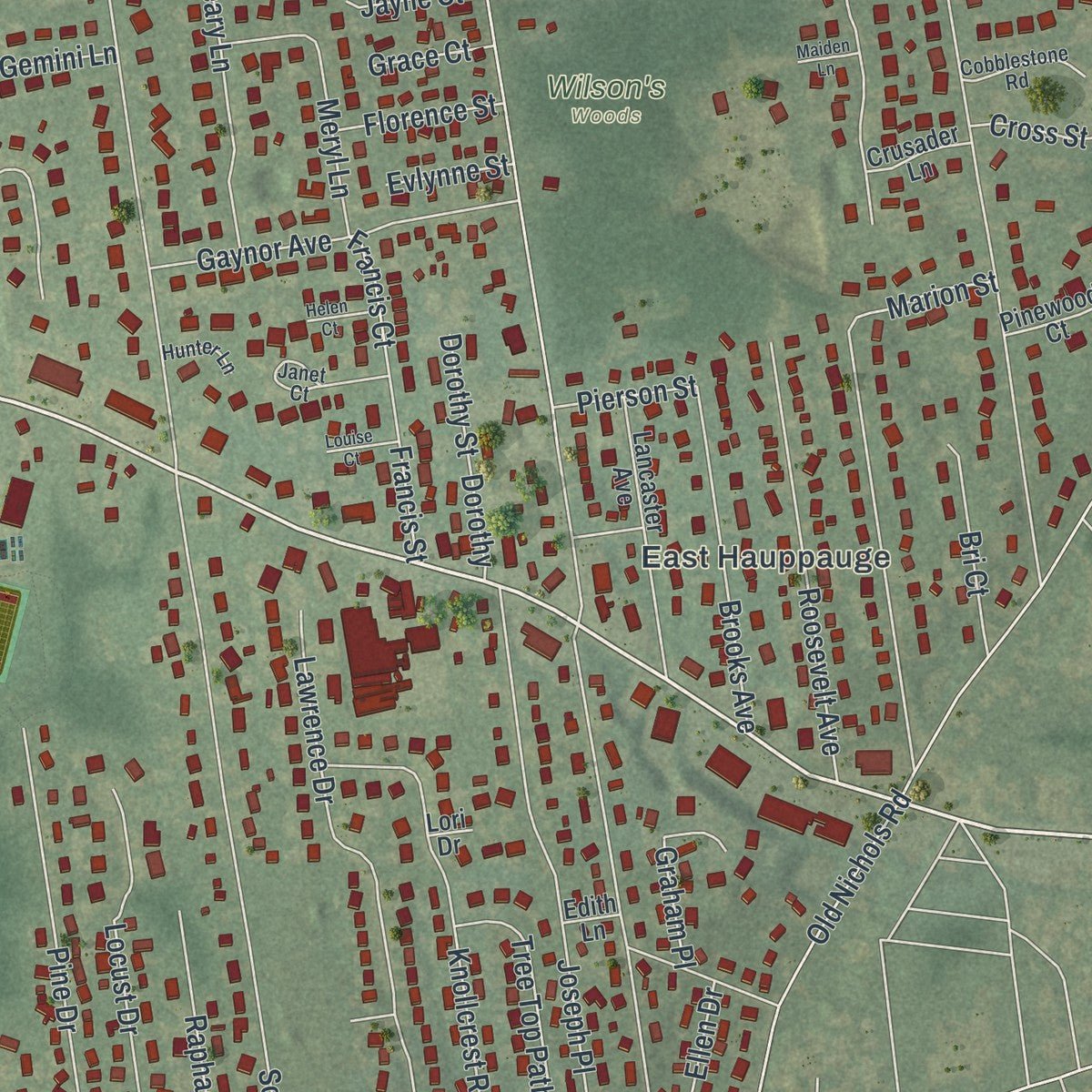
This map was created using accurate cartographic data and authoritative geographic sources, including the U.S. Geological Survey (USGS) and FEMA. The map brings together terrain, waterways, roads, and building detail. The majority of the streets are labeled, houses are accurately depicted, and the topography is derived from government sources. Combining local data with carefully composed color and shading leads to this beautifully detailed Nesconset artwork for your wall.
Rather than simply showing street outlines, we’ve included as many of the street names as we could reasonably fit on the map while keeping their names legible. Zoom in on the high resolution preview to see exactly what’s on the map. We truly set out to create a statement piece for anyone who loves Nesconset. So whether it’s for you, or a gift for someone you love, we hope this map of Nesconset brings back fond memories.
Explore the full map of Nesconset, New York and read about the local places it shows.

About Nesconset, New York
Nesconset, a hamlet, lies in Suffolk County. The 2020 census counted 13,207 residents. Its local story is tied to the communities and institutions of Suffolk County. Those details remain part of the place residents know today.
- Suffolk CountyNesconset is located in Suffolk County.
- 13,207 peopleCounted in the 2020 census.
- River and lakeThe proposed etymology from 1911 claims Nassaconsett translates to "at or near the second going over (by wading or otherwise)", likely a reference to a ford on the Nissequogue River.
- Local landmarkBy the turn of the 19th century, a sparse population of farmers and seasonal residents lived along Middle Country Road and Lake Ronkonkoma.
- Historic districtThe historic Nesconset Schoolhouse was built in 1910 and the Nesconset Fire Department was built by 1935.
Find your street
Names on the Nesconset map
Every name below is printed on this map. Look for your street, your school, the park where you played, or the pond down the road.
Places and landmarks4
- East Hauppauge
- Wilson's Woods
- Sprofera Park
- Lake Grove
Streets and roads215
- Jericho Turnpike
- Smithtown Bypass
- Middle Country Road
- Smithtown Boulevard
- Chivalry Lane
- Avalon Circle
- Glenfield Lane
- Lake Avenue South
- Southern Boulevard
- Nichols Road
- Terry Road
- Lake Avenue
- Browns Road
- Gibbs Pond Road
- Midwood Avenue
- Smithtown Islip Townline Road
- Townline Road
- Alexander Avenue
- Summit Drive
- Deer Valley Drive
- Town Commons Drive
- Sheppard Lane
- Mayfair Road
- South Hillside Avenue
- Old Nichols Road
- Bobann Drive
- Sun Hill Road
- Lincoln Avenue
- Rhoda Avenue
- Highway Place
Show all 215 streets
- Roy Drive
- Paddington Circle
- Lawrence Drive
- Marion Street
- Tiffany Way
- Dover Hill Drive
- Joseph Place
- Galahad Lane
- Maple Glen Lane
- Shenandoah Boulevard North
- White Cliff Lane
- Shenandoah Boulevard
- Pine Drive
- Standish Place
- Knollcrest Road
- Heritage Place South
- Wiigs Road
- Leary Lane
- Nicola Lane
- Locust Drive
- Cambon Place
- Robinhood Court
- Mildred Court
- Roosevelt Avenue
- Dell Marie Lane
- Washington Avenue
- Suburban Lane
- Nesconset Avenue
- Broadley Avenue
- Friendly Road
- Burgundy Lane
- Seagram Avenue
- Gaynor Avenue
- Harding Street
- Quenzer Street
- Chelsea Drive
- Gemini Lane
- Moriches Road
- Canterbury Lane
- Heritage Place
- Wilson Avenue
- Brooks Avenue
- Annetta Avenue
- Charlemagne Drive
- Francis Street
- Diane Court
- Commander Lane
- Raphael Boulevard
- Fairview Street
- Samuel Street
- Beau Jol Court
- Truval Lane
- Chester Street
- Jamor Court
- Bonarck Lane
- Prince Charming Road
- Windwood Drive
- Prospect Avenue
- Yardley Lane
- Meryl Lane
- Donnatella Lane
- Excalibur Lane
- Yarmouth Lane
- Hillcrest Drive
- Laura Court
- Nottingham Court
- Knolltop Drive
- Dorfer Lane
- Raynier Place
- Louis Place
- Lloyd Lane
- Quist Lane
- Debra Drive
- Gaigal Drive
- Bella Court
- Quincy Lane
- Format Lane
- Tree Top Path
- Brookstan Road
- Avery Court
- Bri Court
- Fifth Street
- Bond Lane
- Guinevere Lane
- Michael Place
- Barkley Lane
- Grant Avenue
- Sheffield Court
- Jackson Street
- Carman Lane
- Regency Court
- Park Avenue
- Kental Lane
- Doyle Street
- John Jones Lane
- Locksly Lane
- Florence Street
- Ellen Drive
- Coolidge Place
- Hoover Avenue
- Cross Street
- Sixth Street
- Neslo Drive
- Eighth Street
- South Court
- Tap Court
- Premier Court
- Gilbert Avenue
- Nancy Lane
- Pierson Street
- Jayne Court
- Dorothy Street
- Sara Court
- Graham Place
- Evlynne Street
- Grace Court
- Maggie Court
- Barrett Court
- Atlas Place
- Francis Court
- Unity Court
- Bonny Court
- Dorothy
- 2 Street
- Lisa Court
- Dellmarie Lane
- Seagram Road
- Fairhaven Drive East
- Lancaster Avenue
- Clubhouse Lane
- Snowdance Lane
- Nottingham Court North
- Coventry Lane
- Diane Court South
- Hayes Street
- Westminster Court
- Denise Court
- Addie Lane
- Hearthstone Lane
- Crystal Court
- Third Street
- Pinewood Court
- Belinda Court
- Crystal Brook Court
- Oak Run Drive
- Sycamore Drive
- Adams Court
- Van Buren Court
- Cleveland Place
- Cypress Court
- Garfield Court
- Crusader Lane
- Wysocki Court
- Brae Mar Street
- Zausin Court
- Nicholas Court
- Daremy Court
- Darra Court
- Gina Court
- Gary Drive
- Ozone Place
- Edith Lane
- First Street
- Lori Drive
- Janet Court
- Cobblestone Road
- Raspberry Lane
- Mayfair Court
- Shore View Drive
- Saggese Lane
- Hunter Lane
- Harding Court
- Carr Court
- Castle Court
- Scarborough Drive
- Kensington Drive
- Chapman Road
- Webster Place
- McCarthy Boulevard
- Salvatore Court
- Louise Court
- Helen Court
- Meadow Court
- Maiden Lane
- Valiant Court
Names are listed as they appear on the printed map. Zoom into the product photos to find them.
The art of mapping a place
How This Map Was Made
Real places. Remarkable detail. Discover the layers that turn geographic data into a map of home.

The view from above
Aerial imagery reveals the character of the land: woodland, open fields, and the patterns of a place.

The shape of the land
Elevation data brings hills, valleys, and subtle changes in the landscape into view.

The details of home
Roads, waterways, and building footprints come together to make the map feel unmistakably local.

Geography becomes art
Considered color, shading, and typography bring the layers together in a map made for your wall.


Process illustrated with Mendon, Massachusetts. Aerial imagery: USDA NAIP. Terrain: USGS 3D Elevation Program. Map details and finished artwork: KNOWOL.
The Details
About This Print
Choose an archival matte print, or a black or white Ayous wood frame. The archival matte print is unframed.
Select your size and finish above to see the matching product image and price.
Materials & Craftsmanship
A contemporary map with the character of a classic atlas, printed on archival matte paper. Optional frames are made from Ayous wood.
Your printed map does not include the watermark shown in the full-map preview.
Shipping & Delivery
Free shipping within the United States. Every print is made to order in the USA.
Buying a gift? Add a note in your cart and we'll include it. We never put prices in the package.
Prints ship within 2 to 3 business days. Allow 7 to 10 days total from ordering for delivery. Timing may vary during holidays or periods of high order volume.
Read our shipping policy.
Returns and damaged prints
Each print is made to order. Change-of-mind refunds are not available after production.
If your print arrives damaged, misprinted or incorrect, contact support@knowol.com within 30 days of receiving it. Include your order number, photos and a description of the issue.
Read our full refund and replacement policy. For questions about your order, email support@knowol.com.
Find your town
Looking for another city?
Find a map of home in our New York collection.
Nearby
Maps of towns near Nesconset
Know someone from one of these towns? Their map makes a great gift.


