
Search for another town





Free U.S. delivery 7 to 10 days after you order
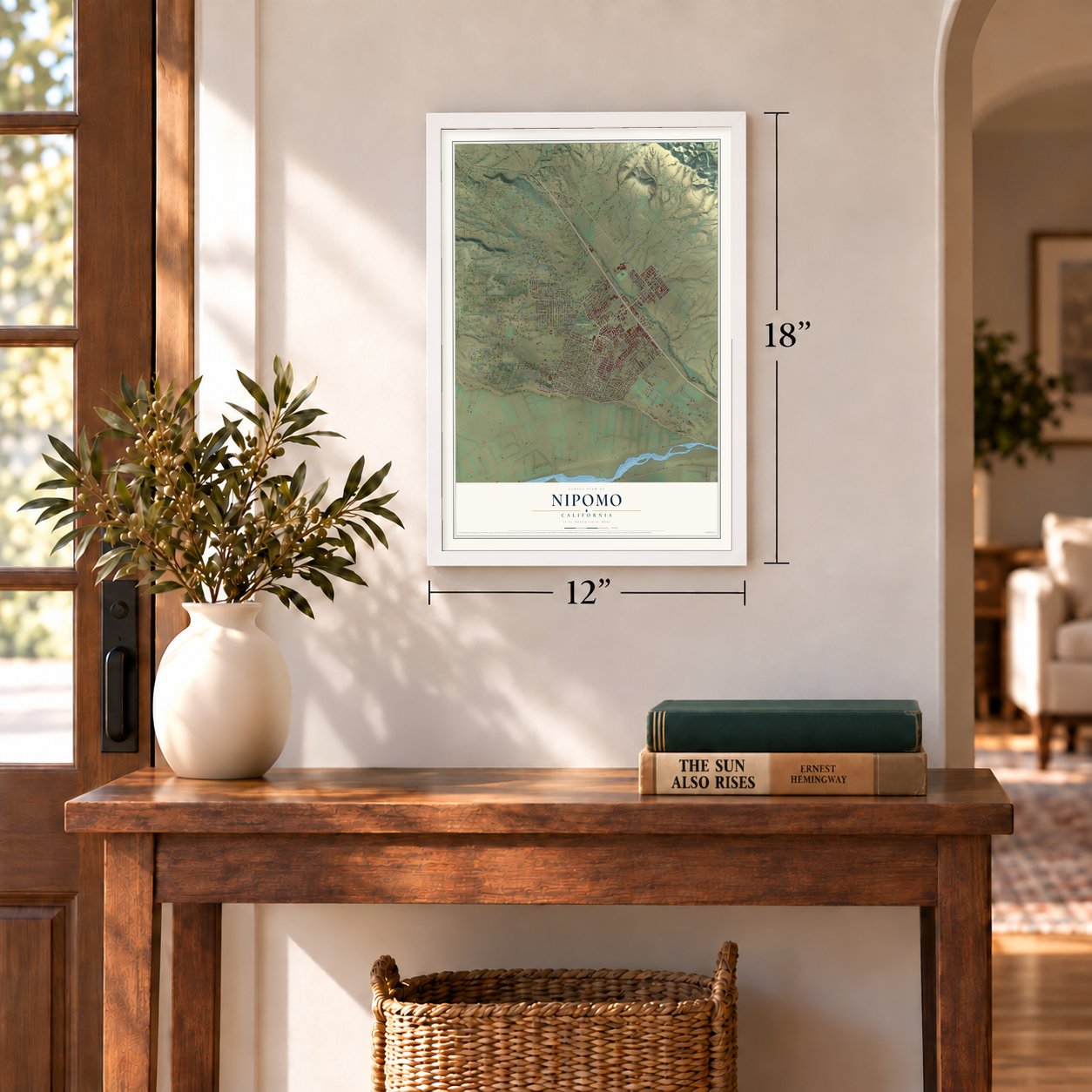
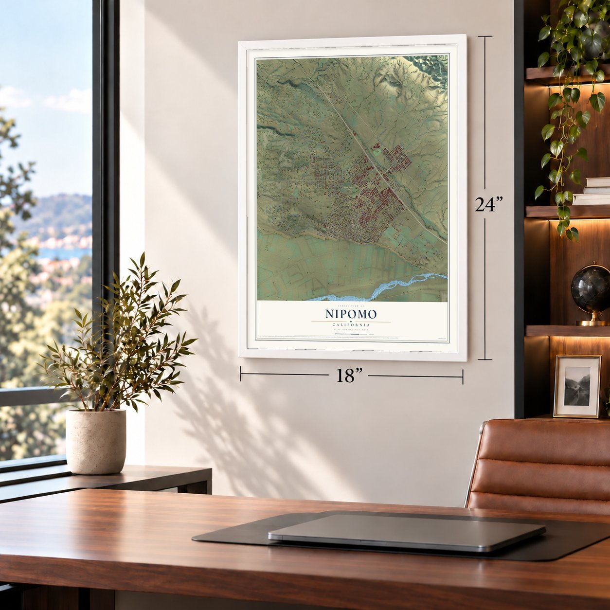
Nipomo, California Map Art
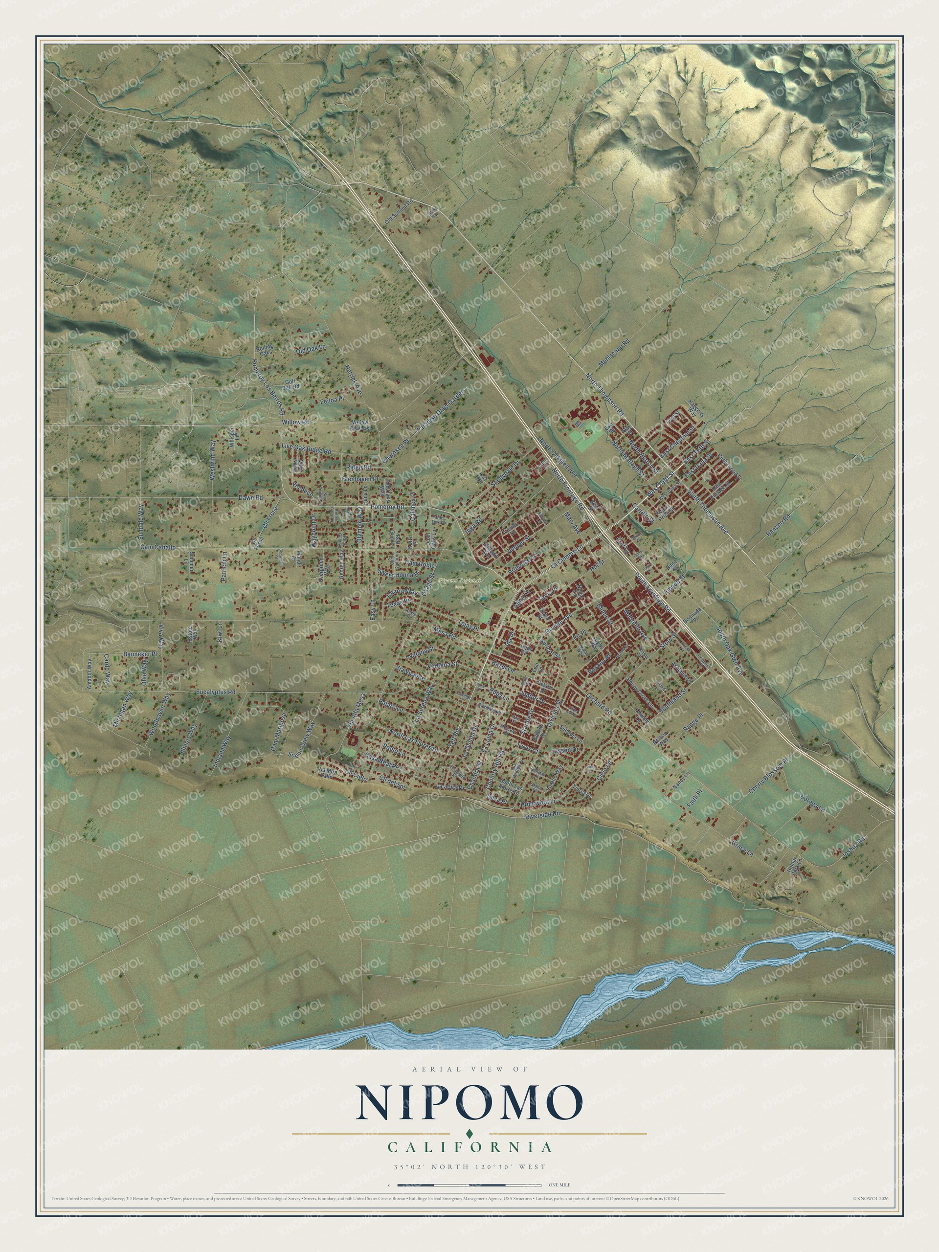
Building by building, with labeled streets and shaded relief.
12" x 18" Archival Matte Print
A Map of Home. A Work of Art.
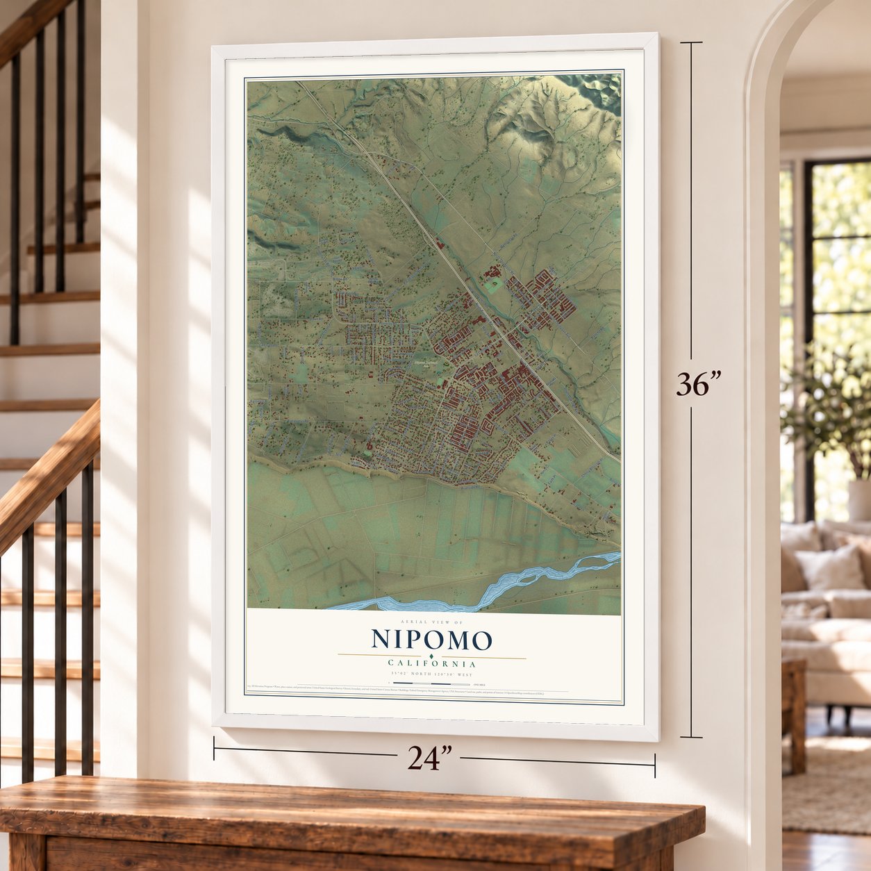
Explore Nipomo, California from a whole new perspective. Created using aerial imagery and detailed geographic data, this map captures Nipomo building by building, with labeled streets, familiar landmarks, and shaded topographical relief that highlights the natural contours of the landscape.
Combining modern data with the timeless character of a vintage atlas, this map is just as interesting up close as it is beautiful on the wall. Whether you grew up in Nipomo, spent memorable years there, or call it home today, this unique map is a great way to celebrate a place that means something to you. Zoom in on the preview to look for your street, and then order a print to put your memories on the wall.
Three ways to hang it
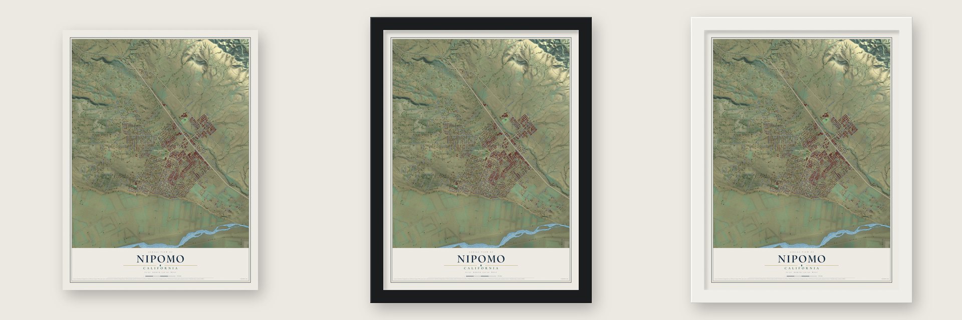
Unframed archival matte, a black wood frame or a white wood frame.
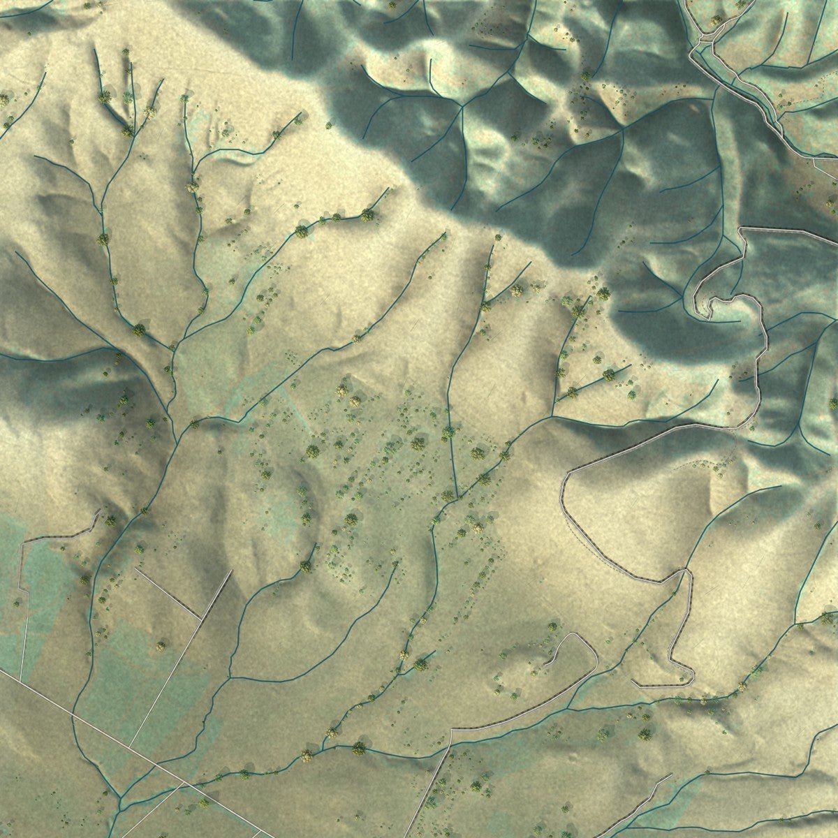
Up close
Geography Worth Displaying
This map was created using accurate cartographic data and authoritative geographic sources, including the U.S. Geological Survey and the Census Bureau. The map brings together terrain, waterways, roads, and building detail. The majority of the streets are labeled, houses are accurately depicted, and the topography is derived from government sources. Combining local data with carefully composed color and shading leads to this beautifully detailed Nipomo artwork for your wall.
Rather than simply showing street outlines, we’ve included as many of the street names as we could reasonably fit on the map while keeping their names legible. Zoom in on the high resolution preview to see exactly what’s on the map. We truly set out to create a statement piece for anyone who loves Nipomo. So whether it’s for you, or a gift for someone you love, we hope this map of Nipomo brings back fond memories.
Read the story behind this map of Nipomo, California from 2026.

Find your street
Names on the Nipomo map
Every name below is printed on this map. Look for your street, your school, the park where you played, or the pond down the road.
Places and landmarks1
- Nipomo Regional Park
Streets and roads193
- La Cumbre Lane
- West Tefft Street
- South Thompson Avenue
- East Tefft Street
- North Las Flores Drive
- Teft Road
- North Thompson Road
- Country Hill Road
- Orchard Road
- South Frontage Road
- Silva Place
- Southland Street
- Tejas Place
- Joshua Road
- Via Seco
- Riverside Road
- South Oak Glen Avenue
- Scenic View Way
- Indiana Way
- East Dana Street
- Pomeroy Road
- Cam Caballo
- Eucalyptus Road
- Willow Road
- Mesa Road
- Division Street
- Hetrick Avenue
- Osage Street
- Grace Lane
- Viva Way
Show all 193 streets
- Dawn Road
- Grande Avenue
- Primavera Lane
- La Serena Way
- North Oakglen Avenue
- Cam Mariposa
- Sandydale Drive
- Mehlschau Road
- Cherry Blossom Place
- Story Street
- Paradise Oaks Garden
- Cherokee Place
- Juniper Street
- Chandra Street
- La Loma Drive
- Cll Fresa
- Westwind Way
- Borega Lane
- Cielo Lane
- Faith Place
- Pomeroy Los Berros Road
- Live Oak Ridge Road
- North Frontage Road
- Via Alta Mesa
- Hazel Lane
- Olympic Way
- Banneker Place
- Range Place
- Blume Street
- North Mallagh Street
- Illinois Way
- Verbena Street
- Rancho Road
- Hill Street
- Pajaro Lane
- North Burton Street
- Charro Way
- Mary Avenue
- La Quinta Drive
- Woodhaven Way
- Inga Road
- Jupiter Drive
- Starlite Drive
- Pablo Lane
- East Chestnut Street
- Via Vicente
- Glenhaven Place
- Cll Cielo
- Meredith Avenue
- Sweet Donna Place
- Feijoa Place
- Lantana Street
- Sundale Way
- Old Oak Lane
- Casa Real Place
- Calimex Place
- Ridge Road
- Cam Roble
- Michigan Way
- Primrose Lane
- Tanis Place
- Waypoint Drive
- Lassen Drive
- Cll del Sol
- Rosana Place
- Ohio Way
- Cardo Way
- Ruby Lane
- Easy Lane
- Amado Street
- La Joya Drive
- Patricio Lane
- Colt Lane
- Texas Place
- Carrillo Street
- Alina Lane
- Apricot Street
- Tyrus Court
- Ida Place
- Kiwi Lane
- Fir Place
- Leaf Street
- South Las Flores Drive
- Willow Road Extension
- Cedarwood Street
- Cll Fessa
- Villa Nona
- Honey Grove Lane
- East Vintage Street
- West Price Street
- Verano Way
- Holder Park Lane
- Chata Street
- Old Summit Road
- Sequoia Lane
- Trevino Drive
- Evergreen Way
- Golf Ball Road
- Higos Way
- George Way
- Amador Way
- Haggerty Way
- Nancy Lane
- Quail Oaks Lane
- Ashland Lane
- Polaris Drive
- Hana Lane
- Ten Oaks Way
- Summer Lane
- Day Street
- Estate Way
- Whisper Lane
- Via Mira Valle
- Tierra Drive
- Rolling Oaks
- Drumm Lane
- Bermuda Place
- Daffodil Avenue
- Nelson Way
- Red Gum Lane
- Galaxy Street
- Tejas Road
- Mandi Court
- Nellie Lane
- Bane Street
- Kurtz Place
- Kent Street
- Lisa Lane
- Eve Street
- Mercury Drive
- West Dana Street
- El Cerrito Drive
- Los Padres Drive
- Shiffrar Lane
- La Camarilla Place
- Cam Codorniz
- Nopal Way
- Blue Gum Lane
- Lindon Lane
- San Ysidro Lane
- Princess Court
- Pluto Street
- Cory Way
- Otono Place
- Tall Tree Drive
- Miles Oak Lane
- Pearlie Lane
- Encino Lane
- Kayle Court
- Widow Lane
- Silver Leaf Court
- Beverly Drive
- Crystal Lane
- Souza Drive
- Mars Court
- Sierra Drive
- Cheyenne Court
- Hunter Ridge Lane
- Sunridge Lane
- Darby Lane
- Rose Drive
- Trifone Way
- Glory Street
Names are listed as they appear on the printed map. Zoom into the product photos to find them.
About Nipomo, California
Nipomo is a town of 18,176 people in San Luis Obispo County. Its name is the Spanish spelling of Nipumuʔ, an Obispeño Chumash place name that means "place of the big house" or "village," and the Chumash have lived on this land for more than 9,000 years.
In 1837 the Mexican governor granted the 38,000-acre Rancho Nipomo to William G. Dana, a Boston sea captain who had sailed to California and married Maria Josefa Carrillo of Santa Barbara. The couple raised thirteen children to adulthood, and by the 1880s Dana's descendants had built their own homes on the rancho. They laid out streets and sold lots to anyone who wanted one, and that is how the town of Nipomo began.
“For many years Rancho Nipomo was the first stopping place on El Camino Real south of Mission San Luis Obispo.”
- California's first mail routeDana finished his adobe house in 1839. Stagecoaches stopped there, and when California got its first regular mail route, the adobe became the place where mail from the north was traded for mail from the south. The Dana Adobe joined the National Register in 1971, and all of Rancho Nipomo is a California Historical Landmark.
- Thirty horses for FrémontIn 1846 U.S. Army Captain John C. Frémont and his soldiers passed through on their march south toward Santa Barbara and Los Angeles. Dana welcomed them with a barbecue and sent the men on their way with 30 fresh horses.
- Narrow-gauge trains from 1882The narrow-gauge Pacific Coast Railway reached Nipomo in 1882. Trains kept running through town until the Great Depression of the 1930s, and by the end of 1942 the rails had been pulled up for the World War II effort.
- Eucalyptus rows from 1909In 1909 two men started the Los Berros Forest Company and planted thousands of blue gum eucalyptus trees on the Nipomo Mesa, planning to sell them as hardwood. The trees aren't native here, but groves of them still stand on the mesa in the straight rows where they were planted.
- Migrant Mother, 1936Dorothea Lange made her photograph Migrant Mother on the Nipomo Mesa in 1936. It became one of the best-known pictures of the Great Depression, and its subject was Florence Owens Thompson. Today one of Nipomo's elementary schools carries Lange's name.
Keep exploring California
Nipomo is one of 1,990 California towns we've mapped. Every dot on the map is a print of its own.
The search covers every state, California first.
Near Nipomo
Order 2 or more town maps and save 10%. Shown in the size and finish you picked above, so they hang as a set.
- Blacklake 12" x 18" / Archival Matte Print $39.99
- Woodlands 12" x 18" / Archival Matte Print $39.99
- Los Berros 12" x 18" / Archival Matte Print $39.99


More maps nearby: Callender, Guadalupe, Santa Maria, Oceano and Arroyo Grande.
The art of mapping a place
How This Map Was Made
Real places. Remarkable detail. Discover the layers that turn geographic data into a map of home.

The view from above
Aerial imagery reveals the character of the land: woodland, open fields, and the patterns of a place.

The shape of the land
Elevation data brings hills, valleys, and subtle changes in the landscape into view.

The details of home
Roads, waterways, and building footprints come together to make the map feel unmistakably local.

Geography becomes art
Considered color, shading, and typography bring the layers together in a map made for your wall.


Process illustrated with Mendon, Massachusetts. Aerial imagery: USDA NAIP. Terrain: USGS 3D Elevation Program. Map details and finished artwork: KNOWOL.
The Details
About This Print
Choose an archival matte print, or a black or white Ayous wood frame. The archival matte print is unframed.
Select your size and finish above to see the matching product image and price.
Materials & Craftsmanship
A contemporary map with the character of a classic atlas, printed on archival matte paper. Optional frames are made from Ayous wood.
Your printed map does not include the watermark shown in the full-map preview.
Shipping & Delivery
Free shipping within the United States. Every print is made to order in the USA.
Buying a gift? Add a note in your cart and we'll include it. We never put prices in the package.
Prints ship within 2 to 3 business days. Allow 7 to 10 days total from ordering for delivery. Timing may vary during holidays or periods of high order volume.
Read our shipping policy.
Returns and damaged prints
Each print is made to order. Change-of-mind refunds are not available after production.
If your print arrives damaged, misprinted or incorrect, contact support@knowol.com within 30 days of receiving it. Include your order number, photos and a description of the issue.
Read our full refund and replacement policy. For questions about your order, email support@knowol.com.