
Search for another town

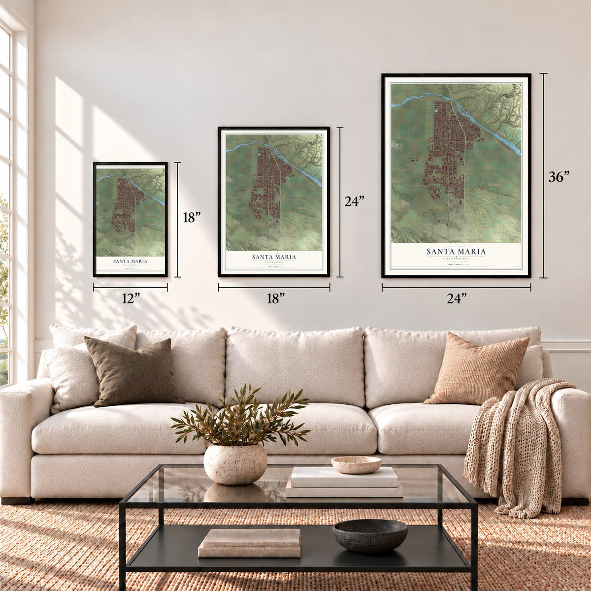
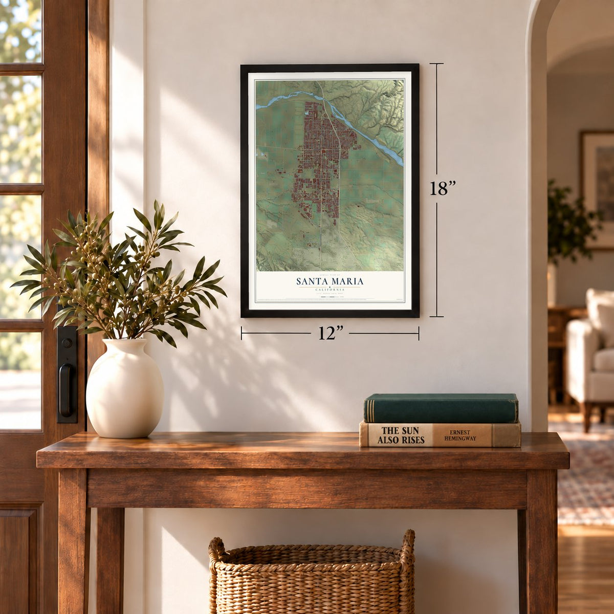
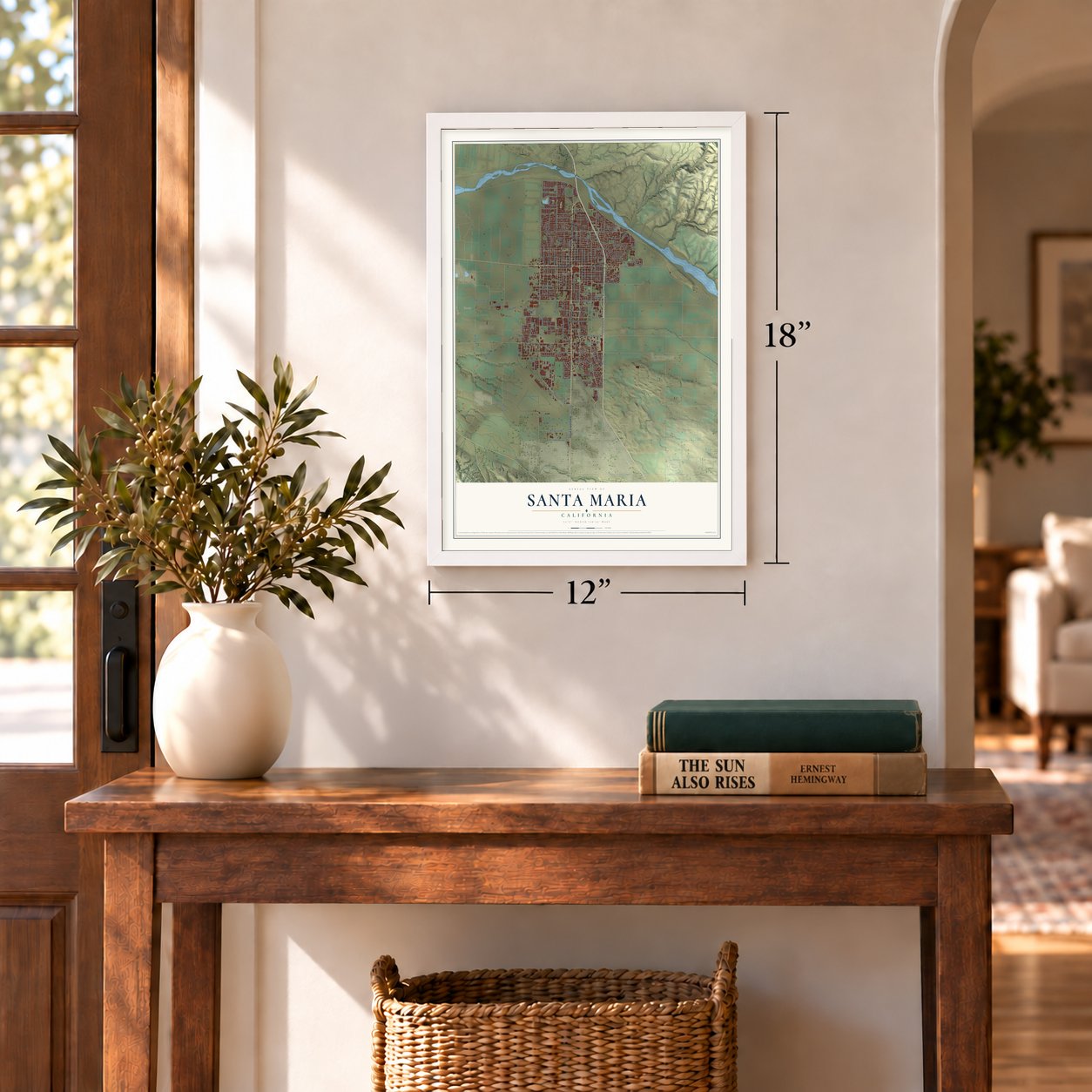
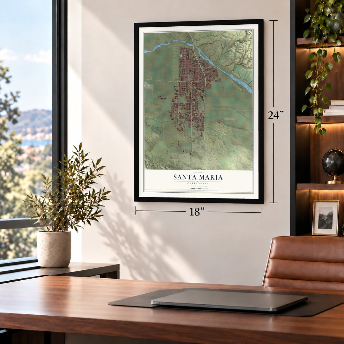

Free U.S. delivery 7 to 10 days after you order
Santa Maria, California Map Art
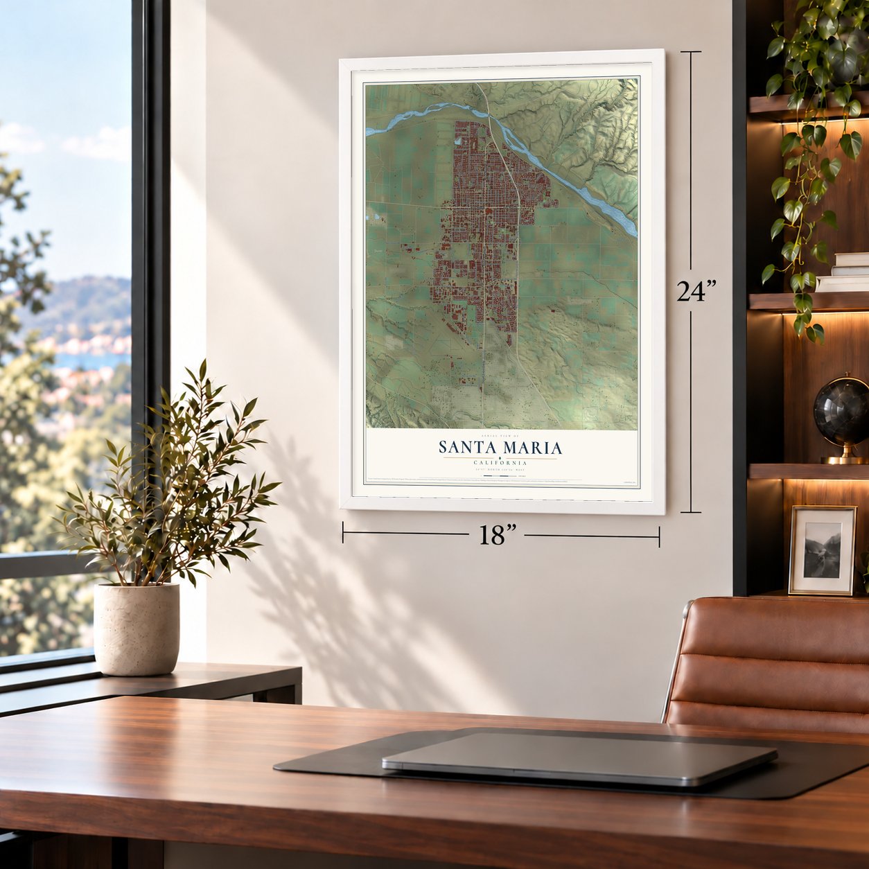
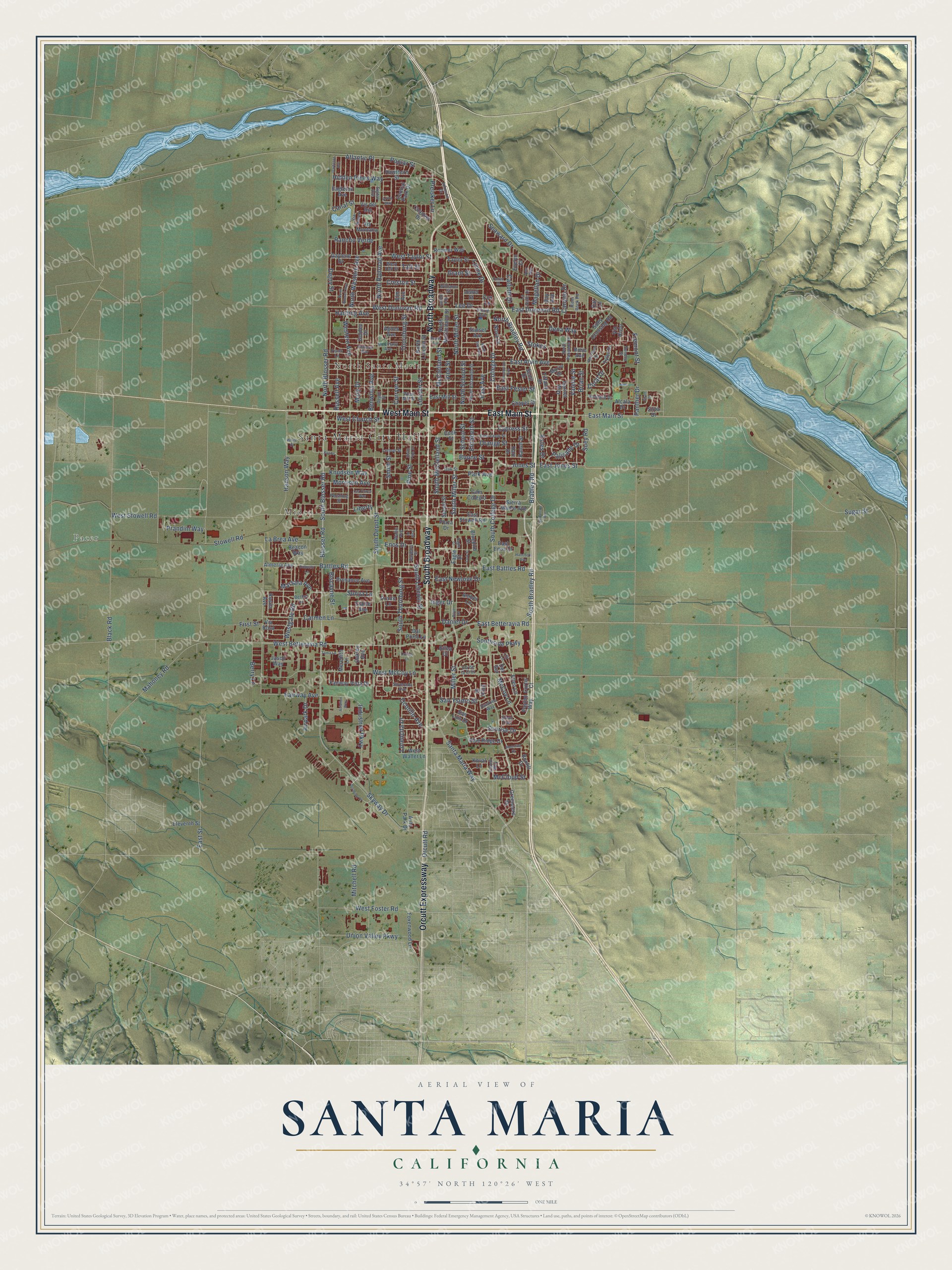
A new map of Santa Maria, California, made in 2026 and printed to order on thick archival matte paper.
12" x 18" Archival Matte Print
A Map of Home. A Work of Art.
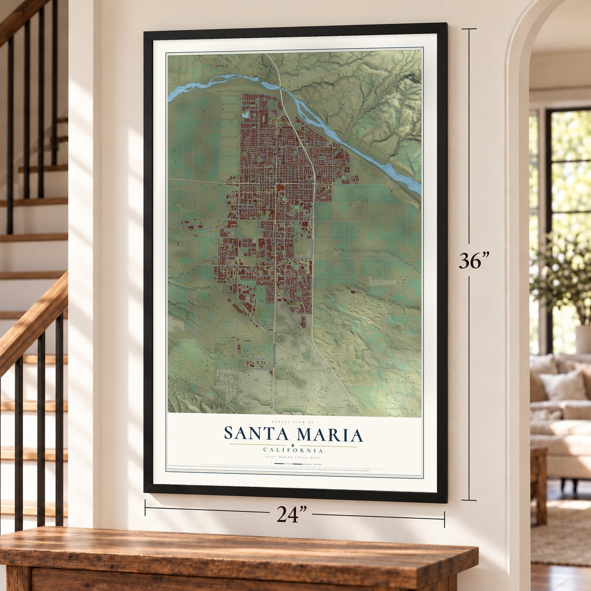
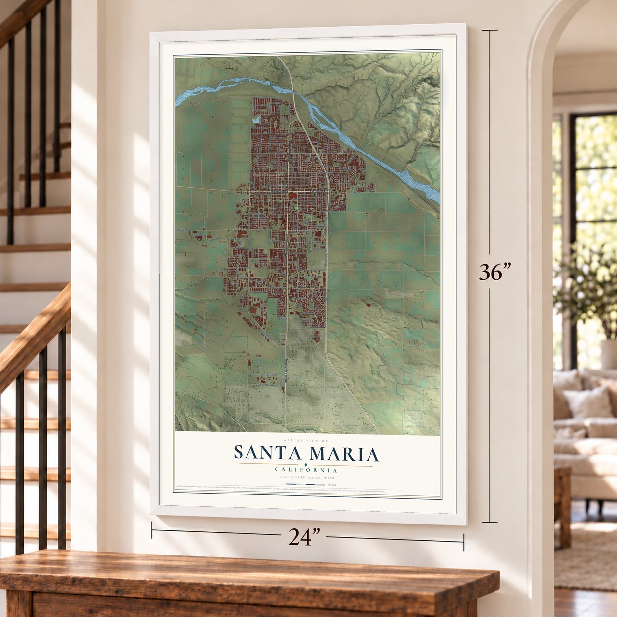
Explore Santa Maria, California from a whole new perspective. Created using aerial imagery and detailed geographic data, this map captures Santa Maria building by building, with labeled streets, familiar landmarks, and shaded topographical relief that highlights the natural contours of the landscape.
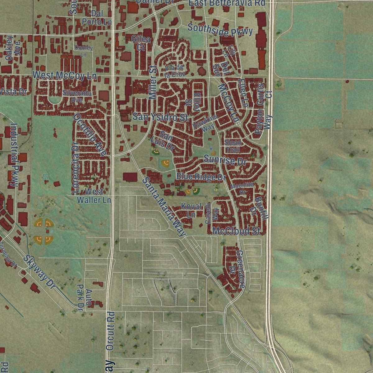
Combining modern data with the timeless character of a vintage atlas, this map is just as interesting up close as it is beautiful on the wall. Whether you grew up in Santa Maria, spent memorable years there, or call it home today, this unique map is a great way to celebrate a place that means something to you. Zoom in on the preview to look for your street, and then order a print to put your memories on the wall.
Three ways to hang it
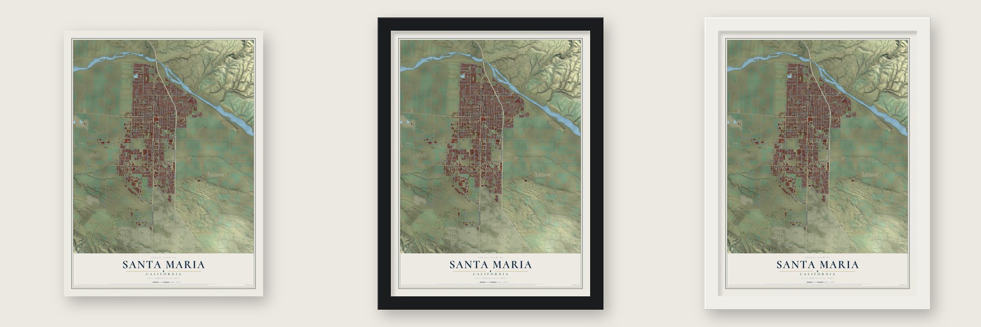
Unframed archival matte, a black wood frame or a white wood frame.
Up close
Geography Worth Displaying
This map was created using accurate cartographic data and authoritative geographic sources, including the U.S. Geological Survey and the Census Bureau. The map brings together terrain, waterways, roads, and building detail. The majority of the streets are labeled, houses are accurately depicted, and the topography is derived from government sources. Combining local data with carefully composed color and shading leads to this beautifully detailed Santa Maria artwork for your wall.
Rather than simply showing street outlines, we’ve included as many of the street names as we could reasonably fit on the map while keeping their names legible. Zoom in on the high resolution preview to see exactly what’s on the map. We truly set out to create a statement piece for anyone who loves Santa Maria. So whether it’s for you, or a gift for someone you love, we hope this map of Santa Maria brings back fond memories.
Read the story behind this map of Santa Maria, California from 2026.

About Santa Maria, California
Santa Maria is a city of 109,707 people in Santa Barbara County, on California's Central Coast. The Chumash lived in this valley for thousands of years, and the Portolá Expedition passed through in 1769. In 1867 B. F. Wiley claimed a quarter section a little north of the spot where the town would later be laid out.
Between 1869 and 1874, four settlers, Rudolph Cook, John Thornburg, Isaac Fesler and Isaac Miller, built houses close together where Broadway now meets Main Street. The townsite was recorded in 1875 as Grangerville, and the name later changed to Central City. Letters kept going by mistake to Central City, Colorado, so on February 18, 1885, the town became Santa Maria. Juan Pacifico Ontiveros had given that name to his property 25 years before. Streets named for the four settlers still frame a 6-block square at the heart of town.
- Oil under the cityDrilling began in 1888. In 1902 Union Oil hit the large Orcutt field, south of town in the Solomon Hills. Two years on, the company had 22 wells pumping. The Santa Maria Valley Oil Field, found in 1934, lay under the city's south and west sides and pushed its growth even further. By 1957 the valley had 1,775 wells at work, and they had yielded more than $640 million worth of oil.
- The home of tri-tipTri-tip, a small triangle of beef from the bottom sirloin, was mostly turned into ground beef or cut into steaks until the late 1950s, when Santa Maria made it a local specialty. The Santa Maria style rubs the meat with salt, pepper and spices and cooks it over local red oak, with garlic bread, pinquito beans and salad on the side. In August 2013, Sunset Magazine named Santa Maria "The West's Best BBQ Town."
- County fair since 1891The Santa Barbara County Fair began in 1891, and it is held each year at the Santa Maria Fairpark on Stowell Road and Thornburg Street. The Fairpark also hosts the yearly Strawberry Festival, which celebrates one of the valley's main crops.
- Famous guests since 1917Frank McCoy built the Santa Maria Inn on South Broadway in 1917, and it is now a registered historic landmark. Herbert Hoover stayed there, and so did the stars Bing Crosby, Charlie Chaplin, Bette Davis and Rudolph Valentino.
Find your street
Names on the Santa Maria map
Every name below is printed on this map. Look for your street, your school, the park where you played, or the pond down the road.
Places and landmarks4
- Santa Maria City Hall
- Pacer
- North Santa Maria
- Midco
Streets and roads249
- South Broadway
- East Main Street
- West Main Street
- North Broadway
- Orcutt Expressway
- Bradley Road
- South Bradley Road
- Battles Road
- East Battles Road
- Westgate Road
- East Betteravia Road
- Sonya Lane
- East Donovan Road
- Boone Street
- College Drive
- South College Drive
- Brian Street
- Fremont Street
- West Donovan Road
- Industrial Parkway
- West Betteravia Road
- School Street
- Fairway Avenue
- Sugar Street
- Pine Street
- North School Street
- Lee Drive
- East Street
- Canyon Drive
- Poplar Street
Show all 249 streets
- Liberty
- Miller Street
- South Miller Street
- Skyway Drive
- South Blosser Road
- Blosser Road
- West Stowell Road
- Western Avenue
- South Thornburg Street
- Thornburg Street
- Lincoln Street
- Black Road
- McClelland Street
- West McCoy Lane
- North Railroad Avenue
- Santa Maria Way
- South Depot Street
- North Western Avenue
- East Alvin Avenue
- North Blosser Road
- Curryer Street
- South Lincoln Street
- Suey Road
- Cypress Street
- Carmen Lane
- North Miller Street
- Creston Street
- Airpark Drive
- Enos Drive
- East Fesler Street
- Orange Street
- Harding Avenue
- East Jones Street
- Russell Avenue
- Morrison Avenue
- Dejoy Street
- South McClelland Street
- Park Avenue
- Benwiley Avenue
- Elizabeth Street
- Jones Street
- East Avenue
- Orcutt Road
- Preisker Lane
- West Foster Road
- West Taylor Street
- Seaward Drive
- West Church Street
- North Bradley Road
- Mary Drive
- Panther Drive
- Smith Street
- Hidden Pines Way
- Hanson Way
- Mahoney Road
- Union Valley Parkway
- Vine Street
- Sunrise Drive
- Palisade Drive
- Lynne Drive
- Dena Way
- Taft Street
- East Newlove Drive
- McCoy Lane
- Valerie Street
- Carlotti Drive
- La Brea Avenue
- Inger Drive
- Rancho Verde
- San Ysidro Street
- Biscayne Street
- Prandini Way
- Lorencita Drive
- Southside Parkway
- Grant Street
- Mitchell Road
- Estes Drive
- Atlantic Place
- Stowell Road
- Daniel Drive
- Knudsen Way
- Berry Lane
- Magellan Drive
- Stokes
- First Street
- Ocotillo Avenue
- Marsala Avenue
- McCloud Street
- Canal Street
- Coral Drive
- Almeria Avenue
- Ellen Lane
- Payton Way
- Rosita Avenue
- Eagle Street
- Fairway Vista Drive
- Plaza Drive
- Alcala Drive
- East Stowell Road
- Chapel Street
- Oakley Avenue
- Sunset Avenue
- Cam Colegio
- North McClelland Street
- North Lincoln Street
- East Enos Drive
- Cox Lane
- Agnes Avenue
- Rose Avenue
- Jewel Street
- Ranch Street
- Cook Street
- East Mill Street
- Sierra Madre Avenue
- Foxenwood Lane
- Via Rosa
- Gaylene Drive
- Scott Drive
- Speed Street
- Dal Porto Lane
- Provance Avenue
- Suey Crossing Road
- Blue Ridge Drive
- Del Sur
- Elm Avenue
- Garnet Way
- Roemer Way
- Bay Avenue
- Greenacre Drive
- West Waller Lane
- Bunfill Drive
- Eleventh Street
- Beacon Way
- Bluebird Street
- Hawthorn Street
- Taylor Street
- Hart Drive
- Meredith Lane
- Golden Drive
- Central Park Drive
- Channel Drive
- Elaine Avenue
- Vis del Rio
- Tyler Drive
- Vis Montana
- San Luis Drive
- Tiffany Drive
- Morro Drive
- Eagleton Avenue
- Amber Lane
- Nova Court
- Praire Lane
- Jason Way
- Koval Lane
- Elliot Street
- Auto Park Drive
- Evelyn Court
- Via Hielo
- Curtis Court
- Gilea Court
- Silva Drive
- Cat Lane
- Bethel Lane
- Williams Street
- North Palisade Drive
- North Elizabeth Street
- McElhany Avenue
- Pershing Street
- East Cook Street
- Oak Street
- West Mill Street
- Barbara Street
- Depot Street
- West Taft Street
- Wallis Avenue
- Vickie Avenue
- Johnson Drive
- Rowland Drive
- Hawkins Way
- La Salle Drive
- Lemon Street
- Harrison Drive
- Caselli Way
- Silverado Avenue
- Frank Lane
- River Rock Road
- Via de la Cruz
- Sloan Trail
- Signal Avenue
- Seneca Street
- Via Nuevo
- Via Rubio
- Lily Lane
- Boone
- Terminal Drive
- Lark Street
- Arora Way
- Concepcion Avenue
- South Pine Street
- North Russell Avenue
- North East Avenue
- Bunny Avenue
- Las Flores Way
- Nicholson Avenue
- Paden Street
- Olive Drive
- Tama Lane
- Yale Place
- Siratt Drive
- White Court
- Darbeton Avenue
- Moonlite Drive
- Hancock Avenue
- Dolcetto Lane
- Raaberg Way
- Aviation Way
- Amy Way
- Cooley Lane
- Eagle Court
Names are listed as they appear on the printed map. Zoom into the product photos to find them.
The art of mapping a place
How This Map Was Made
Real places. Remarkable detail. Discover the layers that turn geographic data into a map of home.

The view from above
Aerial imagery reveals the character of the land: woodland, open fields, and the patterns of a place.

The shape of the land
Elevation data brings hills, valleys, and subtle changes in the landscape into view.

The details of home
Roads, waterways, and building footprints come together to make the map feel unmistakably local.

Geography becomes art
Considered color, shading, and typography bring the layers together in a map made for your wall.


Process illustrated with Mendon, Massachusetts. Aerial imagery: USDA NAIP. Terrain: USGS 3D Elevation Program. Map details and finished artwork: KNOWOL.
The Details
About This Print
Choose an archival matte print, or a black or white Ayous wood frame. The archival matte print is unframed.
Select your size and finish above to see the matching product image and price.
Materials & Craftsmanship
A contemporary map with the character of a classic atlas, printed on archival matte paper. Optional frames are made from Ayous wood.
Your printed map does not include the watermark shown in the full-map preview.
Shipping & Delivery
Free shipping within the United States. Every print is made to order in the USA.
Buying a gift? Add a note in your cart and we'll include it. We never put prices in the package.
Prints ship within 2 to 3 business days. Allow 7 to 10 days total from ordering for delivery. Timing may vary during holidays or periods of high order volume.
Read our shipping policy.
Returns and damaged prints
Each print is made to order. Change-of-mind refunds are not available after production.
If your print arrives damaged, misprinted or incorrect, contact support@knowol.com within 30 days of receiving it. Include your order number, photos and a description of the issue.
Read our full refund and replacement policy. For questions about your order, email support@knowol.com.
Find your town
Looking for another city?
Find a map of home in our California collection, or any town in the country.
Nearby
Maps of towns near Santa Maria
Know someone from one of these towns? Their map makes a great gift.
 Orcutt
, California
From $39.99See the map
 Nipomo
, California
From $39.99See the map
 Guadalupe
, California
From $39.99See the map
More maps nearby: Garey, Casmalia, Woodlands, Blacklake and Sisquoc.