


Search for another town





Free U.S. delivery 7 to 10 days after you order
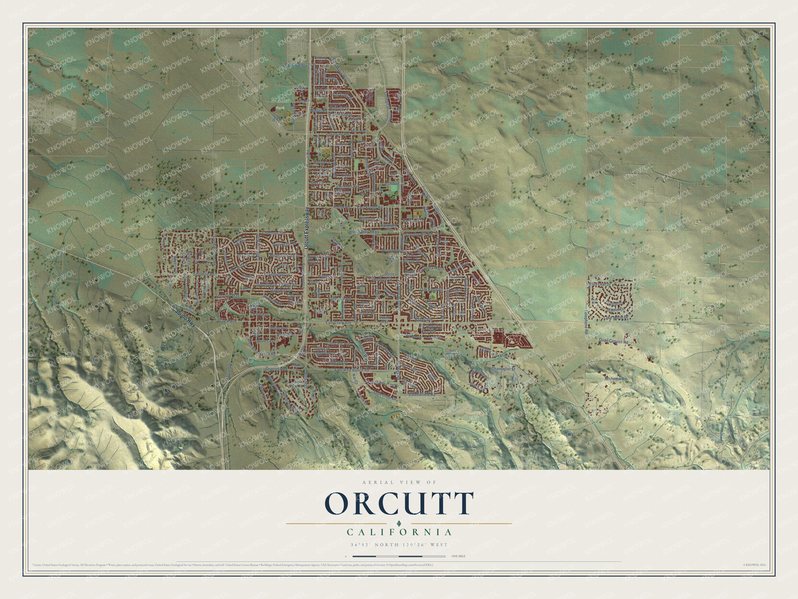
Orcutt, California Map Art
Building by building, with labeled streets and shaded relief.
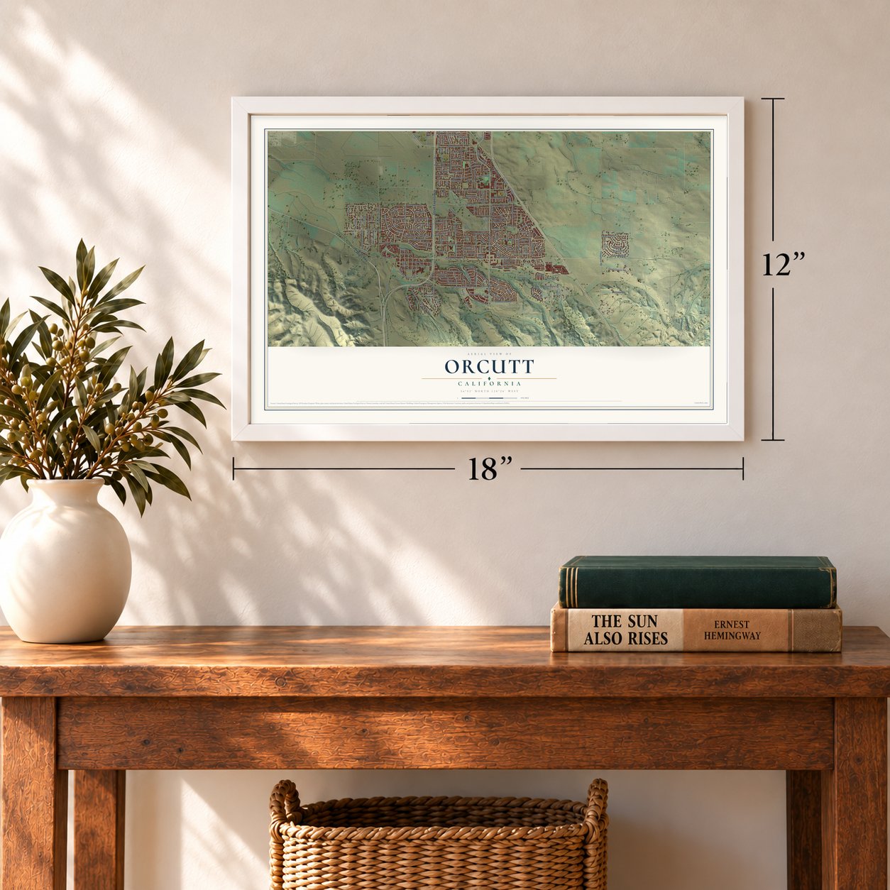
12" x 18" Archival Matte Print
A Map of Home. A Work of Art.
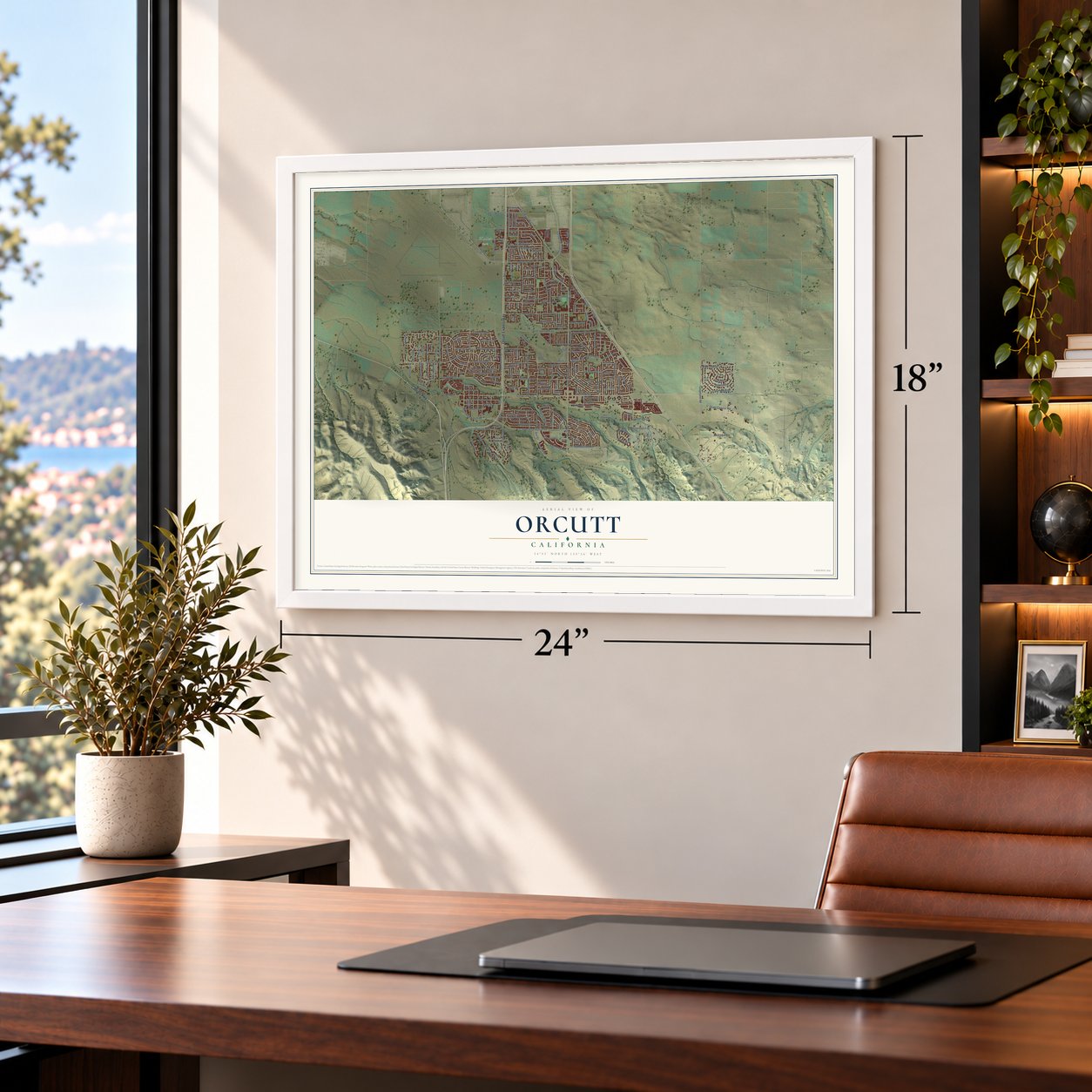
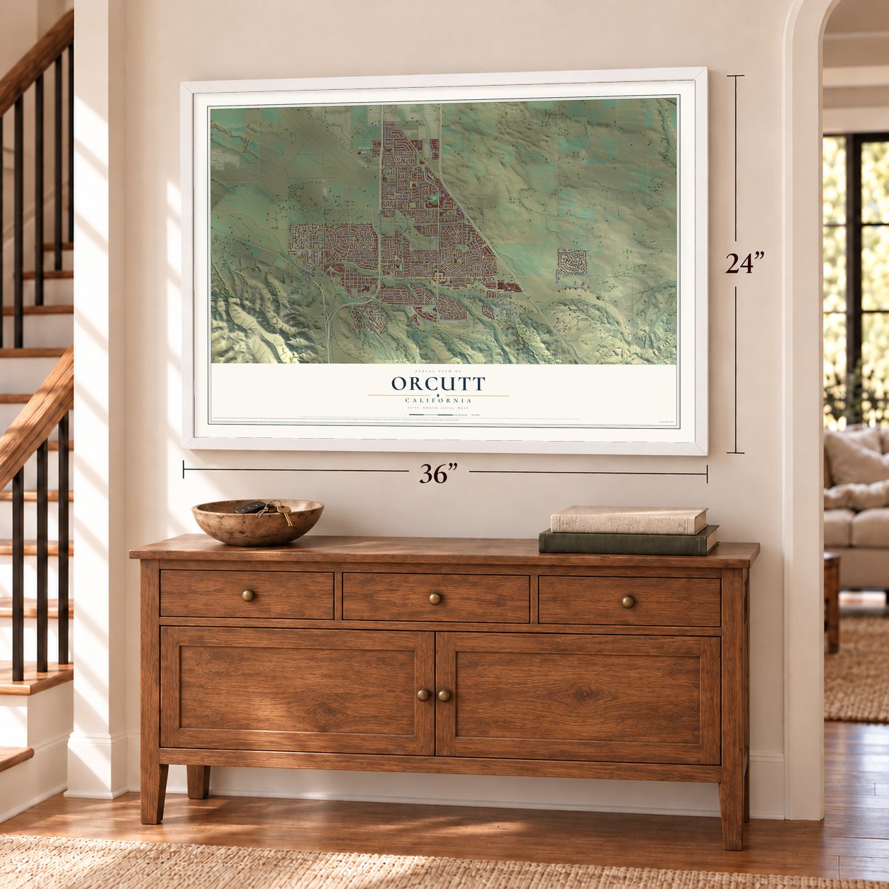
Explore Orcutt, California from a whole new perspective. Created using aerial imagery and detailed geographic data, this map captures Orcutt building by building, with labeled streets, familiar landmarks, and shaded topographical relief that highlights the natural contours of the landscape.
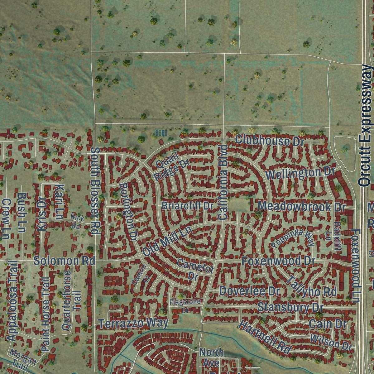
Combining modern data with the timeless character of a vintage atlas, this map is just as interesting up close as it is beautiful on the wall. Whether you grew up in Orcutt, spent memorable years there, or call it home today, this unique map is a great way to celebrate a place that means something to you. Zoom in on the preview to look for your street, and then order a print to put your memories on the wall.
Three ways to hang it
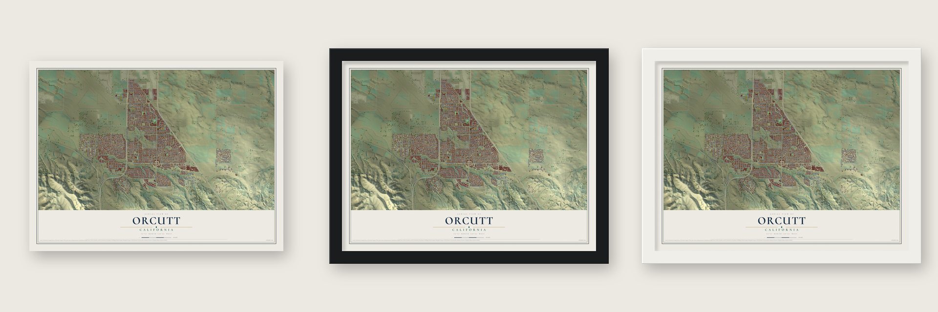
Unframed archival matte, a black wood frame or a white wood frame.
Up close
Geography Worth Displaying
This map was created using accurate cartographic data and authoritative geographic sources, including the U.S. Geological Survey and the Census Bureau. The map brings together terrain, waterways, roads, and building detail. The majority of the streets are labeled, houses are accurately depicted, and the topography is derived from government sources. Combining local data with carefully composed color and shading leads to this beautifully detailed Orcutt artwork for your wall.
Rather than simply showing street outlines, we’ve included as many of the street names as we could reasonably fit on the map while keeping their names legible. Zoom in on the high resolution preview to see exactly what’s on the map. We truly set out to create a statement piece for anyone who loves Orcutt. So whether it’s for you, or a gift for someone you love, we hope this map of Orcutt brings back fond memories.
Read the story behind this map of Orcutt, California from 2026.

Find your street
Names on the Orcutt map
Every name below is printed on this map. Look for your street, your school, the park where you played, or the pond down the road.
Places and landmarks2
- Cimarron Estates
- Waller Park
Streets and roads238
- Cabrillo Highway
- Orcutt Expressway
- Clark Avenue
- Pinal Avenue
- West Rice Ranch Road
- Bradley Road
- South Bradley Road
- East Clark Avenue
- Orcutt Road
- Via Pavion
- East Foster Road
- East Rice Ranch Road
- Hartnell Road
- Solomon Road
- Lakeview Road
- Stubblefield Road
- Union Avenue
- Foster Road
- Santa Maria Way
- Woodmere Road
- Telephone Road
- Foxenwood Drive
- Patterson Road
- Stillwell Road
- Graciosa Road
- Union Valley Parkway
- Kenneth Avenue
- Harmony Lane
- Oakhill Drive
- Hillview Road
Show all 238 streets
- Oak Knoll Road
- Hummel Drive
- Foxenwood Lane
- South Blosser Road
- Glines Avenue
- Black Oak Drive
- Drake Drive
- Clubhouse Drive
- Crescent Avenue
- Lake Marie Drive
- Via Alta
- Glacier Lane
- California Boulevard
- Marcum Street
- Cain Drive
- Fallen Leaf Drive
- Old Mill Lane
- Cherry Avenue
- Winter Road
- Country Hill Road
- Highland Drive
- Sage Crest Drive
- Stansbury Drive
- Quail Canyon Road
- Berwyn Drive
- Via Esmeralda
- Chancellor Street
- Raymond Avenue
- Elkhorn Lane
- Shirley Lane
- Beverly Drive
- Via Santa Maria
- Los Padres Road
- Cll de la Rosa
- Angeles Road
- Richview Road
- Lancaster Drive
- Impala Trail
- Valley Drive
- Jullien Drive
- Boardwalk Lane
- Bauer Avenue
- Fairmont Avenue
- David Road
- College Drive
- Mooncrest Lane
- Hobbs Lane
- Meadowbrook Drive
- Majestic Drive
- Tallyho Road
- Appaloosa Trail
- Village Drive
- Amethyst Drive
- Larch Avenue
- Auto Park Drive
- Oak Bluffs Drive
- Berrywood Drive
- Fair Oaks Drive
- Park Avenue
- Ken Avenue
- Crystal Drive
- Crew Lane
- Millstone Avenue
- West Waller Lane
- Imperial Way
- Wellington Drive
- Quail Court
- Ivory Drive
- Genoa Way
- Kris Drive
- Eileen Lane
- Harsin Lane
- Bush Lane
- Siler Lane
- Terrazzo Way
- Doverlee Drive
- Parkland Drive
- Soares Avenue
- Oakbrook Lane
- Marvin Street
- Via Mavis
- Pabst Lane
- Yarrow Drive
- Roxy Avenue
- Benji Lane
- Montano Drive
- Lydia Drive
- Titan Street
- Kai Court
- Ross Lane
- Kari Lane
- Frontage Road
- South First Street
- Poppy Lane
- Via del Carmel
- Wilson Drive
- Burlington Drive
- Mira Flores Drive
- Miles Avenue
- Dahlia Place
- Dickson Drive
- Kapalua Drive
- Tiffany Park Circle
- Valley View Drive
- Karnes Road
- Skyway Drive
- Paint Horse Trail
- Brookside Avenue
- Bridgeport Road
- Barnette Road
- Quarterhorse Trail
- Esplanada Avenue
- Deer Run Lane
- Royal Oak Road
- Camelot Drive
- Diamond Drive
- Courtney Drive
- Palomino Drive
- Quail Ridge Drive
- Crestwood Drive
- Glenview Drive
- Fleming Lane
- Atherly Lane
- Briarcliff Drive
- Lancer Avenue
- Revere Street
- Mira Loma Drive
- Kit Way
- Lupin Lane
- Jasmine Lane
- Shady Glen Drive
- Martin Avenue
- Flower Street
- Parkview South
- Dorsey Way Drive
- Franklin Road
- Walter Way
- Robin Court
- Linwood Drive
- Pendula Lane
- Stubbs Lane
- Shultz Lane
- Linda Lee Drive
- North Avenue
- Donald Way
- Loma Way
- Edith Drive
- Shilo Court
- Stuart Drive
- Odie Lane
- Vigil Circle
- Sara Court
- Deer Hollow Lane
- Via Vista Verde
- Oak Street
- Goodwin Road
- Poppinga Way
- Princeton Drive
- Blake Street
- Ridgecrest Street
- Cedarhurst Drive
- Radcliff Lane
- Hollysprings Lane
- Dancer Avenue
- Townsend Lane
- Vineland Drive
- Dickinson Street
- Corta Bella Way
- Breezy Glen Drive
- Glenwood Drive
- Goodland Street
- Canyon Creek Road
- Dixie Lee Drive
- Ridge View Drive
- Morgan Trail
- Bent Tree Drive
- Manda Drive
- Sandy Court
- Cherry Hill Road
- South College Drive
- Loch Lomond Drive
- Dyer Street
- Mountain View Drive
- Northpoint Circle
- Morning Ridge Road
- Don Pablo Drive
- Terrace Avenue
- Rick Road
- Hamilton Lane
- Cambria Avenue
- Primrose Lane
- Oak Valley Court
- Domino Avenue
- Prescott Lane
- Harp Road
- Tilbury Court
- Sharry Lane
- Francine Lane
- Flagstone Drive
- Rosalie Drive
- Rita Lane
- Glen Eagles Drive
- Spencer Drive
- Camlin Court
- Carissa Court
- Paige Court
- Huron Way
- Roper Way
Names are listed as they appear on the printed map. Zoom into the product photos to find them.
About Orcutt, California
Orcutt, in the Santa Maria Valley of Santa Barbara County, has never been incorporated. It began after oil was found in the nearby hills in 1903. The Union Oil Company then laid out a townsite for its oil field workers beside a siding of the Pacific Coast Railroad, on the northeast corner of Rancho Todos Santos.
Orcutt has never become a city, so the county Board of Supervisors governs it and the county sheriff patrols it. Over time the oil town turned into a suburb of Santa Maria, which now borders it on the north. In 2005, few places in Santa Barbara County were growing as quickly as Orcutt.
- Named for its founderA 1917 county history says Union Oil named the town for its founder. He was William Warren Orcutt, who ran the company's Geological, Land and Engineering Departments and was called the "Dean of Petroleum Geologists."
- The first bones from La BreaW. W. Orcutt found fossil bones of prehistoric animals in pools of asphalt on the Hancock Ranch. They were the first of many fossils dug from the La Brea Tar Pits. To honor his find, paleontologists named the La Brea coyote Canis orcutti.
- 32,034 people in 2020The oil workers' town has grown into a large community. The census counted 28,905 people in Orcutt in 2010 and 32,034 in 2020.
Keep exploring California
Orcutt is one of 1,990 California towns we've mapped. Every dot on the map is a print of its own.
The search covers every state, California first.
Near Orcutt
Order 2 or more town maps and save 10%. Shown in the size and finish you picked above, so they hang as a set.
- Santa Maria 12" x 18" / Archival Matte Print $39.99
- Garey 12" x 18" / Archival Matte Print $39.99
- Casmalia 12" x 18" / Archival Matte Print $39.99


More maps nearby: Sisquoc, Guadalupe, Vandenberg AFB, Vandenberg Village and Nipomo.
The art of mapping a place
How This Map Was Made
Real places. Remarkable detail. Discover the layers that turn geographic data into a map of home.

The view from above
Aerial imagery reveals the character of the land: woodland, open fields, and the patterns of a place.

The shape of the land
Elevation data brings hills, valleys, and subtle changes in the landscape into view.

The details of home
Roads, waterways, and building footprints come together to make the map feel unmistakably local.

Geography becomes art
Considered color, shading, and typography bring the layers together in a map made for your wall.


Process illustrated with Mendon, Massachusetts. Aerial imagery: USDA NAIP. Terrain: USGS 3D Elevation Program. Map details and finished artwork: KNOWOL.
The Details
About This Print
Choose an archival matte print, or a black or white Ayous wood frame. The archival matte print is unframed.
Select your size and finish above to see the matching product image and price.
Materials & Craftsmanship
A contemporary map with the character of a classic atlas, printed on archival matte paper. Optional frames are made from Ayous wood.
Your printed map does not include the watermark shown in the full-map preview.
Shipping & Delivery
Free shipping within the United States. Every print is made to order in the USA.
Buying a gift? Add a note in your cart and we'll include it. We never put prices in the package.
Prints ship within 2 to 3 business days. Allow 7 to 10 days total from ordering for delivery. Timing may vary during holidays or periods of high order volume.
Read our shipping policy.
Returns and damaged prints
Each print is made to order. Change-of-mind refunds are not available after production.
If your print arrives damaged, misprinted or incorrect, contact support@knowol.com within 30 days of receiving it. Include your order number, photos and a description of the issue.
Read our full refund and replacement policy. For questions about your order, email support@knowol.com.